Scan the QR code and open PeakVisor on your phone
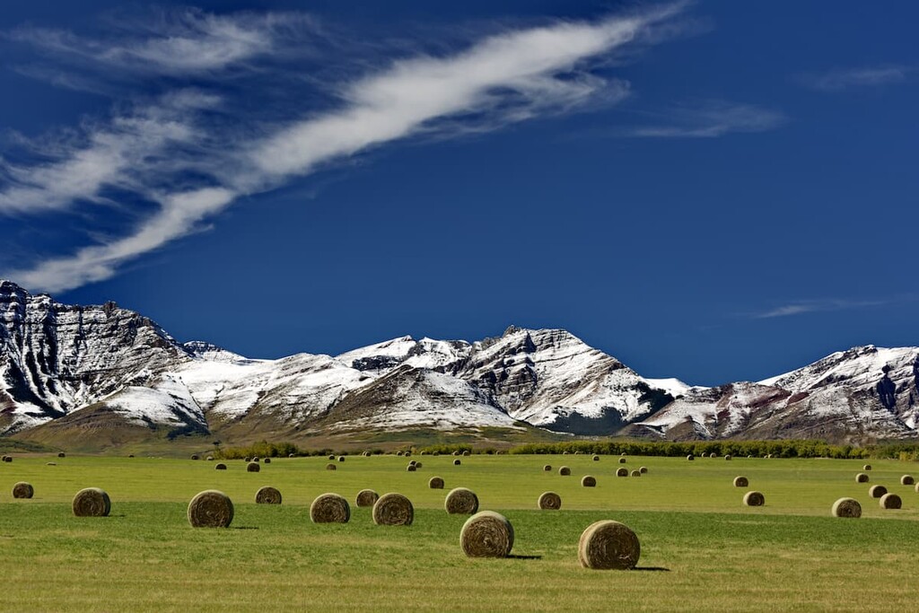
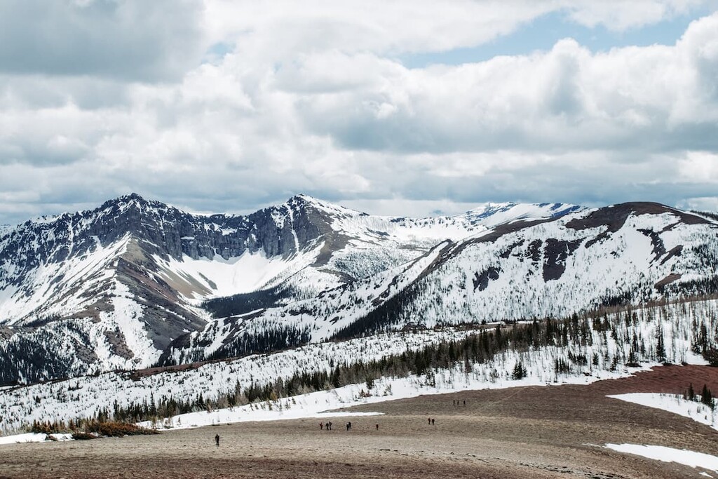
Castle Provincial Park is a protected area located in southern Alberta, Canada that borders both Waterton Lakes National Park and the province of British Columbia. It is located about 22 5km (135 mi) southwest of Calgary and about 20 km (12 mi) west of Pincher Creek. There are 9 named peaks in Castle Provincial Park, the tallest of which is Spades Peak at 2,027 m (6,648 ft) and the most prominent is Mount Backus with 366 m (1,200 ft) of prominence.
Castle Provincial Park is located in southern Alberta near the Continental Divide and British Columbia. The park is about 225 km (135 mi) to the southwest of Calgary and about 20 km (12 mi) to the west of the town of Pincher Creek. Originally protected in 1908 as part of the Rocky Mountains Forest Reserve, Castle Provincial Park was created in 2017.
Castle Provincial Park covers 255 square kilometers (98 square miles) of land and it is bordered by Castle Wildland Provincial Park on the west and south as well as both private and leased rangeland to the north and east.
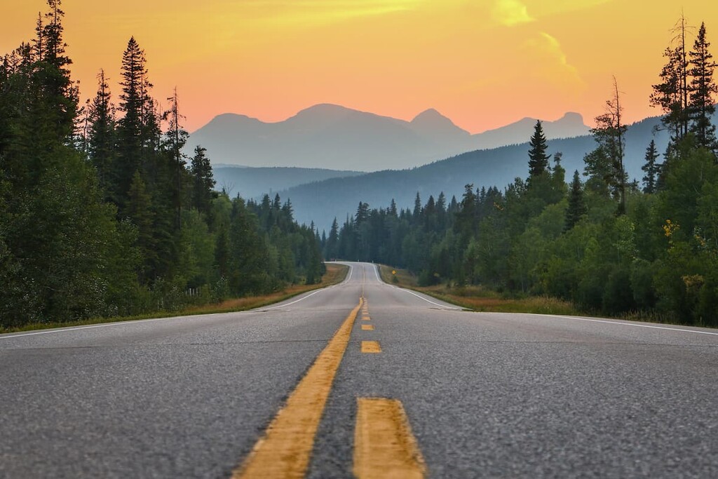
Highway 774 is the main paved road that leads into the park. There are several gravel roads that lead into the park, too, including Sartoris Road, Adanac Road, and Tapay Road.
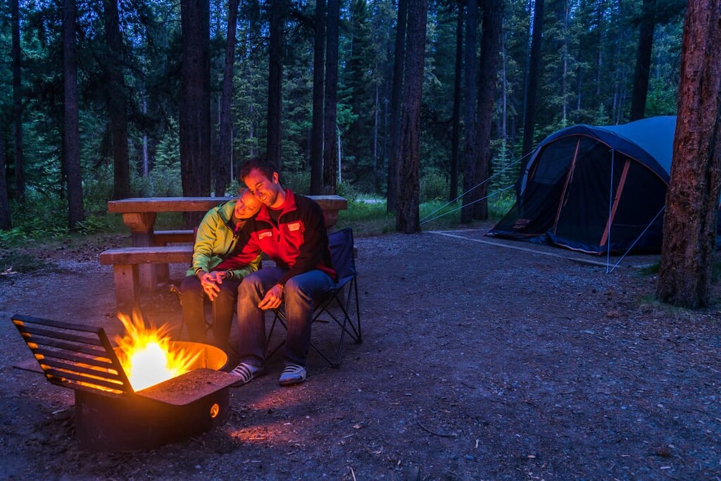
There are many activities that visitors can enjoy at Castle Provincial Park including hiking, mountain biking, cross-country skiing, snowshoeing, equestrian, fishing, swimming, camping, power boating, hunting, and OHV use. The park has many areas in which to camp that are free of charge; however, a self-serve permit is required.
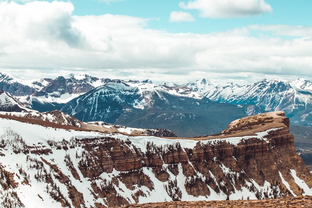
Castle Provincial Park is located within the front ranges of the southern Rocky Mountains in Alberta. About 70 million years ago, the North American plate collided with tectonic plates from the southwest causing the layers of rock to fold, twist, and uplift to form the Rocky Mountains.
A number of periods of glaciation occurred over the last few million years until about 12,000 years ago when the bulk of the ice sheets melted. As the glaciers formed and subsequently melted, they carved the mountains and the valleys in the region, creating the current topography of Castle Provincial Park.
The majority of the rocks of Castle Provincial Park formed hundreds of millions of years ago. During the Jurassic, about 200 million years ago, the area was without volcanic or noticeable effects of tectonic activity; however, by the beginning of the Cretaceous, 145 million years ago, subduction and uplift of massive amounts of rock began.
It was at the beginning of the Cretaceous that the drainage of the eastern slope of the Rocky Mountains reversed flow as the Continental Divide was established. The rocks of Castle Provincial Park are a testament to this major geological event.
Within the layers or Jurassic sediment of the Fernie Formation, there are also large specimens of fossilized wood, plants, and dinosaur tracks. Marine fossils, including giant ammonites, are found above the Fernie formation in the Kootenay formation, which is visible in parts of Castle Provincial Park.
The Cretaceous rocks in the area contain massive deposits of coal, such as the deposits found near the hamlet of Beaver Mines. Coal is also found near the communities of Crowsnest Pass and Blairmore.
Pyroclastic (volcanic) rocks of the Crowsnest formation are visible at Carbondale Hill because of faulting. The rocks in this formation were laid down in a series of explosive eruptions about 100 million years ago during the early Cretaceous. The uncommon minerals of melanite and analcime are also found in this area.
Furthermore, Castle Provincial Park and Castle Wildland Provincial Park are some of the only areas in Alberta to have exposures of volcanic rock.
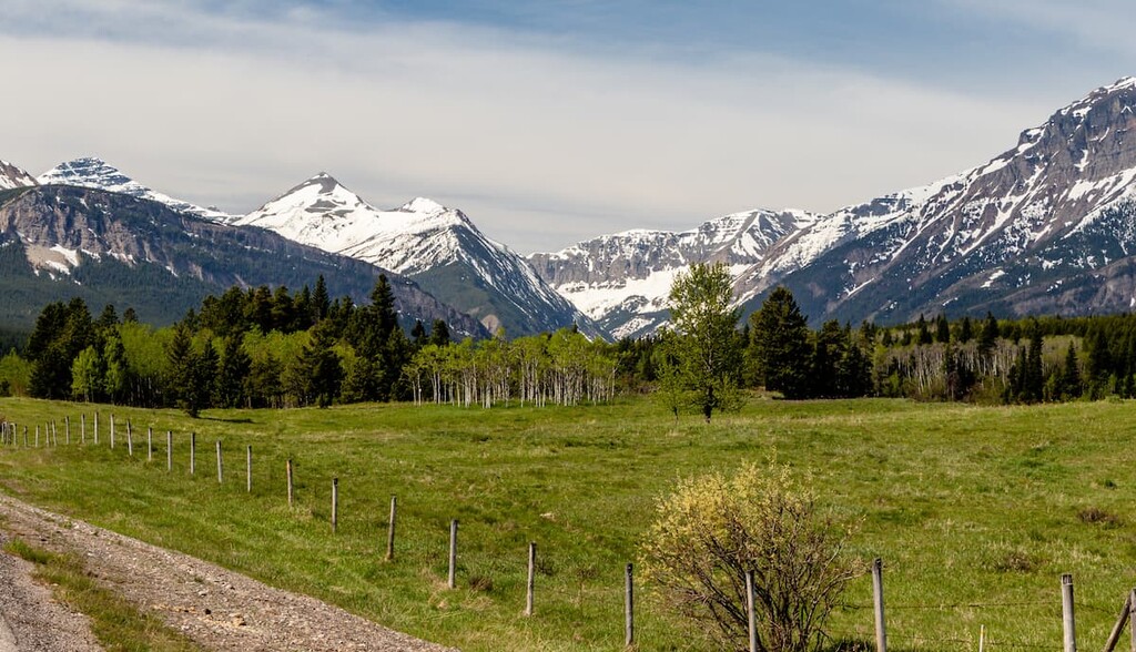
Castle Mountain Park is part of the Montane Natural Subregion of the Rocky Mountains Natural Region. The montane region is the lowest in elevation of all the Rocky Mountain Natural Regions and is therefore the warmest. In southern Alberta, the Chinook winds often create an unseasonably warm spell during the winter months, which makes this ecosystem one of the most desirable to live in.
The region is characterized by a matrix of grasslands, which tend to grow on dry southern and western slopes, and forests, which tend to grow on the damp northern and eastern slopes. Douglas fir forests are also prominent, as are forests of lodgepole pine, aspen, and limber pine.
The forest understory usually features Canada buffaloberry, white meadowsweet, saskatoon, snowberry, and thimbleberry. Castle Provincial Park is the furthest north that creeping mahonia is found. The grasslands tend to be filled with oat grasses, bluebunch wheatgrass, mountain rough fescue, and June grass.
Fish habitat in the region is critical to the health and survival of native trout populations. Bull trout, westslope cutthroat trout, and mountain whitefish are found in the park’s waterways. The creeks and rivers of Castle Provincial Park are critical habitat for westslope cutthroat trout.
The park is at the northernmost range for many bird species, so Castle Provincial Park has a greater diversity of birds than any of the regions to the north. Some of the species to be found are harlequin duck, golden eagle, sharp-tailed grouse, prairie falcon, rufous hummingbird, and golden-crowned kinglet.
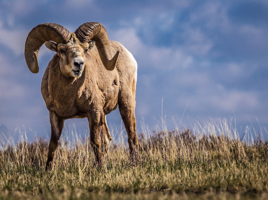
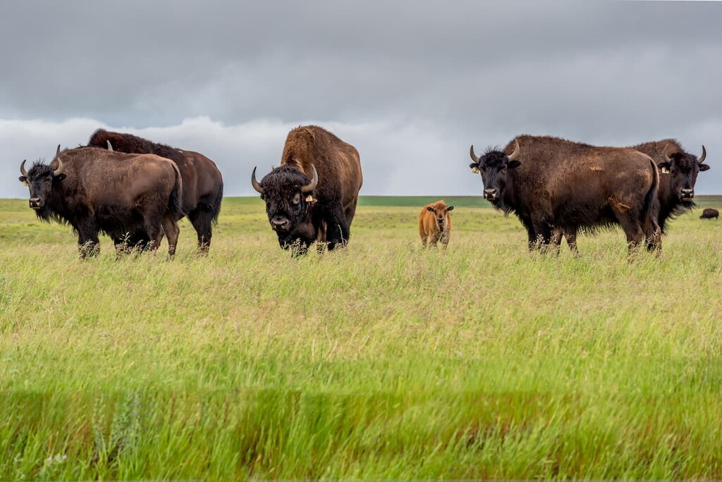
The primary mammals found in the Castle area include black bear, grizzly bear, cougar, bobcat, Canada lynx, elk, bighorn sheep, mountain goat, mule deer, white-tailed deer, fisher, wolverine and gray wolf. Some of these animals such as the grizzly bear, have very large home ranges and will occupy a variety of habitats throughout the year.
As the Pleistocene was coming to an end, around 12,000 years ago, the continental and cordilleran ice sheets had melted significantly to re-open an ice-free corridor from north to south, across the Canadian west. It’s believed that the corridor had opened during previous interglacial periods allowing animals and groups of people to migrate south.
In the Castle area, which is Castle Provincial Park and Castle Wildland Provincial Park, there are 92 archaeological sites, of which 75% represent the pre-contact period of Indigenous heritage. The sites are diverse and represent activities such as toolmaking and camping, to mining and logging. Nearly 30% of the currently known heritage cultural sites represent locations of spiritual importance.
The region of Castle Provincial Park is traditional territory of the Piikani [Peigan], Siksika, Kainaiwa [Blood], and the Blackfeet of the Blackfoot Confederacy, as well as Nitsitapii, Nakoda [Stoney], and K’tunaxa [Kootenay] First Nations. The area is of cultural and spiritual value to the First Nations that traditionally inhabit the region.
The region is a remnant of the wilderness that the Nitisitapii have occupied for more than 1,000 years whose culture is interpreted at the Head-Smashed-In Buffalo Jump World Heritage Site. There are many sites that were traditionally used for harvesting medicinal plants, ceremonial and spiritual practices, burial grounds, and hunting grounds.
These cultural sites and areas maintain their significance to the First Nations. Sites are still used today which are connected to the First Nations cultural values associated with the water, plants, and animals. While hiking or travelling in the park it would be valuable to ponder upon the ancient inhabitants and how they likely travelled the trail you’re on and lived and lived there for generations.
European settlement began around 1880 with logging operations around Mountain Mill (now a ghost town) and Beaver Mines. Coal was discovered in the area, providing jobs for many and creating the need for a town to support the miners and their families. By the early 1900s homesteaders and ranchers started to settle in the region, too.
Previous to World War I, the area was thriving because of the demand for their coal and lumber, which was transported to market via a private railway from Beaver Mines to the main Canadian Pacific tracks near Pincher Creek. However, the short private railway was dismantled to provide steel to the war effort during World War One.
After the war, the area focused on agriculture and ranching, a tradition that has continued to this day. The land within Castle Provincial Park was officially designated as a provincial park in 2017.
The area of Castle Provincial Park was once considered a hidden gem by the locals. Since its designation as a provincial park in 2017, the secret is out and many of the locals are excited to share the special places and trails which they have known about for years. The following are some of the trails and attractions in Castle Provincial Park:
The ghost towns are a unique way to interact with history in the region. The towns of Mountain Mill and Beaver Mines are considered ghost towns; however, Beaver Mines is currently growing in popularity. Mountain Mill was a lumberjack community that existed for 20 years from 1880 to 1900 and had a maximum population of about 75 people.
At the turn of the twentieth century, demand for lumber fell and nearby Beaver Mines was growing. As a result, logging and mining operations in the region were then transferred to Beaver Mines. Mountain Mill ceased to exist; however, the remains can be discovered by a keen observer.
After World War I, the demand for coal diminished and the private railway that once transported raw material from the town was dismantled to provide steel to the war effort. These obstacles were too much, and the residents slowly moved away from town as the region focused on agriculture and ranching for economic growth.
While most residents left as the coal industry was in decline, some residents remained. However, the town became just a shell of what it once was. Currently, Beaver Mines is becoming a popular location for vacation property, thanks to its proximity to Castle Mountain Resort; however, the vestiges of the former mining town are still around to discover.
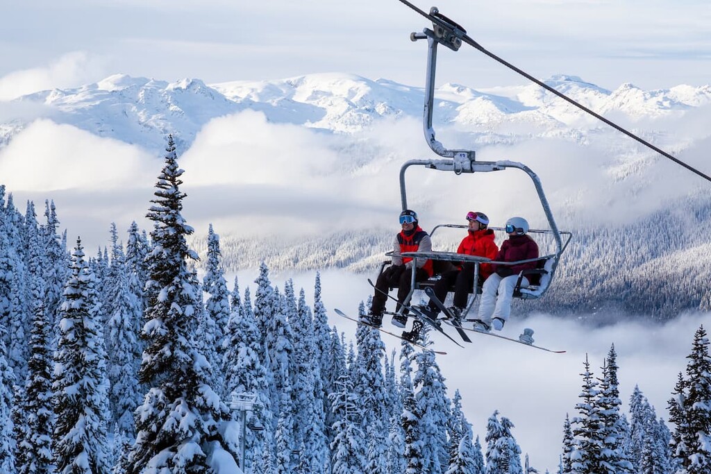
Located at the west end of Highway 774, about 50 km (30 mi) from Pincher Creek, Castle Mountain Resort is a ski area that first opened in 1965. At that time, there was only a T-bar that climbed 750 m (2,500 ft) and a Swiss style lodge.
The resort was a grassroots movement that started attracting downhill enthusiasts from across southern Alberta. The hill hosted the alpine ski event for the 1975 Canada Winter Games after which the hill was sold to the nearby town of Pincher Creek.
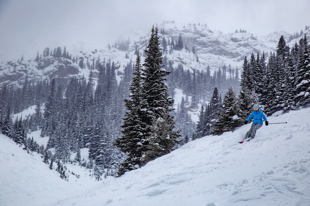
Thankfully after the town became disenchanted with the idea of ski hill ownership, a group of locals and enthusiasts created a fund that would revitalize the resort in the mid-1990s. The resort currently offers several lifts, cat skiing, and a new mountain with ski trails. Castle Mountain Resort is a mountain for skiers, run by skiers, and their dedication to a great mountain experience is evident.
Located south of Crowsnest Pass in Castle Provincial Park, the Willoughby Peak and Ironstone Lookout Trail offers a moderate trail with exceptional views. The trail is 16 km (10 mi) return with 654 m (2,145 ft) of elevation gain. The final peak is won by trudging 4 kilometers (2.5 mi) of switchbacks, but the view is well worth the effort.
The Sincline Lake Loop is an easy stroll through forest and meadows. The trail is 12 km (7 mi) long with only 300m (1,000 ft) of elevation gain throughout. It is great for all skill levels and is a good trail to snowshoe, too. The Sincline Lake Loop trail is in an area with many interconnected trails that have signs to help guide you. The loop can be a standalone outing or part of a larger series of hiking and adventure in Castle Provincial Park.
A Royal Canadian Air Force DC-3 (Dakota) aircraft with seven people on board was reported missing on January 19, 1946. The flight flew from Comox, British Columbia and was on its way to Greenwood, Nova Scotia.
Five days of bad weather hampered search efforts for the missing plane, which was last seen near Cranbrook, British Columbia. Crowsnest Pass Forest Rangers were finally able to snowshoe up to the crash site guided by the smoke of the still smoldering wreckage.
Poor weather conditions were blamed for the crash in which the plane collided with Mount Ptolemy and then plummeted into the valley below. There were no survivors.
While the bodies of the crewmen were removed, the wreckage of the aircraft was scattered over the area. The large section of the plane's tail is a highlight of this historical hike. The trail is 16 to 20 kilometers (10 to 12 miles) long, depending on how far up the trail you decide to drive. The trail is considered difficult and it has 676 m (2,217 ft) of elevation gain.
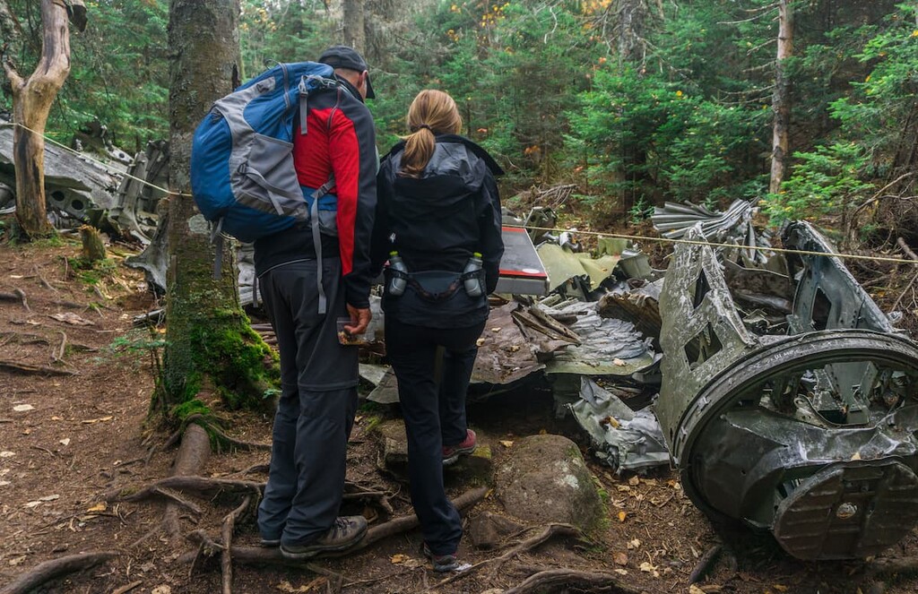
The site of this tragedy should be treated with respect. While at the site, take nothing but photos, and leave only footprints. Beyond the wreckage are some lovely meadows to visit as well. The hike is accessible during the winter with snowshoes; however, there is a risk of avalanches.
While Castle Provincial Park is in the remote southwest corner of Alberta, over 200 km (120 mi) from a major city, there are lots of options for places to stay while you visit the area.
With accommodation options that include a hostel, a hotel, vacation homes, and condos, Castle Mountain Resort caters to the budget of any adventurer. While it is certainly a popular place to stay in the winter, with some accommodations offering ski lifts near your front door, it is also a comfortable basecamp for summer exploration and adventure in the region.
Castle Provincial Park has many camping areas for drive in camping as well as backcountry camping. Many of the drive-in options are free of charge; however, self-registration permits are required.
Additionally, there are two levels of comfort cabins available in the park. One option is a basic cabin with bunks, while the other option has beds and electricity.
Whether camping or staying in a cabin, it is wise to ensure you have all your supplies before you head into the park. The nearest store is the general store at Beaver Mines, which is a decent distance away..
The town of Pincher Creek is about 20 km (12 mi) to the east of Castle Provincial Park. In 1868, a group of prospectors lost a pincher (a tool for horse care) in the creek in this area. In 1874, when the North-West Mounted Police came to southern Alberta, one of them found the rusted tool in the creek and named the creek Pincher Creek.
The town's history dates back to 1876 when the North-West Mounted Police established a horse farm in the area. Since then the town has remained relatively small; however, many of the residents are descendants of these homesteaders of the region.
Pincher Creek has several hotels for travelers to stay as well as restaurants and stores to fulfill your needs. Within the town is the historic Kootenai Brown Pioneer Village which covers six acres, has 27 heritage buildings and over 30,000 artifacts that represent life for the early European settlers of the area.