Scan the QR code and open PeakVisor on your phone
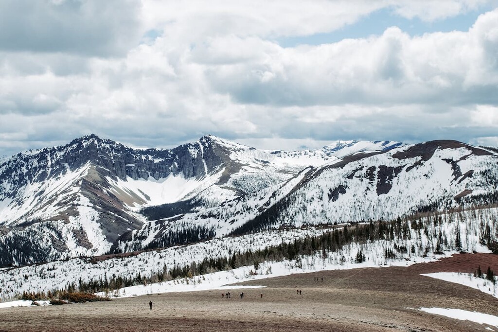
The Municipal District of Pincher Creek is centered around the town of Pincher Creek in southern Alberta, Canada along the eastern slopes and foothills of the Canadian Rockies. There are 70 named peaks in the municipal district, the tallest of which is Ptolemy SE5 with an elevation of 2,761m (9,058 ft) and a prominence of 455 m (1,493ft). The most prominent mountain is Mount Glendowan with an elevation of 2,673 m (8,770 ft) and a prominence of 677 m (2,221 ft).
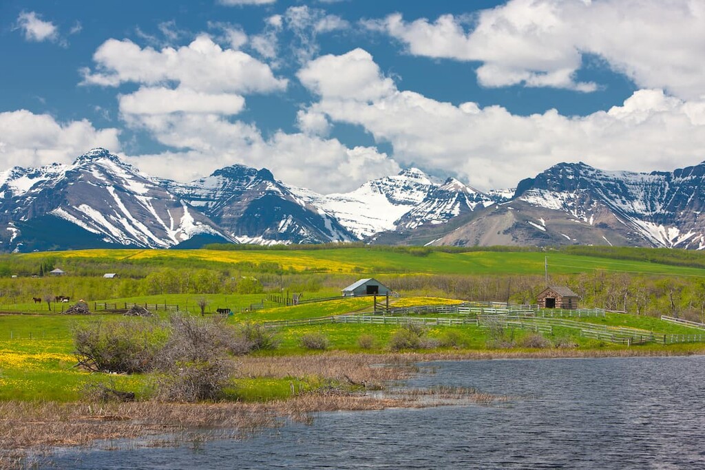
The Municipal District of Pincher Creek (MD of Pincher Creek) is a county along the eastern slopes of the Canadian Rockies in southern Alberta, Canada. The town of Pincher Creek is the largest and only town, and it is located in the middle of the county. The next largest village after Pincher Creek is Lundbreck.
The town of Pincher Creek is located 217 km (130 mi) south of Calgary, Alberta and 57 km (34 mi) east of the municipality of Crowsnest Pass. The municipal district is 3,482 square kilometers (1,344 square miles) in size and it has a population of nearly 3,000 people.
Highway 3, which is also known as the Crowsnest Pass Highway, crosses the county from east to west. Highway 22 (Cowboy Trail) leaves Pincher Creek to the north, while Highway 6 is the major highway that leads south through the county.
There are 71 named mountains in the MD of Pincher Creek, the tallest is Ptolemy SE5 with an elevation of 2,761m (9,058 ft) and a prominence of 455 m (1,493ft). The most prominent mountain is Mount Glendowan with an elevation of 2,673 m (8,770 ft) and a prominence of 677 m (2,221 ft).
Castle Provincial Park, Castle Wildland Provincial Park, and Beauvais Provincial Park are the major conservation and recreation areas around Pincher Creek. The Oldman Dam Provincial Recreation Area is a popular recreation site, as are the scenic falls at Lundbreck Falls Provincial Recreation Area.
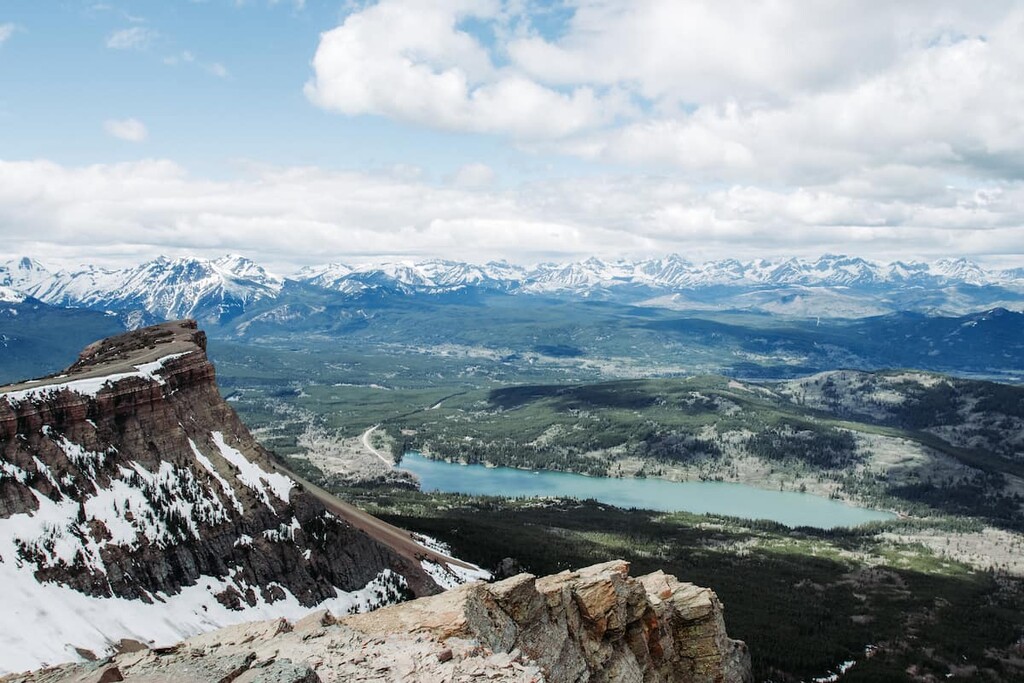
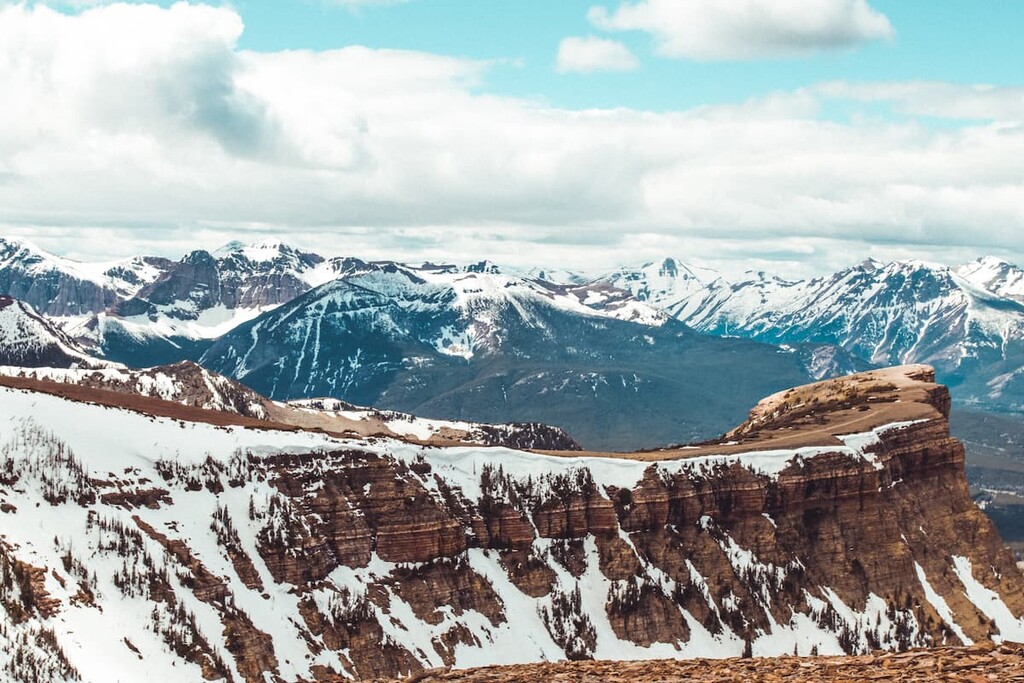
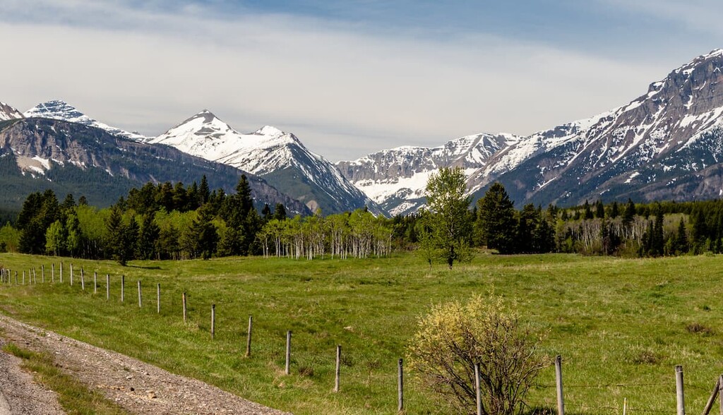
The MD of Pincher Creek is home to the Rocky Mountain peaks of the Clark Range in the southwest, which transition to the foothills and finally into rolling prairie rangeland. The Rocky Mountains started forming about 75 million years ago when the ancient sea-beds were shifted by the collision of tectonic plates.
The layers of rock found in the region at the time were twisted and compressed and ultimately heaved up and stacked, to form the mountain ranges. A number of periods of glaciation followed, allowing the glaciers to carve out the valleys and create the mountain topography that we see today, leaving behind fresh water and glacial till.
The foothills that roll east out of the mountains were formed from the same tectonic activity that formed the Rocky Mountains. However, it was only the Cretaceous layer of sandstone and shale that was thrust up during the formation of the foothills, instead of the deeper Paleozoic sediment layers that form the mountain peaks. As such, the foothills and the rangeland are usually composed of sandstone and shale that was deposited during the time of dinosaurs.
In the southwestern corner of the MD of Pincher Creek in Castle Wildland Provincial Park are some of the oldest sediments in North America. The sediments are Precambrian in age which means they are over 540 million years old, and they contain stromatolite fossils. The Castle stromatolite fossils are among the oldest fossils on earth and are just the beginning of the history of the area as recorded by fossils.
The Castle area in the MD of Pincher Creek contains a vast deposit of fossils which only start with the Precambrian stromatolites. The Cambrian is when complex life began to develop on earth and there are fossils in the area that are like the globally significant fossils at the Burgess Shale in Yoho National Park.
The northwestern part of Castle Provincial Park has layers of rock that represent the Paleozoic from 540 to 250 million years ago. Moving east out of the mountains leads to increased deposits of Mesozoic sediments that hold fossils from the time of dinosaurs, including ancient flora and dinosaur tracks. There are also significant marine fossils from the Jurassic, including giant ammonites.
The Cretaceous layers in the area tend to have coal deposits, such as those near the hamlet of Beaver Mine. While the dinosaurs roamed the Earth, a large seaway flooded regions of Alberta and North America, leading to the formation of much of the coal, oil, and natural gas deposits that dominate the region today.
During the Cretaceous, the Rocky Mountains formed from the immense destabilization of the continent as a result of subduction. Volcanic rifts occurred along the continental margin, which was then located along the British Columbia and Alberta border.
One eruption occurred near Cranbrook, British Columbia where massive amounts of lava flowed from the volcano. As the Paleozoic and Cretaceous layers were stacked on top of each other, creating the mountains, the layer of lava was also pushed west into Crowsnest Pass and Castle Wildland Provincial Park. Subsequent faulting and erosion exposed the layer of lava in several areas of the MD of Pincher Creek which are the only exposures of volcanic rock in Alberta.
It was faulting at Carbondale Hill that exposed a layer of lava, while the rest of the exposures are from erosion. Glaciers and rivers eroded the rocks at Drywood Creek to expose the layer of lava, while it was a glacier that exposed the lava on Newman Peak.
As a glacier formed and retreated from Newman Peak, a massive cirque of igneous rocks was left behind. Further examples of glacial landscapes include the Drywood Hanging Valley which has a 300 m (984 ft) drop to the creek. A hanging valley is formed when a small glacier joins a larger glacier.
The MD of Pincher Creek has several natural regions ranging from the alpine peaks in Castle Provincial Park, down the mountain slopes to the parkland in the foothills, and finally out to the prairie grasslands. The mix of ecosystems played an integral role in the ancient settlement of the region as well as the modern settlement.
From west to east, the natural regions in the MD of Pincher Creek start with the Rocky Mountain Natural Region which has the alpine, subalpine, and montane subregions. While the alpine is generally quite barren with minimal vegetation, such as sedge and heath growing in patches, the lower elevations of the subalpine and montane have a rich diversity of flora and fauna.
The mountains of Castle Wildland Provincial Park and Castle Provincial Park are the coolest area of the county as well as the area that receives the most precipitation. However, there are still more than 300 rare plant species found in the Rocky Mountains, which account for about 65 percent of Alberta’s rare vascular plants. Indeed, about 140 of the rare plants are only found in the Rocky Mountains.
The Castle area of the Rocky Mountain Natural Regions has even more diversity than the rest of the Canadian Rockies since many species are at the edge of their northern range. Such animals include Steller's jay, wandering shrew, the red-tailed chipmunk, and the butterfly Clodius parnassian.
Typical animals are the Columbian ground squirrel, pika, hoary marmot, mountain goat, and bighorn sheep that inhabit the alpine. While grizzly and black bears, white-tail and mule deer, moose, elk, wolf, coyote, and fox are found at the lower elevations.
The animals make their homes among the dense forests of the subalpine and montane regions. Lodgepole pine is the first species to grow after wildfires, while the older forests tend to be a mix of Engelmann spruce and subalpine fir. Douglas fir will grow in the lower elevations while larch prefers to grow along exposed ridges. Aspen and poplar are common deciduous trees.
The Castle area has a rich variety of birds including many sparrows, finches, blackbirds, orioles, woodpeckers, owls, hummingbirds, swans, geese, ducks, gulls, falcons, hawks, eagles, and countless more. Some of the popular ones to watch for are the golden eagle, great blue heron, great horned owl, and the harlequin duck.
As the front ranges of the Canadian Rockies transition to the foothills and prairies, there is a dramatic difference in elevation. The foothills from the mountains in the MD of Pincher Creek are only a thin belt between the mountains and the prairies that are covered by the Foothills Parkland subregion of the Parkland Natural Region.
The parkland is a transitional zone between the ecologies of the prairies and the mountains and as such it also has a greater diversity of flora and fauna than the bordering regions. The vegetation flows as a continuum from the dense forests of the mountains, gradually thinning into a parkland forest with grassy openings until the trees are only found in open stands.
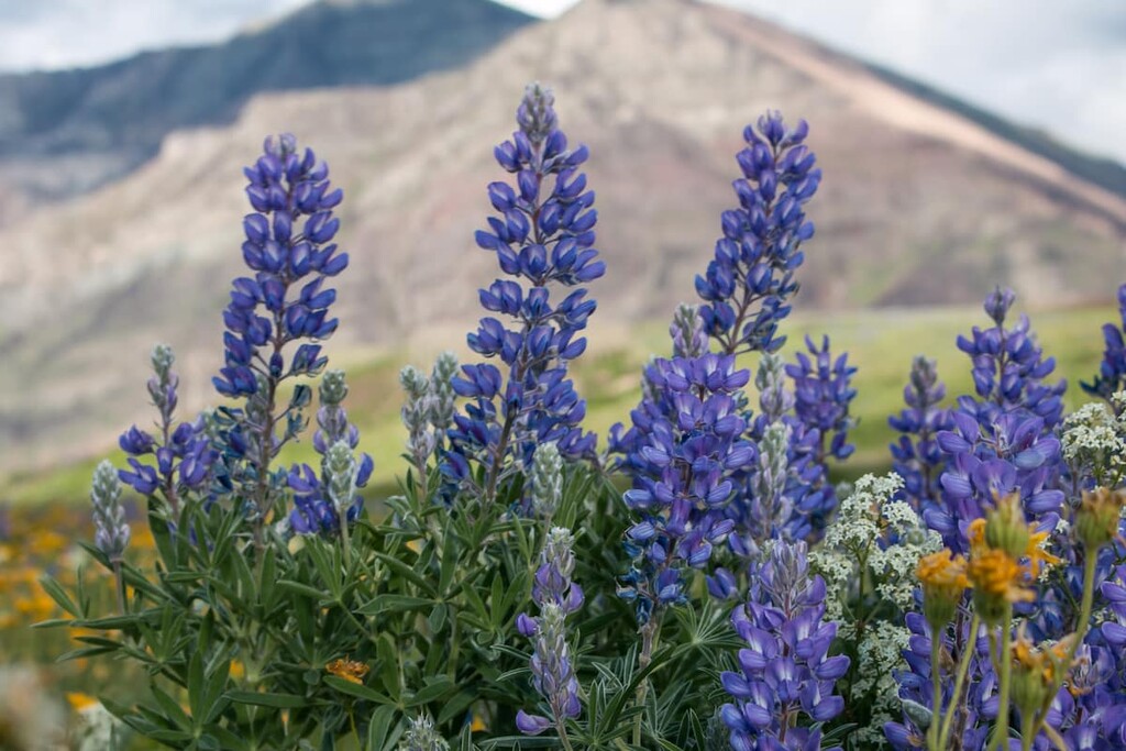
Topography plays a major role in the development of the vegetation, therefore the transition in the vegetation community may occur over very short distances. Aspen and poplar are common trees in the foothills. While lupines, oatgrass, and fescue are plants that commonly occur in the Foothills Parkland. The same grasses transition to the Foothills Fescue subregion that borders the foothills.
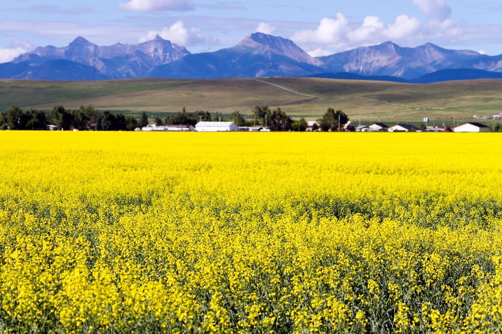
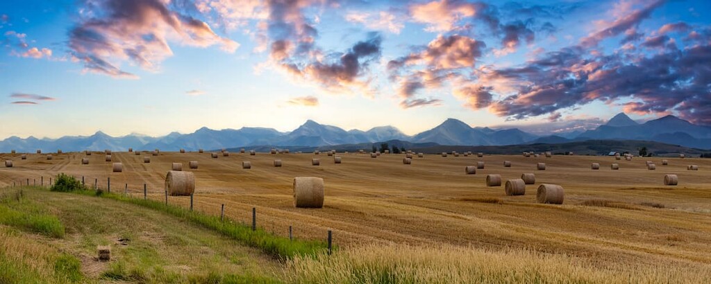
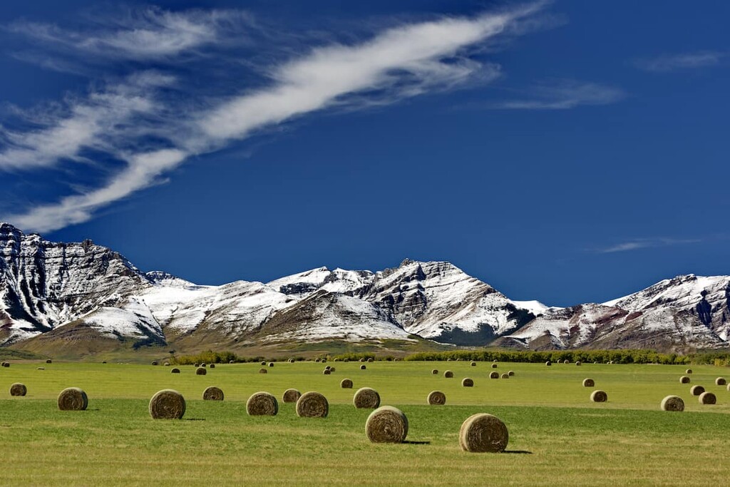
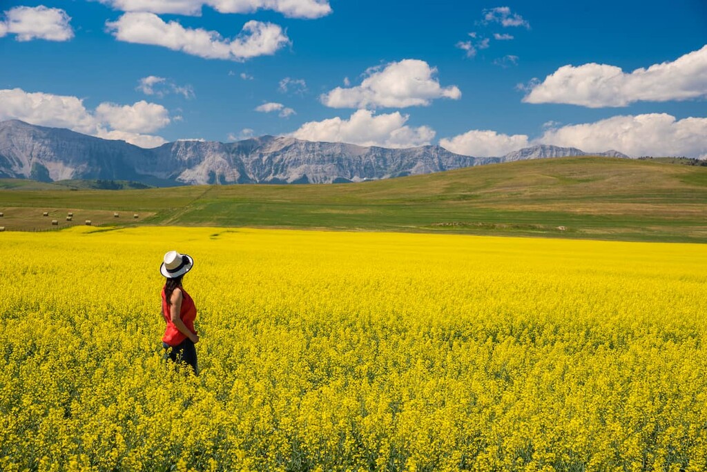
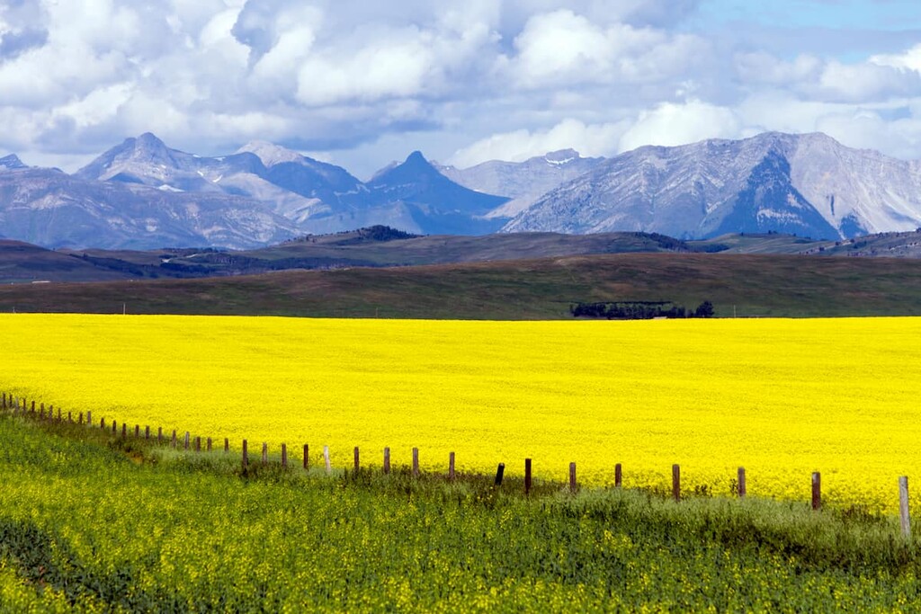
The Grasslands Natural Region is the rolling to level landscape of the MD of Pincher Creek. As the trees give way to open prairie, the Foothills Fescue subregion shares the same grasses as the Foothills Parkland subregion. The area is typically used for hay and feed crop production or grazing cattle. The Grasslands Natural Region is the warmest of all the natural regions in Alberta.
Woodlands grow as narrow strips along rivers and creeks in the grasslands. This is especially apparent around the Oldman Reservoir which is part of the Mixed Grass subregion. The prairies also have some animal species unique to the grasslands. The painted turtle, short-horned lizard, western rattlesnake, swift fox, mountain plover, and the greater sage-grouse are unique to the prairies.
The Richardson ground squirrel, also known as a “gopher,” is common to the prairies. Meanwhile, ungulates such as the pronghorn, white-tail and mule deer, as well as moose can be found wandering the prairies, too. Coyotes are the common predator in the grasslands; however, wolves, cougars, and bears will at times also find themselves in this region.
Geology tells of how the MD of Pincher Creek is located within the corridor where the continental ice sheet and the cordilleran ice sheet would come together during the Pleistocene. This is also among the first places from which the glaciers would melt, creating an ice-free corridor that connected what is now Montana and Idaho to Yukon and Alaska.
People have likely inhabited the MD of Pincher Creek for over 10,000 years, as it was one of the first areas to be free of ice in northern North America. Many archaeological sites have been found around the Oldman and Crowsnest Rivers, indicating that these areas were traditionally used as buffalo jumps and kill sites, campsites, and other evidence of human occupation.
Some of the sites around the Oldman River were found to be from the early period of human activity in this region, likely representing members of the Clovis culture who were among the first inhabitants of the area. The archaeological sites show a near continuous human occupation of the region since men first came to the eastern slopes of the Rockies.
In the Castle area, which includes Castle Provincial Park and Castle Wildland Provincial Park, there are 92 archaeological sites, of which 75 percent represent the pre-contact period of Indigenous heritage. The sites are diverse and they represent activities such as toolmaking and camping, to mining and logging. Nearly 30 percent of the currently known heritage cultural sites in the region represent locations of spiritual importance.
The topography of the MD of Pincher Creek was one of the main reasons that people found and continue to find the area to be desirable to live in. The montane forests and the plains in the area provided prime hunting areas for First Nations. Additionally, Crowsnest Pass provided a trade route with the Ktunaxa who were on the west side of the Rockies. Finally, the chinook winds that bless the southern prairies made the winters warmer and more tolerable.
The MD of of Pincher Creek is the traditional territory of the Piikani (Peigan), Siksika, Kainaiwa (Blood), and the Blackfeet of the Blackfoot Confederacy, as well as Nitsitapii, Nakoda (Stoney), and K’tunaxa (Kootenay) First Nations. The county is covered by Treaty 7, which was signed in 1877. The area is of cultural and spiritual value to the First Nations that traditionally inhabit the region.
Stone arrowheads are among the many artifacts that have been recovered from the prehistoric sites. Some arrowheads were made of chert from Top of the World Plateau in East Kootenay which is the territory of the Ktunaxa. There are many sites that were traditionally used for harvesting medicinal plants, ceremonial and spiritual practices, burial grounds, and hunting grounds.
These cultural sites and areas maintain their significance to the First Nations. Sites are still used today which are connected to the First Nations cultural values associated with the water, plants, and animals.
In 1868, a group of prospectors, Joe Healy, Red Rock Jim, Mart Holloway, John Nelson, and William Lee, traveled through the area. While there, they lost a pincer in the small creek nearby. Pincers were like pliers that were used for horse care.
In 1874, the North West Mounted Police arrived in southern Alberta at nearby Fort Macleod. During a routine patrol, one North West Mounted Police officer happened to discover the rusting tool in the creek that the prospectors had lost six years previous. Pincher Creek was the name given to the creek and by 1880, that name appeared on a Geological Survey Report.
By 1879, ranchers and homesteaders came to settle in the prairies around the Oldman River near the hamlets of Lundbreck and Twin Butte. In 1878, the North West Mounted Police set up a post and a horse ranch near the current site of the town of Pincher Creek and the next year saw the start of the first logging operations at Mountain Mill.
In the early twentieth century, agriculture and mining became important economic activities in the region. Many of the former police retired to the area and started many of the ranches and farms in the municipal district today.
While the coal mines were important in the early 1900s, by the 1940s, natural gas processing was becoming critical to the local economy. Today the economy still relies on natural gas, ranching, and farming. Many of the current residents of the district are descendants of First Nations and Métis communities, as well as of the original police officers that worked in the region.
The MD of Pincher Creek has a gorgeous setting with stunning mountains and natural landscapes to explore as well as a rich and colorful history. The following are some of the fascinating historical attractions and wilderness areas to check out.
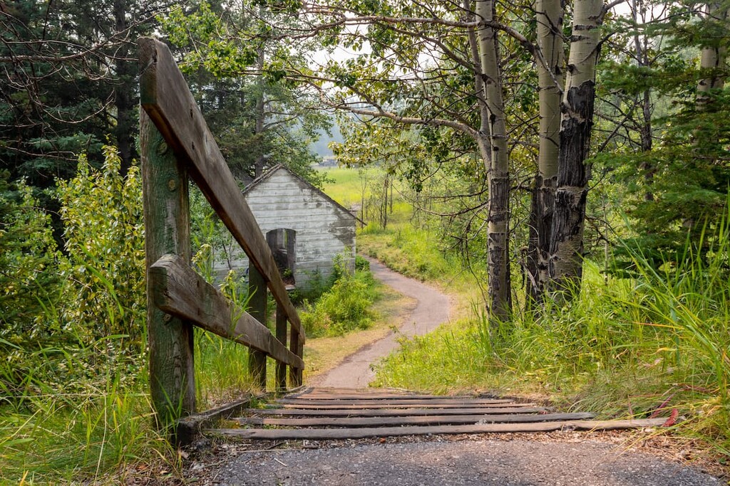
The history of the settling of Pincher Creek and the surrounding area can be seen first hand at the Kootenai Brown Pioneer Village in Pincher Creek. The attraction currently has two museums and 27 historical cabins that take you back to the end of the nineteenth century when settlers of European descent first came to the area.
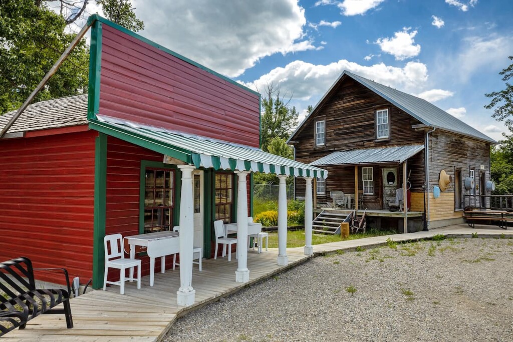
The village is an outdoor heritage facility and visitors can walk into the historic buildings, view the over 30,000 artifacts, and experience the history of the area. Some of the buildings to check out are the Father Lacombe Hermitage, the Fishburn School, the Cox House, the Walrond Ranch House, and the NWMP Horse Barn, the latter of which is one of the oldest buildings in the area.
Additionally, the First Nations Gallery features artifacts that showcase the Indigenous history of the area. Indeed, it is well to remember that over 500 generations of Indigenous peoples lived in the area before the arrival of Europeans in the 1700s.
As the legend goes, there is an immense gold deposit in the Rocky Mountains between the Crowsnest Pass and the Highwood River. In 1870, Frank Lemon and his partner Blackjack apparently discovered the gold; however, Lemon reportedly murdered Blackjack in the night and left the area to return to town where in grief he confessed his crime.
The story goes that two members of the Blackfoot Nation saw the gold and murder, as they were tasked with watching the pair of prospectors. After reporting the events to their chief, the legend says that the gold was then cursed that no one could find it. Lemon tried to retrace his path as did others to no avail, and for over 150 years no one has found this supposedly vast treasure.
Near Pincher Creek, there is a one-room log cabin that was built in the early-1900s and today serves as an example of an early 1900s homestead. At the time of its construction, the area was used by ranchers and miners who were working in the Crowsnest Pass.
The cabin was left by its original inhabitants and by the 1930s, it had become a rest stop where families would briefly stay upon their arrival in the valley before going on to set up their homesteads. In the 1940s and 1950s, it was a gathering place for locals to socialize, host dances, and conduct meetings.
The cabin was made a Municipal Historic Resource in 2008 and remains as a landmark of the lives of the early pioneers, and a gathering place for people in the valley.
First opened in 1965, Castle Mountain Resort is located at the west end of Highway 774, about 50 km (30 mi) from Pincher Creek. At the time it opened, there was only a T-bar that climbed 750 m (2,500 ft) and a Swiss style lodge.
The resort was originally run as a grassroots movement of downhill enthusiasts which attracted skiers from across southern Alberta. While the resort underwent some financial difficulties, by the mid-1990s, the resort was funded and expanded with modern amenities.
The resort currently offers several lifts, cat skiing, and a new mountain with ski trails. Castle Mountain Resort is a mountain for skiers, run by skiers, and their dedication to a great mountain experience is evident throughout the resort.
Castle Provincial Park is an area rich in natural history and beauty. The following are some of the incredible hikes that are worthwhile to do:
Willoughby Peak and Ironstone Lookout hike offers a moderate trail with exceptional views. The final 4 km (2.5 mi) of the 8 km (5 mi) trail feature some steep switchbacks; however, the view is well worth the effort.
The Sincline Lake Loop is an easy 12 km (7mi) stroll through forest and meadows with only 300m (1,000 ft) of elevation gain throughout. It is great for all skill levels and is a good trail to snowshoe, too. The loop can be a standalone outing or part of a larger series of hiking and adventure in Castle Provincial Park.
The hike to the York Creek Plane Crash visits the site where on January 19, 1946 a Royal Canadian Air Force DC-3 (Dakota) aircraft crashed with seven people on board. Poor weather was blamed for the plane’s collision with Mount Ptolemy. There were no survivors.
The trail is 16 to 20 kilometers (10 to 12 miles) long, and is considered difficult with 676 m (2,217 ft) of elevation gain. The wreckage of the aircraft was scattered over the area and a large section of the plane's tail is a highlight of this historical hike. The site of this tragedy should be treated with respect, taking nothing but photos and only leaving footprints.
With an area of 796 sq. km (307 sq. mi), Castle Wildland Provincial Park has many fantastic trails to hike. The following are among the best hikes in the area:
The hike up Table Mountain is 5 km (3 mi) to the summit with 832 m (2,729 ft) of elevation gain. The hike is difficult, and some sections require minor scrambling; however, the views are stunning and worth the effort.
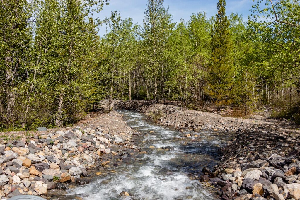
For something more relaxed, the 4 km (2.5 mi) trail to North Drywood Falls is a great choice. The trail is easy walking, and the meadows may be filled with wildflowers. The waterfalls at the end are a beautiful destination and the hike is appropriate for families with smaller children.
The hike to Bovin (Blue) Lake is a beautiful hike up through subalpine valleys to reach an alpine tarn. The views along the 10 km (6 mi) trail are beautiful and the lake is a great place to rest before heading back down to the trailhead.
While this southwestern corner of Alberta has been inhabited for over 10,000 years, there are relatively few towns and villages in the area. The following are some of the towns and places you can find accommodation while exploring the wilderness and trails in the MD of Pincher Creek.
The town of Pincher Creek is located centrally in the MD of Pincher Creek, near the Oldman Reservoir. Pincher Creek has several hotels for travelers to stay as well as restaurants and stores to fulfill your needs. There are also campgrounds around the reservoir, within the Oldman Reservoir Provincial Recreation Area.
There are some attractions within the town, such as the historic Kootenai Brown Pioneer Village which covers six acres, has 27 heritage buildings and over 30,000 artifacts that represent life for the early European settlers of the area. The hiking and recreation areas of Beauvais, Castle, and Castle Wildland Provincial Park are relatively close.
The city of Calgary is the largest city in Alberta and is located about 217 km (130 mi) north of the town of Pincher Creek. Calgary is a major metropolitan area with a mountain and western culture that are present.
Many of the locals head out to the mountains on a regular basis, and the proximity to destinations such as Kananaskis Country, Canmore, Banff, and Lake Louise is a major benefit of the city. However, there are many attractions in the city that are worthwhile to visit. The Calgary Tower, the Glenbow Museum, Studio Bell, and the Calgary Zoo are all interesting places.

The city has many parks and natural areas that are connected by pathways across the city, which allow for a run, walk, or cycle along the Bow or Elbow River, through Fish Creek Provincial Park, around the Glenmore Reservoir, or across Nose Hill.
Located in the southwest corner of the MD of Pincher Creek, Castle Mountain Resort caters to the budget of any adventurer with accommodation options that include a hostel, a hotel, vacation homes, and condos. The resort is a popular winter destination with ski-in/ski-out accommodations; however, it is also a comfortable basecamp for summer exploration and adventure in the region.
Castle Provincial Park has many camping areas for drive-in camping as well as backcountry camping while Castle Wildland Provincial Park has a lot of beautiful locations for random camping. Many of the drive-in options are free of charge; however, self-registration permits are required.
Additionally, there are two levels of comfort cabins available in the park. One option is a basic cabin with bunks, while the other option has beds and electricity. When camping in the Castle area, it is wise to be well-prepared for your trip because the nearest towns of Beaver Mines and Pincher Creek are a fair distance from the parks.