
Scan the QR code and open PeakVisor on your phone
Covering a large and diverse area in the southeastern corner of British Columbia, Canada, The Regional District of East Kootenay is a paradise for outdoor enthusiasts. Alpine and glacial scenery, grasslands with cacti, diverse wildlife, dense forests, wild rivers, historic towns, open meadows, long lakes, and hot springs, make East Kootenay a worthwhile destination.
There are over 670 named mountains in the East Kootenay district to explore. Mount Assiniboine (3618 m/11,870 ft) is the tallest mountain in East Kootenay, while extreme differential erosion has caused Mount Farnham (349 4m/11,460 ft) to have the most significant prominence.
East Kootenay is in the southeastern corner of British Columbia, with Alberta to the east and the US states of Montana and Idaho to the south. It is also located to the east of the Regional District of Central Kootenay and to the south of the Columbia-Shuswap Regional District.
The district is centered along the Kootenay and Columbia River Valley in the Rocky Mountain Trench, with Highway 93 running the length from south to north. East Kootenay extends west from the continental divide along the border with Alberta, across the Rocky Mountain Trench and up to the top of the peaks and ridges in the Purcell Mountains.
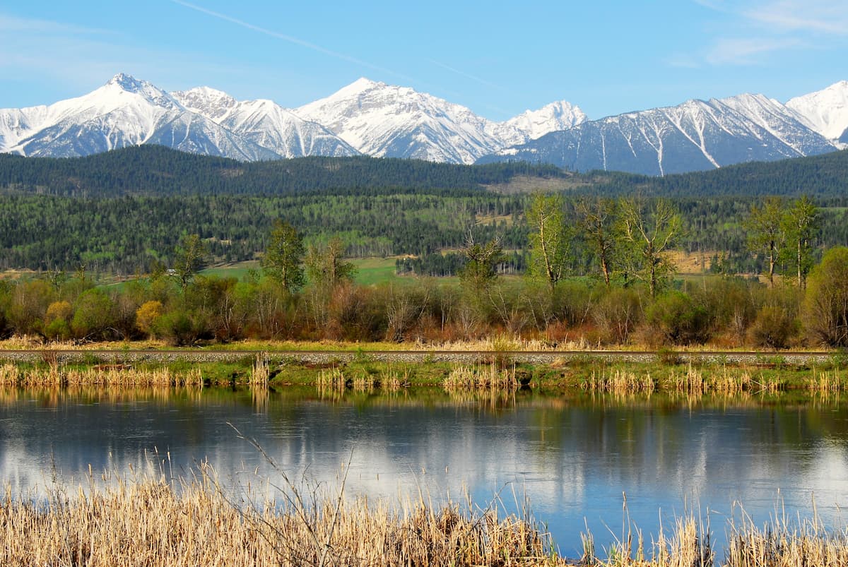
There are several major parks in the district, including Kootenay National Park, Mount Assiniboine Provincial Park, Height of the Rockies Provincial Park, and Purcell Wilderness Conservancy Provincial Park.
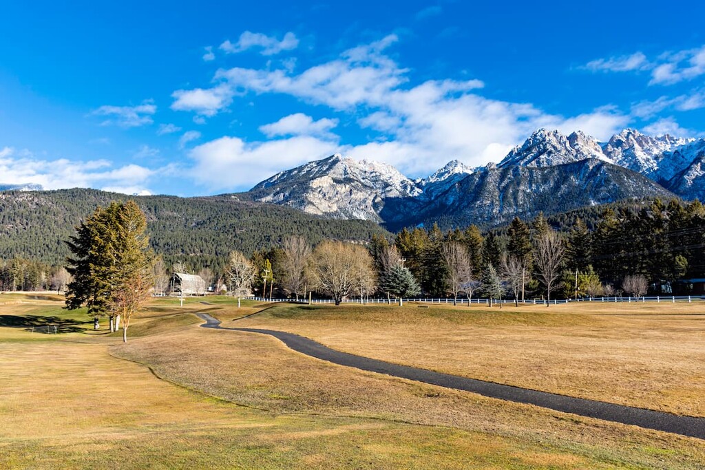
Within the regional district, there are a number of resort towns, such as Fairmont Hot Springs and Invermere that are located along the Columbia River and Kootenay River. Meanwhile, several more resort towns, like Fernie, are tucked away in the mountains.
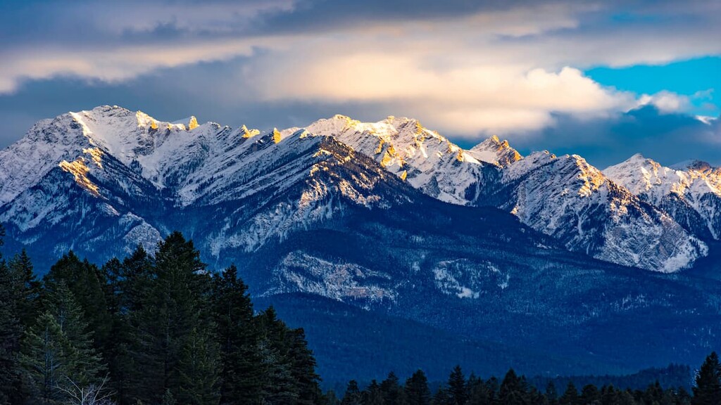
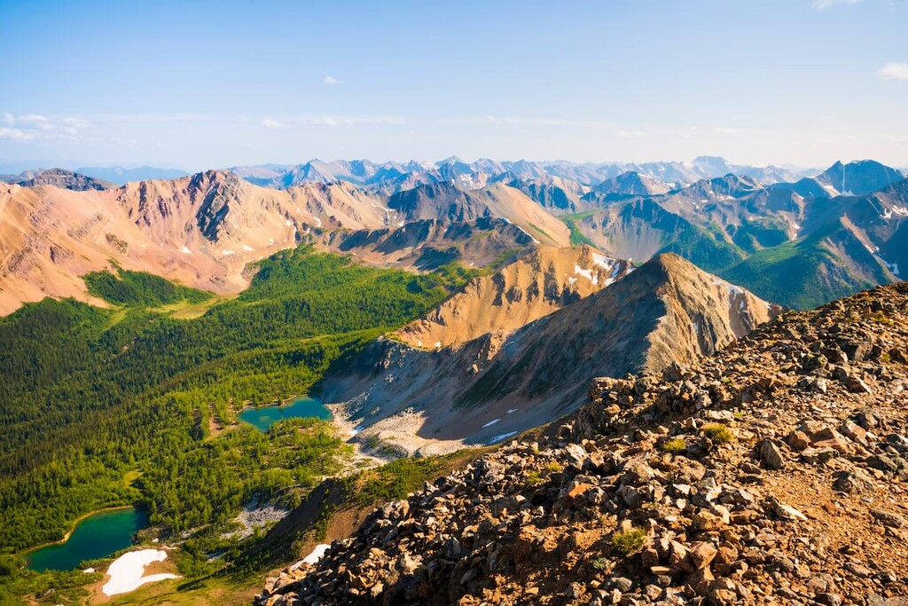
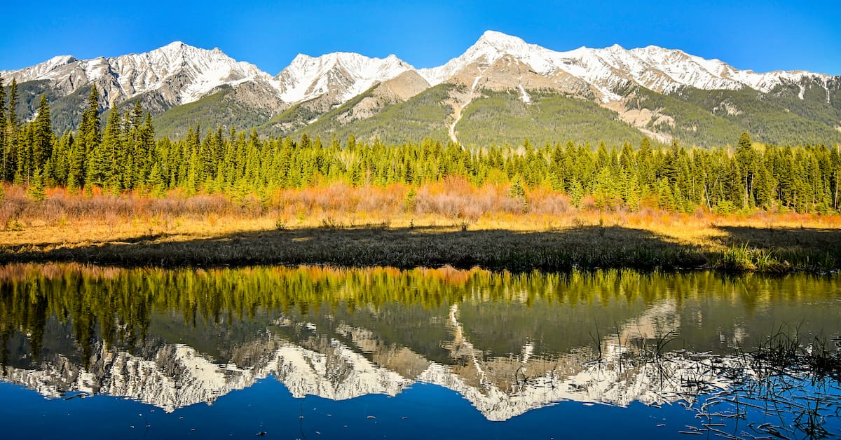
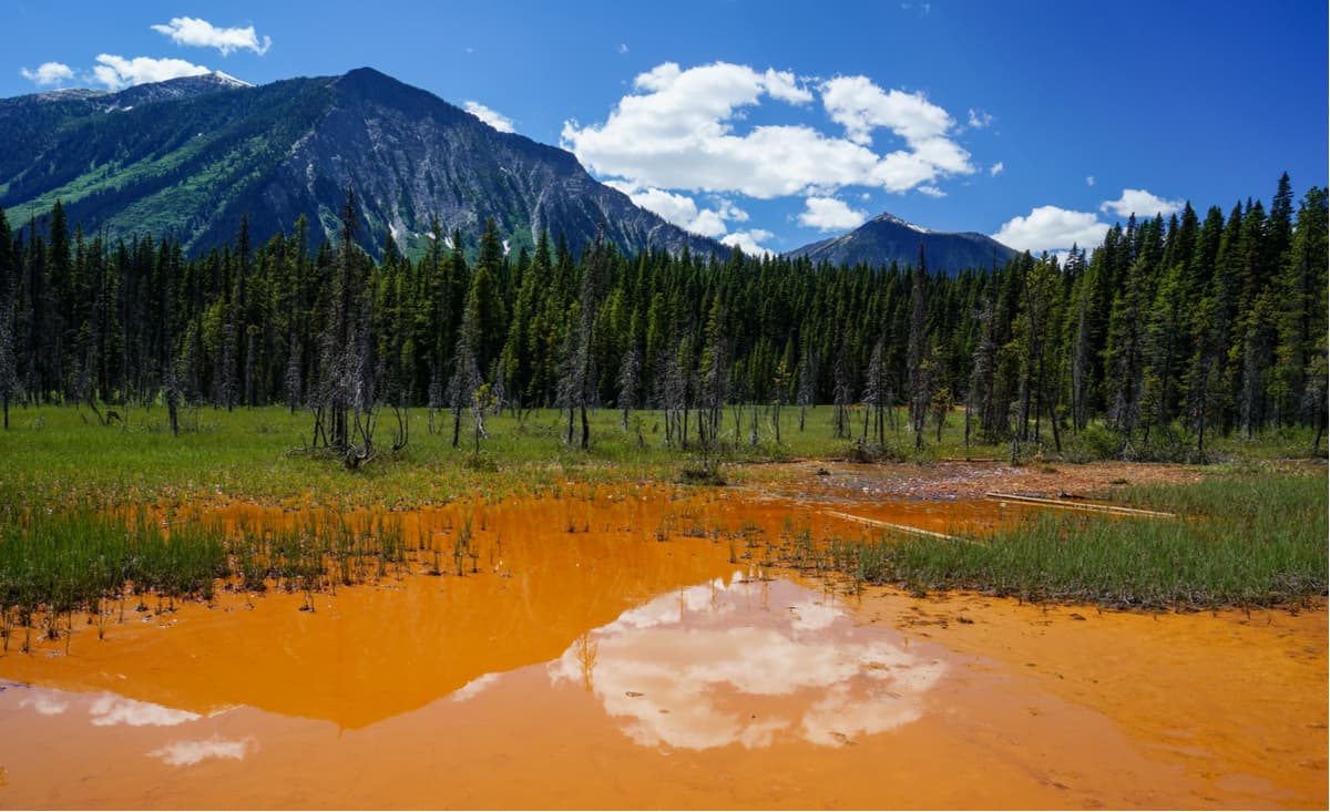
Photo of Kootenay National Park
The Regional District of East Kootenay is centered on the Rocky Mountain Trench, which separates the Canadian Rockies in the east from the Columbia Mountains in the west. While made from essentially the same layers of ancient sediment and stone, the Columbia and Rocky Mountains are different in appearance and age. The following is an introduction to the formation of the mountains on either side of the Rocky Mountain Trench.
The formation of the Rocky Mountains started about 75 million years ago as the tectonic plates under the Pacific Ocean pushed westward into the North American plate. The ancient layers of sediment and rock that spent billions of years forming on the seafloor began to be thrust into the sky. It is believed that the Rocky Mountains may have been over 6 km (4 mi) above sea level when they were at their tallest.
The Rocky Mountains took about 30 million years to form during a period called the Laramide orogeny. This period saw Cambrian and Devonian aged rock sliding over the younger Cretaceous. The upper layers of stone would experience immense friction, causing them to break along weaker spots and stack one layer onto the next, creating mountains and mountain ranges.
As the leading edge of the slab broke apart, the continued force pushed the slabs to create the near vertical mountains of the front ranges, like Mount Yamnuska.
While the trailing end of the slab slid smoothly creating horizontally banded mountains, like Castle Mountain, that erode slower than and therefore remain taller than mountains with vertical banding. It was primarily sedimentary rock, including limestone and dolomite that broke apart and was thrust up, on top of layers of sandstone and shale to create the Rocky Mountains.
The formation of the Columbia Mountains started about 160 million years ago, making it the first of the major ranges to start forming in western Canada. The period of mountain building that created the Columbia Mountains is called the Sevier orogeny, and it lasted about 110 million years, coinciding in part with the Laramide orogeny and the creation of the Rocky Mountains.
As an oceanic plate slid under the North American plate, the thickening crust was compressed and heated. This compression and heating allowed for the creation of mountains as layers of sedimentary and clastic rocks were stacked and folded.
In western Canada, the Columbia Mountains formed earliest in the geologic timeline. This was then followed by the Coast Mountains, which formed as the coast began to deform. Finally, the Rocky Mountains formed as the last of western Canadian ranges.
Towards the end of the orogenies, the fault between the Rockies and Columbia Mountains began to spread apart, creating the Rocky Mountain Trench. The trench is the divide between these ranges in Canada, ending in northern Montana in the United States.
The Canadian Rocky Mountains are characterized by their primary composition of limestone and dolomite. The Columbia Mountains have significant layers of limestone and dolomite too; however, they also have significant clastic layers and areas where the granite and gneiss bedrock are visible. Additionally, the Columbia Mountains contain significant deposits of gold, silver, copper, lead, and zinc.
The topography of the mountains in East Kootenay was created during the Pleistocene Epoch, when this part of the continent was covered by over 1,000 m (0.6 mi) of glacial ice. There were several glacial maximums during the nearly 3 million year period through which the mountains and ranges were eroded to what we see today.
An interesting note about the major rivers in East Kootenay is that while looking at a large-scale map of the area it may appear that only one river flows through the valley; however, there are two rivers that flow out of the valley: the Columbia River and the Kootenay River. Furthermore, the rivers flow in opposite directions from the middle of the valley, with the Columbia River flowing north, while the Kootenay River flows south out of the valley.
The altitude and topography create many diverse ecosystems within the East Kootenay region. Alpine peaks, glaciers, grasslands, forests, and meadows are habitat to many plants and animals.
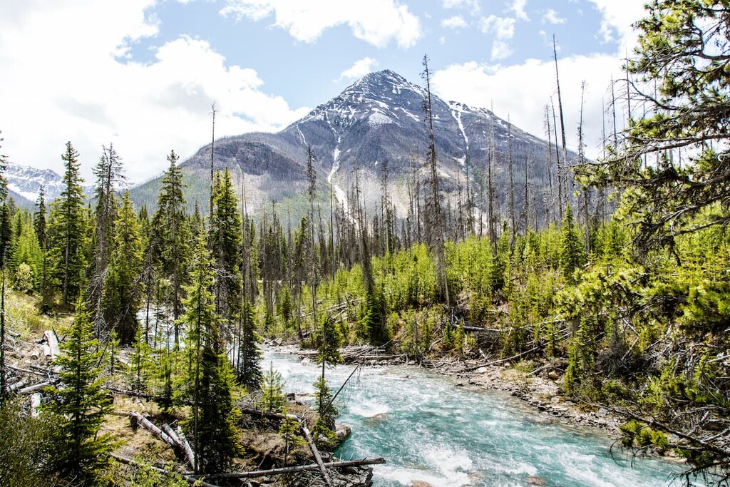
The alpine peaks in East Kootenay are generally barren with only the most hardy brush and sedge species able to live there. There are dense forests that cover much of the mountain slopes and parts of the valley. Engelmann spruce and subalpine fir grow the highest on the mountains, while Douglas fir and ponderosa pine grow at lower elevations.
The Purcell Mountains on the western border of the region create a unique ecosystem by casting a rain shadow on their eastern slopes. A rain shadow is created when the warm and moisture laden air from the Pacific cools as it is pushed over the mountains, making the moisture condense and fall as rain and snow on the western slopes, creating an unusually dry zone on the eastern slopes and rainforests on the western. The rain shadow creates a desert like grassland that is populated with bunchgrass, low shrubs and cacti.
The Columbia River wetlands in the valley are the longest stretch of undeveloped wetlands in North America. These wetlands are crucial habitat for migratory birds and animals such as the grizzly bear, wolverine, western toad, northern goshawk, and the peregrine falcon. The rivers are also habitat for the westslope cutthroat trout.
The valley is an important winter range for many ungulates. There are large herds of elk, deer, and bighorn sheep that live in the region. The southern mountain caribou herds live in the area and are at critically low population levels.
From glaciers, through desert grasslands and dense forests to river valleys, there are many unique ecosystems and wildlife habitats in East Kootenay. The current inhabitants are striving to manage the balance between conservation and commercialization.
Archeological evidence suggests that about 11,500 years ago, people began migrating into the east Kootenay valley as the glaciers melted. The earliest artifacts of habitation were found in the southern Purcell Mountains, and sub-range of the Columbia Mountains, in the southwest corner of East Kootenay, and are part of what is called the Goatfell Complex.
East Kootenay is within the traditional territory of the Ktunaxa Nation, who currently live in the area and traditionally travelled east in the summer to hunt buffalo on the prairies. The English name Kootenay (US spelling: Kootenai) stems from the spoken word Ktunaxa. There is a theory that the present-day Ktunaxa Nation are direct descendants of the valley inhabitants from 11,500 years ago.
This theory proposes the modern Ktunaxa are descendants of the original inhabitants because there has been no break in the 11,500-year archeological record. This means that all ancient technologies that have been found, originate in the area, and that there is no indication that the original inhabitants emigrated.
A second theory argues the modern Ktunaxa Nation immigrated to the area in the eighteenth century. It is hypothesized that the Ktunaxa were forced west out of the eastern Rocky Mountains and the plains by the Blackfoot Confederacy. There is historical and cultural evidence showing the regular, even annual migration of many Ktunaxa people across the mountains for hunting.
There are many cultural sites in the area that include petroglyphs, ancient quarries, and workshops, as well as many artifacts including tools, arrow tips, and spear heads. Artifacts have been found that indicate the Kananaskis Passes and Palliser Pass were used as regular migration routes to the prairies over the last 8,000 years. The many hot springs in the area also show significant use over thousands of years and the Ktunaxa gathered pigment from the paint pots in Kootenay National Park.
The first Europeans to enter the area were possibly led by Alexander Mackenzie during his expedition in the late eighteenth century, making European contact with many First Nations for the first time. Captain John Palliser further mapped the area during his expeditions of the nineteenth century.
Prospectors and surveyors entered the land searching for natural resources to extract. Gold was found and spurred a gold rush in the valley, which triggered settlement of the region. Not long after, vast coal and gypsum deposits were discovered, too, helping to bolster the mining industry in the region.
Colonel James Baker, who emigrated from England to British Columbia, purchased the land that the city of Cranbrook is now on in the 1880s. Baker named the land after his home Cranbrook, Kent, England. In 1898 Baker convinced the Canadian Pacific Railway to run their Crowsnest Pass line through Cranbrook instead of the nearby Fort Steele. With the railway came a boom in commerce and industry, and by 1905, Cranbrook was a city and considered the commercial center of the Kootenay area.
Currently, there are many towns and small cities through the area that cater to the logging and mining industry in the region. Most cities have now expanded their tourism industry, creating resorts that cater to skiers and other outdoor enthusiasts.
The District of East Kootenay includes large valley lakes, many mountain ranges, the headwaters of two major rivers, many hot springs, historical sites, national and provincial parks, and resort towns. The following are several of the destinations and trails in East Kootenay.
Hiking out to the paint pots allows you to go back in time and observe a natural feature that the Indigenous inhabitants of the land have used for thousands of years. With the trailhead located off Highway 93, this 2 km (1.5 mi) hike is a good opportunity to stretch your legs after a long drive and take in a natural wonder of the area.
The interpretive trail will lead you through a Douglas fir and lodgepole pine forest to the ochre beds and paint pots teaching you how the Ktunaxa and early settlers of European descent used and mined the iron-oxide rich mud. The trail is easy, educational, and there are decent views of the nearby Vermillion Range.
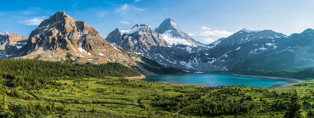
Located along the Alberta border, there are no roads into Mount Assiniboine Provincial Park. In fact, the most direct routes into this park in British Columbia are by trails that originate in Alberta. In 1922, designated the land around Mount Assiniboine as a provincial park, and in 1973 the park was expanded to its current size of 39,050ha (96,495 acres).
Mount Assiniboine is a world-class mountaineering destination and there are also several notable peaks, faces, and ridges nearby to challenge. Indeed, Mount Assiniboine itself is often referred to as the “Canadian Matterhorn” or the “Matterhorn of the Rockies” due to its striking resemblance to the great peak of the Matterhorn in the Alps of Switzerland and Italy.
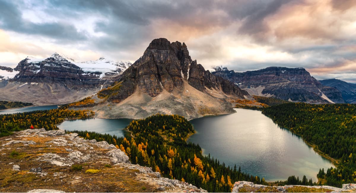
The park is also popular for fishing, hiking, horseback riding, wildlife viewing, winter recreation, and limited hunting zones. The limited access to the park has helped to conserve the pristine wilderness.
There are many campsites and cabins available as accommodation within the park. Despite the limited access, Mount Assiniboine Provincial Park is a popular destination and helicopters are even available to fly people into the park. The Mount Assiniboine area has world class scenery and a wonderful wilderness experience for those that are willing to put in some effort to get there.
Though the Ktunaxa used the springs for hundreds and maybe thousands of years, the first recorded visit by a person of European descent to the hot springs was by George Simpson in 1841. During the late nineteenth century, settlers arrived in the area and popularity of the pools grew, until it was developed into the modern pools we have today. They were named Radium Hot Springs for the trace amounts of radon found in the water.
The first concrete pool and log bathhouse were built in 1914. The facilities have since been expanded and modernized and Radium Hot Springs currently allows visitors to relax in the hot springs, play in the pool, or receive treatments at a spa. The hot springs are a great place to relax after hiking the nearby trails.
Originally founded in 1864 as Galbraith’s Ferry, the town was later renamed after the legendary Sam Steele of the Northwest Mounted Police in 1888. If not for the persuasive Colonel James Baker, Fort Steele would have become the center for commerce in East Kootenay instead of Cranbrook. Since Baker was able to convince the Canadian Pacific Railway to come through Cranbrook, and the proposed railway was diverted from Fort Steele, the town was essentially abandoned and left to decay.
In 1967, the British Columbia parliament designated Fort Steele as an historic site and began renovating the town. Fort Steele Heritage Town opened in 1969 and allows an immersive historical experience for visitors. The town offers street theatre, museum displays, livestock demonstrations, live theatre shows, steam train rides, horse-drawn wagon rides, and heritage trades demonstrations like blacksmithing and carpentry.
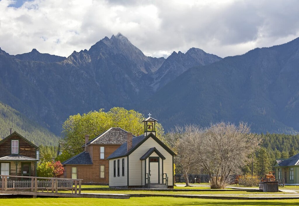
Situated between the magnificent Purcell and Rocky Mountains, Fort Steele has become a popular tourist destination. You can immerse yourself in the history of how the settlers lived and worked in East Kootenay by visiting Fort Steele.
Found at the junction of Highway 93 and Highway 95 in British Columbia, Radium Hot Springs is a small village named after the nearby springs in Kootenay National Park.
Located just south of Kootenay National Park, Radium Hot Springs is located in the geological formation known as the Rocky Mountain Trench. This valley, which is visible from space, separates the Rocky Mountains in the east from the Columbia Mountains to the west. The trench is also known as the Valley of a Thousand Peaks.
Situated in this valley, Radium Hot Springs has doorstep access to incredible mountain scenery, wildlife, and excursions. Some of the notable hikes in the area include trails in Kootenay National Park, The Old Coach Trail, and Sinclair Canyon Trails.
Originally settled by Colonel James Baker, from Cranbrook, Kent, England, the city of Cranbrook lies in the Kootenay River Valley in the Canadian Rockies Trench in British Columbia.
At the end of the nineteenth century, as the railways were expanding westward, Colonel Baker convinced the Canadian Pacific Railway to run their Crowsnest Pass line through Cranbrook. The railway cemented the town's importance and by 1905, Cranbrook had become the commercial and industrial center of the region and was incorporated as a city.
Presently, there are a couple of notable attractions in Cranbrook for tourists and locals. First is the “rails to trails” trail leading from Cranbrook along the old Canadian Pacific Railway right of way that was donated to create a paved trail between towns.
Second is the Cranbrook History Center, which is a museum that exhibits passenger rail cars from the early 1900s, as well as natural history specimens and artifacts from early human habitation. The museum is considered to be of national and international importance for the cultural exhibits that it contains.
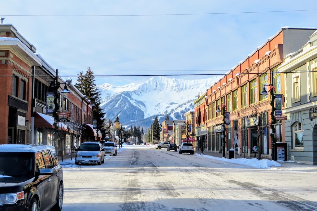
Located along Highway 3, in British Columbia at the south end of the Hughes Ranges, Fernie was founded in 1898 by William Fernie as he made claims to the land and started mining the nearby coal reserves. By 1904, Fernie was incorporated as a city, and, to this day, it is the only city-class municipality to be completely surrounded by the Rocky Mountains.
Fernie started as a coal mining town; however, the town currently caters to outdoor enthusiasts, especially during the winter season. The city’s population of 5,000 swells during the winter months. The recreation opportunities from Fernie are ample and the scenery is incredible. Any time of year, Fernie has something for everyone to enjoy.


ultra
11ers-bc
11ers-ca-rockies
fred-beckey-great-peaks
canada-sampler
british-columbia-ultras
alberta-ultras
ultra
11ers-bc
11ers-ca-rockies
fred-beckey-great-peaks
canada-sampler
british-columbia-ultras
alberta-ultras
ultra
11ers-bc
11ers-ca-rockies
british-columbia-ultras


