Scan the QR code and open PeakVisor on your phone
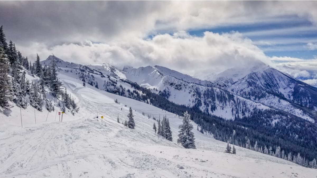
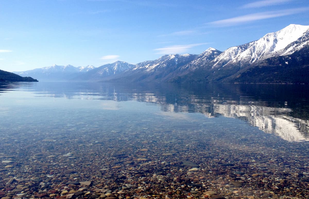
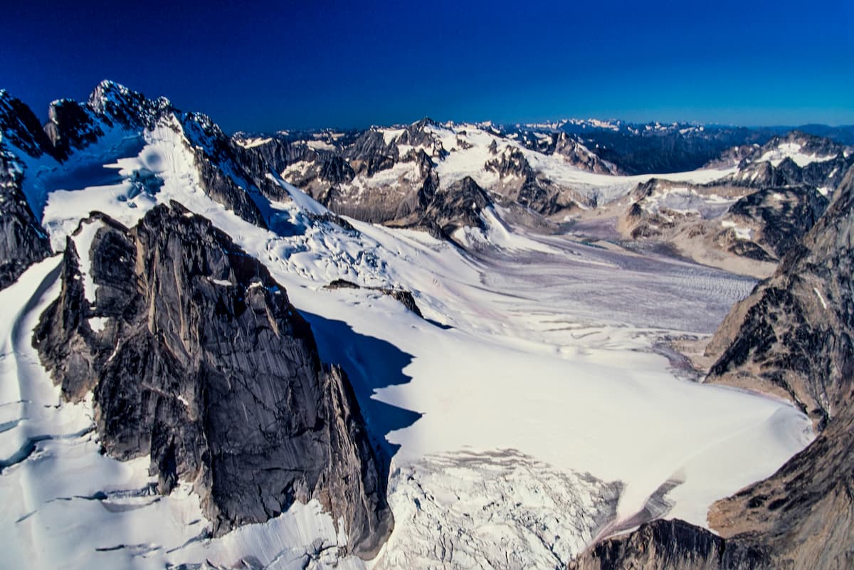
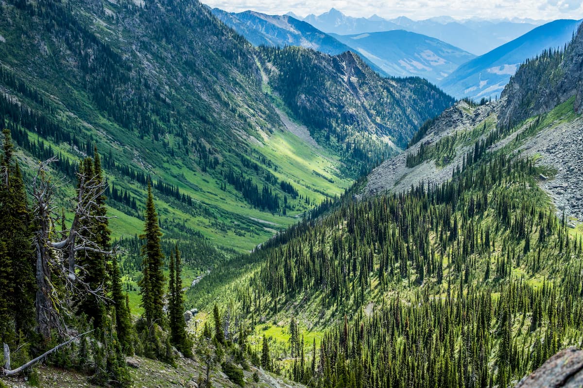
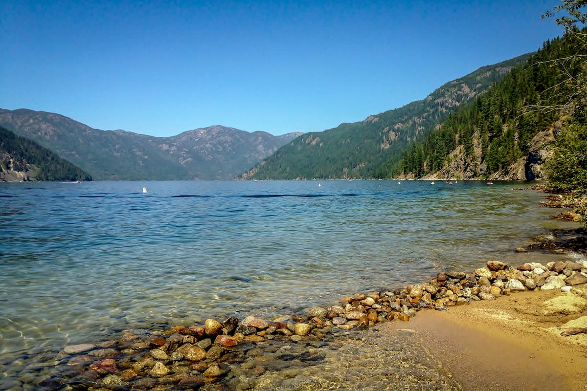
The Regional District of Central Kootenay is a regional district located in the province of British Columbia in western Canada. The district covers a region spanning 22,095 square kilometers and has an estimated population of just under 60,000. There are 561 named mountains in the Regional District of Central Kootenay. Howser Spire is the highest point at 3,401 meters. The most prominent mountain is Mount Odin with 2,404 meters of prominence. The start of the Columbia River lies within this regional district before traveling south towards Washington state in the United States. Kootenay Lake is located in this region totaling 104 kilometers in length and a maximum width of 5 kilometers. Though there are many subranges within this Regional District, the three major ranges include the Monashee, Selkirk, and Purcell Mountains.
This heavily mountainous area contains eleven distinct Provincial Parks. The parks in the region range from massive ones, such as the Purcell Wilderness Conservancy Park, to small ones, like the Bugaboo Park located in the northern region. The overall climate of the region is quite moderate with heavy amounts of snowfall in higher elevations and warmer summer months perfect for hiking. Parks within the district include Greystokes Provincial Park, Monashee Provincial Park, Granby Provincial Park, Valhalla Provincial Park, Goat Range Provincial Park, Purcell Wilderness Conservancy Provincial Park, Gladstone Provincial Park, Kokanee Glacier Provincial Park, West Arm Provincial Park, Kianuko Provincial Park, and Bugaboo Park.
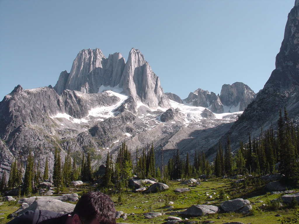
Purcell Wilderness Conservancy Park: Purcell Wilderness Conservancy Provincial Park is located in British Columbia, Canada. The park was established in 1974 and it encompasses over 202,709 hectares. The park contains six major drainages out of the Purcell Mountains. There are over 137 kilometers of trails throughout the park for hiking and winter snow sports. The park is known for being one of the first areas in Canada to become protected because of the activism of citizens. The Purcell Wilderness Conservancy Provincial Park is also thought to be the largest intact ecosystem that is protected in all of southern British Columbia. Notable hikes within the park include Earl Grey Trail and Fry Creek Canyon.
Goat Range Park: This park covers 79,00 ha across southeastern British Columbia. The park was established back in 1995 to help protect the unique species of trout that populate the waters. Known as the Gerrard Rainbow Trout, these fish are thought to be the largest of their kind in the world. The park was also established to help protect the unique “White Grizzly'' that roam the region. Trails in the park often lead to one of the many lakes or the abandoned mining towns scattered throughout.
West Arm Park: This park is named after its location on Kootenay Lake. Though the lake predominately extends north to south, a west arm extends and the surrounding land is protected. The West Arm Park protects the land from Nelson to Harrop and encompasses the surrounding mountains.
Gladstone Park: Located at the southern border of the Regional District of Central Kootenay lies Gladstone Park, extending nearly 40 ha. The park was established back in 1995 and encompasses what used to be Ole Johnson and Texas Creek parks. The primary reason for the park was to help protect California bighorn sheep, Northern leopard frog, and Grizzly bears. There are hiking trails throughout the park, approximately 50 km, as well as opportunities for camping, fishing, canoeing, and kayaking.
The largest town with the Regional District of Central Kootenay is Nelson, BC. Located in the Selkirk Mountains, on the West Arm of Kootenay Lake, sits this small city with a population of approximately 10,000. It is known as “The Queen City” due to the high number of restored buildings during the gold and silver rush days. It was during the 1880’s that the town was formed and railroads passed through the city to connect it with the rest of Canada. The city of Nelson is known for a wide array of restaurants, cafes, and coffee shops, perfect for a post hike meal. Nelson is also known for being near a plethora of outdoor activities including hiking, trail running, mountain biking, skiing, snowshoeing and mountaineering.

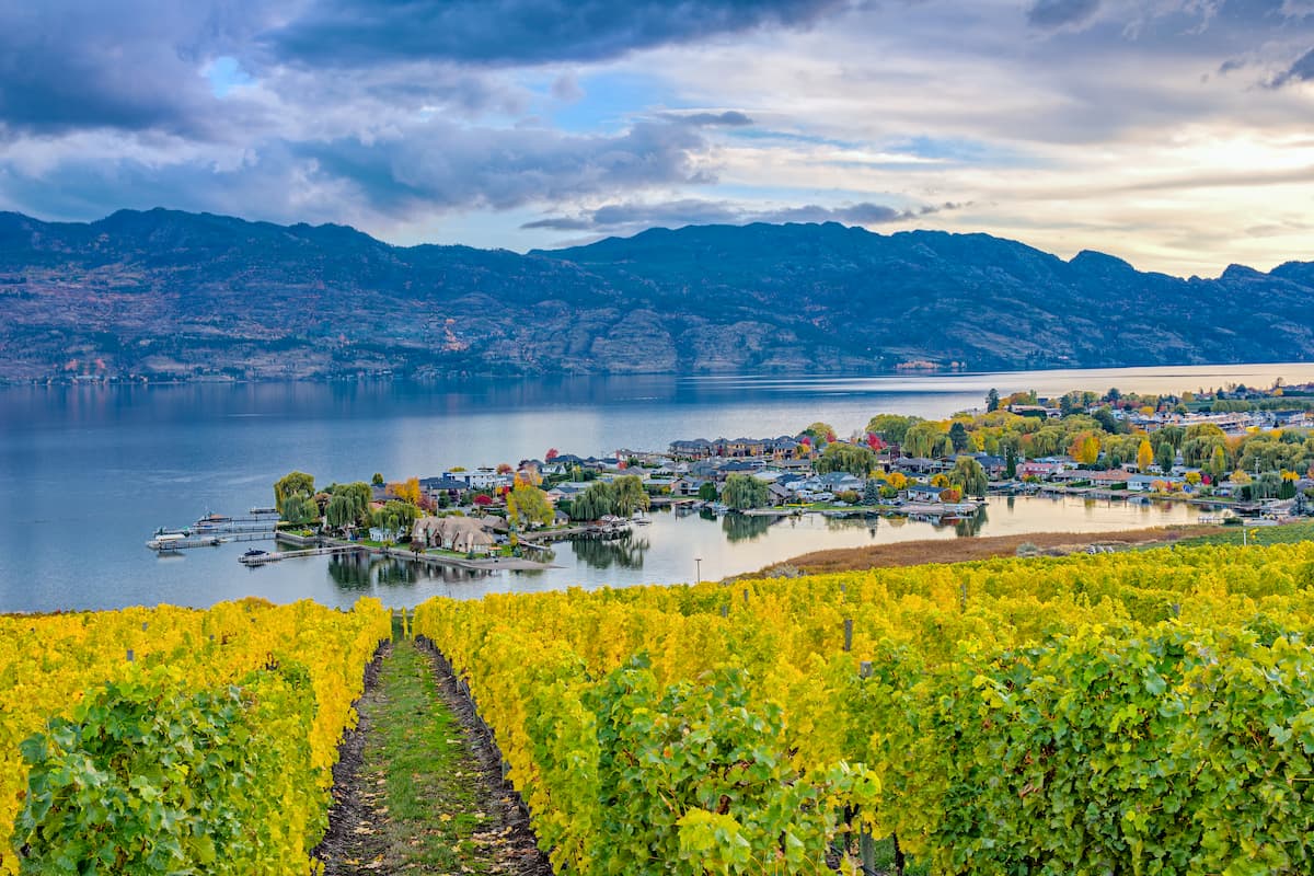
The city of Kelowna lies just 30 minutes from the western edge of the Regional District of Central Kootenay. Located on Okanagan Lake within the Okanagan Valley of British Columbia, Kelowna is the seventh largest city within the province. The term Kelowna is derived from the Okanagan language term for grizzly bear. The city sits on the eastern shore of Okanagan Lake and is a notable stop within the wine country. During warmer months the town is full of water sports, hiking, biking, and running. Take a trip to Myra Canyon on the reclaimed Kettle Valley Railway. From there cycle through tunnels and along a steep canyon rock face.
Just north of this district lies the city of Revelstoke with a population of approximately 8,000. The city lies along the Columbia River just south of the Revelstoke Dam. The town is a haven for outdoor enthusiasts due to its close proximity to the mountains. The Selkirk Mountains lie just to the east along with Glacier National Park. During the winter months the town transforms into a skier’s paradise with Revelstoke Mountain Resort which is home to North America’s largest amount of vertical for a ski resort. The small city is also home to the largest amount of snowfall ever recorded by a Canadian city totaling 24 meters in a single winter.