Scan the QR code and open PeakVisor on your phone
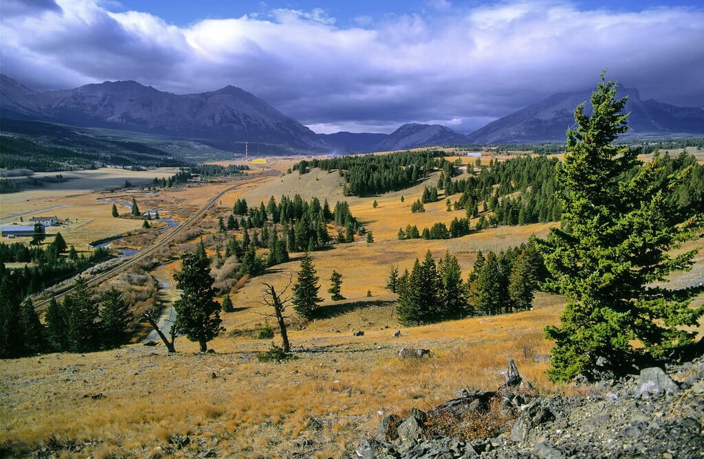
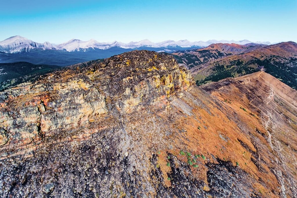
Cataract Creek Public Land Use Zone (Cataract Creek PLUZ) is located at the south end of Kananaskis Country in Alberta, Canada. There are 16 peaks in the zone, the tallest and most prominent of which is Mount Burke with 2542 m (8,338 ft) of elevation and 619 m (2,030 ft) of prominence.
Kananaskis Country is located along the front ranges of the Rocky Mountains in Alberta, Canada. Cataract Creek Public Land Use Zone is found at the southern end of Kananaskis Country, bordered by Livingstone Public Land Use Zone to the south and Kananaskis Country Public Land Use Zone to the north.
Don Getty Wildland Provincial Park also has sections that border Cataract Creek PLUZ. Additionally, Plateau Mountain Ecological Reserve is within the borders of Cataract Creek PLUZ. The primary access to the PLUZ is the Kananaskis Trail (Highway 40) as well as Highway 532, the latter of which heads east into the zone from Highway 22.
Public Land Use Zones are public lands that are wilderness areas for the public to use. Camping and staging facilities for Cataract Creek PLUZ are provided within provincial recreation areas (PRAs). There are campgrounds and trailheads located at Etherington Creek Provincial Recreation Area and Cataract Creek Provincial Recreation Area.
Some of the provincial parks close to Cataract Creek PLUZ are Peter Lougheed Provincial Park and Sheep River Provincial Park. The provincial parks have lots of access roads as well as significant camping and recreation facilities. Nearby wildland provincial parks, such as Don Getty Wildland Provincial Park and Bluerock Wildland Provincial Park are protected areas; however, they have minimal road access and no facilities.
Provincial recreation areas, such as Evan-Thomas PRA, Cataract Creek PRA, and Etherington Creek PRA are designated areas that can manage trailhead parking lots, campgrounds, and other service facilities for wildland provincial parks and public land use zones.
Plateau Mountain Ecological Reserve is a protected area within Cataract Creek PLUZ that was designated to protect specific habitats, ecosystems, or landscapes. There are no services in the ecological reserve and activities are generally limited to non-motorized activities such as hiking, backpacking, mountain biking, and fishing.
The public land use zones of Kananaskis Country and Alberta are a place to recreate with minimal rules on what is and is not permitted. Hiking, mountain biking, hunting, fishing, and horseback riding are generally allowed in all PLUZ. In Kananaskis Country there are four PLUZ, of which some have regulations on what types of activities are allowed.
McLean Creek PLUZ allows all activities that are permitted in public land use zones, including OHV use in the summer and winter. Cataract Creek PLUZ and Sibbald PLUZ only allow OHV use during the winter, and they both have winter trail systems that are maintained for snowmobile use. Kananaskis Country PLUZ is the final PLUZ in Kananaskis Country and it does not allow any OHV use.
Cataract Creek PLUZ is within the Livingstone Range of the Rocky Mountains. The formation of these hills and mountains goes back about 500 million years, when a shallow sea covered the west coast of what is now Canada.
During this time, cyanobacteria, also known as “blue-green algae” inhabited the sea off the west coast of North America. When they die, these cyanobacteria create a calcite particle and the calcite settles to the ocean floor. The crystals accumulated on the ocean floor and formed thick layers of limestone and dolostone.
About 185 million years ago, as North America was moving west, it collided with tectonic plates under the Pacific Ocean and the layers of marine sediment began to deform and uplift. The deformations and uplifts of the continental margin occurred as the denser and heavier tectonic plates under the ocean began to slip under North America, which was the start of the mountain forming process in western Canada.
The Columbia and then Coast Mountains of the Western Cordillera formed first, followed by the Canadian Rockies, which started forming about 75 million years ago. For about 40 million years, as the Kula plate slipped beneath the continent, massive slabs of Paleozoic limestone stacked over the younger Cretaceous sandstone and shale, forming the Canadian Rockies.
After the formation of the Rocky Mountains, the world experienced a period of glaciation. During this time, ice sheets that were over a kilometer thick covered most of Canada, including the Rocky Mountains. The Pleistocene glaciation created the current topography of the Rocky Mountains, including the areas of the Livingstone Range and Cataract Creek PLUZ.
The glaciers carved the valleys by scouring the soft Cretaceous layers of sandstone and shale, while leaving behind more erosion-resistant rocks. The glaciers left remnants of their passing as glacial till formations, which include eskers, kames, and moraines. Cirques and hanging valleys are also scars on the mountains that show the force of glacial erosion.
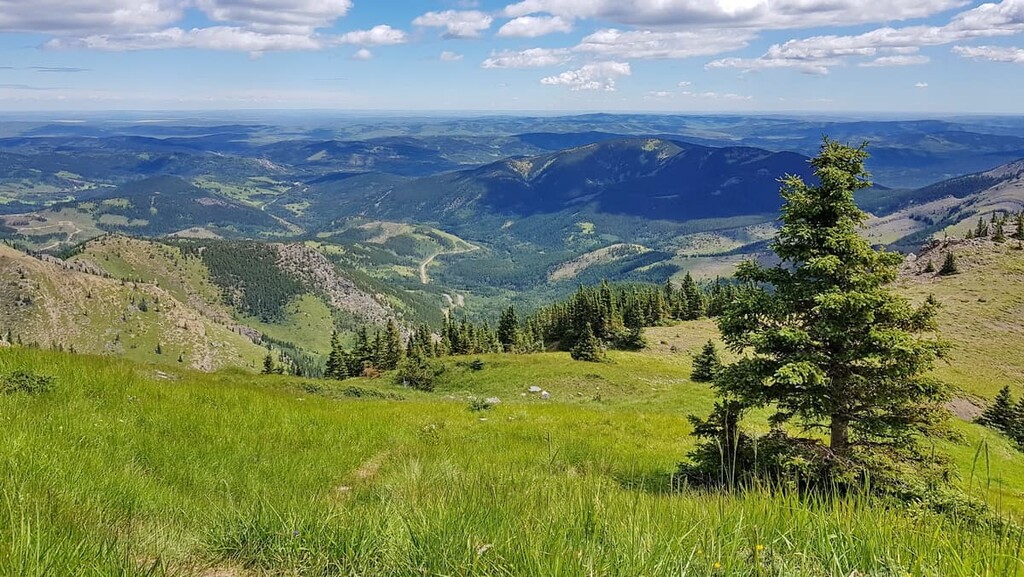
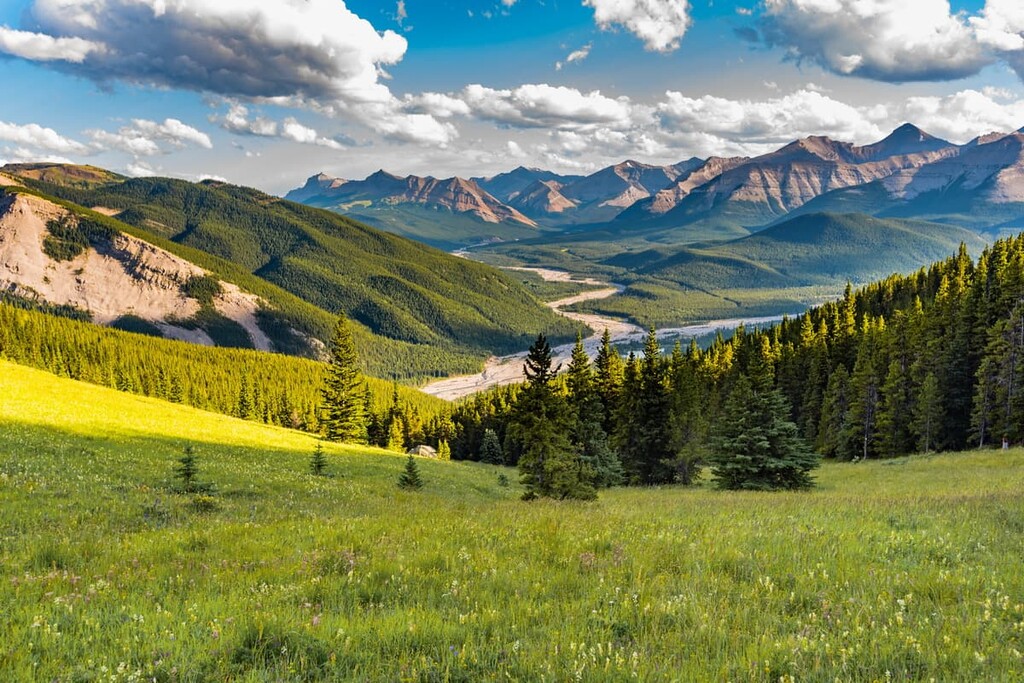
The ecology of Cataract Creek PLUZ is part of the Rocky Mountain Natural Region. There are three subregions of Rocky Mountain ecology found in the region: alpine, subalpine, and montane. The climate of the Rocky Mountains is characterized by long, cold winters and short, cool summers with high amounts of precipitation, which falls mainly as snow.
With minimal vegetation, which usually consists of lichen, sedge and heath, the alpine zone is generally a rocky and barren place. Due to their exposure to fierce winds and winter storms, trees in this area tend to be stunted and twisted in formations known as krummholz.
Most animals avoid inhabiting the extreme conditions of the alpine zone; however, there are several species that spend part of the year on the mountain peaks. Several bird species nest among the alpine rocks, such as white-tailed ptarmigan and the American pipit. Meanwhile, mountain goats and bighorn sheep often retreat to the peaks to avoid predators.
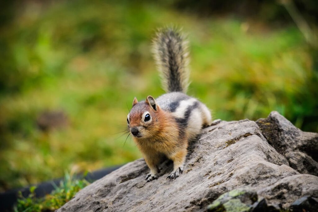
The hoary marmot, Columbian ground squirrel, and pika inhabit the border between the alpine and subalpine. These small mammals burrow under the alpine rocks and feed off the vegetation of the subalpine slopes. Grizzly bears, black bears, cougars, white-tail deer, mule deer, elk, mountain goats, and bighorn sheep spend at least part of the year in the subalpine forests and meadows; however, most animals spend winter in the valleys of the montane ecoregion.
With temperatures that are generally warmer than those of the alpine zone and with less exposure to fierce winter storms, there is a greater variety of plants and animals at the lower elevations of the subalpine zone. The subalpine forests are dominated by the coniferous species of Engelmann spruce, subalpine fir, white spruce, larch, and lodgepole pine.
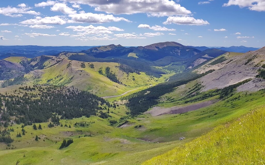
The montane ecology region is home to a great diversity of flora and fauna. Indeed, all the species that are present at the higher elevations also frequently inhabit the lower slopes, valleys, and foothills of the montane ecoregion of Cataract Creek PLUZ.
The montane ecoregion is characterized by a matrix of forests, and grasslands filled with oat grasses, fescue, wheat grass, and June grass. The montane forests also contain Douglas fir, aspen, and poplar, in addition to the larch and other coniferous trees of the subalpine.
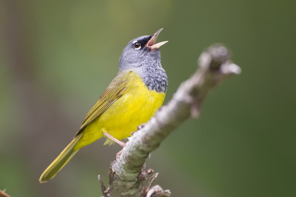
The Rocky Mountain Natural Region is home to many birds, including MacGillivray’s warbler, white-crowned sparrow, lazuli bunting, gray-crowned rosy finch, American pipit, the warbling vireo, and the curious gray jay.
Kananaskis Country, which includes Cataract Creek PLUZ, has been inhabited by humans almost continually for the past 11,000 years. Many of the culturally significant sites in the region are uncovered while surveying for road construction. The sites include ancient campsites, workshops, quarries, and buffalo jumps.
Cataract Creek PLUZ is the traditional territory of the Métis, Tsuu T’ina, Stoney, Ktunaxa nations, and the Blackfoot Confederacy. The first recorded European to enter the area was Peter Fidler in 1791, who also claims the first recorded mountain ascent in the Canadian Rockies, when he summited Thunder Mountain in 1792.
The region was settled by Europeans throughout the twentieth century, who used the area for ranching, logging, and mining. By the 1950s, the eastern slopes of the Rockies were becoming a popular destination for Albertans to come and camp and adventure. The number of visitors grew steadily over the next 25 years. Eventually, Peter Lougheed, then the premier of Alberta, designated part of the eastern slopes as Kananaskis Country, which is a multi-use recreation area.
With the new designation, many areas that were popular for OHV use no longer permitted OHV use. The public lands of Kananaskis Country were divided into areas that allowed for different activities, including OHV use.
Cataract Creek PLUZ was deemed suitable for OHV use during the winter only and has become a popular destination for snowmobile enthusiasts throughout the region during the winter. Summer activities include hiking and other non-motorized adventures in the area which respect the environmental sensitivity of the area.
Cataract Creek PLUZ is home to many unique and special places. The following are a few trails that will bring you closer to nature and let you explore and see some amazing places.
Following Cataract Creek downstream, the Upper Cataract Falls Trail is a casual hike through meadow and forest to the waterfalls. The trail is 4 km (2.4 mi) each way and is neither an official trail nor a maintained path. The trail starts from behind campsite #27 in the Cataract Creek Campground.
Ending in a 6 m (20 ft) waterfall, the Cat Interpretive Trail is a short hike with signs describing the natural history of the area. Interpretive trails are a wonderful and usually a quick way to learn about the region you are exploring.
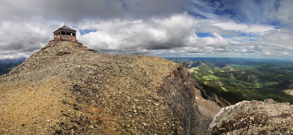
This trail follows a wellsite access road to the top of Plateau Mountain. This hike starts in Cataract Creek PLUZ and enters Plateau Mountain Ecological Reserve. Plateau Mountain is home to unique periglacial features, landscapes, and ecosystems. Plateau Mountain is a very special and unique place in Kananaskis, because along with the tundra ecosystem on the plateau, it was not covered during the recent glacial maximums, which means that Plateau Mountain has been free of ice for about 90,000 years.
Cataract Creek PLUZ is a popular destination for outdoor enthusiasts in southwestern Alberta. With waterfalls, mountain peaks to hike, and incredible snowmobile trails in the winter, the following are some places that offer accommodation and supplies if you want to visit.
With the mountains visible on the horizon from most places in the city, Calgary is a gateway to the Rockies. Located in the foothills of the Rocky Mountains, Calgary is the largest city in Alberta and many tourists pass through Calgary on their way to Canmore, Banff, and most locations in the southern Canadian Rockies.
There are many worthwhile local events and activities to check out if you happen to be in the city. During the summer, there are many outdoor events ranging from street festivals to The Nationals at Spruce Meadows, and the Calgary Stampede.
Calgary has a lot to offer; however, its proximity to the Canadian Rockies is appreciated and a highlight for many residents.

Canmore is located at the north end of Kananaskis Country, while Cataract Creek is towards the south end. Highway 40 is incredibly scenic and will take you through the Highwood Pass, which is the highest paved pass in Canada.
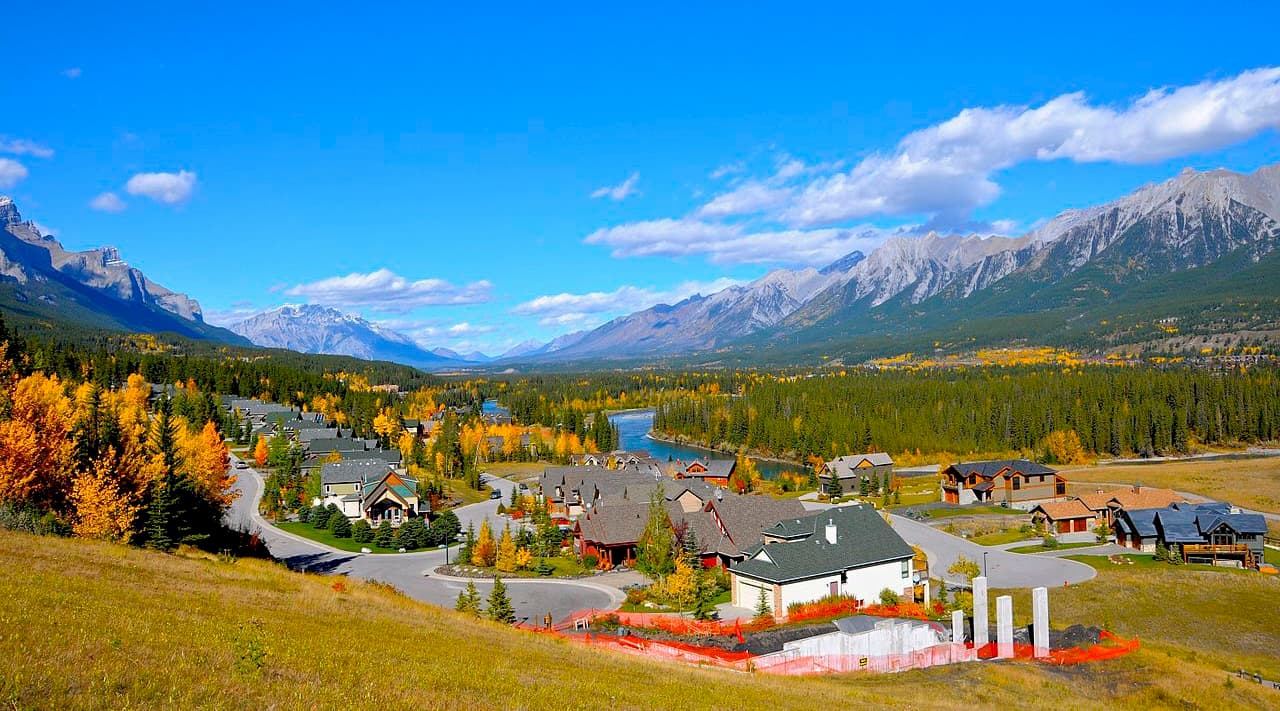
Canmore has come a long way from its coal mining history to become a hotspot for mountain adventures and resorts. The Bow River flows through the town which is spread through the valley and up onto the slopes of the surrounding mountains. The prominent peaks of the Three Sisters and Ha Ling look down upon the town and there are many mountain hikes starting from the edge of town.
Hiking, mountain and road biking, fishing, kayaking, and canoeing are popular summer activities in Canmore. The winter is a busy season in the town, too, with incredible cross country skiing, resort skiing, and ski touring. One popular hike is up to Chester Lake, where fishing is good; however, this hike is even better as a snowshoe trek during the winter.
With amazing views of the mountains, Canmore is a vibrant town in the Rockies with wonderful accommodations, and endless opportunities for adventure.
Crowsnest Pass is located at the southern end of Highway 40, and is one of the closest towns to Cataract Creek PLUZ. There are several communities that make up Crowsnest Pass, including Coleman, and Blairmore which are the largest. There are several hotels and stores to supply your needs while visiting the area.
Settled in the nineteenth century when coal was discovered, the region has seen booms, busts, and tragedies. The Frank Slide Interpretive Centre is a significant regional attraction that explores the tragedy of the night that Turtle Mountain fell and covered the town of Frank.