Scan the QR code and open PeakVisor on your phone
The McLean Creek Public Land Use Zone is an outdoor recreation area of about 202 square kilometers (78 square miles) that’s located on the eastern edge of Kananaskis Country, about 60 km (36 mi) west of Calgary in Alberta, Canada. The public land use zone has 10 peaks, the tallest of which is Quirk Ridge with 1,945 m (6,380 ft) of elevation.
In southwest Alberta, about 60 km (36 mi) to the west of Calgary in the Canadian province of Alberta is the McClean Creek Public Land Use Zone (McLean Creek PLUZ). The McLean Creek PLUZ is also a part of the Kananaskis Country mixed use recreational area.
Highway 66 is the primary road that leads to McLean Creek PLUZ. Additionally, the nearest town is Bragg Creek, which is located about 12 km (7 mi) to the northeast. The PLUZ is located to the south of the Sibbald PLUZ, to the east of the Kananaskis Country PLUZ and Elbow-Sheep Wildland Provincial Park, and to the north of both Sheep River Provincial Park and Bluerock Wildland Provincial Park.
Kananaskis Country has four public land use zones: Kananaskis Country PLUZ, Sibbald PLUZ, McLean Creek PLUZ, and Cataract Creek PLUZ. The different public land use zones were created to separate areas where vehicle use is permitted from areas that it is not.
McLean Creek PLUZ is the only PLUZ that allows off-highway vehicles (OHVs) year-round. Sibbald and Cataract Creek PLUZ only allow OHV use during the winter, while Kananaskis Country PLUZ does not allow any OHV use.
Kananaskis Country covers 4,211 square kilometers (1,625 square miles) of land, and, in addition to the public land use zones, it is divided into five other categories of land management: provincial parks, wildland provincial parks, provincial recreation areas, natural areas, and ecological reserves.
The provincial parks in Kananaskis Country include Peter Lougheed, Bow Valley, Bragg Creek, Sheep River, Spray Valley, and Canmore Nordic Centre Provincial Park. The provincial parks have camping and tourism facilities as well as many access roads.
The wildland provincial parks of Bluerock, Bow Valley, Don Getty, and Elbow-Sheep cover more area than the provincial parks; however, there are no facilities and limited access roads within each park. The Beehive Natural Area and Plateau Mountain Ecological Reserve are also located in Kananaskis Country, but they have no facilities and they are protected to preserve the specific landscape features and unique habitats within their borders.
In addition to these parks, there are 39 provincial recreation areas, which are generally small areas around prime trailheads that manage trailhead and parking facilities. The largest provincial recreation area is the Evan-Thomas PRA which includes Nakiska Ski Hill and Kananaskis Village.
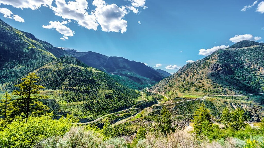
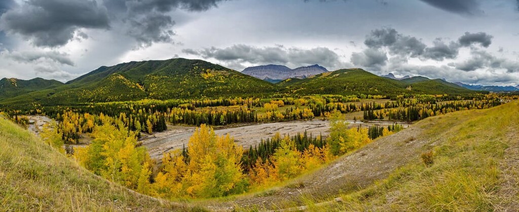
McLean Creek PLUZ is part of the foothills on the eastern edge of the Canadian Rockies. As the Rocky Mountains formed from about 75 to 45 million years ago during what is called the Laramide orogeny, the foothills in the McLean Creek PLUZ also formed.
During this time, thick layers of Paleozoic marine sediment broke along fault lines and stacked on top of the younger Cretaceous sandstone and shale to form the Rocky Mountains.
The process by which the Rocky Mountains formed is called thrust faulting. Thrust faulting is when layers of the Earth’s crust break into slabs and then older rocks are pushed on top of younger rocks. As the North American tectonic plate continued to collide with the Pacific plate, the layers continued to break and stack.
As a result, the foothills are primarily made of sandstone ridges with shale valleys. The stacking of the Cretaceous rock looks like shingles on a roof, with a repeated pattern of a gentle slope rising to a steep drop-off.
The topography of McLean Creek PLUZ, Kananaskis Country, and the Rocky Mountains in general was mostly formed during the last glacial maximum of the Pleistocene. Starting about 2.6 million years ago, the Canadian Rockies were covered in an ice sheet that was about one kilometer thick. The erosive force of the glaciation was massive, and it carved the peaks and valleys as we see them today.
As the glaciers advanced from the mountains into the foothills, they scoured the mountains, displacing immense amounts of rock. As the glaciers retreated, the displaced rocks were deposited to form eskers, kames, and moraines.
The ecology of the McLean Creek PLUZ is representative of the montane subregion of the Rocky Mountain Natural Region. Thanks to the Chinook winds that grace southern Alberta, the montane ecological region, which Mclean Creek PLUZ is part of, experiences some of the warmest winter temperatures in the province.
The Chinook winds are a föhn wind, which is a warm, dry wind that descends from mountains. As warm, moisture laden air is pushed east over the Rocky Mountains, it will condense and precipitate as it reaches the peaks. While the now dry air flows down the peaks, the air condenses, and the pressure increases the temperature of the air.
The Chinook winds are known by the Blackfoot as “snow eaters” because the fast moving, warm, dry winds are particularly effective at melting the region’s snowpack. The Chinooks certainly make Alberta winters more tolerable; however, for good or bad, after a Chinook clears, there is almost always a fresh snowfall.
The winter warmth of the montane region helps it have the largest variety of plant species of the Rocky Mountain ecologies. With over 300 rare plant species, of which 140 only occur in the Rocky Mountain Natural Region, there are a lot of plants to learn about if you visit the area.
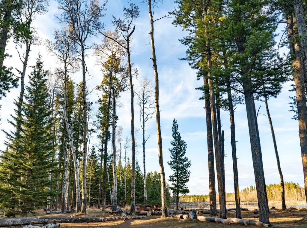
Some of the easiest plants to recognize in the region are the trees. The forests of McLean Creek are filled with lodgepole pine (usually tall and straight with their bottom half bare of branches), aspen (one of the few deciduous trees in the region), white spruce (the small branches are like a bottle brush with short, rigid, needles all around), and Douglas fir (it has the “bearded” pinecones).
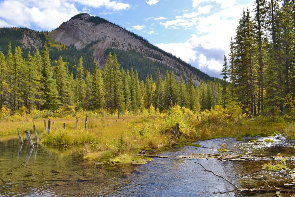
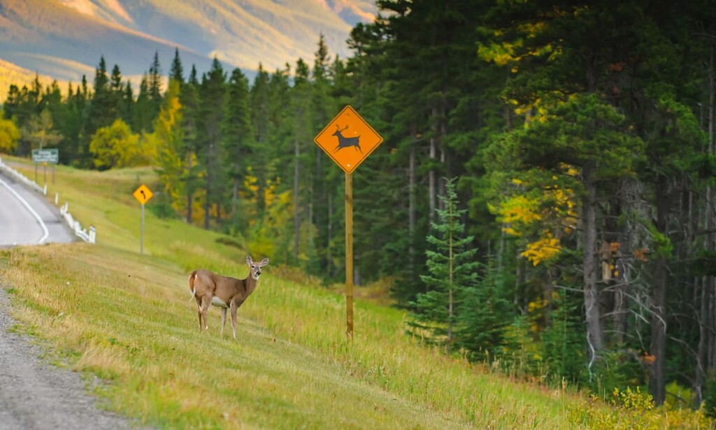
The varied topography creates many different habitats in McLean Creek PLUZ. Indeed, from the ridges to the creeks, there is a large variety of wildlife that inhabit the zone. The area is typical habitat for large mammals, such as grizzly bears, elk, cougars, wolves, moose, and deer; however, with the common OHV use in the area, animal populations are likely lower than the surrounding parks.
The best place to spot wildlife in McLean Creek PLUZ is often around the streams that run through the region’s meadows. This is prime habitat for small mammals, such as the northern bog lemming, long-tailed vole, heather vole, and the rare Richardson’s water vole. You may also find a spotted frog or a long-toed salamander if you’re particularly observant.
As the Pleistocene ice sheets melted out of the Rocky Mountains, Kananaskis Country was among the first areas to be ice-free in Alberta and Canada. The area was part of the ice-free corridor from the southern half of North America to Yukon and Alaska, which is the suspected migration route of the people who first inhabited North America.
McLean Creek PLUZ is located toward the southern end of this ancient corridor and, nearby, there is evidence of inhabitation of the land that dates back thousands of years. North of McLean Creek PLUZ in Sibbald Lake Provincial Recreation Area, an area referred to as “the Sibbald Creek site” was even discovered during excavations for a highway.
The remains of ancient inhabitants were found in the areas surrounding a meadow. It is believed that the meadow provided grazing opportunities for animals, which in turn drew in humans to the region. The site has evidence of continued use for the past 11,000 years, with artifacts representing virtually all the pre-contact societies to have inhabited southern Alberta.
It is possible that McLean Creek PLUZ may have undiscovered archaeological sites for the following reasons: First, the area is currently used for various activities and modern habitation and land use patterns often follow ancient patterns.
Second, most archaeological discoveries in Kananaskis Country occur during construction of roads and infrastructure and there are few roads in McLean Creek PLUZ. Third, the area has possibly been ice free for over 18,000 years and it lies in an area of archaeological interest because it is on the border of the plains and the cordillera, which are distinct physiographic and cultural areas.
Furthermore, McLean Creek PLUZ is on the traditional territory of the Metis, Tsuu T’ina, Stoney, and Ktunaxa nations, as well as that of the Blackfoot Confederacy.
Peter Fidler of the Hudson’s Bay Company was likely the first European to enter the area of the McLean Creek Public Land Use Zone, as he was arguably the first European to use the Kananaskis Trail during his adventures to the region in 1791.
Further European travel continued in the area as James Sinclair led settlers through the region to Oregon in 1841 and 1856, and John Palliser surveyed the border between British North America and the United States between 1857 and 1861. Before 1978, lots of Kananaskis Country was open as public land, and as such, it was a popular destination for camping and OHV use.
When Peter Lougheed officially designated Kananaskis Country, OHV use was restricted in the area. In 1979, the public land use zones were created to split motorized and non-motorized recreation. Sibbald PLUZ, McLean Creek PLUZ, and Cataract Creek PLUZ are the permitted zones for OHV use. Meanwhile, McLean Creek is the only one which allows OHV use all year long.
Public lands in Alberta are an incredible resource for locals and tourists alike. They provide a place to recreate in almost any imaginable way, including hiking, cycling, equine, hunting, fishing, camping, and OHV use.
With that in mind, McLean Creek PLUZ is the only part of Kananaskis Country that allows summertime OHV use. As a result, it is highly popular among OHV riders, so keep this in mind as you hike and always pay attention to OHVs on the trail.
The following is a list of some activities and places to check out while in the area.
While technically not part of McLean Creek PLUZ, the McClean Creek Provincial Recreation Area is surrounded by the PLUZ and provides the major facilities for the PLUZ.
There are 170 campsites for OHV users and non-OHV users alike found in the recreation area. The campsites here are among the few drive-in campgrounds that are open during the winter as well as the summer. This makes them an amazing place to basecamp for winter adventures in Kananaskis Country.
The McLean Creek Interpretive Trail is a 1.7 km (1 mi), easy loop in the McLean Creek PLUZ. The accompanying pamphlet that you can pick up on the AlbertaParks.ca website provides excellent information about the area’s history and function as a watershed.
In particular, the pamphlet teaches how the forests evolved over time and how to identify the major trees and shrubs of the area. This is a great opportunity to learn about the ecology of the Rocky Mountain region through immersion.
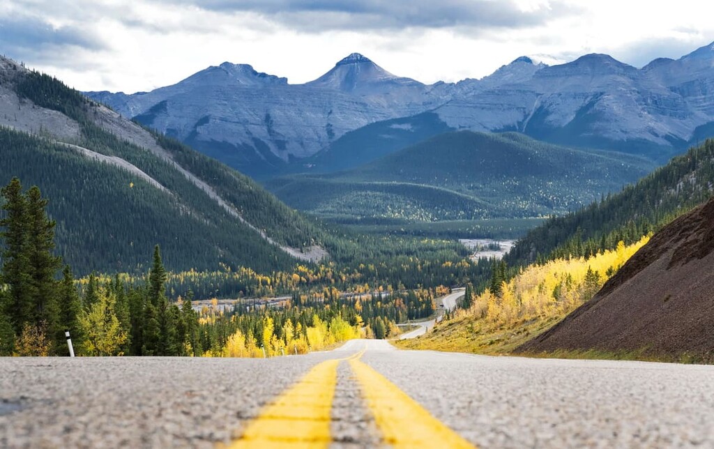
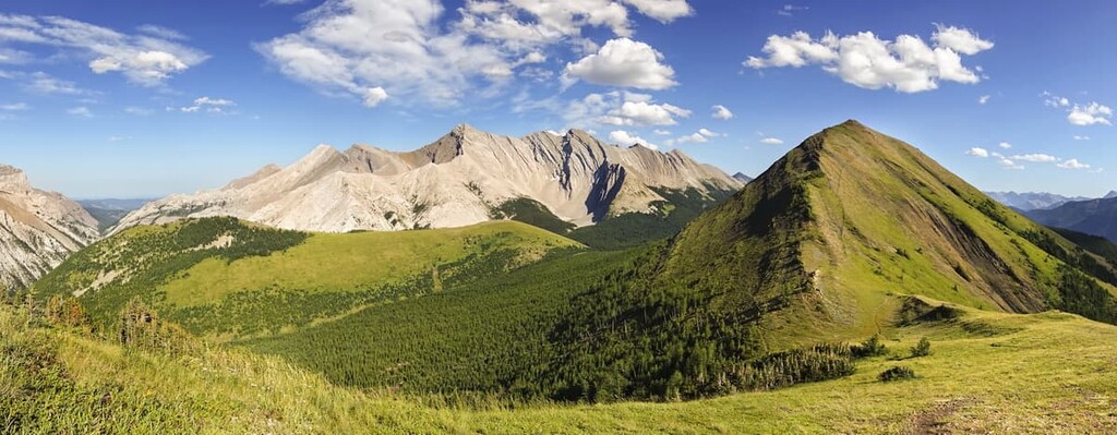
McLean Hill is an easy summit to hike any time of year. The trail is 3.3 km (2 mi) long with about 320 m (1,050 ft) of elevation gain. The top of the hill provides a fabulous view of the surroundings, including a view of Jumpingpound Mountain, Moose Mountain, and into the Fisher Range.
There will always be a trail to this summit; however, the route may change slightly year to year as part of the trail follows logging roads which are regularly rehabilitated.
This is a moderate hike of 8.6 km (5 mi) hike with 509 m (1,670 ft) of elevation gain. The ridge provides a beautiful vantage of the surrounding public and park lands. From the vantage point, Moose Mountain is prominent to the south, while Jumpingpound Mountain and Cox Hill lay in front of the Fisher Range of the Rocky Mountains.
Do note that this trail is crossed by motorbike trails, so it may be best to hike during the week to avoid periods of high traffic.
McLean Creek PLUZ is a popular destination for local OHV enthusiasts; however, it also provides year-round camping for anybody that wants to enjoy Kananaskis Country. While camping is fun, it’s not for everybody, so here are a couple places to sleep while spending your days in the mountains.
Calgary is about 60 km (36 mi) west of McLean Creek PLUZ. With a population of around 1.4 million people, there are many outdoor enthusiasts that regularly head west into the mountains from Calgary. In fact, McLean Creek is a very popular destination for OHV users from the city.

While the mountains are a major attraction from the city, and it is difficult to look away from them as they loom on the western horizon at times, there is a lot to do within Calgary itself. For cycling or walking, there are paths that connect all the major parks and greenspaces from Fish Creek Provincial Park in the south of Calgary, to Nose Hill Park in the north, and the Glenmore Reservoir in between.
The annual Calgary Stampede runs for 10 days in July and with its midway, concerts, rodeo, chuckwagon races, grandstand show, and daily fireworks it is the self-proclaimed “Greatest Outdoor Show on Earth.”
If you’re not in town for The Stampede, there are still lots of events and places to see. The Glenbow Museum houses amazing collections from across the world; however, they also have fabulous sections pertaining to local history. There is also the Calgary Tower, which you can ascend and get a bird’s eye view of the city, or the Calgary Zoo with its incredible animals in their habitats.
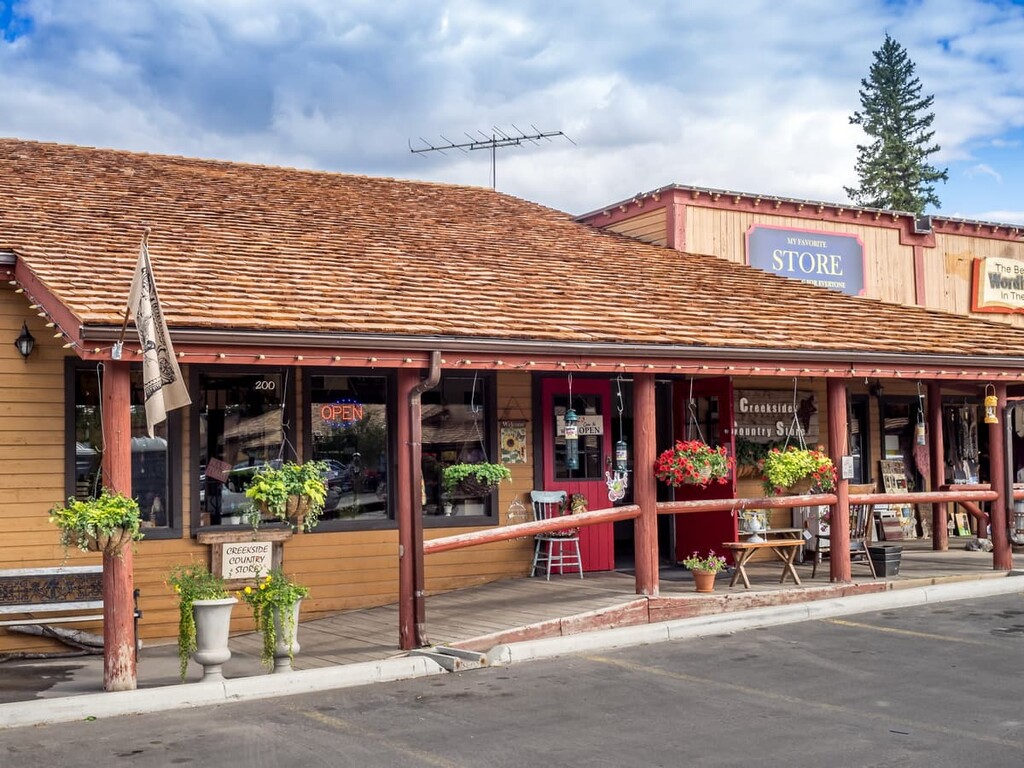
Located about 30 km (18 mi) west of Calgary, Alberta and only 10 km (6 mi) from the McLean Creek PLUZ, Bragg Creek is a lovely hamlet in which to spend a night, a week, or to just grab a bite to eat.
There are hotels and stores and plenty of trails just outside of town. The river is a lovely spot to visit and a great place to fish. If you have a sweet tooth, there is even a candy and ice cream store in the main plaza that’s well worth checking out.