
Scan the QR code and open PeakVisor on your phone
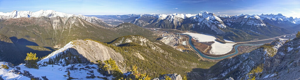
Known for its stunning vistas and fantastic outdoor recreation opportunities, Bow Valley Provincial Park is a popular hiking and watersports destination located in the southwestern part of the province of Alberta in Canada. The park covers 3200 hectares (7,900 acres) and contains just one named peak, Engagement Mountain (1,740m/5,709ft).
Bow Valley Provincial Park is located on the eastern edge of the Rocky Mountains, in the province of Alberta.
The park follows the Bow River to the east of Canmore until its confluence with the Kananaskis River. It also continues south along the Kananaskis River to the Mount Lorette Ponds. The park extends north to include Grotto Mountain Ponds and the Grotto Canyon Trail.
Bow Valley Provincial Park primarily contains the river valleys of the Bow and Kananaskis Rivers, while the surrounding mountains are part of the Bow Valley Wildland Provincial Park and the Elbow-Sheep Wildland Provincial Park.
The park is bordered by Highway 1 and Highway 1A where those roads parallel both sides of the Bow River. Meanwhile, Highway 40 follows both the park and the Kananaskis River to the south.
The main access to the park is Highway 1, which leads from Calgary to Canmore, traversing the north arm of the park. However, accessing the park from Highway 1A or Highway 68, the latter of which has some gravel sections, is generally considered to be the scenic route. Driving this route is well worth doing at least once in order to gain a more intimate perspective of the area.
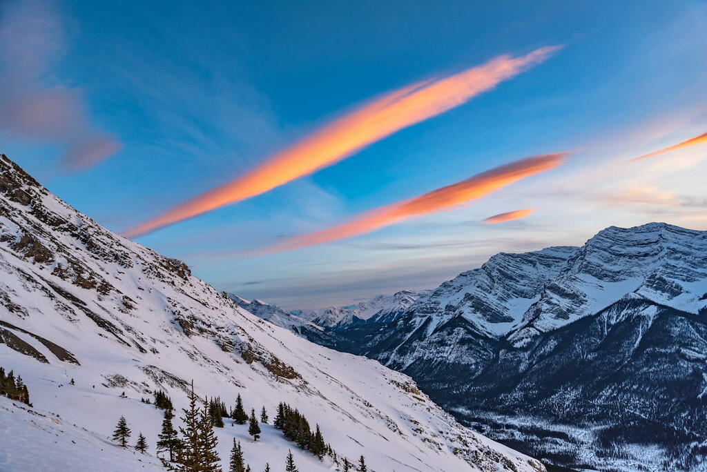
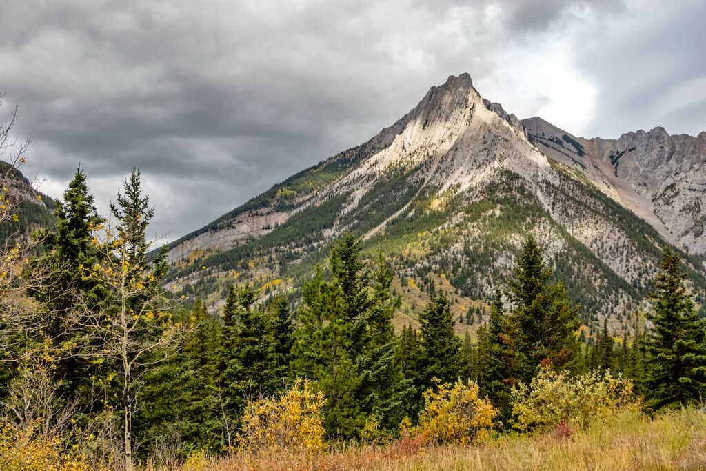
While Bow Valley Provincial Park is a valley, the surrounding mountains belong to the Fairholme Range to the north, the Fisher Range to the east, and the Kananaskis Range to the south and the west. The spectacular mountains that border the park are generally comprised of resistant Cambrian to Devonian age carbonite, which the McConnell Thrust Fault pushed on top of Late Cretaceous shales and sandstones. This geological event is what gives us the iconic cliffs of Mount Yamnuska.
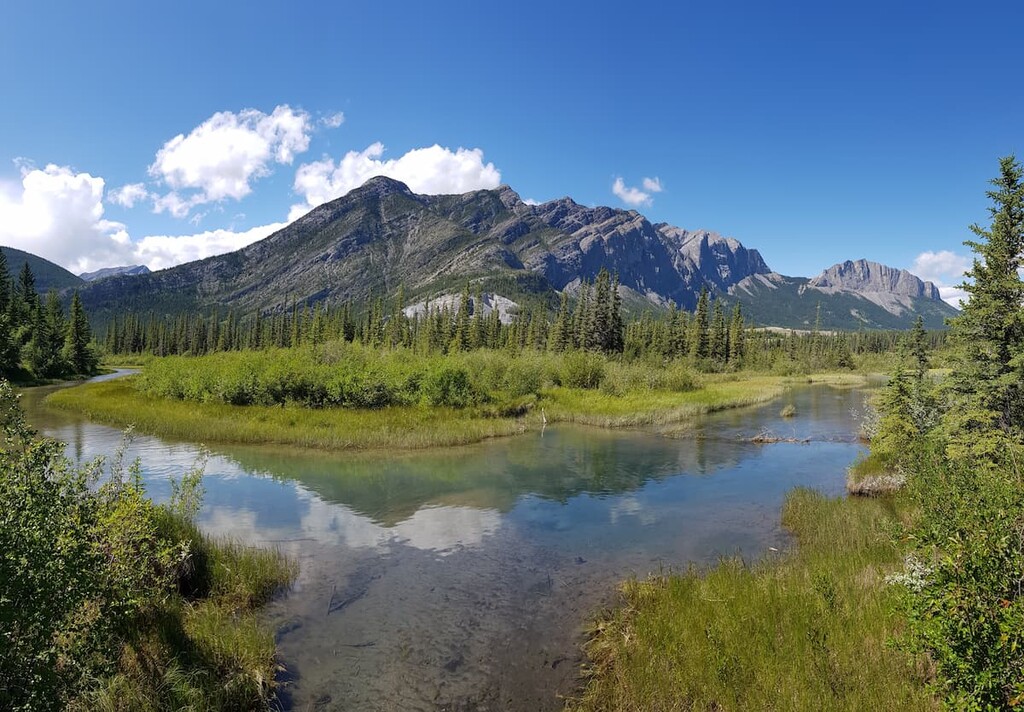
The fault that created the mountains also serves as a conduit for water surfacing at Many Springs. Starting as precipitation in the surrounding mountains, the water percolates 600m (2000ft) underground where it is geothermally heated. It then circulates up along the McConnell Thrust, which lies under the park and surfaces at Many Springs. The spring water flows into the lake at a rate of 100L/sec (26gal/sec) and the lake never freezes, but remains a steady 7°C (40°F)

Once covered by the Bow Glacier that retreated during the late Pleistocene Epoch, often colloquially referred to as the Ice Age, the park contains unique landforms such as kettle lakes, eskers, moraines, and kames. These are the seemingly out of place lakes, sinuous gravel ridges, and gravel mounds which the retreating glacier created as it carved away the surrounding mountains.
The north side of the park consisting of the Fairholme Range and Grotto Mountain, in particular, have been mined for over 100 years. Limestone, shale, and gravel are the primary products mined from the area.
Bow Valley Provincial Park represents the Rocky Mountain Montane Natural Region. The park is characterized by forest and grassland complexes, where the grasslands occur on dry and exposed sites and the forest inhabits the rest of the space.
The primary trees that inhabit this area are Douglas fir and lodgepole pine which are found upland on the mountains. Spruce tends to spread along stream banks and hold onto the north facing slopes. Aspen are usually found in stands upon terraces.

Where the trees start to falter, creeping juniper and bearberry fill the ground until the ground is too dry and the grasses have taken over. Bluebunch wheatgrass, fescue grasses and oat grasses dominate the grasslands and meadows.
The forests and meadows of the park are home to many large animals and are important elk habitat and an important wildlife movement corridor. In addition to elk, you may encounter grizzly bears, black bears, moose, deer, mountain goats, mountain sheep, wolves, and cougars, which all inhabit the park and surrounding mountains.
The area surrounding Many Springs has a unique ecosystem compared to the rest of the park due to the lake never freezing and being a constant temperature. It contains many rare and unique varieties of flora and fauna.
In the Bow and Kananaskis Rivers you will find brown trout, brook trout, and mountain whitefish. It is also possible to catch rainbow trout, cutthroat trout, and bull trout. The Bow River is world famous for trout fishing, though beware of the catch and release regulations.
Human use and habitation of the area likely began thousands of years ago. At some point between 500 and 1300AD, it is believed that members of the Hopi tribe from Arizona travelled at least as far as Grotto Canyon and left symbolic imagery upon the canyon cliffs. On the cliff you can see depicted, among other images, is the “flute player, which is a symbol of the Hopi people.
Many other groups of people migrated through the area for hunting and fishing. It is not known who was contemporary with the Hopi incursion. The park is traditional territory to the Tsuu T’ina, Stoney, Ktunaxa amakis, and Blackfoot/Niisitapi nations.
In addition to the petroglyphs in Grotto Canyon, there are other archaeological and culturally significant sites. In the south end of the park is a Sundance site, with signs asking visitors to respect the site and its purpose. Additionally, alongside the Bow River and Highway 1 is a bison kill site that has been partially excavated.
There are additional culturally significant sites within the park that are not disclosed to the public. However, neither are they closed off, so you may discover and explore them.
If you do find what you believe to be a site of cultural significance, please remember that it is illegal to disturb, remove, or move any artifacts, stones, or plants within the park. It’s recommended to report your find to a conservation officer so they can take appropriate measures to secure the site for future study and preservation.
The late nineteenth century saw the area's first European settlements. 1884 saw the founding of Canmore and by 1886 it was established as an important coal mining town. By the end of the century mines started extracting limestone from the nearby Grotto Mountain. While the coal mines had shut down by 1980, mining of limestone has continued for over 120 years.
It was in 1959 that Bow Valley Provincial Park was officially established to protect the valley from further development and set aside for recreational use. The park was enlarged in 1984, 1998, and 1999 to include the former Bow Flats Natural Area and six other small Provincial Recreation Areas.
While there are many trailheads in Bow Valley Provincial Park, most of the trails leave the park, with a few exceptions. Here are some of the best trails to check out in and around the park:
The trail to the summit of Engagement Mountain is technically an unofficial trail that is neither marked nor maintained. It also has some particularly steep sections that make it a difficult trek.
The nearest Parks trailhead is the Heart Creek Trail parking lot; however, there is a secondary trailhead, which is a rough pullout on the southern side of Highway 1 about 4 km (2.4 mi) east of the Lac des Arcs turnoff. This secondary trailhead is marked with dirt parking spaces and a steel gate across the trail. This same trailhead also leads to Quaite Valley.

Though only a 3.5 km (2.2 mi) out and back trail, the trail does gain 452 m (1,482 ft) of elevation. Due to its difficulty, this hike should be tackled only by hikers with experience with route finding hiking on unmaintained trails. Once atop Engagement Mountain you’ll be treated to views of the Bow Valley as a reward for your efforts.
Most of the trails within Bow Valley Provincial Park are located off of Highway 1 on Highway 1x. Here, you can find the Many Springs, Middle Lake, Montane, and Moraine interpretive trails.
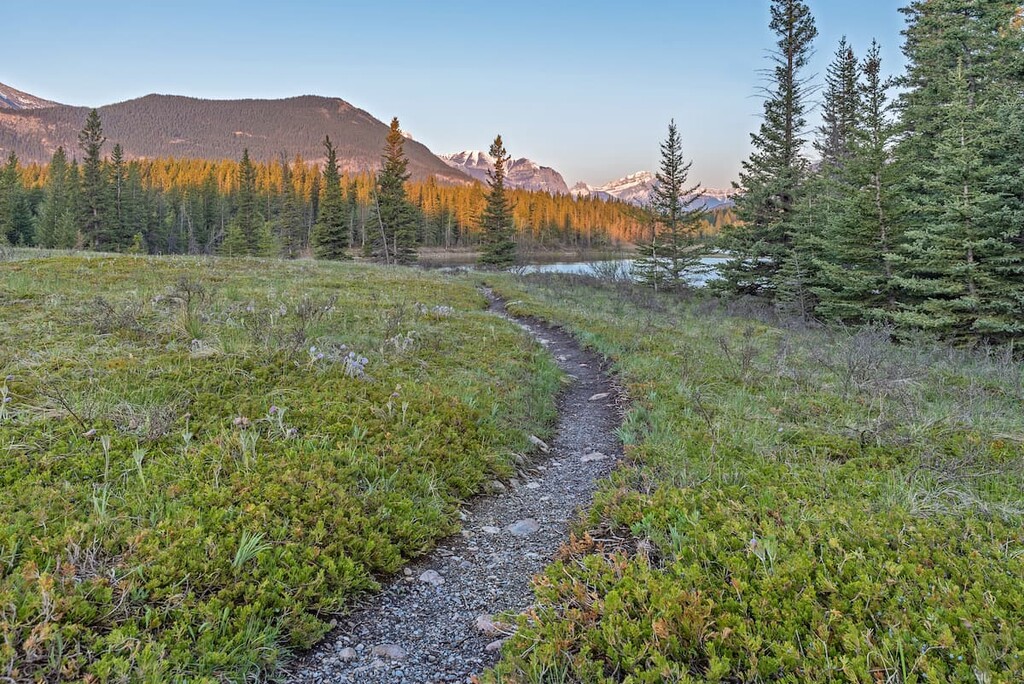
All of these trails are relatively short and easy walks (under 2 km/1.2 mi). They provide both guidance and insight into the area, as well as some educational information about the park’s unique geological features.
The Grotto Canyon Trail is located off of Hwy 1A. The trailhead starts at Grotto Mountain Ponds, which is located at the base of Grotto Mountain.

The trail is a 7.1 km (4.4 mi) out-and-back hike that heads west from the parking lot through the forest to the creek before turning north along the creek. Some of the highlights of this hike are the Hopi petroglyphs that depict the “flute player” Kokapelli, the waterfall, a cave, and the Inukshuk Garden.
This trail is accessible all year round; however, traction devices such as crampons or Microspikes are recommended during the winter due to the frequently icy conditions.
Though you don’t see many mountain views from this trail, it is a unique experience to walk the same route that was used for thousands of years by many First Nations. It is also a chance to experience the unique sights and landscapes of a deep canyon.
The Bow River offers world-class trout fishing as well as spectacular views from the banks. The Bow River is accessible off Highway 1 and Highway 1A.
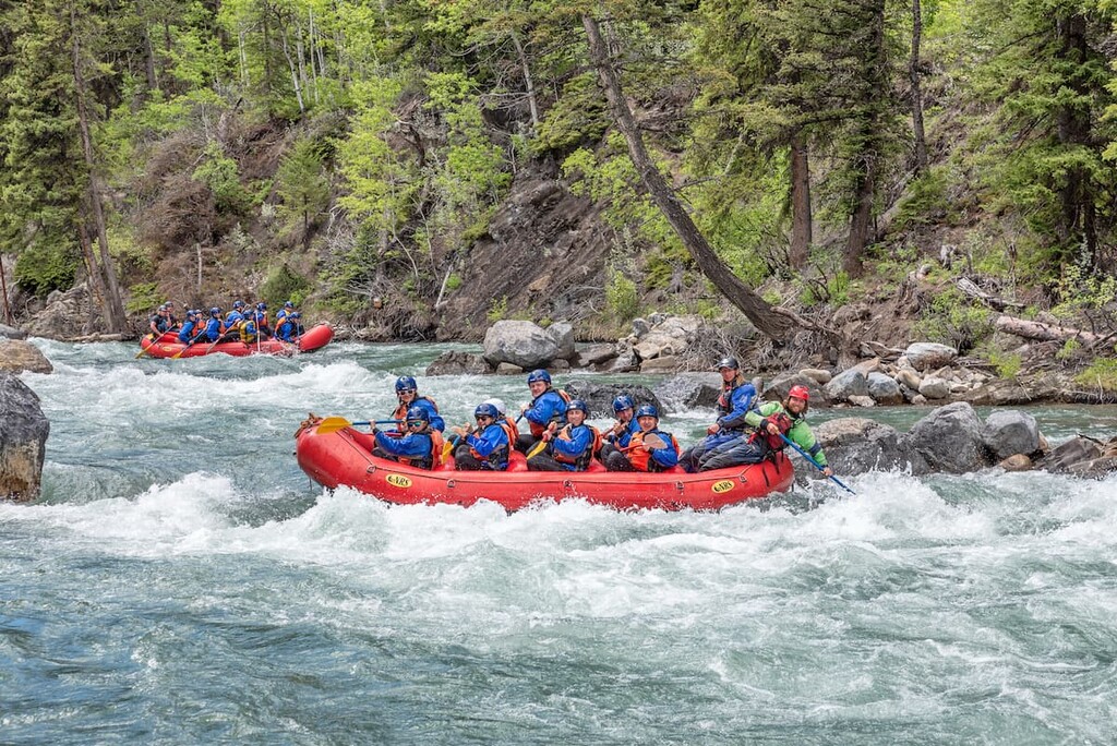
Meanwhile, the Kananaskis River also offers fantastic fishing opportunities. However, the river is best known for its rapids, which offer spectacular paddling opportunities.
Accessible from the Widow Maker Day Use Area, kayakers paddle the river to experience its thrilling drops and rapids. There is also a slalom course further down the river, near the take-out point at Canoe Meadows. Here, there are also places where spectators can watch racing events.
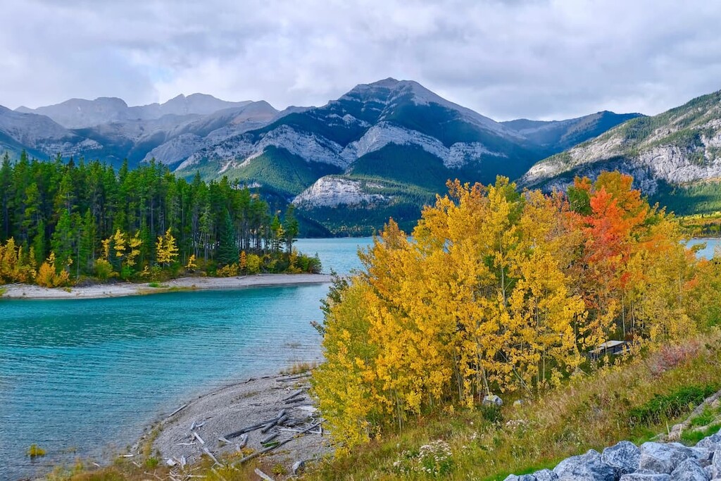
Located in the middle of the park along Highway 1, Lacs des Arcs is one of the main attractions of Bow Valley. Lac des Arcs, which is French for “lake of bows,” is fed by the Bow River. It’s believed that the lake was named after the abundance of trees that surround it, which traditionally provided staves for creating bows made by local First Nations.

Access to the lake is provided by two pull outs along Highway 1. Each provides space for you to stop and visit the lake. A short distance from the western pullout, there is also a small island with a picnic table on it. Locals have been known to swim out there on dates, despite the cold water temperatures.
Furthermore, the east to west orientation of the lake and its surrounding valley encourage strong winds blowing from the west on a regular basis. This makes Lac des Arcs a popular kite and windsurfing destination in Alberta.
A man-made lake created as a hydroelectric reservoir, Barrier Lake is mainly used by kayakers and SUPs, as the views from the water are spectacular. From the water, Mount Baldy dominates the eastern shore. Yates Mountain, with its steep cliffs and tempting ridgeline inhabit the western shore. Twin Towers and Mary Barclay’s Mountain complete the dominant view to the southwest.

There’s also a boat launch for the lake that’s accessible from the southern access road; however, the water level varies and doesn’t always reach the end of the launch.
Kayak, canoe and SUP rentals are available at the lake during the summer season. When the water level is low, you’ll find sandy beaches to enjoy. Plus, if you wander around the shore of the lake, you can sometimes find both anthracite coal and fossils.
Picnic tables and toilet facilities are also available on the north side by the dam and the south side by the boat launch. We should note that, on nice summer days, the north parking area fills quickly. But, if you’re willing to walk along the beach, there’s a lot of space to enjoy yourself at the lake without feeling crowded.
Located at the southern tip of Bow Valley Provincial Park, the Mount Lorette Ponds provide a stunning view of Mount Lorette to the west. They also feature lovely walking paths, picnic areas, a stocked fishing pond, and a boardwalk over the ponds for visitors to enjoy.
The Mount Lorette Ponds are a special place, and if you’re fortunate enough to be there without crowds, standing on the boardwalk, overlooking the serene ponds and majestic mountains, you can commune with nature and connect with the world around you.
Plus, there’s nothing stopping you from putting a kayak or SUP into the ponds and immersing yourself more fully in the landscape.
While there are many campgrounds choices in the area, Bow Valley Provincial Park is also only a short drive from Calgary if you’d prefer a taste of city life. But, if you plan to spend more than a day and you don’t want to camp, Canmore, Banff, and Kananaskis Village provide hotel and hostel lodging. Here’s what you need to know:
Nestled in the heart of the Bow Valley, Canmore, like many towns along the mountain railway, started as a coal mining settlement. It is located near the western edge of Banff National Park, so it’s a nice place to visit if you’re interested in checking out other fun destinations in the region.
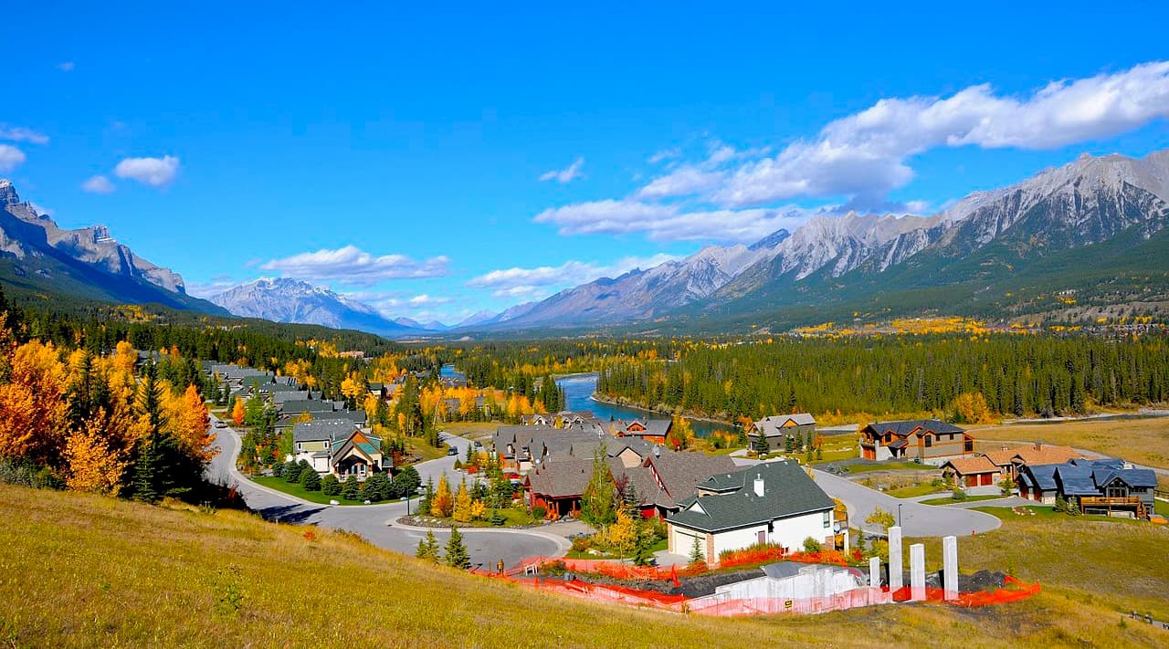
Canmore provides easy access to hiking trails like Ha Ling Peak, Chester Lake and Grotto Canyon. In addition to hiking, Canmore offers ample opportunity for road and mountain biking. The snow-filled months are typically the busiest months in Canmore, as it is a wonderful tourist town for the surrounding ski resorts, such as Sunshine and Lake Louise.
Located in Banff National Park and home to the famous Cave and Basin Hot Springs, Banff offers plenty of lodging and a unique mountain lifestyle experience. With amazing mountain views from the streets, like the iconic East End of Rundle (EEOR), and sites like the world class Fairmont Banff Springs Hotel, Banff offers a first class mountain experience.

From Banff, mountain trails, peaks, and phenomenal views are easily accessible on a day trip. After your trip, you can return to your luxurious lodging and end your day in one of the many spas, where you can enjoy a relaxing massage.
Being an amazing town to visit and see, it does get busy in the summer and winter seasons. Spring and fall offer a time when the trails and sidewalks are less busy, and fall is the time when you can witness the incredible changing colors of the larch trees along the mountain ridges.
Since the town is situated within a National Park, wildlife sightings are to be expected. It isn’t uncommon to see elk roam the townsite.
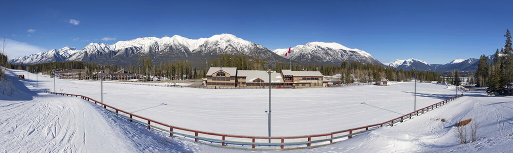
Located 26 km (16 mi) south of Highway 1 on Highway 40, Kananaskis Village is an unincorporated community located in the Evan-Thomas Provincial Recreation Area in the heart of Kananaskis Country. Accommodations in the community range from modest hostels to the more luxurious Kananaskis Lodge.
In Kananaskis Village, there are stores to buy supplies, food, and rent equipment. Kananaskis Village is also located at the base of the Nakiska ski hill, which is a great place to check out in the winter months.
Kananaskis Village offers hikes right outside your door, such as Ribbon Lake and Troll Falls. It is a starting point for many groomed cross-country ski trails in the winter and it is the closest lodging to much of the backcountry skiing offered further south in Peter Lougheed Provincial Park.
The Kananaskis Country Golf Course is also located just south of Kananaskis Village. It was recently rebuilt, after the 2013 floods that changed the face of much of Kananaskis Country. Since the fairways create enticing meadows, wildlife sightings are common, and you should carry bear spray while golfing. For golfing or wildlife sightings, it’s well worth a visit.


