
Scan the QR code and open PeakVisor on your phone
In 1916, during the first World War, the largest naval battle of the war unfolded between Britain’s Royal Navy Grand Fleet and the Imperial German Navy’s High Seas Fleet. The battle, which took place off the North Sea coast of Denmark’s Jutland Peninsula would become one of the world’s last major battles fought primarily on battleships. So, what does this have to do with mountains?
Well, the Kananaskis Range, a mountain range that sits west of the Kananaskis River in the Canadian Rockies, contains several iconic summits named after the ships and people involved in the Battle of Jutland. In fact, the Kananaskis Range used to be referred to as the ‘Ships Range.’ Notable Kananaskis peaks include Mount Galatea, which was named after a Royal Navy cruiser, Mount Bogart, Wind Mountain, The Tower, Mount Sparrowhawk, Mount Lougheed, and Mount Chester.
Mount Bogart, the second highest peak in the Kananaskis range, sits on the eastern bank of the Canadian Rockies and is an iconic summit viewed from Highway 40. Mount Bogart was named after one of the first scientists to study the Rockies and is admirably known as the ‘triangle,’ due to its triangular summit.
It’s not uncommon to hear visitors and locals refer to iconic summits in the Kananaskis Range as ‘Kananaskis Country.’ Kananaskis Country is a park system located west of Calgary, Alberta. Though the Kananaskis Range is found within Kananaskis Country, Kananaskis Country technically contains several Provincial Parks, Provincial Recreation Areas, Wildland Provincial Parks, campgrounds, and two alpine ski areas – Nakiska and Fortress Mountain Resort. In other words, Kananaskis Country extends much further than just the mountains.
Nevertheless, the Kananaskis Range and surrounding Kananaskis Country are both incredibly popular destinations for outdoor recreation and tourism. Kananaskis summits, like Mount Sparrowhawk, Mount Chester, and Mount Fortress are infamous scrambles in the area, while obscure summits, like Mount James Walker, are just beginning to gain popularity amongst climbers and mountaineers.
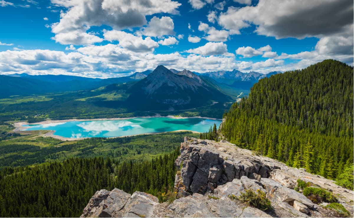
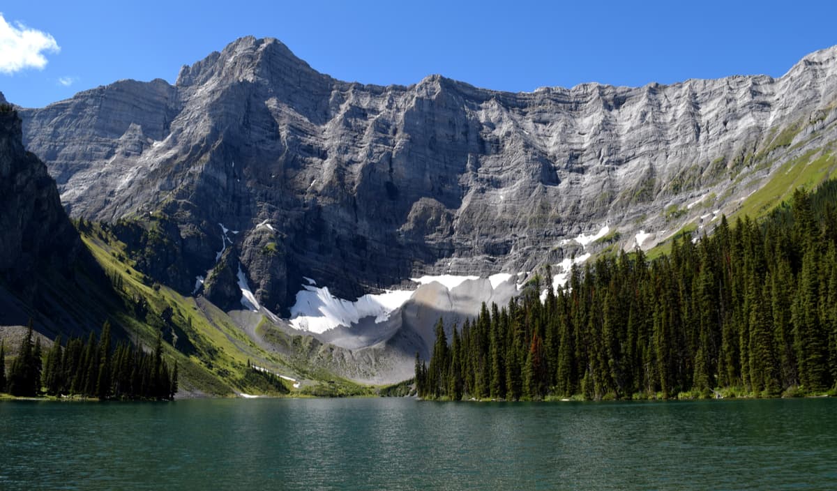
Spray Valley Provincial Park sits along the Spray River, east of the Rocky Mountains and is part of the Kananaskis Country park system. The park is easily accessible via the Bighorn Highway and offers visitors a network of scenic front country and backcountry trails, as well as opportunities to fish, paddle, mountain bike, wind surf, and cross-country ski. Popular hiking trails found within Spray Valley Provincial Park include the Sparrowhawk, Buller Pass, Mount Bogart, Ribbon Creek, Galatea Creek, and Fortress Ridge Trails.
Read’s Tower is a prominent feature on the west face of Mount Sparrowhawk. The moderate, 3.7-mile trek to Read’s Tower takes hikers high above the Spray Lakes Reservoir to panoramic views of the valley below. The trail climbs steadily for 2,119 feet to the treeless crest of Read’s Ridge before making a final ascent to Read’s Tower. At the top, hikers can appreciate sweeping views of surrounding summits, including the illustrious Mount Sparrowhawk.
Arguably one of the most scenic footpaths in Kananaskis Country. The trail begins at the end of the ‘Day Use Area,’ at Upper Kananaskis Lake before dropping down to Sarrail Creek. Hikers will wade through a creek before branching off from the lakeshore trail to climb a series of switchbacks. After enduring the switchbacks, hikers are rewarded with incredible views of Rawson Lake and the rugged slopes of Mount Sarrail. From there, hikers can opt to continue toward Sarrail Ridge. The trek to Sarrail Ridge is a strenuous and steep climb that travels up an avalanche shoot. However, hikers willing to make the effort will be rewarded with jaw-dropping views of Upper and Lower Kananaskis Lakes, as well as the incredible Mount Indefatigable.
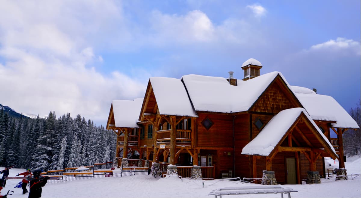
Fortress Mountain is nestled in the heart of Kananaskis Country, just an hour from Calgary, Alberta. The resort receives an average of 300 inches of snow each year and contains over 3,300 acres of skiable terrain, making it the perfect destination for winter recreation enthusiasts. The resort is currently going through redevelopment and in recent years has only been open for cat skiing and a handful of blockbusters like Inception and The Revenant. However, the first phase of the resort’s development, which will include a new day lodge, a tubing zone, and a handful of chairlifts should be completed by the end of 2020.
Known as ‘Calgary’s closest Mountain,’ Nakiska isn’t your everyday Canadian ski resort. This unique ski resort, which isn’t located in a stereotypical alpine town, was built specifically for the 1988 Calgary Olympic Games’ Alpine Events. Today, the resort features Olympic-sized groomed runs and a state-of-the-art snowmaking system. Due to its location, Nakiska is a particularly popular destination for Calgary and Canmore locals, and offers plenty of options for lodging and dining.

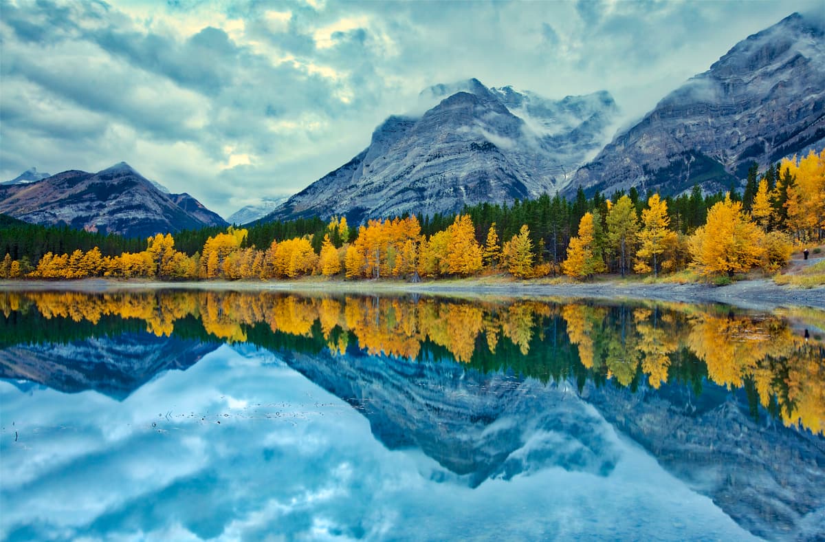
Nicknamed the “Queen Town of the Rockies,” Canmore is often described as a picturesque mountain town enveloped by the majestic Canadian Rockies. Canmore offers unparalleled panoramic mountain views in every direction and boasts a number of popular lodges like the Falcon Crest Lodge, Stoneridge Mountain Resort, and Silvertip Resort. Visitors can not only access Bow Valley, Spray Valley, and Kananaskis Valley from Canmore, but can explore nearby summits like Ha Ling Peak, Read’s Tower, Sarrail Ridge, Mount Yamnuska, and Mount Lady Macdonald.


