Scan the QR code and open PeakVisor on your phone
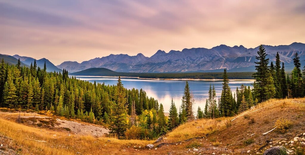
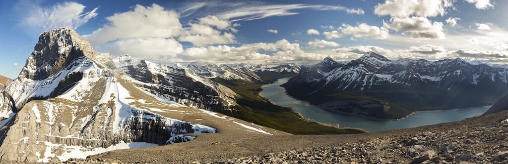
The Kananaskis Country Public Land Use Zone is a managed outdoor recreation area of some 1,100 square kilometers (425 square miles) that’s along the eastern edge of Kananaskis Country, about 100 km (60 mi) to the west of Calgary, Alberta, Canada. The zone has 74 named peaks, the tallest of which is Tiara Peak at 2545m (8,347ft). Some of the popular mountains are Moose Mountain, Prairie Mountain, Powderface Ridge, and Mount Baldy.
In southwest Alberta, about 100 km (60 mi) west of Calgary, is the Kananaskis Country Public Land Use Zone (Kananaskis Country PLUZ). The Kananaskis Country PLUZ is part of the Kananaskis Country mixed use recreational area.
Kananaskis Country covers 4,211 square kilometers (1,625 square miles) and is divided into six categories. Provincial parks, such as Peter Lougheed and Bow Valley Provincial Park, have significant access and facilities. Meanwhile, wildland provincial parks, such as Bow Valley Wildland Provincial Park, have minimal access and no facilities.
Provincial recreation areas, such as Evan-Thomas PRA and West Bragg Creek PRA, are smaller zones that provide facilities for a wider recreational area. Natural areas, such as Beehive Natural Area, are intended to protect significant natural areas from development.
Ecological reserves, such as the Plateau Mountain Ecological Reserve, protect specific ecologies, habitats, or landscapes. The final category of land in Kananaskis Country is a public land use zone, such as Sibbald PLUZ and McLean Creek PLUZ. These are areas of public land with very few additional rules and facilities.
Kananaskis Country has four public land use zones. Three of the public land use zones—Sibbald PLUZ, McLean Creek PLUZ, and Cataract Creek PLUZ—allow OHV use. The final area, Kananaskis Country PLUZ, covers over 25 percent of Kananaskis Country, including all the rest of the land that is not designated as parks, recreation areas, or areas that allow OHVs.
The major roads that access Kananaskis Country PLUZ are Highway 68 and Highway 66 in the north end and both Highway 546 and Highway 541 towards the south. Nearby cities and towns include Calgary and Bragg Creek to the west, Canmore to the north, and Pincher Creek to the south.
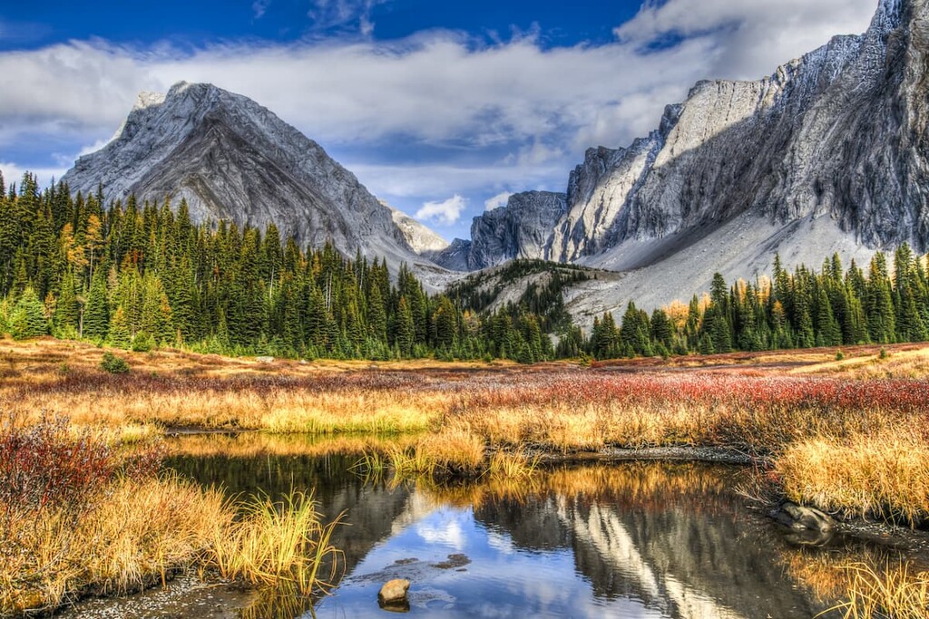
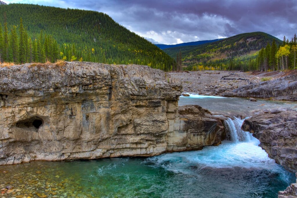
Kananaskis PLUZ is located in the Canadian Rockies and it contains parts of both the Fisher Range and Highwood Range as well as the foothills to the east. The rocks of the Rocky Mountains began forming over a billion years ago. While Alberta was covered in a sea, dead marine organisms would accumulate in layers on the seafloor which were compressed by additional sediment to form thick sheets of limestone and dolomite.
About 70 million years ago, the North American tectonic plates began colliding with the tectonic plates under the Pacific Ocean. The collision caused the Paleozoic layers of marine rock to stack upon the younger Cretaceous shale and sandstone. The front ranges of the Fisher Range and the Highwood Range are created from nearly vertical slabs of Paleozoic limestone.
However, the force of the tectonic collision didn’t completely dissipate with the final uplift of the front ranges. Where the layers of limestone stopped stacking, the force continued to push against the Cretaceous top layer of rock. The sandstones and shales east of the mountains were pushed and as they broke along faults, the layers were stacked, like shingles on a roof, to create the foothills along the eastern edge of Kananaskis Country PLUZ.
The current elevation of the mountains and their topography are the results of two series of events. First, as the continent buckled about 100 million years ago in an event that helped to create the Continental Divide, it reversed the flow of water from west to east. As the sea that once covered Alberta began to drain from the continent it stripped away over 1,000 m (3,280 ft) of rock.
Second, a period of glaciation started occurring 2.58 million years ago which covered western Canada and the area that is now Kananaskis Country in over 1,000 m (3,280 ft) of ice with parts of North America covered in over 3,000 m (9,840 ft) of ice. The ice sheets and glaciers moved massive amounts of stone, modified river systems, and created new lakes as the glaciers retreated.
As the glaciers moved through the mountains, they stripped away the layers of the softer Cretaceous rock from between the harder layers of Paleozoic limestone, creating the major valleys we see in the region today. Additionally, the glaciers scoured all surfaces, redistributing rock into the glacial formations of kames, eskers, and moraines while also creating cirques and hanging valleys.
Major peaks in the PLUZ include Tiara Peak, Odlum Ridge, Moose Mountain, Midnight Peak, Prairie Mountain, Powderface Ridge, and Mount Baldy.
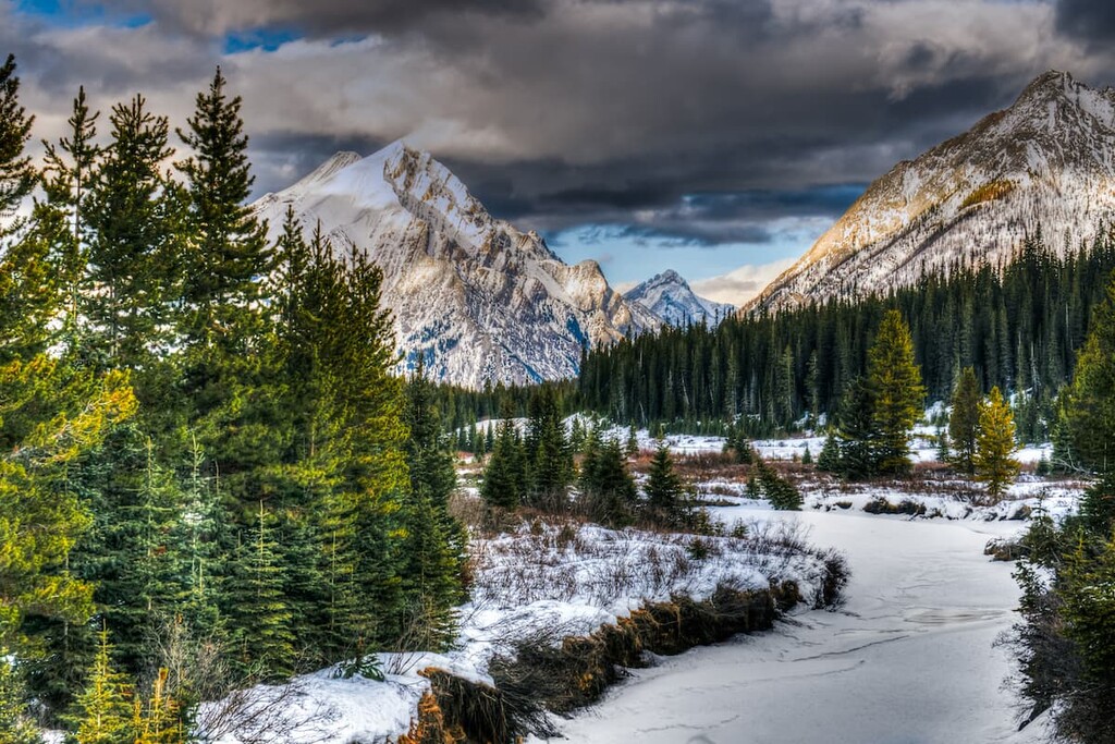
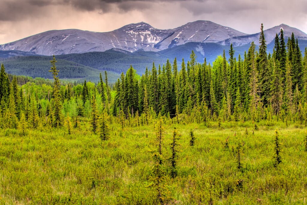
The ecology of Kananaskis Country PLUZ is part of the Rocky Mountain Natural Region. This region has the highest precipitation in Alberta, long cold winters, and short cool summers. There are three subregions of Rocky Mountain ecology found in the region: alpine, subalpine, and montane.
The alpine ecology typical of the Rockies has minimal representation in Kananaskis Country PLUZ as it is found only at the top of the area’s highest peaks, such as Mount Baldy and Moose Mountain. Subalpine ecology is better represented along the slopes and hilltops of the area; however, most of the area is part of the montane ecoregion.
There are more than 300 rare plant species that occur in this region, and 140 of them only occur in the Rocky Mountain Natural Region. Due to the varied topography in the area, there are many different habitats in the region, with the lower elevations of the montane subregion having the largest variety of wildlife and vegetation.
The alpine is rocky with minimal vegetation, which usually consists of lichen, sedge and heath. The trees that attempt to inhabit the alpine region are stunted and twisted and are referred to as krummholz. Mountain goats and bighorn sheep use the alpine zone and some birds, such as the white-tailed ptarmigan will nest among the alpine rocks.
The border between the alpine and subalpine is the territory of the hoary marmot, Columbian ground squirrel, and the pika. These small mammals burrow under the alpine rocks and feed off the vegetation of the subalpine slopes. The subalpine is also frequented by grizzly bears, black bears, cougars, white-tail deer, mule deer, elk, mountain goats, and bighorn sheep; however, most animals spend winter in the valleys of the montane ecoregion.
The forests of the subalpine are dominated by the coniferous species of Engelmann spruce, subalpine fir, white spruce, larch, and lodgepole pine. Moist sites commonly grow dwarf birch and willow shrublands. Further down the mountain slopes and into the foothills, the average temperature is a little warmer so there is a greater variety of plants and animals.
The montane ecology region is home to a great diversity of flora and fauna. Indeed, all the species that are present at the higher elevations also frequently inhabit the lower slopes, valleys, and foothills of the montane ecoregion of Kananaskis Country PLUZ.
The montane forests also contain Douglas fir, aspen, and poplar, in addition to the larch and other coniferous trees of the subalpine. The montane ecoregion is characterized by a matrix of forests, as mentioned, and grasslands filled with oat grasses, fescue, wheat grass, and June grass.
There are many birds that inhabit or migrate through Rocky Mountain Natural Region, including MacGillivray’s warbler, white-crowned sparrow, lazuli bunting, gray-crowned rosy finch, American pipit, and the warbling vireo. The rare harlequin duck is also found in this area of the Rocky Mountains.
About 14,000 years ago, Kananaskis Country was some of the first terrain to be freed from the ice sheet that once covered most of what is now Canada. By about 12,500 years ago, the Cordilleran ice sheet, which covered the mountains and the Laurentide ice sheet, which covered Canada to the east of the Rocky Mountains, began to divide, creating an ice-free corridor.
The lands in the Kananaskis PLUZ were at the southern end of this ice-free corridor that connected Alaska with Yukon and the southern half of North America at a time when North America was also connected to Asia by Beringia.
It is speculated that the ice-free corridor had opened on several occasions during the Pleistocene, allowing populations of wildlife and people to migrate south. Eventually, however, the corridor closed during periods of increased glaciation.
Archeological evidence of use of the corridor during previous interglacial periods is difficult to discern because the subsequent glaciation of the corridor likely destroyed all evidence of small, nomadic bands that traveled the area.
The “corridor” has long been considered one of the entry points for early humans that inhabited North America with evidence of human habitation dating back as early as about 11,000 years ago. There are many archeological sites that have been discovered in the region, including campsites, stone quarries, workshops, and cultural sites.
A significant site, referred to as the “Sibbald Creek site” in Sibbald Lake Provincial Recreation Area is adjacent to Kananaskis Country PLUZ. The site has been occupied repeatedly over the last 11,000 years with at least two historic period occupations. The site contains evidence of habitation from virtually all the pre-contact civilizations known to have inhabited southern Alberta.
Most of the archeological discoveries in Kananaskis Country occurred during construction of roads and infrastructure, so it is reasonable to assume that since Kananaskis Country PLUZ has few roads, there are many significant sites yet undiscovered. Additionally, Kananaskis Country PLUZ is an area of archaeological interest because it is on the border of the plains and the cordillera, which are distinct physiographic and cultural areas.
Kananaskis Country PLUZ is the traditional territory of Métis, Tsuu T’ina, Stoney, Ktunaxa, and the Blackfoot Confederacy. Additionally, Peter Fidler of the Hudson’s Bay Company may have been the first European to enter the area of the Kananaskis Public Land Use Zone, as he first crossed the Kananaskis Trail in 1791.
Further European travel continued in the area as James Sinclair led settlers to Oregon in 1841 and 1856, and John Palliser surveyed the border between British North America and the United States between 1857 and 1861. Previous to 1978, a substantial amount of Kananaskis Country was open as public land, and as such, it was a popular destination for camping and OHV use.
When Peter Lougheed officially dedicated Kananaskis Country, OHV became restricted in the area. In 1979 the public land use zones were created to split motorized and non-motorized recreation. Sibbald PLUZ, McLean Creek PLUZ, and Cataract Creek PLUZ are the permitted zones for OHV use, McLean Creek is the only one that allows OHV use year-round.
Kananaskis Country PLUZ doesn’t allow motorized recreation and was the remaining land in Kananaskis Country that isn’t designated as parks, recreational areas, or motorized PLUZs. As such, there are no facilities in Kananaskis PLUZ; however, there are some incredible trails to enjoy.
Part of the beauty of Kananaskis Country PLUZ is that while logging does occur, much of the land is otherwise kept in a wild and natural state for recreation, allowing for innumerable experiences and adventures. The following is a list of some of the amazing gems in the area.
West of the town of Bragg Creek, Kananaskis Country PLUZ envelopes a large parking lot with a few facility buildings that is known as the West Bragg Creek PRA. Provincial recreation areas are created to manage facilities, so, while the facilities are not in Kananaskis Country PLUZ, all of the trails that lead from West Bragg Creek PRA are in Kananaskis Country PLUZ.
The recreation area is the trailhead for a massive trail system that includes hundreds of kilometers of trail on over 60 distinct routes. Many of the trails loop around the recreation area; however, there are also longer trails that connect to the other areas of Kananaskis Country.
Trails are designed for seasonal hiking, snowshoeing, equestrian, mountain biking, and fat-biking. During the winter, many trails are groomed for cross-country skiing. This area is dense with trails for all abilities and with distances to fill however much time you have.
A poorly kept secret of the Kananaskis Country PLUZ is that of the ice caves. These are often called the Canyon Creek Ice Caves or the Moose Mountain Ice Caves. Since their recorded discovery in 1905 by Stan Fullerton, this location has been a popular destination for experienced cavers and inexperienced hikers alike.
While an oil and gas road leads most of the way to the base of Moose Mountain, it now remains gated and locked. The gate was locked to reduce accidents by increasing the distance to the cave to discourage casual visitors. It worked. The trail is now about 6.5 km (4 mi) long, with 4 km (2.4 mi) of that being the access road while the remainder is a 2.5 km (1.5 mi) hike 472 m (1,548 tft) up Moose Mountain to the ice caves.
The cave was formed by water enlarging fractures within the limestone and the entrance to the cave was enlarged from frost wedges during the freeze-thaw cycle. The rear of the cave is often closed off with ice and is formed in a manner that, while sitting at the back of the cave during the day, you can be in complete darkness.
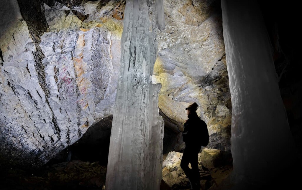
There are ice formations throughout the cave that may change annually. Some of the more spectacular formations to discover in the region are the massive ice columns that sometimes form near the entrance to the cave.
By the nature of its formation, there is a lot of loose rock around and in the cave. The final ascent into the cave is a bit of a scramble and care should be taken around the cave to prevent rocks falling onto hikers below.
The cave is a fascinating place to explore and the view from the entrance is fantastic. As an extra bonus for your hike, you can search for the sulfur spring down in the valley which feeds into the creek.
Jumpingpound Mountain is a great day hike option with three trails to the summit to allow you to cater the hike to your ability and time. While the ridge walk can be windy, there are wide open views of the Fisher and Opal Ranges to the west and the foothills and the tiny speck of Calgary on the horizon to the east.
The three trailheads to the mountain are all off of Powderface Trail Road, which is a 34 km (21 mi) gravel road that connects Highway 66 in the north near Sibbald Flats to Highway 68 in the south near Elbow Falls. This road itself is popular among mountain bikers.
The most northern trailhead to the mountain leaves from Dawson Equestrian and leads 16.5 km (10.3 mi) to the summit of Jumpingpound Mountain via Cox Hill. With 1,059 m (3,473 ft) of elevation gain, this is the longest and most grueling trail to the summit. However, the trail is incredibly rewarding with a lovely walk along the lodgepole pine covered ridge, the spectacular views from two peaks, and a comparatively easy walk back down.
The second trailhead is about 8 km (4.5 mi) down the road from Dawson equestrian. This section of the road is closed from December to May each year. The trail leads up the side of the mountain gaining elevation quickly through a series of switchbacks for a total gain of 819 m (2,686 ft). Once you’ve reached the ridge, you’ll turn right at the trail junction and follow the ridge to the summit. This route is a moderate hike; however, it is very enjoyable once you reach the ridge, and the views are fantastic.
The third trailhead is just over 15 km (9 mi) down the road from Dawson Equestrian. It is the shortest distance at 3.2 km (2 mi) to the summit with only 414 m (1,358 ft) of elevation. This is certainly the shortest hike with the least elevation; however, it is a straight shot up the mountain through the forest. If you’re pressed for time and only wish to summit a mountain, this is a good option. The second option is my favorite as it allows for a nice walk along the ridge.
With fantastic trails to hike, rivers for fishing, and mountains to climb Kananaskis Country PLUZ is a popular destination. The following are a couple places to stay or visit while in the area.
Alberta’s largest city, Calgary is located about 65 km (40 mi) to the west of Kananaskis Country PLUZ. With a population of around 1.4 million people, there are many outdoor enthusiasts that regularly head west into the mountains.
As it is home to the closest international airport to many provincial and national parks, mountain tourists will often fly into Calgary before being shuttled to the Rocky Mountains. While its proximity to the mountains is a wonderful feature of the city, Calgary has more to offer than just a transportation hub.
For the days where the weather isn’t friendly for mountain adventures there are cultural attractions and venues including the Glenbow Museum, opera, symphony, theatre projects and more to enjoy in the city. There’s also the Calgary Zoo as well as the Calgary Tower, which is located downtown.

Across the city, there are pathways connecting all the major parks and green spaces. Paths go from Fish Creek Provincial Park in the south up along the Glenmore Reservoir. The paths continue along the Bow River and Elbow River to Nose Hill Park in the north, and beyond.
Annual activities range from street festivals to the “Greatest Outdoor Show on Earth”—the Calgary Stampede. As a result, there’s a lot to enjoy in the city in between mountain days.
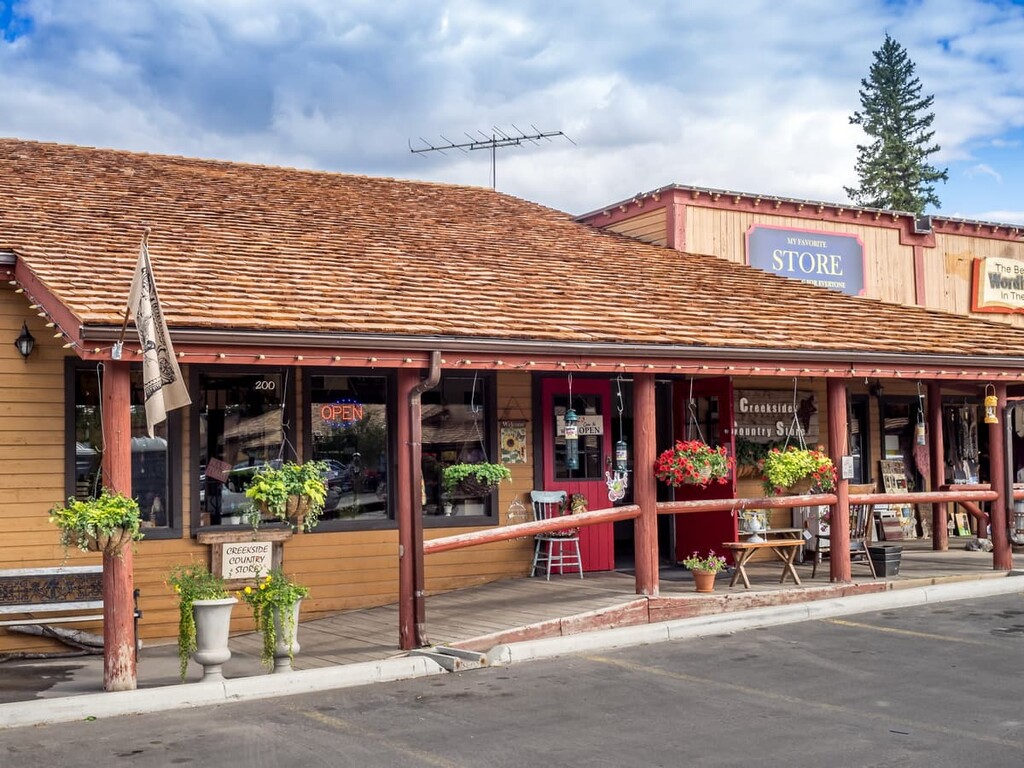
Located about 30 km (18 mi) west of Calgary, Alberta and only 10 km (6 mi) from Kananaskis Country PLUZ, Bragg Creek is a quaint mountain village. The town is charming with many of the structures built in the log-cabin style. The town has some amazing restaurants that serve cuisine representative of the original settlers of the region and shops that support local artists and artisans.
There are hotels available in town as are stores where you can stock up on supplies for mountain adventures. The main plaza has a candy and ice cream shop, too, that is sure to have something to please everybody, regardless of the season.