
Share

Scan the QR code and open PeakVisor on your phone
Scan the QR code and open PeakVisor on your phone
In 1978, the premier of Alberta, Peter Lougheed, designated a large wilderness area in southeastern Alberta, Canada as Kananaskis Country. Although Kananaskis Country is not a nation or a state in its own right like Canada is, the term “country” is used locally in this part of Alberta and in other areas of North America to refer to a general region.
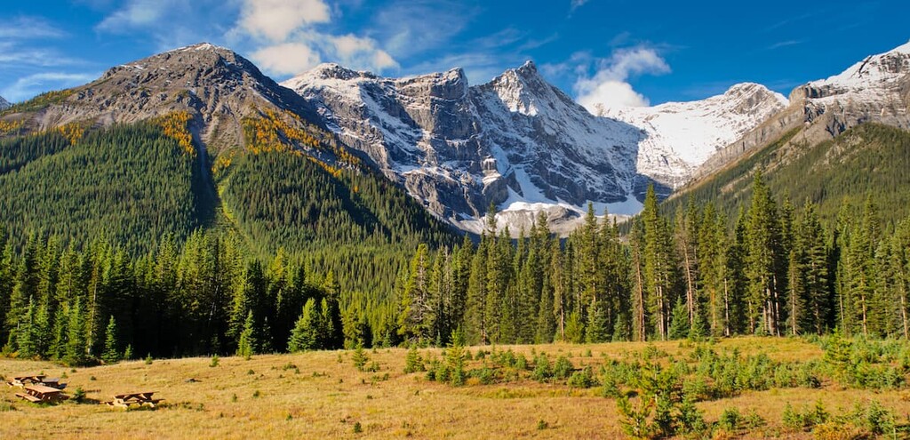
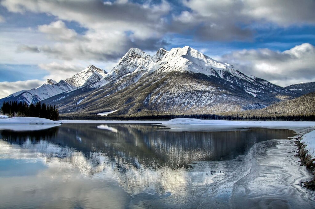
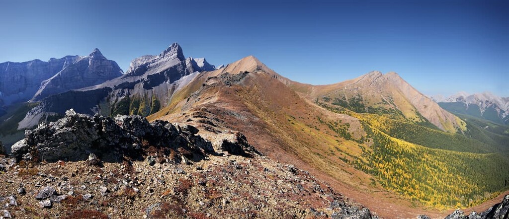
Kananaskis Country is a topographically diverse region of prairie grasslands, foothills, wetlands, rivers, valleys, and mountains. It covers over 4,000 square kilometers (1,540 sq. mi) of land, extending from the foothills to the west of Calgary to the Continental Divide in the east. There are 370 named mountains in Kananaskis Country, of which the tallest and most prominent is Mount Joffre (3434m/11,263ft).
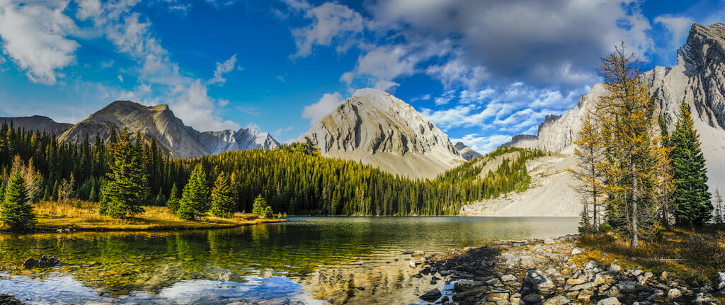
Located west of Calgary, near Canmore, Kananaskis Country borders Highway 1 (Trans-Canada Highway) in the north and Banff National Park and the Continental Divide on the west. It follows the mountain ranges south along Highway 40 (Kananaskis Trail) through the Highwood Pass and out through the rangeland and onto the prairies.
Kananaskis Country is managed as a multi-use recreational area that allows use in each zone based on sensitivity to environmental impact. Hiking, cycling, camping, fishing, hunting, off-highway vehicles and snowmobile use, cattle grazing, and oil exploration are all activities that can take place in designated areas. Over two-thirds of the area is protected as parks and conservation areas.
Kananaskis Country is a “management area” and not a park itself; however, it contains 6 provincial parks, 4 wildland provincial parks, 39 provincial recreation areas, 1 ecological reserve, and 1 natural area, while the remaining area is a “public land use zone.”
The different designations between the areas and parks allow for varying levels of conservation and development, dependent upon each area’s sensitivity to environmental impact. Areas of high conservation priority are designated as ecological reserves and provincial parks.
Plateau Mountain Ecological Reserve is in the south of Kananaskis Country and only allows access by foot to preserve the delicate ecosystem on the plateau. Provincial parks and wildland provincial parks make up most of the protected areas of Kananaskis.
The following provincial parks are in Kananaskis Country:
Furthermore, the four wildland provincial parks in Kananaskis Country are:
Approximately 70 to 80 million years ago, during the Late Cretaceous, tectonic plates from the west started sliding under the North American plate. The pressure from the impact forced the relatively flat seabed into massive folds and ripples, creating the Rocky Mountains. The formation of the Rocky Mountains, during an event called the Laramide orogeny, lasted between 15 and 45 million years.
Prior to the Laramide orogeny, shallow seas covered Kananaskis Country, where sea creatures lived and died for millions of years, leaving their remains to settle and compact on the seafloor. As the plates collided, the sedimentary layers stacked and lifted to form the Canadian Rockies.
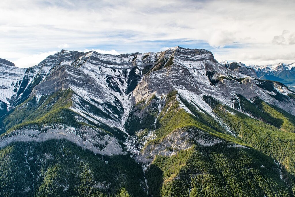
The rock formations and ridges on the eastern edge of Kananaskis were formed as slabs of sedimentary rock were pushed up on top of the next one, like roof shingles, along the fault lines. These fault lines created nearly parallel rows of hills and ridges leading west to the front ranges.
The front ranges in Kananaskis are the leading edge of a massive slab of Paleozoic limestone that was thrust over much softer, Cretaceous sandstone and shale. The alternating layers of stone were stacked near vertically along thrust lines to create the jagged and rugged mountains that tower above the foothills. Tight folds and steep dipping of the layers of rock are very apparent in the front ranges and especially easy to see from Highway 40 in the Opal Range.
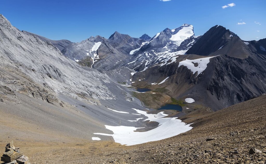
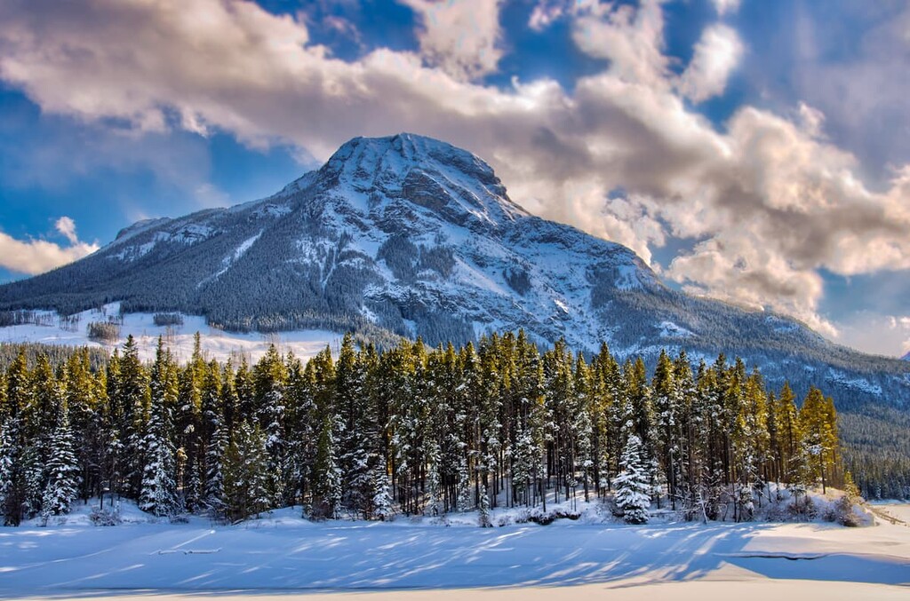
During the Pleistocene epoch, about 2.6 million to 11,700 years ago, Kananaskis and the Rocky Mountains were covered with ice sheets upwards of a kilometer thick. The glaciation and subsequent retreating of the glaciers created much of the topography of the mountains. The layers of sandstone and shale were eroded faster than the harder limestone layers creating different effects depending upon how the layers were stacked.
On Mount Murray, the glacier carved out a depression in the slope, called a cirque. Where the sedimentary slabs were thrust more vertically, glaciers removed the softer rocks, leaving the harder stone as spires and jagged saw-like ridges, as seen on Mount Birdwood and in the Opal Range. If the sediment bands were more horizontal, the glacier would leave vertical cliffs between the bands, giving a castellated look such as the one found on Mount Kidd.
Many glaciers and icefields in Kananaskis as remnants of the last glacial maximum. The evidence of past glaciation can be seen throughout Kananaskis Country in the form of moraines, eskers, kames, cirques, and kettle lakes.
Within Kananaskis Country, there are four distinct ecological regions, each of which has its own respective assortment of flora and fauna. The following are descriptions and characteristic flora and fauna of the ecological regions in Kananaskis: the alpine, subalpine, montane and aspen parkland regions.
Plants and animals are sparse in the alpine areas of Kananaskis and consist mainly of lichen covered rocks, grassy meadows, mat vegetation, shrubs, and krummholz. The rugged mountain tops do not have sufficient soil to sustain plant growth.
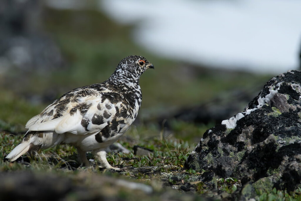
Mountain avens grow between the rocks which add a bit of color. Sedges, grasses, and mountain heaths cling to the edges of snowbeds, while grouseberry and snow willow thrive in protected areas. Stunted subalpine fir and Engelmann spruce may be spotted amongst the rocky outcrops and grasses. Lengthy snow cover, cold temperatures, and the steep, rugged terrain prevent most flora from thriving amongst the peaks.
Birds are the only animals known to regularly inhabit the alpine areas. White-tailed ptarmigan, gray-crowned rosy finch, horned lark, and the American pipit nest among the alpine rocks.
The subalpine region of Kananaskis Country is full of lodgepole pine, alpine fir, and Engelmann spruce/white spruce hybrids. Grasses, willows, creeping juniper, and aspens fill the meadows around the creeks and rivers.
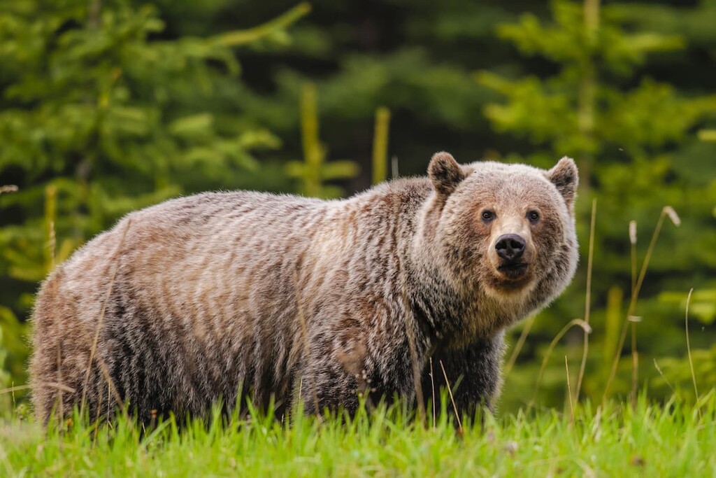
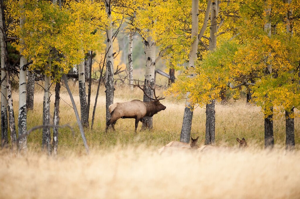
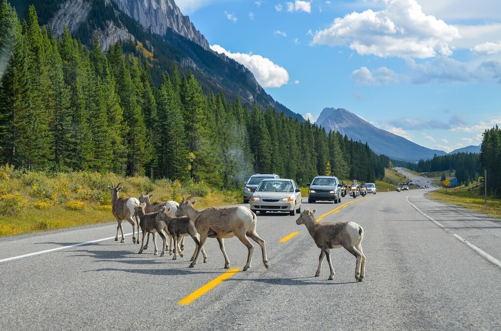
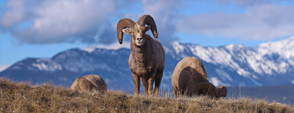
Marmots scream from the rocks, while pika and ground squirrels chirp as they run along the boundary between the valleys and the rocky slopes. Large predators such as grizzly bears, black bears, cougars, and wolves inhabit the slopes of Kananaskis. Ungulates, such as elk, mule deer, white-tailed deer, mountain goats, and mountain sheep are found across the area and mountain sheep are frequently found on the roads licking the accumulated salt and minerals.
The montane region of Kananaskis Country is characterized by forest and grassland complexes along the valley floors. The grasslands occupy dry, exposed sites and forests fill the rest of the space.
The primary trees that inhabit this area are Douglas fir and lodgepole pine. Spruce tends to spread along stream banks and hold onto the north facing slopes and aspen are usually found in stands upon terraces.
Below the tree line, creeping juniper, and bearberry fill the ground until the ground is too dry and the grasses have taken over. Bluebunch wheatgrass, fescue grasses and oat grasses dominate the grasslands and meadows.
The montane forests and meadows of Kananaskis are home to many large animals and the valleys are important wildlife movement corridors. Most animals will spend their winter in the lower altitude, montane regions.
The Aspen Parkland ecological region dominates the eastern edge of Kananaskis Country. Aspen parkland is characterized by forests of aspen mixed with open grass. The warmer, dryer south slopes are often devoid of trees, while the cooler, wetter north slopes are usually covered with white spruce.
Animals such as elk, white-tailed deer, coyote, and ruffed grouse inhabit these areas. The aspen parkland is the last contiguous tree cover before the expanse of the prairies.
People have been visiting and living in Kananaskis Country for over 8,000 years. There are many culturally significant archeological sites across Kananaskis, ranging from Hopi petroglyphs, buffalo jumps, teepee circles, ceremonial areas, and many more traces of the original inhabitants of this land.
The Kananaskis Valley is traditional territory to the Tsuu T’ina, Stoney, Ktunaxa amakis, and Blackfoot/Niisitapi nations. The name Kananaskis was given to the valley and river by John Palliser in the nineteenth century. It is said that Palliser named the area after a legendary First Nations warrior who had taken a serious axe blow to the head and continued to live and fight. Palliser thought it fitting that this “tough” valley be named after someone as tough as Kananaskis.
Europeans recorded their passage through Kananaskis as early as 1787, when David Thompson made his first trip into the mountains. There were only a handful of other Europeans who came to Kananaskis before Palliser started mapping the area in 1858. The Palliser Expeditions opened the mountains to an era of European industry and recreation.
The late 1800s saw the beginning of logging and coal mining in Kananaskis Country. The town of Kovach was founded near Ribbon Creek to house the miners. The first of many hydroelectric projects was started in 1932. As workers came to work on the new dam projects, they began to see the recreation potential of the Kananaskis Valley.
During the Great Depression, in 1936, a work camp was built in the valley to bring in unemployed men to start building the infrastructure and roads of Kananaskis Country. World War II saw the work camp converted to a prisoner of war camp to house German POWs. The prisoners were led out on work details to log the reservoir sites and to build park infrastructure.
In 1952, the Kananaskis forestry road, first built in the 1930s, was upgraded and extended through the Highwood Pass to Coleman, Alberta. This increased accessibility to the area and subsequent development. The Kananaskis Valley started to become a popular mountain destination for Calgarians.
Kananaskis Country was officially created in 1978, when the premier of Alberta, Peter Lougheed, was convinced of the need to conserve the natural landscapes and resources of the area for recreation and tourism. The idea of a multi-use area was conceived, which allows delicate ecosystems and remarkable landscapes to be protected under strict use guidelines while allowing cattle grazing, oil exploration, and off-highway vehicle use in areas that are more robust.
Later, in 1983, Kananaskis Improvement District was created in order to allow a single council to govern the affairs of Kananaskis Country by redrawing adjacent district boundaries to create a new district aligned with Kananaskis Country boundaries. Improvement districts are similar to counties; however, counties have locally elected councils, whereas, improvement districts have provincially appointed councils.
The most recent infrastructure projects in Kananaskis were built for the 1988 Calgary Winter Olympics. Nakiska Ski Areal was built on eastern slopes of Mount Allan as a venue for the downhill ski event and the hotels at Kananaskis Village were constructed to house Olympic athletes. Kananaskis Village has since added a couple more resorts and a golf course.
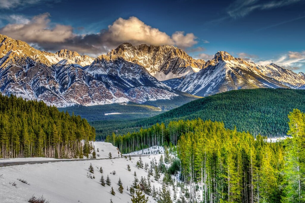
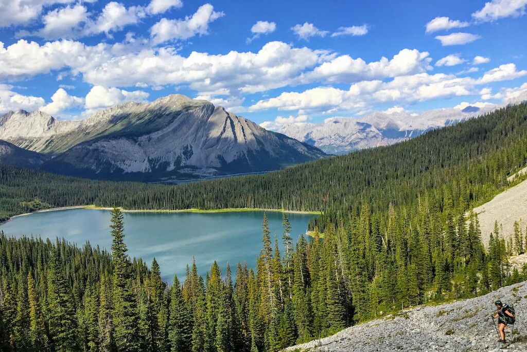
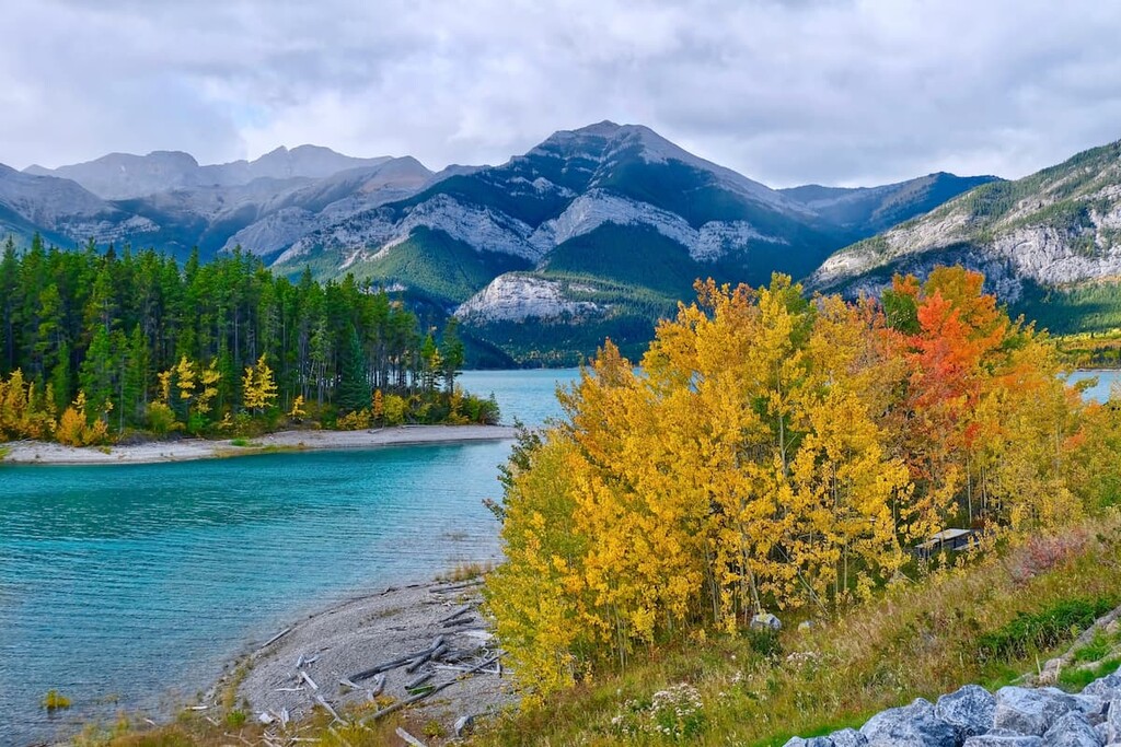
Kananaskis Country has become a beloved playground for local outdoor enthusiasts. With dozens of campgrounds, countless picnic areas, visitor centers, interpretive programs, hundreds of kilometers of hiking trails, hundreds of mountain peaks, groomed cross-country ski trails, abundant fish in the rivers and lakes, kayaking rapids, large and small lakes to paddle, and incredible scenery, Kananaskis Country has something for everyone.
With 370 named mountains, over 50 designated parks and recreation areas, hundreds of kilometers of trails, and dozens of lakes, there is a lot to see and do in Kananaskis Country. The following are just a small sample of the trails and attractions in the area.
Ecological reserves are created to protect rare and fragile landscapes, plants, animals and geological features. Preservation of the habitats, features, natural ecosystems, and biodiversity of Plateau Mountain are the primary intent of the strict conservation restrictions.
There is no public vehicular access to the plateau but the trail follows a well site access road from Highway 40, from the southwest corner of the mountain. The trail is 6.7 km (4 mi) from the trailhead to the lookout with 250 m (82 0ft) of elevation gain.
During the last glacial maximum, the top of Plateau Mountain was not covered by the glacier and as a result several unique features were created upon this high altitude plateau. The plateau features an ice cave with ice crystals, curls, sheets and pillars. An increase in temperature of 1°C can cause these fragile ice crystals to melt. Additionally, periglacial features, such as patterned ground, are found in the ecological reserve. These features include active permafrost, sorted stone circles, polygons, steps, and frost boils.
Care should be taken when visiting delicate ecosystems such as those in the Plateau Mountain Ecological Reserve to protect their natural state. The plateau is home to a unique ecosystem of flora and fauna because the ground was not covered by the most recent glaciation. The plateau is also an important winter range for bighorn mountain sheep.
On the west side of Highway , just south of Barrier Lake, there is a unique rest area that is hard to miss. On the slopes of Mount Baldy water pours from a spring and cascades down the slope, passes a wishing well, goes under a picturesque wooden bridge, into a culvert and under the highway.
This little area was the vision and creation of John O’Shaughnessy who was the engineer for the construction of the Kananaskis Highway. The creek created problems for the previous gravel road because it refused to follow the culvert along the highway, allowing water to flow across the road. This flow caused ice in the winter and a ditch from erosion when the water flowed freely. The plan to tame the creek was to install a large pipe along the stream to direct the water into the culvert.
The water diversion plan did not appeal to the aesthetic nature of John O'Shaughnessy. He took it upon himself to design and create the waterfall in hopes that it would control the flow of the stream. The waterfall construction led to landscaping the site and building the wishing well. All the hard work and long hours came from O'Shaughnessy’s spare time.
A member of the Canadian Forestry Service named the falls in O'Shaughnessy’s honor. It now stands as a testament of how one person can make a difference, and provides a unique place to stop and visit.
Located at the southern tip of Bow Valley Provincial Park, the Mount Lorette Ponds provide a stunning view of Mount Lorette to the west. They also feature lovely walking paths, picnic areas, a stocked fishing pond, and a boardwalk over the ponds for visitors to enjoy.
The area was specifically developed as a place for people who use wheelchairs and those with limited mobility to fish. Paved paths surround the fishing pond and lead out to the boardwalk making it friendly for strollers as well.
The Mount Lorette Ponds are a special place, and if you’re fortunate enough to be there without crowds, standing on the boardwalk, overlooking the serene ponds and majestic mountains, you can commune with nature and connect with the world around you.
Plus, there’s nothing stopping you from putting a kayak or SUP into the ponds and immersing yourself more fully in the landscape.
Heart Mountain is a distinct peak along the southern shore of the Bow River, across from the hamlet of Exshaw.
The mountain was named for the distinct heart shape of the ridge along the peak, that looks like a heart. The trek up Heart Mountain is a scramble, not a hike. This scramble requires climbing and the use of hands for stability. There is moderate exposure (risk of falling off) along the route and route finding is a necessary skill because there is no official trail.
The scramble up Heart Mountain is popular and appealing because it is close to Calgary and is often one of the first peaks to lose its snow during the summer months. Additionally, the warm Chinook winds (a type of föhn wind) blast this peak and keep it moderately clear of snow through the winter. However, without the warm winds, spring snow storms can cover the top of this mountain with a meter or more of snow and caution should be used.
The trail that leads to this scramble starts at the Heart Creek trailhead, accessed from the Lac des Arcs turnoff from Highway 1. The trail heads east into forest and over a hill until you reach the river. Follow the trail and after the second bridge over the river a sign will direct you left, towards the Quaite Valley trail or right, up the Heart Creek trail. Turn left and follow the Quaite Valley trail a few hundred meters (400 yards) to the base of Heart Mountain.
A sign warning that this trail is not maintained and that it is a scramble, rather than a hike, welcomes you to your trail. The trail along the lower slopes is easy to follow, and you just keep ascending. The trail becomes steeper and less distinct as you ascend. Near the summit there is a 3 m (10 ft) cliff that you need to climb, and beyond the cliff the route is steep, difficult to follow, and exposure is high. There are some blue reflective markers at some points to help lead you the right way.
As you ascend, your view of the Bow Valley increases and at the top you get to see the ranges laid out around you. Kananaskis Range lies to the south, while the Fairholme Range with Mount Yamnuska is to the north. The Fisher Range with Mount Baldy lay to the southeast and the Goat Range along the Spray Lakes is to the west. Mount McGillivray is the mountain you see to the west, across Heart Creek.
There is a risk of getting lost coming down from scrambles. This mountain in particular has seen several rescues of hikers who lost the trail who kept climbing down and got stranded upon cliffs with no safe way back up or down.
This is a popular trail which starts at the north Barrier Lake day-use area. The trail is 7.7 km (4.8 mi) one way and leads up to McConnel Ridge on Yates Mountain. Previously, the Pigeon fire lookout was upon this ridge; however, the Barrier Lake Lookout at the top of Yates Mountain made it redundant in 1983, so it was removed.
From the lookout you see down the Kananaskis Valley and along Barrier Lake. Mount Baldy is the large mountain across the lake to the east. Trails lead further along giving options for forays and making the hike a loop as well as the summit of Yates Mountain.
From the ridge you can see north though Jewell Pass and the backside of Heart Mountain and Mount McGillivray, which are normally viewed from the front from Highway 1.

The hike follows the old fire lookout access road, so it is a wide trail that is easy to follow. Though long, it is a good hike for families with children. After the hike you can relax on the sandy beach if the reservoir is low enough or paddle out in a kayak to experience the area at a different level.
Kananaskis Country is an exceptionally large area of protected wilderness and as such there are many notable towns nearby. The following are several of the towns where you will find hotel accommodations and major tourist attractions.
Located along the Bow River, just a short drive from the mountains, Calgary is a city with nearly 1.5 million people. Often seen as the gateway to the Rockies, many people are quickly shuttled from the airport out to Canmore or Banff.
The city does have an international airport with flights coming from all over the world; however, Calgary can be more than just a pit stop on your way to the mountains. It hosts a local ski hill along with winter sport training facilities. It has climbing centers to practice your trade, and you’ll likely notice the climbing center beside Highway 1 as you head west to the mountains as it has a prominent outdoor climbing wall.

In addition to training facilities, there are cultural and sporting events to see in the city. The Stampeders hit hard and play a good football game, while the Roughnecks lacrosse games are exciting with the quick pace and party like atmosphere in the stadium.
Calgary has excellent restaurants no matter your budget or preferences. During July, Calgary hosts the Calgary Stampede. There are cultural festivals throughout the year, and Spruce Meadows equine events take place each summer. Calgary has a lot to offer; however, its proximity to the Canadian Rockies is appreciated and a highlight for many residents.
Nestled in the heart of the Bow Valley, Canmore, like many towns along the mountain railway, started as a coal mining settlement. It is located near the western edge of Banff National Park so it’s a good place to stay if you’re interested in exploring fun destinations and activities in the region.
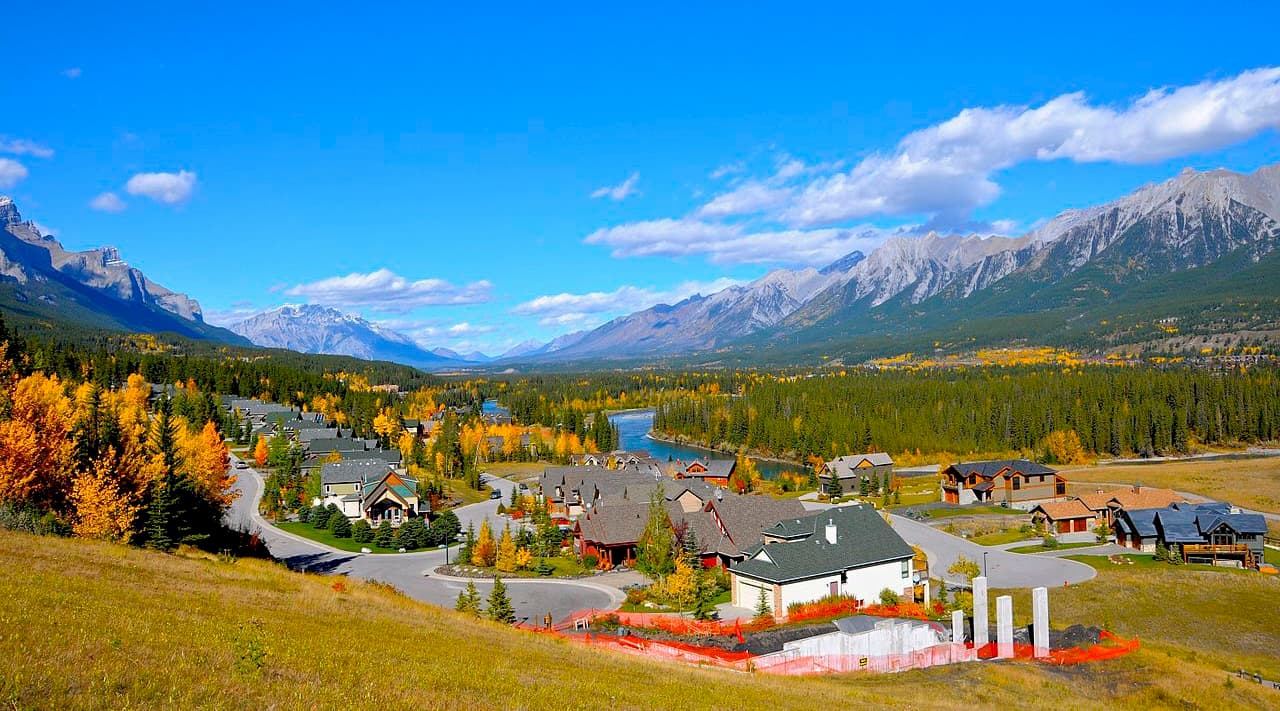
Canmore provides easy access to hiking trails like Ha Ling Peak, Chester Lake and Grotto Canyon. In addition to hiking, Canmore offers ample opportunity for road and mountain biking.
The snow-filled months are typically the busiest months in Canmore, as it is a wonderful tourist town for the surrounding ski resorts, such as Sunshine and Lake Louise.
Located in Banff National Park and home to the famous Cave and Basin Hot Springs, Banff offers plenty of lodging and a unique mountain lifestyle experience. With amazing mountain views from the streets, such as the iconic East End of Rundle (EEOR), and the world famous Fairmont Banff Springs Hotel, Banff offers a first-class mountain experience.
From Banff, mountain trails, peaks, and phenomenal views are easily accessible as a day trip. You can then return to your luxurious lodging and end your day in one of the many spas, where you can enjoy a relaxing massage.

This amazing town does get busy in the summer and winter seasons. Spring and fall offer a time when the trails and sidewalks are less busy, and fall is the time when you can witness the incredible changing colors of the larch trees along the mountain ridges.
Since the town is situated within a national park, wildlife sightings are to be expected. It isn’t uncommon to see elk roam the townsite.
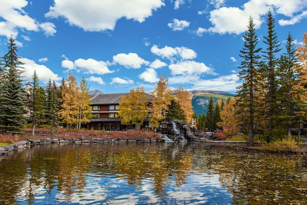
Located 26 km (16 mi) south of Highway 1 on Highway 40, Kananaskis Village is an unincorporated community in Evan-Thomas Provincial Recreation Area in the heart of Kananaskis Country. Accommodations range from a modest hostel to the more luxurious Kananaskis Lodge.
In Kananaskis Village, there are stores to buy supplies, food, and rent equipment. The village is also located at the base of the Nakiska Ski Area and resort, which is a great winter destination.
Kananaskis Village offers hikes beginning right outside your door, such as Ribbon Lake and Troll Falls. It is a starting point for many groomed cross-country ski trails in the winter and it is the closest lodging to much of the backcountry skiing offered further south in Peter Lougheed Provincial Park.
The Kananaskis Country Golf Course is also located just south of Kananaskis Village. It was recently rebuilt after the 2013 floods which changed the face of much of Kananaskis Country. Since the fairways create enticing meadows, wildlife sightings are common and bear spray is recommended. It’s well worth a visit.

Explore Kananaskis Improvement District with the PeakVisor 3D Map and identify its summits.


