Scan the QR code and open PeakVisor on your phone
Sibbald Snow Vehicle Public Land Use Zone (Sibbald PLUZ) is an outdoor recreation area that’s located on the eastern edge of Kananaskis Country, about 70 km (42 mi) to the west of Calgary in Alberta, Canada. The public land use zone has 7 peaks, the tallest of which is Valleyside Ridge with 1,827 m (5,993 ft) of elevation. The most prominent is Deer Ridge with 240m (787ft) of prominence.
Located in southwest Alberta, about 70 km (42 mi) to the west of Calgary in the Canadian province of Alberta is Sibbald Snow Vehicle Public Land Use Zone (Sibbald PLUZ). Sibbald PLUZ is also a part of the Kananaskis Country mixed use recreational area.
Highway 68 is the primary road that leads to Sibbald PLUZ. Additionally, the nearest town is Cochrane, which is located about 50 km (36 mi) to the northeast. The Sibbald PLUZ is located in the northeast corner of Kananaskis Country with Bow Valley Provincial Park located to the north and Kananaskis Country PLUZ encompassing the rest of the PLUZ.
Covering 4,211 square kilometers (1,625 square miles) of land, Kananaskis Country is divided into six categories of land management: public land use zones, provincial parks, wildland provincial parks, provincial recreation areas, natural areas, and ecological reserves.
Kananaskis Country has four public land use zones: Kananaskis Country PLUZ, Sibbald PLUZ, McLean Creek PLUZ, and Cataract Creek PLUZ. The different public land use zones were created to separate areas where vehicle use is permitted from areas that it is not.
Sibbald PLUZ and Cataract Creek PLUZ only allow OHV use during the winter, while Kananaskis Country PLUZ does not allow any OHV use. McLean Creek PLUZ is the only PLUZ that allows off-highway vehicles (OHVs) year-round in Kananaskis Country.
The provincial parks in Kananaskis Country include Peter Lougheed, Bow Valley, Bragg Creek, Sheep River, Spray Valley, and Canmore Nordic Centre Provincial Park. The provincial parks have camping and tourism facilities as well as many access roads.
The wildland provincial parks receive the same protection as the provincial parks; however, there are fewer access roads and no facilities within the wildland provincial parks. Bluerock, Bow Valley, Don Getty, and Elbow-Sheep Wildland Provincial Park protect vast wilderness and mountain areas.
The Beehive Natural Area and Plateau Mountain Ecological Reserve are also located in Kananaskis Country, but they have no facilities and they are protected to preserve the specific landscape features and unique habitats within their borders. Plateau Mountain Ecological Reserve has unique ecosystems and periglacial landscape features.
Provincial recreation areas are generally small areas around prime trailheads that manage trailhead and parking facilities.
Among the 39 provincial recreation areas in Kananaskis Country, there are also some that manage camping facilities within the borders of wildland provincial parks and public land use zones. The largest provincial recreation area is the Evan-Thomas PRA which includes Nakiska Ski Hill and Kananaskis Village.
Sibbald PLUZ is part of the foothills on the eastern edge of the Canadian Rockies and it borders the Bow River Valley. The foothills of Sibbald PLUZ formed at the end of the Laramide orogeny, which was a mountain building event that started about 75 million years ago. The Laramide orogeny is the same event that created the rest of the Rocky Mountains.
For about 35 million years, as the North American plate pushed against the tectonic plates under the Pacific, thick layers of Paleozoic marine sediment broke along fault lines and stacked on top of the younger Cretaceous sandstone and shale to form the Rocky Mountains.
The process that stacked the layers of the Rocky Mountains is called thrust faulting. The thrust faulting for the Canadian Rockies started in the southwest and progressed northeast creating the Rocky Mountain ranges as we know them today.
Across the mountains, the force of the tectonic collision pushed the older Paleozoic marine sediment on top of the younger Cretaceous rock. The thrust faulting created up-thrust layers of alternating limestone/dolomite and sandstone/shale.
The mountains stopped forming at the front ranges because the force of the collision and the power that was building the Rocky Mountains dissipated as it traveled east. At this point, there was no longer sufficient energy to deform the Paleozoic layers, so the Cretaceous layers started thrust faulting independently of the deeper and older layers.
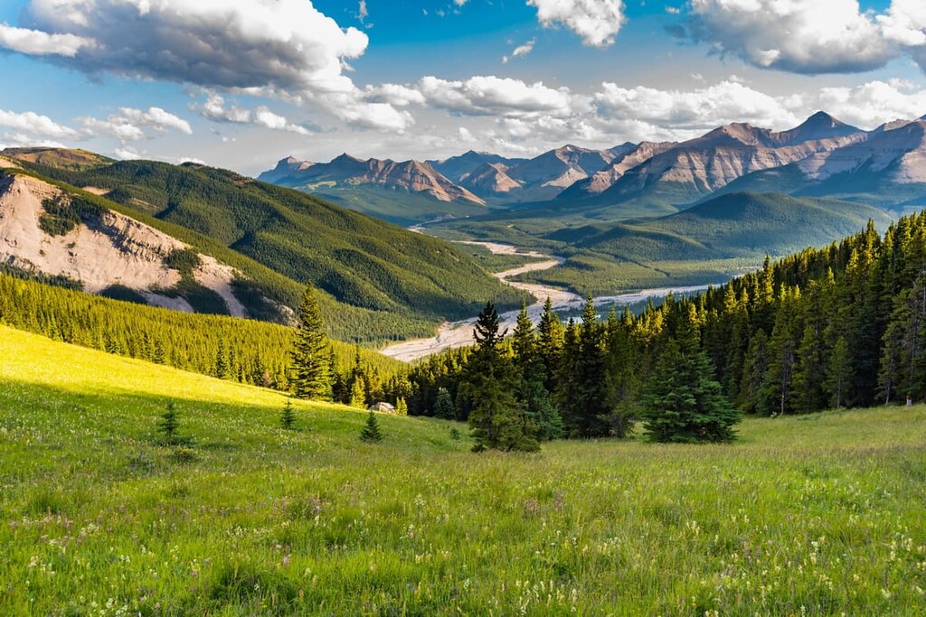
As a result, the foothills are primarily made of sandstone ridges with shale valleys. The stacking of the Cretaceous rock looks like shingles on a roof, with a repeated pattern of a gentle slope rising to a steep drop-off.
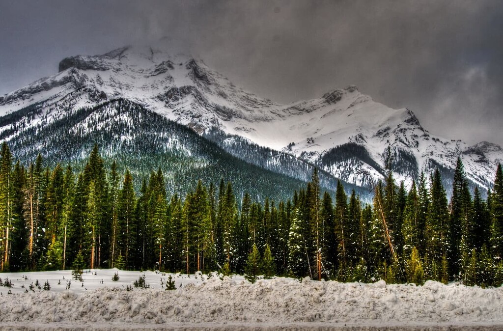
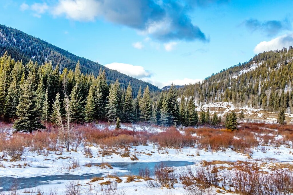
The topography of Sibbald PLUZ, Kananaskis Country, and the Rocky Mountains in general, formed during the last glacial maximum of the Pleistocene. The Canadian Rockies went through periods of glaciation for the past 2.6 million years and were covered in kilometer-thick ice sheets. The glaciers scoured the softer layers of sandstone and shale out of the valleys and left behind durable limestone peaks.
As the glaciers advanced from the mountains into the foothills, they scoured the mountains, displacing immense amounts of rock. As the glaciers retreated, the displaced rocks were deposited to form eskers, kames, and moraines.
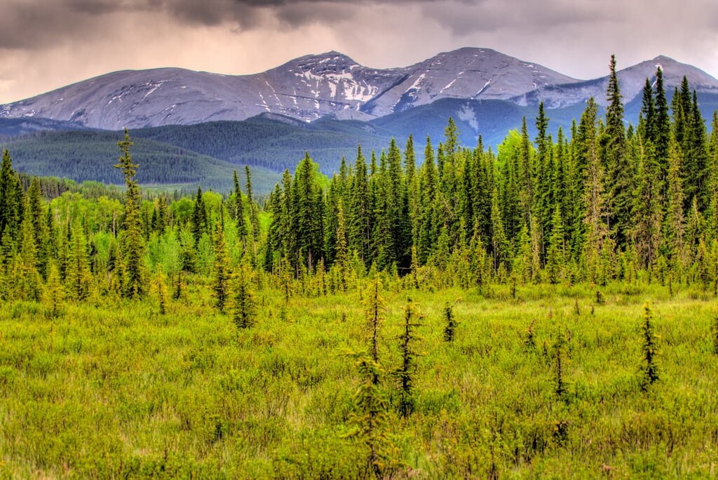
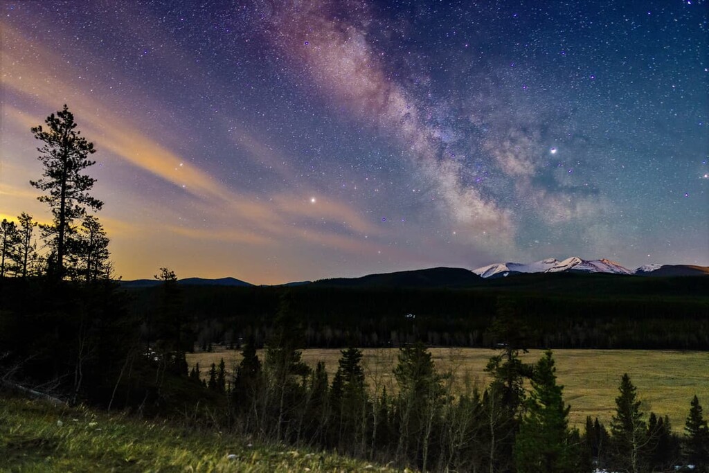
The ecology of Sibbald PLUZ is representative of the montane subregion of the Rocky Mountain Natural Region. Thanks to the Chinook winds that grace southern Alberta, Sibbald PLUZ experiences some of the warmest winter weather in Alberta, making it a perfect place for winter activities.
The Chinooks are warm, dry winds that descend into the prairies from the Rocky Mountains. They are created from warm, moisture laden air that is pushed east over the Rocky Mountains, and as it rises it will condense and precipitate as it reaches the peaks. The now dry air flows down from the peaks, condensing, and increasing in pressure which increases the temperature of the air.
Chinook winds are known as föhn winds in other parts of the world. The Chinook winds are also known by the Blackfoot as “snow eaters” because the fast moving, warm, dry winds sublimate the snow before it even has a chance to melt.
The Chinooks of the montane region helps it have the largest variety of plant species of the Rocky Mountain ecologies. There are over 300 rare plant species in the Rocky Mountain Natural Region with 140 species that are unique to the region.
Some of the easiest plants to recognize in the region are the trees. The forests of Sibbald PLUZ are filled with lodgepole pine (usually tall and straight with their bottom half bare of branches), aspen (one of the few deciduous trees in the region), white spruce (the small branches are like a bottle brush with short, rigid, needles all around), and Douglas fir (it has the “bearded” pinecones).
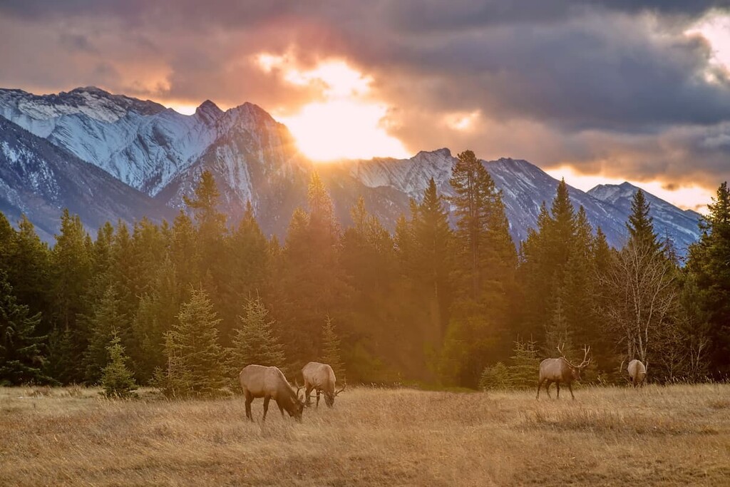
The old and new forests, streams and creeks, the wetlands and the meadows of Sibbald PLUZ are all important habitats to the wildlife in the region. The area is typical habitat for large mammals, such as grizzly bears, elk, cougars, wolves, moose, and deer. Beavers are an interesting resident of the region and by building their dams and flooding meadows, they create habitat for other animals, especially a variety of birds.
The banks of the streams and along creeks are prime habitat for small mammals, such as the northern bog lemming, long-tailed vole, heather vole, and the rare Richardson’s water vole. You may also find a spotted frog or a long-toed salamander if you’re particularly observant. There are several large meadows in the Sibbald area that have been prime grazing for ungulates and therefore, prime hunting grounds for predators.
As the Pleistocene ice sheets melted around 12,500 years ago and the Rocky Mountains and Kananaskis Country became ice free, humans came to what is now the Sibbald PLUZ to hunt game.
The remains of these ancient inhabitants were found in the areas surrounding a meadow in what is known as the “Sibbald Creek Site.” It is believed that the meadow provided grazing opportunities for animals, which in turn drew humans to the region. The site has evidence of continued use for the past 11,000 years, with artifacts representing virtually all the pre-European contact societies to have inhabited southern Alberta.
It’s believed that Sibbald PLUZ and Kananaskis Country were among the first areas to become uncovered after the last glacial maximum (ice-age) of the Pleistocene. Kananaskis Country was located at the southern end of the ice-free corridor through Alberta, which connected Yukon and Alaska to the southern half of North America.
This ice-free corridor was likely the route by which humans populated North America, as they traveled from Asia and over Beringia (the ancient land bridge that connected Asia to North America).
As it is home to at least one significant archeological site within its boundaries, Sibbald PLUZ may yet have other undiscovered archaeological sites. As with the “Sibbald Creek Site,” most archaeological discoveries in Kananaskis occur during preliminary site surveys for road construction, which leaves ample space that has never been surveyed.
Sibbald PLUZ is the traditional territory of the Metis, Tsuu T’ina, Stoney, and Ktunaxa nations, as well as that of the Blackfoot Confederacy. It is possible that some of the battles and skirmishes between the Ktunaxa and the Blackfoot occurred in the area.
In 1791, Peter Fidler of the Hudson’s Bay Company pioneered the contemporary Kananaskis Trail along the Kananaskis River for the European fur trade. It is possible that Fidler was the first European to have entered within the current borders of Sibbald PLUZ.
Further recorded European travel near Sibbald PLUZ includes James Sinclair, who led settlers over the Kananaskis Pass in Peter Lougheed Provincial Park to get to Oregon in 1841 and 1856. John Palliser surveyed the border between British North America and the United States between 1857 and 1861, and as he was searching for a viable route for the railway, Palliser entered the Kananaskis River valley.
It was Palliser who named the Kananaskis River and areas after the Cree “Kin-e-a-kis,” a warrior who survived an axe blow to the head. Alberta premier Peter Lougheed officially designated Kananaskis Country in 1978 as protected land and a mixed-use recreation area.
Before Lougheed created Kananaskis Country, OHV use was a popular activity in the region. New restrictions prohibited OHV use except in the designated PLUZs. Sibbald PLUZ was opened for winter OHV use only, as was Cataract Creek PLUZ. However, McLean Creek PLUZ is open to OHV use year-round.
Public lands such as Sibbald PLUZ are an incredible resource for locals and tourists alike. They provide a place to recreate in almost any imaginable way, including hiking, cycling, equine, hunting, fishing, camping, and OHV use.
With its proximity to Calgary, Sibbald PLUZ is a popular destination all year long. The following is a list of some activities and places to check out while in the area.
While technically not part of Sibbald PLUZ, the Sibbald Lake Provincial Recreation Area is surrounded by the PLUZ and provides the major facilities for the PLUZ.
There are 134 campsites for visitors laid out through the forest in the recreation area and it’s only a short walk to go down to the lake for fishing or boating. Sibbald Lake PRA provides the major facilities and trailheads for Sibbald PLUZ and there are many fascinating interpretive trails and hikes to go on.
Some hikes lead you to the top of a ridge to take in the view, while others show you how the area has been used for the past 11,000 years.
There are four interpretive trails in Sibbald PLUZ that give insights into the history and ecology of the area. For example, the 2.2 km (1.5 mi) Moose Creek trail explores forests and forest management. Meanwhile, the 4 km (2.4 mi) Pine Woods trail winds through a stand of pines that was machine planted in 1974, leading you to a scenic viewpoint.
Additionally, Sibbald Flat Interpretive Trail is 1 km (0.6 mi) long and it explores the area’s human history and offers a view of the Sundance site. Also, the Sibbald Reforestation Interpretive Trail provides views of various stages of forest regrowth through a reforestation program.
Eagle Hill is a 14 km (9 mi) out and back trail that leads to the top of Eagle Hill. The trail leads through forests and meadows and features a moderate to the peak. The views from the top are of northern Kananaskis Country though you can also look towards the Fairholme Range and the Fisher Range.
The trail is accessible year-round; however, the best times to enjoy it are when it is frozen in the winter or when the trail has dried out, from June to November.
Sibbald PLUZ is a popular destination for locals and it offers front country camping for visitors; however, if you’re not wanting to camp or maybe you need a bit of civilization in your visit, the following are a few places to go.
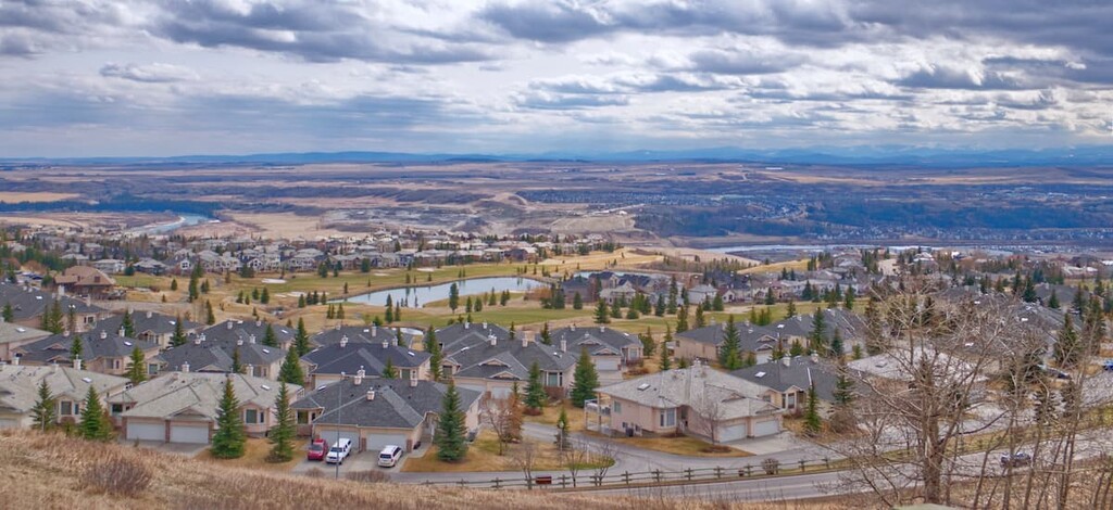
Calgary is located about 70 km (42 mi) west of Sibbald PLUZ. With a population of around 1.4 million people, there are many outdoor enthusiasts that regularly head west into the mountains from Calgary. The proximity of Sibbald PLUZ to Calgary makes it a popular destination for weekend warriors.
Calgary is often just the airport that tourists fly into so they can make their way to the majestic Rockies; however, Calgary is a destination in its own right. Locals and visitors can make their way across the city via the paths that connect all the major parks and greenspaces from Fish Creek Provincial Park in the south of Calgary, to Nose Hill Park in the north, and the Glenmore Reservoir in between.

Local and Canadian history are highlighted alongside international exhibits at the Glenbow Museum. The Calgary Tower gives you a bird’s eye view of the city that has sprawled out from the river over the past 100 years, and the Calgary Zoo is a fantastic example of animal husbandry and wildlife conservation efforts, some of which include studying whooping cranes to aid in their recovery as a species.
Finally, if you want a taste of Calgary at its most raucous, the annual Calgary Stampede runs for 10 days in July and with its midway, concerts, rodeo, chuckwagon races, grandstand show, and daily fireworks it is the self-proclaimed “Greatest Outdoor Show on Earth.”
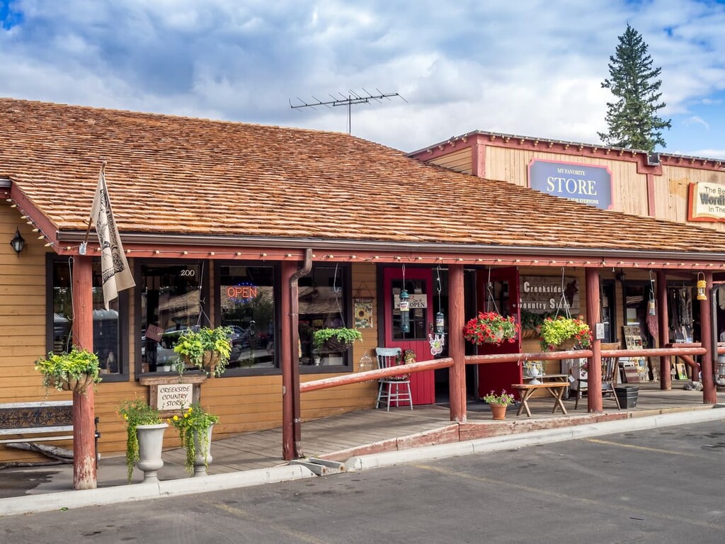
Located about 30 km (18 mi) west of Calgary, Alberta and only 60 km (36 mi) from Sibbald PLUZ, Bragg Creek is a lovely hamlet in which to spend a night, a week, or to just grab a bite to eat.
There are some fun stores to explore in this hamlet, including a used book store, art galleries, the general store, and stores that feature products from local artisans such as specialty soap, jewelry, and clothing. Plus, the nearby river features excellent trout stocks for the anglers among us.
After your activities, you can meet up for a picnic at Bragg Creek Provincial Park which offers hiking trails and picnic sites with firepits. Before you leave town, get an ice cream from the candy store to enjoy on your drive home.
Cochrane is a jewel of a town that is tucked into the foothills of Alberta along the Bow River. It holds strong to the western and cowboy culture on which the town was originally founded. The main street has an incredible ice cream parlor that makes their own ice cream. A walk down the main street with your ice cream will give you time to enjoy the heritage buildings, such as the Cochrane Hotel, which also has a great weekend breakfast.
Along the Bow River, there are many playgrounds, green spaces, ponds, a disc golf course, and a boat launch. While the town is too big to easily walk around, there is a transit system, and nothing is more than a 10-minute drive to any part of town.
The town is 20 minutes from Calgary, and 40 minutes to Sibbald PLUZ. Cochrane is the largest town in Alberta and has everything you’d need for a mountain adventure. Plus, staying there puts you 30 minutes closer to the mountains than most parts of Calgary.
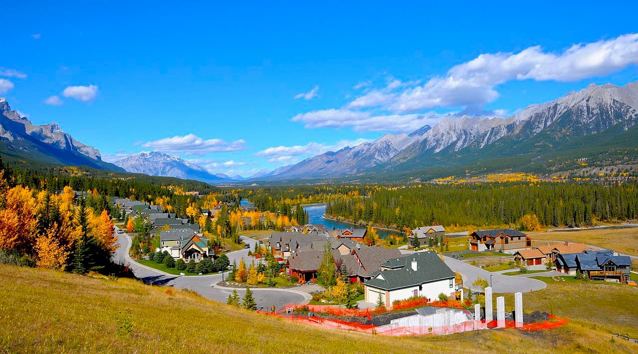
Located about 45 minutes west of Sibbald PLUZ, Canmore is a town that’s situated amidst towering peaks and the world class trout fishing of the Bow River. Canmore caters to tourists as it features ample accommodation options and easy access to the region’s mountainous playground.
The distinct peaks of the Three Sisters watch over Canmore and every road from Canmore can take you to some fantastic adventure. There are paths to cycle and trails to hike from the edge of town. There are also picturesque reservoirs and rivers to explore in kayak or canoe.
Canmore also features some great downhill skiing opportunities as well as the Canmore Nordic Center Provincial Park, which is home to hundreds of kilometers of trails for cross-country skiing in the winter. These trails are also used for hiking, roller skiing, and mountain biking in the summer, and there is even a disc golf course if you feel like chasing your frisbee through the forest.