
Scan the QR code and open PeakVisor on your phone
The Bluerock Wildland Provincial Park is located in Alberta, Canada. The park lies southwest of Calgary in the eatern foothills of the Rocky Mountains. Bluerock spans 31,382 acres across the foothills within the Kananaskis Improvement District. Much of the entire Rocky Mountain Range is protected with the Bluerock Wildland Provincial Park lying next to the Sheep River Provincial Park, Don Getty Wildland Provincial Park, and the Elbow-Sheep Wildland Provincial Park. There are 8 named mountains in Bluerock Wildland Provincial Park. The highest and the most prominent mountain is Bluerock Mountain at 8,986 feet with 1,204 feet of prominence.
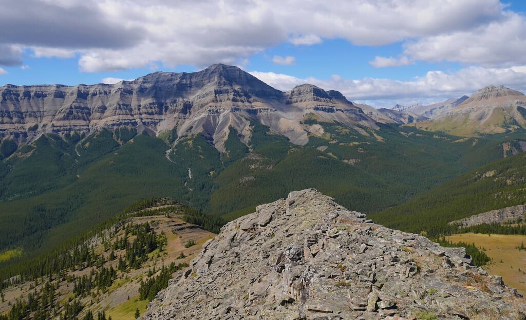
The park helps protect the Sheep River Valley that extends from the Elbow-Sheep Wildland to Kananaskis County. Because the park is located in the foothills, its landscape varies slightly from the central Rocky Mountains. Western reaches of the park become more rugged with jagged peaks, lodgepole pine and spruce trees. The eastern stretches of the park are characterized by the more gradual rolling hills, forests, and open meadows as they transition into the Alberta plateau.
Despite being on the foothills of the Canadian Rockies, Bluerock Wildland Provincial Park is still home to a variety of wildlife. The lower elevations help provide a travel corridor for much of the province's larger species. Similar to the surrounding region, the Bluerock Wildland Provincial Park is home to elk, moose, deer, black bear, grizzly bear, bighorn sheep, cougars, and various fish.
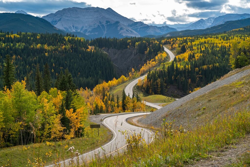
The park’s close proximity to Calgary makes it accessible throughout the year. Common activities amongst the park include hiking, mountain biking, fishing, hunting, backpacking, and horseback riding.
Bluerock Mountain: The trail to the highest point in the park is no easy feat. The trail totals 12.6 miles out and back with just under 5,000 feet of elevation gain. Starting at the end of Highway 546 the route climbs steeply up through the forest before reaching above the treeline. Once there the trail then passes three false summits before hiking along the ridgeline. Scrambling is involved for reaching the summit so hikers should be prepared.
Long Prairie and Pine Ridge Loop Trail: For an easy route through the park, hikers explore the Long Prairie and Pine Ridge Loop that is four miles long and has just 550 feet of elevation gain. The gradual trail can be accessed throughout the year and winds steadily through the forest with viewpoints and open meadows along the way. During the warmer months the trail is used by hikers, runners, and bikers while the winter months attract snowshoers and cross country skiers.
Sandy McNabb Trail: The Sandy McNabb Trail is a 6.6-mile loop with 1,033 feet of elevation gain. Located just south of Highway 546, the trail climbs steadily before following along the ridgeline of the rolling hills. Hikers and cross country skiers alike have views of the Bluerock Wildland with the nearby snow capped peaks of the Rocky Mountains.

Calgary, Alberta lies just an hour northeast of the Bluerock Wildland Provincial Park. This major city is located at the confluence of the Elbow and Bow Rivers in the foothills of the Canadian Rockies. The city has a population of 1.4 million making it the fourth largest city in the entire country of Canada. Due to its proximity to the mountains, Calgary is a popular destination for outdoor sports. In the summer months the city is full of hiking, running, and mountain biking trails. In the winter months the area is full of skiing, cross-country skiing, hockey, and snowshoeing.

The city of Banff lies two hours to the northwest from Bluerock Wildland Provincial Park. The city is located within the Banff National Park which sits in the Rocky Mountains. The crystal blue waters of Lake Louise have been named as one of the most beautiful places in Canada, as well as the world. During the summer months the town is full of tourists looking for their next outdoor activity. In the winter months skiing, snow shoeing, and cross-country skiing are available due to the proximity to the mountains. Banff National Park was the first park to be established within the country. The city sits just two hours northeast to the east side of Purcell Wilderness Conservancy Provincial Park.


