Scan the QR code and open PeakVisor on your phone
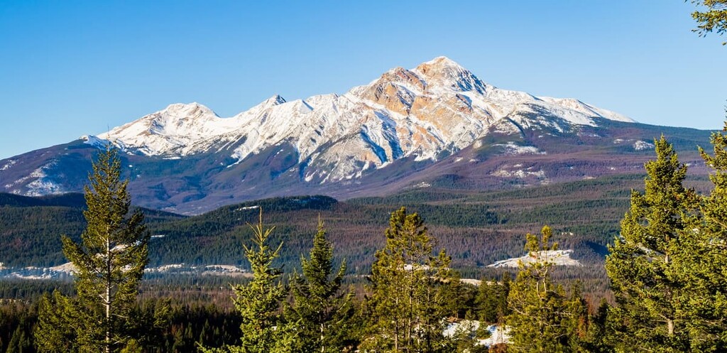
The Municipality of Jasper is a town located in Jasper National Park in Alberta, Canada. There are 21 named peaks surrounding the town, the tallest of which is Pyramid Mountain with an elevation of 2,766 m (9,075 ft) and a prominence of 741 m (2,431 ft).
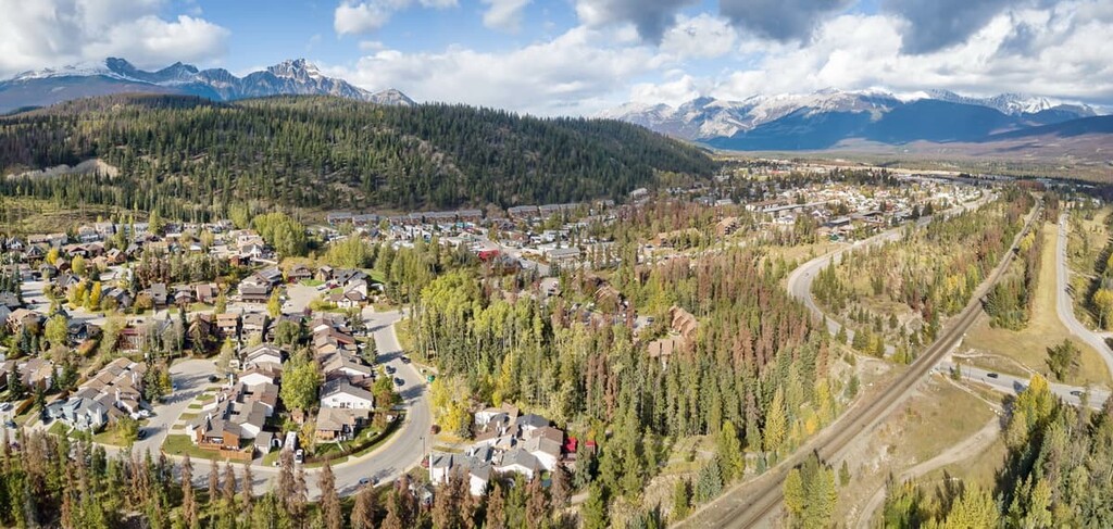
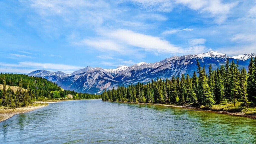
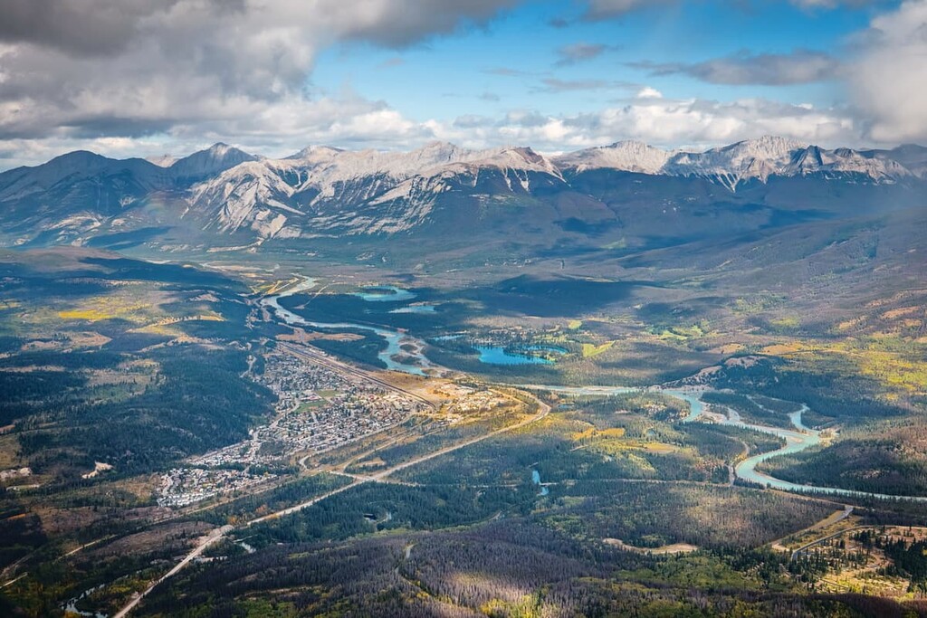
Located in the Canadian Rockies in Jasper National Park, the municipality of Jasper is the commercial center for the national park. Founded in 1813 as Jasper House, a trading post for the North West Company, the town resides at the confluence of the Miette and Athabasca Rivers.
The primary highway to the town of Jasper is the Yellowhead Highway (Highway 16) which runs east to west as the northern branch of the Trans Canada Highway.
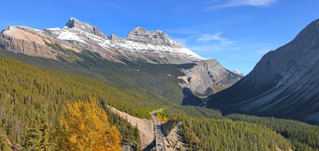
In 1940, the Icefields Parkway (Highway 93) was completed as a single lane gravel road that connected Banff National Park, north of Lake Louise to Jasper National Park and the town of Jasper. Upgraded to a paved highway in 1961, the Icefields Parkway is one of the most scenic drives in the world.
Jasper National Park is located to the north of Banff National Park and to the south of Willmore Wilderness Park in Alberta. To the west, across the Yellowhead Pass and the Continental Divide, in British Columbia are Mount Robson Provincial Park and Wells Gray Provincial Park.
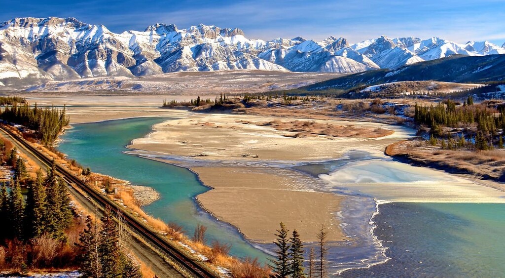
The rocks of the Canadian Rockies were formed as layers of marine sediment in a shallow sea off the ancient coast of Alberta, which was once the coast of North America. The oldest rocks in Jasper National Park are found several miles east of the town of Jasper, near the entrance to the park.
High on the slopes of Roche Miette are beds of limestone with the molds of large salt crystals. Additionally, in a layer that is a little older, trilobites are found which date the rocks to the Cambrian which is a period about 500 million years ago.
Along the base of a 1,070 m (3,500 ft) rock wall about 11 km (7 mi) to the north of Jasper, called the Palisades, the rocks divulge the ancient history of the Rocky Mountains. Where a brook cuts a deep notch in the wall, the lowest exposure of the rocks contain an abundance of brachiopods and other fossils representing Ozarkian fauna that represent life in the region some 485 million years ago.
For nearly 400 million years, sediment accumulated off the western coast of North America until the Rocky Mountains started to rise above sea. The formation of the Rocky Mountains occurred during an event called the Laramide orogeny which lasted for about 40 million years. During the Laramide orogeny, a 400 km (240 mi) wide band of the ancient continental coastline was compressed into the Rocky Mountains, which are less than 200 km (120 mi) wide.
The Laramide orogeny stacked alternating layers of Paleozoic limestones with Cretaceous sandstones and shales. The mountain ranges are made of durable limestone while erosive forces carved away the sandstone and shale to leave valleys.
Furthermore, during the Pleistocene, at which time glaciers and ice sheets covered much of North America and the earth, glaciers created the current topography of the Canadian Rockies. Remnants of old glacial moraines are found over 300 m (1,000 ft) above the current valleys which indicate that glaciers filled the Athabasca Valley and tributaries. Some of the glacial till has been determined to have originated in mountain ranges over 40 km (25 mi) away.
The mountains located northwest of Jasper are part of the Victoria Cross Range and the Maligne Range is located east of Jasper. The mountains to the southwest of Jasper are part of the Trident Range.
The ecology of the municipality of Jasper is part of the Rocky Mountain Natural Region which has the three subregions of alpine, subalpine, and montane. This region has the highest precipitation in Alberta, long cold winters, and short cool summers.
Due to the varied topography in the area, there are many different habitats in the region, with the lower elevations of the montane subregion having the largest variety of wildlife and vegetation. There are more than 300 rare plant species that occur in this region, and 140 of them only occur in the Rocky Mountain Natural Region.
The alpine is rocky with minimal vegetation, which usually consists of lichen, sedge, and heath. Any trees that start growing in the alpine are stunted and twisted because of the fierce winds that blow across the mountain tops. Some birds, such as the white-tailed ptarmigan will nest among the alpine rocks and mountain goats and bighorn sheep use the alpine to avoid predators.
The hoary marmot, Columbian ground squirrel, and the pika make nests among the alpine rocks. They inhabit the border between the alpine and subalpine to feed off the vegetation of the subalpine slopes. The subalpine is also frequented by grizzly bears, black bears, cougars, white-tail deer, mule deer, elk, mountain goats, and bighorn sheep; however, most animals spend winter in the valleys of the montane ecoregion.
There are many birds that inhabit or migrate through Rocky Mountain Natural Region, including MacGillivray’s warbler, white-crowned sparrow, lazuli bunting, gray-crowned rosy finch, American pipit, and the warbling vireo.
Conifers, such as Engelmann spruce, subalpine fir, white spruce, larch, and lodgepole pine fill the subalpine forests. Moist sites commonly grow dwarf birch and willow shrublands. There is a greater variety of flora and fauna in the montane region at the bottom of the Athabasca River Valley.
The montane ecology region is home to a great diversity of flora and fauna. Indeed, all the species that are present at the higher elevations also frequently inhabit the lower slopes, and valleys of the montane ecoregion of the municipality of Jasper. The montane region is characterized by a mosaic of forests, as mentioned, and grasslands filled with oat grasses, fescue, wheat grass, and June grass.
In addition to the larch and other coniferous trees of the subalpine, the montane forests also contain Douglas fir, aspen, and poplar. Douglas fir were named after the Scottish botanist, David Douglas who recorded the tree in detail during his lifetime.
Jasper and the Athabasca River Valley were covered by the cordilleran glaciers until about 12,000 years ago. At the end of the Pleistocene, as Earth was coming out of the last glacial maximum, the eastern slopes of the Rockies were among the first parts of Canada to be ice-free. An ice-free corridor formed between the retreating cordilleran and Laurentide ice sheets from Alaska and Yukon, through Alberta to Montana and Idaho.
There is archaeological evidence that suggests the region around Jasper and the Athabasca River has been continuously inhabited for the past 10,000 years. The municipality of Jasper is part of the historical territory of the Rocky Mountain Cree, Shuswap, Tsuu T'ina, Stoney, Ktunaxa, and Mountain Métis Nations.
The Ktunaxa Nations have inhabited the Kootenay and Columbia Valleys for the past 10,000 years and would traditionally cross the Rockies to hunt bison on the plains. The Shuswap are part of the Interior Salish people who originated on the Pacific Coast between 3,000 and 6,000 years ago. They moved inland to the interior of British Columbia and traveled to the current area around Jasper to hunt and trade.
The Tsuu T’ina migrated from the northern forest to the plains and originally inhabited the lands around Jasper and Edmonton. The Cree moved west with the fur trade and were firmly established in the area by the mid seventeenth century. With the guns they acquired through trade with Europeans, they were able to force the Tsuu T’ina to the south, and the Tsuu T’ina eventually settled near Calgary, Alberta.
Like the Cree, the Stoney worked as guides for the North West Company and Hudson’s Bay Company after moving west from the Great Plains of what is now the United States. By the middle of the eighteenth century, the Stoney had settled on eastern slopes of the Canadian Rockies. Meanwhile, the Mountain Métis are the descendents of the European fur traders and the Iroquois.
From 1810–1811, David Thompson traveled from Rocky Mountain House in search of a pass through the Rocky Mountains to expand trade to the Pacific and to China. Previously, Thompson had established Howse Pass for European use; however, many of the First Nations of the region were not pleased with these developments because they wanted to control trade through Howse Pass.
Thompson went on to establish a route through Athabasca Pass for the North West Company, which would later prove to be a lucrative trade route through the Rockies.
Jasper House was built in 1813 as a post where traders could provision before or after crossing the pass. Jasper House remained in use for nearly 60 years until it closed in 1884. In 1907, the Jasper Forest Reserve was created, which forced First Nations who lived within the boundaries of the reserve to relocate.
The Grand Trunk Pacific Railway established a siding in the forest reserve in 1911 and originally named it Fitzhugh after a Grand Trunk Vice President. In 1913, the townsite was surveyed and it was renamed Jasper, after the former fur trade post. The Jasper Forest Reserve was given national park status in 1930.
Jasper was accessible by road from Edmonton by 1931 and the Icefields Parkway which connects Jasper to Lake Louise and Banff National Park was first opened in 1940. Jasper is currently a specialized municipality that is the commercial center for Jasper National Park like Banff is for Banff National Park in the south.
Some of the most beautiful landscapes in the world are found in Jasper National Park and around Jasper. Jasper National Park is part of a UNESCO world heritage site, along with the other Canadian Rockies national parks. The following are some interesting attractions as well as some scenic hikes near the town of Jasper.
Jasper House National Historic Site is 35 km (21 mi) east of the Jasper townsite and is accessed by a short trail. The trail leads to a wooden platform with a lookout across the Athabasca River. There are several interpretive signs on the platform describing the history of Jasper House.
Established in 1813, Jasper House was named after Jasper Haws, who operated the post from 1814 until 1817. The post was a rest and provisioning stop as well as a meeting place for fur traders, voyageurs, missionaries, explorers, and others. The post serviced travelers of the Yellowhead and Athabasca Passes until 1884.
The building was dismantled in 1909 to provide lumber to the Grand Trunk Pacific Railway and all that remains on the original site is a small cemetery. The site was designated a national historic site in 1924 and is marked by a commemorative stone and plaque.
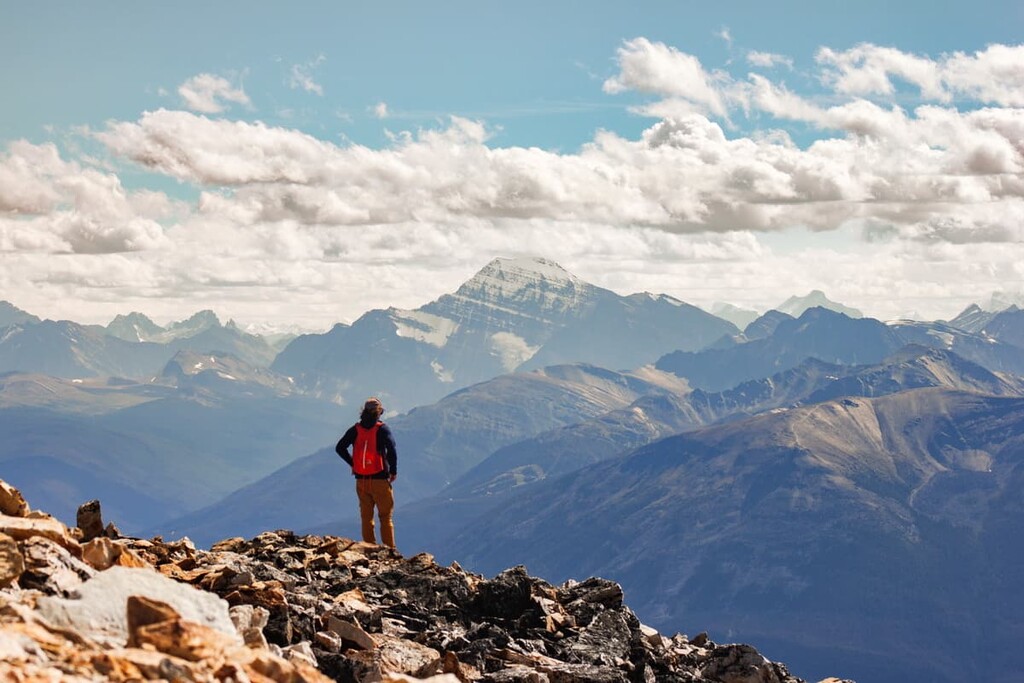
The trail to the top of Pyramid Mountain is 14 km (8.4 mi) long with an elevation gain of 1,550 m (5,084 ft). The trail starts from parking lots along the shore of Pyramid Lake and follows an old forestry road for a significant portion of the hike.
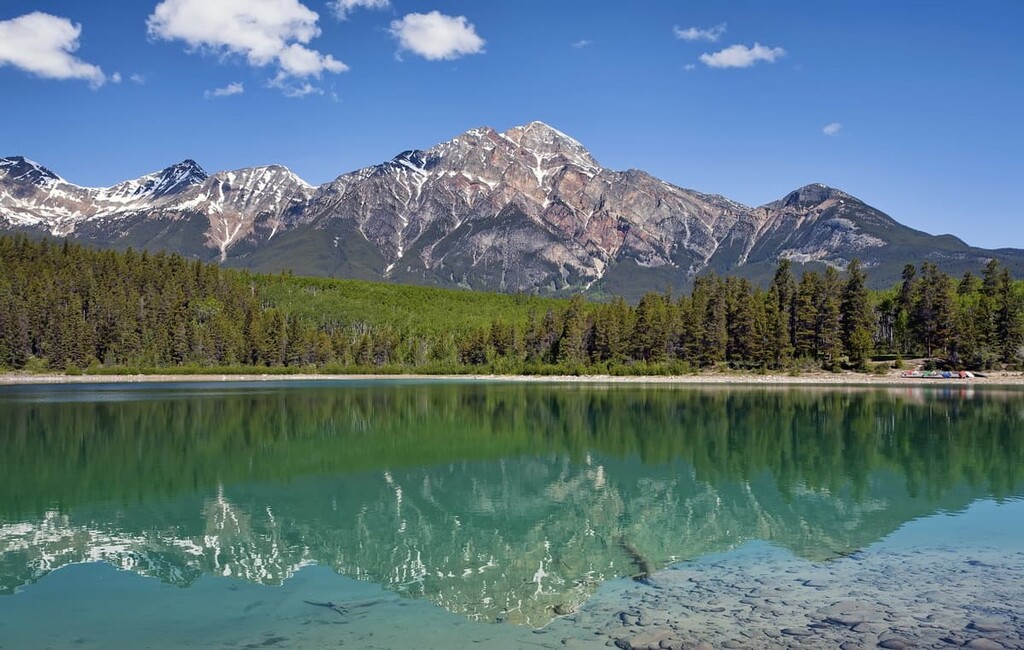
The final push requires minor scrambling to reach the summit. From the summit, you can gaze down the Athabasca River Valley and across the valley to the town of Jasper. The beautiful Maligne Lake can be glimpsed down the valley to the southeast.
The hike is considered difficult; however, a bike can be taken for a significant portion of the trail and makes the descent much faster. Patches of snow can persist along the trail well into the summer months, especially near the summit, and may make it unsafe to continue to the summit.
The wilderness around the townsite of Jasper is home to beautiful forests, stunning lakes, scenic lookouts, and the wild Miette and Athabasca Rivers. There are dozens of trails leading from the town that allow you to explore the beautiful sites around Jasper.
Some of the popular trails lead to Pyramid or Patricia Lake. Other trails follow the Athabasca or Miette River, while others wind through the forested hills that overlook the town. From a morning or evening stroll to grueling treks that will make you happy that you have a comfortable bed to sleep in, there are trails to accommodate all experience levels in Jasper.
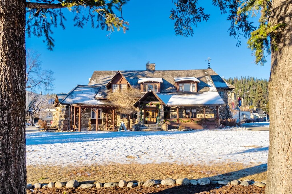
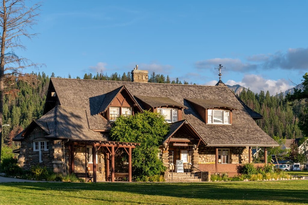
Jasper is a specialized municipality in Jasper National Park. It serves as the commercial center for the Park. The following are some towns and accommodations that provide easy access to the wilderness around Jasper.
Jasper, Alberta is the commercial center for Jasper National Park. Originally established in 1813 as a fur trading post, the original fort serviced travelers who were using the Athabasca and Yellowhead Passes for over 70 years.
Jasper Forest Reserve was established in 1907 and was upgraded to Jasper National Park in 1930. The town continues its historical use by providing services and accommodation to tourists visiting the stunning wilderness of the Canadian Rockies.
Some of the popular destinations from Jasper include the beautiful Maligne Lake, the Columbia Icefield, the stunning Athabasca Falls, as well as countless hikes and trails around the town. Pyramid Mountain is located just north of the town and from the summit you can take in a stunning view of the Rockies.
The Glacier View Lodge is the first and only glacier view hotel in Canada. It is located about 80 km (48 mi) to the south of Jasper townsite along the scenic Icefields Parkway. The lodge offers cozy and comfortable luxury rooms with either a glacier or mountain view.
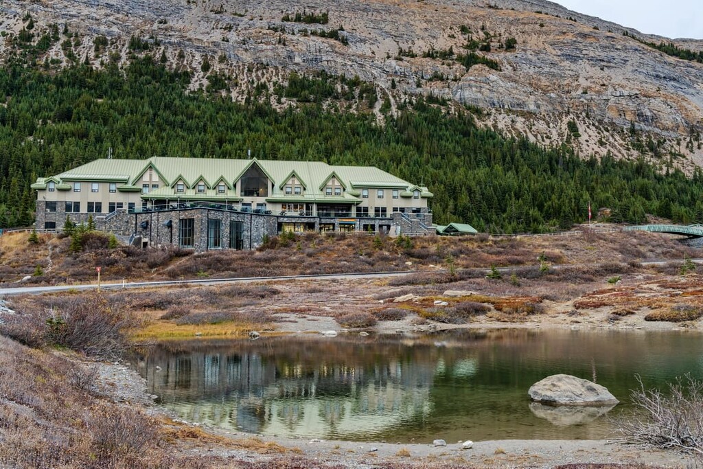
The Columbia Icefield is the most accessible icefield in North America and the Lodge provides an opportunity to experience the glaciers in unique and exciting ways. While there are fine dining options the real magic comes from the opportunity to see the icefields under a sky full of stars. There is also the opportunity to join a private tour to the icefields under the morning sun or to walk the glacier skywalk in the evening as the sun is setting.
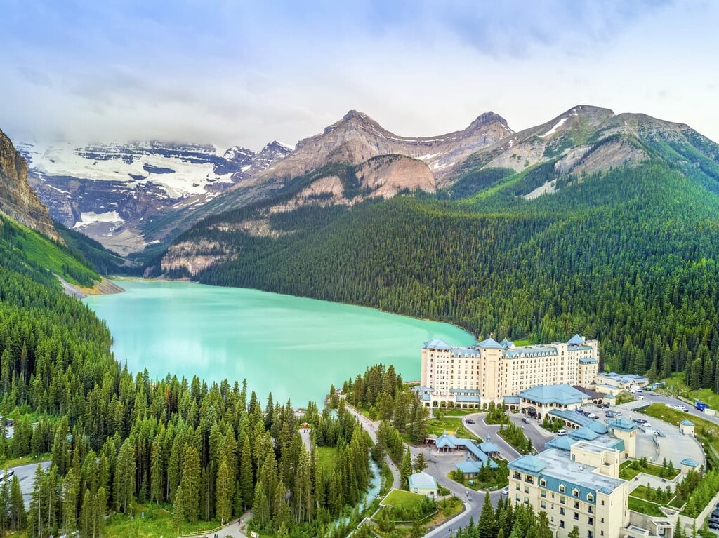
Lake Louise is located 232 km (200 mi) to the south of the Jasper townsite and about 100 km (60 mi) to the north of the Banff townsite in Banff National Park. In 1940, the Icefields Parkway was completed, allowing motor travel between Lake Louise and Jasper. The drive along the Icefields Parkway is one of the most scenic drives in the world.
Enjoyable trails lead around Lake Louise as well as up the surrounding mountains. These include treks to locations such as the Beehives or the Plains of the Six Glaciers where a teahouse was built to feed guests in the early twentieth century.
The view across the lake towards the Victoria Glacier is one of the iconic views from the Canadian Rockies. The Lake Louise Ski Hill is nearby, and other winter activities include the Ice Festival, which features an ice castle on the lake as well as an ice carving competition that brings competitors from across the world.