
Scan the QR code and open PeakVisor on your phone
Known admirably as the ‘land of 41 named waterfalls,’ Wells Gray Provincial Park is an incredible, untamed wilderness park located in east-central British Columbia. Created by fire and ice, Wells Gray encompasses 1.3 million acres and protects most of the southern Cariboo Mountains, including impressive peaks like Mount Goodall, Mount Pierrway, and Mount Hugh Neave.
Wells Gray was established in 1939 and named after Arthur Wellsley Gray, Minister of Lands for British Columbia. Prior to the arrival of Europeans, however, these parklands were cherished hunting grounds to the Sepwepeme (Shuswap) and Chilcotin First Nations People.
British Columbia’s fourth largest park, Wells Gray is almost the size of the Canadian province of Prince Edward Island and encompasses most of the Clearwater watershed. The park’s diverse terrain is often credited to the convergence of several surrounding landscapes. However, violent volcanic eruptions followed by a long period of cooling formed the park’s spectacular lakes, mountains, rivers, and waterfalls.
Wells Gray shares its northern border with Cariboo Mountain Provincial Park and Bowron Lake Provincial Park, two true wilderness areas that are dominated by the high, serrated peaks and glaciers of the Cariboo Mountains. Some of the tallest peaks in the park, including Mount Goodall, Mount Pierrway, Mount Winder, Mount Beaman, Mount Hogg, and Mount Aves, are found in this part of the park. These iconic summits were named to honor Canadian soldiers that were killed in action during World War II.
The southern third of Wells Gray is characterized by incredible volcanic plateaus, lava flows, deep canyons, and several well-known summits, including Battle Mountain and Mount Philip. The Wells-Gray Clearwater volcanic field, or Clearwater Cone Group, is also found in this part of the park. This potentially active volcanic field houses Fiftytwo Ridge, a subglacial volcano that formed when the area was buried beneath the Cordilleran Ice Sheet during the Quaternary glaciation period.
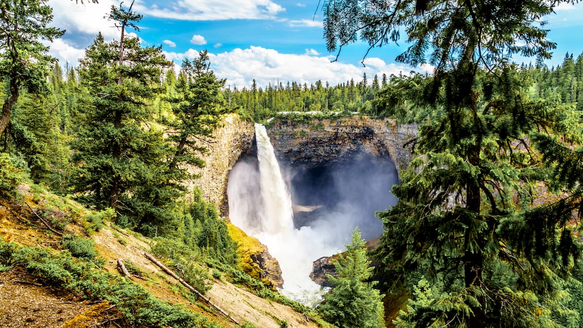
Even the waterfalls, for which Wells Gray is famous, are mostly the result of volcanic eruptions and glacial activity. Helmcken Falls, the fourth highest waterfall in Canada and arguably the most iconic waterfall in the park, cascades 463 feet over the edge of a volcanic plateau that formed over 200,000 years ago.
Wells Gray is also home to a wide variety of wildlife and diverse ecosystems. The park contains over 700 species of vascular plants, 56 species of mammals, and 219 species of birds. Larger animals, including grizzly bear, wolf, cougar, lynx, and bobcat can sometimes be spotted along the park’s forested corridors or along higher elevation trails.
Wells Gray is best-known for its spectacular hiking trails, though winter recreation, fishing, kayaking, and canoeing are also popular activities in the park. Several accessible viewpoints also allow visitors to experience the park’s grandeur without having to venture too far into the backcountry.
An easy 5-mile trail follows the rim of Helmcken Falls, the most iconic waterfall in the park. Helmcken Falls is one of the main reasons Wells Gray Provincial Park was created, so you won’t want to miss an opportunity to experience this 463-foot beauty. During the winter, the rim trail is also the perfect place for snowshoeing or cross-country skiing.

The 8-mile Pyramid Mountain trail is an excellent backcountry trek that leads to awe-inspiring views of the Premier Range and allows visitors to get up close and personal with a variety of unique volcanic exhibits. Pyramid Mountain is a volcano that erupted under a glacier roughly 11,000 years ago. The main trail skirts the base of Pyramid Mountain, but most hikers will opt to take a side trip to the summit or nearby Pyramid Lakes.
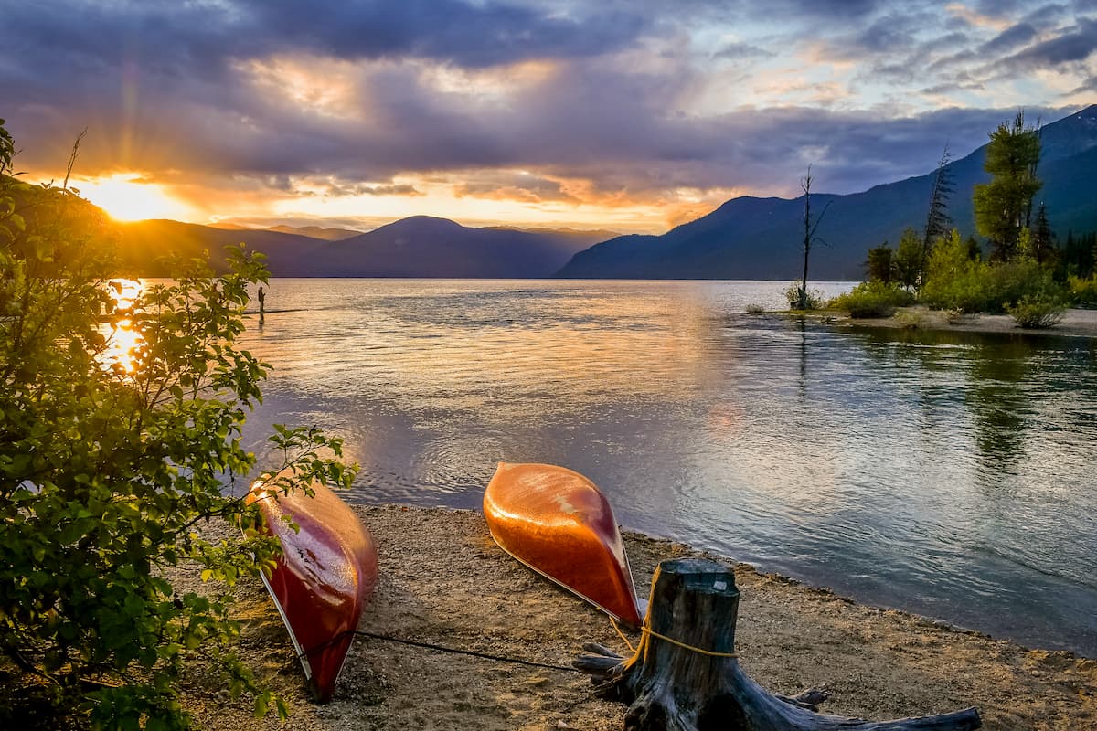
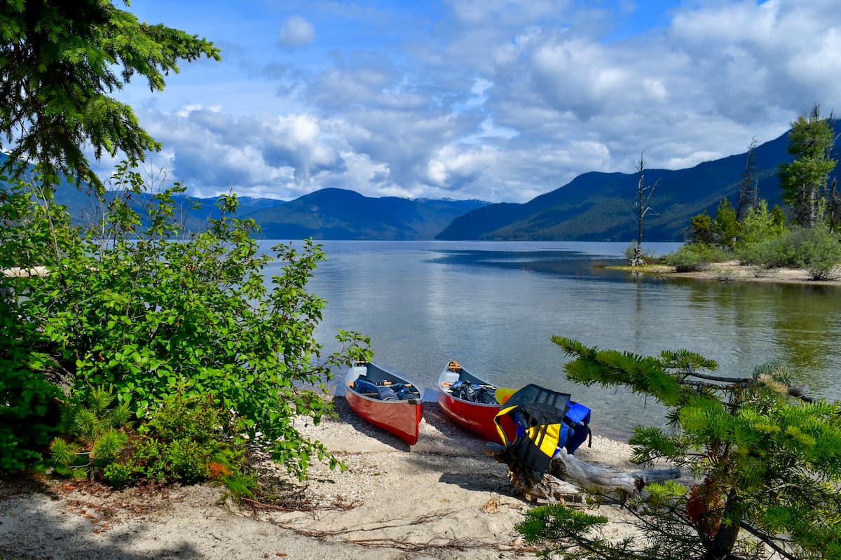
Murtle Lake is a lava dammed lake that is fed primarily by the Murtle River. This particular lake is understandably popular among canoers, because it’s the largest canoe-only lake in North America. The North Arm of the lake extends deep into the Cariboo Mountains, while the West Arm houses several sandy beaches, coves, and islands. Nestled in a pristine mountain valley, Murtle Lake is accessible via a winding, gravel road and a 1.5-mile hike.
One of the most iconic landmarks in the park, Trophy Mountain, sits in the Shuswap Highlands and contains nine summits. This stunning set of peaks is particularly popular for its colorful alpine meadows and numerous hiking routes. Summiting Trophy Summit is a rigorous trek that can take anywhere from 9 to 12 hours. However, the meadows are one of the most accessible sub-alpine meadows in the province.
The Helmcken Falls Lodge is a small, rustic, family-owned wilderness lodge that is located just 13 minutes from Helmcken Falls. The lodge features 33 rooms, an onsite restaurant, and a campground. The lodge sits just far enough away from the city to feel secluded, while still offering plenty of amenities for an enjoyable vacation.
The Clearwater Lodge is the largest hotel in Clearwater and has offered comfort, style, and customer service for the last 14 years. The lodge is just 20 minutes from Silvertip Falls in the Clearwater Valley and 30 minutes from Moul Falls. The Clearwater Lodge offers spacious rooms, modern amenities, and offers the perfect family-friendly accommodations for exploring nearby Wells Gray.


