Scan the QR code and open PeakVisor on your phone
Straddling the border of the United States and Canada, the US Glacier National Park is a vast swath of land encompassing over 1 million acres (4,000 km2 of land. The park sits on the border of the state of Montana and the provinces of Alberta and British Columbia.
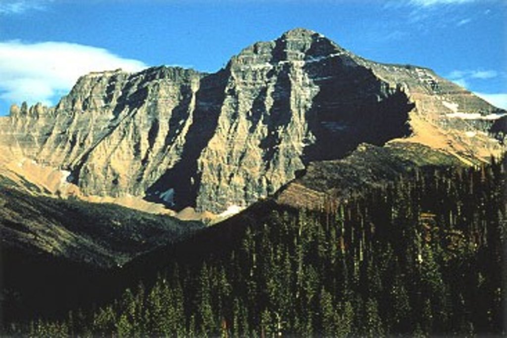
Glacier National Park has long been lauded as the “Crown of the Continent Ecosystem” because it is home to over 1,000 different species of plants and hundreds of different animal species. The highest and most prominent mountain in the park is Mount Cleveland (10,466ft/3,190m).
The small portion of the Clark Range found within the park boundaries contains Long Knife Peak, a 9,711-foot monolith whose slopes extend into the Canadian Province of British Columbia. The Lewis Range contains the parks tallest summit, Mount Cleveland, as well as several other snow-capped park icons like Mount Jackson, Mount Siyeh, Going-to-the-Sun Mountain, and Mount Stimson. The Livingston Range, which traverses the park north to south, contains over 15 summits that exceed 9,000 feet including Kintla Peak, Kinnerly Peak, Rainbow Peak, and Mount Carter.
To say Glacier’s summits are impressive is an understatement. At least 150 of the park’s peaks exceed 8,000 feet in elevation and another 50+ reach over 9,000-feet above sea level. Though the park originally earned its name from the million-year-old glaciers and glacial forces that shaped its rugged landscape, its towering granite peaks are some of the most impressive in North America.
Aside from housing some of the most incredible high-alpine peaks and valleys in the states, Glacier also contains over 130 named lakes, more than 1,000 different species of plants, 276 species of birds, and hundreds of species of animals. In fact, 71 species of mammals call Glacier home, including one of the largest remaining grizzly bear populations in the lower 48 states.
The park’s global infamy, however, is generally related to climate influence. In 1966, the park contained 35 named glaciers. By 2015, however, just 26 named glaciers remained. A recent study predicted that the park’s largest glaciers could become active as early as 2030 due to rising levels of carbon dioxide. Glaciers within the park are rapidly receding and are frequently used as a visual representation of global climate change.
Ironically, Glacier National Park isn’t exactly the easiest place to see a glacier. Most of the parks iconic ice masses are tucked along the Continental Divide and visitors need to tackle strenuous or technical terrain to reach them. Fortunately, a few glaciers can still be seen from the roadside and others can be reached via designated hiking trails. The most accessible glaciers include – Jackson Glacier, Salamander Glacier, Grinnell Glacier, Sperry Glacier, Piegan Glacier, and Sexton Glacier.
Fortunately, even if you can’t catch a glimpse of an active glacier, there’s plenty to do in the park. Glacier’s amazing alpine meadows, craggy mountains, spectacular lakes, and pristine forests can be accessed via over 700 miles of trails and via the scenic Going-to-the-Sun Road.
Most credit the preservation and subsequent protection of the park to George Bird Grinnell, an American anthropologist, historian, and naturalist, whose published articles generated a considerable amount of interest in giving the area a national park designation. In fact, prior to becoming a National Park, Grinnell named many of the features found within the St. Mary and Swiftcurrent Valleys. In 1932, the park joined Waterton Lakes National Park in Alberta to form the world’s first international peace park.
Archaeological evidence tells us that first peoples arrived in the area that is now Glacier National Park some 10,000 years ago. These people are the ancestors of the modern-day Flathead (Salish) and Kootenai, Shoshone, Cheyenne, and Blackfeet who consider the Glacier National Park region to be their ancestral homelands.
In particular, the Blackfeet lived on the eastern edge of the park and on the plains further east, which provided them shelter from the harsh winter weather. This protection allowed the Blackfeet to hunt both bison and other game to supplement their diet. The Blackfeet believe that the mountains of the Glacier National Park region, especially Chief Mountain (9,081ft/2,768m) to be the “Backbone of the World.”

After the arrival of white settlers and after immense pressure from the United States, and in the face of a rapidly dying bison herd in the region, Chief White Calf of the Blackfeet sold the mountainous parts of the region to the US federal government for a sum of $1.5 million in 1895. This sale came with the understanding that the Blackfeet would have lasting hunting rights on the land, which was to become publically owned.
While this sale established the current boundary between the US Glacier National Park and the current Blackfeet Indian Reservation to the east. Over the next decade, mineral prospectors tried and failed to find mineral wealth in what then became a forest reserve, and President William Howard Taft eventually signed a law in 1910 designating the region as Glacier National Park.
However, with the establishment of Glacier National Park, there was no mention in the legislature regarding the access and usage rights of the Blackfeet. For the past 110 years, since the inception of the National Park, the Blackfeet have not been allowed to hunt in Glacier National Park.
Instead, the park has been preserved for recreation, which was aided early on by the development of the Great Northern Railway in 1891 and a subsequent slew of mountain chalets and lodges. Soon after it was established, Glacier National Park became very popular, especially considering its relative remoteness at the time.

With the advent of the automobile, the park began construction on the iconic 53-mile “Going-to-the-Sun Road,” which was completed in 1932. The road bisects the park and crosses the Continental Divide at Logan Pass halfway through the route, allowing access into the most remote parts of the range.
These days, Glacier National Park is managed by the National Park Service and sees about 2.2 million visitors each year, though the majority stay close to the park’s roads, hotels, and campgrounds. The Glacier National Park is a center for alpine pursuits and is a fantastic hiking destination for the outdoor adventurer, thanks to the region’s abundant wildlife, rugged mountains, and fantastic glaciated terrain.
Glacier National Park is a hiker’s paradise with over 700 miles of maintained hiking trails for any adventurer. There are plenty of great day hikes out there as well as great backpacking opportunities, so it’s easy to scale your trip to meet your needs. Do keep in mind, though, that Glacier National Park is remote and that you’re traveling in bear country, so take the proper precautions when you go out!
Here are some of the most popular hikes:
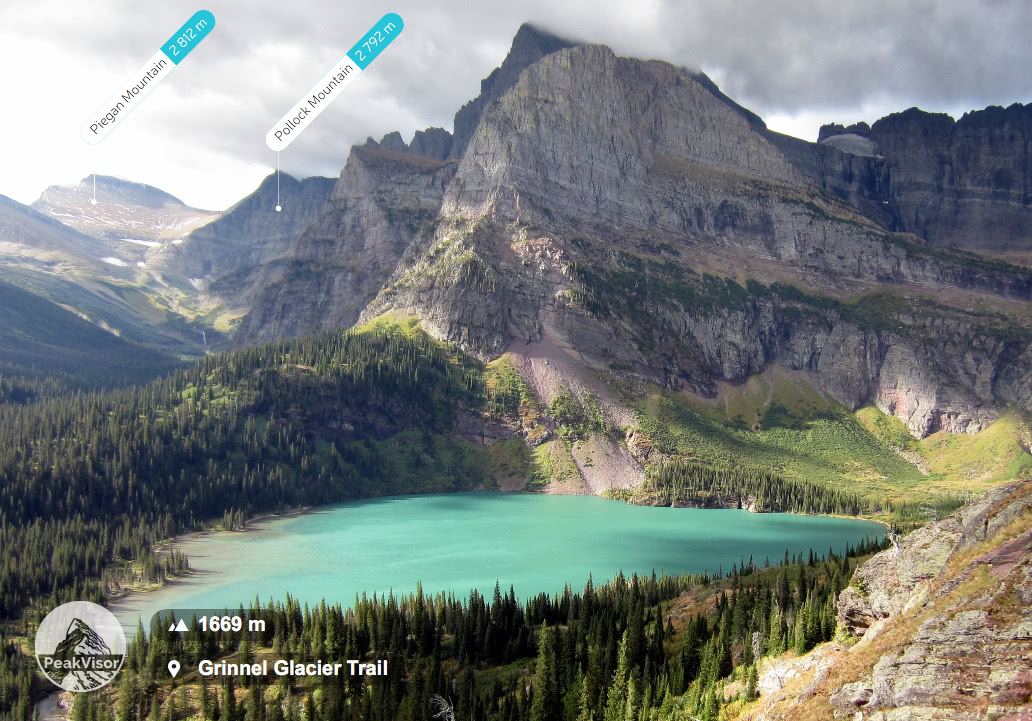
The Grinnell Glacier trail takes ambitious hikers to one of the most iconic glaciers in the park. This challenging trek travels 5.5 miles each way, or 3.8 miles if you take a boat across Swiftcurrent Lake and Lake Josephine. The challenging 1,600-foot climb along the flanks of Mount Grinnell offer sweeping views of Mount Gould and Grinnell Lake, as well as the chiseled walls of Angel Wing that rise abruptly above Grinnell Lake’s emerald waters.
This 11.4 mile thru-hike trail starts near the Logan Pass Visitor’s Center and climbs up to the junction of the Grinnell Glacier Overlook before continuing on to the Granit Park Chalet. From here, you get fantastic views of the Garden Wall before heading down a steep 2,200 foot (670m) descent to your exit trailhead at the Loop.

The Pitamakin Pass Trail starts at the Two Medicine/Pray Lake Campground and continues for 17.9 miles up and over Pitamakan Pass. After ascending a ridge of Rising Wolf Mountain (9513ft/2899m), the trail continues past a large waterfall and switchbacks up to the pass. After enjoying the views from the top, you descend back down through Dawson Pass and into Bighorn Basin before returning to the shores of Two Medicine Lake.
The Iceberg Lake Trail starts at the Swiftcurrent Motor Inn parking lot and travels 9.6 miles as you hike below the shadows of Altyn Peak (7,949ft/2,432m) and Mount Wilbur (9,326ft/2,839m) to Iceberg Lake - a stunning alpine lake with floating icebergs at the base of a cirque of 2,000-foot cliffs. Iceberg Peak towers more than 3,000 feet above the lake’s emerald blue waters. What’s not to love?
The trek to Iceberg Lake is one of the most popular in the park and is notoriously popular for wildlife sightings. It’s important to be bear aware when traveling to Glacier National Park!
The Avalanche Lake Trail takes you 4.6 miles, roundtrip, up and out of the forest into the stunning Glacier National Park alpine zone. After leaving the Avalanche Campground, you hike through a forest and reach the lake, which is surrounded by steep cliffs and cascading waterfalls - perfect for a half-day hike.
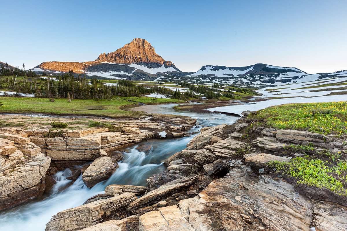
Montana’s world-renowned scenic highway, Going-to-the-Sun Road, is a 50-mile two-lane highway that spans the width of Glacier National Park, crossing the Continental Divide at 6,646-feet at Logan Pass. Along the way, visitors can expect breathtaking panoramic views of glacial lakes, subalpine meadows, cascading waterfalls, humbling mountain peaks, and incredible alpine tundra. There are plenty of opportunities to snap photos at scenic viewpoints along the road, as well as several epic hiking trails to explore.
Nervous drivers beware - this drive isn’t for the faint of heart. Portions of Going-to-the-Sun Road are narrow and navigate over sheer cliff sides, hugging the mountainside. If you’re uneasy about driving the road yourself, there are several bus tours available.
Glacier National Park is pretty darn remote, but you can find plenty of wilderness lodges, campgrounds, and motor inns within the park boundaries. If you do want to stay at any of these places during the summer months, it’s highly recommended that you book well in advance as they tend to fill up quickly!
Built by the Great Northern Railway, Many Glacier Hotel was once Montana’s largest hotel. The hotel was completed July 4, 1915 on the shores of Swiftcurrent Lake and has remained a spectacular lakeside resort ever since. The five-story hotel features 2 suites, 7 family room and 205 guest rooms. The hotel is rustic and contains modest amenities, but its location is ideal for adventure-enthusiasts hoping to explore Glacier’s many impressive hiking trails.
Lake McDonald is a historic hotel that sits on the southeast shore of the park’s beloved Lake McDonald. Built in 1913, the lodge retains its historical charm by offering 82 Swiss chalet-style guest rooms. The lodge offers visitors the opportunity to dine in Russell’s Fireside Dining Room, kick back in Lucke’s Lounge, or hop on boat cruises throughout the day. The accommodations are rustic but offer a few modern amenities to ensure that visitors are comfortable during their stay.
The Glacier Park Lodge, which sits just outside the park boundaries in East Glacier Park, was first built in 1913 by a subsidiary of the Great Northern Railway. The lodge was initially built to accommodate visitors traveling to the park via railroad. In fact, for the last 100 years, Glacier Park Lodge has been the first stop for visitors traveling to the park by Amtrak. The lodge is best-known for its stunning Douglas fir pillars and historic décor. However, it also offers plenty of modern amenities to keep visitors entertained in their down time, including an outdoor swimming pool and nine-hole golf course.
Outside of the park, there are two nearby cities:
Missoula, Montana is a college town located some 2.5 hours southeast of Glacier National Park. Home to the University of Montana and situated at the confluence of the Clark Fork River, Bitterroot River, and Blackfoot Rivers, Missoula has some 66,000 residents, a regional airport, and plenty of shops, restaurants, and hotels - perfect for starting your adventure.
Located some 4.5 hours west of Glacier National Park, Spokane, Washington is a major metropolitan area in the less densely populated eastern portion of Washington state. Spokane has everything you can think of, from food to climbing gear, and has an international airport, so it’s a great starting point for a trip to Glacier.