
Scan the QR code and open PeakVisor on your phone
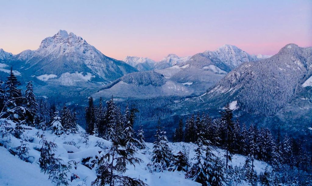
The Vancouver Island Ranges include 537 named peaks. The highest is Golden Hinde at 2,195 m. Other notable peaks include Elkhorn Mountain, Victoria Peak and Mount Colonel Foster.
The Vancouver Island Ranges are a collection of mountain ranges located on Vancouver Island in the southwestern part of the province of British Columbia in Canada. There are 18 subranges of the Vancouver Island Ranges and a total of 537 named mountains. Golden Hinde is the tallest and most prominent mountain on the island with an elevation and prominence of 2,195 m (7,201 ft).
The Vancouver Island Ranges cover the entirety of Vancouver Island, which is located off the west coast of British Columbia, Canada. There are 532 named peaks and 18 named subranges on the island. The tallest and most prominent mountain on Vancouver Island is Golden Hinde in Strathcona Provincial Park. Golden Hinde is unique in that its elevation and prominence are both the same, namely 2,195 m (7,201 ft) tall.
Vancouver Island is 456 km (283 mi) long and 100 km (60 mi) wide at its widest points. The island is the largest and most populated island on the west coast of the Americas and there are seven regional districts, or counties on the Island.
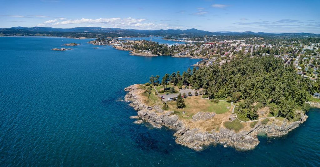
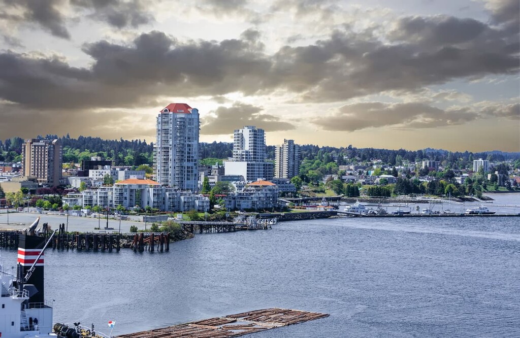
Capital Regional District is located on the south end of Vancouver Island and it is home to the province’s capital city of Victoria as well as nearly half the population of the island.
Alberni-Clayoquot Regional District is located to the north of the capital on the west coast while the regional districts of Cowichan Valley and Nanaimo are located on the east coast. Strathcona Regional District is then followed by the Regional District of Mount Waddington at the north end of the island.
There are several major highways that cross the island; however, in general, the further west and north that you travel on the island, the more the road quality declines. Highway 1 connects Victoria to Nanaimo, while Highway 14 connects Victoria to Port Renfrew.
Highway 19 connects Nanaimo to Port Hardy, which is located on the north end of the island. Meanwhile, Highway 4 connects the west coast towns of Tofino and Ucluelet to the east coast via Parksville. There are a couple other highways; however, access to large areas of the island, including some provincial parks, is by logging roads, where the ruts are large and logging trucks always have the right of way.
The Vancouver Island Ranges are part of the Insular Mountains, which are the westernmost part of the Canadian Cordillera. The Insular Mountains are often regarded as part of the Canadian Coast Mountains; however, they are geologically distinct. The Insular Mountains include the Alaskan Panhandle, the Haida Gwaii, and Vancouver Islands. They are sometimes called the Northwest Coast Islands
The terrane that makes the Insular Mountains also includes the underwater terrane between these islands and the mainland, including parts of the sea floor that extend about 100 km (60 mi) west of Vancouver Island. The Vancouver Island Ranges have 18 subranges.
From the city of Nanaimo, south to Victoria there are five ranges. The Beaufort Range, which is located inland from Qualicum Beach, and the Pelham and Somerset Range are near the west coast to the east of the Alberni Inlet. Meanwhile, the Seymour Range is situated to the south of Cowichan Lake and the Gollwand Range is located to the east of the Saanich Inlet.
The Sutton Range, Newcastle Ridge, and the Prince of Wales Range are all located along the coast to the north of Campbell River. Additionally, Karmutzen, Hankin, Franklin, and Bonanza Ranges are located between Alert Bay and Sayward on the north end of the island.
The Pierce Range is situated to the south of the Muchalat Inlet of the Nootka Sound. The Refugium Range is located on the west coast and covers the Brooks Peninsula while the Sophia and Genevieve Ranges are situated on Nootka Island.
The Insular Mountains and the Vancouver Island Ranges were part of a landmass called Wrangellia, which started forming about 380 million years ago. The first layers of Wrangellia were underwater lava flows that were then covered with layers of marine sediment.
The thickest and most prominent layer of the Vancouver Island Ranges is a layer of basalt that is 6 km (3.6 mi) thick that was part of a series of eruptions that occurred some 230 million years ago. This basalt layer was covered with marine sediment for about 100 million years, at which time Wrangellia collided with mainland North America.
The collision of Wrangellia coincided with part of the Sevier orogeny, which formed the Columbia and Coast Mountains. As the Insular Plate subducted beneath North America, the Farallon Plate was subducting under the Insular Plate, leading to volcanic and tectonic activity across what is now Vancouver Island.
During the Pleistocene, there were at least four glacial maximums during which Vancouver Island was covered with ice. During the Fraser Glaciation between 29,000 and 15,000 years ago, there was an ice sheet covering Vancouver Island and the sea between the mainland as well.
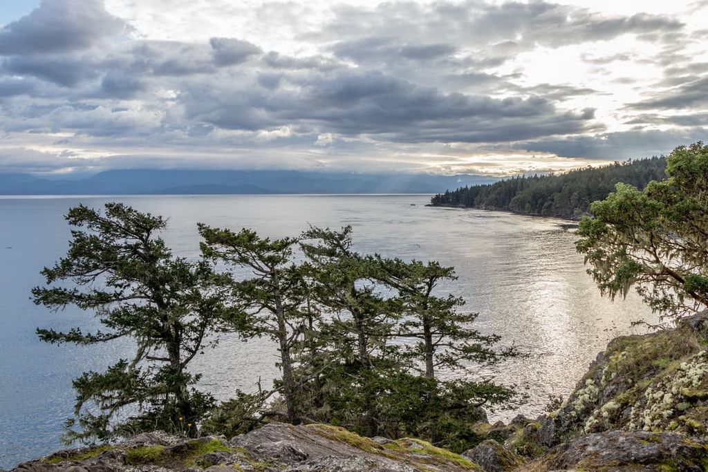
Near Victoria, there are many places where you can see the striations that the glaciers left behind as they passed over the rocks. The overall ice flow was from north to south; however, there were some local variations, especially on the west coast where the glaciers carved out massive west to east valleys.
The glacial valleys were carved from the mountains down to the ocean, and after the ice melted and the sea level began to rise, water filled the valleys to create the steep sided fjords on the west coast. Additionally, the weight of all this ice caused Vancouver Island to sink up to 300m (984 ft).
As the ice melted, the island rebounded, such that for about 1,500 years, the sea level was significantly lower than it is today. The sea level gradually rose as the world’s glaciers melted, returning their water to the oceans in the process.
There are four major ecological zones on the island. The ecological differences between each zone depends greatly on the zone’s elevation, location on the island, and aspect (directionality toward or away from the sun). Most of Vancouver Island is covered with the Coastal Western Hemlock ecology, which dominates a variety of areas, including the coasts and the mountains.
With increasing elevation along the interior mountain slopes, the forests and ecology transition to the Mountain Hemlock ecology and finally to a Coastal Alpine ecology at the peaks of the tallest mountains. However, the southern end of the island lies in the rain shadow of the Insular and Olympic Mountain. This gives it a dry and more Mediterranean-like climate than the rest of the island.
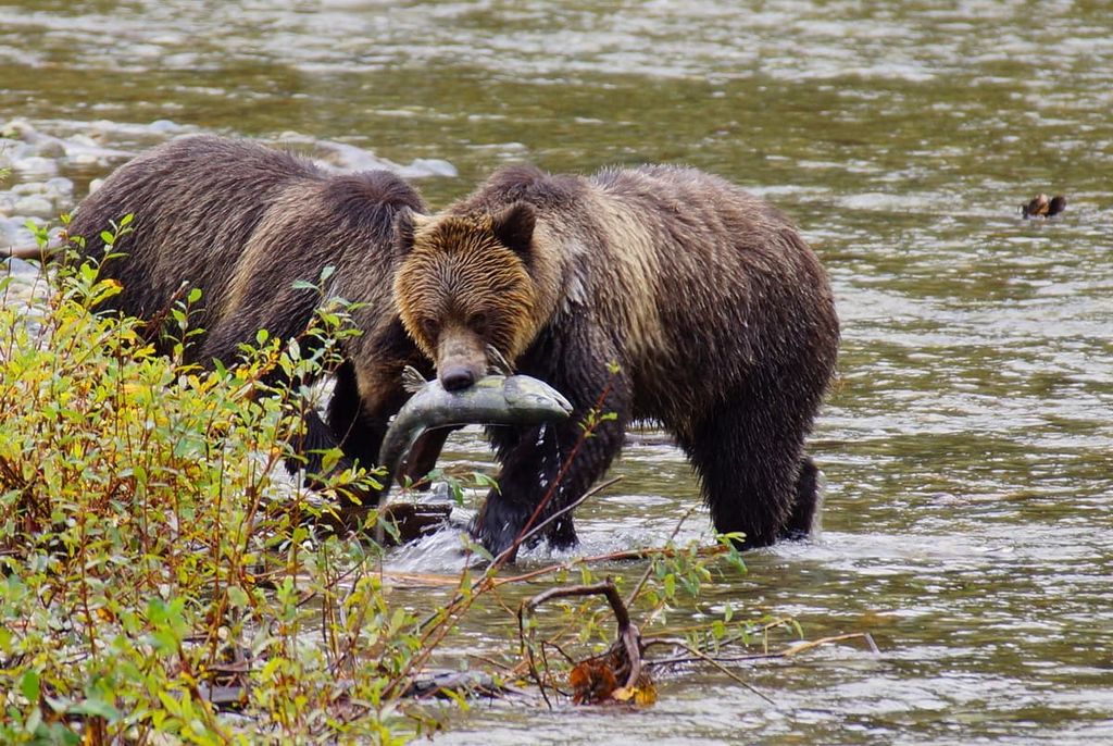
Across the island, the common land mammals are black bears, Columbian black-tailed deer, cougars, and Roosevelt elk. Grizzly bears are becoming more common and grey wolves are only found on the north half of the island.
Some of the animals that are very common on the mainland but are conspicuously missing from the island’ s ecosystems are mountain goats, moose, coyotes, porcupines, skunks, chipmunks, and other small mammals.
The temperate rainforest consists of the Coastal Western Hemlock and Mountain Hemlock Ecozones. These zones are where the famous giant red cedar, Sitka spruce, and Douglas fir are found. The other common trees are western hemlock, alder, and bigleaf maple, all of which can also grow to tremendous sizes.
The tallest tree in Canada is a Sitka spruce that grows in the untouched and ancient forest in Carmanah Walbran Provincial Park. The Sitka spruce dominates the coastal fringe forests because it has adapted to the high levels of magnesium coming from the salty spray of the ocean.
Further inland, the rainforests have dense undergrowth of ferns, mosses, and other shrubs. As the elevation rises, the western hemlock is exchanged for mountain hemlock and yellow cedar becomes more common than red cedar.
The forests gradually thin to scattered stands and open meadows before the onset of the alpine zone. The island alpine has rocky and barren areas at the highest elevations; however, meadows of heather and sedge are most commonly found at the tops of the island peaks.
At the south end of the island, centered around the Saanich Peninsula and including the coastal areas up the east side of the island to Nanaimo, is the Coastal Douglas Fir Ecozone. The Greater Victoria area and the southeast coast are in the rain shadow of the Vancouver Island Range and the Olympic Mountains in Washington state.
The area is typically dry; however, the steep-sided valleys can retain plenty of moisture and have a rainforest feel to them. The plains across the southern end of the island are dry and have a Mediterranean-like climate. Meanwhile, Arbutus and Garry oak grow predominantly at the southern end of Vancouver Island in the Coastal Douglas Fir Ecozone.
Arbutus and Garry oaks grow along the arid hill tops of the southern end of the island, while giant cedars, Douglas fir, and western hemlock fill the more fertile valleys. Microclimates across the island host a variety of epiphytes, including several species of orchid that may grow in the rainforest or along the cliffs near waterfalls.
Indigenous peoples have inhabited Vancouver Island for over 4,000 years. The descendents of these first peoples of the island and the surrounding region include many contemporary First Nations that identify as one of the following cultural and linguistic groups:
While archaeological discoveries date human presence on the island to at least 4,000 years ago, it is possible that the island was inhabited earlier. As the glaciers melted, Vancouver Island, which had been pushed down up to 300 m (984 ft) by the weight of the ice, rebounded faster than the sea level rose, creating a time of about 1,500 years where the area of the island was significantly larger than it is today.
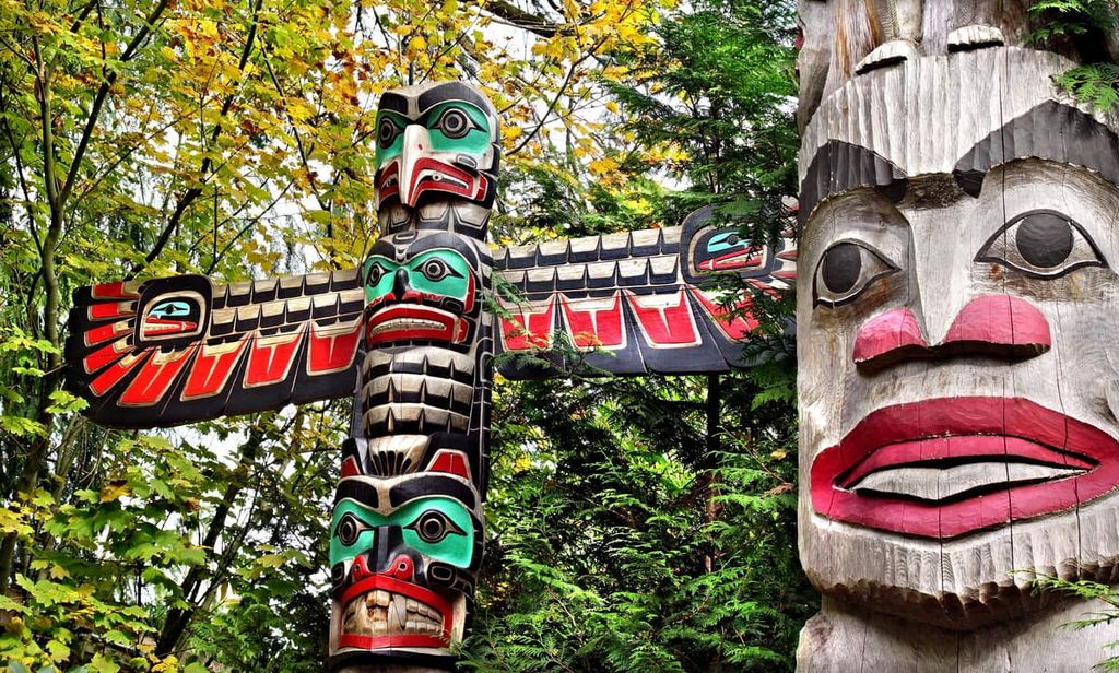
Additionally, many of the First Nations of what is now called Vancouver Island have similar origin and creation stories that describe a flood over the land and how their ancestors tied their canoes to the tops of high mountains to survive. Some stories tell of how some canoes were washed elsewhere to establish other nations, while theirs held and became the First Nations of today.
When it comes to the first Europeans to arrive at what is now Vancouver Island, there are controversial claims that Sir Francis Drake may have sailed as far north as Vancouver Island during his voyage around the world in 1579. Whether or not Drake landed on the shores or merely sailed by is still to be established; however, English coins dating to the sixteenth century have been discovered across Vancouver Island.
The tallest mountain on the island, the Golden Hinde, was given its English-language name after Drake’s ship, Golden Hind, to acknowledge that he was possibly the first European to see Vancouver Island. It wouldn’t be until 1774 that the Spanish sent ships to assert their sovereignty on the Pacific Northwest; however, they did not make landfall.
It was Captain James Cook who made the first recorded landfall on Vancouver Island, at Nootka Sound in 1778. Captain Cook made the first recorded reference to the mountains on Vancouver Island. With further European settlement of the island, it is estimated that 90% or more of the Indigenous peoples of the island were killed by smallpox and other diseases.
As many First Nations succumbed to diseases from which they had no immunity, many more settlers came to the region and began the settlements that have grown to the major cities of the islands, such as Comox, Courtenay, Nanaimo, and Victoria. Other communities grew around the traditional fishing settlements of the local First Nations.
The first large-scale expeditions to survey Vancouver Island didn’t start until the late nineteenth century. It was only in 1856 that Adam Horne “discovered” the trail leading from Port Alberni to Qualicum, even though the trail had been used by local First Nations since time immemorial. Furthermore, it wasn’t until the mid-1880s that the southern half of the island was fully surveyed and 1890 by the time the whole island had been fully surveyed by settlers.
Furthermore, it was Reverend William Bolton, the headmaster of the Victoria School for Boys, who was responsible for exploring the interior mountains of Strathcona Provincial Park in 1894 and 1896.
Vancouver Island became a popular settlement destination because of the rich farmland in the Comox Valley as well as the ample job opportunities available in mining and forestry. The Fraser Canyon Gold Rush brought tens of thousands of miners and prospectors through Vitoria to get permits, and many people stayed, and the population of Victoria grew from hundreds to thousands, in only a few years.
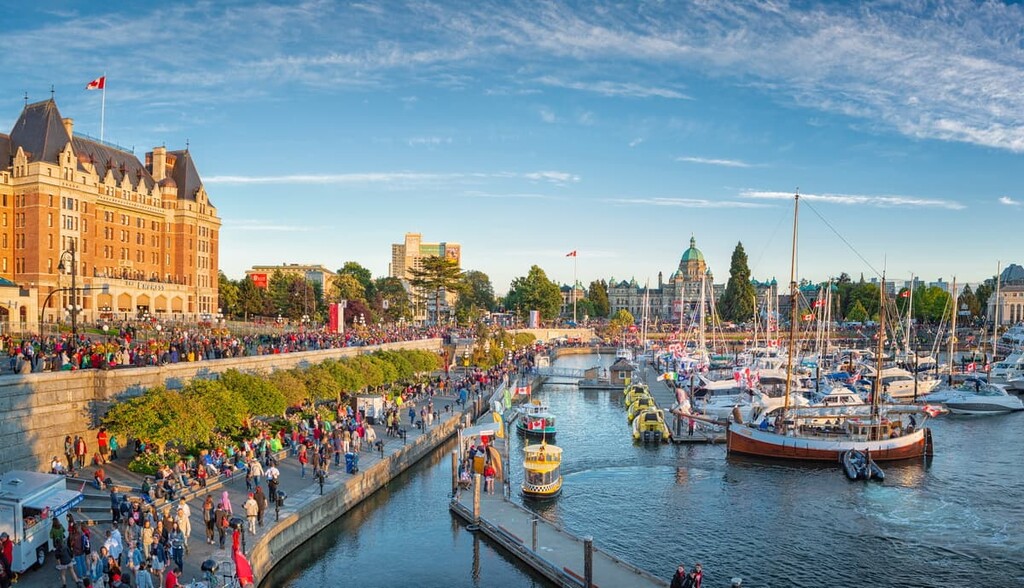
After Vancouver Island became an official British colony in 1849, they formed a legislature and built government buildings. The current British Columbia legislature building was built in 1898 and it still stands today near Victoria Harbour.
In 1866, the Vancouver Island Colony joined with the mainland British Columbia colony, making Victoria the capital of the colonies. In 1871, several years after the Canadian Confederation of 1867, British Columbia signed a contract to join the Confederation.
The deal that brought the British Columbia colonies into confederation was heavily influenced so that the colonial elite would be able to maintain their status, prestige, wealth, opportunities, and privilege.
The agreement required rail connections to the west coast, which would boost the economy. Furthermore, colonial officials were granted security in their positions and the most controversial agreements had to do with First Nations land policy. The settlers had an agreement that would perpetuate British Columbia’s pre-confederation practices which has resulted in many current claims of unceded lands.
While the meteoric rise of Victoria was eclipsed when railroads were built to Vancouver, and Victoria was replaced as the commercial and industrial hub of British Columbia, Victoria continued to steadily grow over the years. While initial growth was focused on mining, forestry, and fishing, modern growth is still occurring based on a growing technology industry and tourism.
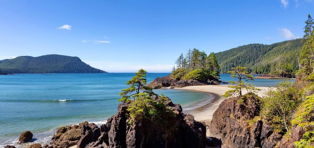
Vancouver Island is the largest island on the west coast of the Americas and it has an abundance of natural beauty. There are rugged coastlines on the Pacific side, as well as incredible mountains, rivers, waterfalls, across the island, lush rainforests, and gentle beaches. The following are some of the top-rated hikes on Vancouver Island.
Located along the west coast of Vancouver Island, the West Coast Trail is part of the Pacific Rim National Park Reserve and is easily one of the most famous Canadian hikes.
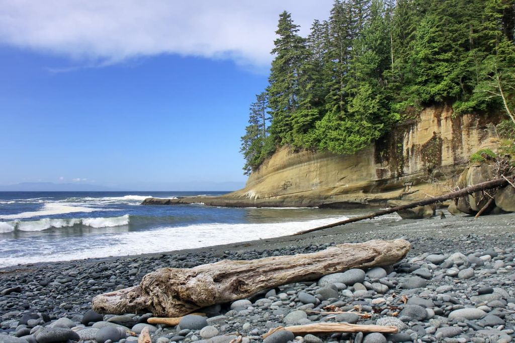
Stretching over 75 km (45 mi) from Bamfield to Port Renfrew, the trail was originally constructed in the beginning of the twentieth century as a “lifesaving trail” for the survivors of the hundreds of shipwrecks along the coast. The trail traverses bogs, forests, beaches, and passes by waterfalls, creeks, and stunningly large trees.
The trail typically takes seven days to complete and permits and reservations are required to backpack the trail; however, day hiking is allowed at no charge. There are around 70 ladders, 130 bridges, four cable cars, dangerous tides and currents, and slippery trails to navigate on this bucket list hike.
The Juan de Fuca Marine Trail follows the coast where the West Coast Trail ends, near Port Renfrew to China Beach. There are several incredible beaches to hike and explore along this trail, including Botanical Beach, with its interesting geological formations and brilliant tidal pools and Sombrio Beach with its incredible surf and a hidden waterfall.
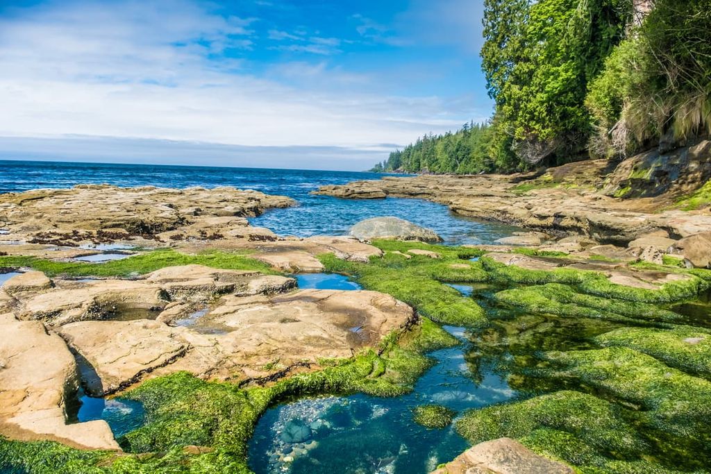
There are many opportunities for day hikes and trail runners may wish to take on the whole 47 km (28 mi) trail in one day. You’ll have the opportunity to walk among giant cedars and Douglas fir, as well along sandy beaches, and alongside rugged coastline where the waves pound the rugged coastline. The trail and beaches are incredibly beautiful for day trips and backpacking.
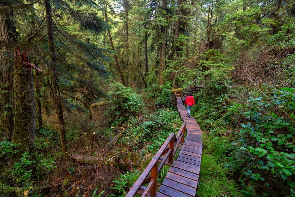
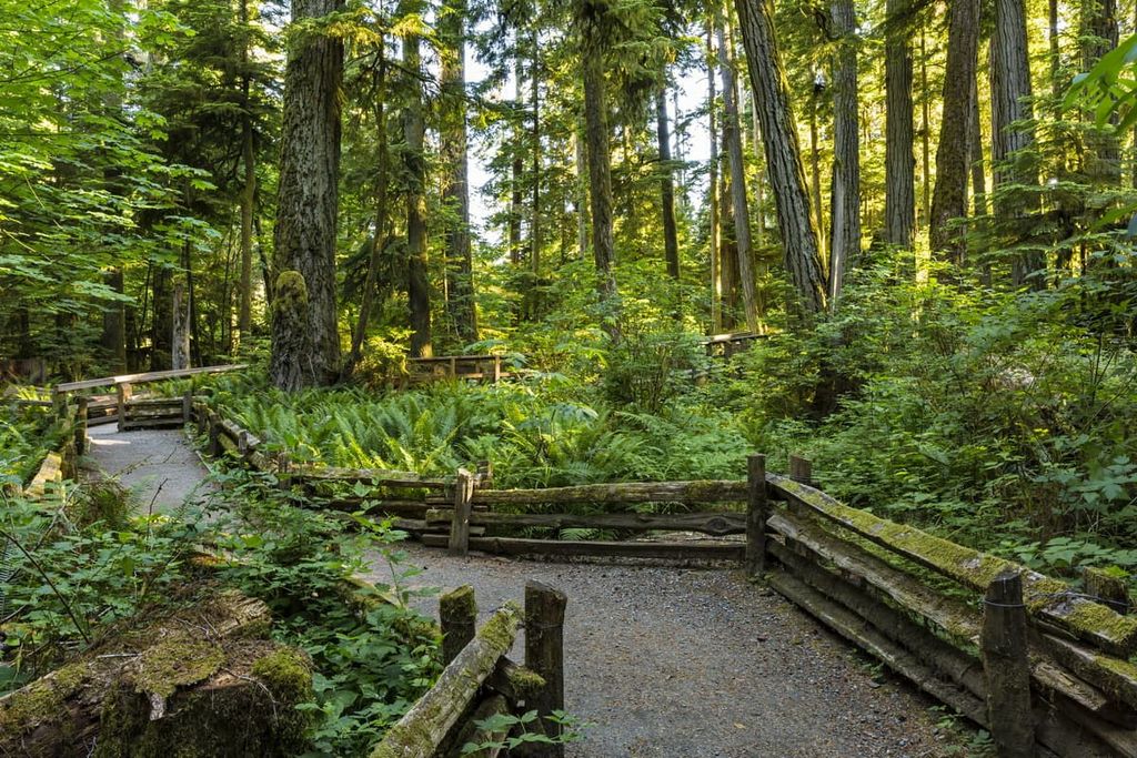
Near Tofino on the west coast of Vancouver Island in Pacific Rim National Park Reserve, there are two boardwalk trails through the rainforest. Each trail is 1 km (0.6 mi) long and the boardwalk make it east to walk while looking up towards the tops of the massive trees. These trails are perfect for families who want to enjoy the 800 year old trees in these ancient forests.
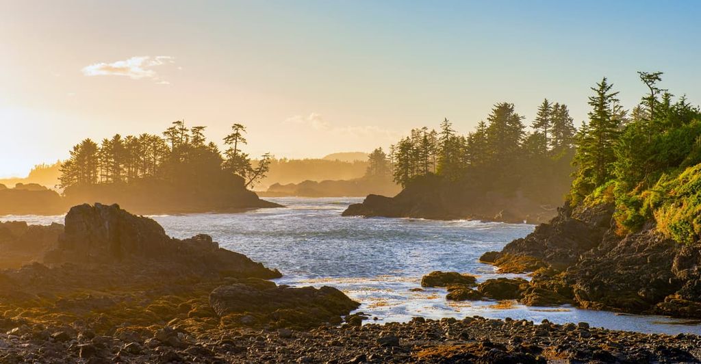
The Wild Pacific Trail on the west coast of Vancouver Island is located to the south of the Long Beach Unit of the Pacific Rim National Park Reserve. It offers a different trail and perspective than the typical beach trails of the area.
While most of the trails in the region lead to beaches, the Wild Pacific Trail has views of offshore islands, waves crashing on rocks, a lighthouse, and the gnarly windblown coastal trees. There are two trails to choose from, the Lighthouse Loop is 2.6 km (1.5 mi) popular trail and the Brown’s Beach to Rocky Bluff is an 8 km (4.8 mi) return along the ocean and through rainforest.
One of the most beautiful and accessible hikes in the Greater Victoria area is the Coast Trail in East Sooke Regional Park. This 10 km (6 mi) one-way hike traverses beaches, rocky shores, and over headlands. It also offers amazing views over the Juan de Fuca Strait towards Mount Olympus and the Olympic Mountains.
The most popular trailhead is at Aylard Farms, which is a popular day use area. There are trails leading to the beautiful beaches and rocky shores with lots of space to play, swim, or explore.
The hikes in the Gowlland Range, including those in Goldstream and Gowlland Tod Provincial Parks and the Mount Work and Thetis Lake Regional Parks, offer incredible hiking with minimal effort. Just a short drive and a short hike can take you to views over the Saanich Inlet, the Juan de Fuca Strait, and of the Olympic Mountains.
The Mount Work trail is only 4.5 km (2.7 mi) long and it leads to two viewpoints. The proximity to the city and the short distance of the trail makes this a popular hike, and it is recommended to summit Mount Work on a clear day to fully appreciate the vistas.
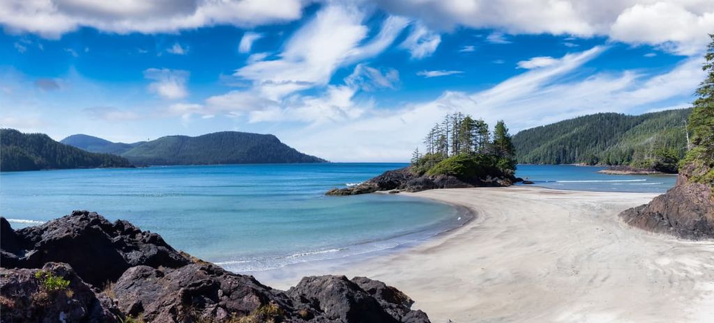
If you happen to be on the north end of the island, the little visited Cape Scott Provincial Park is worth a visit. The park has dramatic views of the rugged west coast and beautiful trails through the ancient forests.
The San Jose Bay Trail is an easy 5 km (3 mi) round-trip to a beach with a rocky shoreline that has tidal pools to explore at low tide, sea stacks, and a view to appreciate. There are small shore caves to explore at low tide while you appreciate the remoteness and solitude of the area.
In Strathcona Provincial Park, one of the most popular trails is the Elk River Trail—an 11 km (6.6 mi) trek 600 m (1,968 ft) up the Elk River Valley to Landslide Lake. There are a couple locations where you can camp along the way if you wish to make the hike in two days; however, there is no camping permitted at Landslide Lake.
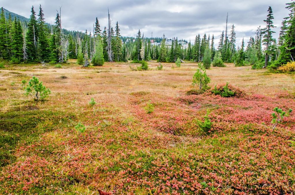
The Paradise Meadows Loop at the base of Mount Washington is a casual trail that is accessible for those with limited mobility or anyone who uses a wheelchair. Its 4.2 km (2.5 mi) boardwalk and gravel path leads to a beautiful subalpine area that is full of wildflowers in the summer months.
If you’re near Qualicum Beach, or if you’re on Highway 4 to Tofino, a stop at Cathedral Grove is well worth the time if you’re interested in hiking among giant Douglas firs. There are a few loops through the ancient forest, where some of the trees are believed to be over 800 years old. The largest tree in the park is a 76 m (250 ft) Douglas fir called The Big Tree.
There are trails on either side of Highway 4 to enjoy and there is usually plenty of parking. The trails are flat and easy to walk along as you pass by trees that are upwards of 9 m (29 ft) in diameter. In addition to Douglas firs, there are bigleaf maples and giant western red cedars to admire.
There are several major cities across Vancouver Island where you’ll find accommodations, restaurants, and whatever services you may need. The following are some of the places to stay while exploring Vancouver Island:
Victoria is the capital of British Columbia, and it has been a major and important city for over 150 years. With humble beginnings as a trading post for Hudson’s Bay Company, Victoria has become a beautiful urban gem of the west coast. The colonial history is very apparent from the architecture of the historic buildings around Victoria Harbour, such as the Legislature Building and the Empress Hotel.
In addition to the historic buildings, other city attractions are Beacon Hill Park, Butchart Gardens, and the Shaw Ocean Discovery Centre. Victoria Harbour is a beautiful place to visit, and you’ll soon understand why Victoria is called the “Garden City.”
There are also some great walking and hiking trails around the city and near Victoria. Some trails to look for are the Coast Trail near Aylard Farm in East Sooke Regional Park, the Mount Work Trail, Thetis Lake Trail, Mount Douglas Hiking Trails, and the Niagara Falls Hiking Trail in Goldstream Provincial Park. Additionally, Gowlland Tod Provincial Park has several incredible lookouts over the Saanich Inlet.
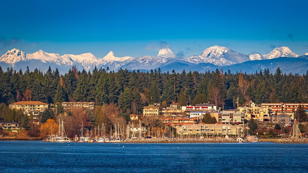
The cities of Courtenay, Comox, and Cumberland are the central municipalities of the Comox Valley, and they form the primary commercial and residential area of the region. While Courtenay and Cumberland were developed through industries such as fishing, mining, and forestry; however, Comox was a tourist town from the beginning.
Comox grew slowly as a vacation town that offered golf, dining, fishing, hunting, tennis, and more to the affluent visitors. With the beautiful beaches along the coast as well as clear lakes, rivers full of salmon, and an incredible wilderness just outside of town, tourism has grown significantly in the region in recent years.
Some of the attractions and trails worth checking out are the Seal Bay Nature Park, the Rosewall Creek Trail, Trent Falls, and Helliwell Provincial Park Loop. The cities also have annual festivals in the summer months that celebrate their nautical history with music, arts, and an amateur boat building competition.
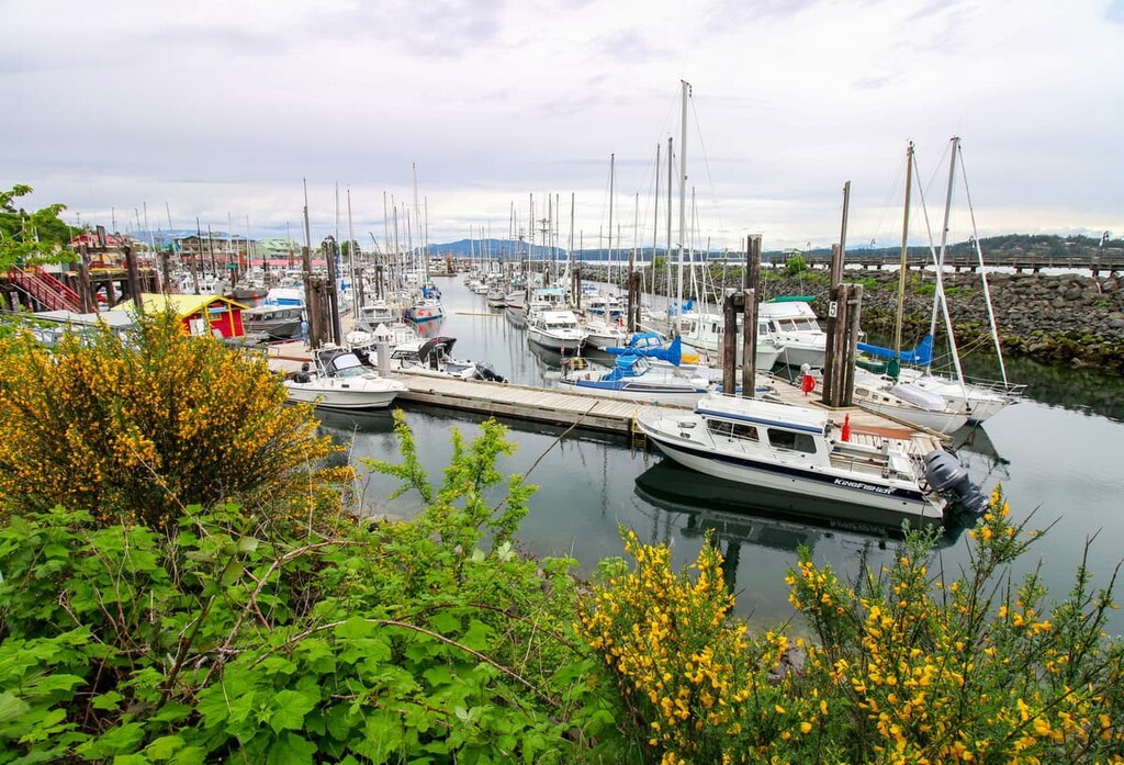
Located on the east coast of Vancouver Island, Campbell River is connected to the rest of the island via Highway 19, which is the major highway on this part of Vancouver Island. Campbell River has many great places to stay, fantastic places to eat, and some incredible beaches for relaxation.
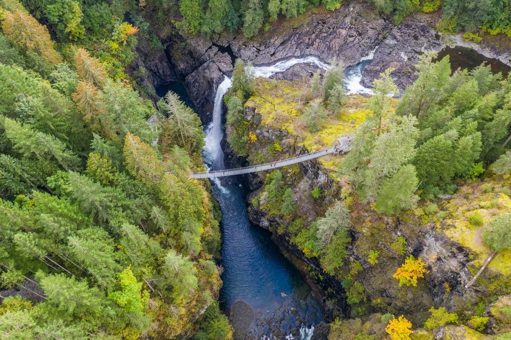
One place worth visiting to hike and experience the wilderness is Elk Falls Provincial Park, where a wide trail leads though incredible forests filled with massive red cedars, Douglas fir, and bigleaf maple. There are several vantage points to see the stunning Elk Falls, including a suspension bridge that spans the canyon.
Other trails worth hiking are the Campbell River Lookout Trail, Mount Menzies, and the Quinsam River Hatchery Trail. The weather is beautiful, the food is great, and the wilderness is beautiful and majestic, all of which make Campbell River a worthwhile destination while exploring Vancouver Island.
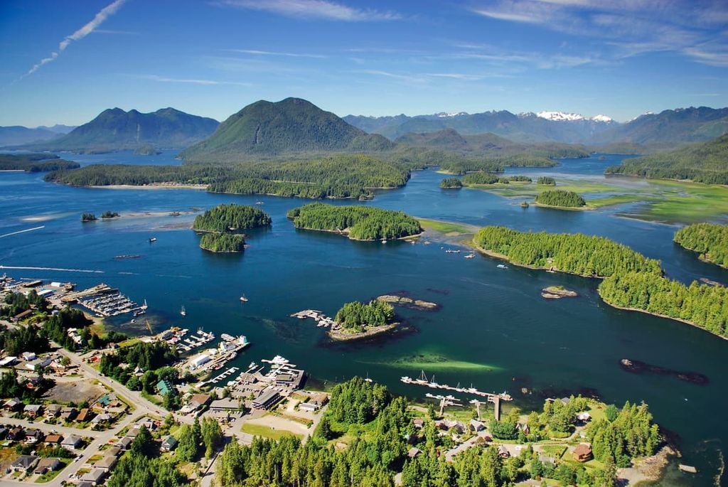
Nanaimo is located on the east coast of Vancouver Island, and it is one of the primary ports for ferries bringing passengers from mainland British Columbia. Nanaimo, British Columbia is the home of the Nanaimo bar, a delicious treat that features yellow custard sandwiched between chocolate ganache and a coconut-graham crust.
Avid enthusiasts of the Nanaimo bar can check out the Nanaimo Bar Trail, which lists stops for various takes on the local treat. After touring Nanaimo Bar Trail, you might want to burn some calories on Gordie’s Trail up Mount Benson, the Mount Benson Loop, Westwood Lake Trail, or the Cable Bay Nature Trail.
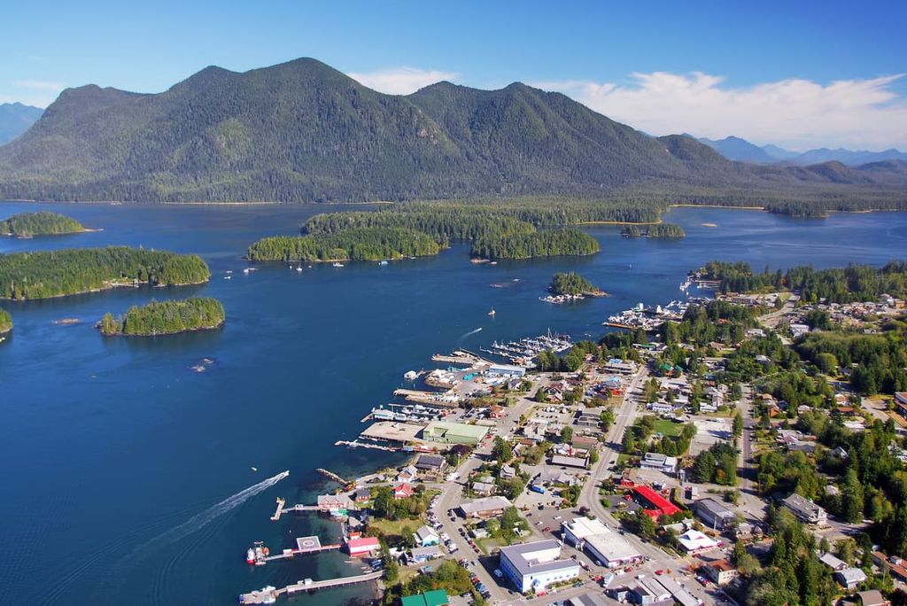
Tofino is a year-round tourist destination on the rugged west coast of Vancouver Island. Located on the edge of Clayoquot Sound, the population of the town swells during the summer months with tourists seeking the rugged wilderness and seascape adventures. The area attracts surfers, campers, backpackers, hikers, mountain bikers, whale watchers, bird watchers, and anybody that wants to enjoy nature.
Just down the coast from Tofino is Long Beach in Pacific Rim National Park Reserve, which is especially popular among surfers. Long Beach is considered the birthplace of Vancouver Island surfing; however, the winter at Long Beach is as spectacular as the summer. The winter storms bring the full force of the Pacific Ocean crashing against the shores near Tofino, and it is a spectacular and terrifying experience.


ultra
canada-sampler
island-qualifiers
ramblers-lifetime-objectives
british-columbia-ultras
ultra
island-qualifiers
ramblers-lifetime-objectives
british-columbia-ultras
ultra
canada-sampler
island-qualifiers
ramblers-lifetime-objectives
british-columbia-ultras
ultra
island-qualifiers
ramblers-lifetime-objectives
british-columbia-ultras
ultra
island-qualifiers
ramblers-lifetime-objectives
british-columbia-ultras
The highest peak in the Vancouver Island Ranges is Golden Hinde, at 2,195 m.
The Vancouver Island Ranges have 537 named peaks.


