
Scan the QR code and open PeakVisor on your phone
The Pelham Range include 2 named peaks. The highest is Mount Blenheim at 723 m. Other notable peaks include Cowishil.
The Pelham Range is a collection of peaks located on the west coast of Vancouver Island in British Columbia, Canada. The remote range rises to a high point of 723 m (2,373 ft) from the Pacific Ocean at the summit of Mount Blenheim.
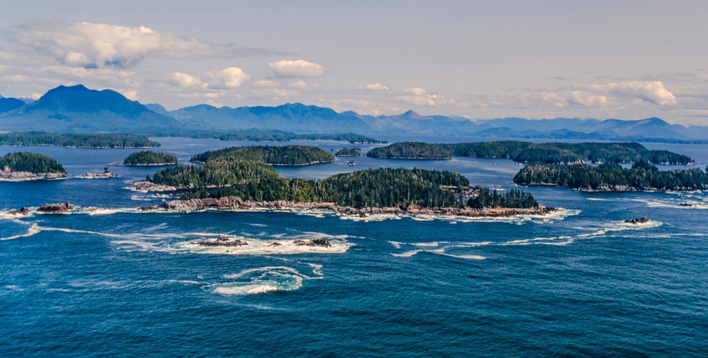
Located on the west coast of Vancouver Island, in British Columbia, Canada, the Pelham Range is a collection of peaks that spans the Alberni Inlet. The range’s tallest point is the summit of Mount Blenheim (723 m/ 2,373 ft).
The Pelham Range is located to the northwest of the Bamfield Main Road. From Bamfield, there are a number of logging roads that enter the range.
From the Pelham Range, the closest communities are Sarita and Bamfield, which are situated along the coast. Pacific Rim National Park Reserve and Carmanah Walbran Provincial Park are both located nearby, too, as they are situated just to the southwest of the Pelham Range.
The Pelham Range is composed of rocks that are part of the ancient Wrangellia terrane. The Wrangellia terrane started forming about 300 million years ago in the Pacific Ocean from lava flows on the ocean floor.
The initial lava flows were subsequently covered by marine sediment for about 100 million years until about 200 million years ago when the region’s volcanic eruptions started again. For the following five million years, lava erupted and built up a volcanic island arc that we would eventually call Wrangellia.
The five million years of eruptions created the distinct Karmutsen geological formation. The Karmutsen formation is composed of upward of 6,000 m (19,680 ft) of basaltic and picritic pillow lavas, pillow breccia, and thick basalt flows.
The widespread basalt and pillow flows that formed most of Wrangellia are the basis of the Insular Mountains. The Insular Mountains include the peaks in Haida Gwaii, parts of the Alaskan panhandle, and the Vancouver Island ranges, which include the Pelham Range.
The Karmutsen formation also includes the volcanic rocks of the Pelham Range; however, there are layers of limestone in the range, too. This limestone formed from the marine sediments that were deposited upon the initial lava flows of the Wrangellia terrane starting about 300 million years ago.
Known today as Quatsino limestone, the limestone of the range is of the Triassic age, and if you look closely at the rocks, you may find examples of Triassic-aged fossils.
Major aspects of the topography of the range were created during the Pleistocene. During the Pleistocene, a massive ice sheet extended across the island. The ice sheet formed as glaciers grew in the mountains along the spine of Vancouver Island and coalesced in the valleys.
These glaciers created massive U-shaped valleys as they made their way to the ocean. As the glaciers melted and the sea level rose again, some of the glacial valleys flooded and became the rugged fjords that now dominate the west coast of Vancouver Island and mainland British Columbia.
The Alberni Inlet, which divides the Pelham Range, was likely created by glaciers flowing from the center of the island. As the glaciers eroded the mountains, they picked up massive amounts of debris that was eventually deposited off the coast or spread as a veneer in the valley bottoms.
The low-elevation mountains of the Pelham Range are part of the Coastal Western Hemlock ecosection, which accounts for most of the land of Vancouver Island and the coast of British Columbia.
The Coastal Western Hemlock ecosection is characterized by temperate coastal rainforests that are filled with massive red cedars, Douglas fir, western hemlock, big leaf maple, alder, and Sitka spruce.
Some of the largest trees on the island are located near the Pelham Range as well as in Carmanah Walbran Provincial Park. However, there are no protected areas in the Pelham Range and most of it is part of a logging lease.
There are many areas that have been clear-cut in the range and there are many parcels that have second- and third-growth forests. Areas of old-growth forests may be found along the coast and in difficult-to-access terrain within the range.
While there are logging roads that transect the range, there are many areas that are still wild enough for animals to inhabit. The largest animals that inhabit the range are black bears and Columbian black-tail deer.
The Pelham Range is in the traditional territory of the Huu-ay-aht, Uchucklesaht, and Tseshaht First Nations, all of which are part of the Nuu-chah-nulth Tribal Council. The Nuu-chah-nulth are one of the three major Indigenous groups that have ancestral ties to the island. The other First Nations cultures in the region include the Coast Salish, who traditionally reside along the south end of Vancouver Island, and the Kwakwaka’wakw, who traditionally reside on the east coast.
Many of the First Nations of the island have creation stories that describe how their ancestors came to be. The origin story of the Tseshaht Nation tells that their people were first created on Benson Island, which is part of the Broken Group Islands of Barkley Sound.
It is said that on Benson Island, their creator granted their ancestors the highest spiritual responsibility and stewardship of the Broken Group Islands. The Tseshaht were historically good whalers, and their name translates to “people of the rancid smelly place” because of the stench of the whale oil, which signified their great wealth.
The Tseshaht and other First Nations of the island typically had hereditary leadership and a class system. Their class system would define their privileges for economic and intellectual resources. Economic resources include rivers, fish trap sites, and plant gathering sites while intellectual resources include names, ceremonial songs, dances, and regalia.
The lives of many of Vancouver Island’s First Nations economies were determined by their seasonal round. In the late winter and spring, many First Nations would traditionally spread out to hunt halibut, rockfish, salmon, and other marine animals. As the seasons progressed different resources came available, and they would all typically spend winter together in the heart of their territory.
While there are no official trails or parks in the Pelham Range, there are still some areas that are worth stopping at and hiking through if you’re in the region. Here are some of the main destinations in the Pelham Range:
Keep in mind that there aren’t any official or maintained trails in the Pelham Range, so the area is only suitable for very experienced hikers who are comfortable with route finding and backcountry travel.
The Pelham Range is located along the shore of the Alberni Inlet on Vancouver Island. The following are the closest towns and cities to the range.
Bamfield is a community that's located along the south side of Barkley Sound about 15 km (9 mi) to the west of the Pelham Range.
The community is the northern terminus for the famous West Coast Trail and is home to the Bamfield Marine Sciences Centre. The Marine Sciences Centre is known around the world as a premier educational destination, and it offers educational tours and university credit courses.
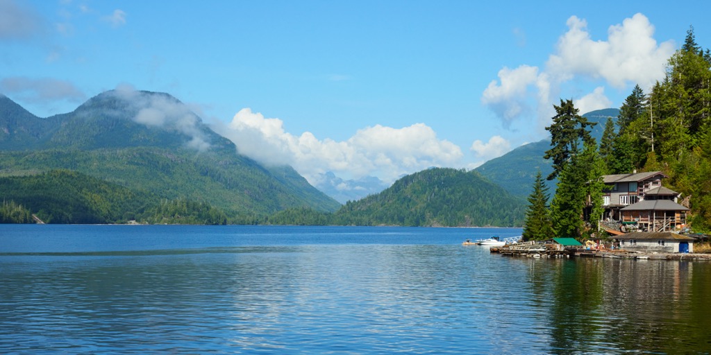
Additionally, Bamfield is the starting point for adventures in the Broken Group Islands thanks to its many ferry and water taxi services. It can also serve as a launching point for a sea kayaking adventure. The community boasts spectacular scenery, fresh seafood, and lots of opportunities for adventure.
Port Alberni is located at the head of the Alberni Inlet on the west coast of Vancouver Island, and it is situated about 25 km (15 mi) to the northeast of the Pelham Range. The town is named after Don Pedro de Alberni, who commanded Fort San Miguel at Nootka Sound from 1790 to 1792.
Port Alberni is the gateway to the rugged and wild west coast of Vancouver Island and there are many activities in the town for visitors to enjoy. In general, Port Alberni is a good jumping-off point for many outdoor activities, including marine and freshwater fishing, hiking, kayaking, and mountain biking.
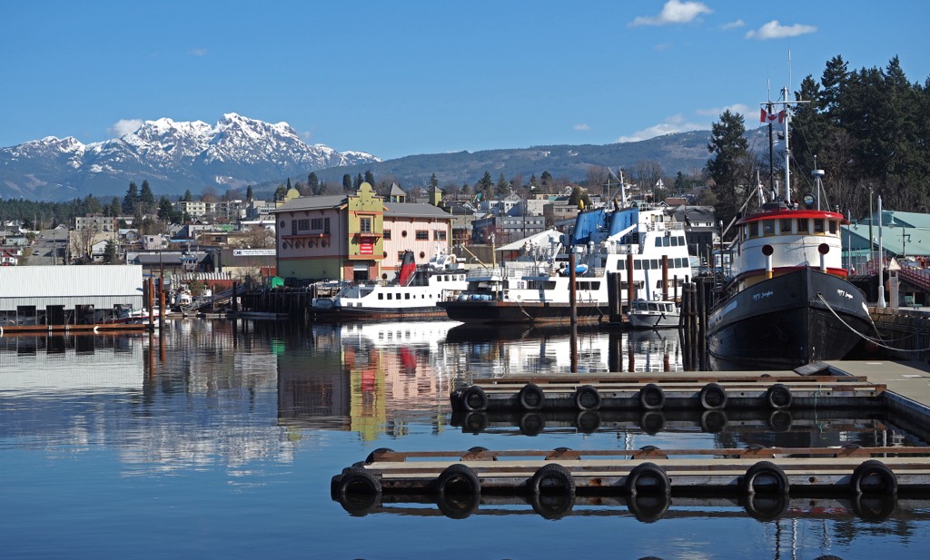
There are several hiking trails in Port Alberni and over a hundred trails in the surrounding valley and mountains. Some of the most popular hikes in the area are the Horne Lake Trail, Log Train Trail, and the Inlet Trail. Mount Arrowsmith is also located nearby if you want to hike the Saddle Trail or climb to the summit.


The highest peak in the Pelham Range is Mount Blenheim, at 723 m.
The Pelham Range have 2 named peaks.


