Scan the QR code and open PeakVisor on your phone
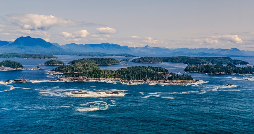
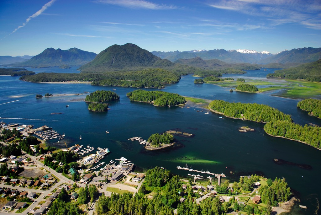
The Broken Group Islands Unit of the Pacific Rim National Park Reserve are located off the west coast of Vancouver Island in British Columbia, Canada. There are over 100 islands, islets, and rocky outcrops that make up the Broken Group Islands and Meares Bluff (75 m/ 246 ft) on Effingham Island is the tallest point in the islands.
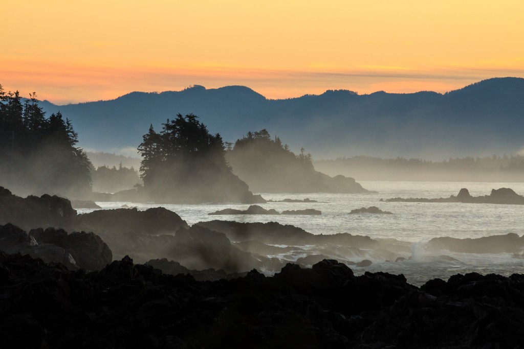
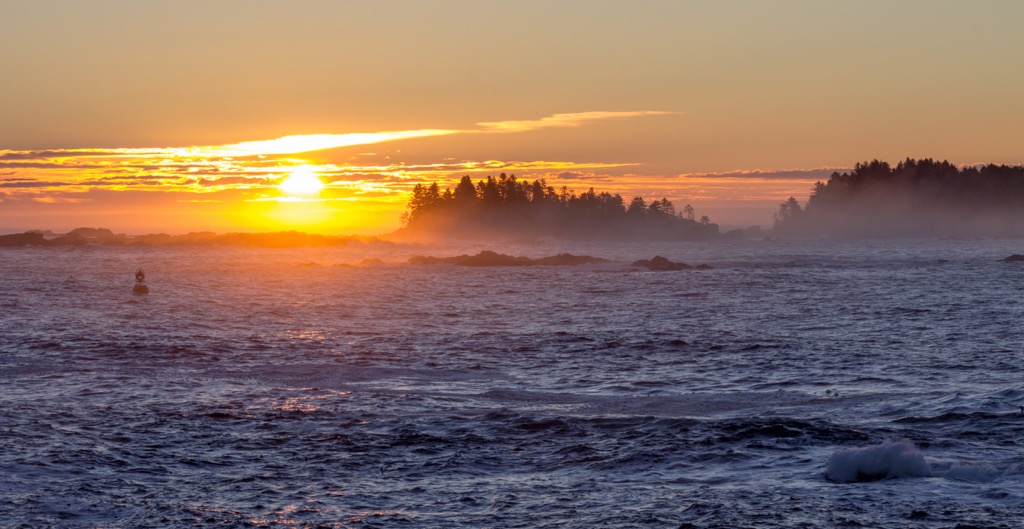
The west coast of Vancouver Island in British Columbia, Canada, is a wild landscape that consists of steep-sided fjords, rugged and rocky islands, and the occasional sandy beach. The rugged nature of the coast has been the cause of many shipwrecks and the area is known as the Graveyard of the Pacific.
Pacific Rim National Park Reserve conserves and protects the terrestrial and marine environment along a portion of the Pacific coast of Vancouver Island. The National Park Reserve consists of three units; the Longbeach Unit, the West Coast Trail Unit, and the Broken Group Islands Unit.
The Longbeach Unit covers the massive, sandy beach between Ucluelet and Tofino where surfing is popular. The West Coast Trail Unit covers the coastal trail between Bamfield and Port Renfrew and is a world-famous hiking trail that consists of many ladders, river crossings in cable cars, and camping on beaches.
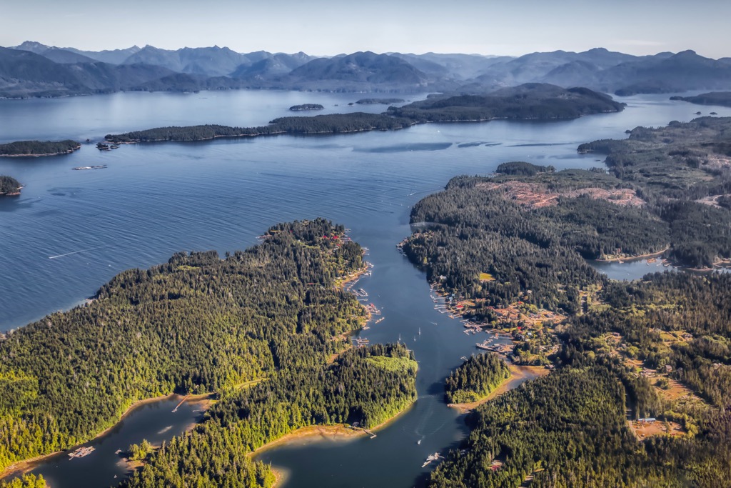
The Broken Group Islands consists of over 100 islands, islets, and outcrops which are spread out over 10,607 ha (40 square miles) in Barkley Sound. The area of the Broken Islands Groups falls between Loudon Channel and Imperial Eagle Channel in Barkley Sound. Of the 106 square kilometers (40 square miles) in this unit of the National Park, there are only 13.5 square kilometers (5 square miles) of land.
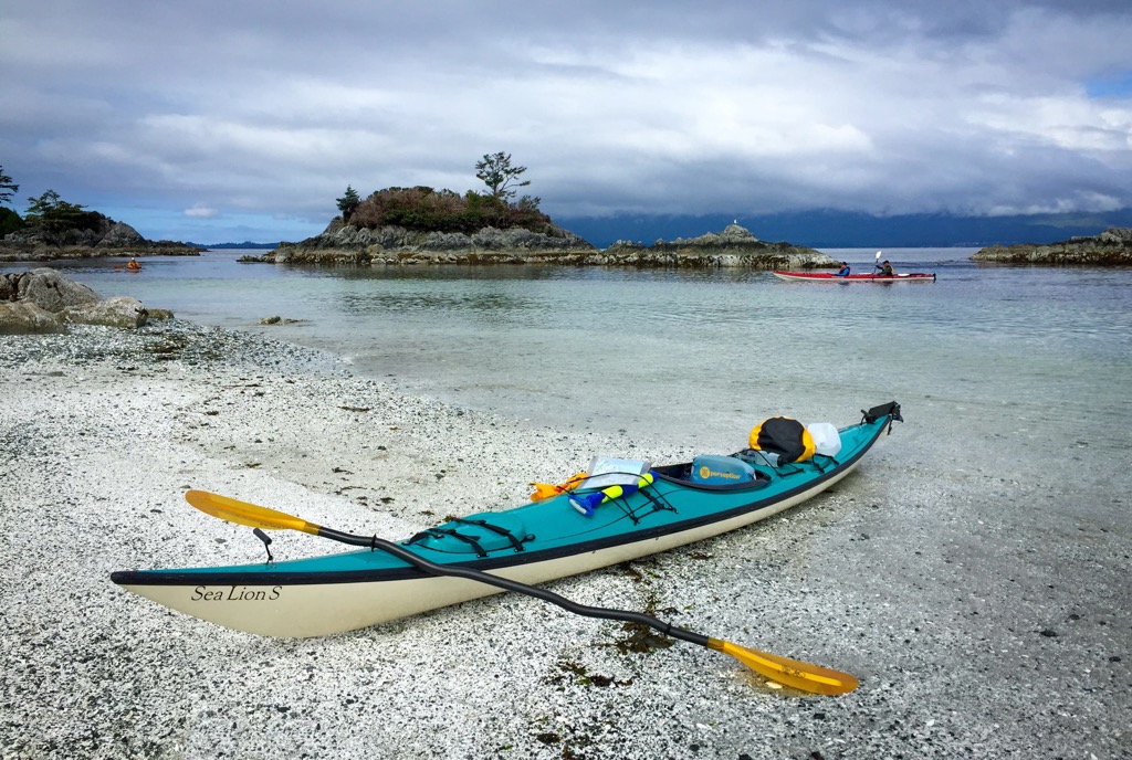
Travel to and through the Broken Groups is only by boat. Kayaks are one of the most popular methods for visitors to travel through the park; however, motorized and sail boats also make their way into the area.
There are some ferry services from Port Alberni and Ucluelet that bring passengers and their gear to a starting point in the islands. Visitors can also hire a water taxi to drop you and your gear off at any island in the park, with pick-up services also available. The final way to enter the park is by kayaking from Vancouver Island.
Most visitors that make their own way to the Broken Group Islands depart from Secret Beach, near Ucluelet. Paddling directly from Ucluelet or Bamfield is discouraged due to the exposed passages of Imperial Eagle and Loudon Channels.
The Broken Group Islands display bedrock of the Wrangellia Terrane, with the Pacific Rim and Crescent terrane rocks bordering the Barkley sound and forming bands offshore. These terranes were formed out in the Pacific Ocean and they all collided with the west coast of Canada.
The Wrangellia terrane started forming about 300 million years ago when a rift in the ocean floor allowed lava flows to create the base of the terrane. Following the first volcanic event, marine sediment settled upon the base of the terrane. Finally, about 200 million years ago, a major volcanic event formed the topmost layers of the terrane and raised the terrane above sea level.

The final volcanic event that created Wrangellia included about 5 million years of volcanic activity and lava flows that created a 6 km (3.6 mi) thick layer of basaltic lava. As such, the Broken Group Islands contain limestone, mafic and felsic intrusives, and metamorphics.
The metamorphic rocks include amphibolite, agmatite, gneiss, quartz diorite, and hornblende-plagioclasse. The Jurassic aged felsic intrusive rocks include granodiorite, quartz diorite, granite, and quartz monzonite.
The West Coast Fault crosses the mouth of Barkley Sound, where the Broken Group Island sits, and the Tofino Fault separates bands of the Crescent and Pacific Rim Terranes. The Crescent and Pacific Rim Terranes are outboard terranes formed in a similar manner to Wrangellia; however, they are much smaller.
The Wrangellia terrane stretches from Alaska to the southwest corner of British Columbia, and forms most of the islands off the coast of the province as well as the Alaskan panhandle. When the Wrangellia terrane collided with North America, the collision helped to form the mountains of western Canada.
The Pacific Rim terrane accreted to the west coast of Vancouver Island about 65 million years ago and helped in the uplift of the Vancouver Islands Ranges. The Crescent terrane collided with southwest Vancouver Island, and includes the area around Sooke. The collision of the Crescent terrane is responsible for the uplift of the Saanich Peninsula, where Victoria, the capital of British Columbia, is found.
During the Pleistocene, several glacial events covered Vancouver Island with thick layers of ice. The local glaciers typically formed in the middle of the island in what is now Strathcona Provincial Park. The glaciers flowed from the peaks, carving U-shaped valleys as they made their way to the ocean which are now fjords or occupied by finger lakes.

The glaciers had an interesting effect on the sea level world-wide and the elevation of Vancouver Island. There is evidence that the weight of the glaciers during the Pleistocene depressed the island at least 50 m (160 ft) compared to the relative sea level at the time.
There is also evidence that so much water was tied up as glaciers during glacial maximums that large areas of the continental shelf were exposed at the time and are now submerged. As such, Barkley Sound is at the junction of where several glacial fjords coalesced, and the Broken Group Islands are the peaks of the submerged, ancient mountains that were formed along the coast of Vancouver Island.
The Broken Group Islands are a cluster of islands, islets, and rocky outcrops in the middle of Barkley Sound, off the west coast of Vancouver Island. Most of the islands are covered with dense coastal forests and the surrounding marine areas are filled with an abundance of wildlife.
Coastal Western Hemlock forests dominate the islands and feature western hemlock and amabilis fir as the dominant climax trees. Western red cedar, Sitka spruce and Douglas fir are also found upon the islands.
The northern latitude rainforests are famous for the Douglas fir, which can approach heights of 100 m (330 ft). They are also famous for their massive western red cedars and Sitka spruce, which reach up to 4 m (15 ft) in diameter.
There are very few large terrestrial animals found upon the islands; however, visitors to the islands may discover traces of raccoon, marten, mink, or short-tailed weasel, and river otters are other terrestrial mammals that visit and inhabit the park.
Whales, sea lions, and seals inhabit the waters of the park and are the most spotted mammals. California sea lions, Steller’s sea lions, and harbor seals are common and northern fur seals and northern elephant seals are occasionally spotted.

Orcas are spotted throughout the park, as are humpbacks, sperm whales, dolphins, and porpoises; however, gray whales are the more common cetacean species in the region. Gray whales are most predictably spotted during the spring, as they migrate north.
In the 1900s, commercial whalers nearly destroyed this west coast population of gray whales, reducing it to only a few hundred individuals. With conservation practices in place, the Pacific herd is now an estimated 20,000 strong and represents the only significant known population of gray whales in the world.
The Broken Group Islands are part of the traditional territory of the Tseshaht people who are one of the 14 groups that make up the Nuu-chah-nulth. Benson Island, one of the many islands of the Broken Group is recognized as the creation site of their spiritual origin.
The origin story of the Tseshaht says that they were created at a place called c̓išaa, which is now commonly referred to as Benson Island in the Broken Group Islands. It is upon this island that their creator, n’aas granted the first ancestors the highest spiritual responsibility and stewardship of the Broken Group Islands.
It is speculated through archeological evidence that the site at c̓išaa was first occupied over 5,000 years ago. The Tseshaht oral history tells of a continuous occupation of the area until Europeans arrived in the region.

The Tseshaht lived lives closely connected to the ocean, and fishing and whaling were their primary sources for sustenance. c̓išaa translates as “rancid smelly place”, and as such Tseshaht translates as “people of the rancid smelly place”. The inhabitants of the village were great whalers and their village was permeated by the foul smell of whale oil.
While readers of this information today may be confused and possibly see the name as insulting, the Tseshaht were pleased with their name and situation as it signified great wealth.
The people of Barkley Sound followed a traditional seasonal round that involved groups migrating to the outer edges of their territory to harvest resources during the summer and returning to the central area to congregate during the winter.
Ruled by a hawilth, or king, this hereditary leader was a senior representative of the bloodline most closely linked to their creation. Among the Tseshaht there were hereditary class distinctions that determined their privileges and prerogatives.
Their hereditary rights determined how economic resources such as rivers, fish trap sites, and plant gathering sites; and intellectual resources such as names, ceremonial songs, dances, and regalia can be used. Such rights determined their rank in society and were passed from generation to generation within a family.
In time, through warfare and agreements, the Tseshaht territory expanded beyond Barkley Sound to include the Alberni inlet, Alberni Valley, and the surrounding areas. In 1791, Santa Saturina entered Barkley Sound, making the first European contact with the inhabitants of the area. Smallpox and other diseases nearly eradicated the indigenous population over the next hundred years.
It wasn’t until 1893 that Benson Island was given its current name, when John W. Benson, a sealing captain, purchased the island and made a large home on it. The home was later expanded to a hotel and ten acres around it were cleared for a garden and orchard, which supplied the hotel.
In 1970, Benson Island and the rest of the Broken Group Islands were incorporated into the newly designated Pacific Rim National Park Reserve. The island is a popular destination for kayakers, and recreational sailors in the area.
Due to its cultural significance to the Tseshaht First Nation, camping and overnight visits to the island are now prohibited. However, day visitors are still encouraged to visit the island and interpretive displays that have been constructed, including a wooden statue that was carved to signify the importance of the island in the Tseshaht origin story.
The Broken Group Islands of the Pacific Rim National Park Reserve are a stunning collection of beaches, coastal forests, rocky outcrops, and uninhabited islands. The following are some of the major attractions and activities while visiting the park.
Sea kayaking is likely the most popular way for visitors to enjoy the beauty of the Broken Islands Group. There are many commercially available tours that provide the necessary equipment and a guide around the islands or visitors can choose to go their own way.
With multiple designated camping sites, sandy beaches, alcoves to explore, and many square kilometers of densely packed natural beauty, exploring the Broken Group Island by kayak is an incredible experience.
Also known as c̓išaa, Benson Island is a culturally significant site to the Tseshaht First Nation. Archeological evidence suggests that the island and area has been inhabited for over 5,000 years and the island is the location of the Tseshaht people.
Marked with a commemorative statue, carved by a local Tseshaht artist, Benson Island is where the first Tseshaht man and woman received their spiritual responsibility to watch over and protect the Broken Group Islands.
Camping is not permitted upon the island; however, there are walking trails and interpretive signs that help visitors understand the history and cultural significance of the island.

The west coast of Vancouver Island is known for spectacular scenery, sandy beaches, rugged fjords, and many remote islands. The following are some of the towns and cities closest to the Pacific Rim National Park Reserve – Broken Group Islands.
Located on the Ucluelet Peninsula on the west coast of Vancouver Island, Ucluelet is one of the major communities that offer water taxi and ferry services to the Broken Group Islands. Ucluelet has become a year-round tourist destination that caters to backpackers, surfers, and many more visitors who venture to the west coast of Vancouver Island.
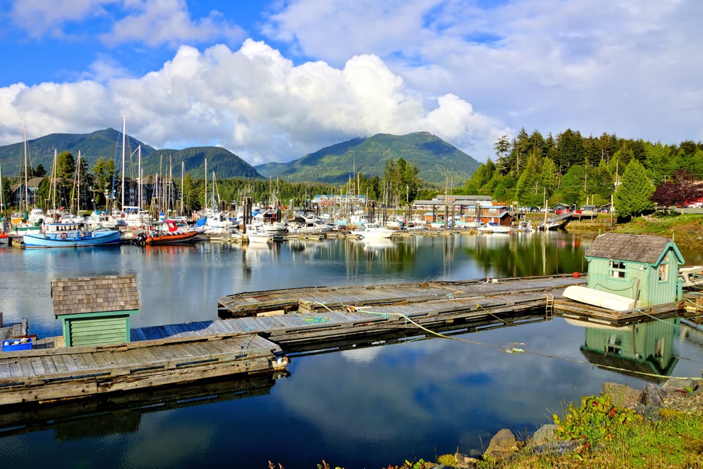
Long Beach and the Broken Group Islands of the Pacific Rim National Park Reserve are located on either side of the community and are one of the main attractions for the community. In addition to the National Park, there are many other worthwhile trails and attractions. Surfing, fishing, camping, hiking, kayaking, swimming, and beach combing are popular activities, and the powerful winter storms draw their fair share of visitors as well.
Starting near the mouth of the Ucluelet Inlet, the Wild Pacific Trail is a regional trail that follows the rugged coastline and offers tremendous views. It travels along the Pacific coastline through Big Beach Park and ends just outside Ucluelet. The path is well maintained and there are stunning coastal views to enjoy along the way.
Tofino is a year-round tourist destination located on the west coast of Vancouver Island. The town is found at the end of Highway 4 and at the edge of Clayoquot Sound. My favorite time to visit Tofino is during the winter to view the fierce Pacific storms pounding the coast; however, most people prefer to visit in the summer.
The area attracts surfers, campers, backpackers, hikers, mountain bikers, whale watchers, bird watchers, and anybody that wants to enjoy nature. Most people traveling to this area of the coast on their way to the Broken Group Islands will spend some time in the picturesque coastal community of Tofino.
Bamfield is a small community on the south side of Barkley Sound and is one of the starting points for tours of the Broken Group Islands. Furthermore, the community is the northern terminus for the famous West Coast Trail and is home to the Bamfield Marine Sciences Centre.
While the Marine Sciences Centre is known around the world as a premier educational destination, and it offers educational tours and university credit courses, most visitors to the community come for wilderness adventures along the West Coast Trail or in the Broken Group Islands. The community boasts spectacular scenery, fresh seafood, and lots of opportunities for adventure.