
Scan the QR code and open PeakVisor on your phone
The Capital Regional District of British Columbia, Canada is an administrative area that’s located on the south end of Vancouver Island. There are dozens of provincial and regional parks within the district, as well as 157 named mountains. The tallest mountain in the region is Edinburgh Mountain with an elevation of 1,135 m (3,724 ft), while the most prominent is Mount Modeste with an elevation of 1,117 m (3,665 ft) and a prominence of 848 m (2,782 ft).
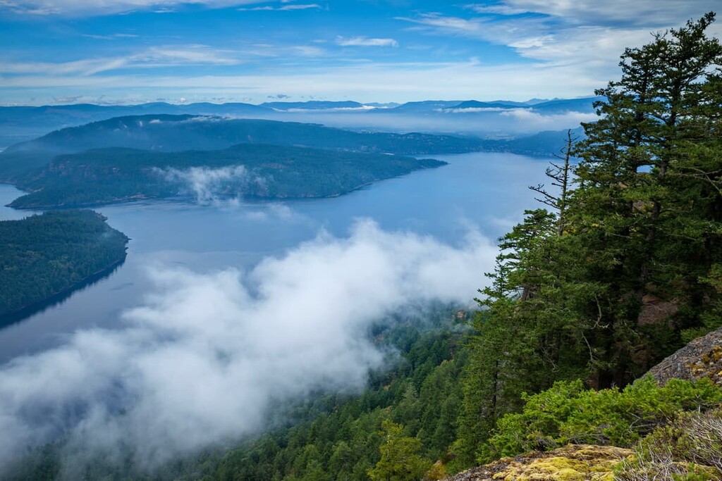
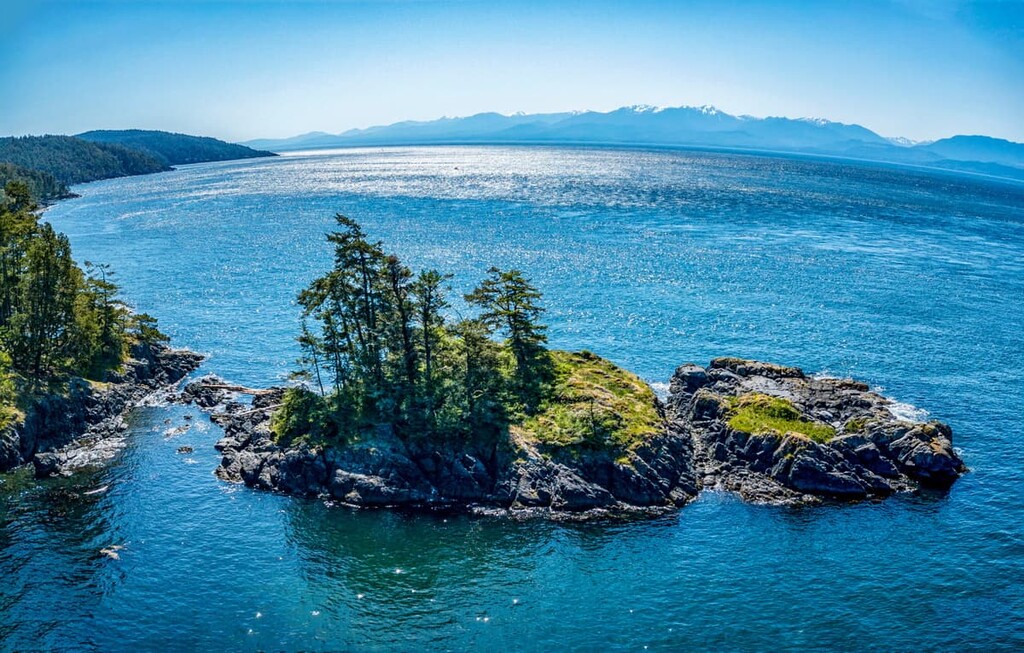
The Capital Regional District of British Columbia, Canada encompasses the western side of Vancouver Island to the south of Nitinat Lake. It extends southward to the Saanich Inlet and it also includes the Saanich Peninsula, as well as many of the region’s coastal islands, which are referred to as the southern Gulf Islands.
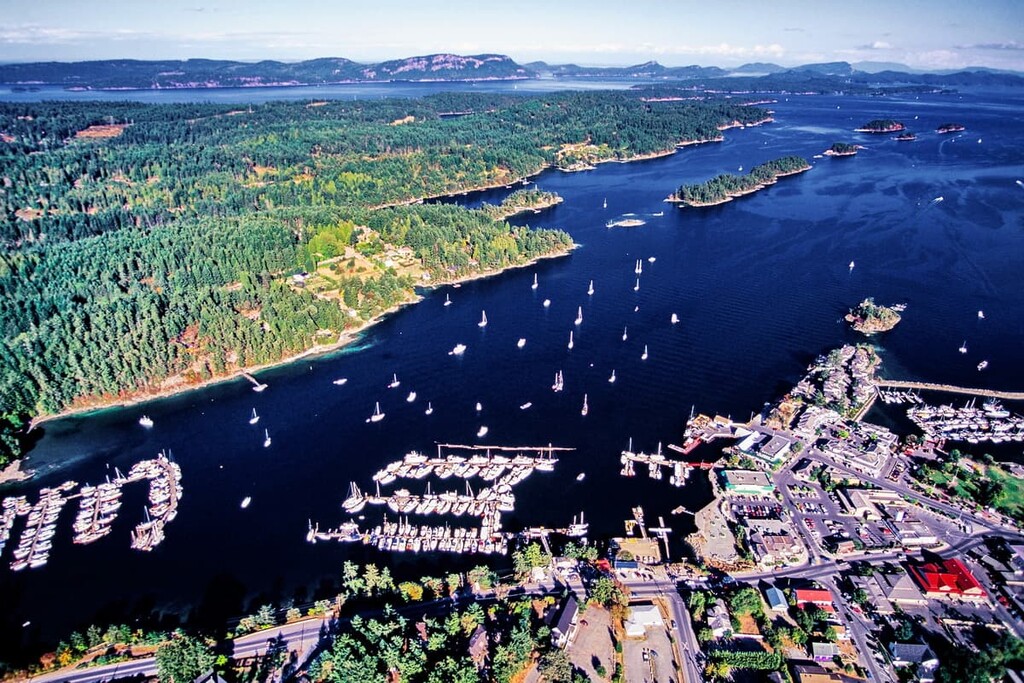
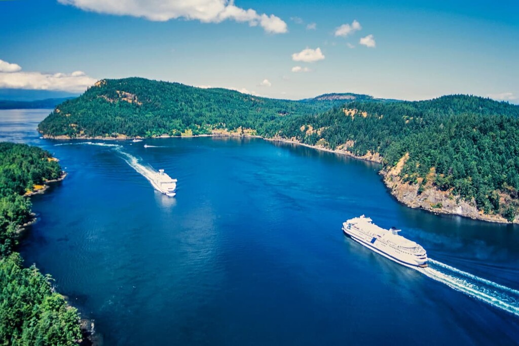
The southern Gulf Islands are located to the north of the Saanich Peninsula and the city of Victoria. Some of the larger islands that are part of the Capital Regional District are Galiano Island, Salt Spring Island, Prevost Island, Mayne Island, North and South Pender Islands, and Saturna Island. There are regular ferry services connecting the Gulf Islands to Vancouver Island and to mainland British Columbia.
Highway 1, which is part of the Trans-Canada Highway, runs from Victoria, the capital of British Columbia to Nanaimo, on the east coast of the island. Highway 17 connects the communities on the Saanich Peninsula, including Sydney, Saanich, and Victoria, while Highway 14 connects the communities on the west coast, such as Sooke and Port Renfrew, to the capital.
The Capital Regional District is home to the island’s major metropolitan area, which contains many independent municipalities. The city of Victoria is the heart of the Greater Victoria area, and it’s located on the south end of the Saanich Peninsula, bordered by Saanich and Esquimalt. Located further up the peninsula are Brentwood Bay, Saanichton, North Saanich, and Sydney.
Located just to the west of the Saanich Peninsula are the municipalities of Langford, Colwood, and Goldstream, all of which are also considered part of the Greater Victoria area. Down Highway 14, on the west coast of Vancouver Island, is the municipality of Sooke, which is only 40 km (24 mi) from Victoria, while Port Renfrew is located some 111 km (67 mi) west of Victoria.
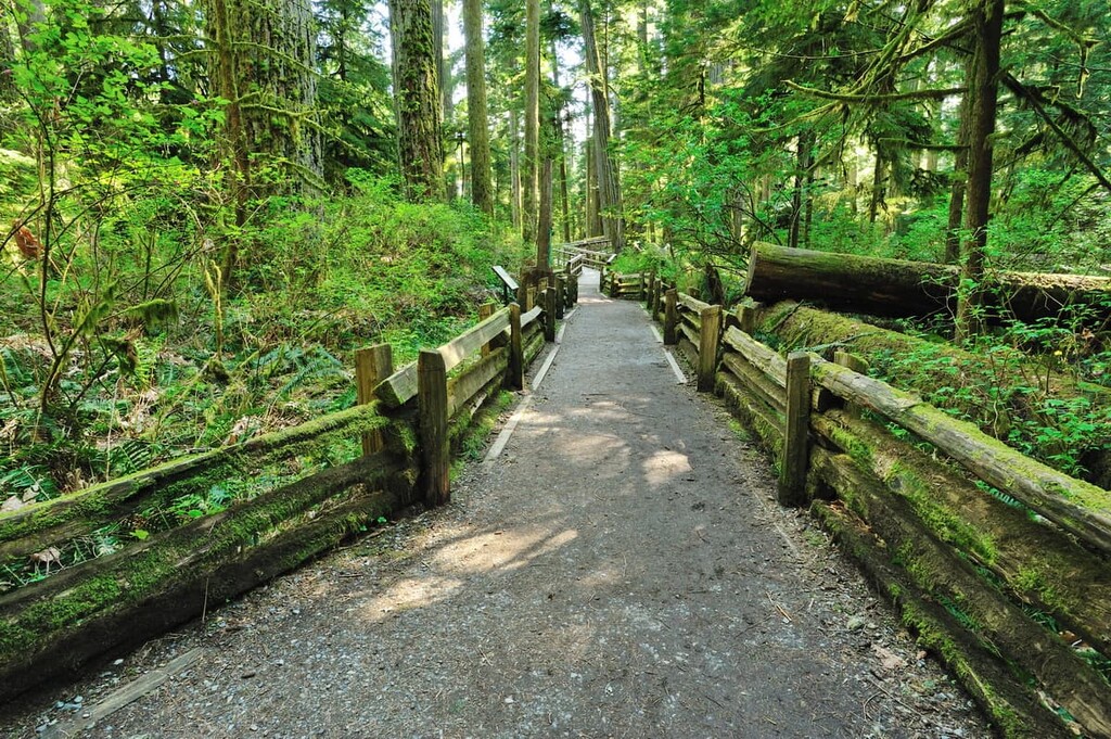
The Capital Regional District has an abundance of beautiful scenery and landscapes that are protected in provincial and regional parks. Many of the parks are incredibly accessible from the Greater Victoria area and all of them are stunningly beautiful. The following are some the national and provincial parks in the region to check out:
The following are some of the incredible regional parks that are worthwhile destinations with incredible wilderness, trails, and views:
The Capital Regional District is bordered by the Cowichan Valley Regional District on the east coast and the Alberni-Clayoquot Regional District on the west coast of Vancouver Island. The province’s border with the United States runs through the Juan de Fuca Strait, which is located to the south of Vancouver Island, and the Haro Strait, which is situated to the east of the Saanich Peninsula. You can easily see the state of Washington and Mount Olympus of Olympus National Park from the southwest coast of Vancouver Island.
While most of the geology of Vancouver Island has the same history, there are a couple of unique aspects of the geology of the Capital Regional District when compared to the rest of the island.
Nevertheless, most of Vancouver Island is the result of an ancient land mass called Wrangellia. Wrangellia started forming 380 million years ago, and its remnants now make up the land for most of Vancouver Island, southeast Alaska, the Queen Charlotte Islands, and part of the Coast Mountains.
Undersea volcanoes erupted out in the Pacific Ocean some 380 million years ago, covering a large area with lava deposits in the process. These lava deposits were the start of Wrangellia. For 150 million years, layers of marine sediments gradually covered the ancient undersea lava until the crust split, about 230 million years ago.
When the crust split, lava started flowing again, creating layers of basalt. Pillow basalt is commonly found along the coast of Vancouver Island and the basalt layer is the thickest and most widespread rock on Vancouver Island.
About 145 million years ago, Wrangellia started accreting to mainland Canada. This coincided with part of the Sevier orogeny, which created the Columbia and Coast Mountains of British Columbia. As the terrane collided with the mainland, some terrane buckled to form mountains while some crumbled and eroded away.
The Vancouver Island Ranges were taking form as Wrangellia was buckling under pressure against the mainland. The only named subrange in the Capital Regional District of the Vancouver Island Range is the Gowlland Range, which is located to the east of the Saanich Inlet and includes Mount Work.
At the end of the Laramide orogeny (the mountain formation event that was responsible for the Rocky Mountains) about 55 million years ago, two smaller terranes accreted to the west coast of Vancouver Island. The Pacific Rim terrane is protected as part of Pacific Rim National Park Reserve, while the Crescent terrane is marine volcanic rock that is the underlying rock of the areas of Sooke, Metchosin, and Colwood.
The Southern end of the Saanich Peninsula is composed of gneiss and granite, which was created from slow cooling undersea magma intrusions and subsequent metamorphosis. As the Pacific Rim and Crescent terranes collided and accreted onto the west coast of Vancouver Island they uplifted the southern end of the peninsula, exposing the granite above the ocean, upon which the Greater Victoria area was built.
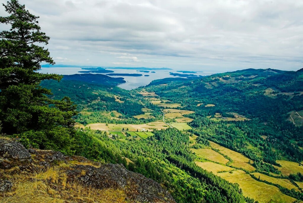
The Capital Regional District has two distinct ecological zones, the Coastal Western Hemlock zone, and the Coastal Douglas Fir zone, as well as a very distinct and abrupt border between the two. The border between the two zones is a line between the Saanich Inlet and the municipality of Metchosin. To the east of this line is the dry Coastal Douglas Fir zone, and to the west are the incredible rainforests of the Coastal Western Hemlock zone.
The Coastal Douglas Fir zone includes the Saanich Peninsula and the Gulf Islands. The area is considered to have an Inner Coast Climate that is Mediterranean-like. The precipitation and cloud cover of the peninsula and islands are greatly reduced compared to the rest of the west coast of Vancouver Island because they are in the rain shadow of the Olympic Mountains and the mountains of Vancouver Island.
There are many dry and warm climate plant species that thrive on the peninsula and Gulf Islands. Some of the unique trees are the arbutus and the Garry oak tree. The deep, sheltered, valley bottoms of the Coastal Douglas Fir zone are moister than the hilltops and there is a marked difference between the massive western hemlocks, Douglas fir, bigleaf maple, and cedars that grow lower down and the arbutus and Garry oak that thrive on the arid hilltops.
The Saanich Peninsula used to be covered with a mosaic of meadows and stands of arbutus and Garry oak trees. The meadows were long maintained by First Nations in the region who would use fire to clear trees, so the camas lily would easily grow and serve as a food source.
The lush coastal forests of western Vancouver Island are filled with giant Sitka spruce, red cedar, Douglas fir and western hemlock. These ancient old growth forests haven’t had a major fire for hundreds, or even thousands of years, and blowdown is the major cause of disturbance in the ecosystem. As trees fall, they decompose and provide nutrients to their replacement.
Moving inland, ridges steeply rise, and the dry-loving Douglas fir are more common; however, there are also more forest fires in the dry areas, so many of the forests are of the same age. The forests continue to rise to the subalpine where mountain hemlock, Pacific silver fir, and yellow cedar become the common trees.
The west coast of Vancouver Island receives double the precipitation of the Saanich Peninsula and the forest understory is significantly denser. Ferns and mosses are common across the island; however, the west coast forests are much denser than those of the Saanich Peninsula, in fact, the old growth forest of Carmanah Walbran Provincial Park has twice the biomass of a tropical rainforest.
The Capital Regional District has a history of human inhabitation that dates back at least 4,000 years. The Saanich Peninsula and the southeastern end of Vancouver Island is the traditional territory of Coast Salish nations while the west coast, around Jordan River and Port Renfrew is the traditional territory of members of the Nuu-chah-nulth Tribal Council.
The Indigenous communities of the region traditionally followed a seasonal round, camping along the coast or the banks and mouths of large rivers during the summer and moving to their permanent village for the winter. During the winter, several families would typically share a longhouse and there would be many celebrations and ceremonies throughout the cold season.
Europeans started sailing by Vancouver Island in 1774 when Spain sent an expedition to the area to assert their claim to the Pacific Northwest. The first recorded landfall on Vancouver Island by a European was by Captain James Cook, who landed at Nootka Sound in 1778. The first European trading post was established in 1786 by James Mears and initiated settlement and inland expansion.
It wasn’t until 1843 that the Hudson’s Bay Company built Fort Albert, which was renamed Fort Victoria, on the southern end of the island. The colony of Vancouver Island was established in 1849, and Captain Walter Grant was the first independent European settler to arrive. He eventually set up a homestead in what is now Sooke on the west coast of the island.
In 1862, Victoria was incorporated and became the capital of the Vancouver Island Colony. When the Vancouver Island Colony joined with the mainland British Columbia Colony, Victoria maintained its status as capital. Until 1886, when the Canadian Pacific Railway reached the Burrard Inlet, connecting Vancouver to the rest of North America, Victoria, with her naval base, was the most important city in western Canada.
While Victoria’s importance was overshadowed by the booming city of Vancouver, Victoria and the region have had steady growth continuing to the present day. The naval base and the government are major employers in the region; however, the technology industry has grown on the island and tourism is a major contributor to the local economy.
The Capital Regional District of British Columbia encompasses some incredible wilderness areas as well as some significant historical and natural attractions. The following are some places that are worth the time and effort to check out while on Vancouver Island.
Robert and Jennie Butchart came to Vancouver Island from Ontario in 1904 to build a cement plant at Tod Inlet where there was a rich limestone deposit. As the limestone was quarried, Jennie imagined a grand garden filling the landscape. Little by little, Jennie worked to bring in topsoil and plant a garden in the exhausted quarries.
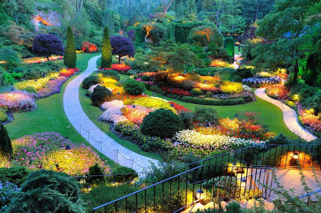
Over the next 30 years, the gardens were expanded with the construction of the Japanese Garden along the seaside, the Italian Garden on their former tennis court, and the Rose Garden. The Gardens were passed to their grandchild who transformed them into the world-renowned destination, which has become a National Historic Site of Canada.
The Gardens remain in the family and attractions are regularly added to the site. The gardens still have the remnants of the cement plant, and you’ll recognize the original limestone quarries that Jennie Butchart first planted. Currently there are millions of plants in over 900 varieties for you to enjoy as you wander through The Gardens.
The Juan de Fuca Marine Trail is a hiking trail that connects all the beaches of Juan de Fuca Provincial Park. The trail is 47 km (28 mi) long and its ends are at Botanical Beach in the west and China Beach in the east. While the trail is typically reserved as a strenuous day hike or a multi-day backpacking trip, there are several nearby areas that offer easier hikes if you’re looking for something more casual.
Botanical Beach in the north has unique ridges of shale and quartz that form huge tableaus that jut through the black basalt. The beach is also famous for the rich tidal pools that dot the sandstone and granite shore when the tide is low.
Sombrio Beach, along the Juan de Fuca Marine Trail is a popular destination for backpacking, surfing, and a day at the beach. If you hike down the beach, you can search for the creek to follow up to a stunning, hidden waterfall.
Gowlland Tod Provincial Park is on the eastern shore of the Saanich Inlet, in the Capital Regional District. It is a stunningly beautiful wilderness area that has many hikes through the forest and many spectacular viewpoints of the Saanich Inlet and Salt Spring Island.
The park protects the natural area of the Gowlland Range, which is one of the last remaining natural areas in Greater Victoria. The Gowlland Range has significant biodiversity with over 150 different plant and animal species identified to date. Rare and protected species that are found in the park include the northern red-legged frog and the fragrant white rein orchid.
There are about 25 km (15 mi) of hiking trails in Gowlland Tod Provincial Park. Some of the destinations and trails are Holmes Peak, Jocelyn Hill, and the Squally Reach Viewpoint. Most of the hikes start down in the valley and climb though incredible Douglas fir and cedar forests to end on the meadowed ridge with stands of beautiful arbutus trees.
Along the west coast of Vancouver Island, near the municipality of Sooke, is the East Sooke Regional Park. There are 50 km (30 mi) of trails that lead through a variety of landscapes, including dense coastal forest, open meadows, rocky and sandy beaches, and even an old apple orchard.
There are pocket beaches to enjoy, as well as rocky bays and tide pools to explore. Scuba diving and snorkeling are some of the ways to view marine wildlife. There are also beautiful views of the Juan de Fuca Strait and the Olympic Mountains in the state of Washington.
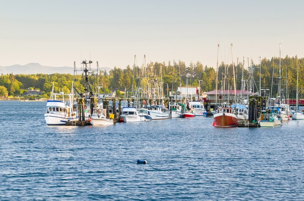
The Capital Regional District is home to the densest metropolitan area on Vancouver Island. In addition to the Greater Victoria area, there are many beautiful towns and communities from which to find amazing seaside and wilderness experiences. The following are some of the major cities and towns that are worth visiting while in the region.
As the capital of British Columbia, Victoria has been a major and important city for over 150 years. While it had humble beginnings as a trading post for Hudson’s Bay Company, Victoria became the capital of the Vancouver Island Colony and a beautiful colonial gem of the west coast.
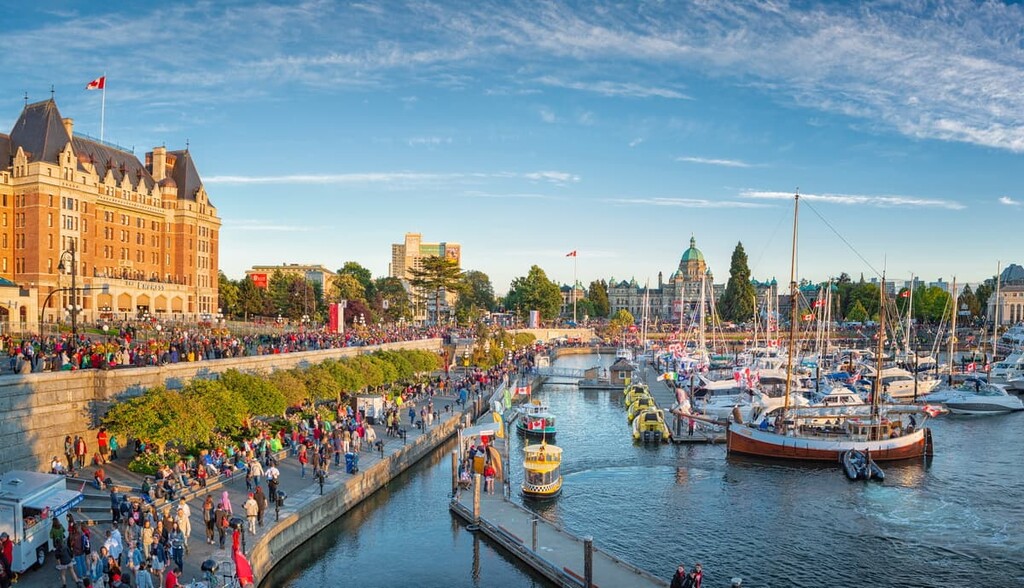
The city has a strong British colonial history, which is apparent in the architecture of many of the historic buildings in Victoria. Two famous landmarks are the Parliament Building, which was completed in 1897, and the Empress Hotel which opened in 1908.
Victoria’s Chinatown is the second oldest in North America, after that of San Francisco, and there is a beautiful First Nations cultural presence throughout the city as well. In addition to the historic buildings and communities, other city attractions are Beacon Hill Park, Butchart Gardens, and the Shaw Ocean Discovery Centre.
There are also some great walking and hiking trails around the city and near Victoria. Some trails to look for are the Coast Trail near Aylard Farm in East Sooke Regional Park, the Mount Work Trail, Thetis Lake Trail, Mount Douglas Hiking Trails, and the Niagara Falls Hiking Trail in Goldstream Provincial Park.
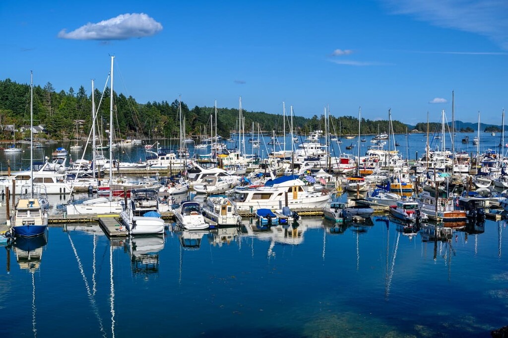
Located at the north end of the Saanich Peninsula, Sidney is situated close to the Victoria airport and the Swartz Bay ferry terminal, the latter of which brings in passengers from mainland British Columbia on a daily basis. While Sidney is considered part of the Greater Victoria Metropolitan area, it has charm and personality that are unique and worth a visit.
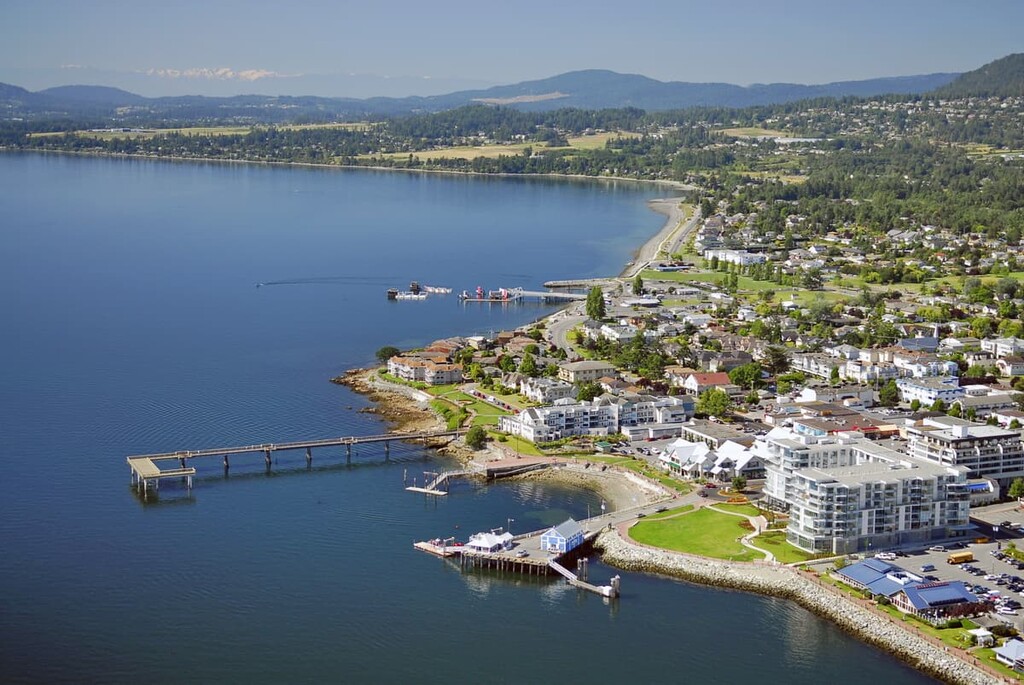
Sidney is the gateway to the southern Gulf Islands National Park Reserve which is an eco-tourist destination with scuba diving, bird watching, kayaking, and whale watching. Additional wildlife experiences can be found at the Shaw Ocean Discovery Centre and the Shoal Harbour Migratory Bird Sanctuary.
Sidney has a local history museum, an aviation museum, street markets, and annual festivals and celebrations. One of the unique attractions are the dozen or so bookstores that can be found downtown on almost every street. The bookstores, quaint cafes and restaurants, and a delicious bakery ensure that a visit to Sydney can be quite relaxing and enjoyable.
Located on the west coast of Vancouver Island, Sooke is one of the main municipalities in the Capital Regional District. Sooke has long been a popular tourist area with destinations such as Sooke Potholes Provincial Park and the adjacent Sooke Potholes Regional Park, as well as Whiffin Spit Park, and the East Sooke Regional Park with its Coast Trail.
Sooke is rapidly gaining popularity with mountain bikers as local clubs are expanding trails, as well, Sooke is a popular jumping off spot for some of the major trails in the area such as the Juan de Fuca Marine Trail and the West Coast Trail.
Between Sooke and Port Renfrew are some of the most incredible beaches, including Sandcut, French Beach, Fishboat bay, and China beach. Further up the west coast are Mystic beach, Sombrio beach with great surf and a waterfall to discover, and the incredible Botanical beach with its unique rock formations and colorful tidal pools.


