
Scan the QR code and open PeakVisor on your phone
ȽÁU,WELṈEW̱/John Dean Provincial Park is a protected area that’s located on the Saanich Peninsula of Vancouver Island in British Columbia, Canada. The small provincial park encompasses only one mountain, ȽÁU,WELṈEW̱ (Mount Newton), which is 306 m (1,004 ft) tall and has 245 m (804 ft) of prominence.
Vancouver Island, off the west coast of mainland British Columbia, Canada, is home to many incredible provincial and regional parks. ȽÁU,WELṈEW̱/John Dean Provincial Park is one of the many parks on the island. It’s situated in the Capital Regional District on the Saanich Peninsula to the east of the Saanich Inlet.
This 174 ha (430 acre) park sits atop Mount Newton, or ȽÁU,WELṈEW̱. Mount Newton is the only summit in the park and it is 306 m (1,004 ft) tall and has 245 m (804 ft) of prominence.
The name ȽÁU,WELṈEW̱ means “place of refuge” in Saanich (also known as Sencoten and written as either Sənčáθən or SENĆOŦEN).
Saanich is the Salishan dialect that’s traditionally spoken by the First Nations Saanich (W̱SÁNEĆ) people. This includes members of the Pauquachin First Nation (BOḰEĆEN) who currently hold title to three reserves, including one that borders the park.
Other parks on and near the Saanich Peninsula in the Capital Regional District are:
The oldest rocks on Vancouver Island started out as lava flowing from undersea volcanoes 380 million years ago. Over the next 100 million years, marine sediment slowly accumulated on top of the lava.
Then, approximately 230 million years ago, the Earth’s crust opened and massive amounts of lava poured out creating a 6 km (3.6 mi) thick layer of basalt. This basalt now forms most of the rocks of Vancouver Island.
About 100 million years ago, this land mass, called Wrangellia, collided with North America. This caused some of the land to buckle and form mountains while other parts crumbled and eroded away.
The rocks that form Mount Newton were all part of Wrangellia, whereas other parts of the Capital Regional District are also made from the Pacific Rim and Crescent terranes. Mount Newton is composed of the Island Plutonic suite of rocks, which contains mostly granodiorite and quartz diorite.
By 38 million years ago, the basic geologic features of Vancouver Island had formed, and were now fully subjected to the sculpting powers of erosion. Massive topographical changes occurred during the Pleistocene where at least four glacial maximums, and possibly as many as 20, scoured the island mountains.
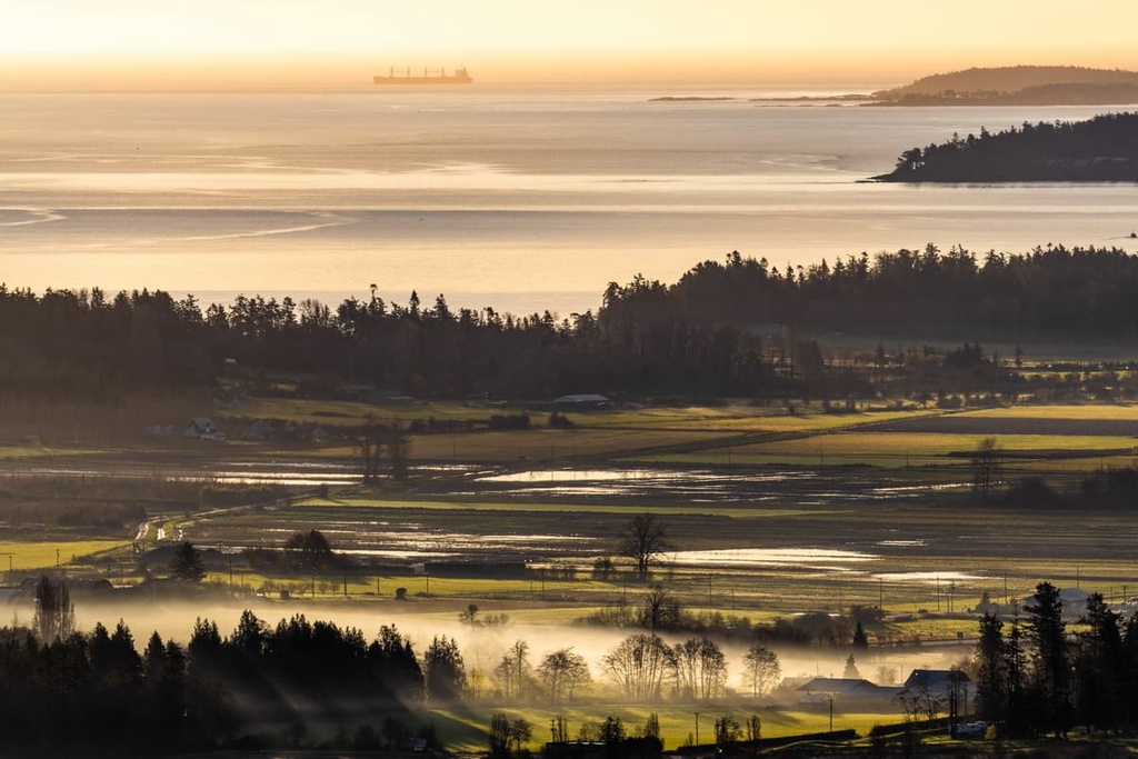
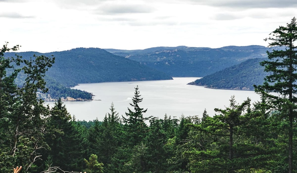
The Finlayson Arm and the Saanich Inlet were the result of glaciers forming in the mountains and eroding large U-shaped valleys as they moved toward the coast. The last glaciers melted from southern Vancouver Island about 9,000 years ago.
As the ice sheet and glaciers melted away 9,000 years ago, Vancouver Island gained elevation as it rebounded from the depressing weight of the ice sheet. As worldwide temperatures increased, melting glaciers worldwide, the sea level rose and submerged some of the coastline again, filling areas such as the Saanich Inlet.
The collision of tectonic plates and the subsequent formation of mountains is still actively occurring near and across Vancouver Island.
To the west of Vancouver Island, the Juan de Fuca plate is still actively subducting beneath the North American Plate. The subduction process is rarely smooth and it normally happens in bursts, causing earthquakes and tremors of varying magnitude across the island and mainland Canada.
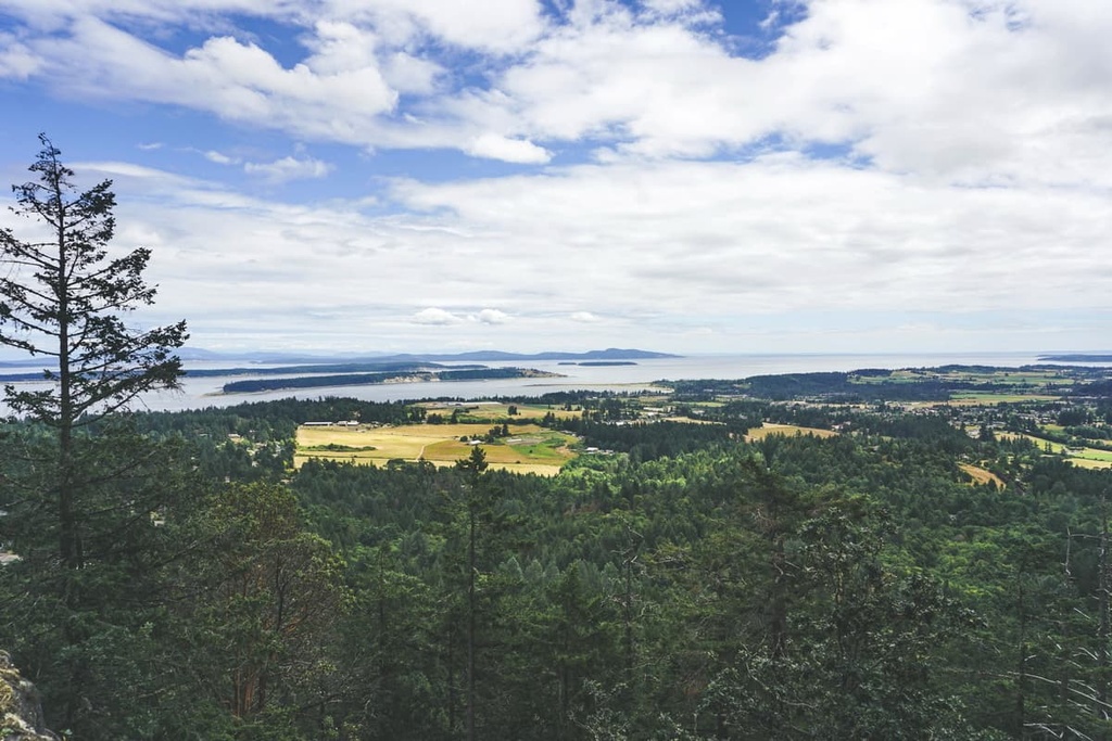
The ecology of ȽÁU,WELṈEW̱/John Dean Provincial Park is that of the Coastal Douglas-fir zone. The park lies in the rain shadow of the Vancouver Island ranges as well as the Olympic mountains, creating a Mediterranean-like climate.
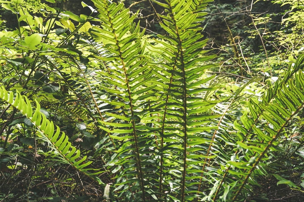
Massive Douglas fir and red cedars reach from the valleys towards the skies in the park. Many of the old trees show scars from the forest fires that have occurred in the area over the past couple hundred years. The mossy trunks of bigleaf maple, alder, and western coastal hemlock add to the valley forests.
While climbing to the summit of ȽÁU,WELṈEW̱ (Mount Newton), the ecology transitions to parkland with open grassland amid the rocky outcrops. The arbutus, Garry oak, and manzanita tree are the dominant tree species in the region, as they are adapted to the dry, acidic soil conditions on the hill tops.
Columbian black-tailed deer are the most common animal to see in the park, though they are just one of many species in the region. Black bears and cougars may be found in the park, too; however, the proximity and isolation of the park within the Greater Victoria area prevents typical animal migration.
While hiking in the island’s mountains, you may be fortunate to hear or see one of the rare island marmots. From the summit and slopes of Mount Newton, ravens, red-tailed hawks, bald eagles, and turkey vultures can also be seen perched in the trees along the coast or soaring through the air.
ȽÁU,WELṈEW̱ (Mount Newton) has a prominent place in the history of the Saanich people, as ȽÁU,WELṈEW̱ means “place of refuge” in the Sencoten dialect. This name is a reference to the place where the ancestors of many First Nations on what is now Victoria Island managed to take refuge during the Great Flood.
For thousands of years, the story of the Great Flood and their ancestors who survived it, has been told by the elders of the First Nations. During the flood, which is thought to have occurred many thousands of years ago, the ancestors sought refuge in their canoes as the water was flooding the land.
Fearing being washed away; they used a long cedar rope to tie their boats to an arbutus tree on the top of a mountain. ȽÁU,WELṈEW̱ is revered as the mountain to which the ancestors anchored their canoes and were saved during the flood.
When the flood waters receded and the ancestors came down from the mountain, they were named the Wsanec (Saanich), “the emerging people.” The story of the Great Flood is a shared theme in the history of many of the First Nations that inhabit Vancouver Island.
Early descriptions of the mountain describe large stone rings of white stone that were placed by the Saanich. A portion of the park became part of the homestead of John Dean, an early settler of European descent on Vancouver Island. In 1921 Dean donated 32 hectares of property to the park. Later, four other settlers who then contributed land to the park.
Remnants of the homesteads are still present and visible in the park. ȽÁU,WELṈEW̱/John Dean Provincial Park was created December 9, 1921 covers 174 ha (430 acres) of land in the southern part of Victoria Island.
Since the park only covers 174 ha (430 acres) there is limited space for hiking trails; however, there are still 6 km (3.6 mi) of trails that include easy walking routes and a more strenuous hike to the summit of Mount Newton.
Some of the main attractions of the park are the old growth Douglas fir forests, which contain some of the oldest Douglas fir trees on the Saanich Peninsula. Visitors can also check out the Garry Oak ecosystems, which are rare and endangered.
The park has trails that wind around Mount Newton, so you can experience different views of the region. There is also a viewing platform that has stunning views of the Gulf Islands.
Other features of the park are beautiful ponds and creeks as well as the old homesteads. While the park is located in the dry climate of the Saanich Peninsula with its coastal Douglas fir ecology, when it rains, the trails can get very slippery and should be navigated with caution.
ȽÁU,WELṈEW̱/John Dean Provincial Park is located within Greater Victoria. As such, it is surrounded by many communities and cities. The following are some of the cities that are near the park and that are worth checking out.
Victoria was the first European settlement built on Vancouver Island. It is also the current seat of the provincial government of British Columbia. Victoria has an international airport that services the island, as well as a major seaport that receives thousands of people daily.
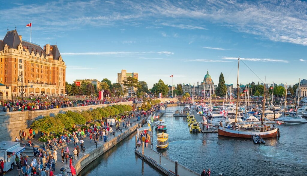
The city has many historic buildings, some of which date back to the nineteenth and early twentieth centuries. Other attractions in Victoria are Beacon Hill Park, Butchart Gardens, and the Shaw Ocean Discovery Centre. Victoria Harbour is a beautiful place to visit, and you’ll soon understand why Victoria is called the “Garden City.”
Victoria is surrounded by beautiful beaches, islands, and some incredibly scenic parks. Gowlland Tod Provincial Park, Thetis Lake Regional Park, Mount Work Regional Park, and Lone Tree Hill are just several of the amazing and accessible hiking and recreation areas near Victoria.
Located on the north end of the Saanich Peninsula, Sidney is only minutes away from John Dean Provincial Park. While considered to be a part of Greater Victoria, Sidney has a charming small town feel and it’s a great place to stroll downtown or to walk along the shoreline.
Sidney is considered to be a “Book City” because of all the bookstores it has. While walking down the main street you may be surprised at how different all the bookstores are.
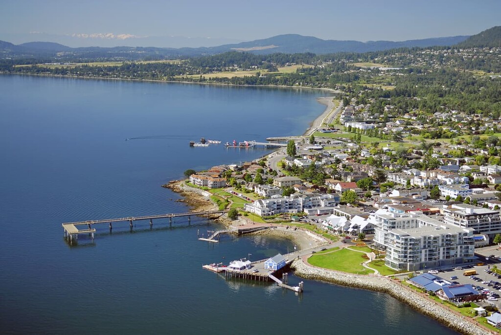
Part of the Sidney charm is all the town’s bookstores, as well as its many coffee shops where, after purchasing your new book, you can unwind. Or, if you’d prefer, there are benches along the pier where you can watch people crabbing and fishing while reading your new book.
Just north of Sidney is the ferry terminal at Swartz Bay where you can board a ferry to one of the many destinations in the Gulf Islands. You can Island hop and see the various parts of the Gulf Islands National Park Reserve. Or, you can find your way to Salt Spring Island to discover the beautiful beaches and Mount Maxwell Provincial Park.
If you’re lucky, you’ll get a chance to visit the Highlands, because there are literally over 100 unique trails and dozens of peaks to summit within 10 km (6 mi) of the city. In fact, John Dean Provincial Park is less than 25 km (15 mi) away from Langford.
The Highlands is home to the Caleb Pike homestead, which was built in 1883. It is now a national historic place and there are easily over 100 amazing hikes within 10 km (6 mi) of the Highlands.
For example, Gowlland Tod Provincial Park, Goldstream Provincial Park, Thetis Lake Regional Park, Mount Work Regional Park, Sooke Hills Wilderness Regional Park, and Mount Wells Regional Park are situated only minutes from the city.
If you’re willing to drive only a little further you can reach the incredible wilderness areas of Sooke Mountain Provincial Park, Sooke Potholes Provincial and Regional Parks, Sea to Sea Regional Park, Old Baldy Mountain Park, and East Sooke Regional Park.
Plus, the city has fantastic restaurants for visitors to check out. There are also many “mom and pop” stores that are fun to go to in order to support the local economy and to maybe have a good conversation with the owner.


