Scan the QR code and open PeakVisor on your phone
Sea to Sea Regional Park is in the Capital Region of British Columbia, Canada, on Vancouver Island. As the second-largest regional park in the Capital Region, Sea to Sea encompasses nearly 4,000 ha (9,884 acres) of land, including 18 named mountains. Empress Mountain is the tallest peak in the park with an elevation of 682 m (2,238 ft) and 473 m (1,552 ft) of prominence.
Sea to Sea Regional Park is situated in the southern part of Vancouver Island in British Columbia, Canada. Located in the Capital Regional District, Sea to Sea is part of a corridor of protected green spaces that traverses Vancouver Island between the Juan de Fuca Strait and the Saanich Inlet.
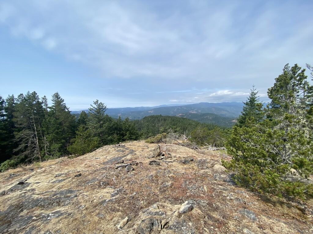
Encompassing nearly 4,000 ha (9,884 acres) of land, Sea to Sea Regional Park contains 18 mountains, 57 km (34 mi) of designated hiking trails, and the tallest mountains in the Capital Regional District. The tallest and most prominent mountain in the park is Empress Mountain with an elevation of 682 m (2,238 ft) and 473 m (1,552 ft) of prominence.
To reach Sea to Sea Regional Park, follow Highway 1 from Victoria and take the exit for Millstream Road towards Sooke onto Highway 14. Finally, follow Highway 14 until Harbourview Road, which leads into the park. The drive from Victoria takes approximately 45 minutes.
As it is part of a corridor of natural areas that stretches from west to east coast of Vancouver Island, there are many natural areas near Sea to Sea Regional Park. Some of the nearby parks include:
Other noteworthy parks that are in the region are Gowlland Tod Provincial Park, Mount Work Regional Park, Lone Tree Hill Regional Park, and Thetis Lake Regional Park.

The mountains of Sea to Sea Regional Park are part of the Vancouver Island Ranges, which in turn are a subrange of the Insular Mountains. The Insular Mountains are the westernmost range of the Western Cordillera. They are followed by the Coast Mountains, Columbia Mountains, and the Rocky Mountains, the latter of which are the easternmost of the Cordillera ranges.
Vancouver Island and Haida Gwaii are home to some of the higher elevations of the Insular Mountains. These areas were fully exposed during the last glacial maximum, 18,000 years ago.
At the time of the last glacial maximum, which is called the Fraser Glaciation, Vancouver Island was covered with over 1,000 m (3,280 ft) of ice and the continental shelf was a broad coastal plain, extending from the current mainland to west of Vancouver Island.
The Insular Mountains started forming about 380 million years ago as undersea volcanoes erupted and formed a massive layer of basalt on the ocean floor. For the next 100 million years, sediment accumulated over the lava and finally, about 280 million years ago, the thickest layer was added as the Earth’s crust split and lava flowed outward, creating a 6 km (3.6 mi) thick layer of basalt.
The land mass was named Wrangellia, and about 100 million years ago, the Insular plate, on which Wrangellia was created, began subducting beneath the North American plate. As the Insular plate subducted, a terrane known as Wrangellia accreted to the western edge of what is now North America.
During the collision, parts of Wrangellia and the western edge of British Columbia buckled, forming mountains, while other parts crumbled and were eroded away. The Wrangellia collision coincides with the Sevier orogeny, which was the mountain building event that was responsible for the creation of the Columbia and Coast Mountains.
During the Pleistocene, it’s estimated that at least four and up to 20 glacial maximums scoured the Vancouver Island Ranges. It’s likely that the glaciers that formed in or near Sea to Sea Regional Park were responsible for the creation of the glacial valley that became the Saanich Inlet.
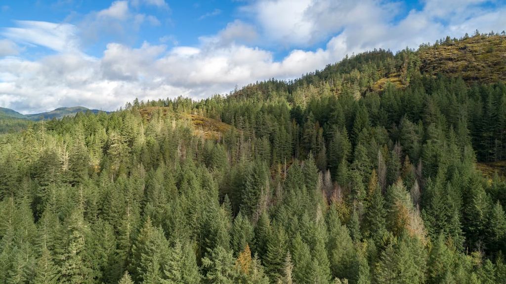
The entirety of Sea to Sea Regional Park is part of the Coastal Western Hemlock Zone. The Coastal Western Hemlock Zone is characterized by warm, moisture-laden Pacific winds that are pushed onto the coast where the mist and fine rain falls through the forest canopy into the thick understory. This is one of Canada’s wettest climates and, as such, one of the most productive forest areas.
The forest of the Coastal Western Hemlock Zone and in particular, the forests of Sea to Sea Regional Park, are dominated by massive western hemlocks and western red cedars. Douglas fir and bigleaf maple are common in drier areas where the water quickly drains. Additionally, alder is also found in the park.
The old-growth forests of Sea to Sea Regional Park provide important habitat for the animals of the region. The forests provide shelter and forage for black tailed deer, while the park also has black bears, cougars, and many different bird species.
Some of the highlights to look for in Sea to Sea Regional Park are the calypso orchid and the pileated woodpecker. A popular pastime of people on Vancouver Island is to admire the bald eagles as they soar overhead and hunt for food in the region’s forests and rivers.
There are three main Indigenous groups on Vancouver Island. These First Nations have inhabited the island for countless generations. The three main Indigenous groups are the Coast Salish, Kwakwaka’wakw, and the Nuu-chah-nulth, of which, Sea to Sea Regional Park is part of traditional Coast Salish Territory, and specifically that of the T’sou-ke Nation.
There is evidence of human habitation on Vancouver Island starting at least 4,000 years ago. Indeed, it is possible and likely that groups of people inhabited the broad coastal plain that existed during the Fraser Glaciation, which ended about 10,000 years ago.

The Coast Salish are descendants of the survivors of a great flood that covered the island. Their ancestors boarded canoes with their food and supplies, and as the tide continued to rise, they paddled to the tallest mountains where they tied their canoes to a tree. Their origin story says that those who were not prepared were washed away, and that those who lived are the ancestors of the many Coast Salish First Nations.
The T’sou-ke First Nation oral history tells of hunting and gathering within Sea to Sea Regional Park. Forest products for medicinal, spiritual, household, and food use were traditionally gathered by the T’sou-ke, as was blue camas, which were harvested throughout the region.
Seasonal camps were set up along the shores of the lakes, where fish and game were processed for easier transport to coastal villages. Most of the history of the First Nations of the region is known by oral tradition and generational knowledge as there is very little archaeological evidence in Sea to Sea Regional Park.
Europeans arrived on the south end of Vancouver Island, in what is now the Capital Regional District, in the nineteenth century. Colonial settlement across the island began as Europeans found fertile land for agriculture and were in awe of the massive trees that crowned the island. After the fur trade declined, forestry, agriculture, and mining were the main industries of the region.
The vision for protected areas in the region began in 1928 with the founding of Sooke Mountain Provincial Park. In time, an uninterrupted belt of protected land from the Juan de Fuca Strait to the Saanich Inlet was acquired by the regional government. The Sea to Sea Regional Park is now a part of this protected corridor.
With 57 km (34 mi) of official trails in Sea to Sea Regional Park, there are hikes that lead to nearly all the peaks of the park. The following are some of the popular trails in Sea to Sea Regional Park.
The trek to the summit of Empress Mountain via the Harrison and Todd Creek Trails is a 14 km (8.4 mi) out-and-back hike with 627 m (2,056 ft) of elevation gain. The trail is generally wide and easy to walk; however, there are some more adventurous sections that use the creek bed as the trail. The views from the summit are beautiful.

Empress Mountain is the tallest mountain in Sea to Sea Regional Park as well as the entire Capital Regional District. With 523 m (1,715 ft) of elevation gain over 12.6 km (7.5 mi), this trail to the summit of Empress Mountain is considered difficult. While the trail offers few views while you hike, the summit view is spectacular and is well worth the effort.
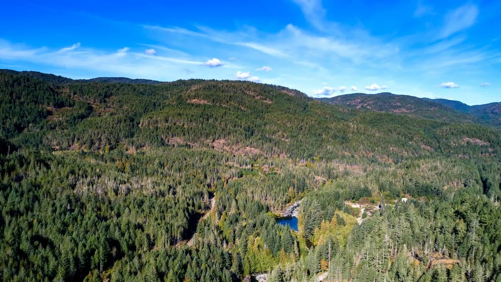
Shields Lake is one of several lakes in the Sea to Sea Regional Park and is one of the most popular destinations for backpackers in the region. The Shields Lake Campsite is accessible via the 8.5 km (5 mi) Grass Lake Trail, which follows the Charter River past Grass Lake to the sites at Shield Lake. There are several rustic campgrounds around both Shield and Grass Lake.
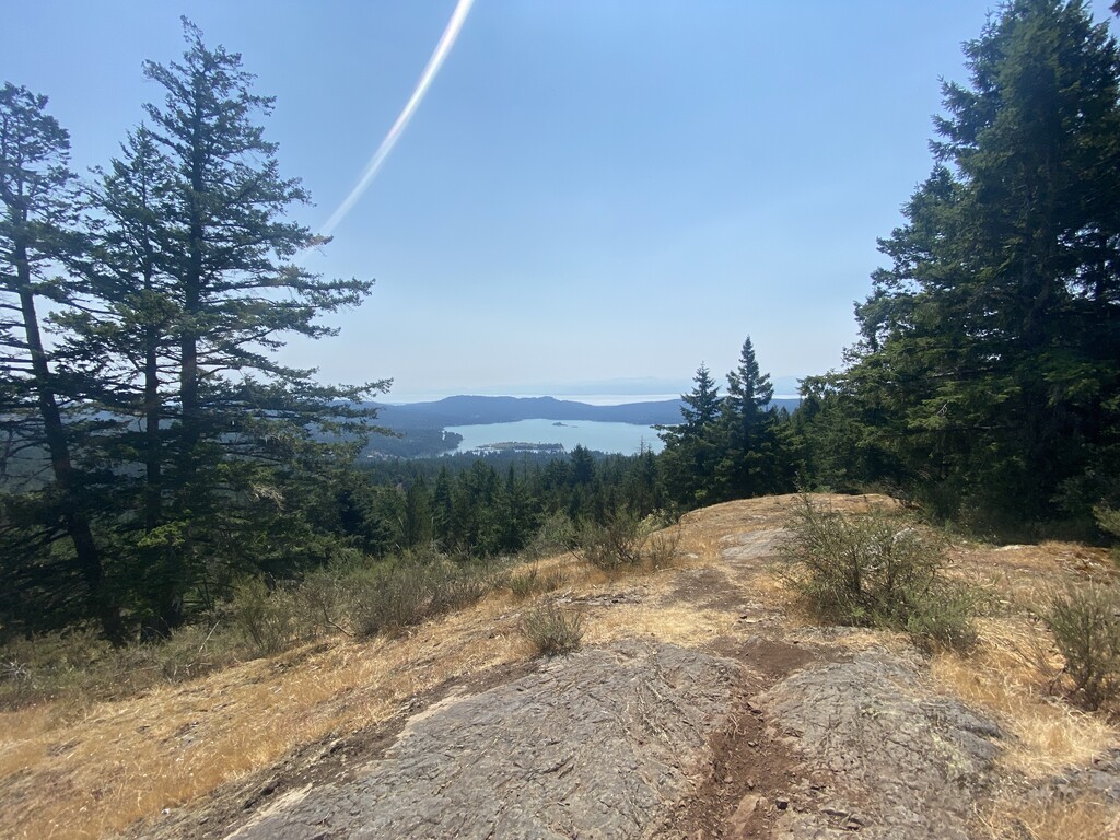
The 10 km (6 mi) loop to Mount Manuel Quimper is a moderately difficult trail with 478 m (1,567 ft) of elevation gain. The well maintained trail is a nice mix of challenging and easy sections leading to the summit of Mount Manuel Quimper. From the summit, there are lovely views of Sooke Harbour.
With the relatively low elevations and high concentration of mountain peaks in the Sea to Sea Regional Park, there are many peaks with hiking trails to their summits. The following are some of the peaks with trails leading to their views from their summit.
Empress Mountain and Mount Manuel Quimper are great hikes that have already been mentioned.
Puzzle Peak, Screen Hill, West Clapper, Devastation Hill, Pleasant Mountain, and The Emperor are situated on the east side of the park and have hiking trails to their summits. Meanwhile, Larkspur South, Rick Peak, Todd Hill, Elephant Hill, Lunch Peak, White Rock, Black Bear Mountain, Trafalgar are located on the west side of the park and offer exceptional views.
There are also several peaks that are just outside the park; however, regional trails lead to their summits. These peaks include Larkspur North, Monument Mountain, Pinnacle Peak, and Land’s End.
Due to its location in the Capital Regional District of British Columbia, Sea to Sea Regional Park is in the most densely populated district of Vancouver Island. The following are some of the many places to stay and explore while traveling to or from your adventures in the park.
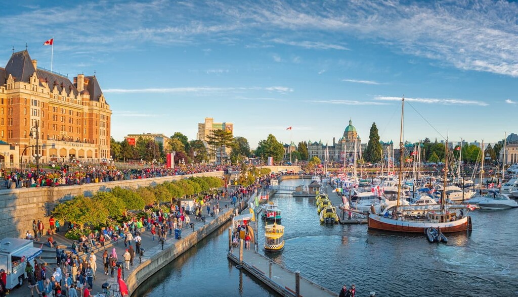
Greater Victoria is the metropolitan area of Victoria, the capital of British Columbia. The metropolitan area includes the cities of Victoria, Esquimalt, Saanich, Sidney, Langford, Colwood, and several other communities. Victoria proper is only 36 km (21.6 mi) from Sea to Sea Regional Park.
The area is home to nearly half the population of Vancouver Island and there are many natural areas nearby with hundreds of trails to explore. Some of the great areas to explore are Gowlland Tod Provincial Park, East Sooke Regional Park, Mount Work Regional Park, and Thetis Lake Regional Park.
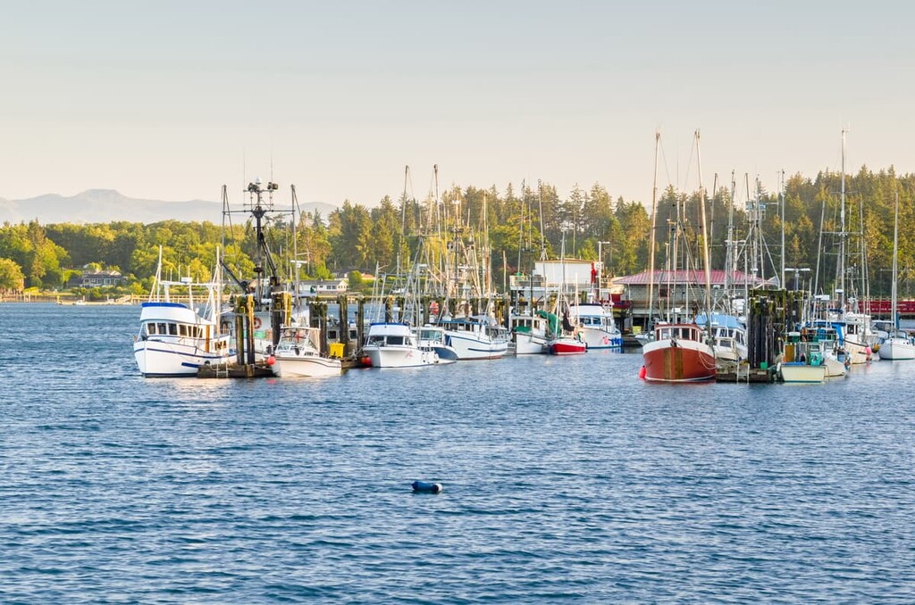
Located on the southwest coast of Vancouver Island, the municipality of Sooke is less than 10 km (6 mi) southwest of Sea to Sea Regional Park. Sooke is a small community that has been a popular tourist destination for generations.
Some of the wilderness and natural highlights around Sooke can be found at Sooke Potholes Regional Park and the adjacent Sooke Potholes Provincial Park, Whiffin Spit Park, and East Sooke Regional Park.
Sooke is also popular for the stunning beaches that surround it and the neighboring communities of Jordan River and Shirley. Some of the beaches that are worthwhile to visit are Sandcut Beach, Mystic Beach, French Beach, China Beach, and Fishboat Bay.