Scan the QR code and open PeakVisor on your phone
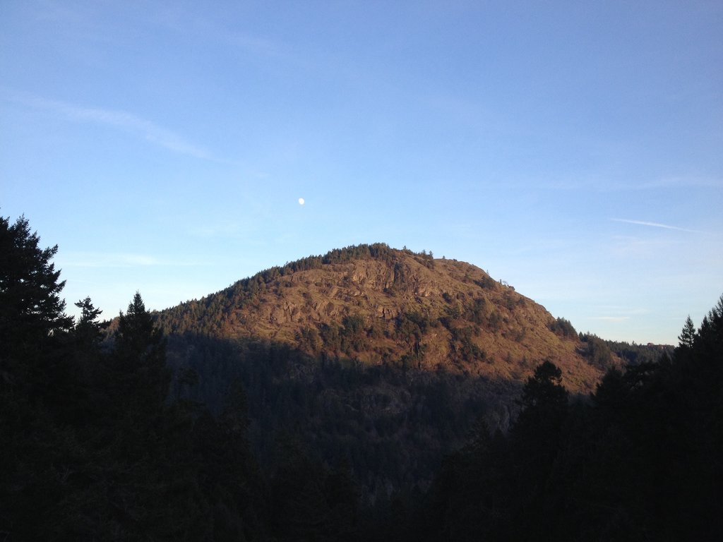
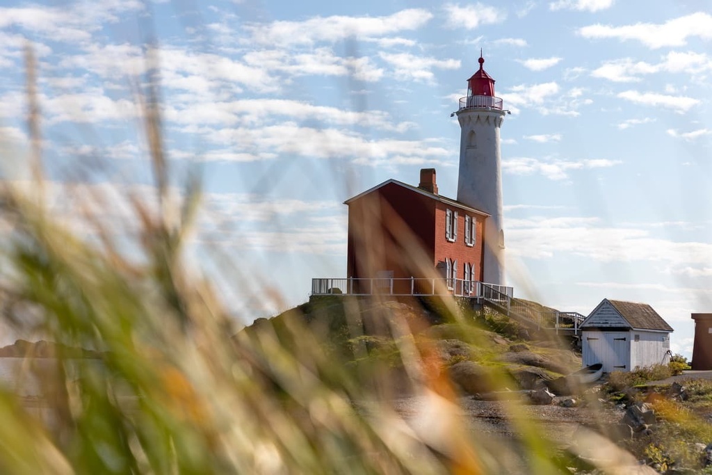
Goldstream Provincial Park is a protected outdoor recreation area that’s located at the end of the Saanich Inlet on Vancouver Island in British Columbia, Canada. The park has several waterfalls, one of which cascades down a 47 m (154 ft) cliff, a beautiful vehicle-accessible campground, and a single peak, Mount Finlayson, which is 417 m (1,368 ft) tall.
While only a 15 minute drive from Victoria, the capital of British Columbia, Canada, Goldstream Provincial Park feels like a remote wilderness park. The park straddles the Trans-Canada Highway as it leaves the city of Langford; however, the highway makes it difficult to get from one side of the park to the other.
Goldstream Provincial Park is located at the end of the Finlayson arm of the Saanich Inlet. It is also adjacent to several other wilderness provincial and regional parks. The following are the other parks that are near Goldstream Provincial Park:
Goldstream Provincial Park is part of a corridor of parks and protected areas that compose a continuous band of protected areas across the southern half of Vancouver Island.
Vancouver Island and the Capital Regional District, in particular, have a fascinating geological history that begins about 380 million years ago. During this time, about 380 million years ago, volcanoes erupted on the floor of the Pacific Ocean and massive amounts of lava spread across the sea floor.
After these volcanic eruptions, the resulting volcanic rock was covered up by marine sediments. This sediment deposit continued for about 150 million years.
Later, the Earth’s crust opened once again to add a massive 6 km (3.6 mi) thick layer of basaltic rock to the forming Wrangell terrane. Most of the Saanich Peninsula is part of Wrangellia, including a significant part of Goldstream Provincial Park. This terrane is dominated by gabbroic and quartz dioritic gneisses with areas of older metavolcanic and metasedimentary rock.
However, the parts of Goldstream Provincial Park that surround the Finlayson Arm of the Saanich Inlet and the area to south of the inlet are part of the Pacific Rim terrane.
This area of the park is underlaid with metamorphosed mudstone, sandstone, chert, and mafic volcanic rocks that are greater than 100 million years old. They are also cut by 88 million-year-old granitic rocks.
Later, this area was then uplifted as the Crescent terrane subducted beneath the Pacific Rim terrane some 43 million years ago. Then, 2 million years ago, during the Pleistocene, an ice-sheet and glaciers covered Vancouver Island.
A glacier later flowed through the Saanich inlet, carving out the deep, steep sided slopes that we see in the inlet today. The glacier eroded away any overlaying Wrangell terrane to expose the Pacific Rim terrane that had accreted to the west side of the island.
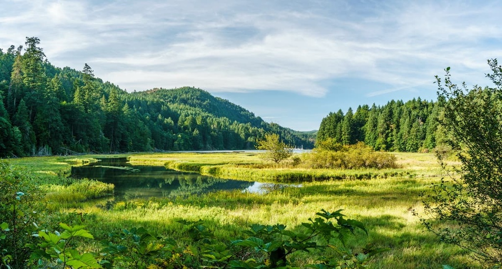
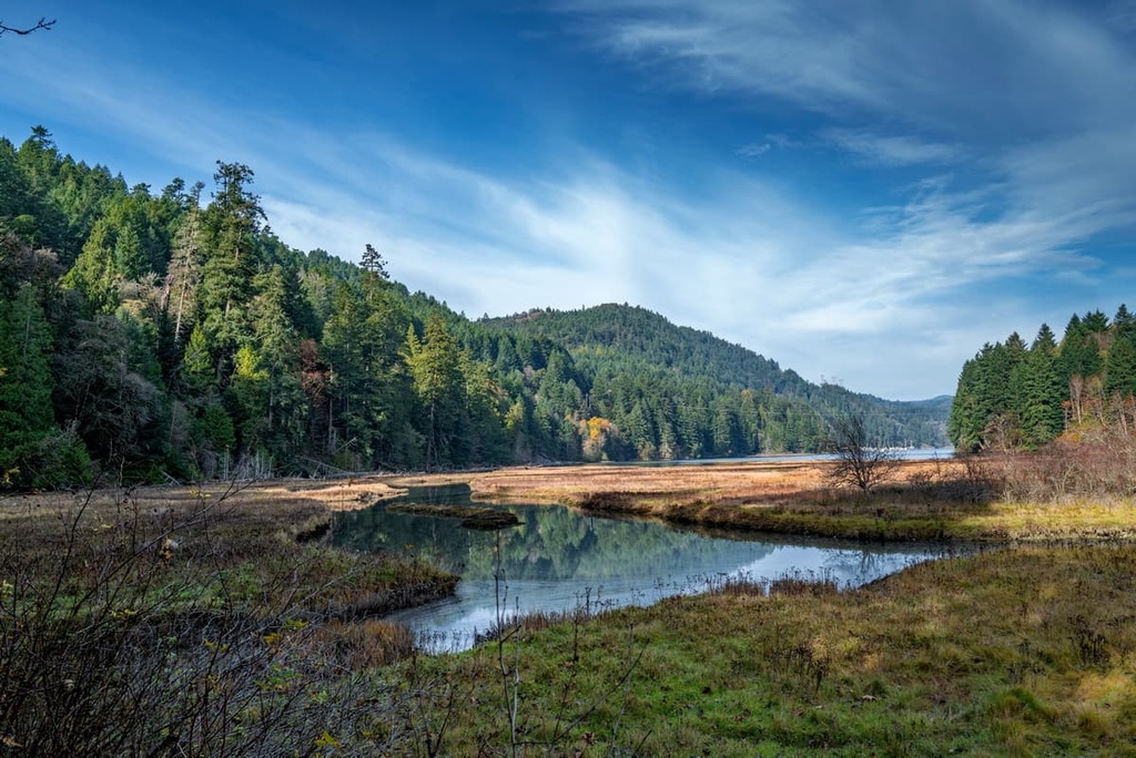
There are two distinct ecologies in Goldstream Provincial Park: the dry Coastal Douglas-Fir zone and the Coastal Western Hemlock zone. Most of the park is filled with temperate rainforests that are home to 600-year-old Douglas firs and western red cedars.
Growing between the massive firs and cedars are western yew, hemlock, red alder, big leaf maple, and black cottonwood. Arbutus and Garry oak prefer acidic soil associated with rocky outcrops, and while they will grow along the borders of the temperate rainforests, they thrive on the dry rocky slopes of the coastal Douglas fir zone.
Small Garry oak meadows are found throughout the park. These meadows are reminiscent of the landscape of the Greater Victoria area before the colonization of the island. The arbutus trees are beautiful with their red peeling bark over the green trunks, as well as their large leathery green leaves.
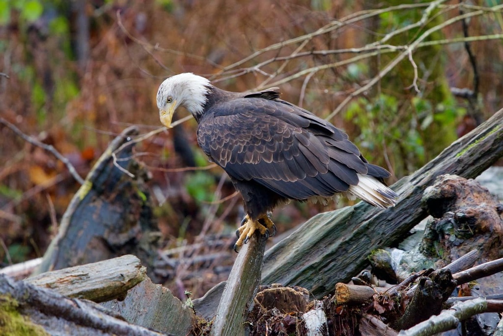
Columbian black-tailed deer are the most abundant large mammal seen in the park, however, there are many small mammals that like to live along river banks, such as raccoons, mink, river otters, rabbits, and rodents. Cougars are also occasionally spotted in the park boundaries.
Additionally, the park is also home to several rare and endangered species, such as the dense spike primrose and the Pacific waterleaf. There are also various reptiles and amphibians in the parks and the park plays a vital role in conserving the Goldstream River salmon run for the chum, coho, and chinook salmon.
The archaeological history of Vancouver Island dates back about 4,000 years; however, oral histories that have been passed down through the generations of the First Nations refer to events that may have occurred upwards of 10,000 years ago.
The Coast Salish First Nations have lived in the southern part of what is now called Vancouver Island for countless generations. The First Nations have an origin story that describes a Great Flood. The ancestors of these First Nations are said to have sought refuge in their canoes during the flood and tied their canoes to the top of a mountain.
The Saanich First Nations tell of how they tied their canoes to an arbutus tree on top of ȽÁU,WELṈEW̱ (Mount Newton), which means “place of refuge” in their dialect of Salishan. When their ancestors descended from the mountain, they referred to themselves as the W̱SÁNEĆ (Saanich) which means “the emerging people”.
Indeed, each of the three distinct Indigenous cultures on the island have a version of the Great Flood story in their history and how their people were saved. It is unknown whether or not all of these communities emerged from common ancestors or if their ancestors found a common solution to the same problem.
There is no evidence of First Nations communities in Goldstream Provincial Park. However, the Goldstream River has been a traditional indigenous fishery for many generations so it’s possible that there are many cultural remains but that they simply haven’t been found in recent centuries.
There was a brief gold rush in 1858 that prompted Europeans to Peter Leech’s so-called Gold Creek. Some small-scale workings along the slopes of Mount Skirt are the only visible evidence of the brief gold rush in Goldstream Provincial Park.
Goldstream Provincial Park has many attractions, such as Mount Finlayson, several waterfalls, old gold mine workings, as well as lakes, creeks, the Goldstream River, and beautiful wilderness areas. The following are some of the popular and worthwhile trails and attractions to visit while in the park.
Seven Peaks is a 33 km (20 mi) point-to-point trail that generally starts from Goldstream Provincial Park and continues along the Saanich Inlet to Gowlland Tod Provincial Park, Mount Work Regional Park, and Thetis Lake Regional Park.
With 1,625 m (5,330 ft) of elevation gain spread across 33 km (20 mi), this hike is difficult and long. However, in only a day, this hike takes you to the summits of seven peaks, including Mount Finlayson, Holmes Peak, Jocelyn Hill, Mount Work, Mount Stewart, Scafe Hill, and Seymour Hill.
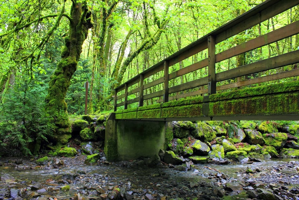
The Gold Mine Trail is a 3.5 km (2 mi) out and back trail with only 135 m (442 ft) of elevation gain. It’s located on the north side of the Trans-Canada Highway, and it’s a nice walk past the site of a gold mine site from the 1858 Goldstream gold rush.
The trail winds through lush temperate rainforests filled with massive moss covered trees, with the Douglas fir and cedars standing hundreds of feet in the air.
Walking through Goldstream Provincial Park is an incredible experience, making you feel like you have gone back in time. The forest is particularly spectacular if you visit on a rainy day, where the trees and understory are glistening with water, and there is a profound peace, silence, and tranquility that can be experienced in such moments.
While not the most direct route to the top of Mount Finlayson, The Mount Finlayson Loop is a great trail if you want a bit of a challenge. The loop is only 6 km (3.6 mi) long; however, there is 436 m (1,430 ft) of elevation gain through some challenging and steep terrain. The final kilometer to the summit is a scramble up a steep rock face.
The trail is difficult and you must be prepared for the steady incline, but the trail is also quite exciting. Additionally, the views from the summit of Mount Finlayson are beautiful and the hike through the lush forests can be relaxing and peaceful, despite the ascent.
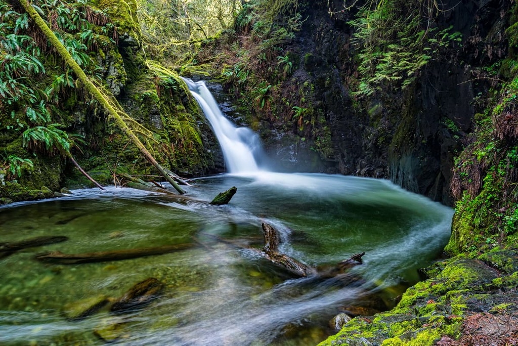
There are three waterfalls you can discover in Goldstream Provincial Park. The easiest falls to see are only a short walk from the end of the Goldstream Provincial Park campground. Following this wide trail, you descend a lot of stairs to find a stunning waterfall pouring out over a short cliff.
The other falls are located along the Trans-Canada Highway. In fact, the Hidden Springs Falls are only a few hundred meters from a highway pullout. These falls are not tall; however, they are located at the end of a fun hiking trail amidst towering firs and cedars. After the water trickles off the short, overgrown cliff face, it flows in a small creek towards the highway.
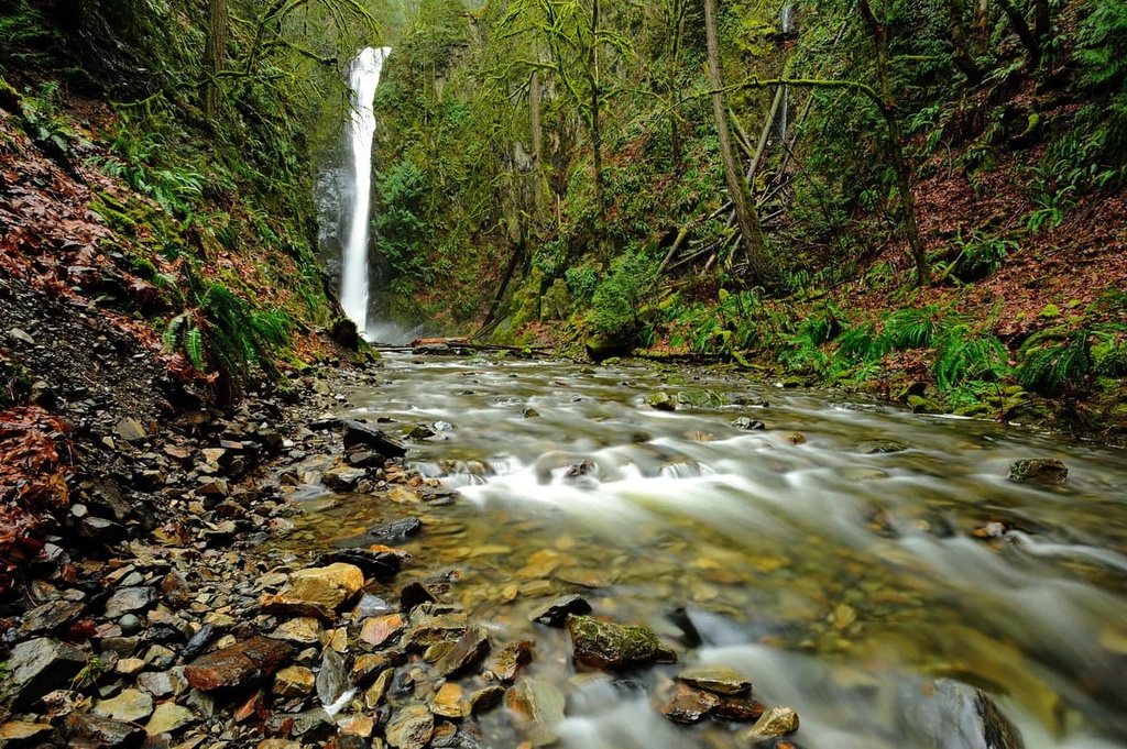
The largest of the waterfalls in Goldstream Provincial Park are the 47 m (154 ft) Niagara Falls, which are named after the famous Canadian waterfalls in Ontario and New York. A short trail from the visitor center leads under the highway and towards the falls. You’ll first walk through the beautiful forest before you come upon the thundering falls as they pour nearly 50 m (164 ft) down the cliff face.
Goldstream Provincial Park is located at the end of the Saanich Inlet, and it’s adjacent to the cities that make up Greater Victoria. The park is one of the many wilderness areas scattered around the Capital Regional District on Vancouver Island. The following are some of the major communities and cities near the park.
Langford is part of Greater Victoria, and it’s adjacent to Goldstream Provincial Park. The city has restaurants, shopping malls, grocery stores, and any access to any services you may require. One of the best features of Langford is that it is located centrally among several provincial and regional parks.
There are over 100 unique wilderness and mountain trails within 10 km (6 mi) of Langford.
This includes trails in the nearby Gowlland Tod Provincial Park, which has several summits along the Saanich Inlet that provide spectacular views of the inlet, Gulf Islands, as well as the Malahat area across the inlet.
Other hiking areas near Langford include Sooke Hills Wilderness Regional Park, Lone Tree Hill Regional Park, Mount Wells Regional Park, Thetis Lake Regional Park, and Mount Work Regional Park.
Victoria is the capital city of British Columbia. It is often referred to as the “Garden City.” The city maintains many features of its colonial history, including historic buildings. This includes the Provincial Legislature and the iconic Empress Hotel, which were constructed around the turn of the twentieth century.
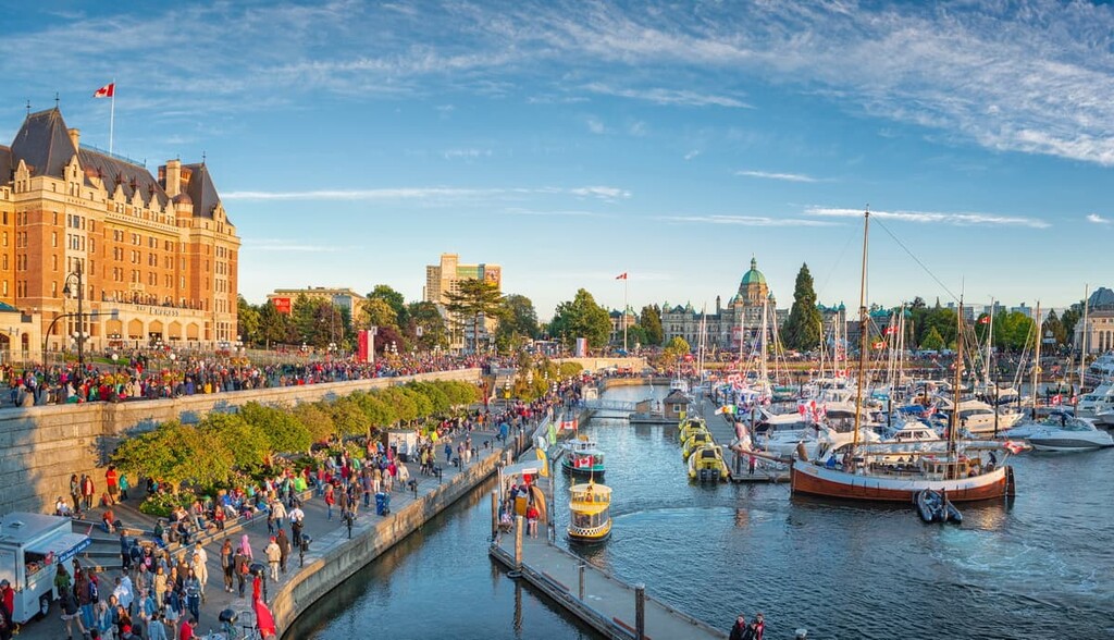
Furthermore, downtown Victoria has beautiful gardens and landscaping that date back over 100 years to a time when the Royal British Navy patrolled the Pacific Ocean from the harbour at Esquimalt. There are many attractions in and around the city, such as the historic Butchart Gardens, Miniature World, the Victoria Bug Zoo, the Royal BC Museum, or the totem poles at Thunderbird Park.
There are also many wilderness and hiking areas to explore that are only a short distance from Victoria. East Sooke Regional Park has beautiful beaches as well as meandering seaside and forest trails through the coastal Douglas fir forests.
Additionally, Sooke Potholes Provincial and Regional Park, Sea to Sea Regional Park, Sooke Mountain Provincial Park, and Sooke Hills Wilderness Regional Park are wilderness areas with amazing hikes to many easy summits that overlook the Capital Regional District. From many of these parks, you can also look across the strait to the Olympic Mountains of the US state of Washington.
The city of Sidney is located about 25 km (15 mi) from Goldstream Provincial Park. Sidney is home to the Victoria Airport as well as the Swartz Bay Ferry Terminal. It is technically part of Greater Victoria; however, it maintains its charm as a quaint seaside community.
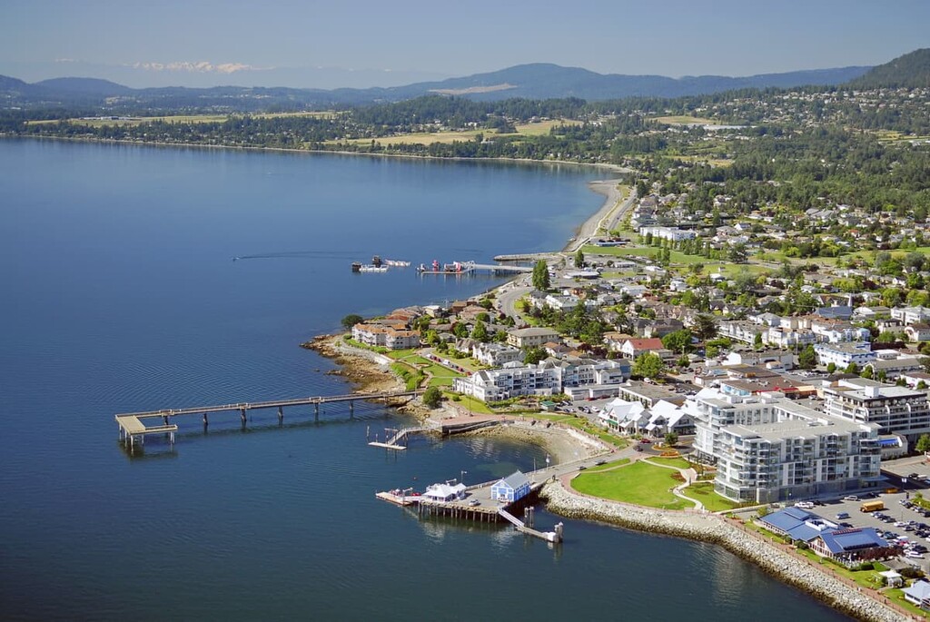
The city has an incredible bakery with a large assortment of delicious pastries, cakes, breads, donuts, and other delicatessens. Sidney is also famous for having many bookstores, which are fun to explore, as each store fills a unique niche and offers a different selection of new and used books, maps, and other local artefacts.
Just south of Sidney, on the Saanich Peninsula is ȽÁU,WELṈEW̱/John Dean Provincial Park. While the park only has about 6 km (3.6 mi) of hiking trails, the trails are beautiful and well maintained. Additionally, the Pickle Bluffs viewpoint is a stunning outcrop of rocks overlooking the Georgia Strait, Sidney, and the Saanich Peninsula.