Scan the QR code and open PeakVisor on your phone
Sooke Hills Wilderness Regional Park is a protected area located in the Capital Regional District of Vancouver Island in British Columbia, Canada. The regional park has 16 named peaks, the highest of which is Mount Braden (479 m/1,572 ft) and the most prominent of which is Mount McDonald (439 m/1,440 ft) with 204 m (669 ft) of prominence.
Located on the south end of Vancouver Island, British Columbia, Canada, Sooke Hills Wilderness Regional Park preserves 40 square kilometers (15 square miles) of the Capital Regional District as a wilderness area. The park has 16 named peaks within its borders as well as many kilometers of hiking trails.
The tallest mountain in Sooke Hills Wilderness Regional Park is Mount Braden at 479 m (1,572 ft) in elevation and with 142 m (466 ft) of prominence. The most prominent peak is Mount McDonald at 439 m (1,440 ft) in elevation and with 204 m (669 ft) of prominence.
The park is adjacent to several other regional and provincial parks. In particular, Goldstream and Gowlland Tod Provincial Park are located to the north of Sooke Hills Wilderness Regional Park. Meanwhile, Mount Wells Regional Park is located across the road to the east and both Sooke Mountain Provincial Park and Sea to Sea Regional Park are located to the west.
Most of Vancouver Island formed as a result of the collision between the ancient land mass Wrangellia and the west coast of North America. Wrangellia started forming about 380 million years ago, and its remnants now dominate most of Vancouver Island, southeast Alaska, the Queen Charlotte Islands, and part of the Coast Mountains.
Most of Vancouver Island consists of lava from undersea volcanoes. Over the course of millions of years, volcanic eruptions added to the land mass. At the time, the land mass was covered with marine sediment. However, it was eventually covered with a 6 km (3.6 mi) thick layer of basaltic lava.
As Wrangellia collided with the mainland, about 145 million years ago, parts of the terrane folded and buckled while other parts cracked and crumbled. Throughout this process, mountains slowly formed across Vancouver Island.
About 55 million years ago, two smaller terranes collided with the west coast of Vancouver Island: the Pacific Rim terrane and the Crescent terrane. Part of the Pacific Rim terrane is now protected as part of Pacific Rim National Park Reserve.
The Crescent terrane is the marine volcanic rock that underlies the areas of Sooke, Metchosin, and Colwood. Sooke Hills Wilderness Regional Park is located in a fascinating geological area where the Wrangellia, Pacific Rim, and Crescent terranes meet.
During the Pleistocene, and in particular, during the final glacial maximum on Vancouver Island, which was called the Fraser Glaciation, a vast ice sheet covered the island. As the glaciers worked their way across the island, the fault lines were particularly susceptible to erosion and, as such, the glaciers eroded the landscape, leaving behind the Sooke Hills behind.
Additionally, large pieces of the glacier were left behind during the general glacial retreat, and these ice lobes formed the lakes in the area as kettle lakes. Between 14,000 and 12,000 years ago, the lakes formed and the soil in the region began to take shape, setting the stage for the growth of the forests that now dominate the region.
Between 14,000 and 12, 000 years ago, the glaciers began to retreat from Sooke Hills Wilderness Regional Park. Afterward, soil started to develop to the point where it could sustain plant life. As vegetation began to grow in the region, it was affected by the local and regional topography.
Sooke Hills Wilderness Regional Park is located in an area that is part of the Coastal Western Hemlock zone. The Coastal Western Hemlock zone is found in regions where warm, moist air that flows east from the Pacific Ocean brings plentiful precipitation to high-elevation areas.
The park is part of one of Canada’s wettest climates and much of its vegetation is considered a temperate rainforest. The forests in and around the park are extremely productive. However, unfortunately, many of the larger trees have been removed by past generations of settlers.
The typical forests in the region are filled with coastal western hemlock, western red cedar, big leaf maple, and alder. A unique ecological feature of Sooke Hills Wilderness Regional Park is that it is located near the physiographic border that separates the wet Coastal Mountain Hemlock zone from the dry Coastal Douglas Fir zone.
As such, there are some trees, such as the arbutus and Garry oak, present on the slopes and peaks of some of the mountains, such as Mount McDonald, where it is dry enough for them to grow.
Some of the large mammals that you may encounter in Sooke Hills Wilderness Regional Park include the Columbian black-tail deer and black bears. There are also a wide variety of birds that inhabit the park as well as smaller mammals.
The Saanich Peninsula and the southeastern end of Vancouver Island is the traditional territory of a number of Coast Salish First Nations. There is evidence that Vancouver Island has been inhabited for at least 4,000 years.
Traditionally, the Salish communities of the region followed a seasonal migration round. The migration consisted of camping along the coast or the banks and mouths of large rivers during the summer and moving to their permanent village for the winter.
During the winter, several families would typically share a longhouse and there would be many celebrations and ceremonies throughout the cold season. There are no known cultural or archaeological sites in Sooke Hills Wilderness Regional Park; however, there are several sites that attest to the history of the European settlers of the area.
There are several old hunting cabins and homesteads in the park, as well as others that are rumored to be in the area.
An old building on the shores of Cabin Pond was once a roadhouse for the horse-drawn carriage service between the communities to the north and Victoria. Furthermore, there is evidence of dams and water diversion channels that were used to supply residents with drinking water.
Mountain summits, regional and national trails, a waterfall, and a suspension bridge are some of the many attractions in Sooke Hills Wilderness Regional Park. The following are some of the trails that will lead you to the park’s best features.
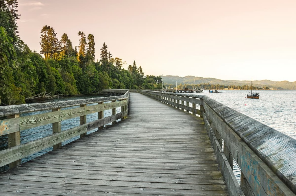
One of the primary trails to Waugh Creek Falls starts from the Humpback Reservoir. This hike follows a 5.6 km (3.3 mi) trail and is rated as moderately difficult. This trail has a suspension bridge and has a relatively flat gradient, so it’s a fun option for families.
Mount McDonald is the most prominent mountain in Sooke Hills Wilderness Regional Park with 439 m (1,440 ft) of elevation and 204 m (669 ft) of prominence. The trailhead for this route is along the road, and while the trail is wide, there is no signage indicating where the trail leads.
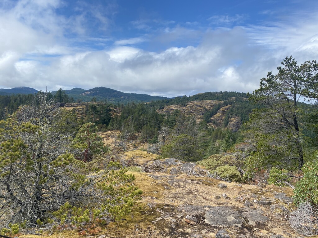
This 2.3 km (1.5 mi) trail leads directly up the east slope of Mount McDonald to a viewpoint atop exposed basaltic rocks. It then ventures slightly beyond this viewpoint to the summit, which is home to a meteorological station. The trail is steep throughout, with areas that require some scrambling along the way.
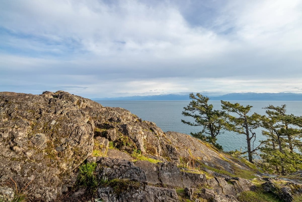
From the viewpoint, you can look across at Mount Wells or east toward Victoria. Looking south, you’ll see tree covered rolling hills, punctuated with the occasional community. The actual summit has no good view, as it is covered in trees.
From the summit there are several ways to descend the mountain. This includes one option that allows you to summit multiple peaks or another that lets you make your hike a loop trip instead of an out-and-back trek.
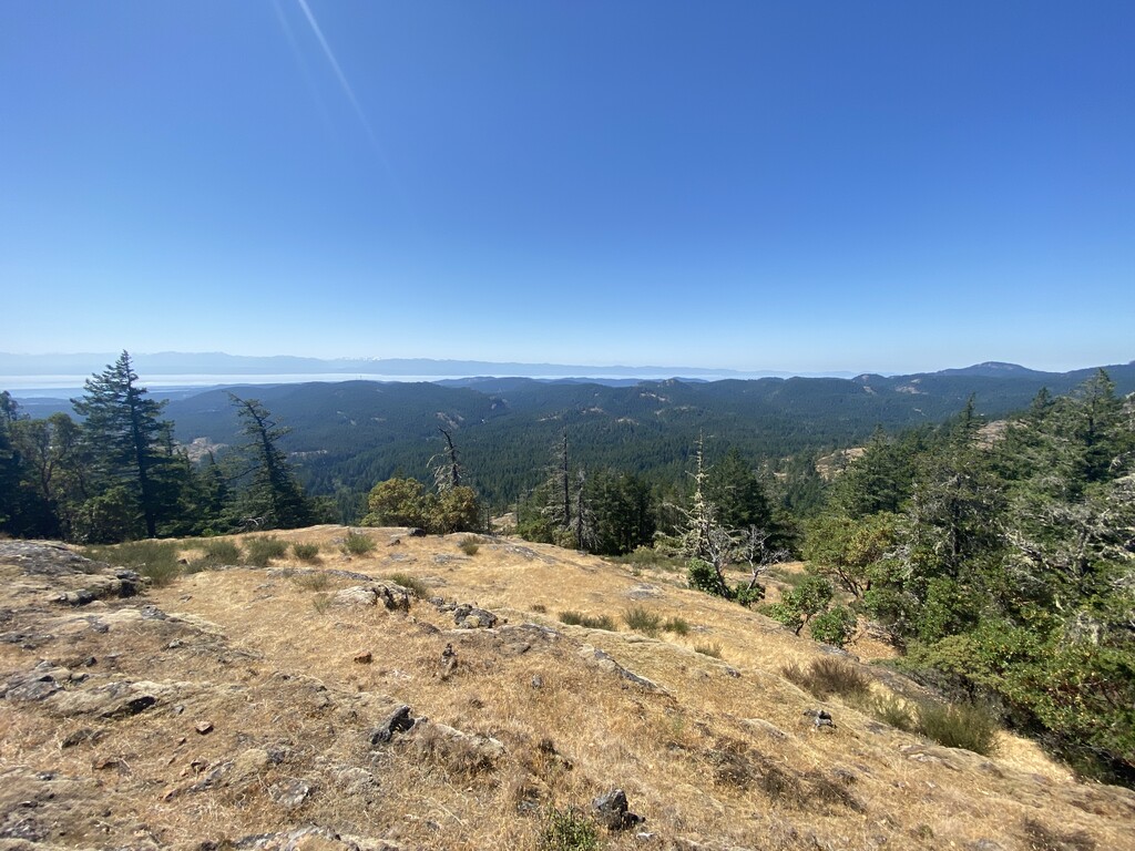
The Mount Braden Loop is a 10 km (6 mi) loop with about 426 m (1,400 ft) of elevation gain. The trail is considered difficult because it has some steep sections.
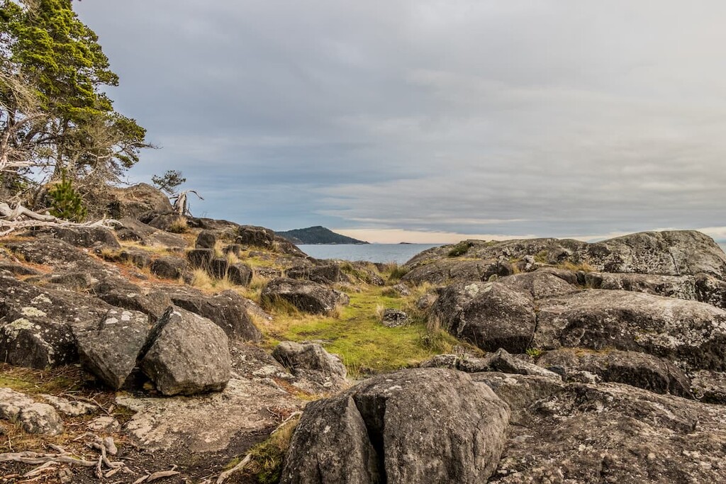
The hike has lots of variation in the terrain even though you walk through shaded forest for most of the trail. Along the way and at the summit, there are excellent views of the surrounding mountains and the ocean.
In addition to Mount McDonald and Mount Braden, there are several other peaks in the park that have hiking trails to the top. This includes :
However, while there are trails to the summits listed, some of them are not frequently used and as such can become overgrown quickly in this temperate rainforest. Additionally, some trails are not yet well established, since the park is relatively new.
However, part of the fun of hiking in Sooke Hills Wilderness Regional Park is that the mountains are so close together, and they are not very tall, so you can easily hike to the summits of two or more in only a few hours.
One of my favorite hikes in the area is to hike from the trailhead at the Humpback Reservoir to the summit of Mount Wells, in Mount Wells Regional Park via the summit trail. After, you can continue past the summit to descend straight towards Mount McDonald. Subsequently, you can hike the MacDonald Trail to the summit of Mount McDonald and then descend by the alternate trail to the trailhead.
This trail, although steep and strenuous in some areas, is also a lot of fun as you walk along steep cliffs, descend down steep gullies, scramble up small cliffs, and pass through lush forests of giant hemlock, cedars, and massive ferns. Trails in this park are truly a wonderful way to spend a morning or afternoon.
One of the incredible features of Sooke Hills Wilderness Regional Park is that it is located only minutes from several communities and cities. The following are some of the cities that enjoy the easily accessible wilderness of Sooke Hills Wilderness Regional Park.
Victoria is the capital of British Columbia. It is situated on the south end of the Saanich Peninsula of Vancouver Island.
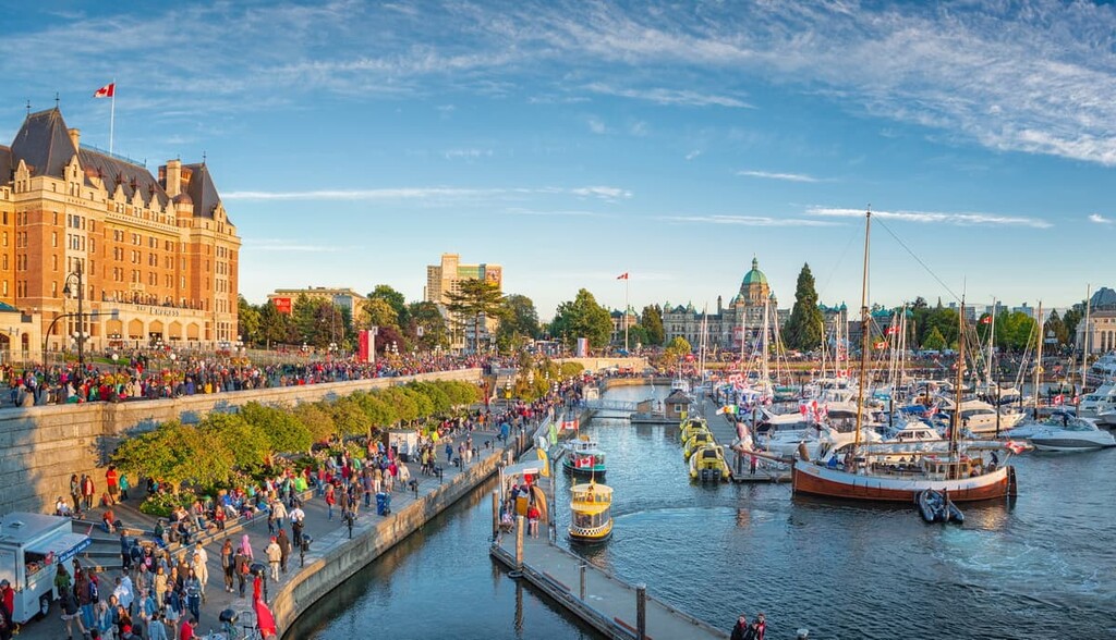
While not the oldest settlement on the island, it has some of the grandest examples of colonial architecture on the island. This includes the beautiful historic Provincial Legislature building and the grand Empress Hotel, which were constructed at the turn of the twentieth century.
A walk through Victoria will evoke images of its colonial past, with the remarkable architecture and the manicured colonial gardens that were built during the period. However, there are also art features that remind us that there are also incredible First Nations cultures that have existed on the island since time immemorial.
While Victoria is a beautiful city, it also has some incredible wilderness and oceanside attractions nearby. When in Victoria, the beautiful and historical Butchart Gardens are worth visiting, as are the nearby Gowlland Tod and Goldstream Provincial Parks, where you can find incredible views of the ocean as well as beautiful rivers and stunning waterfalls.
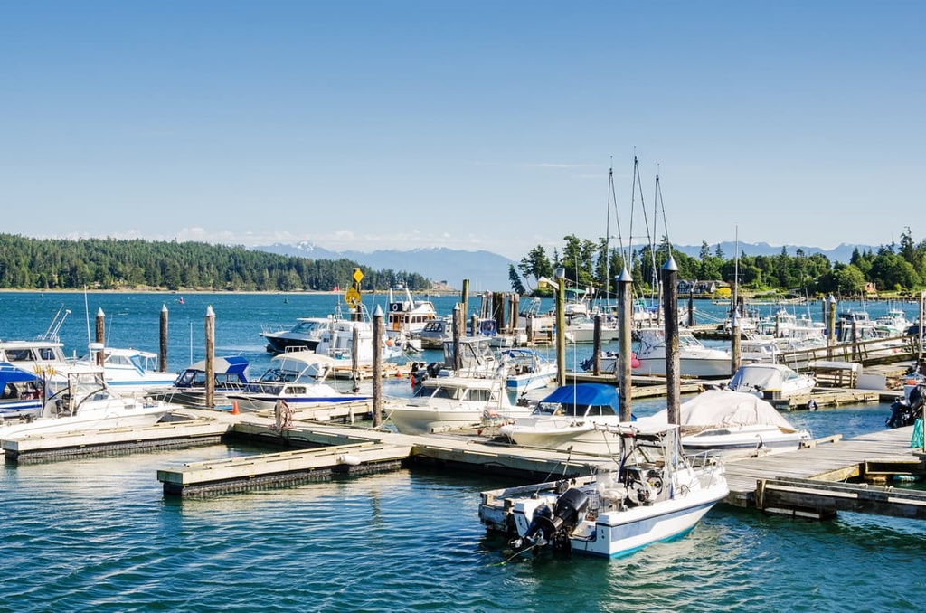
Located on the north end of the Saanich Peninsula, Sidney is home to the Vitoria Airport as well as Swartz Bay, where the ferries come in from the surrounding region. However, despite the massive volume of people that regularly pass through Sidney, the city has maintained an incredible small town feel.
Perhaps the feeling comes from the friendliness of the locals as you visit one of the many bookstores or coffee shops along the main street near the harbour. Maybe the small town feeling comes from how people will line up to visit the bakery in the morning to have one of their delicious pastries or an island favorite, the Nanaimo bar.
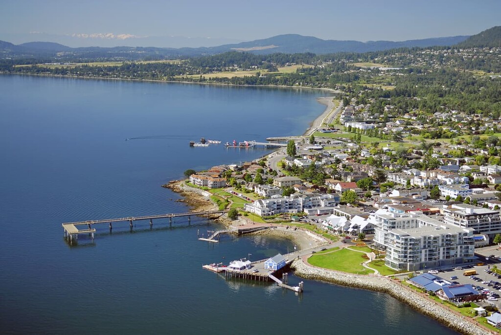
Regardless of why Sidney feels good, it just does. It is a pleasant city to visit and hopefully you’ll find yourself breathing a little easier and relaxing.
Some of the best places to visit from Sidney are the provincial parks in the Gulf Islands, such as Mount Maxwell and Burgoyne Bay Provincial Park on Salt Spring Island. Alternatively, you may want to visit Galiano, Pender, or one of the many sites that are part of the Gulf Islands National Park Reserve.