
Scan the QR code and open PeakVisor on your phone
The Regional District of Mount Waddington is located along the northern region of Vancouver Island and extends northeast across the Queen Charlotte Strait and into mainland British Columbia. The district spans 7,816 square miles across the province and has an estimated population of around 11,1000 people. The Kwakwaka’wakw reside within the regional district with a population of around 3,600 people. The district was named after one of its most iconic landmarks, Mount Waddington.
There are 352 named mountains in the Regional District of Mount Waddington. The highest and the most prominent mountain is Mount Waddington at 13,169 feet with 10,794 feet of prominence. This mountain lies along the northeastern border of the district and is also the highest point in all of British Columbia. Another notable peak within the district is Mount Silverthrone which is the tallest volcano in all of Canada. The Coast Mountains of British Columbia roughly define the eastern boundary of the Regional District of Mount Waddington.
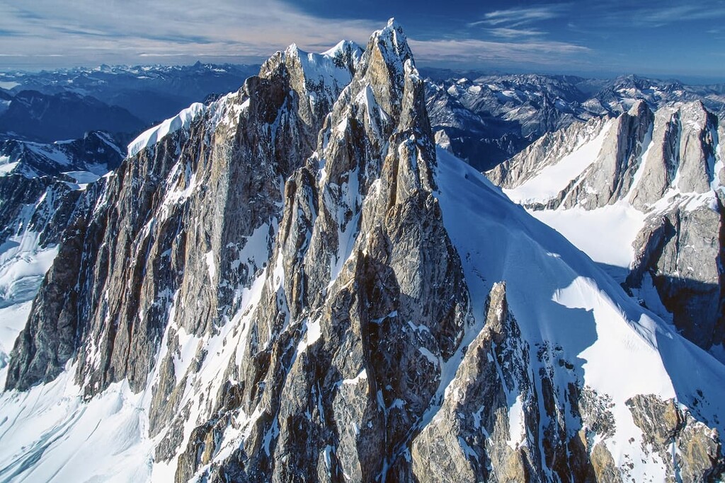
Mount Waddington is an iconic landmark for all of British Columbia. The surrounding mountains make up the Waddington Range, a subrange of the Pacific Range. As a whole the Pacific Range is full of rugged and remote stretches of land that is relatively unexplored. One of the features that makes Mount Waddington such an impressive sight, is the fact that the inlets of the Pacific Ocean lie just a few miles away. Amidst this subrange lie the Homathko and Klinaklini Rivers along with their 10,000-foot gorges, flanked on either side by the jagged mountain peaks. The structure of Mount Waddington is often compared to that of Mount Blanc in Europe which straddles, Italy, Switzerland, and France. Though beautiful, the mountain requires immense technical skill in order to climb it.

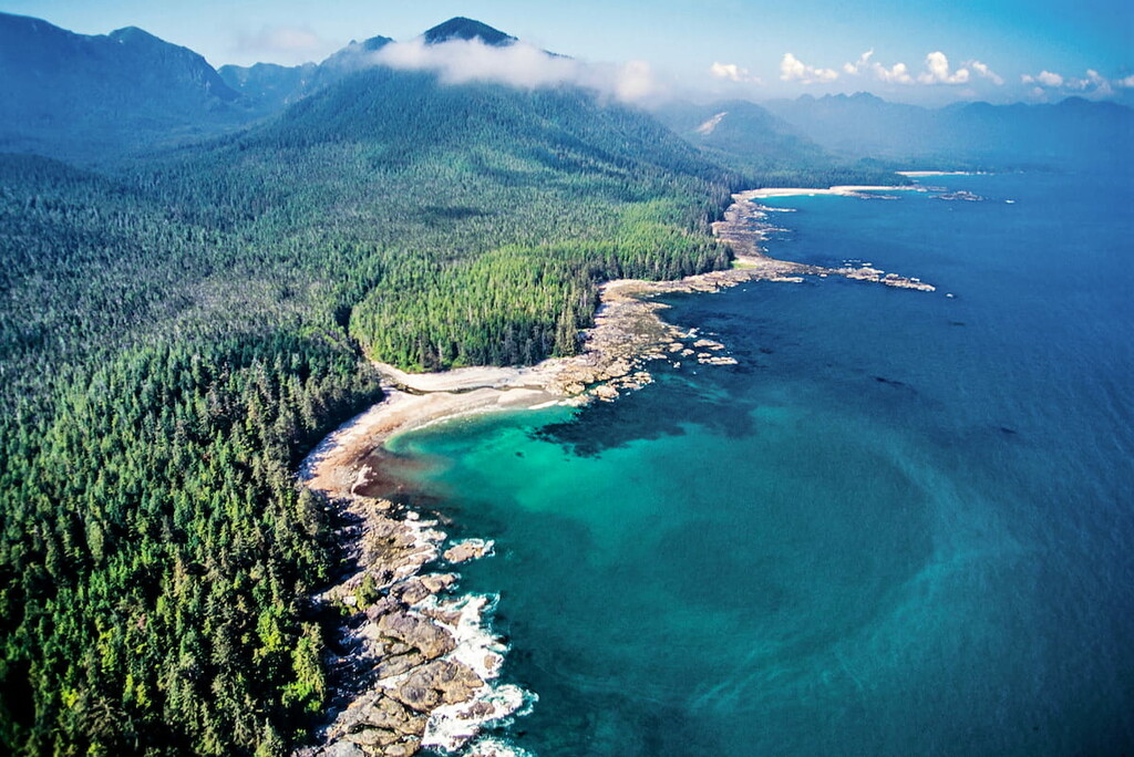
Much of the district is made up of a rugged landscape, leading to its relatively small population. The remote mountains, and uninhabited islands make up much of the land. The northern reaches of Vancouver Island and mainland BC are home to a variety of wildlife which includes Black Bears, Orcas, Bald Eagles, Cougars, mountain goats, bighorn sheep, elk, deer, sea lions, marmots, and various others.

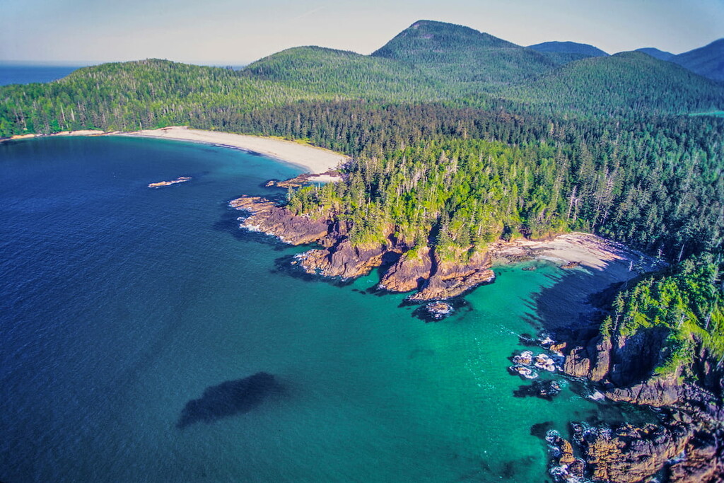
Cape Scott Provincial Park: Located on the northwestern tip of Vancouver Island lies Cape Scott Provincial Park. The small park spans 55,090 acres and sits across the water from the Lanz and Cox Islands Provincial Park. Cape Scott Provincial Park is best known for its old growth forest that extends up to its sandy beaches. Being on the tip of Vancouver Island means that it often receives much stronger rainfall and storms. The most popular trail is a backpacking route known as the Cape Scott Trail that is 30 miles long and takes one through the entire park. Other trails include San Josef Bay and Mount St. Patrick Trail.

Brooks Peninsula Provincial Park: Located on the west coast of Vancouver Island lies the Brooks Peninsula Provincial Park. The park covers 127,583 acres of land but is only accessible by boat or plane. The park is quite unique due to the fact that the taller points in the park were exposed since the previous ice age, leading to a vast amount of biodiversity. There are no maintained trails in the park but primitive trails begin at Columbia Cove and Ouokinsh Inlet.
The largest population in the regional district lies at Port Alice. This small village has a population of around 700 people and is located along the Neroutsos Inlet in northern Vancouver Island. The small village was once a paper mill location and is now surrounded by hiking destinations. Near the city also lies the infamous Devil’s Bath which is Canada’s largest sinkhole. Popular hiking regions in the area include Devil’s Bath, Eternal Fountain, Vanishing River and the Reappearing River.

Though not located in the regional district, Victoria is the closest major city. Located at the southern tip of Vancouver Island lies the largest city, Victoria. The city of Victoria is the capital for the province of British Columbia and has a population of 85,792 with the greater area having a population of 367,770. The island can be reached by ferry from mainland British Columbia as well as Washington State in the United States. The city was named after Queen Victoria and is one of the oldest cities in the Pacific Northwest. The region is known for rock climbing, hiking, kayaking, surfing, and skiing. The close proximity to both the ocean and mountains make this city a mecca for outdoor activities.


.jpg)
ultra
glacier
4000ers-canada
11ers-bc
fred-beckey-great-peaks
canada-sampler
british-columbia-ultras
ultra
glacier
4000ers-canada
11ers-bc
fred-beckey-great-peaks
canada-sampler
british-columbia-ultras
ultra
island-qualifiers
ramblers-lifetime-objectives
british-columbia-ultras


