
Scan the QR code and open PeakVisor on your phone
Cape Scott Provincial Park covers the northern tip of Vancouver Island in British Columbia, Canada. Extending from San Josef Bay in the west to Shushartie in the east the provincial park is 22,294-hectare (55,090-acre) and is watched over by three named peaks in the park.
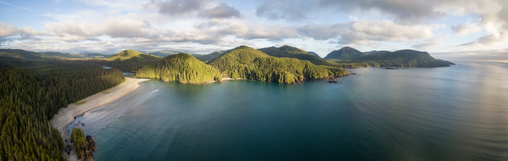
Overlooking the rugged northern coast of Vancouver Island are Mount St. Patrick (418 m/1,371 ft), Northwest Nipple (219 m/718 ft), and Nahwitti Cone (185 m/607 ft). The park is a wilderness park without any major facilities; however, there are several small and scenic towns adjacent and near the park.
Located upon the north shore of Vancouver Island, in British Columbia, Canada, Cape Scott Provincial Park is a beautiful park that offers backcountry wilderness excursions along the rugged coastline. The park is located in a region of the island that is part of the Nahwitti Lowland, which is a subunit of the Hecate Depression, and a part of the Coastal Trough.

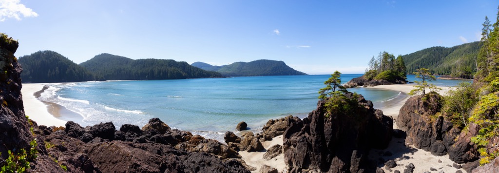
The park has rugged terrain mixed with incredible sandy beaches. Cape Scott experiences significant rainfall and violent storms in their season which caused the sinking of many ships over the past couple centuries.
The park is also known to have incredible old growth forests where the Sitka spruce and red cedars are over 3 m (10 ft) in diameter. The park is known for its old growth forest and sandy beaches. The terrain is rugged, and the area experiences heavy rain and violent storms. The park's highest point is Mt. St. Patrick, 422 meters (1,385 ft) above sea level.
While there are no roads in the park, there is road access to the western end of the park via the Port Hardy-Holberg-San Josef Bay forest service roads. Otherwise access to other areas of the park are by boat or float plane and during the summertime, a water taxi service operates from Port Hardy.
Cape Scott Provincial Park is the northernmost park on Vancouver Island. The following are some of het other parks that are nearby:

Cape Scott Provincial Park is found upon the Nahwitti Lowland and subunit of the Hecate Depression and part of the northern Coastal Trough. The Coastal Trough extends more than 800 km (500 mi) as a topographically low belt from Puget Sound to Dixon Entrance, between the Insular Mountains on the west and the Coast Mountains to the east.
The Vancouver Island Ranges and Haida Gwaii are part of the Insular Mountains, while the mountains along the west coast of mainland British Columbia are part of the Canadian Coast Mountains. The Hecate Depression is mostly below sea-level, rarely deeper than 90 m (300 ft); with only a few areas above sea-level.
The Queen Charlotte Lowland on Graham Island of Haida Gwaii, the Nahwitti Lowland on the north end of Vancouver Island, and the Hecate Lowland along the mainland coast are the areas of Hecate Depression above sea-level. Cape Scott Provincial Park is characterized as an area of low relief with rounded hilled which is punctuated by isolated summits in which the dissected Tertiary erosion surface slopes to sea-level at Cape Scott.
In general, the bedrock geology is a mixture of sedimentary and volcanic formations of the Tertiary time period belonging to the Bonanza group, which is well represented in the nearby Bonanza Range. The Nahwitti Lowland ends at a fault that separates it from the Hankin, Bonanza, and Franklin Ranges which are subranges of the Vancouver Island Ranges.
The coastal plains of Cape Scott Provincial Park are geologically more part of Haida Gwaii than Vancouver Island. During the Pleistocene when Vancouver Island was covered in over a kilometer of ice, glacial ice moved south and southwest across the Queen Charlotte Strait scouring the Cape Scott area. The areas with glacial deposits form well-drained upland pockets amongst the predominantly boggy lowlands.
The park received large amounts of precipitation throughout the year, helping the trees of the old growth forests attain their significant girth and height. The forests of Cape Scott Provincial Park are considered part of the Coastal Western Hemlock Biogeoclimatic Zone.
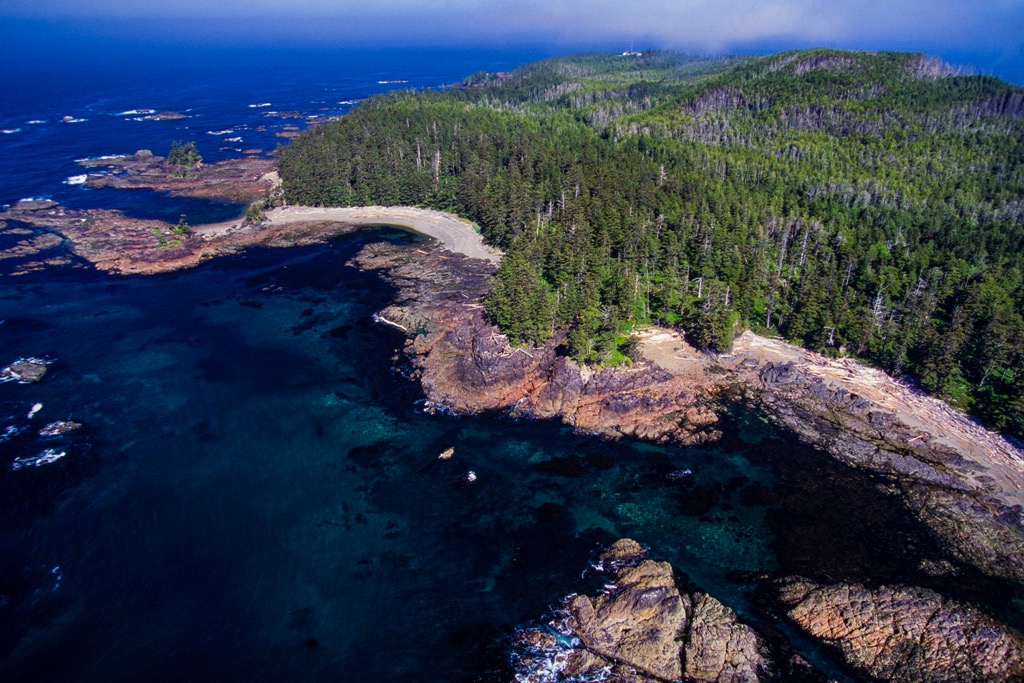
The park's forests are typically filled with stands of redcedar, western hemlock, and Sitka spruce. Some of the ancient spruce and cedar have reached 3 m (10 ft) in diameter. The vegetation is heavily influenced by the differences in topography, exposure and drainage.
Sitka spruce is the dominant tree cover along the coastal fringe as it is the most tolerant of salt water spray and thrives in well-drained exposed soil. The intense coastal winds and stormy conditions stunt the tree growth and shape them, making parts of the coast appear as though it is covered in giant bonsai trees.

Despite the best efforts of the wind and sea, some of the Sitka spruce and western hemlock in the park are over 250 years old and exceed 36 m (118 ft) of height. Land that is not continuously water-saturated supports climax forests of redcedar and western hemlock, along with a thick understory.
Some of the precious areas of the park include the Stranby valley bottom, where almost no logging has taken place and it still contains a significant stand of old growth spruce forest. As a result, a narrow riparian spruce floodplain ecosystem is intact in the lower watershed. The Shushartie valley also contains a substantial old growth spruce forest due to minimal logging in the past.
Areas such as the Nahwitti valley and east of Jepther point have been thoroughly logged during the past and they no longer contain first growth trees. Dense second growth dominates these areas with red alder dominating the riparian zone, instead of the original Sitka stands.
Some of the other tree species that are in the park are lodgepole pine which is common in the higher elevation muskeg areas. Pockets of yellow cedar have also been noted in the park and are particularly common in the boggy areas. Wild lily of the valley and bedstraw are common understory plants in the forested areas.
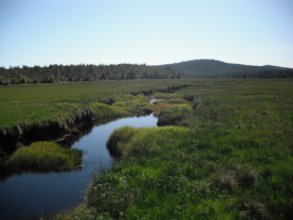
Marshland vegetation typically consists of stunted yellow cedar, redcedar, and lodgepole pine, with mosses, grasses, salal, salmonberry, and skunk cabbage, dominating the understory. While many varieties of small herbs and grasses which yield to dense cover of shrubs, such as salmonberry and salal, near the forest edge, are found along the beach.
In the sand, above the high tide line, sandwort , hairy rockcress, coast strawberry, Indian paintbrush, sea plantain, and pea can be found. While the gravel bars are filled with sea milkwort and cinquefoil.
Due to the early Dutch settlers in the region, the sand dunes of Guise Bay and Experiment Bight have a unique ecology in the park. Hyacinth, snowdrops, daffodils, holly, ivy, laurel, rhododendrons, monkey puzzle trees, and cinquefoil, which are considered common garden weeds are found across the area.
There is a great diversity of life found along the shore and in the tidal pools of Cape Scott Provincial Park. Periwinkles, limpets and barnacles are found on the rough rocky surfaces, and the tidepool sculpin hairy hermit crab, a variety of sea stars, and sea anemones are some of the inhabitants of the rock pools.

Some of the animals that were harvested during low tide are rock scallops, northern abalone, and razor clams. Some of the other clam species that inhabit the park are sand clams, mud clams, butter clams, and littleneck clams. Hermit crabs, helmet crabs, and Dungeness crabs also inhabit the tidal flats of the park.
The rivers, especially the Stranby and Shushartie rivers are highly valued for fish and fish habitat. Coho salmon, pink salmon, steelhead trout, and chum salmon inhabit the Stranby River. Sockeye, coho, pink, chum and steelhead use the Shushartie River and the Nahwitti River contains coho, chum, pink, and sockeye salmon, winter steelhead, cutthroat trout, and Dolly Varden trout.
Pods of killer whales may be seen swimming off the coat or perhaps a grazing gray whale. Sea lions and seals can be seen from the park, either in the water or lazing upon the rocky outcrops. There have also been occasional sightings of harbour porpoises and elephant seals.
While hiking through the park you may come upon traces of the black bears, cougars, and wolves that live in the park.; however, these are especially difficult to spot. Other animals that inhabit Cape Scott Provincial Park are the American beaver, river otter, mink, raccoon, Roosevelt elk, and mule deer. The most abundant animals in the park are red squirrels and white-footed mice.
While touring Cape Scott Provincial Park you may hear or see one of the many bird species that inhabit the park. Perhaps you’ll be treated to the sight of the Rufous hummingbird, pileated woodpecker, Steller’s jay, or the winter wren.

The marshlands have their own unique ecosystems and birds that prefer this habitat. Some of the species found in the marshlands are the short-eared owl, American kestrel, and the occasional snowy owl and northern harrier. There are many more birds that can be seen throughout the park and there are even an estimated two dozen occupied bald eagle nests in the park.
The Cape Scott Islands were occupied by the Yutlinuk until the early nineteenth century when the European presence became more prevalent in and around Cape Scott. Remnants of the Yutlinuk mixed with the Nakomgilisala and Tlatlasikwalaw who had traditionally inhabited Cape Scott.
Through amalgamations and relocations, the descendants of the Yutlinuk, Tlatlasikwala, and Nakomgilisala are now collectively known as the Kwakwa̱ka̱ʼwakw. There are three First Nations reserves adjacent to the park, including the former village of Nahwitti.
Having lived upon the cape and the nearby islands for countless generations, the indigenous had named the areas and features. A section of the park, the sand neck between Experiment Bight and Guise Bay has interpretive signs that help visitors know the indigenous names of the area and the features.
The bight name meant "whale between on beach," and the neck was "against each other." The terms for the cape were "trail on the surface," "foam place, "sea monster," and "swell on beach." It has been shared that to avoid the cape’s turbulent waters, the Kwakwaka'wakw would haul their canoes across the sandy neck.
The most recent name for the cape came in 1786, when the cape was named in honour of David Scott. David Scott was a merchant of Mumbai (Bombay), who had backed James Strange's maritime fur trade voyage to the Pacific Northwest Coast.
The traditional Kwakwa̱ka̱ʼwakw economy was based primarily on fishing, with some hunting and gathering wild fruits and berries. Th people became very adept at crafts, and they made ornate weaving and woodwork, which along with slaves were part of their wealth.
The first documented contact with Europeans was in 1792, when Captain George Vancouver made landfall around Nootka Sound. As a result of this contact, disease quickly spread among the indigenous populations on Vancouver Island. With the 1862 smallpox epidemic killing half of the Kwakwa̱ka̱ʼwakw, their population dropped by 75% between 1830 and 1880.
In recent years the Kwakwa̱ka̱ʼwakw have acted to restores their ties to their land, culture and rights to bring back their customs, beliefs and language. Some of the actions they take are to hold Potlatches to reconnect to their birthright, and the use of language programs, classes, and social events to restore the language.

As settlers began to inhabit Vancouver Island during the nineteenth and twentieth centuries, shipping traffic increased, which brought the increase of shipwrecks along the cape. Some of the notable wrecks are the 1860 Brig Consort that wrecked at San Josef Bay, as well as the 1896 sealing schooner Wanderer that wrecked at the same place.
Over the decades, several ships wrecked off the coast of Cape Scott, including the Maggie Mac in 1892, Clara C in 1908, St. Denis in 1910, and Northholm in 1943. In 1946, a freighter, the Pelican, sank at Fisherman’s Bay, which was the landing site for the Danish-Canadian settlement at the head of Hansen Lagoon.
The settlement was established in 1897 and it had a general store, a postmaster, community hall, and a newspaper that served a population of about 90 people. Unsuitable boats made fishing difficult, which created excessive trapping.
Problems at the settlement were compounded by cougars hunting in the area and also attacking cattle. While farms were built and cattle were being raised, the loss of their community sloop in 1899 and the government’s reneging on their promise to build a connecting road essentially made it impossible for the settlers to transport their goods to market, which eliminated the viability of the settlement.
Collapsed buildings, rusty farming implements, neglected wells, random fence posts, and some gravesite monuments, are all that remain of those earlier attempts to settle this unforgiving environment. The current hiking trails follow the remains of wagon roads that the settlers once used to transport themselves and their goods to and from their homesteads.
The unforgiving landscape and elements combined with a lack of support made living in and around Cape Scott difficult. The last of the settlers moved or passed away by the middle of the twentieth century, leaving the region deserted. The cape and adjacent features are now part of a wilderness park that encourages exploration and communion with nature while adventuring along the rugged coast.
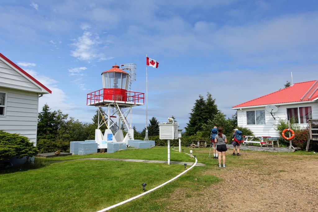
There are eleven core trails in Cape Scott Provincial Park that cross and connect as the backbone of transportation across the park. The trails, while usually muddy, are rated as easy to moderate and range in length from 2.5 to 23.6 km (1.6 to 14.7 mi) each way.
In general water sources can be far apart, and campsites have pit toilets and often have metal food caches, and tent platforms. If you are camping where there are no toilets or tent platforms, the intertidal zone is the best place for your business and the sandy dunes are the best place to ensure you leave no trace of your adventure.

The Cape Scott trail is a 48.4-km out-and-back trail that takes hikers along the northwest corner of Vancouver Island. While this trail is most popular for backpacking, day hikers can enjoy the accessible parts of the trail and make it part of an exciting day along the cape.
Most visitors spend at least three days making their way toward or from San Josef Bay. The beaches are beautiful and with effort; however, while the trail is topographically flat, the uneven terrain and typically muddy conditions can wreak havoc on feet.
A typical excursion will start with an 18 km (10.8mi) hike to Nels Bight for the first night. The second day is a 14 km (8.4 mi) hike to and from the Cape, and the third day is the trail back to the parking lot along the same route you took in. An addition to this trip can be a short excursion for a night or day to San Josef Bay.

The North Coast Trail is a 44.4 km (26.6 mi) point-to-point trail that is generally considered a challenging route. Some people liken this trail to the West Coast Trail, without all the bridges and ladders. This is a popular trail for backpacking and there are fantastic ocean views from the beaches.
Some comments on the trail suggest that while the trail goes in and out of the forest, it is generally easier and faster to walk along the beach during low tide. It is also recommended to bring gaiters, as the trail can be quite muddy year-round.
For those looking for adventure that is off the beaten track and willing to be challenged by the weather and the terrain, the North Coast Trail is a fantastic option.
The hike to and from San Josef Bay is a great option for a day trip in Cape Scott Provincial Park. The nearly 9 km 5.5 mi out-and-back trail from the forest service road to the bay is considered an easy route and should take less than 2.5 hours of walking to complete.
The trail is well groomed and can be relatively busy on the weekends; however, most visitors will be able to appreciate solitude in this spectacular wilderness. This trail is also a starting point for further exploring along the cape, where multi-day backpacking excursions might be more suitable to allow you the time to appreciate the park.
While there were communities in the park until the mid-twentieth century, there are no longer communities nor facilities in Cape Scott Provincial Park. The following are the closest communities and major communities that you’ll likely pass through on your way to Cape Scott Provincial Park.
The small community of Port Alice is located on Neroutsos Inlet and is one of the largest towns near the Brooks Peninsula. It is about southeast of Cape Scott Provincial Park and was named for Alice Whalen, who was the mother of the two brothers that built a pulp mill on the site in 1917. The community is known for its good saltwater fishing opportunities and its incredible scenery.
One of the major attractions of the community is Devil’s Bath, which is a cenote near the community. Devil’s Bath measures 359 m (1,177 ft) in diameter and 44 m (144 ft) deep, making it the largest cenote in Canada.

Aside from the cenote, visitors should take the time to hike to the Eternal Fountain and Vanishing River & Reappearing River, which are other examples of the ancient karst formations that underlay the region.
Port McNeill is home to the regional offices of the Regional District of Mount Waddington and is located about 50 km (30 mi) southeast of Cape Scott Provincial Park. The primary industries in Port McNeil are logging and tourism, and it is the gateway to the scenic islands of the Broughton Archipelago.
With a regular ferry service to Alert Bay on Cormorant Island and Sointula on Malcolm Island visitors can explore the rugged and scenic wilderness off the coast of Vancouver Island. The seaways and wilderness areas of north Vancouver Island are beautiful and full of opportunities for adventure.

Some of the amazing places to visit near Port McNeil include the scenic islands of the Broughton Archipelago. You can also check out Nimpkish Lake Provincial Park, Little Huson Caves Regional Park, and the beautiful Cape Scott Provincial Park during your visit to the area.
Situated along the east coast of Vancouver Island, the town of Campbell River overlooks the Georgia Strait and you can see mainland British Columbia from the beaches as well as the beautiful Discovery Islands. Campbell River is about 250 km (180 mi) southeast of Cape Scott Provincial Park, and the city is considered to be the gateway to Vancouver Island’s northern wilderness.
While there are many great wilderness and hiking areas adjacent to Campbell River, such as the Campbell River Lookout Trail, the trail to Mount Menzies, and the Quinsam River Hatchery Trail. The city is also located close to some great recreational and hiking areas such as Strathcona Provincial Park, Schoen Lake Provincial Park, Mount Arrowsmith Massif Regional Park, and Elk Falls Provincial Park.

A little further north of the city and you’ll find yourself among the beautiful mountains of the Karmutzen and Bonanza Ranges where you can enjoy the Nimpkish Lake and the Tsitika River. There are so many options for wilderness getaways and retreats when you travel north from Campbell River.


