
Scan the QR code and open PeakVisor on your phone
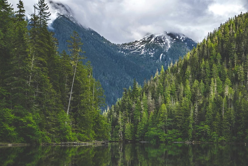
Schoen Lake Provincial Park is a protected area located on the northern end of Vancouver Island in British Columbia, Canada. The park is situated within the Regional District of Mount Waddington, and it has three named peaks. The tallest peak in the park is Mount Schoen (1,865 m/6,119 ft) and the most prominent peak in the park is Genesis Mountain (1,486 m/4,865 ft).
Schoen Lake Provincial Park is located about 130 km (78 mi) to the northeast of Campbell River on Vancouver Island in British Columbia, Canada. The park is situated in the Regional District of Mount Waddington, and it contains three named peaks as well as its namesake, Schoen Lake.
Mount Schoen is the tallest mountain in the park with 1,865 m (6,119 ft) of elevation and 843 m (2,766 ft) of prominence. It is a stunning peak to gaze upon while paddling Schoen Lake or while resting on the lake’s eastern shore while eating lunch.
Genesis Mountain is the most prominent peak in the park as it is 1,486 m (4,865 ft) tall with 932 m (3,048 ft) of prominence. The third and final mountain in the park is Mount Abraham (Seth Mountain) with 1,697 m (5,568 ft) of elevation and 306 m (1,880 ft) of prominence.
Other parks that are located nearby include Woss Lake Provincial Park, Strathcona Provincial Park, and the Lower Tsitika River Provincial Park.
Highway 19 is the primary highway on the north end of Vancouver Island and it is the primary access road to Schoen Lake Provincial Park. The final kilometers of road on Highway 19 before arriving at the park are not paved; however, cars and RVs usually don’t have problems navigating this section of rough road.
The geology of Schoen Lake Provincial Park is typical of the Vancouver Island Ranges. The park is composed of the sedimentary and volcanic layers of rock that are consistent with the Wrangellia terrane, which formed hundreds of millions of years ago.
Wrangellia is composed of layers of volcanic and marine sedimentary rock that accumulated in the Pacific Ocean. About 150 million years ago, Wrangellia collided with the coastal margin of North America. This collision was part of the mountain building event that formed the Columbia, Coast, and Rocky Mountains.
As Wrangellia’s tectonic plate subducted beneath North America, the terrane buckled against the continental margin, forming the Insular Mountains. The Insular Mountains contain the Vancouver Island Ranges, Haida Gwaii, part of the Alaska panhandle, and the islands of the Inside Passage.
During the Pleistocene, an ice sheet and glaciers covered Vancouver Island, including the mountains of Schoen Lake, grinding away the softer rock. The strait between Vancouver Island and the west coast of British Columbia is estimated to have a layer of glacial till that’s over 100 m (330 ft) thick deposited on the seafloor.

The ecology of Schoen Lake Provincial Park represents the full extent of Vancouver Island’s mountain ecology. The alpine is representative of the Coastal Mountain-Heather Alpine ecology, while the subalpine is part of the Mountain Hemlock ecology, and the valleys are part of the Coastal Western Hemlock ecology.
The park contains a diverse mountain ecology with rocky peaks that are covered with communities of mountain heather and old growth forests that are found along the slopes and in the valleys.
The upper elevations of the park consist of old growth forests of mountain hemlock, Pacific silver fir, and yellow cedar. The valleys, lake shore, and the areas along the creeks in the park are filled with massive Douglas fir, western red cedar, big leaf maple, and alder.
Black bears, Columbian black-tailed deer, Roosevelt elk, cougars, and wolves are the primary wildlife of the park. Roosevelt elk are a relatively rare species on Vancouver Island and the park’s snow depth is a limiting factor for ungulate habitation; however, the valleys and wetlands associated with the park are productive and they serve as an important part of the summer range for the elk.
Columbian black-tailed deer are an important species in the park and the park provides several areas that are suitable for winter ranges for the deer. The deer are a major food source for the wolves who bring a balance to the deer population.
The lake and wetlands in the park are home to loons and mergansers as well as several fish species. Cutthroat trout are the main fish species in the lake, accounting for 95 percent of the fish caught, with rainbow trout and dolly varden accounting for the remaining fish population. Schoen Lake is considered a fantastic lake to fish, with very favorable success rates.
Schoen Lake Provincial Park became a park in 1977. It was established in order to protect, exhibit, and interpret the geology and ecology of the Insular Mountains Natural Region on Vancouver Island. While there are no known archaeological sites within the park, the park is suspected to have been part of a hunting and fishing corridor by the Nootka First Nations.
The park has no significant recent historical events associated with it, aside from some logging that has occurred over the past century. There are tree carvings on the east end of Schoen Lake that date back to 1938, and there are anecdotal stories of Otto Schoen hunting and trapping in the area at the turn of the century.

Schoen Lake Provincial Park is a phenomenal local provincial park for residents of Campbell River and the communities on the north end of Vancouver Island. It is also an excellent destination for those looking for a wilderness experience.
The park has a small vehicle accessible campground on the west side of the lake; however, most travel through the park requires boating across Schoen Lake.
Trails available in the park include:

The north end of Vancouver Island, which is part of the Regional District of Mount Waddington, is the least densely populated and most rugged area of the island. The following are some of the communities around Schoen Lake Provincial Park.
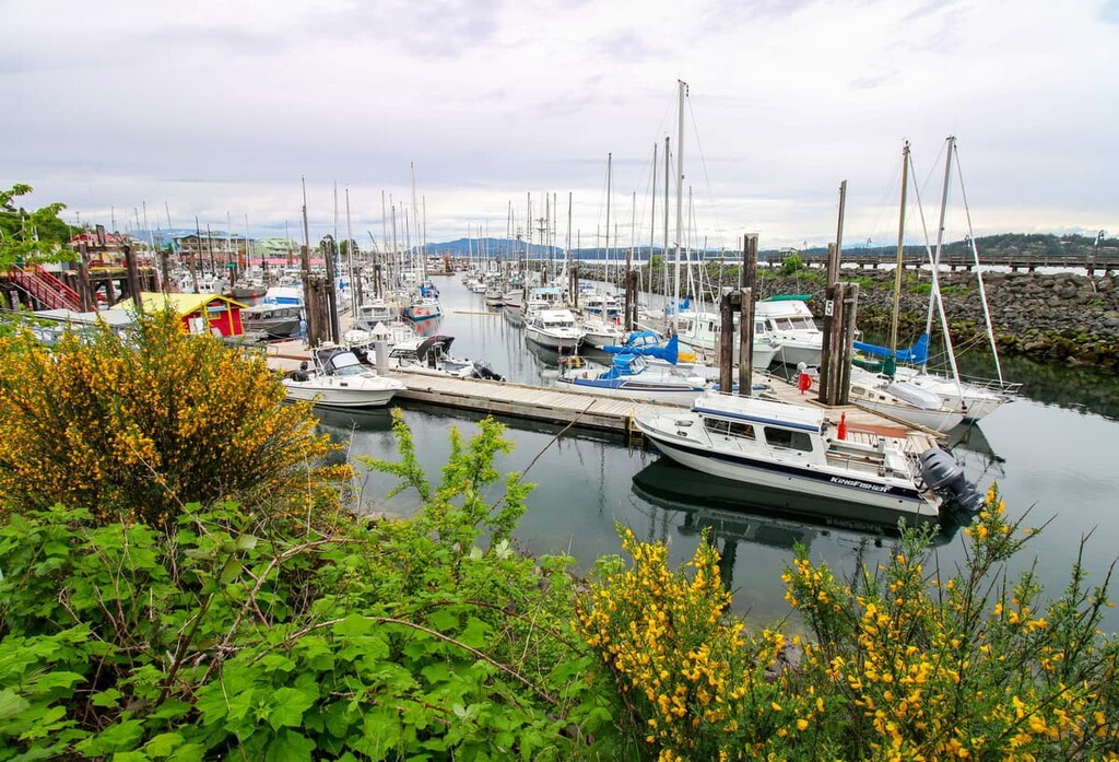
The city of Campbell River is the gateway to the north end of Vancouver Island. It is the largest and closest city to Schoen Lake Provincial Park. From Campbell River, it’s only a 132 km (80 mi) drive northeast to the park along Highway 19.
Campbell River is home to an incredible stretch of beach, where you can sit on beautiful volcanic outcrops, cobble rocks, or soft sand. There are stunning views into the Georgia Strait toward the Pacific Ranges on the mainland as well as toward Quadra Island, Cortes Island, and many of the other islands that make up the Discovery Islands.
In addition to being a gateway to the north end of the island, Campbell River is also home to the ferry terminal that gives access to the beautiful Discovery Islands. The islands are home to incredible wilderness parks, such as Ha’thayim Marine Provincial Park on Cortes Island and Maine Lake Provincial Park on Quadra Island.
If you don’t want to board a ferry, Elk Falls Provincial Park is only a short drive away, as are the trails in Strathcona Provincial Park, and Seal Bay Regional Nature Park. Between Campbell River and Comox, to the south, there are many more spectacular wilderness areas for hiking and mountain biking.
Port McNeill is home to the regional offices of the Regional District of Mount Waddington. Here, the primary industries are logging and tourism. The town is located about 90 km (54 mi) to the northwest of Schoen Lake Provincial Park along Highway 19.
As the gateway to the scenic islands of Broughton Archipelago, Port McNeill has regular ferry service to Alert Bay on Cormorant Island, and Sointula on Malcolm Island. The town is also home to the Port McNeill Airport, which is the regional airport for the north end of Vancouver Island.
The seaways and wilderness areas of north Vancouver Island are beautiful and full of opportunities for exploring and adventure. Some of the amazing places to visit are the scenic islands of the Broughton Archipelago, where there are several marine provincial parks. Here, you could also check out Nimpkish Lake Provincial Park and the beautiful Cape Scott Provincial Park.


