
Scan the QR code and open PeakVisor on your phone
Ha’thayim Marine Provincial Park is a protected area located on Cortes Island, one of the Discovery Islands in the Inside Passage between Vancouver Island and mainland British Columbia, Canada. The park is best accessed by boat; however, there are hiking trails that lead into and throughout the park. Cliff Peak is the only peak in the park and it has an elevation and prominence of 446 m (1,463 ft).
Located on Cortes Island, Ha’thayim Marine Provincial Park is one of several provincial parks on the Discovery Islands of British Columbia, Canada. The Discovery Islands are located to the east of the Campbell River, in the Inside Passage between Vancouver Island and the mainland. They are accessible by private boat or by ferry from Campbell River.
Ha’thayim Marine Provincial Park is about 13 square kilometers (5 square miles) in size and it has one named peak. Cliff Peak is the only peak in the park, and it has an elevation and prominence of 446 m (1,463 ft).
The park is accessible by private boat or by hiking trails that start from either Squirrel Cove or the trailhead at the salmon enhancement facility along Whaletown Road.
The main islands of the Discovery Islands are Quadra Island, Cortes Island, Read Island, Maurelle Island, and Sonora Island. Quadra and Cortes Islands are home to most of the residents of the Discovery Islands and are the only islands accessible by ferry.
The Inside Passage is a popular route for cruise ships to visit when traveling to Alaska because of the spectacular landscapes, wildlife, and scenery found in the region. In addition to Ha’thayim Marine Provincial Park, there are several other provincial and regional parks in the Discovery Islands, including:
Cortes Island, along with the rest of the Discovery Islands, is part of the Insular Mountains which are situated off the west coast of British Columbia, Canada. In addition to the Discovery Islands, the Insular Mountains also include the Vancouver Island Ranges, Haida Gwaii, and most of the islands off the west coast of British Columbia.
The Insular Mountains started forming about 380 million years ago as volcanoes erupted in the Pacific Ocean and started creating land masses of volcanic rock. Although marine sediments later accumulated over the earlier volcanic eruptions, these eruptions, which occurred 230 million years ago, created the predominant rock layer in the terrane. This rock layer is a massive, 6 km (3.6 mi) thick layer of basaltic volcanic rocks.
About 100 million years ago, the land mass, called Wrangellia, collided with the coastal margin of North America, causing parts to buckle and form mountains while other parts crumbled apart. Vancouver Island, the Discovery Islands, and, more specifically, Cortes Island, are the peaks of the submerged Insular Mountains.
During the Pleistocene, an ice sheet covered the Inside Passage and all the Discovery Islands, eroding most of the jagged peaks into rounded hills. There were several successive glaciations that also eroded and shaped the islands and their terrain. In total, about 110 m (360 ft) of glacial debris was deposited in the Georgia Strait, which surrounds the Discovery Islands.
The ecology of Ha’thayim Marine Provincial Park is representative of the Coastal Western Hemlock Zone.
Dense forests of Douglas fir, western hemlock, and western red cedar dominate the park and Cortes Island, in general. Stands of Sitka spruce, lodgepole pine, big-leaf maple, and red alder round out the species of trees that are prevalent around Von Donop Inlet of Ha’thayim Marine Provincial Park.
There are areas of mature old growth forest in the park between the inlet and Robertson and Wiley Lakes. Meanwhile, other areas in the park are predominantly forested with mature second growth forests where the remnant stumps of giant Douglas fir and cedar can be found. Oregon grape and other shrubs are part of the understory in these forests, as are shade-tolerant ferns that frequently stand over 1.5 m (5 ft) tall.
The forests, rivers, lakes, and inlets in the park are home to a spectacular variety of wildlife. Flying and Douglas squirrels are common in the forests and both river otters and mink can be found in the park, too. Wolves are a frequent visitor to the park, as are seabirds, whose populations in the park balloons during the winter.
Various species of thrush, including Swainson’s thrush, flycatchers, as well as yellow-rumped townsend’s and black-throated grey warblers, are inhabitants of the park. Additionally, majestic bald eagles are often seen soaring overhead above the inlet.
Ha’thayim Marine Provincial Park is specifically a marine park, and, as such, the region’s marine wildlife is an important reason for the conservation of the area. California and Steller’s sea lions are present in the inlet, and orcas may be present along the northern channel of the park.
Butter clams and littleneck clams are present in Ha’thayim Marine Provincial Park, as are jellyfish, sea cucumbers, octopus, sea sponges, and tunicates. The waters are also noted for their populations of salmon and rockfish.
Although the park was officially established in 1993, Ha’thayim Marine Provincial Park is the traditional territory of the Klahoose First Nation, which is one of the Coast Salish First Nations. The area has been used for generations for harvesting resources from the land and the sea.
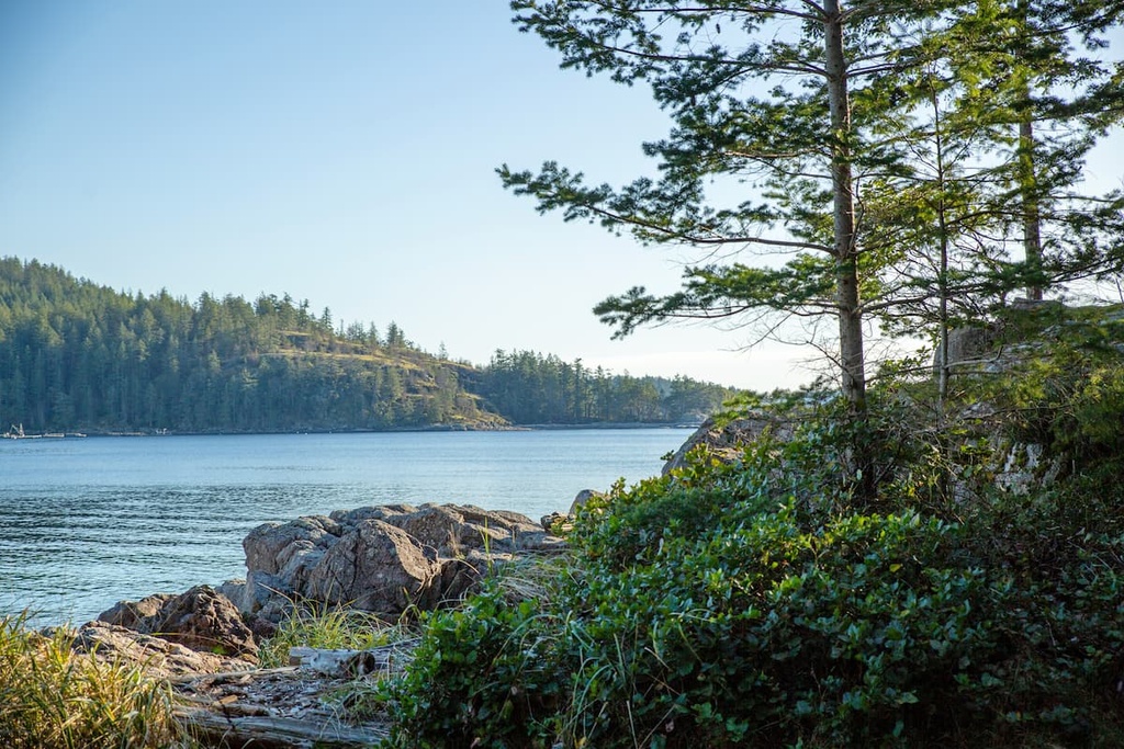
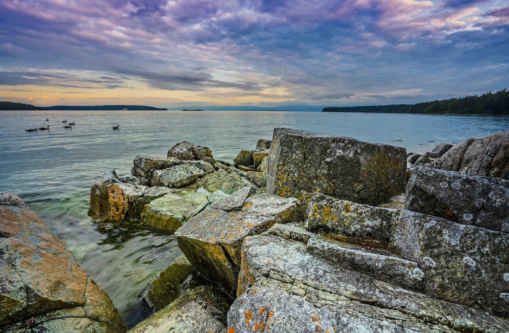
The main feature of the park is Von Donop Inlet, which was named by Captain Daniel Pender of the Royal Navy during his survey of the region between 1860 and 1879. However, First Nations had already named the inlet Ha’thayim.
Since being surveyed in the late nineteenth century, the inlet was subject to extensive logging of the old growth forests. Soon afterwards, settlements were constructed in the park. The land is currently home to regenerated mature second growth forests, where logging had occurred over the past 150 years. These settlements are also inconspicuous as nature is reclaiming the park.
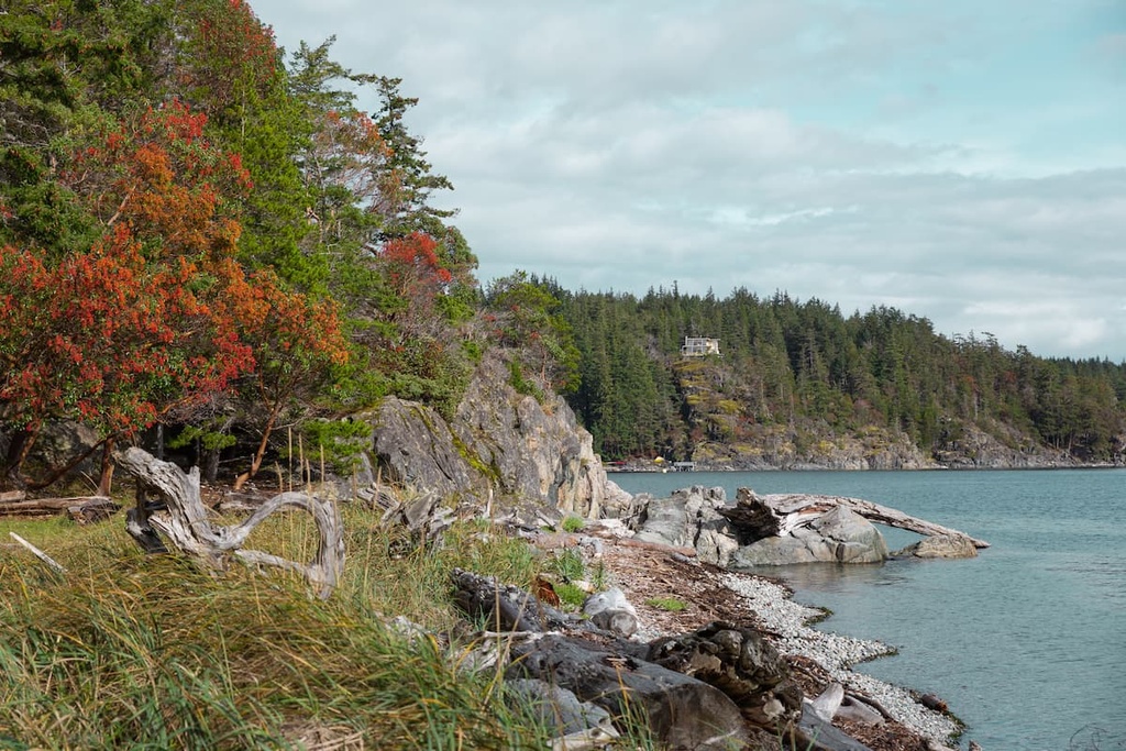
Ha’thayim Marine Provincial Park is only 13 square kilometers (5 square miles) in area, and it is centered around Ha’thayim, or Von Donop Inlet. The major feature of the park is the inlet itself, which provides a mostly sheltered harbour to boats.
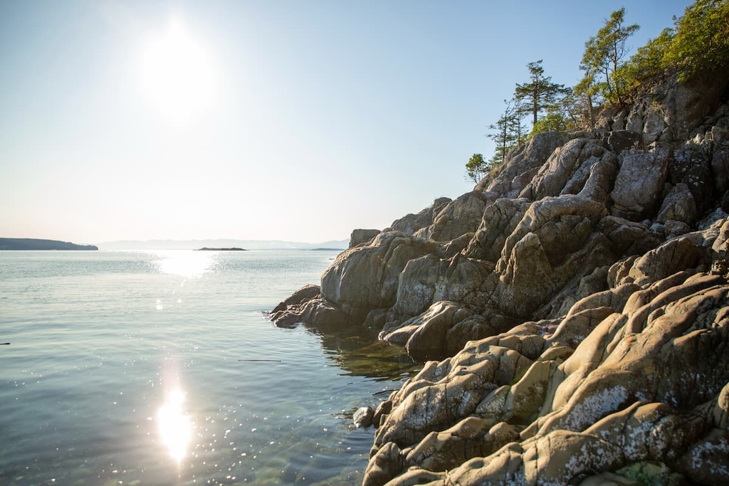
Along the inlet are beautiful cliffs and a shore that is covered in dense forest and vegetation. There is no road access directly into the park and there are no official trails in the park; however, there are some well-travelled trails between the inlet and the community of Squirrel Cove and the trailhead at the Klahoose Salmon Enhancement Facility.
The trail from the salmon enhancement facility, off Whaletown Road is an easy 3 km (1.8 mi) walk from the trailhead to the inlet, whereas the trail to Squirrel Cove is about 5 km (3.1 mi) long. According to those who travel to the park by boat, many visitors moor their boat in the harbour and walk to Squirrel Cove for supplies or a cold beer.
While there are no official trails in the park, there are well worn paths to the inlet. There are also some paths to other locations in the park; however, the trails are not as popular, and they may be more difficult to find.
Some of the locations around the park that visitors trek to include Robertson and Wiley Lake, as well as Cliff Peak, the only summit within the provincial park. The forest trails here are spectacular as they let you wander among massive ferns that carpet the forest floor under a canopy of alder, Douglas fir, big-leaf maple, and cedar.
The rocky and rugged coastline in the region is extremely beautiful and wilderness camping is permitted within the park. There are also plenty of picturesque places to camp if you have travelled by land as opposed to the sea.
Visiting Ha’thayim Marine Provincial Park on Cortes Island requires a private boat or two ferries from Campbell River, which is located on Vancouver Island. The park and Cortes Island can be seen in a day trip; however, if you have the time, you can have an amazing experience by spending at least a couple days on the island.
The following are the major towns and accommodations that you can check out while visiting Ha’thayim Marine Provincial Park.
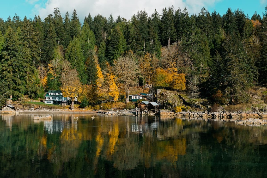
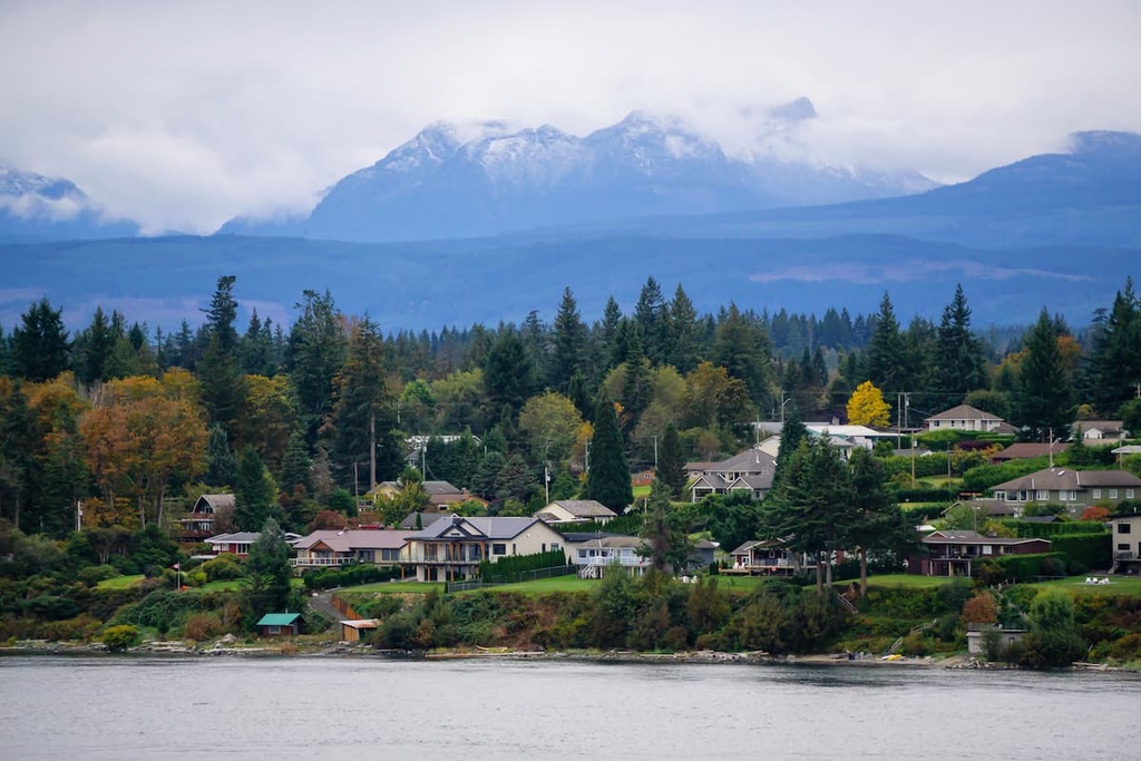
There are many small towns and resorts located on Cortes Island in which you can find lodging and supplies for your island adventures.
If travelling by vehicle, Whaletown is the town that you’ll find at the entrance to the ferry terminal on Cortes Island. The main commercial centers on the island are Whaletown on the west side, Manson’s Landing in the south, and Squirrel Cove on the east.
The offerings for supplies on the island are fairly extensive; however, prices are often double what you will find on the mainland, or even on Vancouver Island. As mentioned, there are also many resorts across the island, and there are several restaurants, too.
Smelt Bay Provincial Park, on the south end of Cortes Island, is home to the main provincial, vehicle accessible campground on the island. The beaches along Smelt Bay Provincial Park are secluded, and they offer great views of the city of Campbell River on Vancouver Island and of Quadra Island.
Located on the east coast of Vancouver Island, Campbell River is connected to the rest of the island via Highway 19, which is the major highway on this part of Vancouver Island. From here, you need to take two ferries to reach Ha’thayim Marine Provincial Park on Cortes Island.
Campbell River is the gateway city to the Discovery Islands if you are travelling by vehicle. The first ferry ride is a short trip across the Discovery Passage to the terminal at Quathiaski Cove. When travelling to Cortes Island, you must then take the 45 minute ferry ride from Heriot Bay to Whaletown on Cortes Island.
Be aware that during the busy summer season, the ferries can fill up and you may not be able to board the voyage of your choice. Nevertheless, there are usually beautiful views, small cafés, and restaurants to enjoy at the harbour if you have to wait for your sailing.
There are some fantastic cafes and restaurants in Campbell River, as well as many seaside resorts and RV parks to stay in while visiting.
If you have time, the wilderness of Elk Falls Provincial Park is stunning and easy to get to. At Elk Falls, wide trails lead though forests of massive red cedars, Douglas fir, and bigleaf maple. The falls are stunning from several viewpoints, including a suspension bridge that spans the canyon.
Other trails worth hiking are the Campbell River Lookout Trail, the trail to Mount Menzies, and the Quinsam River Hatchery Trail. Here, the weather is beautiful, the food is great, and the wilderness is majestic. All of these features make Campbell River a worthwhile destination while exploring Vancouver Island or an exciting stop along your trail to the Discovery Islands.


