
Scan the QR code and open PeakVisor on your phone
Located on the shores of Nimpkish Lake on Vancouver Island in British Columbia, Canada, Nimpkish Lake Provincial Park is a protected area that encompasses and preserves the old-growth forests of the Tlakwa Creek drainage in the Karmutzen Range. Karmutzen Mountain (1,426 m/ 4,678 ft) overlooks Nimpkish Lake and is the highest point in the park.
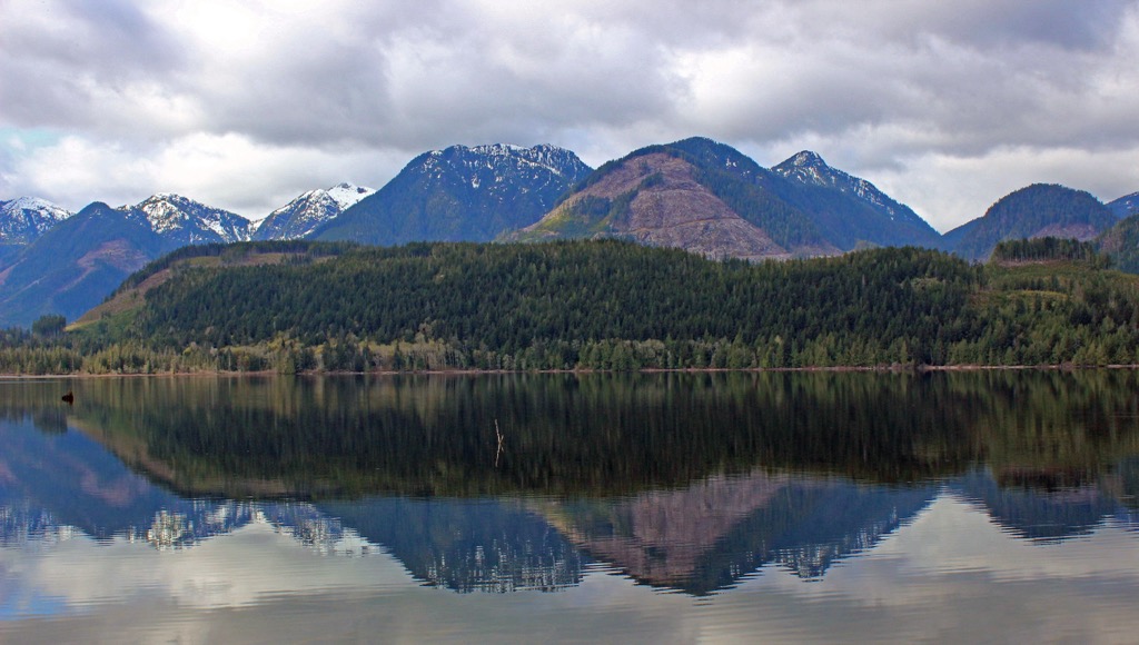
Nimpkish Lake Provincial Park encompasses the southern end of Nimpkish Lake and the eastern slopes of the Karmutzen Range on Vancouver Island in British Columbia, Canada. Typically, visitors access the remote wilderness park via boat from the Kim Creek recreation site, which is located between Woss and Port McNeill.
Additionally, there are several logging roads that end near the park boundary. Some of these logging roads can serve as good starting points for strenuous hikes into the park.
Telkwa Creek, Upper Tahsish River, Kilpala Creek, and Karmutzen Creek roads all lead near the park, too. However, visitors should seek information on the road activity before heading to the area. It’s also important to be very cautious of the loaded logging trucks that drive on the region’s roads as unsuspecting drivers can cause serious accidents if they’re not paying attention.
Nimpkish Lake Provincial Park is one of many remote wilderness parks that’s located on the northern end of Vancouver Island. Some of the other nearby parks that are worth visiting include:
Karmutzen Mountain is the only peak in Nimpkish Lake Provincial Park. The peak is the namesake of the Karmutzen Range, and it is 1,426 m (4,678 ft) tall. The mountain offers opportunities for backcountry camping, hiking, and mountaineering.

Nimpkish Lake Provincial Park encompasses the southeastern slopes of the Karmutzen Range, which are part of the Vancouver Island Ranges. The Vancouver Island Ranges are also part of the greater Insular Mountains.
The geology of the Vancouver Island Ranges is relatively consistent. However, each of the range’s subranges has its own unique geologic properties.
The Insular Mountains, which contain the Vancouver Islands Ranges, also include the peaks that form Haida Gwaii as well as some of the mountains in the Pacific Ranges of the Canadian Coast Mountains.
In Nimpkish Lake Provincial Park, the Karmutzen formation dominates the local geology of the Karmutzen Range. The Karmutzen formation is a sequence of pre-Cretaceous sedimentary and volcanic rocks that have been intruded by granitic batholiths. The Karmutzen formation is likely one of the thickest visible accreted sections of an oceanic plateau in the world.
The Karmutzen formation features alternating sedimentary and volcanic rocks and is visible across Vancouver Island. The formation contains over 6 km (3.6 mi) of basal sediment-sill complexes, basaltic pillow lavas, pillow breccia, and thick basalt flows. It is part of the Wrangellia terrane, which formed as a volcanic island arc in the Pacific Ocean about 300 million years ago.
The Wrangellia terrane rose above sea level about 200 million years ago due to major volcanic eruptions. The eruptions lasted about 5 million years and created the majority of the Karmutzen formation.
It was around 105 million years ago that, while riding upon the Farallon Plate, Wrangellia accreted to the western continental margin of North America and formed the basis for Vancouver Island, Haida Gwaii, and the many islands of the west coast of British Columbia and Alaska.

With additional outboard terranes crashing into the west coast of Vancouver Island, the Karmutzen Range rose to be taller than the range as we see it today. The Karmutzen Range was subjected to periods of uplift and intense erosion over the course of millions of years as rivers found new paths through the range.
In general, this period of pre-Pleistocene uplift and erosion created an extremely rugged topography across northern and central Vancouver Island. The mountains of Strathcona Provincial Park, Schoen Lake Provincial Park, and Nimpkish Lake Provincial Park are examples of the rugged topography that was created during the initial uplift of the Insular Mountains.
Vancouver Island was subjected to several major glacial events during the Pleistocene that covered the island in over 1,200 m (4,000 ft) of ice. Local glaciers carved out the bases of the serrated peaks of the Karmutzen Range that stood above 1,200 m (4,000 ft). During this time, these tall peaks, including Karmutzen Mountain, stood as monadnocks above the ice sheet.
The layers of sedimentary limestone that are now found across the Karmutzen formation are the cause of many unique formations and cave systems. When water dissolves limestone to create caves and other features, it often creates a phenomenon called karst topography.
Vancouver Island is home to over 1,600 known caves that formed in its limestone karst terrain. Nimpkish Lake Provincial Park is home to visible karst formations along the shores of the lake, which appear as a line of limestone; however, there are no known caves in the park itself.
Nimpkish Lake Provincial Park is home to a unique variant ecology of the temperate rainforest that dominates the island and west coast of Canada. The area is part of the Coastal Western Hemlock ecosystem; however, the eastern slopes of the Karmutzen Range, including Nimpkish Lake Provincial Park, are considered to be relatively dry.

The relatively dry climate of the park is likely the result of a localized rain shadow from the Karmutzen Range. There are areas of old-growth forests in the park, especially along the shore of the lake; however, most of the park is filled with second-growth forests.
Western hemlock, amabilis fir, Douglas fir, and yellow cedar are the typical trees of the forests of Nimpkish Lake Provincial Park. The second-growth forests are primarily the result of the railway-related logging of the Telkwa drainage in 1928.
The park contains animals that are typical of northern Vancouver Island, including black bears, Vancouver Island gray wolves, and Columbia black-tailed deer. Telkwa Creek is important for spawning salmon and the park contains habitat for the endangered northern goshawk and marbled murrelet.
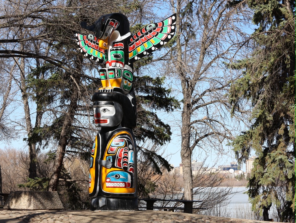
Nimpkish Lake Provincial Park is part of the traditional territory of the Namgis First Nation. The park contains many historical and cultural artifacts that are important to local First Nations.
In particular, within the park are the remains of a former Namgis village, which was used at different times of the year for fishing, hunting, and gathering resources. Other evidence of First Nations use of the region includes the many culturally modified trees that are found within the park.
Culturally modified trees can take many forms, but in this area, they are typically cedar trees that have had part of their bark removed in strips. These cedar strips could have been large enough for use as planks or for building houses. Other times, these strips of bark were used for making clothing or baskets.
Furthermore, Nimpkish Lake was part of an ancient grease trail, which was a trade route that led across Vancouver Island. The route crossed the island to Kyuquot Sound by way of the Tahsish River, Atluck Lake, and Nimpkish Lake.
Grease trails are traditional trade routes that started at the coast and led inland that coastal First Nations historically traveled to trade eulachon oil. Eulachon oil has long been processed from small fish in the region and was historically traded to inland First Nations for obsidian, copper, furs, and other resources.
It was only in 1928 that the idyllic wilderness peace of Nimpkish Lake Provincial Park was interrupted as a railway was built along the Telkwa drainage to aid in the removal of the region’s valuable large old-growth trees.
The Telkwa drainage was heavily logged at this time; however, the drainage is the only part of the park that was historically logged, and there are still large stands of old-growth in the park that can be found along the shores of Nimpkish Lake.

In and around Nimpkish Lake Provincial Park, there are many opportunities for wilderness recreation. Hiking, mountaineering, and backpacking are among the most popular activities in Nimpkish Lake Provincial Park. While Nimpkish Lake is not part of the park, it is also a popular destination for swimming, windsurfing, paddling, boating, and fishing.
During the summer, many visitors enter the park to make their way to the summit of Karmutzen Mountain. Hikers typically gain access to the park via one of the nearby forestry service roads, though there aren’t many maintained trails within the park itself.
Throughout the winter, Karmutzen Mountain and nearby Tlakwa Mountain are also destinations for advanced backcountry skiing and ski touring.

Nimpkish Lake Provincial Park is located among the northern ranges of Vancouver Island. While the northern end of the island is stunningly beautiful, it is sparsely populated compared to the southern end of the island. With that in mind, the following are the major cities and communities that are located near Nimpkish Lake Provincial Park.
As it is located about 25 km (15 mi) to the north of Nimpkish Lake Provincial Park, Port McNeill is the closest city to the park. Port McNeill is also home to the regional offices of the Regional District of Mount Waddington, and its primary industries are logging and tourism.

While it is the closest city to many of the northern parks on Vancouver Island, it is also the gateway to the scenic islands of the Broughton Archipelago. Indeed, Port McNeill has regular ferry service to Alert Bay on Cormorant Island and Sointula on Malcolm Island.
The seaways and wilderness areas of northern Vancouver Island are beautiful and full of opportunities for adventure. In addition to the beautiful Broughton Archipelago Marine Provincial Park, some of the other places to visit in the region include Nimpkish Lake Provincial Park, Little Huson Caves Regional Park, and the beautiful Cape Scott Provincial Park.
Campbell River is located about 170 km (102 mi) to the south of Nimpkish Lake Provincial Park, and it is nestled along the eastern coast of Vancouver Island.
The city calls itself the Salmon Capital of the World and is essentially the gateway to the north end of Vancouver Island. There are many great places to stay, fantastic places to eat, and some incredible beaches for relaxation in and around the town of Campbell River.

Campbell River is also located close to some great recreational and hiking areas, such as Strathcona Provincial Park, Schoen Lake Provincial Park, Mount Arrowsmith Massif Regional Park, and Elk Falls Provincial Park. Also, there are a number of great local hikes and walks in the greater Campbell River region, including the Campbell River Lookout Trail, the trail to Mount Menzies, and the Quinsam River Hatchery Trail.
Elk Falls Provincial Park is located close to the city, too, and it has a well-maintained trail that leads through incredible forests filled with massive red cedars, Douglas firs, and bigleaf maples. There are even several vantage points along the trail where you can see the stunning Elk Falls, and there is also a suspension bridge that spans the canyon and overlooks the falls for visitors to enjoy.


