Scan the QR code and open PeakVisor on your phone
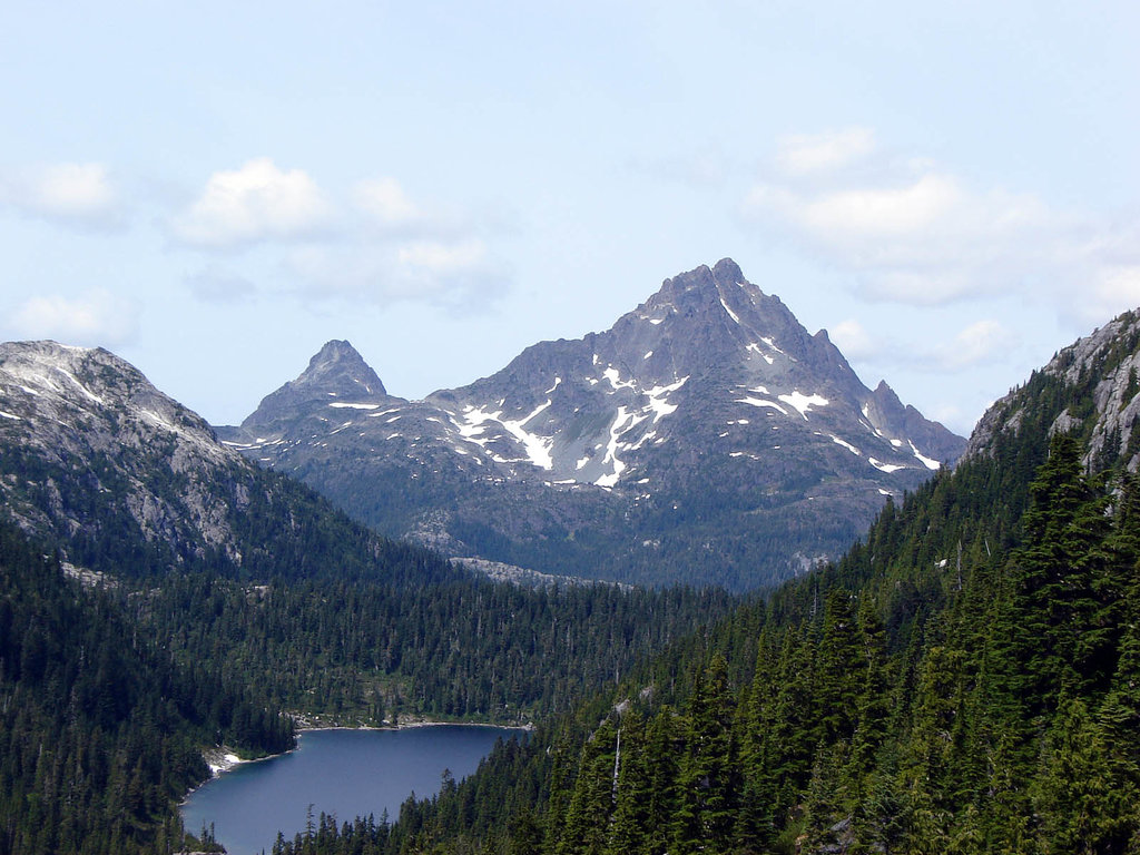
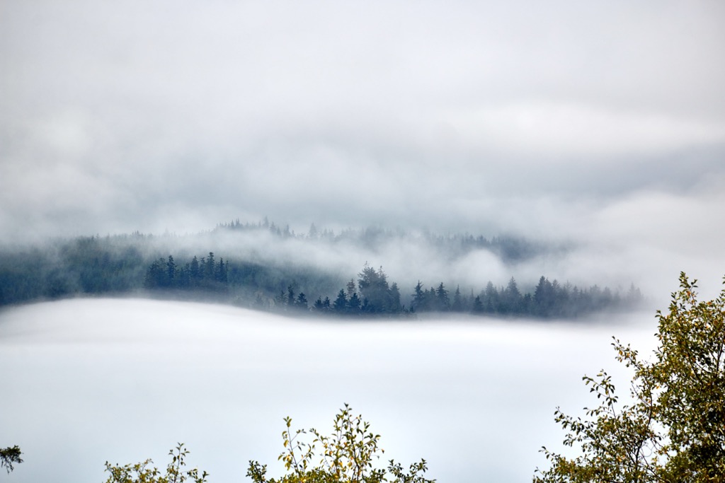
Situated at the head of Kyuquot Sound on the west coast of Vancouver Island in British Columbia, Canada, Tahsish Kwois is a rugged wilderness park. Snowsaddle Mountain (1,354 m/4442 ft) is the tallest of the park’s six peaks and it overlooks pristine lakes, rugged mountains, and forests of Giant Sitka spruce and western hemlock.

Tahsish Kwois Provincial Park is located on the west coast of Vancouver Island in British Columbia, Canada. Situated at the head of Kyuquot Sound, the park encompasses 6 peaks of the Vancouver Island Ranges that form the watersheds for the Tahsish River and Kwois and Silburn Creeks.
The park is in the Strathcona Regional District and the peaks are part of the Vancouver Island Ranges. Snowsaddle Mountain (1,354 m/4442 ft) is the tallest of the park’s 6 peaks and False Ears (1,059 m/3,474 ft) is the most prominent. False Ears has 913 m (2,995 ft) of prominence.
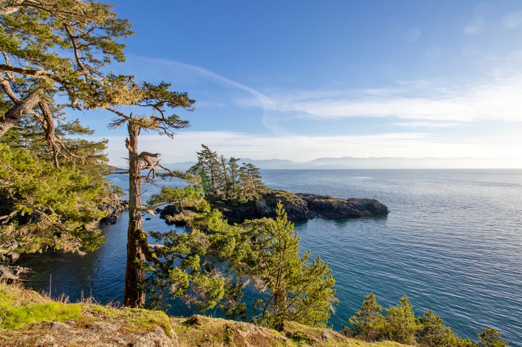
The park is isolated and there is no direct road access to the park. Many visitors paddle up Kyuquot Sound to arrive in the park and others arrive overland, hiking to the park from logging roads along the upper portion of the Tahsish River watershed.
Vehicles can reach the shores of Kyuquot Sound at Artlish River or Fair Harbour by way of the roads to the community of Zeballos. From these access points, visitors can start their paddling journey to Tahsish Kwois Provincial Park.
There are no facilities in the park; however, excursions are permitted, and overnight camping is allowed. Tahsish River Ecological Reserve is located within Tahsish Kwois Provincial Park and recreational activity is not appropriate within the ecological reserve, except for paddling up the river, through the ecological reserve, to access the rest of Tahsish Kwois Provincial Park.
Tahsish Kwois encompasses nearly 110 square kilometers (42 square miles) of Vancouver Island’s rugged west coast, making it one of the largest provincial parks on the island. Strathcona Provincial Park is the largest park on the island and the oldest in British Columbia. The following are some of the other parks nearby:
Tahsish Kwois Provincial Park is in the Vancouver Island Ranges which are part of the Insular Mountains. The Insular Mountains encompass the Vancouver Islands Ranges, the island archipelago of Haida Gwaii, as well as some of the mountains in the Pacific Ranges of the Canadian Coast Mountains.
In general, the Karmutzen formation dominates the local geology of the area, which is a sequence of pre-Cretaceous sedimentary and volcanic rocks that have been intruded by granitic batholiths. The Karmutzen formation is part of the ancient Wrangellia terrane and makes up one of the thickest visible accreted sections of an oceanic plateau in the world.
The formation alternates between layers of sedimentary and volcanic rock and it is visible across Vancouver Island. One of the major features of the formation and a dominant geological feature of the island is the 6 km (3.6 mi) thick layers of volcanic rocks, such as basal sediment-sill complexes, basaltic pillow lavas, pillow breccia, and thick basalt flows.
While the island arc that would become known as Wrangellia began forming about 300 million years under the Pacific Ocean, the thick layer of volcanic rocks formed about 200 million years ago. At the time, eruptions were ongoing for about 5 million years and produced the rock that forced the terrane above sea level.
Originally riding upon the Farallon plate, Wrangellia was slowly moving towards North America. About 105 million years ago, the Farallon plate was subducting beneath North America and the buoyant island arc was rafted from its original plate and accreted to the edge of the continent.
During the past 100 million years, additional terranes collided with Vancouver Island, uplifting mountains, and altering the local topography. In general, this period of pre-Pleistocene uplift and erosion created an extremely rugged topography across northern and central Vancouver Island.
The mountains of Strathcona Provincial Park, Schoen Lake Provincial Park, and Nimpkish Lake Provincial Park are examples of the rugged topography that was created during the initial uplift of the Insular Mountains. Furthermore, the glaciers and ice sheets of the Pleistocene had an effect on the topography, especially along the west coast of the island.
The local ice sheet likely covered Vancouver Island in over 1,200 m (4,000 ft) of ice which spread across the island from the mainland. There were some places that remained ice free during part of the Pleistocene, like the Refugium Range; however, however, most of the island was covered with ice.
Local glaciers carved the bases of the mountains and created the U-shaped valleys along the coast. In time, as the glaciers melted and the sea-level rose, the glacial valleys along the west coast were filled with water and became the rugged fjords of western Vancouver Island. Some of the long inland lakes, like Nimpkish Lake, were also created by glaciers.
Tahsish-Kwois Provincial Park is located at the head of the Kyuquot Sound where the Tahsish River flows into Tahsish Inlet. The park features old-growth forests covering the majestic peaks of the Vancouver Island Ranges, a high-elevation and a low-elevation lake, a scenic river canyon, and a pristine tidal estuary.
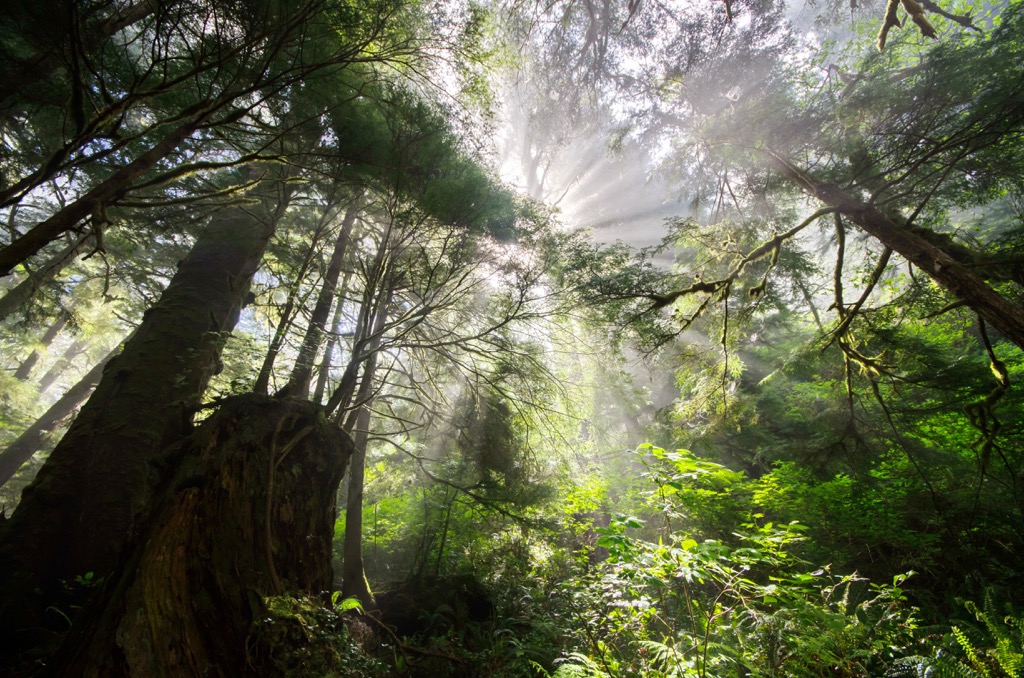
Sitka spruce, western red cedar, alder, big leaf maple, and western hemlock dominate the lower elevation forests. The higher elevation forests transition to have yellow cedar and mountain hemlock as well.
Vancouver Island grey wolves, cougars, and black bears are all common inhabitants of the park, as are river otter, mink, raccoon, black-tailed deer, and Roosevelt elk. The lower Tahsish River is believed to be among the best elk ranges on Vancouver Island.
At the mouth of the Tahsish River is a 70 hectare (173 acre) tidal estuary which constitutes the Tahsish River Ecological Reserve, encompassed within Tahsish Kwoi Provincial Park. The lush estuary is home to tidal meadows that contain tidal meadows and unaltered Pacific tidal estuary habitat and various rare species of flora and habitat for the marbled murrelet.
Tahsish-Kwois Provincial Park is in the traditional territory of the Ka:’yu:’k’t’h’/Che:k’tles7et’h’ First Nations. Hunting and fishing were the most prominent traditional activities practiced. Nearby, upon the Tahsish River estuary there is a village site that was traditionally inhabited during the salmon season. While there are no standing structures, archaeological deposits are expected to be present.
Historic documents and native legend refer to further use of the area as part of a major trade route known as the Grease Trail. There were many Grease Trails that ran inland from the coast. This particular Grease Trail ran between Tahsish Inlet and the mouth of Nimpkish River via the Tahsish River valley, Atluck Lake and Nimpkish Lake.
It was determined that the wilderness around the Tahsish Inlet required conservation, otherwise industry would likely come and destroy the delicate and valuable habitat. As such, Tahsish-Kwois Park was established in 1995, with an addition in 2001 to further protect the estuary and some old growth forest.
For those willing to make the trek to the rugged west coast park they will not be disappointed. Tahsish Kwois Provincial Park features rugged mountains and coastline, old growth forests, two lakes, a scenic river canyon, and tranquil river valleys.
Visitors can enter the park by paddling their canoe or kayak Tahsish Inlet, viewing the spectacular shoreline along the way. However, when arriving by boat, visitors must first paddle through Tahsish River Ecological Reserve where recreational use is prohibited. Paddlers are permitted to travel the river, through the ecological reserve, to reach the park.
Whether paddling or hiking, random wilderness camping is permitted in the park as there are no designated campsites or other facilities. Visitors are asked to practice “Leave No Trace” camping ethics and as a special note, campfires are only permitted within two kilometers of the coast.
When visiting the park, hunting within season and with a license is permitted, as is fishing with the appropriate license. While difficult to access, there is good fishing up the Tahsish and Kwois rivers which are home to coho, Chinook, chum, and pink salmon as well as three species of trout and Char.
Tahsish Kwois Provincial Park is on the rugged west coast of Vancouver Island where access is limited. Most areas along the west coast are only accessible by boat or plane, and Tahsish Kwois is no exception. The following are some of the closest communities and gateway cities to the remote wilderness of the west coast of Vancouver Island.
When traveling to Tahsish Kwois Provincial Park, the small community of Fair Harbour is pretty much the end of the road and is several kilometers southwest of the park. From Fair Harbour visitors can charter boats or planes to visit the park or launch their own personal watercraft to travel across the sound to Tahsish Kwois Provincial Park.
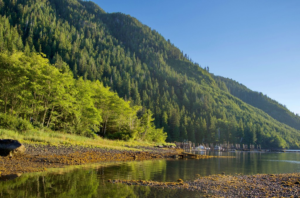
The community is reached via logging roads and it has a campground for visitors, a government dock, rental cabins, fuel, and basic facilities for people who are venturing to or from locations along the west coast.
Some of the wilderness areas that are accessible from Fair Harbour are Tahsish Kwois Provincial Park, Checleset Bay Ecological Reserve, Mquqᵂin/Brooks Peninsula Provincial Park, and Big Bunsby Marine Provincial Park. Some of the landside parks near Fair Harbour that are good for hiking include Woss Lake Provincial Park, Nimpkish Lake Provincial Park, and Artlish Caves Provincial Park.
The village of Zeballos is about 30 km (18 mi) south of Tahsish Kwois Provincial Park. Zeballos is a deep-sea port surrounded by dense forests and rugged mountains and the logging roads that lead towards Fair Harbour and the park generally pass by Zeballos.
The community is a popular starting point for excursions along the rugged west coast of Nootka Sound and Kyuquot Sound as well as into the nearby Haihte Range. Nootka Island, Fair Harbour, and Brooks Peninsula Provincial Park are other popular locations to visit from Zeballos.
ORiginally a gold mining town that was established in the 1930, the populations and industry peaked in the 1940s. The village's population now hovers around 100 people with most people working in the logging industry; however, there are some worthwhile small businesses that specialize in ecotourism and sight-seeing.
Campbell River is on the east side of Vancouver Island and is considered the gateway to all of northern Vancouver Island. The city calls itself the Salmon Capital of the World and it is built along the Campbell River and the beautiful Inside Passage.
The city is surrounded with wilderness areas and incredible beaches. There are many great places to stay, fantastic places to eat, and many places for relaxation and adventure around town.
Some of the nearby wilderness areas include Strathcona Provincial Park, Schoen Lake Provincial Park, and Mount Arrowsmith Massif Regional Park which have great day hikes and opportunities for paddling and other excursions. Elk Falls Provincial Park is adjacent to the community and some of the other local hikes include the Campbell River Lookout Trail, the trail to Mount Menzies, and the Quinsam River Hatchery Trail.