
Scan the QR code and open PeakVisor on your phone
The Haihte Range include 13 named peaks. The highest is Rugged Mountain at 1,861 m. Other notable peaks include Merlon Mountain, Ya'ai Peak and Haihte Spire.
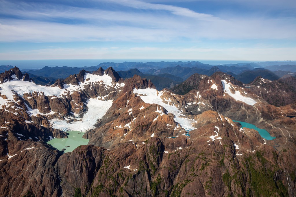
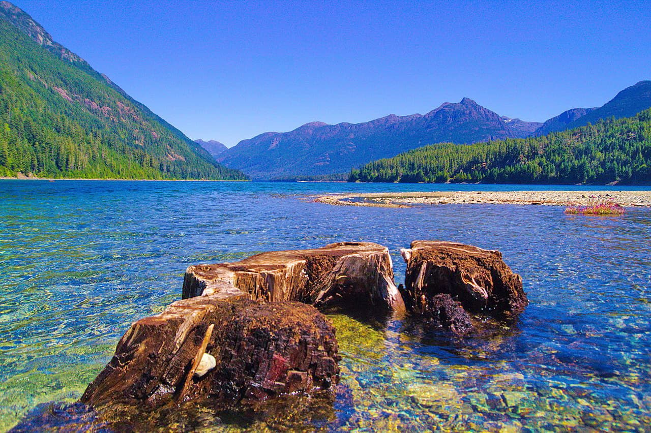
The Haihte Range is located on the northern end of Vancouver Island in British Columbia, Canada. The range has extensive alpine areas and is surrounded by the dense coastal forests of western hemlock and red cedar. Rugged Mountain (1,861 m /6,106 ft) is the tallest and most prominent of the range’s 13 peaks.
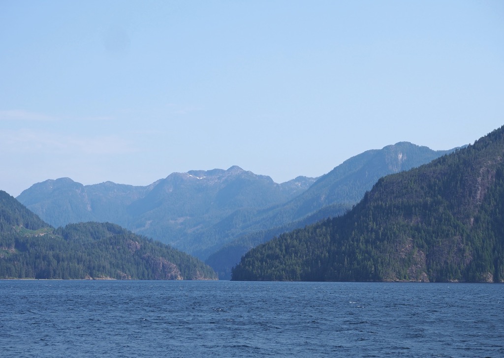
Northern Vancouver Island, in British Columbia, Canada is home to dense forests, rugged fjords and coastline, beautiful lakes, and untracked mountains. The Haihte Range is one the eighteen subranges of the Vancouver Island Ranges, which are part of the Insular Mountains.
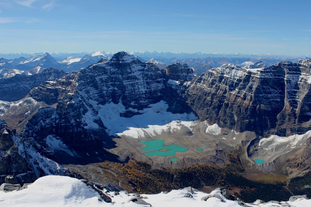
Often cited as a “Little Patagonia”, the range is a single arcing ridge system crowned with jagged spires that rise over glacial shelves. Geographically the range is west of the Tashsis River, northeast of the Nomash River, southeast of Zeballos Lake, and immediately west of Woss Lake. The Haihte Range contains some of the largest remaining glaciers on Vancouver Island.
Rugged Mountain is the tallest and most prominent peak in the range and is the third most prominent peak on Vancouver Island. It is 1,861 m (6,106 ft) tall with a prominence of 1,567 m (5,141 ft) it is part of the nine peaks climbers refer to as the “Island Qualifiers”.
Visitors can access the range from either Tahsis or Woss Lake; however, the most popular access is from the logging road in the Nomash River Valley. After following Highway 19, which is the major highway on the north end of the island, turn south onto the Zeballos Road just north of Woss.
Just outside the town of Zeballos is a major left turn towards the Nomash which leads to your destination. There is a pullout among the alders that marks the start of the N20, which is an old spur road that has been kept relatively clear as a trail. The N20 leads towards Nathan Creek Col which is often used as the location for basecamps during climbing and exploration of the Haihte Range.
The northeastern slopes of the range are part of Woss Lake Provincial Park; however, the other side of the range is not in a protected area. Some of the other parks that are nearby include:
The Haihte Range, which is a subrange of the Vancouver Island Ranges formed during several events which include the creation of the Wrangellia terrane and the subsequent uplift of the mountains of Vancouver Island.
Over 300 million years ago, oceanic volcanoes began to create a layer of volcanic rocks upon the floor of the Pacific Ocean. Around 280 million years ago was the start of an immense volcanic event which lasted millions of years and created the most notable part of the terrane which is a layer of basaltic and pillow lavas 6 km (3.6 mi) thick.
Wrangellia is referred to as an outboard terrane, which means that it was created away from where it sits now, typically having been created out in the ocean. The terrane was an arc of volcanic islands that moved east toward North America as rifts in the Pacific opened.
As Wrangellia’s tectonic plate approached and collided with North America, the oceanic plate subducted beneath the continent. The subduction of the oceanic plates beneath continents has to do with their relative densities and that oceanic plates are denser than continental plates.
As the oceanic plate slides violently beneath the continent, the buoyant islands are scraped off and added to the continental margin. Wrangellia was one of the most recent terranes to accrete to the western edge of Canada.
The Alaskan panhandle, Haida Gwaii, Vancouver Island, and many of the coastal islands off the coast of British Columbia are all part of the Wrangellia terrane which started colliding with North America about 170 million years ago.
Some of the peaks of the Vancouver Island Ranges started forming from this initial tectonic collision; however, the collision and accretion of two additional terranes to the west coast of the islands created the final uplift of the Haihte Range.
The Pacific Rim terrane and the Crescent terrane collided with the west coast of Vancouver Island about 60 million years ago and 45 million years ago, respectively. The collision and accretion of the Pacific Rim terrane is generally responsible for the uplift of the Haihte Range.
The Pacific Rim terrane consists of the lands that are now mostly protected as part of the Pacific Rim National Park Reserve which is along the west-central coast of the island. The Crescent terrane collided with the southern end of Vancouver Island and mainly lifted the Saanich Peninsula above sea level.
Most of the rocks in the Vancouver Island Ranges, including the Haihte Range, are volcanic in origin. There are abundant examples of volcanic and igneous rocks throughout the range and there are many examples of rocks that underwent metamorphism.
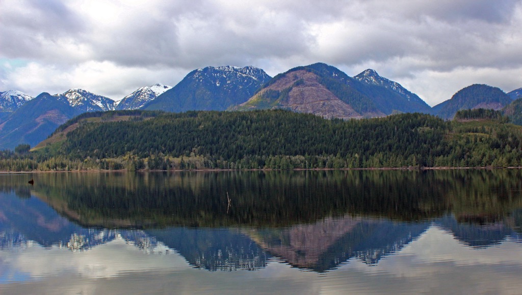
The Haihte Range is home to some of the largest remaining glaciers on Vancouver Island which have their origin as part of the vast ice sheet that covered western Canada during the Pleistocene. The Cordilleran Ice Sheet covered Vancouver Island at times during the Pleistocene.
Many of the island's original glaciers formed and flowed from the tallest peaks on the island, such as those around Golden Hinde in Strathcona Provincial Park. The glacial fingers of the ice sheet formed the valley that is now filled by Woss Lake and the fjords that are west of the Haihte Range.
The erosion caused by the movement of the glaciers and the ice sheets were responsible for creating much of the topography of the island that we see to this day, especially the long u-shaped valleys and fjords.
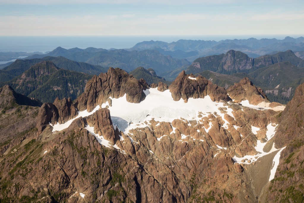
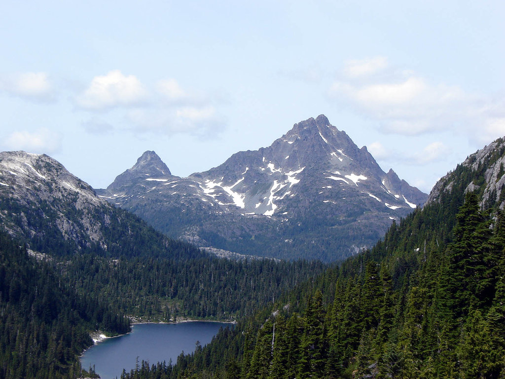
The Haihte Range has a rather extensive alpine area filled with rocky spires, craggy cliffs, and extensive glaciers and snowfields. The alpine area of the range is likened to the stunning Patagonia of South America.
Below the glaciers and rugged peaks are meadows of dense heather and grass which quickly transitions to dense forests of mountain hemlock and yellow cedar. The lower slopes are dominated by the incredible coastal rainforest.
The northern slopes are protected as part of Woss Lake Provincial Park and contain some of the original old-growth forests of massive western hemlock, red cedar, Sitka spruce, Douglas fir, big leaf maple, alder, and amabilis fir. Some of these trees are estimated to be over 400 years old.
However, logging has prevailed along the western slopes and the cut-blocks scar the landscape.
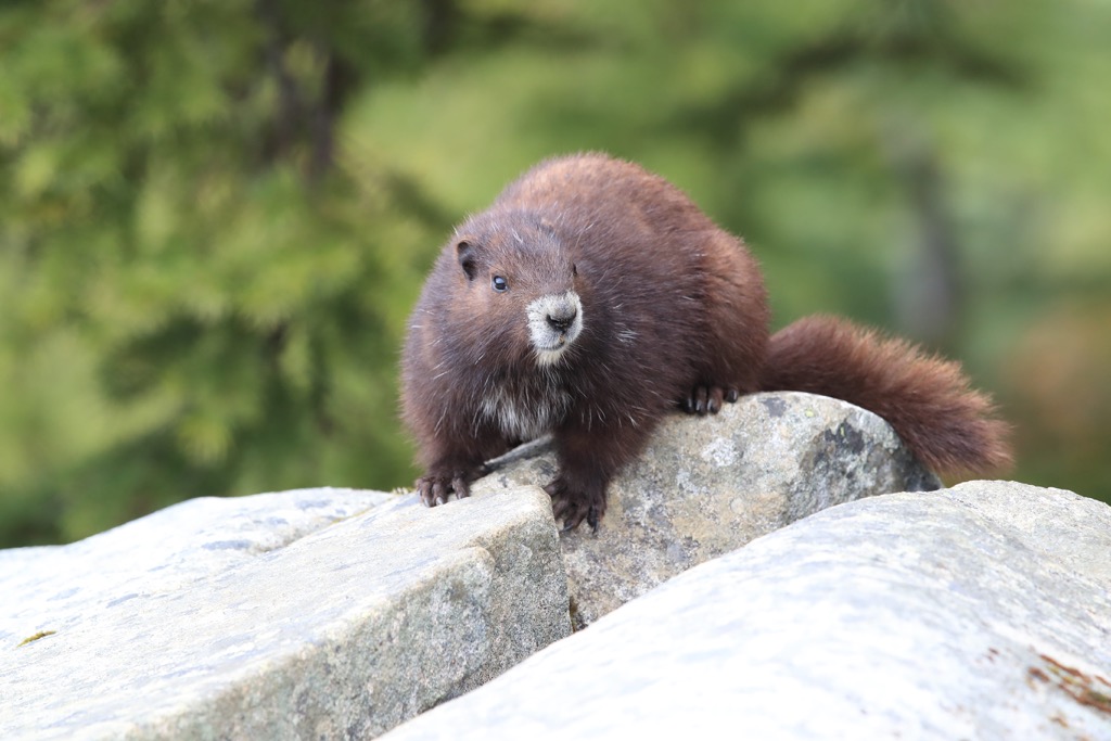
Vancouver Island wolves, black bears, and Columbia black-tailed deer are known to inhabit the Haihte Range. Other animals that inhabit the range are the Vancouver Island wolverine, Vancouver Island marmot, and Roosevelt elk.
While the arrival date of the ancient inhabitants to use and inhabit the Haihte Range and adjacent valleys is debated, it is likely that people first arrived in the area about 15,000 years ago. The range is part of the traditional territory of the Namgis First Nation and the area is an important part of their culture and identity.
Throughout the area there are pictographs, arborglyphs, and culturally modified trees that are related to the Namgis First Nation and their ancestors. Woss Lake Provincial Park which occupies the eastern slopes of the Haihte Range is home to several ancient villages, ceremonial, and spiritual sites.
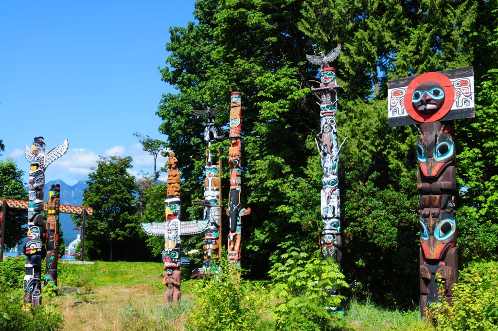
The area is also the site of several of the ancient origin stories that describe the emergence of some of the Namgis houses, or clans. Members of the Namgis First Nation still use the range for hunting, fishing, trapping, and the harvesting of food and traditional medicines.
An ancient Grease Trail runs along the southern end of the range connecting Woss Lake to the Tahsis Inlet. The trail facilitated trade and commerce between the Namgis and the adjacent Mowachaht / Muchalaht First Nations.
Rock climbing, ice climbing, hiking, mountaineering, and ski touring are all popular activities in the Haihte Range. Rugged Mountain is one of the most popular destinations in the range, as it is the tallest mountain in the range and one of the few ultra-prominent peaks on Vancouver Island.
Visitors to the range typically make their way to the Nathan Creek Col for their basecamp, after following the N20 spur trail. The trail certainly takes some effort and backcountry navigation skills; however, the Haihte Range is a spectacular location for whichever activity you choose.
Some people actually refer to the area around Rugged Mountain and Merlon Mountain as “Little Patagonia”, because it is a place for glacial mountaineering and trad climbing. The glaciers and persistent snowpack in the range also allows for some incredible winter ski-touring and is a great location for some late season runs.
The rugged wilderness and glacier-capped mountains of the range are incredible places for experienced backpackers and mountaineers to visit. The following are some of the closest communities to the Haihte Range.
Campbell River is the largest community on the northern end of Vancouver Island, and it is located about 150 km (90 mi) away from the Haihte Range. The city is located on the east coast of Vancouver Island, along the Campbell River.
The city has amazing walking paths along the coast that bring you to some of the region’s best beaches. It is also located adjacent to and near some provincial parks, such as Elk Falls Provincial Park, Strathcona Provincial Park, Mount Arrowsmith Massif Regional Park, and Schoen Lake Provincial Park.
The city is the gateway to the Discovery Islands which occupy the Georgia Strait and the northern Vancouver Island wilderness. The beautiful Quadra Island is a short ferry ride away and another ferry takes you to Cortes Island where you can hike to Ha’thayim Marine Provincial Park.

Port McNeill is nestled about 90 km (54 mi) to the northwest of the Haihte Range is the gateway to the scenic islands of Broughton Archipelago. Regular ferry service to Alert Bay on Cormorant Island and Sointula on Malcolm Island can be found from Port McNeill.
The community is surrounded by beautiful beaches and stunning wilderness. In addition to the scenic islands of the Broughton Archipelago, some incredible wilderness parks nearby include Nimpkish Lake Provincial Park and the beautiful Cape Scott Provincial Park. The wilderness, beaches, and seaways of north Vancouver Island are all beautiful and are full of opportunities for adventure.

Built upon the shores of Woss Lake, the community of Woss is adjacent to Woss Lake and is adjacent to Woss Lake Provincial Park and across the lake is the Haihte Range. The small community pened up after the 1960s when a road was finally built to the community. Previously, the town was only accessible by rail and it was mainly occupied by loggers living in bunkhouses.
Woss Lake is the main attraction for visitors to Woss as it offers opportunities for boating, swimming, and fishing. There are also opportunities for hiking, backpacking, and mountaineering in the nearby mountains. Mount Cain is a popular location for locals to go skiing during the winter months
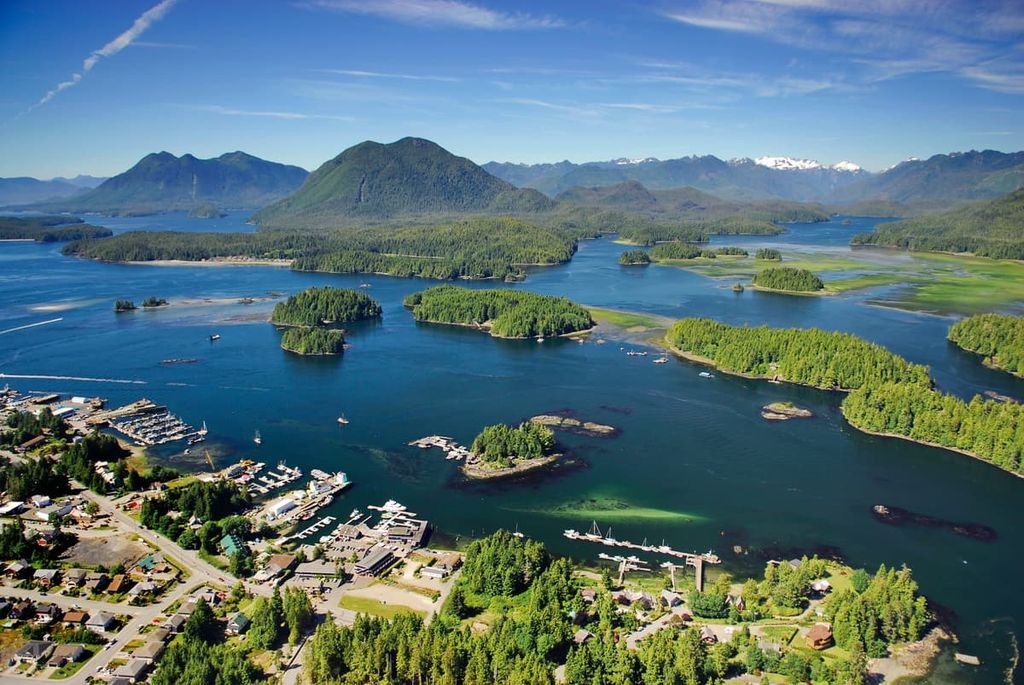
The village of Zeballos is less than 10 km (6 mi) west of the Haihte Range. Zeballos is a deep-sea port surrounded by dense forests and rugged mountains. The community is a popular starting point for excursions into the Haihte Range, as well as excursions to the nearby Nootka Sound and Kyuoquot Sound.
Nootka Island, Fair Harbour, and Brooks Peninsula Provincial Park are other popular locations to visit from Zeballos. While it was a gold mine town in the 1930 and topped out with a population around 5,000 between 1938 and 1943. The village's population now hovers around 100 people, and while most work in the logging industry, there are small businesses that specialize in ecotourism and sight-seeing.


ultra
island-qualifiers
ramblers-lifetime-objectives
british-columbia-ultras
ultra
island-qualifiers
ramblers-lifetime-objectives
british-columbia-ultras
The highest peak in the Haihte Range is Rugged Mountain, at 1,861 m.
The Haihte Range have 13 named peaks.


