
Scan the QR code and open PeakVisor on your phone
The Northwest Coast Islands include 1,548 named peaks. The highest is Golden Hinde at 2,195 m. Other notable peaks include Elkhorn Mountain, Victoria Peak and Mount Colonel Foster.
Encompassing the rugged region along the northwestern coast of the United States and Canada, the Northwest Coast Islands are a collection of islands known for their stunning natural landscapes. The islands contain 1,466 named peaks, the highest and most prominent of which is Golden Hinde (2,195 m/7,201ft).
The Northwest Coast Islands are roughly defined as the islands located between Vancouver Island in the south in British Columbia, Canada and Chichagof Island in Alaska, USA to the north. These islands are grouped together somewhat informally as a result of their geographic proximity along the northwestern coast of North America.
Most of the islands along this northwestern coast are highly mountainous. Indeed, the region is located within a rugged portion of North America. The islands are surrounded on three sides by other ranges, including the Canadian Coast Mountains to the east, the Cascade Range to the south, and the Yukon Intermountain Ranges and the Saint Elias Mountains to the north.
Due to the vast geographical area that these islands cover, it’s easiest to categorize them by their geopolitical status as either part of British Columbia in Canada or Alaska in the United States.
The southern half of the Northwest Coast Islands are located in the province of British Columbia in Canada. These islands start to the south at Vancouver Island in BC, though one could, technically, also include the hills on the San Juan Islands in the state of Washington as the southern terminus of the islands, too.

Within British Columbia, the Northwest Coast Islands can be found in the Capital, Cowichan, Nanaimo, Alberni-Clayoquot, Comox Valley, Strathcona, Mount Waddington, Central Coast, Kitimat-Stikine, and North Coast regional districts.
Some of the most notable islands in this area include Vancouver Island and the archipelago of Haida Gwaii (X̱aaydag̱a Gwaay.yaay / X̱aayda gwaay).
Vancouver Island is actually the 43rd largest island on the planet, trailing closely behind Prince of Wales Island in Nunavut. For comparison, Vancouver Island is just slightly smaller than the island of Taiwan and just slightly bigger than the island of Sicily in Italy.
There are many protected areas within the British Columbia section of the Northwest Coast Islands. Some of the national park units in this region include:
Furthermore, there are many provincial and regional parks on these islands, such as:

Finally, the British Columbia portion of these islands also contains a number of conservancies, which are designed to protect biodiversity while allowing for sustainable land use. This includes:
The northern half of the Northwest Coast Islands is located within the southeastern region of the US state of Alaska near Canada’s Yukon Territory.
The exact line between Canadian territory and US territory here is actually still disputed in an area known as the Dixon Entrance to the north of Haida Gwaii and to the south of Prince of Wales Island. However, the islands of the Alexander Archipelago, which includes Prince of Wales Island, are included as part of US territory.
Interestingly, the Dixon Entrance and the border between the US and Canada cuts right through the heart of Haida Nation traditional territory, which spans the southern part of the Alexander Archipelago and the archipelago of Haida Gwaii. The Tlingit people of the Central Council of Tlingit & Haida Indian Tribes of Alaska have also lived in the region since time immemorial.
Within Alaska, the Northwest Coast Islands can be found in the Sitka, Juneau, Ketchikan Gateway, Wrangell, Petersburg, and Haines boroughs as well as the massive Unorganized Borough.
This region contains a handful of federally-protected land areas, such as:

Although the Northwest Coast Islands are located in close proximity to each other, they are geologically very diverse.
The bulk of the islands are located on or near the boundary of the North American and Pacific plates, with the exception of the southern portion of the islands near Vancouver Island, which are situated on the edge of the North American and Juan de Fuca plates.
To the south, Vancouver Island was mostly formed alongside the edge of the Kula oceanic plate, which has since subducted completely below the North American plate. Over the millennia, a number of smaller mountain ranges developed on the island, including:
Meanwhile, Haida Gwaii to the north is home to its own unique and complex geologic structures. Haida Gwaii is located along a transform fault called the Queen Charlotte Fault between the Pacific and North American plates. The islands are primarily composed of both volcanic and sedimentary rocks, though there is also a very prominent metamorphosed greenstone belt in the archipelago.
Finally, the northernmost edge of the Northwest Coast Islands, the Alexander Archipelago, is part of a terrane known as the Alexander terrane that accreted onto the North American plate sometime during the Jurassic. This terrane is dominated by limestones, cherts, and ocean sediments, though it has also experienced a number of major igneous intrusions and widespread faulting.
Major peaks in the range include Golden Hinde, Elkhorn Mountain, Victoria Peak, Mount Colonel Foster, Mount Albert Edward, Mt. Lacey, Mount Bassie, and Mount Ada.
Despite the fact that the Northwest Coast Islands stretch nearly 10º of latitude from 49ºN in the south all the way to 58ºN in the north, the islands mostly lie within a few very similar ecoregions.
As defined by the WFF, these ecoregions include:

These ecoregions, as their names suggest, are home to dense coniferous forests. For the most part, these regions were heavily glaciated during the Pleistocene, which helped carve out the steep and narrow bays that we see today. In areas where the glaciers have more recently retreated, glacial moraine deposits and post-glacial plant succession dominate the region.
The forests on these islands are, generally speaking, temperate coastal rainforests. They are actually part of a much larger stretch of temperate rainforests that spans from the northern part of California through Oregon, Washington, and British Columbia and into Alaska where they terminate near Kodiak.
Here, the dominant species include western hemlock, western red cedar, mountain hemlock, and the widespread Sitka spruce.
The region is also home to a superb collection of wildlife. Some of the major species found in the region include grizzly bears and black bears, including the Kermode bear (spirit bear), which sometimes has an off-white fur coloring.
Other animals found in the region include Sitka deer, gray wolves, and bald eagles. Salmon are also abundant in the waters around the islands.
Humans have lived on the Northwest Coast Islands for thousands of years. Many First Nations consider the region to be part of their ancestral homelands. This includes the many First Nations of the Coast Salish peoples such as the Cowichan Tribes and the Sc'ianew (Cheanuh) First Nations, the Tsimshian First Nations, the Tlingit and Haida Indian Tribes of Alaska, and the Haida Nation, among many others.

The first peoples of European descent to visit the region were likely members of a number of Spanish expeditions to what is now called Vancouver Island during the 1770s. However, it is quite likely that Russian fur traders and trappers also made it to the northern part of the coastal islands during this time.
At the very least, the records are clear that Captain James Cook visited what is now called Nootka Sound in 1778. Not long after, Captain George Vancouver also arrived in the area in order to solidify British claims to the region.
However, this led to conflict with Spanish sailors that also wanted to claim what we now call Vancouver Island for their country though, of course, many First Nations already lived on the island. The Spanish eventually gave up their claims to the island and the British asserted their control over it.

Around the same time, Russian fur traders established a settlement that is now referred to as “Old Sitka” in 1799. However, this settlement was destroyed in a conflict with the Tlingit Nation in the early 1800s that is now called the Battle of Sitka. Soon afterward, the Russians formed another settlement, “New Archangel,” which served as the capital of Russian America until the 1860s.
During the 1800s, the British also established a number of colonies in the region. This includes the Colony of Vancouver Island in 1849 and the Colony of the Queen Charlotte Islands (Haida Gwaii) in 1853.
By the mid-1800s, major geopolitical changes were underway in the Northwest Coast Islands.
The first of these changes was the Oregon Treaty, which established the boundary between the US and what is now Canada along the 49th Parallel (except Vancouver Island) in 1847. In a bizarre surveying twist of fate, a small portion of land that extends below the 49th Parallel to the south of Vancouver, now known as Point Roberts, became a part of the United States, making it one of the few non-Alaska American exclaves in Canada.

The next two major events happened in the same year. First was the formation of the Dominion of Canada as a self-governing dominion of the United Kingdom in July of 1867 on what is now called Canada Day. The second event was the purchase of Alaska by the United States from Russia in what is now called the Alaska Purchase.
All of these events, more or less, established the international boundaries that we see today, with a few exceptions.
These days, the Northwest Coast Islands are a diverse place. While the southernmost parts of the islands, particularly around Vancouver Island, are relatively heavily populated, the northern coast of British Columbia and the northern parts of the islands are relatively sparsely populated with smaller communities.
Much of the region’s economy depends on fishing, timber, shipping, and mining. However, the region is also popular among tourists, particularly on cruise voyages through the Inside Passage.

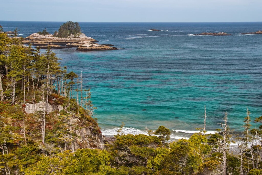
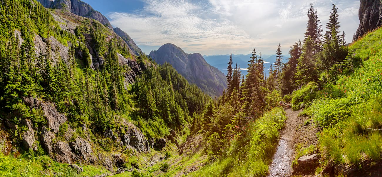
While much of the region is highly remote, there are plenty of opportunities for hiking, kayaking, and other outdoor recreation pursuits for visitors to enjoy.
The Northwest Coast Islands are, for the most part, remote and fairly difficult to get to, at least to the north of Vancouver Island. However, there are plenty of superb outdoor recreation areas and ecological reserves to check out if you get the chance. Here are some of the best hiking areas in the region:
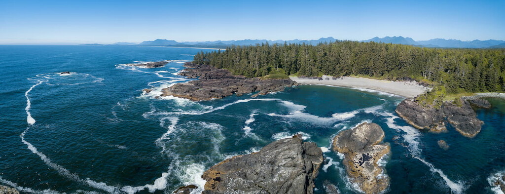
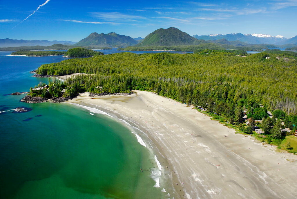
Pacific Rim National Park Reserve is a stunning national park unit located on the souhtwestern portion of Vancouver Island. The park is split up into three units—West Coast Trail, Broken Group, and Long Beach—each of which boasts its own recreation opportunities.

The park reserve is located on the traditional territories of many First Nations, including the nations that are now part of the Nuu-Chah-Nulth Tribal Council.
Within Pacific Rim National Park Reserve, there are a number of great hiking opportunities. Perhaps the most famous hike is the West Coast Trail, which is a week-long backpacking trip through some of the most remote terrain on the island. Permits are required for the trail, however, so be sure to make a reservation for your preferred hiking dates early on in the planning process.

Located on the southern tip of the Haida Gwaii archipelago, Gwaii Haanas National Park Reserve and Haida Heritage Site is a national park unit that protects both stunning national landscapes and important cultural areas. The park reserve and heritage site contain 43 named mountains, the highest and most prominent of which is Mount de la Touche.
The park is currently managed by both the Government of Canada and the Council of the Haida Nation, the latter of which hold traditional claims to the land. Part of the park reserve and heritage site are also a designated UNESCO World Heritage Site.

However, the park reserve is very remote. So, visiting the park reserve involves either a boat charter, floatplane, or sea kayak. Due to the remoteness of the region there are few managed trails, though there are plenty of scenic and important cultural destinations in the park reserve to visit for anyone willing to head off the beaten path.
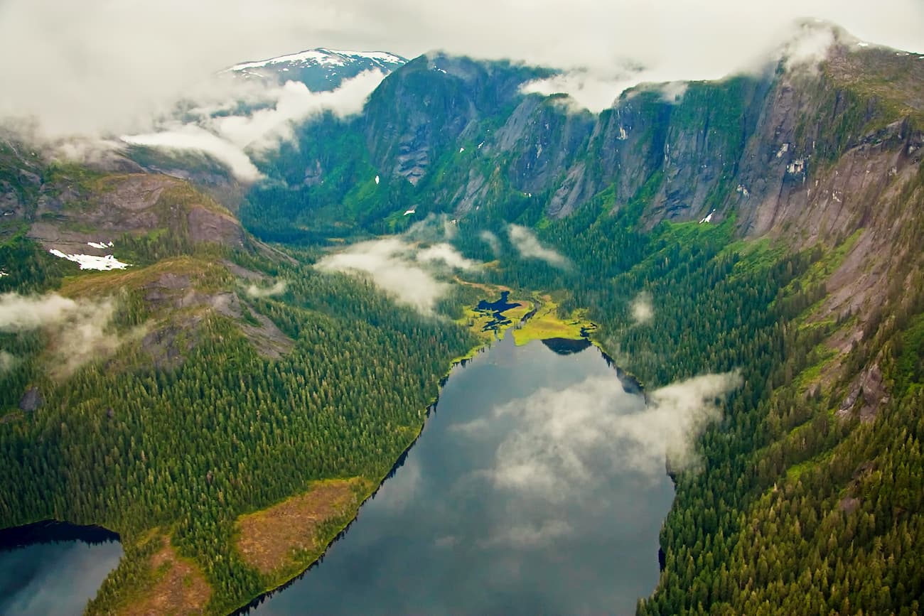
Tongass National Forest is the largest national forest in the United States. With a total area of more than 16.7 million acres (6.7 million hectares), Tongass is roughly the size of the state of West Virginia.

The forest is located in various parcels throughout southeastern Alaska, including on many of the Northwest Coast Islands. Much of the forest is quite remote, so boats or float planes are required to access some regions.
Within the forest, there are ample opportunities for hiking. Some of the many trails in the forest include the Salvage Trail, the Whitman Trail, and the Deer Mountain Trail.
Looking for a place to stay during an upcoming trip to the Northwest Coast Islands? Check out one of these great cities:
The city of Vancouver is located in southern British Columbia. Technically, it is located just outside the Northwest Coast Islands, but its status as the largest city in the province of British Columbia makes it worthy of a mention.
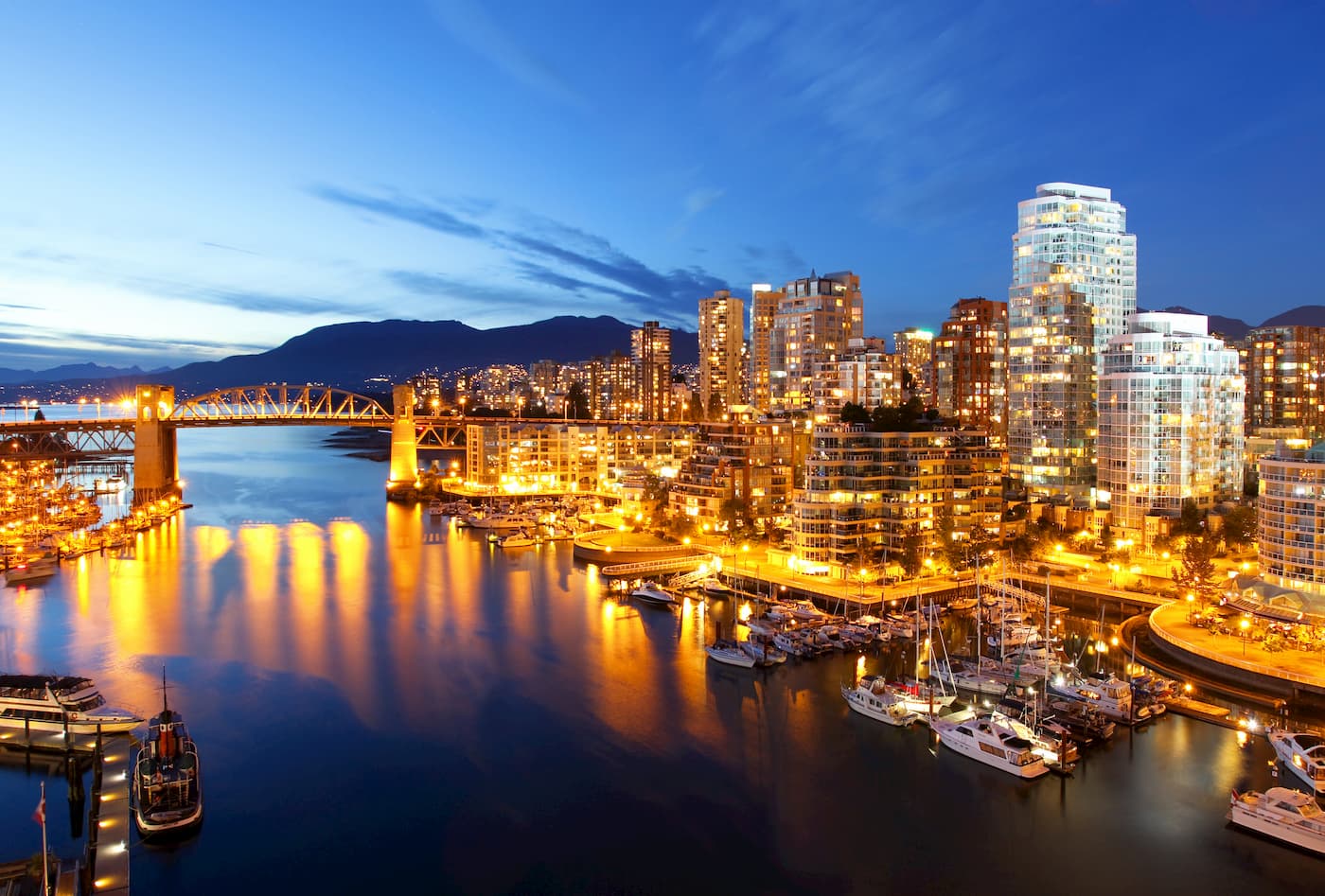
Vancouver is home to nearly 700,000 residents. It is a hub for culture and commerce in the region as well as one of its biggest tourist destinations. Vancouver is easy to get to by road and air, so it’s an easy place to get to if you’re coming from further afield.
Victoria is both the capital of British Columbia and the largest city on Vancouver Island. It is home to about 90,000 residents and it is just a short ferry away from the state of Washington.
In addition to being British Columbia’s seat of government, Victoria is also a popular tourist destination. It is generally ranked high in terms of quality of life and it offers superb access to the island's many hiking, climbing, and paddling opportunities.

One of the northernmost communities on the coast of British Columbia, Prince Rupert is a city of some 12,000 people located just to the south of the international border with Alaska. The city is one of the major seaports in the northern part of the province.
These days, Prince Rupert has a strong fishing industry, though it is also growing as a hub for trans-Pacific trade. The city’s relatively new cruise ship port has also helped bring tourism to the region. In fact, the city is an important stop along the Inside Passage due to its deep harbor and lack of waterway traffic.

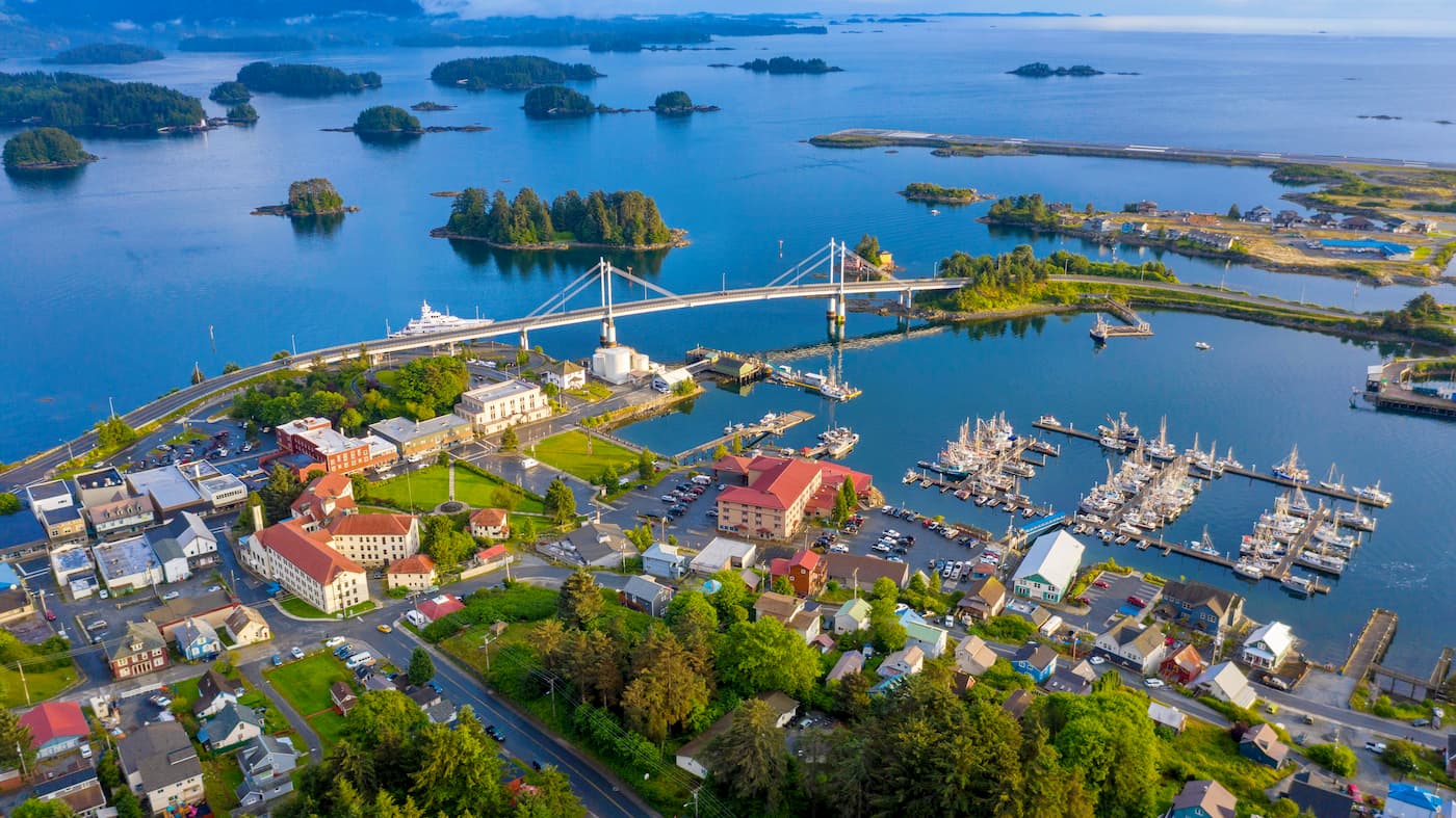
Sitka is a borough and city located in the northern part of the Northwest Coast Islands. It technically contains parts of Chichagof and Baranof islands in the Alexander Archipelago.
Sitka is home to around 9,000 people, making it one of the largest communities in southeastern Alaska. Due to its location along the Inside Passage, Sitka is a popular stopping point for cruise ships during the summer months.
Situated in the Gastineau Channel, Juneau is the capital of the state of Alaska. Although it is home to just 30,000 residents, making it a fraction of the size of the city of Anchorage, Juneau is the capital of the state of Alaska.
Interestingly, Juneau is the only state capital in the United States that is not connected to other cities in the state via road. In fact Juneau can only be reached by air and boat, even though it is technically located on mainland Alaska. It has one of the busiest airports in southeastern Alaska, so Juneau is a great place to start a trip to the northern part of the Northwest Coast Islands.


ultra
canada-sampler
island-qualifiers
ramblers-lifetime-objectives
british-columbia-ultras
ultra
island-qualifiers
ramblers-lifetime-objectives
british-columbia-ultras
ultra
canada-sampler
island-qualifiers
ramblers-lifetime-objectives
british-columbia-ultras
ultra
island-qualifiers
ramblers-lifetime-objectives
british-columbia-ultras
ultra
island-qualifiers
ramblers-lifetime-objectives
british-columbia-ultras
The highest peak in the Northwest Coast Islands is Golden Hinde, at 2,195 m.
The Northwest Coast Islands have 1,548 named peaks.


