
Scan the QR code and open PeakVisor on your phone
Located along the interior coast of Vancouver Island in British Columbia, Canada, the North Cowichan Municipal Forest Reserve is a protected area that consists of several blocks of publicly owned forest. Straddling the Trans-Canada Highway, near the community of North Cowichan, the forest reserve has 7 named peaks, the highest of which is Mount Prevost (786 m/2,578 ft).
Situated along the interior eastern coast of Vancouver Island in British Columbia, Canada, the North Cowichan Municipal Forest Reserve surrounds the community of North Cowichan in the Cowichan Valley Regional District. The forest reserves lie about halfway between Victoria, the capital of British Columbia, and Nanaimo, which is a major ferry port on the island.
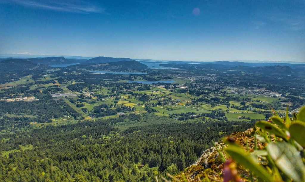
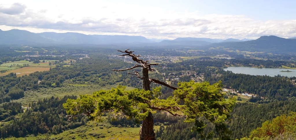
The reserve is easily accessible via Highway 1, and there are a number of side roads that lead to some amazing recreational areas within the reserve. The tallest mountain in the forest reserve is Mount Prevost, which stands 786 m (2,578 ft) tall and has 599 m (1,964 ft) of prominence. Mount Prevost is covered with hiking and biking trails, as are many of the other mountains in the reserve.
Within the reserve, peaks like Mount Tzouhalem and Maple Mountain command spectacular views over Maple Bay and toward Saltspring Island. Many of these peaks feature incredible hiking and biking trails. Additionally, Big Sicker Mountain is covered with hiking and downhill biking trails.
While the volunteers of the local hiking and biking groups have put a lot of work into creating and maintaining the amazing trails in and around North Cowichan Municipal Forest Reserve, there are also many other hiking and recreational areas nearby if you’re searching for more adventure. Some of the many other nearby parks and recreational areas include:
The rocks that underlay North Cowichan Municipal Forest Reserve were part of an ancient terrane known as Wrangellia. Wrangellia started forming hundreds of millions of years ago as undersea volcanoes erupted and created layers of rock on the ocean floor.
Eventually, sediment started to collect upon the original layers of volcanic rock. However, additional eruptions that occurred about 200 million years ago were responsible for creating the major mass of Wrangellia, which consists of a 6 km (3.7 mi) thick layer of volcanic rock.

Around 100 million years ago, the tectonic plate carrying Wrangellia collided with and subducted beneath the western coast of North America. The collision and subduction added exotic terranes to the western coast of North America, creating a large region that included what is now Vancouver Island. This collision was also part of the driving force for the uplift of the western cordillera, which includes the Rocky Mountains.
Compared to the entire Wrangellia terrane, the Cowichan Valley is very small; however, like the rest of the terrane, most of the modern topography was created during and since the last glacial maximum. The most recent glacial maximum along the west coast, which is called the Fraser Glaciation, is responsible for creating the contemporary topography of most of the west coast and Vancouver Island.
During the Pleistocene, glaciers formed in the mountains near the east coast of the island and slowly carved their way toward the sea. The glacier that formed the Cowichan Valley was corralled by the peaks and slopes of Mount Prevost, Mount Richards, Maple Mountain, and Mount Tzouhalem.
Throughout this time, basins were carved into the soft bedrock by the passing glaciers, creating the locations for the future Somenos and Quamichan Lakes. Additionally, glacial debris was deposited along the margins of the Cowichan Glacier. However, at some point between 18,000 and 19,000 years ago, the Fraser Glacier advanced across the Georgia Strait from the mainland and overrode the Cowichan Glacier.
The Fraser Glacier covered the southeast end of Vancouver Island while other glaciers covered the rest of the island. The ice sheet was hundreds of meters thick and heavy enough to depress the island over 150 m (500 ft) from its current level. As the ice melted and the oceans filled with water again, the island was slow to rebound. Consequently, the sea level during that time was about 90 m (300 ft) higher at North Cowichan than it is now.
It took several thousand years for the sea level and Vancouver Island to arrive at its current state. In fact, the rise and fall of the sea level and the island over the last millennia is part of what has made archeological research on the island and along the coast so difficult.
About 15,000 years ago, the climate of Vancouver Island began to warm and the region’s glaciers were finally losing their frozen grip on the coast. The retreating glaciers originally left behind a stark, barren, and rocky landscape; however, the remnant glacial till created fertile pockets of land that could support pioneer vegetation.
At the end of the Pleistocene, the major contributors to the area's current climate were now in place, including the Olympic Mountains across the strait, the Vancouver Island Ranges that run through the middle of the island, and the Pacific Ocean to the west. The mountains created a rain shadow across the southeast side of the island where a dry, Mediterranean-like climate could flourish.
The first ecosystems to evolve on the island were pine and oak savannas along the coast and in the valleys. Meanwhile, alpine meadows grew at higher elevations in the region. Eventually, conifers, such as Douglas fir, began to colonize the landscape. Afterward, species like western hemlock, arbutus, western flowering dogwood, bigleaf maple, and western red cedar began to flourish.
As the forests matured, the understory of these forests developed to support species like Indian plum, salmonberry, western snowberry, Oregon grape, honeysuckle, and salal. Additionally, the wildlife in the region began to diversify to include a range of species, such as various ducks, eagles, bears, elk, and deer.
Nowadays, North Cowichan Municipal Forest is home to the coastal Douglas fir and western hemlock ecosystems. These ecosystems thrive along the southeast end of Vancouver Island, where the dry summers and warm, wet winters prevail.
Additionally, within the forest reserve are pockets of the endangered Garry oak ecosystem, which is among the most endangered ecosystems in Canada. This rare ecosystem is regarded as having many species that are endangered in Canada and in the world, including 7 species of reptiles, 7 amphibian species, 33 distinct mammals, 104 types of birds, 694 different plants, and over 800 insects and spiders.
The Garry oak ecosystem currently covers only about 5 percent of its previous territory. The ecosystem was traditionally valuable to the First Nations of the island who were able to practice a form of agriculture in the ecosystem to increase their harvest of camas lilies bulbs. While the ecosystem may have been artificially prolonged due to Indigenous efforts, much of the fertile land was turned to agriculture and developed with the arrival of European settlers.
The climatic conditions at the end of the Pleistocene have made it difficult to find evidence of exactly when people first arrived on Vancouver Island. It is estimated that people inhabited Vancouver Island approximately 8,000 to 10,000 years ago. There are also archeological sites in the region that are estimated to be at least 4,000 years old.
The North Cowichan Valley is the traditional territory of Coast Salish people, including the Halalt First Nation, who have lived in the area for countless generations. The Indigenous inhabitants of the Cowichan Valley were traditionally dependent upon their seasonal rounds, which helped them take advantage of seasonal resources in the region.
First Nations in the region have long understood the season of the spawning salmon and the migrations of the elk and deer, and how to take advantage of that knowledge to ensure their sustenance and survival. Local First Nations had also gained knowledge over the course of generations of how to burn areas of the Garry oak forests to promote the spread of camas lilies so that they could be harvested as food against the winter.
However, in the 1800s, the first European settlers arrived in the Cowichan Valley. In 1859, Oliver Wells was the first non-Indigenous person to create a detailed survey of the valley. He exclaimed that the valley has “45,000 acres of superior agricultural land that could be parceled into farms for 500 to 600 settler families.”
Logging companies arrived in 1860 to start clearing the land of the valley for agricultural use. By 1913, the Canadian Pacific Railway had extended a line to the valley, and, by 1920, there were 18 different logging companies that employed over 1,200 men in the region.
Unfortunately, in their zeal to harvest prime timber and take their logs to market, the logging industry detrimentally impacted the Cowichan Valley and the river. Falls and rapids were blown up to facilitate the movement of logs down the river to market and to facilitate greater access for harvesting. The impact is still noticeable and even now dykes are needed to mitigate winter floods in the valley.
Many contemporary communities in the valley are still tied to their settler history, as logging and agriculture are still important industries in the region.
Tourism is also popular across Vancouver Island and the valley, as there are many stunning beaches and incredible rivers for fishing. Additionally, there are many mountain biking enthusiasts that practice their craft on the slopes of Cowichan Valley, which makes for a remarkable downhill playground.
Within the North Cowichan Municipal Forest Reserve, there are several areas where the locals have come together to create amazing recreational opportunities. The following are some of the best hiking and biking areas in the forest reserve:

Looking over Maple Bay on the east shore of Vancouver Island, Maple Mountain stands 505 m (1,656 ft) tall. From the summit, there are not only views of the bay, but also a panorama that extends over Saltspring Island toward the snow capped mountains of the mainland Pacific Ranges.
Upon and around the mountain, there are many trails to enjoy, such as the Maple Mountain Summit Trail, the Maple Bay Loop, and the Blue and Yellow Trails through Osborne Bay Park, among others. Most of the trails are easy or moderate in difficulty and make for a good day hike or afternoon excursion.
There are many trails that wind across the slopes of Mount Tzouhalem. Most of the major trails lead to the summit and to other lookout points. There are also many incredible downhill runs for cyclists to enjoy. With several parking areas around the mountain and many trails that traverse the mountain, it is a good idea to bring a map with you to help you find your way back to your car.
While the summit of Mount Tzouhalem doesn’t offer panoramic views, it is a nice area to sit, relax, and allow nature to permeate your soul. There are trails that follow the edge of the mountain that offer views toward Maple Bay, Cowichan Bay, and over Quamichan Lake. Most of the trails are easy to moderate; however, creeks also flow down some trails during the winter and the trails can be slippery.
Located in an inland part of the North Cowichan Municipal Forest Reserve, Big Sicker Mountain and Mount Prevost have some amazing hiking and biking trails. There are trails that lead to the summits of both mountains as well as many other exciting options for adventure.
Some of the trails to check out at Big Sicker Mountain and Mount Prevost include the Mount Prevost Trail, Big Sicker Mountain Loop, Big Sicker Mountain Mine, and the Prevost Mainline. Local volunteers have put in a lot of effort to create and maintain all the trails throughout the forest reserve.
As it is located along the Trans-Canada Highway on Vancouver Island, there are several communities and cities situated near the North Cowichan Municipal Forest Reserve. The following are the major cities near the forest reserve that you can check out during your visit.
Nanaimo is a city located on the eastern coast of Vancouver Island. It is situated about 60 km (36 mi) to the north of the forest reserve. Nanaimo is one of the primary ports for ferries that bring passengers from mainland British Columbia.
In addition to the beautiful coastline and wilderness areas around the city, Nanaimo, British Columbia is the home of the Nanaimo bar, a delicious treat that features yellow custard sandwiched between chocolate ganache and a coconut-graham crust.

Avid enthusiasts of the Nanaimo bar can check out the Nanaimo Bar Trail, which lists stops for various takes on the local treat. After touring Nanaimo Bar Trail, you might want to burn some calories on Gordie’s Trail up Mount Benson, or on other hikes like the Mount Benson Loop, Westwood Lake Trail, and the Cable Bay Nature Trail.
Located just south of the forest reserve along the Trans-Canada Highway, Duncan is the smallest city by area in Canada, as it covers only 2.07 square kilometers (0.8 square miles) of land. The population of Duncan is about 5,000 people, but it serves as the commercial and service center for the Cowichan Valley, which has a population over 80,000 people.
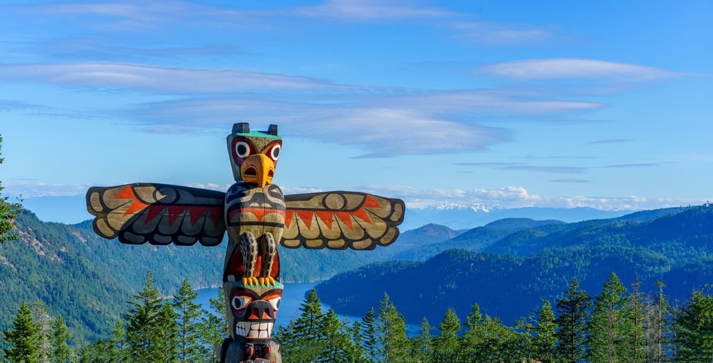
Thanks to the abundant natural resources of the region, the city has realized slow but steady growth since the late nineteenth century, when it was originally settled. The city currently has one of the largest collections of totem poles in Canada, many of which were made by citizens of the Cowichan Tribes.
There are many beautiful hiking areas around Duncan, including Glenora Trails Head Park, Glenora River Park, Sandy Pool Regional Park, Cowichan River Regional Park, and Mount Prevost. Some of the coastal hiking areas include Eves Provincial Park, Mount Tzouhalem, Cowichan Estuary Trail, Maple Mountain, and Osborne Bay Park.
First established as Fort Albert in 1843, the fort was quickly renamed Fort Victoria in honor of Queen Victoria. Due to the Fraser Canyon gold rush around 1860, the population of the fort grew. Soon enough, the fort was incorporated and it became the capital of the new province of British Columbia.

Victoria is built upon the Saanich Peninsula, and it is situated about 60 km (36 mi) to the south of the North Cowichan Municipal Forest Reserve. There are many incredible historic sites to visit around Victoria as well as many incredible wilderness areas. Some of the beautiful hiking areas around Victoria include Sea to Sea Regional Park, Gowlland Tod Provincial Park, Mount Work Provincial Park, and Thetis Lake Regional Park.


