Scan the QR code and open PeakVisor on your phone
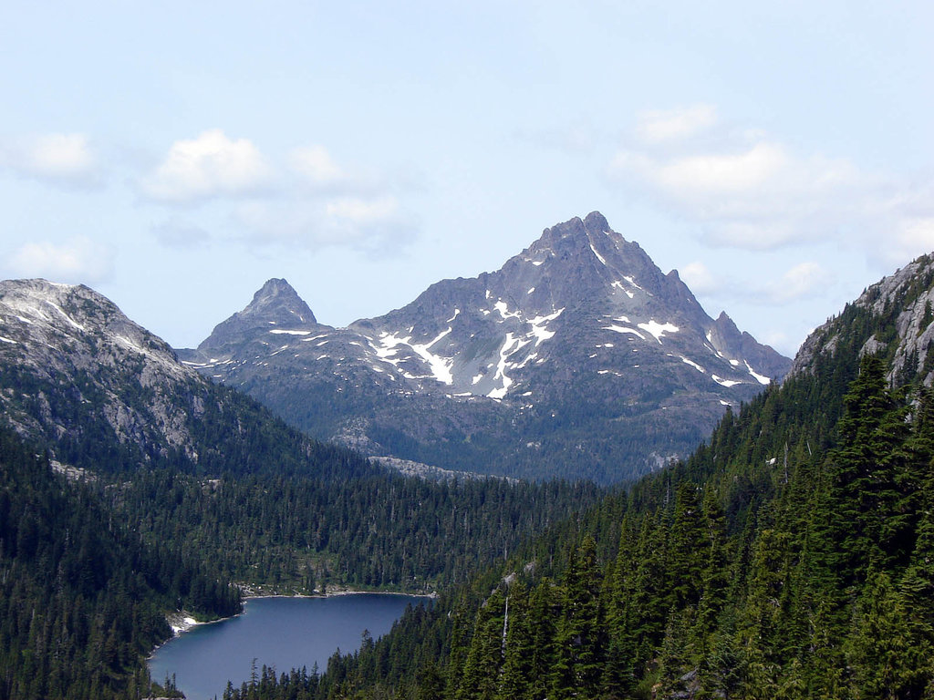
The Brooks Peninsula Provincial Park is located along the west coast of Vancouver Island in British Columbia, Canada. The park was established in 1995 and spans 127,583 acres along the Brooks Peninsula. There are 8 named mountains in Brooks Peninsula (Muqqiwn) Provincial Park. Mount Seaton is the highest point standing at 3,143 feet. The most prominent mountain is Nunatak Mountain with 1,627 feet of prominence.
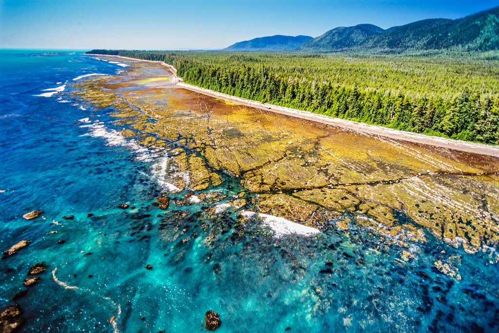
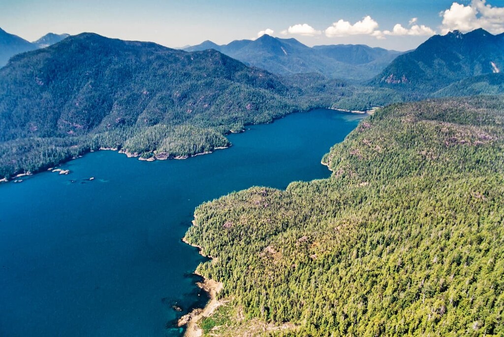
The mountains inside the park are part of the Refugium Range. One of the most unique features of this park is the fact that it can only be accessed by boat or plane due to its remote location. The coastline through the peninsula park is quite rugged intermixed with patches of sandy beaches. The higher points within the park are home to a unique variety of plants due to the fact that they were not covered by the massive glaciers of our last ice age. This unique feature of the Brooks Peninsula means that it is frequently visited for studying purposes.
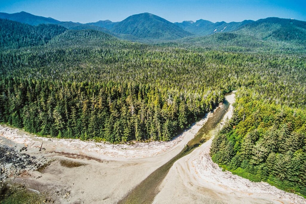
From a far the landscape may appear to be the same as the rest of Vancouver Island, when it is in fact quite different. The old growth forest that covered the rugged peaks of the peninsula are rich with biodiversity, rushing creeks, and pristine rivers. One rare species that lives within the coastal rainforest is the Marbled Murrelet. These birds spend their entire lives out at sea and come back to the island just to nest for a short period of time. The ocean surrounding the park offers the chance to see Gray whales, sea otters, and sea lions.
Today the park encompasses land that belongs to the Kyuquot/ Cheklesahht and Quatsino First Nations. The peninsula holds cultural heritage for these First Nations. One of the southern bays of the park is named Battle Bay since many battles were once fought there. It is recommended that visitors to the park notify the First Nations before entering.
Though the park is more remote than most on Vancouver Island, Brooks Peninsula Provincial Park is full of recreational opportunities. Boating and kayaking allow for nature and wildlife viewing whilst on the water. Though there are a few trails in the park, none of them are maintained and there are no facilities.
Columbia Cove: Starting at Columbia Cove this route takes hikers along the eastern beach towards the southern coast of the peninsula. Hikers can take in the sights of this 20-minute stroll or connect to one of the more primitive trails that run throughout the park. No trails are marked in the park so hikers should always bring safety supplies to ensure they don’t get lost.
Other primitive hiking trails have been reported along the Ououkinsh Inlet along the Power River that leads to Power Lake.
The nearest village to the park is Port Alice. This small village has a population of around 700 people and is located along the Neroutsos Inlet in northern Vancouver Island. The small village was once a paper mill location and is now surrounded by hiking destinations. Near the city also lies the infamous Devil’s Bath which is Canada’s largest sinkhole. Popular hiking regions in the area include Devil’s Bath, Eternal Fountain, Vanishing River and the Reappearing River.

Located at the southern tip of Vancouver Island lies the largest city, Victoria. The city of Victoria is the capital for the province of British Columbia and has a population of 85,792 with the greater area having a population of 367,770. The island can be reached by ferry from mainland British Columbia as well as Washington State in the United States. The city was named after Queen Victoria and is one of the oldest cities in the Pacific Northwest. The region is known for rock climbing, hiking, kayaking, surfing, and skiing. The close proximity to both the ocean and mountains makes this city a mecca for outdoor activities.