
Scan the QR code and open PeakVisor on your phone
Covering a peninsula on the northwest corner of Vancouver Island, in British Columbia, Canada, the Refugium Range is a unique subrange of the Vancouver Island Ranges. The range has 9 named peaks, the highest and most prominent of which is Nunatak Mountain, which stands 931 m (3,054 ft) above sea level and has (496 m / 1,627 ft) of prominence.
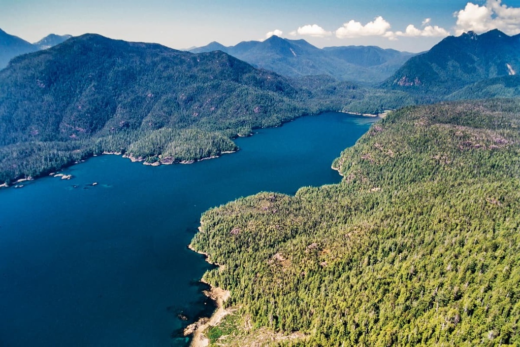
The Refugium Range dominates the Brooks Peninsula on the northwest coast of Vancouver Island, which is situated off the Pacific Coast of British Columbia, Canada.
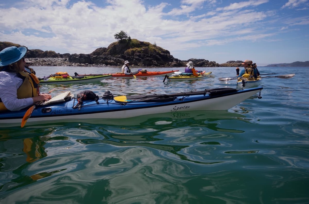
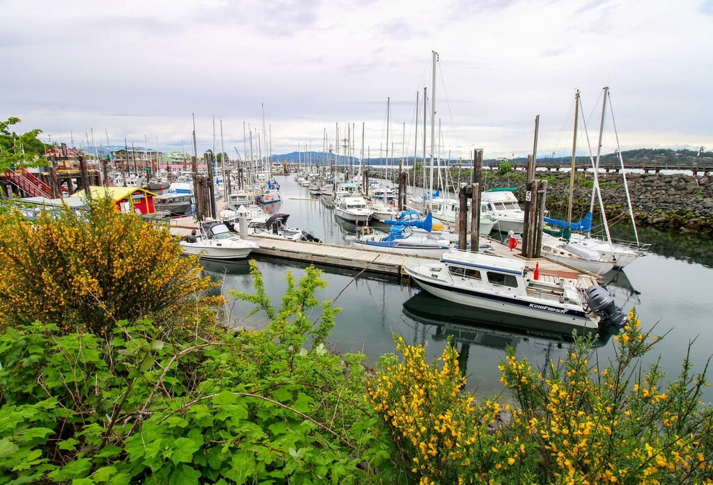
There are no roads into the Refugium Range and visitors to the range typically take a boat from one of the nearby communities. Some of the nearby ports that have charter boats and water taxis to the range are located in Kyuquot, Fair Harbour, and Quatsino Sound.
The range was named in 1981 for the fact that the peaks were not covered in ice during the last glacial maximum and was therefore a refuge from the glaciers (called a refugium). It was discovered that the ice did not likely cover above 600 m (1,950 ft) during this time. As a result, the peaks stood above the ice as nunataks and the vegetation in the range has been left mostly undisturbed for the past 25,000 years.
The aptly named Nunatak Mountain is the tallest and most prominent peak in the range, standing 931 m (3,054 ft) above sea level with 496 m (1,627 ft) of prominence. In addition to the tall, rocky peaks of the range, the region is also home to a couple of volcanic cones, including Yaky Kop Cone and Shields Cone.
Most of the Refugium Range is protected as part of Mquqʷin / Brooks Peninsula Provincial Park. Other nearby protected areas include:
The Brooks Peninsula and the Refugium Range represent several diverse geological units. While the entirety of the range is considered to be part of the Vancouver Island Ranges, which are a subrange of the Insular Mountains, the Refugium Range itself includes several different geological complexes.
The history of the Refugium Range starts over 380 million years ago, when a rift created a layer of volcanic rocks on the ocean floor. Over the course of the following 150 million years, layers of marine sediment built upon this layer of volcanic rocks.
Starting about 230 million years ago and lasting for about 5 million years, the rift opened again on the floor of the Kula tectonic plate and a massive 6 km (3.6 mi) thick layer of volcanic rock was added to the previous layers. During this time, the volcanoes rose above the ocean to create a massive arc of volcanic islands, which came to be called Wrangellia or the Wrangellia Terrane.
About 100 million years ago, the Kula Plate collided with the west coast of North America, carrying Wrangellia with it. As the tectonic plate subducted beneath the continent, the force of the event started the Laramide orogeny, which is the formation event of the Rocky Mountains.
However, Wrangellia was too large and buoyant to subduct beneath the continent, so it was accreted to the coastal margin of the continent, compressing and deforming in the process. When Wrangellia finally came to rest, part of it had been accreted to the western edge of the mainland.
The western edge of Wrangellia became the backbone of the Vancouver Island Ranges and Haida Gwaii, while other parts were folded and now reside below sea level. During the collision, the terrane fractured along faults, the mountains were pushed up, and magma intruded into the layers of the terrane.
Following the accretion of Wrangellia to North America, about 66 million years ago, another terrane, called the Pacific Rim Terrane collided with the west coast of Vancouver Island. As a result of the accretion of the Pacific Rim Terrane, the Brooks Peninsula now has two distinct faults and several different geological complexes.
The eastern, inland side of the peninsula is crossed by the West Coast Fault, which separates the rocks of the volcanic Bonanza group from the Westcoast Crystalline Complex. The rocks in this complex make up most of the Brooks Peninsula. The western tip and coastal shelf of the peninsula are composed of rocks from the Pacific Rim Terrane, which is a terrane of metamorphosed sedimentary and volcanic rocks.
The Cape Cook Fault separates the Westcoast Complex from the Pacific Rim Terrane. Additionally, the Pacific Rim Terrane has exotic blocks of gray shale, called “knockers,” some of which are up to 50 m (160 ft) high and can be seen on topographical maps.
While this is a rather simplistic description of the geology of the Refugium Range, there are many incredible geological features to be found in the region. Some of these features include the incised valleys, the glacier carved cirques, as well as interesting rock layers and complexes, such as the “knockers” at the tip of the peninsula.
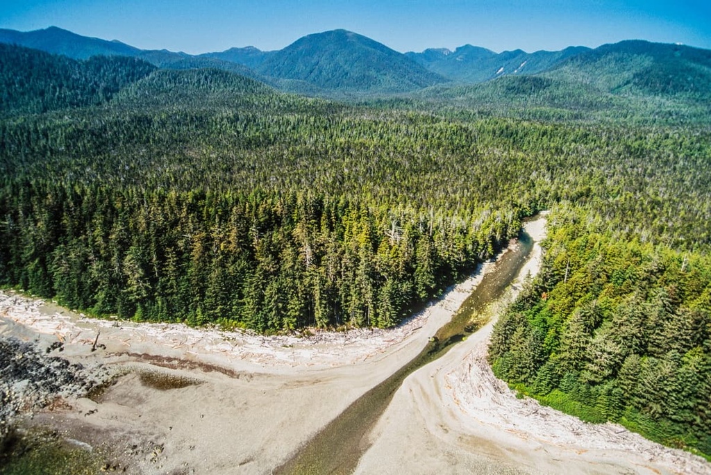
As a refugium from the Fraser Glaciation, the Refugium Range contains some unique ecologies, as well as many plant species that are endemic and disjunct. The primary ecosystem of the Refugium Range is the Coastal Western Hemlock ecosystem; however, that is a very broad term for all the unique ecological aspects of the range.
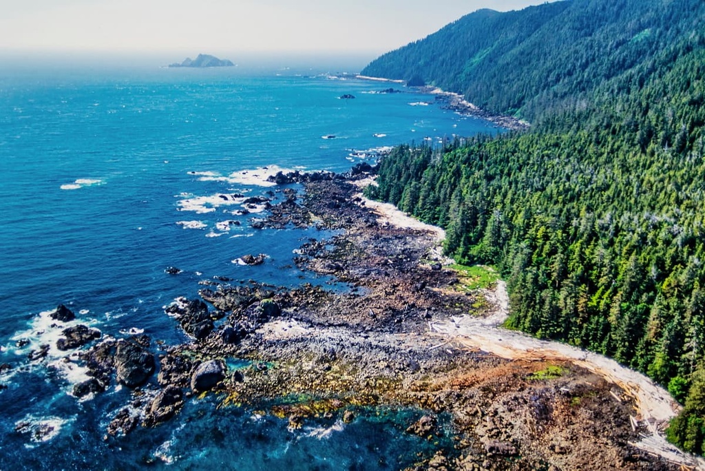
The forests of the range are filled with western hemlock, red cedar, Douglas fir, and Sitka spruce. Sitka spruce has adapted to thrive along the coast and is now more resistant to the salty sea spray and the salty in the air than other similar trees.
The winds blow off the Pacific at speeds upwards of 160 kph (100 mph), wreaking havoc on the coastal trees and ridges. Indeed, many of the coastal trees appear as though they were sculpted as bonsai trees. Additionally, the ridges are often barren of anything more than shrubs and grasses.
In addition to the forested valleys, the Refugium Range is graced with bogs, alpine meadows, coastal lowlands, tidal lagoons, rivers, and lakes. The bogs on the peninsula don’t contain stands of western hemlock, either, making them unique compared to the rest of the island.
Other unique features of the range include the endemic species that are only found on Vancouver Island and Haida Gwaii. Some of the endemic plant species found in the Refugium Range include the Queen Charlotte avens, Queen Charlotte twinflower violet, alp lily, and the dwarf maiden-hair-fern.
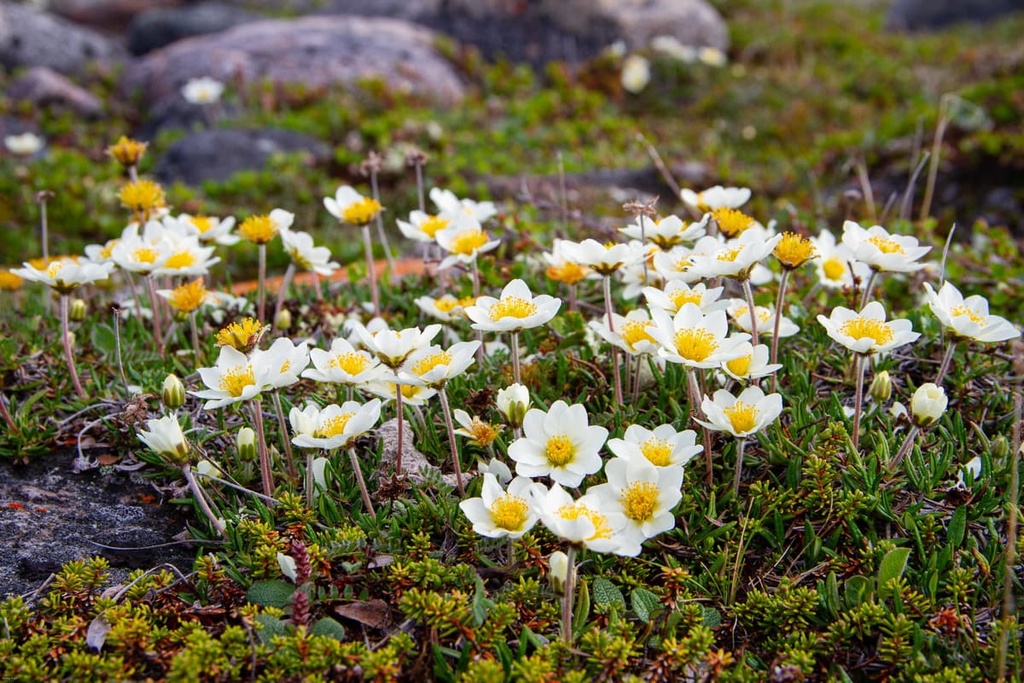
The western hedysarum plant was also discovered on the peninsula and is considered disjunct from its main ranges in the mountains of mainland British Columbia and Alaska. Many other rare and endangered plant species have been identified in the region by the diligent scientists who have surveyed the Refugium Range.
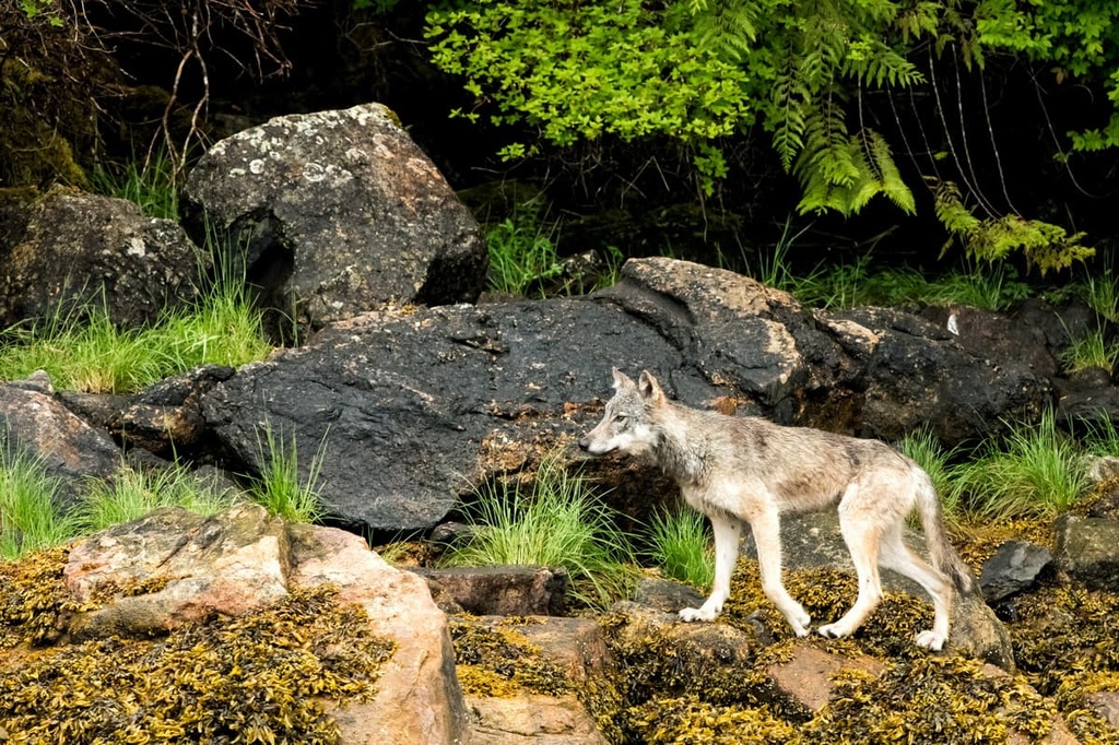
The Brooks Peninsula is also inhabited by black bears, gray wolves, black-tailed deer, Roosevelt elk, Townsend’s vole, American mink, river otters, sea otters, and other rodents and bats. The peninsula is also home to the Haida Gwaii slug.
The waters of the range are home to all five species of Pacific salmon, which are Chinook, chum, sockeye, pink, and coho. Furthermore, the wildlife of the peninsula includes many rare bird species. Some of the birds found in the range include Cassin’s auklet, tufted puffin, fork-tailed storm-petrel, Pelagic cormorant, black oystercatcher, peregrine falcon, and marbled murrelet.
The Brooks Peninsula and the Refugium Range are located in the traditional territory of the Che:k’tle7et’h, Nisma, and Quatsino First Nations. Archeological evidence and cultural knowledge indicate that people have inhabited the peninsula and range for thousands of years.
The range has clear evidence of ancient village sites, trails, hunting areas, and fishing areas. There are also many areas that would have been used for gathering food, medicine, and other materials over the last few thousand years.
Culturally modified trees have also been uncovered in the range. Some of these trees have had strips of bark removed, while others have faces carved into them, and others still have been modified into markers.
The peninsula was rich with resources and many battles were fought between different First Nations for control of the region. Battle Bay was named for its evidence that many battles were fought at the bay, likely for control of the peninsula.
It has been speculated that glacial refugium, such as the one discovered in the Refugium Range, could have created a pocket of habitable land where people could have survived through the Pleistocene. However, there is no evidence of human habitation in the Refugium Range beyond the past several thousand years.
The lifestyle of the First Nations in the region was upended with the arrival of European ships. With the arrival of Europeans along the west coast of Vancouver Island in the eighteenth century, demand for sea otter pelts led to the extirpation of Vancouver Island sea otters. Smallpox, which was introduced by Europeans, also ravaged Indigenous communities.
Within a matter of decades, many First Nations lost over 90 percent of their citizens due to the introduction of smallpox and the onset of conflict with Europeans. By the early twentieth century, all the villages in the Refugium Range had been abandoned as the residents migrated to inland communities where it was easier to access resources.
A small amount of logging was done on the Brooks Peninsula in the twentieth century. But other than that, the ecosystem of the Refugium Range has been unaltered for over 25,000 years.
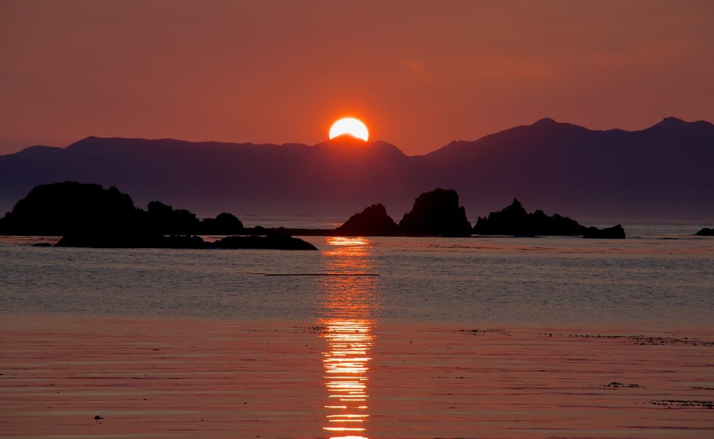
The only way to arrive at the Brooks Peninsula and the Refugium Range is by boat or floatplane. This difficult to access area is filled with the opportunity for incredible backcountry adventures.
The following are some ideas of how to spend your time upon in the Refugium Range:
The only way to access the Refugium Range is by boat or floatplane. Several communities, such as Kyuquot, Fair Harbour, and Quatsino offer charter boats and other services in the region.
The following are some of the larger communities and cities where you can find additional information for your adventures in the Refugium Range and prepare for your excursions.
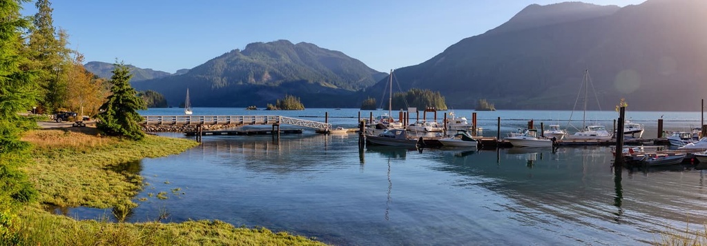
The small community of Port Alice is located on Neroutsos Inlet and is one of the largest towns near the Brooks Peninsula. The community was named for Alice Whalen, who was the mother of the two brothers that built a pulp mill on the site in 1917.
The community is known for its good saltwater fishing opportunities and its incredible scenery. While in the town, it is worth checking out Devil’s Bath, which is a cenote near the community. Devil’s Bath measures 359 m (1,177 ft) in diameter and 44 m (144 ft) deep, making it the largest cenote in Canada.
The cenote is one of the many interesting destinations around the community. Other places worth hiking to near Port Alice are the Eternal Fountain and Vanishing River & Reappearing River, which are other examples of the ancient karst formations that underlay the region.
Port McNeill is home to the regional offices of the Regional District of Mount Waddington. While it is located on the opposite side of Vancouver Island, Port McNeill is the largest city near the Refugium Range.
The primary industries in the community are forestry and tourism. It is the gateway to the scenic islands of Broughton Archipelago. Port McNeill has regular ferry service to Alert Bay on Cormorant Island and Sointula on Malcolm Island. The town is also home to the Port McNeill Airport, which is the regional airport that serves the north end of Vancouver Island.

The wilderness and coast of northern Vancouver Island is a rugged and untamed environment. There are incredible opportunities for excursions and adventures in this area of the island. Some of the places to visit are the scenic islands of the Broughton Archipelago, Nimpkish Lake Provincial Park, Tstitika Mountain Ecological Reserve, Marble River Provincial Park, and the beautiful Cape Scott Provincial Park.
Unless you take a regional flight into Port McNeill, you’ll likely pass through Campbell River on your way to the north end of Vancouver Island. Indeed, Campbell River is the gateway to many incredible locations on the north end of the island as well as the island groups off the east coast of Vancouver Island.
The city of Campbell River offers incredible views across the Georgia Strait, where you can see the snow-capped peaks of the Pacific Ranges and the many islands of the Discovery Islands, such as Quadra and Cortes Islands. Additionally, the community is poised on the edge of the incredible wilderness of northern Vancouver Island.
Some of the incredible places that are accessible from Campbell River include the historic hike to Ripple Rock and the suspension bridge across Elk Falls. Many locals and visitors test their angling skills in the Campbell River. Furthermore, Schoen Lake Provincial Park, Strathcona Provincial Park, Ha’thayim Marine Provincial Park, and even Pacific Rim National Park Reserve are only a short trip away from the community.


