
Scan the QR code and open PeakVisor on your phone
Juneau is home to 157 named mountains. The highest is Devils Paw at 2,541 m.
Situated in the southeastern portion of the US state of Alaska, the City and Borough of Juneau is home to snow-capped mountains and sprawling temperate rainforests. The City and Borough of Juneau contains 132 named mountains, the highest of which is Devils Paw (8,340ft/2,542m) and the most prominent of which is Snow Tower (6,427ft/1,959m).
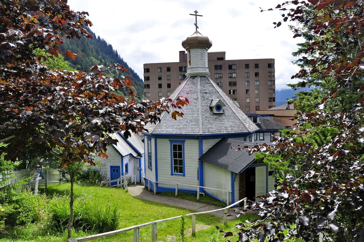
Juneau (Tlingit: Dzánti K’ihéen; Russian: Джуно) is the capital city of the US state of Alaska. It is located in the southeastern panhandle of the state, along the state’s border with the Stikine Region of the province of British Columbia in Canada.
The city is bordered by the boroughs of Skagway and Haines to the northwest and by both the Petersburg Borough and Unincorporated Borough to the southeast. It is separated from Admiralty Island (the northern section of which is part of the borough) and Chichagof Island of the city borough of Sitka by the waters of the Inside Passage.
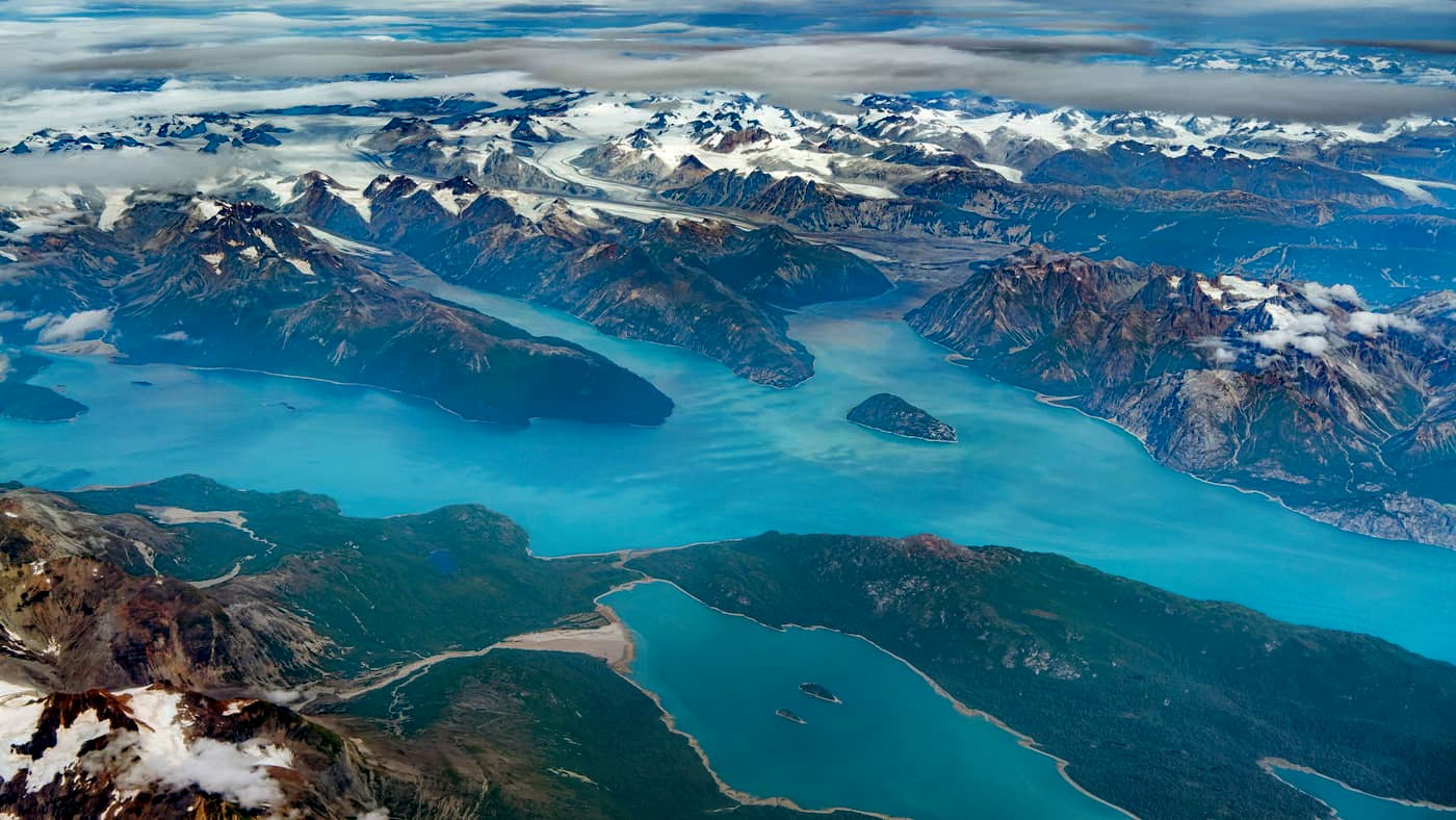
The Juneau Icefield, which extends across the Canadian border into Altin Provincial Park, is also partially located within the borough. Moreover, Juneau is to the southeast of Glacier Bay National Park and Preserve and Tatshenshini-Alsek Provincial Park. Much of the region to the northeast of the city is included as part of the transnational Kluane/Wrangell-St. Elias/Glacier Bay/Tatshenshini-Alsek UNESCO World Heritage Site.
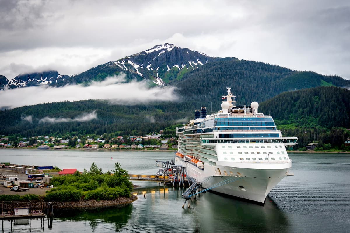
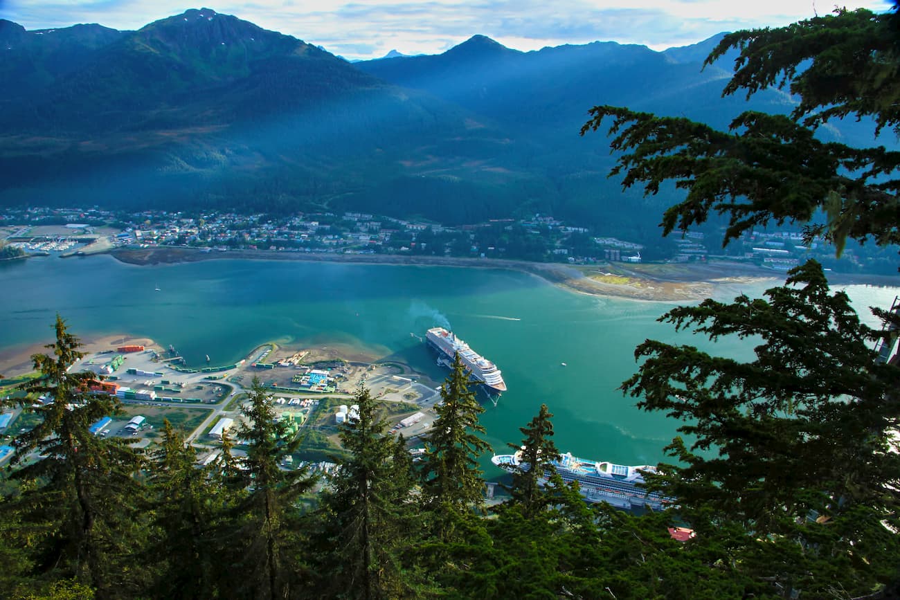
Interestingly, Juneau, despite being the capital of Alaska, is not connected to the rest of the state or the country by road. While the city is technically on the mainland, its rugged surroundings make a road network mostly unfeasible, so all the goods and people that enter or exit the city do so by boat or plane.
The borough contains part of various national protected areas, including Tongass National Forest, the Tracy Arm-Fords Terror Wilderness, the Admiralty Island National Monument, and the Kootznoowoo Wilderness.
Geologically, the majority of the mountains in the City and Borough of Juneau are part of the Canadian Coast Mountains, which extend from the province’s border with the Yukon Territory to the north all the way to British Columbia’s border with the US state of Washington to the south.
This range includes a substantial number of peaks, some of which are volcanic in origin, and is part of a much larger system of mountains which runs the length of the west coast of North America, including parts of the Cascade Range, the Saint Elias Mountains, the Chugach Mountains, and the Olympic Mountains.
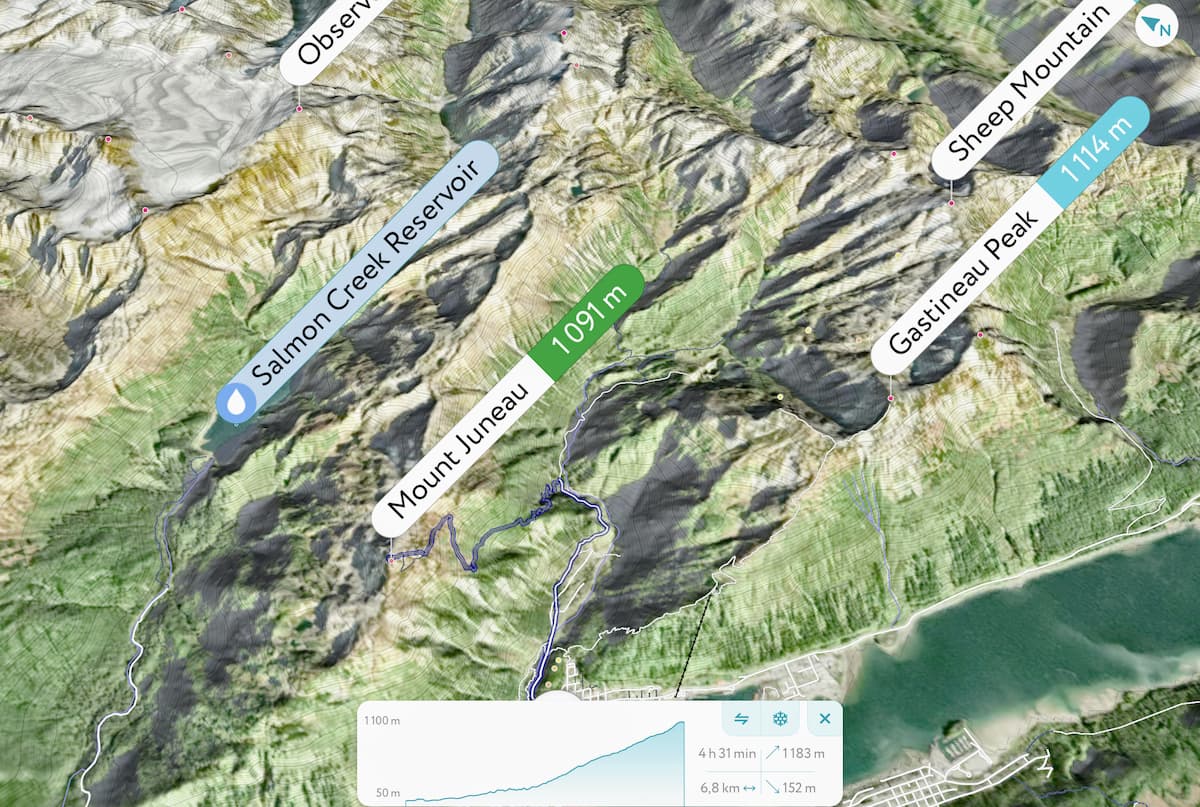
Major peaks in the area include the Mendenhall Towers, Snow Tower, Devils Paw, Mount Bressler, Mount Ogilvie, and Mount Juneau.
The region in and around Juneau is also known for having substantial gold deposits, which spurred an era of mining in the late 1880s after the California Gold Rush. In particular, the Treadwell Gold Mine, which is on the southern side of Douglas Island just to the southeast of Juneau’s downtown was one of the world’s largest hard rock gold mines at the time.
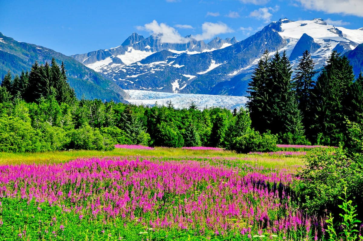
The region in and around Juneau is dominated by vast temperate rainforests at lower elevations. These rainforests are mostly home to large stands of Sitka spruce, western red cedar, and western hemlock.
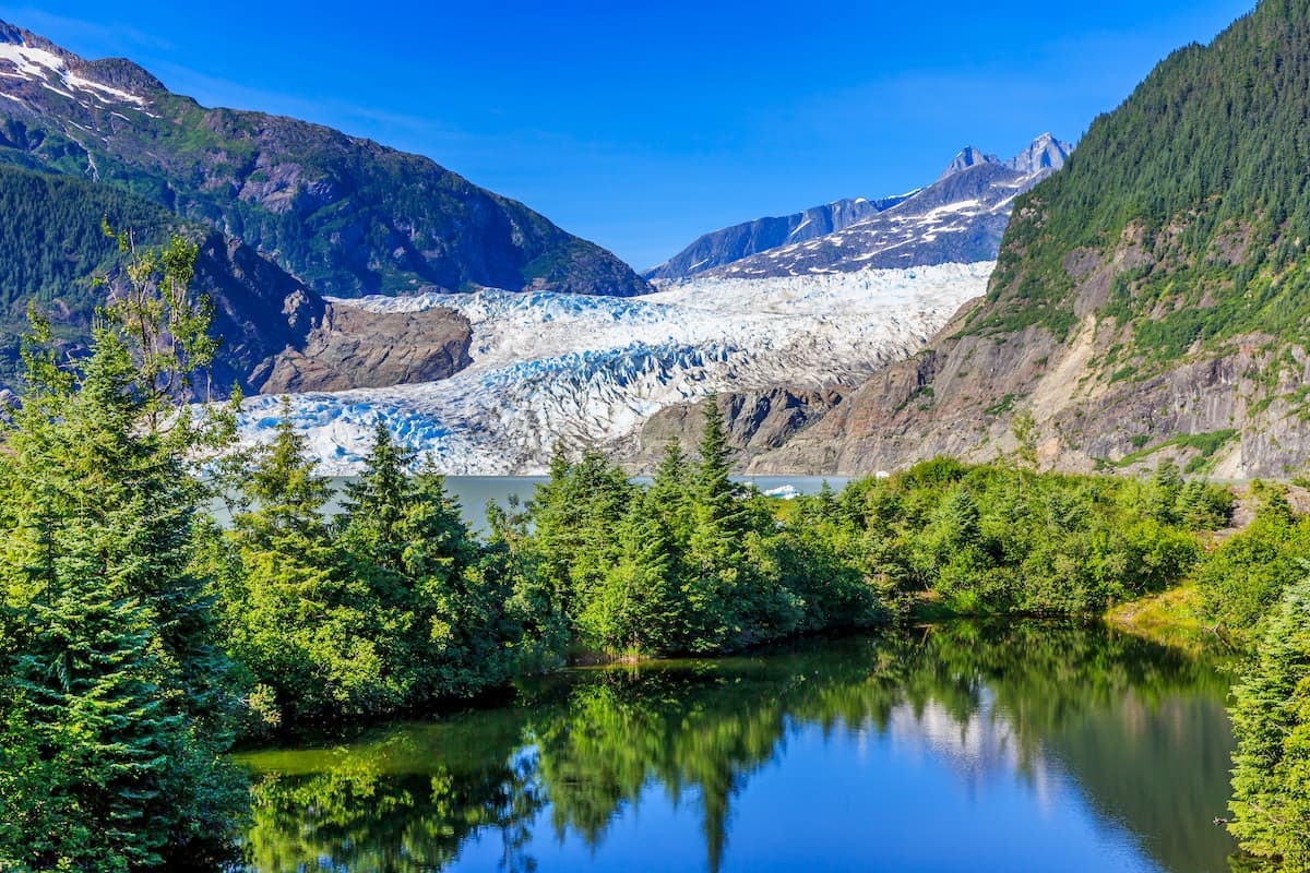
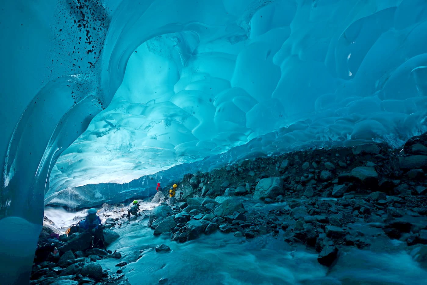
At higher elevations, the region is covered by snow and ice, particularly around the Juneau Icefield and the Mendenhall Glacier. The coastline around Juneau is characteristically rugged, like much of the Alaskan Panhandle.
Major terrestrial wildlife includes black bears, brown bears, mountain goats, Sitka black-tailed deer, and wolves. In the fertile waters surrounding Juneau, all five species of Pacific salmon can be found, as can orcas, sea lions, humpback whales, sea otters, seals, and porpoises, among other marine animals.
Southeastern Alaska and the region to the east in the northernern reaches of Canada have been home to humans for tens of thousands of years. In the millenia before the arrival of non-Indigenous peoples to North America and what would later become the state of Alaska, the region around Juneau was inhabited by many groups, mostly the Tlingit.
The Russsians first arrived in Alaska in the late 1700s, though they did not establish a settlement in Juneau. Perhaps the first non-indigenous people to visit the Juneau area were on the Discovery, led by Joseph Whidbey of the 1791-1795 George Vancouver Expedition.
However, Juneau wasn’t extensively settled by Europeans and European-Americans until almost a century later. In the 1880s, Joe Juneau, a Canadian from what is now Quebec, found deposits of gold nuggets in the region.
Soon afterward, he established a large mining camp, which grew so large that it became a village and, later, a settlement named after Joe Juneau, himself.
As the fur and whaling industry in nearby Sitka started to decline, the capital of the territory of Alaska was moved to Juneau in 1906. Although Juneau was among the largest cities in the state at the time (and it still is a major population center today), Anchorage is now nearly 10 times larger. Interestingly, Juneau is the only capital city in the US that has an international border.
These days, Juneau’s economy is diverse, with the government, medical, educational, fishing, mining, and tourism sectors making up a substantial amount of the city’s employment and income. The Sealaska Corporation, a native corporation with tens of thousands of Tlingit, Tsimshian, and Haida shareholders, is also headquartered in Juneau.
There are dozens of maintained and unmaintained hiking areas in and around Juneau. For those who are willing to hike off trail, the region offers a lifetime of recreation opportunities. Here are some of the best places to check out:
The 3 mile (4.8km) Mount Juneau Trail offers a strenuous climb to the top of the peak that overlooks the city of Juneau. This trail is steep, rocky, and exposed, so caution is necessary for anyone looking to reach the summit.
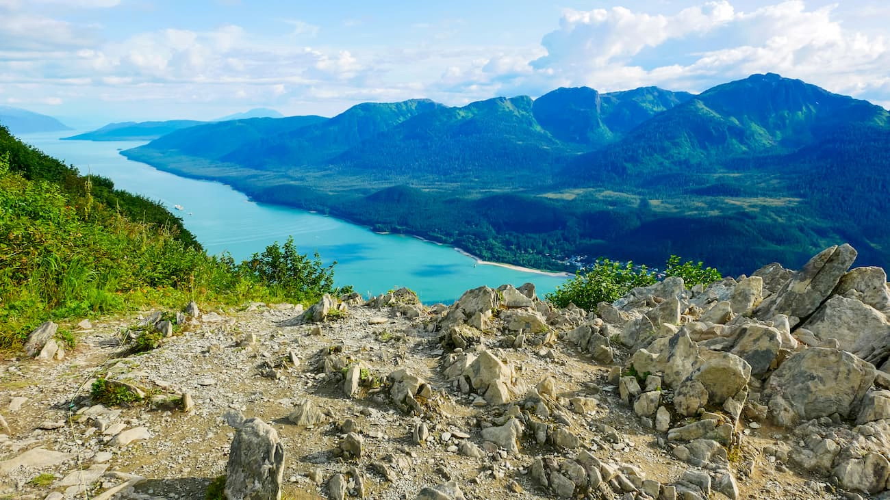
The Mount Roberts Alpine Loop Trail is a network of trails on the western side of Roberts Peak near Gastineau Peak. Throughout the trail system, the paths are well marked and there are great opportunities to see sprawling vistas and the stunning peaks of the surrounding area.
Starting at the Mendenhall Glacier Visitor Center, the East Glacier Loop is a 3.5 mile (5.6km) long hike to view the Mendenhall Glacier, which flows some 12 miles (19.3km) off of the Juneau Icefield into the Mendenhall Valley. The glacier is the southernmost road-accessible glacier in the state and is a popular tourist attraction.
Most people who visit the borough of Juneau choose to stay in the city of Juneau, though there are a few other nearby places to stay if you’re looking to spend more time in Southeastern Alaska.
Juneau is the capital city of Alaska. The city and the borough have some 31,000 residents, many of whom live in the city itself. The entire borough covers an area that’s larger than both Delaware and Rhode Island.
Juneau is accessible only by sea and by air. It has the largest airport in the southeastern panhandle of Alaska and it is a stop along the Alaska Marine Highway.
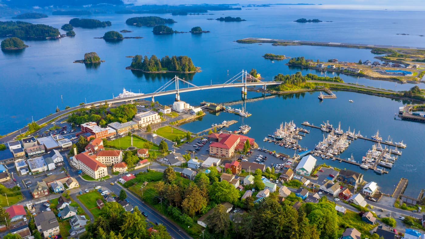
The City and Borough of Sitka are located to the southwest of Juneau. Sitka is among the largest cities in the region with nearly 9,000 inhabitants. Like Juneau, Sitka is only accessible by air and by sea, and there are some regularly scheduled flights between the two cities.


Yes. Juneau has 157 named mountains. The highest is Devils Paw at 2,541 m.
The highest mountain in Juneau is Devils Paw, at 2,541 m.
Juneau has 157 named mountains.


