
Scan the QR code and open PeakVisor on your phone
The Skagway Ranges include 65 named peaks. The highest is Mount Service at 2,376 m. Other notable peaks include Mount Leland, Mount Switzer and Mount Poletica.
The Skagway Ranges are a subrange of the Alaska Boundary Ranges located on the Canada-US border in southeastern Alaska. In total, the Skagway Ranges cover an area of 3,213 sq. mi (8,323 sq. km) and contain 65 named mountains. Mount Service (7,795 ft/2,376 m) is the highest point in the ranges. The most prominent mountain in the range is Birch Mountain (6,755 ft/2,059 m).
The Skagway Ranges cover parts of three administrative regions: Alaska, British Columbia, and Yukon. Nearly 70 percent of the range’s land area lies within British Columbia, but it is typically accessed from Alaska or Yukon.
The western border of the range parallels the Klondike Highway, which provides some of the only road access to the area. The range stretches toward the small town of Carcross, Yukon, to the north, Lake Atlin to the east, and the Chilkoot Inlet to the south.
The Skagway Ranges are part of the greater Boundary Ranges, which also include the Chilkoot Ranges, Juneau Icefield, Brundage-Ogden Area, Central Boundary Ranges, Stikine-Ambition Area, Unuk-Iskut Divide, and South Boundary Ranges.
The Boundary Ranges themselves are the largest and northernmost subrange of the Canadian Coast Mountains.
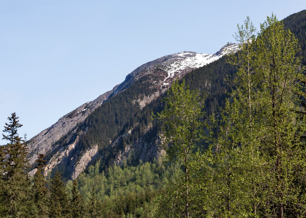
The Skagway Ranges, like other Boundary Ranges, sits at the meeting point of the Pacific and North American tectonic plates. The collision of these two plates began hundreds of millions of years ago and eventually crumpled the North American plate. The towering peaks of the Boundary Ranges are a result of this geological uplift.
The region also sits on an oceanic-continental convergence that resulted in fractures deep below the surface rock, which ultimately filled with intruding magma. Over time, this magma cooled, hardened, and transformed into granite. Millions of years of erosion weathered away the surface rock, resulting in the imposing granite cliffs seen today through the Skagway area.
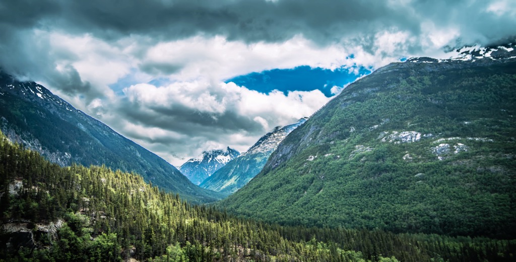
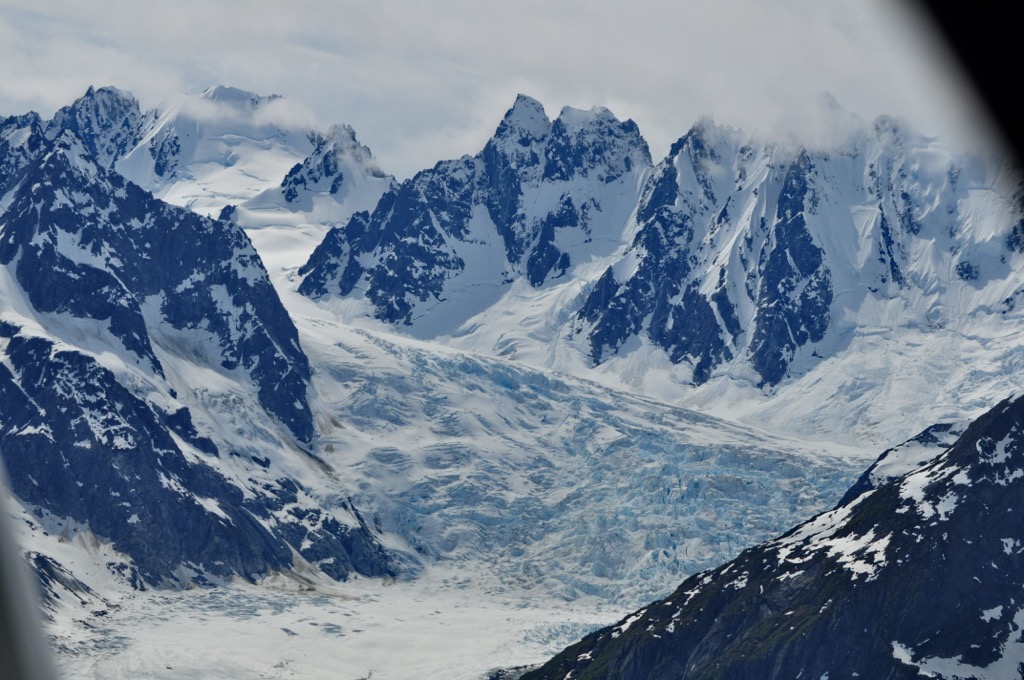
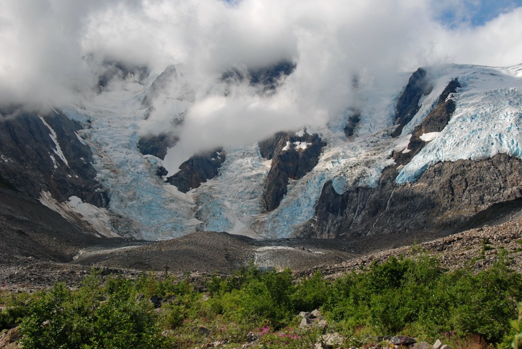
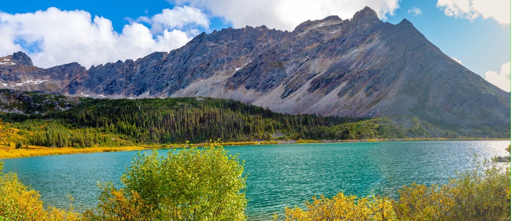
Glaciation has and continues to play a significant role in sculpting the topography of the Skagway Ranges. The landscape in the range includes cirques, horned peaks, moraines, aretes, nunataks (isolated peaks once fully surrounded by ice and snow), hanging valleys, and some of the largest glaciers and icefields that remain on the planet outside Greenland and Antarctica.
The ecological diversity of the Skagway Ranges belies its northern latitude. Cold temperatures are moderated in the range by a humid coastal maritime climate, which transitions into a drier continental climate further into the range.
The moderating influence of the Pacific Ocean, plus a mix of estuarine, maritime, subalpine, and alpine life zones, has led ecologists to classify the region as a “biological hotspot” in which the density and diversity of the area’s flora and fauna are exceptionally high.
Most of the range lies in the alpine zone. The vegetation here consists mostly of dwarf shrubs, low willow, and various lichen species. Toward the subalpine zone, alder shrubs and bluejoint reedgrass grassland begin to appear.
Estuarine life zones can be found in the inlets on the western side of the range. They are characterized by salt-tolerant grasses, forbs, and sedges. The maritime life zone of the surrounding coastal forests is dominated by a dense mix of cottonwood and Sitka spruce in the valleys. Here, the forests eventually transition to western hemlock and Sitka spruce on the mountainsides.
The range provides a habitat for a rich mix of animal life. Some of the many species found here include brown bear, grizzly bear, Dall sheep, mountain goat, moose, wolf, pika, coyote, fox, snowshoe hare, Arctic ground squirrel, and hoary marmot. Many bird species, including ptarmigan, American golden plover, and golden eagle can also be spotted throughout the Skagway Ranges.
The Tlingit people have inhabited the valleys and neighboring coastal lands of the Skagway Ranges for thousands of years. Skagway is an anglicization of the Tlingit word skagua, which can be translated as “place where the north wind blows.”
The town of Skagway, which is located on the western border of the range, was founded as the gateway to the famous Klondike goldfields. Itinerant prospectors would begin their long journey over the Chilkoot Pass and on to Dawson City from the town. Klondike Highway 2 now connects Skagway to the Alaska Highway. It is one of the few municipalities in the Alaskan panhandle with road access to the mainland.
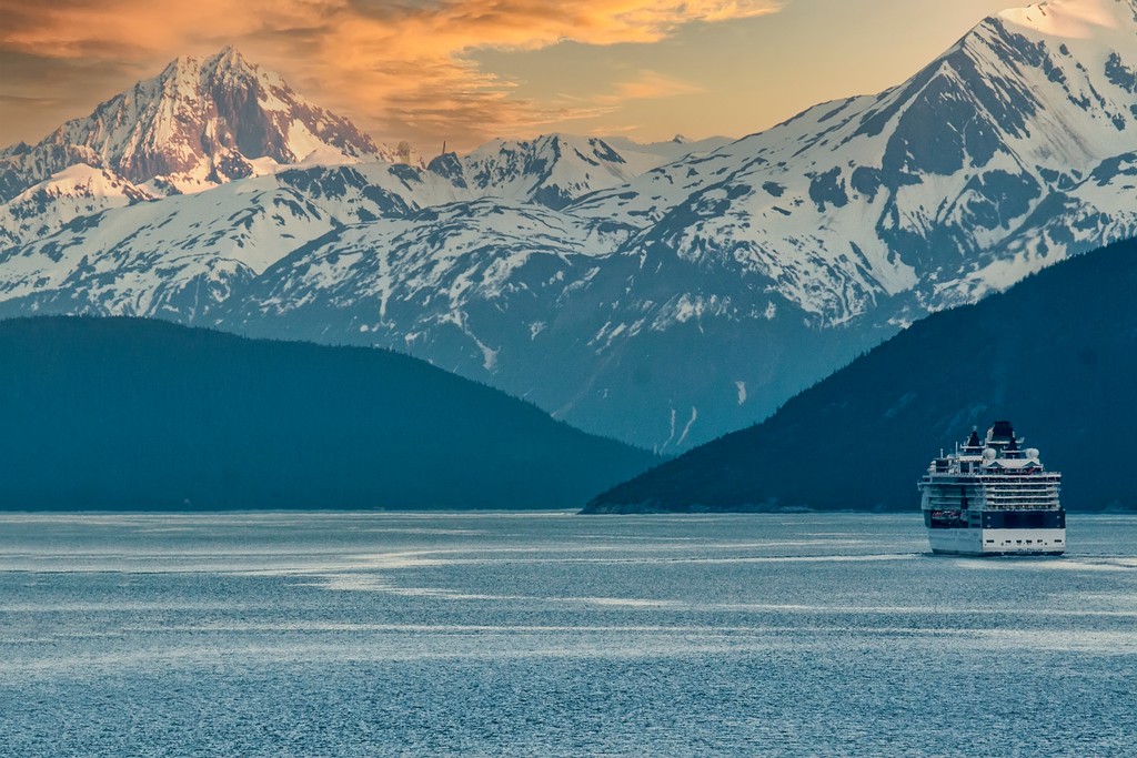
As the Klondike Gold Rush faded into history, tourism overtook mining as the leading industry in the region. Skagway is a popular stop for commercial cruise ships, with hundreds of thousands of passengers visiting this sleepy town every year.
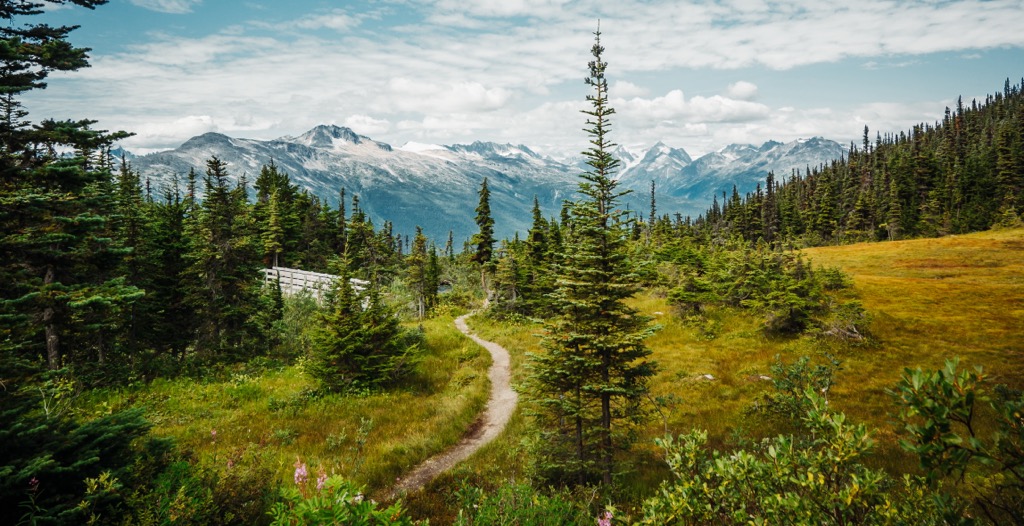
Mountaineers, hikers, and skiers also now come to the Skagway Ranges year-round. Its epic landscapes, which are filled with rugged mountains, sprawling icefields, and unclimbed peaks, have created a thriving outdoor recreation industry in the area.
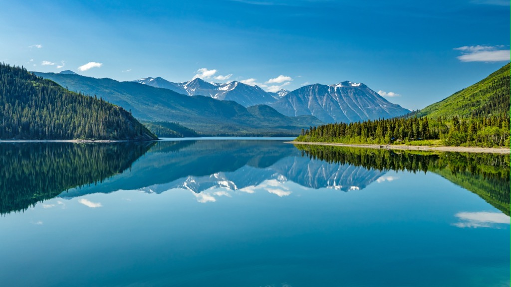
The best hiking access to the Skagway Ranges is along the Klondike Highway, which runs between Dawson City and Skagway via Carcross and Whitehorse. However, the range itself is very remote and rugged, so most of the adventure opportunities in the region require an intense multi-day expedition.
Although most of the range is off-trail and is only accessible to experienced hikers, there are some shorter trails in the region. Note that the Alaska Panhandle is home to a large number of black and brown bears, so proper bear precautions are needed while hiking in the area.
With that in mind, here are some of the best hikes to check out in the Skagway Ranges.
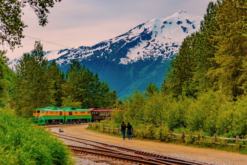
The Laughton Glacier Trail is a 4.2 mi (6.8 km) out-and-back hike located to the north of the Skagway townsite. Following the Skagway River, the trail leads hikers through the northernmost stretches of the lush Tongass National Forest and rises gradually up to the base of the imposing Laughton Glacier.
There is no road access to the trailhead, though. To get there, you’ll need to take a train from Skagway via the White Pass & Yukon Route Railroad. Hikers can also extend their trek by staying at the Laughton Glacier Cabin along the trail.
Another hike that can be completed along the White Pass and Yukon train line is the Denver Valley Trail.
Beginning at the Denver train station, the 5 mi (8 km) trail follows the torrential Denver River upstream to its source. On this trail, hikers will wind through majestic old-growth Sitka spruce and hemlock to a viewpoint of Denver Glacier and the surrounding peaks before returning back to the train station.
The Upper Dewey Lake Trail starts right in the town of Skagway. As it passes Lower Dewey Lake, the trail begins to ascend steeply into the subalpine before arriving at the shores of Upper Dewey Lake.
A rustic six-person cabin is located at the lake and is free to use for overnight stays. Staying a night at the cabin opens opportunities for additional hiking, including visits to Devil’s Punch Bowl—another alpine lake. However, spending the night in the cabin requires making advance reservations.
This out-and-back trail is only 5 mi (8 km) in length. But the steep and technical climb makes it feel much longer, so it’s only suitable for experienced hikers.
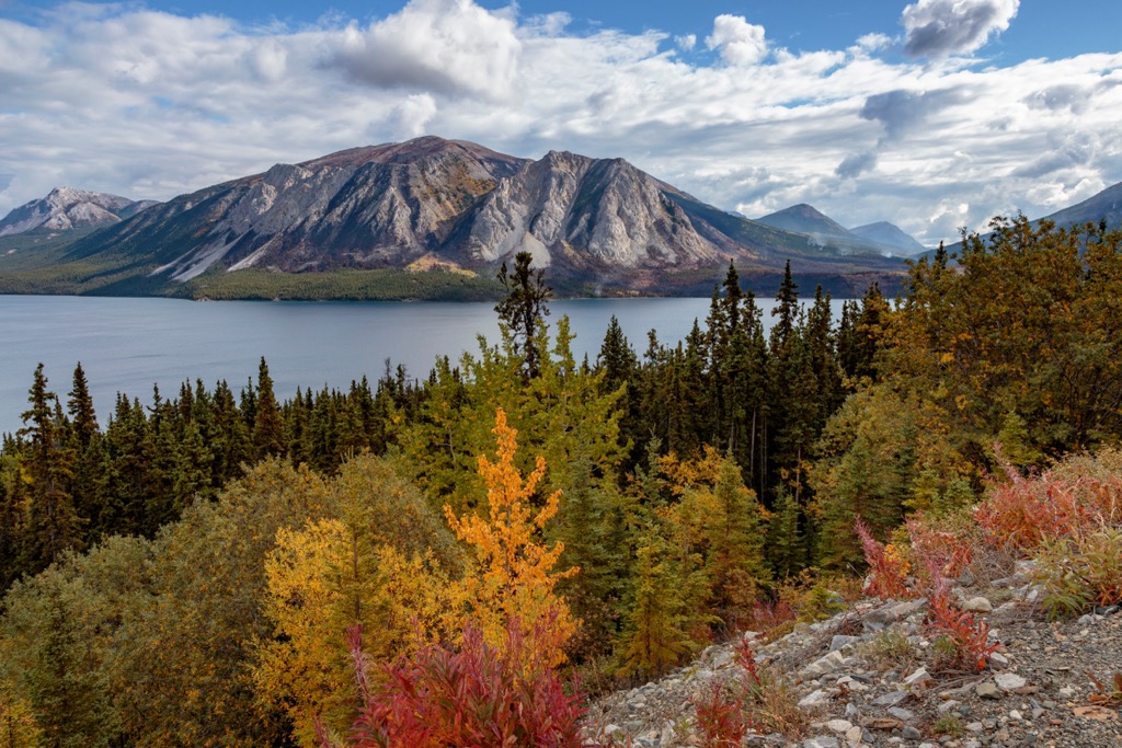
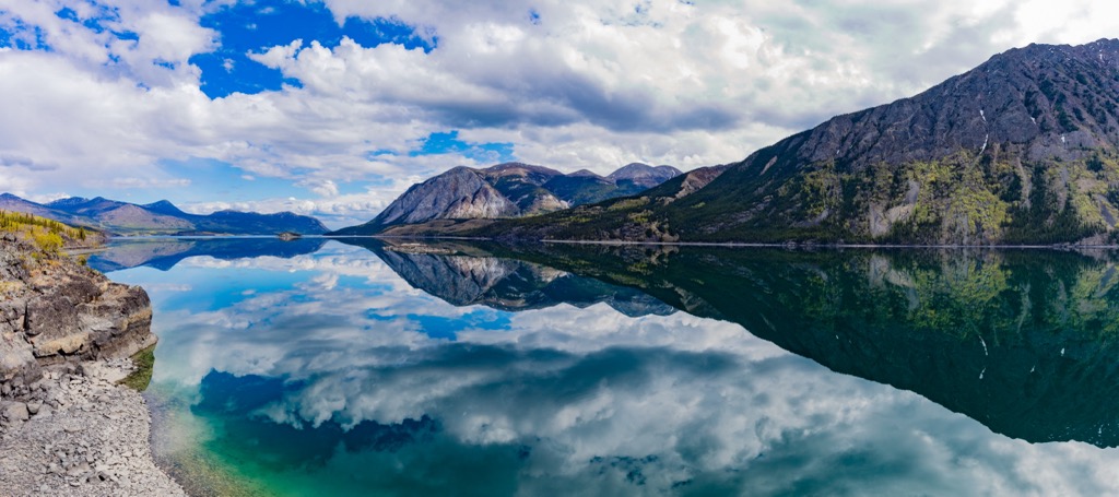
Paddy Peak is one of the highest and most eye-catching summits in the northern Skagway Ranges. Located to the south of Carcross, Yukon, the peak offers panoramic views of surrounding mountains and the sprawling Tutshi and Bennett Lakes.
The 10.8 mi (17.5 km) out-and-back Paddy Peak Trail can be made easier with the right vehicle. In fact, the first 4.3 mi (7 km) are on a rough 4x4 road, so trekkers that have access to an appropriate off-road vehicle can drive most of the way up and complete the short and steep scramble up to the summit.
A shorter—but still immensely rewarding—hike on the Yukon side of the Skagway Ranges is the Windy Arm Overlook.
This 2.5 mi (4 km) trail starts just to the west of the Klondike Highway where it rises along the slopes of Dail Peak to a dramatic view of the Windy Arm of Tagish Lake and the peaks to its east. In summer, the trail overflows with fresh raspberries and wildflowers.
Looking for a place to stay while exploring the Skagway Ranges? Here are some of the best cities and towns to visit in the region.
The town of Skagway boasts the closest access to the majority of trails in the range. As it is located at the terminus of the Klondike Highway, the town can be reached by car via the Yukon. Skagway is also a popular stop for many Alaskan cruises.
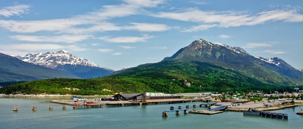
Skagway has preserved much of its gold rush era architecture and is full of boutique shops, museums, and restaurants that are worth exploring. In particular, the Historic Skagway Inn and the Westmark Inn are located right in town and offer quick access to the nearby parks and trails.
Carcross is a small village located near the Yukon-Alaska border that is home to the nearby Carcross Desert—one of the smallest deserts in the world. The town is located on the White Pass and Yukon Route railway line, and it is also accessible via the Klondike Highway.
Although many of its visitors are cruise ship passengers who travel by bus from nearby Skagway, Carcross is beginning to garner attention as a premier mountain bike destination as well. For example, nearby Montana Mountain features endless miles of rugged singletrack.
Note that services are fairly limited in Carcross. There are a few shops, gas stations, and cafes, but you’ll find more amenities in Skagway. The Carcross Tagish First Nation Campground offers the closest accommodation options to the community.
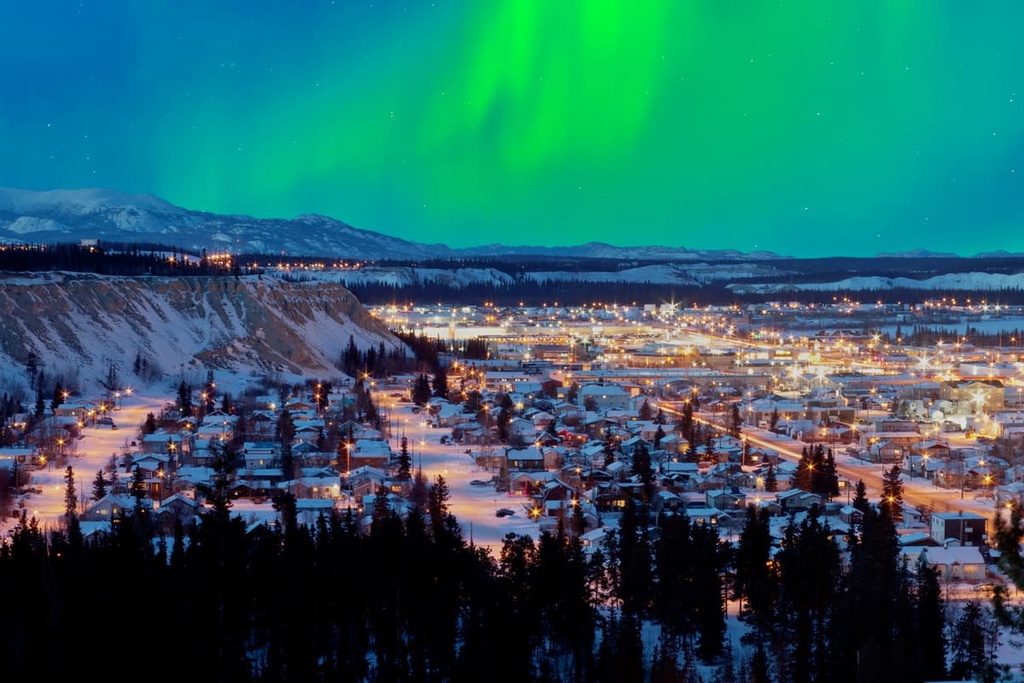
Located approximately 45 minutes by car further to the north of Carcross is the city of Whitehorse. As it is the biggest population center in all of Canada’s territories, many visitors to Yukon, Nunavut, and the Northwest Territories begin their travels by flying into Whitehorse’s airport, which offers direct flights to several major Canadian cities.
There are dozens of hotels and campgrounds located in and around Whitehorse, too, making it a great home base for people looking to explore the wild and beautiful Skagway Ranges that are located just to the south of the city.


The highest peak in the Skagway Ranges is Mount Service, at 2,376 m.
The Skagway Ranges have 65 named peaks.


