
Scan the QR code and open PeakVisor on your phone
The Juneau Icefield include 101 named peaks. The highest is Devils Paw at 2,541 m. Other notable peaks include Nelles Peak, Mount Nesselrode and Mount Bressler.
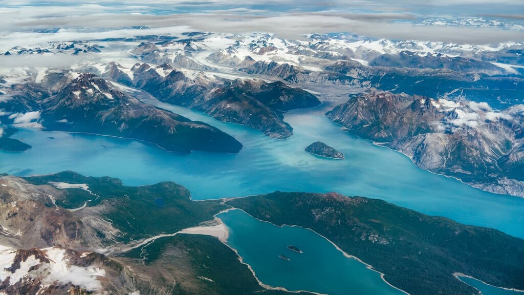
Nestled in the Coast Mountains, the Juneau Icefield covers more than 1,500 square miles of land, stretching nearly 100 miles north to south and 45 miles east to west. A remarkable natural wonder, the Juneau Icefield is the fifth largest icefield in North America and one of the world’s largest non-polar masses of snow and ice.
The 3,000-year-old icefield is believed to have reached its maximum glaciation point around 1700. However, it is in a constant state of advance and retreat due to our variable climate. For the last 60 years, the Juneau Icefield Research Program (JIRP) has studied the icefield and its glaciers in order to better understand and educate the public on the impacts of climate change on our environment.
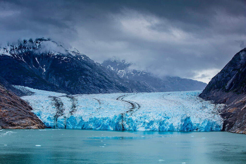
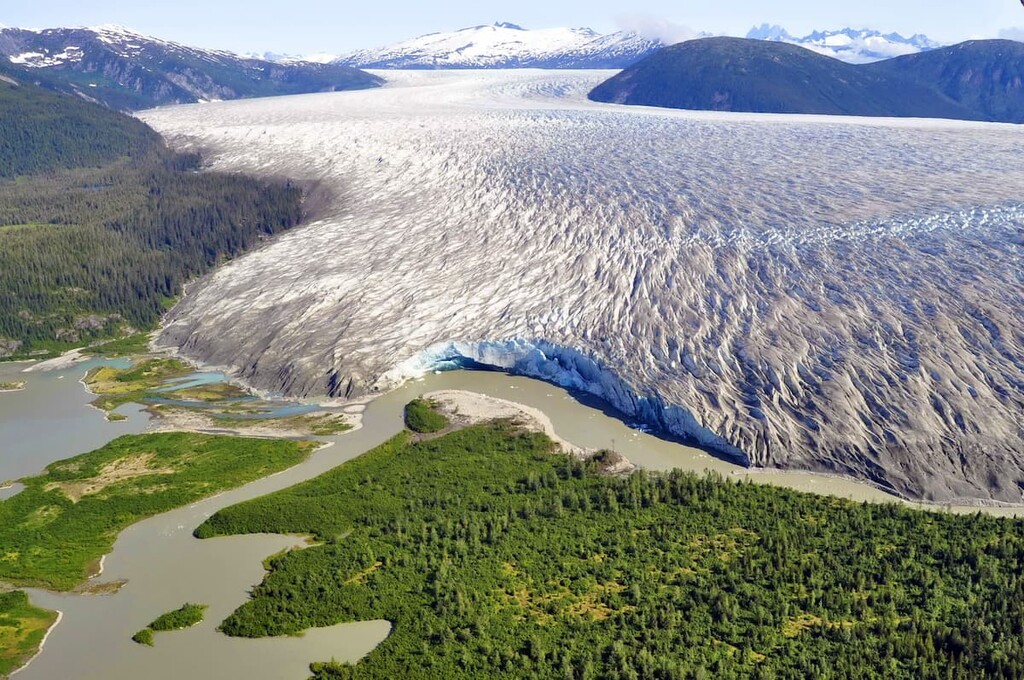
The Juneau Icefield is home to at least 38 major valley glaciers, including the deepest and thickest alpine temperate glacier in the world, Taku Glacier. Until 2019, Taku Glacier was the last remaining advancing glacier flowing out of the Juneau Icefield. Unfortunately, according to glaciologists with the U.S. Geological Survey, Taku is beginning to retreat at a rapid rate and is expected to significantly contribute to rising sea levels.
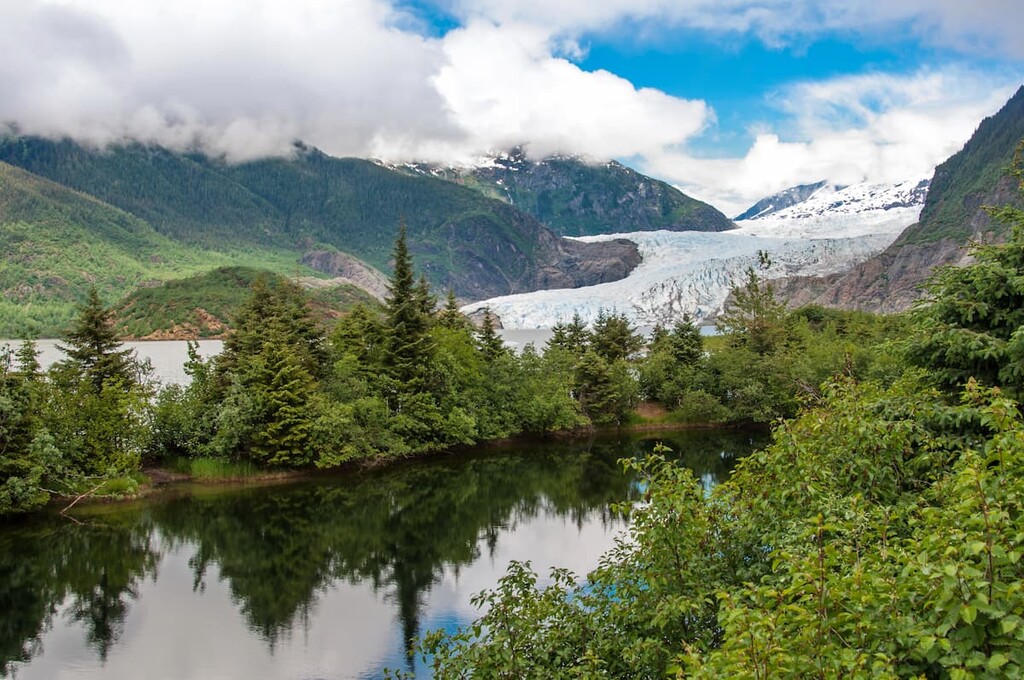
The Mendenhall Glacier, another renowned Juneau Icefield glacier, has retreated roughly 2.5 miles since its most recent maxima during the Little Ice Age in the mid 1700s. Mendenhall is the only glacier in Southeast Alaska that is accessible by road, making it a popular tourist destination. The Mendenhall Glacier Visitor Center also provides visitors a look into the fascinating history and future of glaciers in the region.
Most of the Juneau Icefield lies within the nation’s largest national forest, Tongass National Forest. Tongass National Forest is often referred to as the ‘crown jewel of the Forest Service,’ and is cherished for its lofty, weather-beaten summits and vast temperate rainforests.
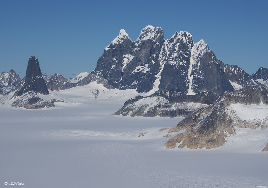
The tallest summits in the Juneau Icefield are tucked within the Boundary Ranges of the Coast Mountains. Several of these Boundary Range peaks exceed 8,000 feet in elevation and feed nearby lakes and glaciers.
Devils Paw, the tallest in the region, feeds Tulsequah Lake and the Tulsequah Glacier. Its north face plummets 7,000 feet in just three miles and its southeast side drops 8,000 feet in roughly seven miles. Nearby the second-tallest peak in the icefield, Nelles Peak, rises to over 8,300 feet along the western edge of Tulsequah Lake.
Other remarkable peaks in the area include the Taku Towers, a pair of 6,600-foot peaks that sit along the edge of the Taku Glacier, and the Mendenhall Towers, a series of serrated peaks that serve as the awe-inspiring backdrop to Mendenhall Glacier.
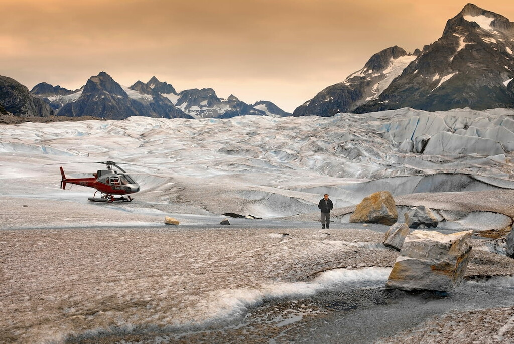
Though seemingly remote and forbidding, the Juneau Icefield’s close proximity to Alaska’s capital makes it a popular destination for mountaineering, climbing, and backcountry skiing. Keep in mind, however, extensive mountaineering and glacial travel skills are required in order to traverse the area without a guide or tour group.
Visitors that lack mountaineering skills can still appreciate the grandeur of the Juneau Icefield via a variety of guided glacier tours. Mendenhall Glacier tours are incredibly popular and allow visitors to walk on top of the glacier and explore hidden caves, waterfalls, and rivers in the region.
Several scenic trails can also be found near the Mendenhall Glacier Visitor Center. The Photo Point, Nugget Falls, Trail of Time, Steep Creek, and East Glacier trails all allow visitors to safely explore Mendenhall Glacier and its surrounding landscape.
Located in one of the largest wilderness areas in the United States, Juneau serves as the primary basecamp to explore the Juneau Icefield. Downtown Juneau lies at the base of Mount Juneau and across the channel from Douglas Island, making it the ideal location to admire the vast Alaskan wilderness.
Despite its modest, permanent population, Juneau receives thousands of visitors throughout the year, most of which arrive on cruise ships. Though there are no roads that connect the city to the rest of the state, Juneau can easily be reached via a quick flight from Seattle or Anchorage or via the Alaska Marine Highway, a ferry service that boasts roughly 32 terminals throughout Alaska, British Columbia, and Washington.

Built in 1923, the historic Taku Glacier Lodge is a popular destination for visitors looking to experience the greatness of Taku Glacier. Visitors to the lodge are often encouraged to partake in a scenic flightseeing tour, take advantage of an all-you-can-eat Salmon dinner, and explore nearby trails before returning to Juneau.


The highest peak in the Juneau Icefield is Devils Paw, at 2,541 m.
The Juneau Icefield have 101 named peaks.


