
Scan the QR code and open PeakVisor on your phone
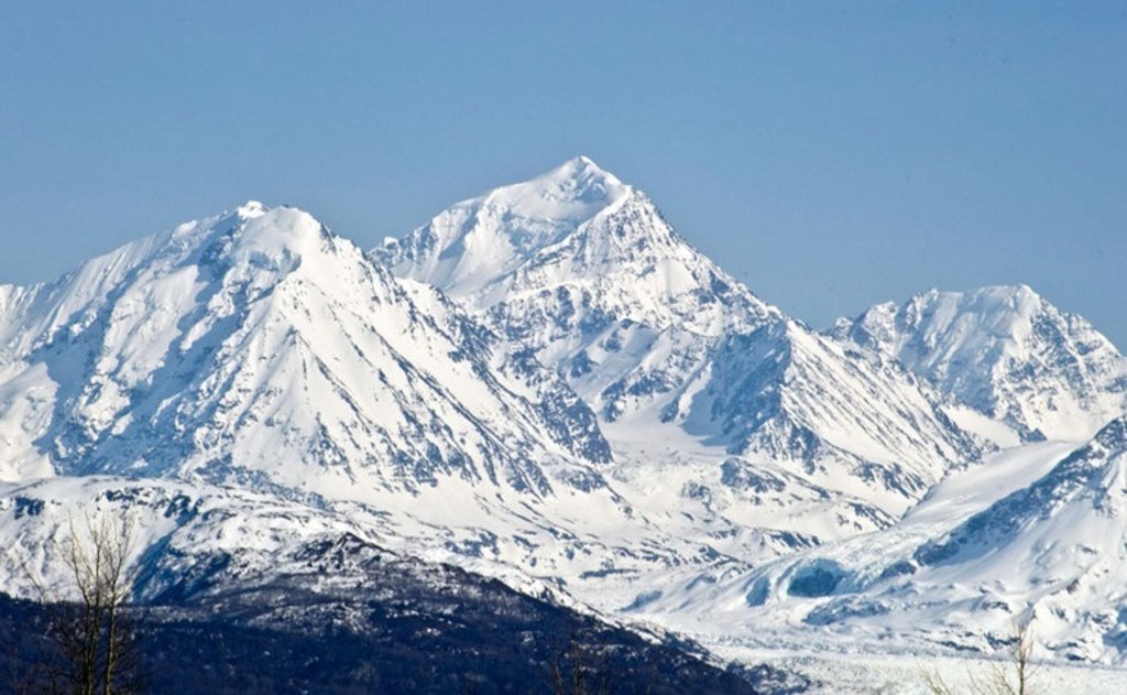
The Chugach Mountains include 590 named peaks. The highest is Mount Marcus Baker at 4,016 m. Other notable peaks include Mount Thor, Mount Gilbert Lewis and Mount Valhalla.
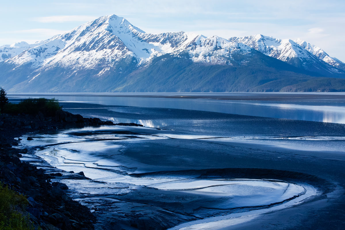
The northernmost chain of mountains in the greater Pacific Coast Range, the Chugach Mountains are home to some of southern Alaska’s most iconic peaks. At approximately 250 miles (402km) long and 60 miles (97km) wide, the Chugach Mountains are a prominent landmark in southcentral Alaska, extending from the Knik and Turnagain Arms of the Cook Inlet in the west all the way to the Tana River in the east.
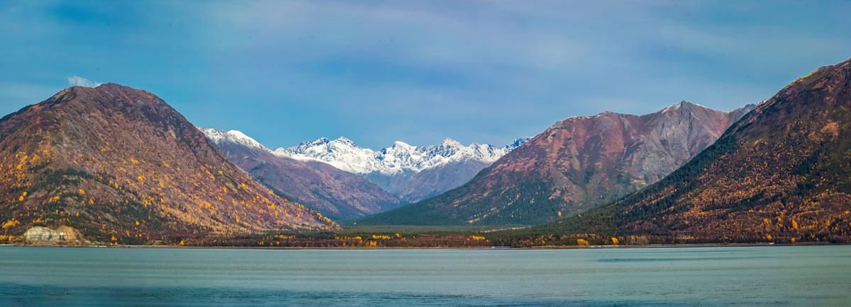
The Matanuska, Copper, and Chitina rivers form the northern boundary of the Chugach Mountains, while the great, stormy Gulf of Alaska borders the range to the south. The Chugach Mountains are home to 327 named peaks, the highest and most prominent of which is Mount Marcus Baker (13176ft/4016m).
The Chugach Mountains get their name from the Chugach Sugpiaq people’s word, “Cuungaaciiq,” one of the original names for the area. The Chugach Sugpiaq are an Alutiiq people native to Alaska who originally inhabited the Kenai Peninsula and much of the area around the Prince William Sound before the arrival of white settlers.
Archeological evidence tells us that the Chugach Sugpiaq have lived in the region of the Chugach Mountains for millennia, living off of the land’s abundant plant and wildlife, as well as the rich marine life in the Prince William Sound and the Gulf of Alaska. The Chugach Sugpiaq people were the first to encounter Vitus Bering, the Danish cartographer who sailed for Russia in a 1741 expedition to Alaska.
Many attribute the current English spelling of “Chugach” to United States Army Captain William R. Abercrombie, who visited the area in 1898 while on an expedition to find an overland route from coastal Alaska to the Klondike, a region of the Yukon. During this expedition, Abercrombie spelled the name as “Chugatch,” which was later simplified to the current English language spelling.
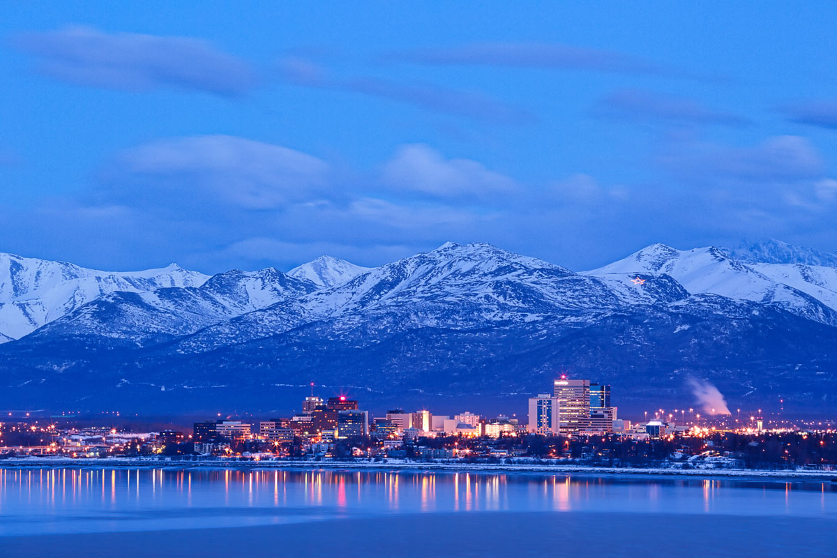
These days, the Chugach Mountains are heavily protected as part of both the Chugach State Park and the Chugach National Forest, though the easternmost part of the range is within the Wrangell-St. Elias National Park and Preserve. The peaks and their surrounding lowlands are an incredibly popular outdoor recreation destination for nearby Anchorage residents (who can see the mountains from town) and the millions of people who visit Alaska each year.
During the summer months, the Chugach Mountains are a popular backpacking and day hiking area, though much of the range is trailless and remote. The adventurous among us head out on climbing and mountaineering trips in the mountains, while others opt to enjoy the fantastic fly fishing opportunities in the range’s many rivers. In the winter, however, ice climbing, winter mountaineering, and backcountry skiing are a great way to pass the time and explore the Chugach Mountains.
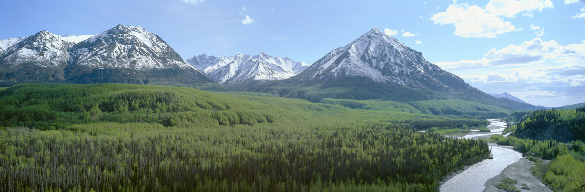
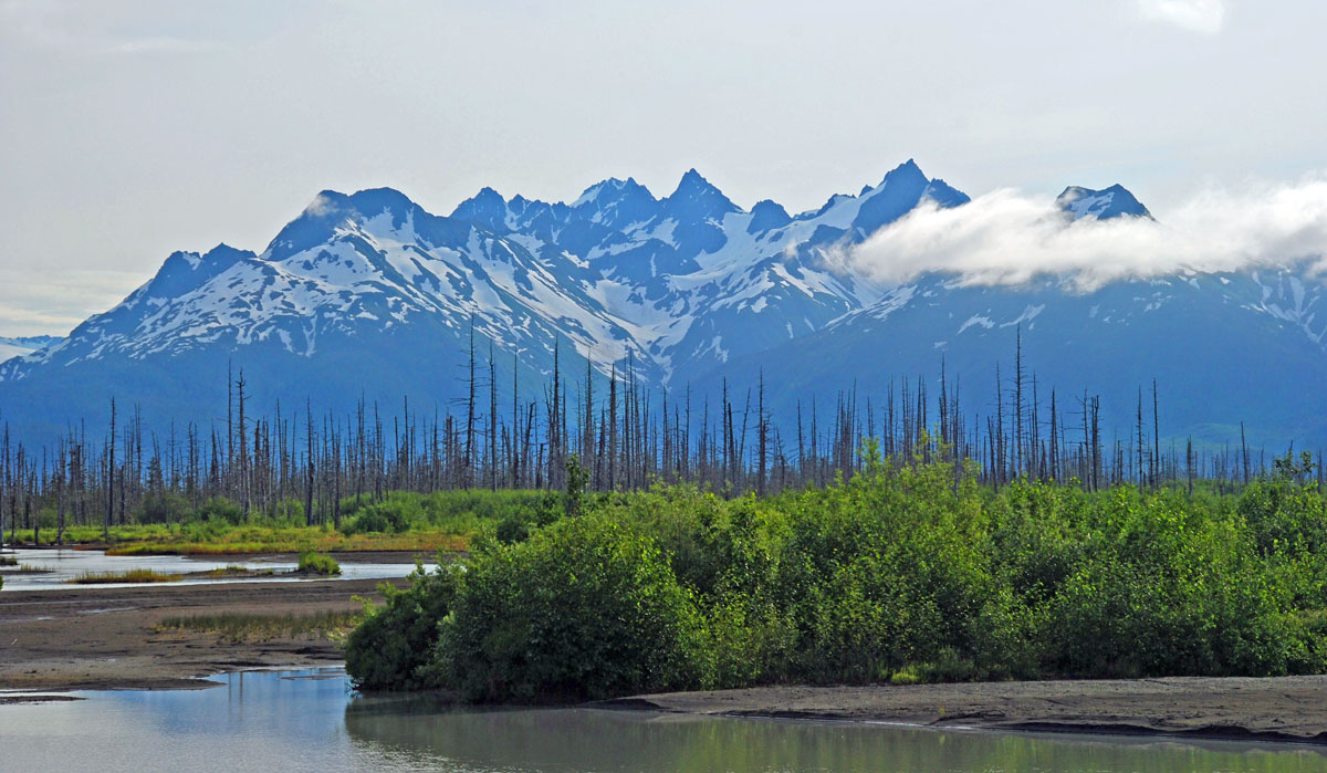
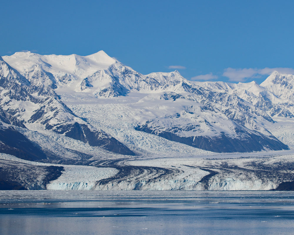
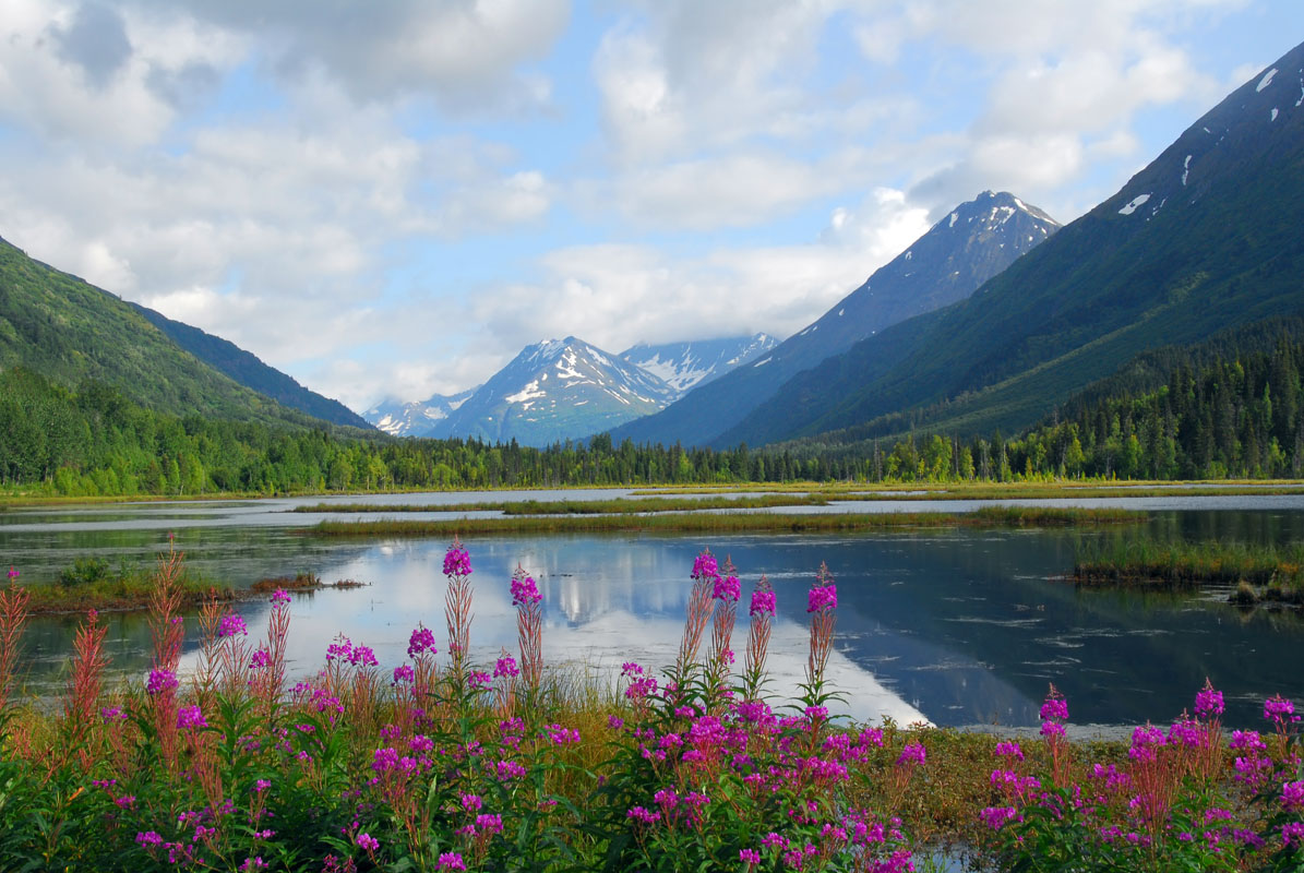
The mountains themselves are typical of southcentral Alaska, featuring sharp, jagged peaks, alpine meadows, glaciers, and seemingly endless scree slopes. The Chugach Mountains showcase many of the characteristics of a recently deglaciated area, with plentiful moraines and wide glacial valleys.
Low-lying areas in the range are often heavily forested with Sitka spruce, mountain hemlock, and similar conifers, while more recently deglaciated terrain is home to black cottonwood, spruce, willow, alder, and an abundance of wildflowers in the summer months. The Chugach’s large rivers are home to an abundant fish population, which, when coupled with summertime berries, supports the region’s megafauna, including brown and black bears, moose, mountain goats, and Dall’s sheep.
Despite the mountain’s extensive wilderness areas, however, the Chugach Mountains are actually fairly well connected to some of southcentral Alaska’s most populous towns and villages. The Richardson Highway, Portage Glacier Highway, Glenn Highway, and the Seward Highway all cross through the Chugach mountains, providing the primary means of access to towns such as Whittier, Seward, Girdwood, and Palmer.
Like most of Alaska, the Chugach Mountains are remote. While you will find some trails in the Chugach, don’t expect well-maintained paths, interpretive signs, and ranger-staffed visitors centers. Anyone looking to get out and explore the Chugach needs to be prepared to be self-sufficient for the duration of their adventures.
That being said, while much of the range is trailless, there are some great trails to check out in the Chugach Mountains. Here are some of the more scenic places to check out:
Flattop Mountain is perhaps the most visited peak in all of Alaska. Located just a short drive south of Anchorage off of O’Malley Road, Flattop is a three-mile round-trip hike with 1,350 feet of elevation gain to a rocky summit.
Aptly named, Flattop’s summit is about the size of a football field and, on a sunny day, you can get some fantastic views of Denali to the north and the mountains of the Aleutian Islands to the southwest. Or, if you’re feeling spicy, you can take the five-mile one-way trail to Williwaw Lakes or climb the 5.5-mile one-way trail to the summit of Wolverine Peak, all from the Flattop trailhead.
Some 45 minutes south of Anchorage, off of Canyon Road is the Ptarmigan Pass Trailhead, which takes you to a scenic plateau in the heart of the Front Range of the Chugach Mountains. From the trailhead, you quickly make your way up a wide trail to the meadow above treeline, getting great views of McHugh Peak above you.
After two miles of hiking, you’ll start to see a gap in the ridgeline that forms the rim of what’s known as Ptarmigan Pass. Soon enough, you’ll make the 800-foot ascent up to the top of the pass, where you’ll be treated to amazing views of the sprawling plateau below you. Here, you can choose to stop and turn back to the trailhead, or you can continue on to the base of Ptarmigan Peak and a beautiful emerald alpine tarn lake.
The Crow Pass Trail starts at the head of Cross Pass Road, a scenic 7 mile drive up Crow Pass Road from Girdwood. From the trailhead, you embark on what is one of the most popular backpacking trails in the Chugach - and for good reason.
Following along portions of the original Iditarod Trail, the Crow Pass Trail is 21-miles from end to end. Some people choose to run the whole trail in a day, while others spend a few nights out backpacking the Crow Pass Trail. Many more, however, hike just the first four miles of the trail through some amazing vistas.
Once you leave the trailhead, you’ll quickly make it above treeline and see mountains rising into the sky from the Crow Creek Valley. As you walk, you’ll pass by the ruins of the Monarch mines, some stunning waterfalls, and amazing mountain views.
After some switchbacks, you’ll get even better views of the waterfalls, which make for a great stopping point on a day hike. Or, you can choose to continue on to Crystal Lake, the source of the falls. Anyone looking for a longer day in the mountains can even hike to the crest of Crow Pass for some of the best views in the area.
If you’re looking for a workout, the Bird Ridge Trail is one of the best in the Chugach Mountains. Climbing some 3,000 feet in just over one mile, the Bird Ridge Trail takes you from the Seward Highway up to the crest of a ridge for some out-of-this-world views of the Turnagain Arm.
Since the trail is south-facing, it melts out quickly in the spring and is home to amazing wildflowers. If you’ve only got a few hours to play with, the Bird Ridge Trail is a must-do.
If you’re looking to get to the Chugach Mountains, you have a number of different options available to you for your starting point, depending on which side of the range you’d like to explore. Here are some great places to stay in the Chugach Mountains:
Although it’s not the state capital, Anchorage is Alaska’s most populous city, home to some 300,000 of Alaska’s 700,000 permanent residents. The Anchorage Airport is the state’s main transportation hub with daily flights on major airlines flying to a number of different cities in the Lower 48, as well as bush planes and smaller prop planes that service many of Alaska’s small, remote villages.
From Anchorage, it’s fairly easy to access the southern part of the Chugach Mountains via the Seward Highway, which leads to the town of Seward on the Kenai Peninsula. In Anchorage, you can get nearly anything you might need for an adventure in the mountains and there are plenty of lodging and eating options in town, too.
Girdwood is a small resort town at the base of Alyeska Ski Resort along the Turnagain Arm. Located just off of the Seward Highway, Girdwood is only an hour’s drive south of Anchorage and offers unparalleled access to the Chugach Mountains.
The town itself is surrounded by seven glaciers and a lifetime’s worth of outdoor recreation opportunities. Although it’s not as populated as Anchorage, Girdwood’s proximity to the city means you can get many of the same supplies in town. There are a few different lodging options, though there’s a lot of camping in the area, too, making Girdwood a great place to basecamp when exploring the Chugach.


13er
ultra
glacier
alaska-13ers
alaska-ultras
13er
ultra
glacier
alaska-13ers
alaska-ultras
ultra
chugach-7000ers
western-chugach-7000ers
alaska-ultras
The highest peak in the Chugach Mountains is Mount Marcus Baker, at 4,016 m.
The Chugach Mountains have 590 named peaks.


