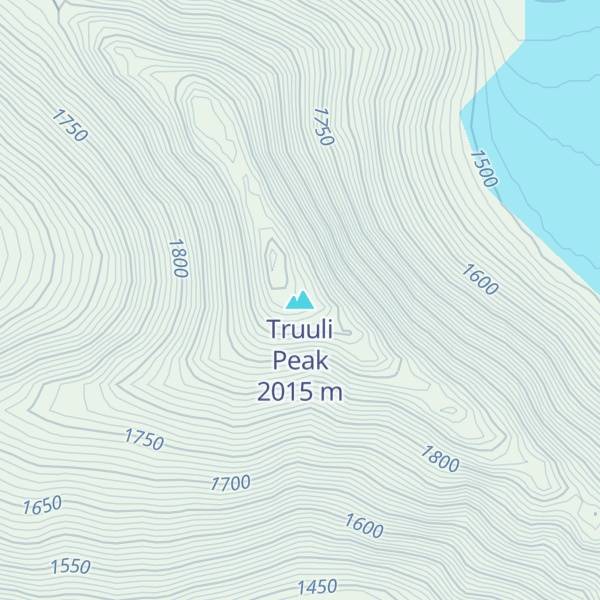
Truuli Peak is a mountain summit located in the Kenai Mountains, in the U.S. state of Alaska. At 6,612 ft (2,015 m), Truuli Peak is the highest mountain in the Kenai Mountains on the Kenai Peninsula in southern Alaska. It is located in the Kenai National Wildlife Refuge in the southwest of the Harding Icefield between the Chernof and Truuli glaciers.
The closest higher peak is Mount Redoubt, 143 km (89 mi) away in the Chigmit Mountains west of the Cook Inlet.
The first ascent of the Truuli Peaks took place in 1968 under the direction of Vinn Hoeman as part of the first recorded crossing of the Harding Icefield, which led from Kachemak Bay to the Exit Glacier. The name "Truuli" was given by Hoeman and comes from the Indian name for the Kenai Mountains.
By elevation Truuli Peak is
# 17 out of 200 in Kenai Peninsula # 1 out of 19 in Kenai National Wildlife Refuge # 1 out of 12 in Kenai Wilderness
By prominence Truuli Peak is
# 37 out of 3806 in Alaska # 66 out of 91437 in USA # 5 out of 200 in Kenai Peninsula # 1 out of 19 in Kenai National Wildlife Refuge # 1 out of 12 in Kenai Wilderness # 5 out of 575 in the Chugach Mountains # 8 out of 847 in the South-Central Alaska
We use GPS information embedded into the photo when it is available.
3D mountains overlay
Adjust mountain panorama to perfectly match your photos because recorded by camera photo position might be imprecise.
Move tool
Rotate tool
Zoom
More customization
Choose which peak labels should make into the final photo and what photo title should be.
Next
Photo Location
Satellitte
Flat map
Relief map
Latitude
Longitude
Altitude
OR
Latitude
°'''
Longitude
°'''
Apply
Register Peak
Peak Name
Latitude
Longitude
Altitude
Register
Teleport
PeakVisor
This 3D model of Sagarmatha National Park in Nepal was made using the PeakVisor app topographic data. The mobile app features higher precision models worldwide, more topographic details, and works offline. Download PeakVisor maps today.
Download OBJ model
PeakVisor
The download should start shortly. If you find it useful please consider supporting the PeakVisor app.
PeakVisor for iOS and Android
Be a superhero of outdoor navigation with state-of-the-art 3D maps and mountain identification in the palm of your hand!