
Scan the QR code and open PeakVisor on your phone
Regional District of Kitimat-Stikine is home to 598 named mountains. The highest is Mount Ratz at 3,090 m.
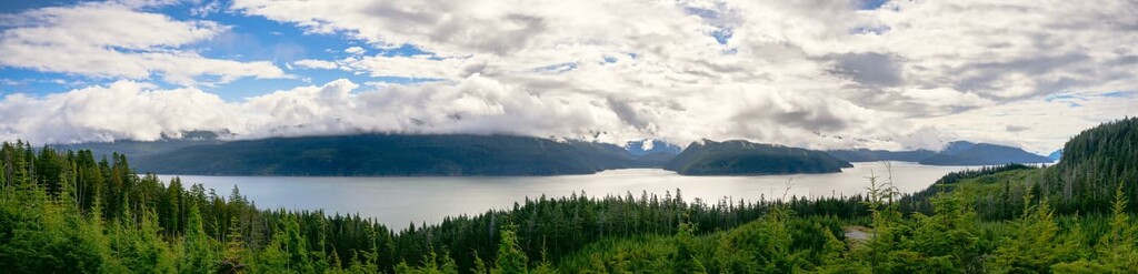
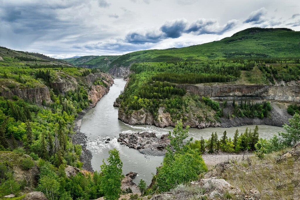
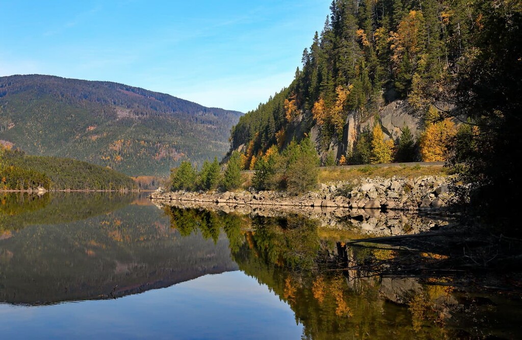
An area of beautiful, rugged coastline and picturesque forests, the Regional District of Kitimat-Stikine is an administrative district located in northwestern British Columbia, Canada. There are 598 named mountains in the district, the tallest of which is Mount Ratz, with an elevation of 3,090 m (10,135 ft) and a prominence of 2,431 m (7,974 ft).
The Regional District of Kitimat-Stikine is located in northwest British Columbia. The district covers an area of 91,910 square kilometers (35,624 square miles) and it has a population of under 40,000 people even though it is the third largest regional district in the province by total area after the Stikine Region and the Peace River Regional District.
The city of Terrace is the regional seat of the district. It is also a regional retail and service hub for most of northwestern British Columbia. Terrace was originally named Littleton; however, Canada Post rejected the name because it was too similar to Lyttleton, New Brunswick. The new name is descriptive of how the land rises from the river.
The drive from Vancouver, British Columbia to Terrace is over 1,300 km (780 mi) and takes more than 15 hours to complete. The major roads that run through the Kitimat-Stikine Region are the Yellowhead Highway (Highway 16), which traverses the region from east to west, and Highway 37, which runs from south to north.
British Columbia and the Regional District of Kitimat-Stikine, in particular, is densely packed with mountains, and the coast has many islands, bays, rivers, and other landscapes and natural areas that are worth protecting. The provincial government, in collaboration with the local population, has created many protected areas within the District of Kitimat-Stikine.
The district contains the following provincial parks which are lands dedicated to the preservation of the natural environment and for the enjoyment, use, and inspiration of the public.
The following are the ecological reserves in the district that are reserved either for scientific research or because they are areas representative of British Columbia’s natural ecosystems, areas that are inhabited by rare or endangered flora or fauna, and areas that contain unique biological or geological phenomena. The ecological reserves in the district include:
Additionally, there are over 20 conservancies and other protected areas in the region, which are lands dedicated for the protection of biological diversity and natural environments as well as the preservation and maintenance of social, ceremonial cultural uses of First Nations.
Conservancies are also dedicated to the protection of the area’s recreational value, and development of the natural resources in a manner consistent with the previously mentioned values. Some of the conservancies in the regional district include:
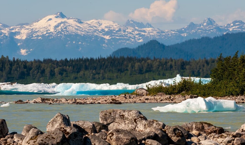
The geology of the Regional District of Kitimat-Stikine is representative of some interesting geological events. In particular, the district is part of the Pacific Ring of Fire volcanic area. As such, the rock and mountains are deformed igneous and metamorphosed pre-Cenozoic rocks.
The land of the district was generally created over 66 million years ago from volcanoes erupting in the Pacific Ocean. Volcanoes would erupt, allowing the magma to flow to the surface of the earth as lava, creating islands. As the North American continent moved west, the heavier oceanic tectonic plates which were moving east were sliding under the North American plate.
As the Insular plate subducted below the North American plate, the Farallon plate was subducting below the Insular plate. This twin subduction of plates caused an unusual occurrence and created parallel belts of volcanoes at the North American continental margin and in the Pacific Ocean.
By about 50 million years ago, the oceanic plates had subducted, and the volcanic islands were skimmed from the oceanic plates and welded to the continental margin adding most of modern-day British Columbia to Canada. The collision created the Rocky Mountains further to the east, as well as the mountain ranges in British Columbia from the relatively newly added land.
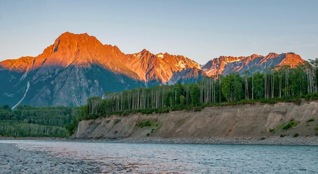
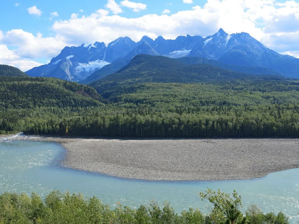
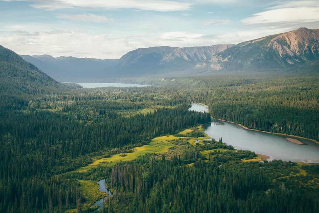
The Regional District of Kitimat-Stikine includes mountains from several major mountain ranges. The mountains right along the coast are part of the Pacific Ranges, which includes the Boundary Range with the Burniston and Cambria Range. Additionally, the regional district contains parts of the Coast Mountains with the Kitimat Ranges.
The islands located off the west coast of the regional district to the west of the Pacific Ranges are mainly part of the Northwest Coast Islands Ranges. Meanwhile the British Columbia Interior Mountains are located east of the Pacific Ranges. The Interior Mountains of the Kitimat-Stikine region include the Cassiar Mountains, Stikine Ranges, Skeena Mountains, and the Eaglenest Range.
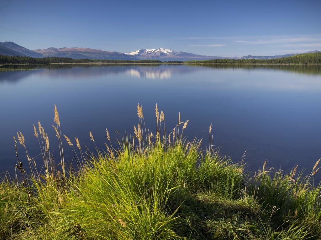
The ecology of the Regional District of Kitimat-Stikine can be broken up into five primary categories. The categories and their characteristics are as follows:
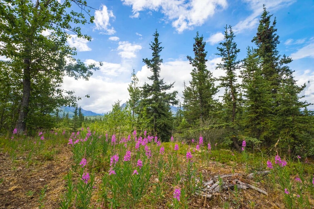
Cold winters, combined with a short, cool growing season create conditions that are unfavorable to most trees and many plants. While there are significant areas that are barren rock in the regional district, there are patches of parkland with interspersed trees and alpine meadows.
The alpine is dominated by dwarf shrubs, heaths, herbs, mosses, and lichen. The climate of the Alpine Tundra Zone is harsh and sparsely vegetated and, as such, it is generally unattractive to wildlife.
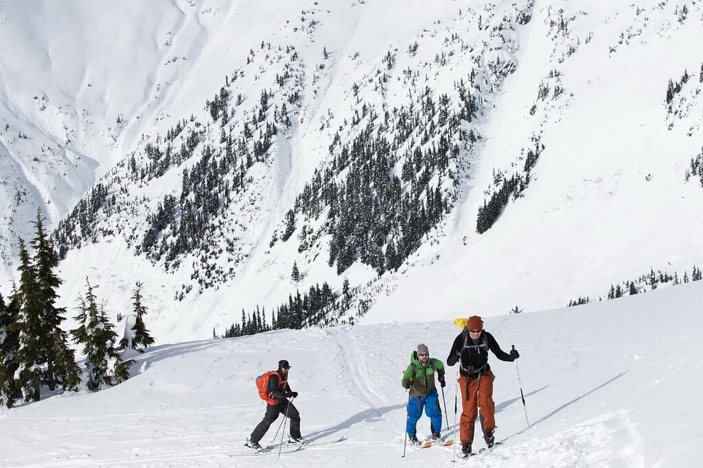
The coastal regions receive large amounts of snow in the winter, making the area unattractive to even the mountain goats, which are admirably adapted and will generally winter in the alpine in other parts of the province.
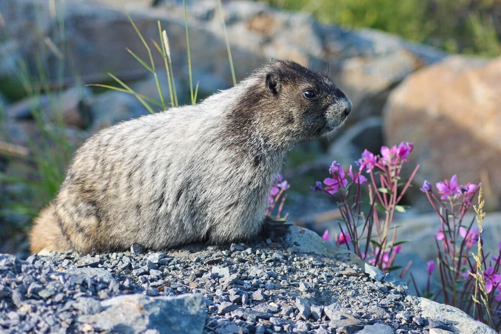
While nearly all wildlife will evacuate the alpine regions of Kitimat-Stikine during the winter, the summer sees a lot of animal activity among the mountain peaks. Roosevelt elk, blacktailed deer, and mule deer forage in the krummholz and meadows. The golden eagle, the white-tailed ptarmigan, and mammals, such as the wolverine and hoary marmot, are present during the summer months. The endangered Vancouver Island marmot also inhabits the region.
The Mountain Hemlock zone is a high elevation subalpine zone along the Pacific coast. The ecological zone represents a thin band below the alpine zone of the coastal mountains in the Kitimat-Stikine region. The annual precipitation in this region is high and the winters are long and cold, creating a short summer growing season.
From the barren alpine, the forests start as thin parkland stands that are interspersed with sedge and mountain heather communities. At lower elevations, the forest becomes denser and is filled with mountain hemlock, amabilis fir, and yellow cedar.
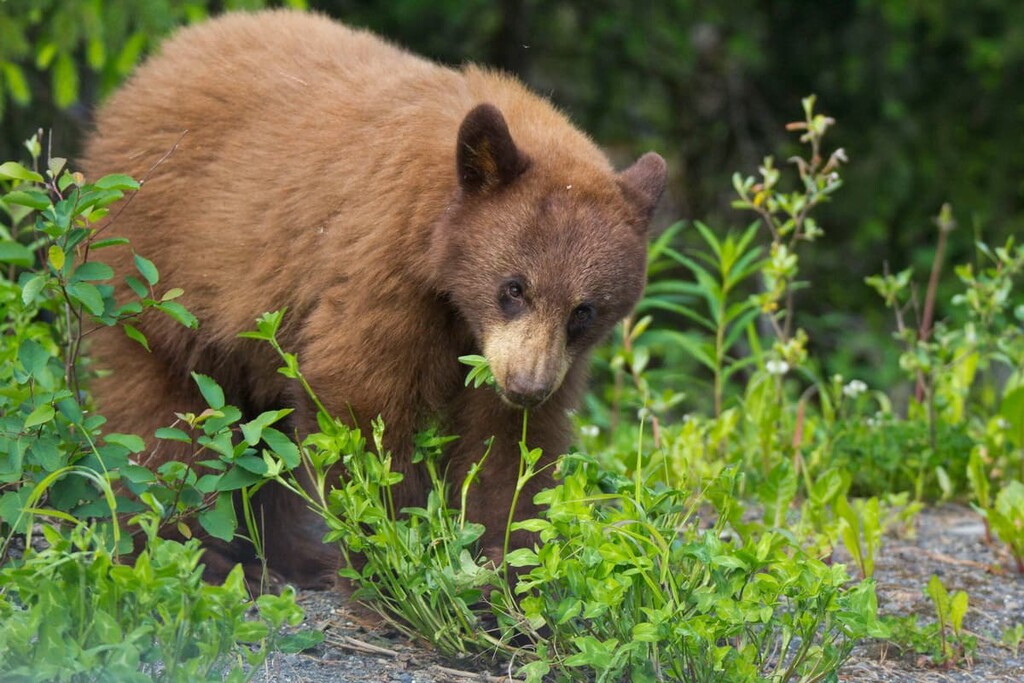
While the winters are long and cool and the terrain is generally steep, there are many animals that inhabit the Mountain Hemlock Zone. Black bears, grizzly bears, Roosevelt elk, and black tailed deer are common inhabitants of the zone. Mountain goats prefer the open rocky outcropping during the summer and will winter on the steep, south facing slopes of the zone.
The mature forests of the zone are preferred by many bird species for the access to insects, small animals, and conifer seeds as food. The great horned owl, great grey owl, Clark’s nutcracker, and several woodpecker species are common to the forests of the zone. The willow ptarmigan, blue grouse, and the Vancouver Island marmot prefer the parkland meadows of the zone.
The Engelmann Spruce – Subalpine Fir Zone is a subalpine zone that occurs in the northeast corner of the Kitimat-Stikine region at high elevations. The weather in this zone is cold and severe, so only vegetation that can withstand long periods of frozen ground survive in this zone.
Engelmann spruce, subalpine fir, and lodgepole pine are the dominant trees of this subalpine region. The boundary between the alpine and subalpine is a patchwork of open parkland with trees clumped and matrixed with herb meadows, grasslands, and heath.
While the weather is harsh in this region, it creates the perfect conditions for a large variety of wildlife. Avalanche tracks provide food for moose, black bear, and grizzly bear during the summer. Mountain goats, caribou, and moose, and mule deer are found all across this subalpine region, while elk, bighorn sheep, and white-tail deer are only found in their preferred habitats.
The conifer forests are prime habitat for many small mammals such as marten, fisher, and wolverine. There are also hoary marmots and Columbian ground squirrels which make a good meal for the Golden Eagles that nest on the cliffs.
This zone is found in the middle to lower elevations of the interior regions of the Kitimat-Stikine area. While the winters are cool and wet, the summers are dry and warm. This allows for the widest variety of coniferous tree species of any zone in the province.
Western redcedar and western hemlock are the characteristic trees of this zone. Meanwhile, white-Engelmann spruce hybrids and subalpine fir are also commonly found. Lodgepole pine and Douglas fir are more common in dry areas of the zone.
This ecological zone has an interesting mosaic of old and young forests. The old forests receive substantial precipitation and the size of the trees rival the old growth forest of the coast; however, the drier areas on the lee side of the slopes will have more frequent forest fires that change the habitats.
With the matrix of old and young forests, there is a diverse variety of wildlife in the region, with some that prefer the old forests and others that prefer the more open spaces of the young forests. Woodpeckers and owls prefer the mature forests, while ruffed grouse, American robins, and golden eagles prefer the open forests and parkland.
Like many of the mountainous ecozones of British Columbia, there is significant snowfall during the winter which creates an outflow of animals during the fall. While some animals such as bears will hibernate, most other mammals will go to warmer regions for the winter, except for moose who have adapted to moving through the deep snow.
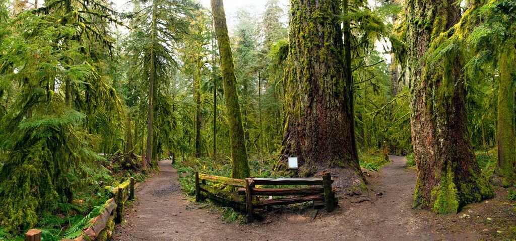
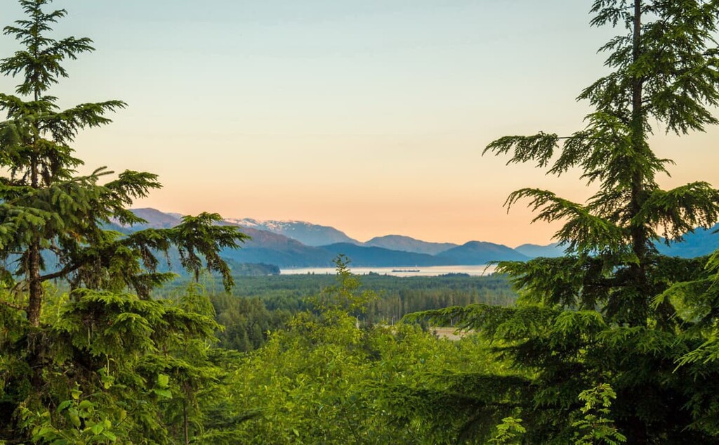
The Coastal Western Hemlock Zone is the area with the legendary giant trees of British Columbia. The Douglas fir can reach upwards of 100 m (327 ft) in height while the western redcedar and Sitka spruce can grow to 4 m (13 ft) in diameter. These are the most productive forests in British Columbia, with the dominant tree species being western hemlock and amabilis fir.
While this is the land of giant trees, there are many other habitats that are typical of the region. There are coastal margins, wetlands, estuaries, and extensive upland forests. This zone has the greatest diversity of wildlife habitat of any ecological zone in British Columbia.
Wildlife that is unique to this region are the many species of colony-nesting coastal birds that need this region for their nesting. Tufted puffins, ancient murrelets, Cassin’s auklets, and rhinoceros auklets nest on the rocky islands that are part of the Coastal Western Hemlock Zone.
The Regional District of Kitimat-Stikine has been inhabited for around 14,000 years. The region is one of the oldest continuously occupied regions of the world, and before European contact, it was one of the most densely populated areas north of Mexico.
The region is the traditional territory of many First Nations including Gitga’at, Nisga’a, Gitxsan Laxyip, Takla, Kitselas, Kitsumkalum, Haisla, Gitsxaala, Kitasoo, Heiltsuk, and Nuxalk. Many of the First Nations were part of the greater group of Tsimshian communities.
The lives of those who first inhabited the region were met with an abundance of salmon to eat, which allowed for complex societies to develop that were able to focus on social responsibility, warfare, and the arts.
Archaeological evidence suggests that many of the current First Nations of the regions have local history going back 5,000 years or more. Kitselas means “people of the Canyon” in the Tsimshian language of Sm’algyax, and the people have been inhabiting Kitselas Canyon for over 5,000 years.
Unfortunately, with European contact beginning in the sixteenth century disease began to rip through the local communities. It’s estimated that 90 to 95 percent of the First Nations communities were killed from diseases that were introduced by European settlers. Smallpox was especially devastating to First Nations as Indigenous peoples in the region had never built up any immunity to this introduced disease.
While there are not many people currently living in the Regional District of Kitimat-Stikine (less than 40,000), a large portion are members of First Nations. Many of the First Nations follow their ancestral lifestyle of fishing and hunting for sustenance and support. Logging and mining, in addition to fishing, are the major industries of the region.
In addition to scenic landscapes, the Regional District of Kitimat-Stikine has many historic sites that are worth visiting. The following are several attractions and trails that are worthwhile to discover when in the region.
Home to remains of houses and totem poles that have stood since the 1800s, Kitselas Canyon is a National Historic site that’s well worth checking out.
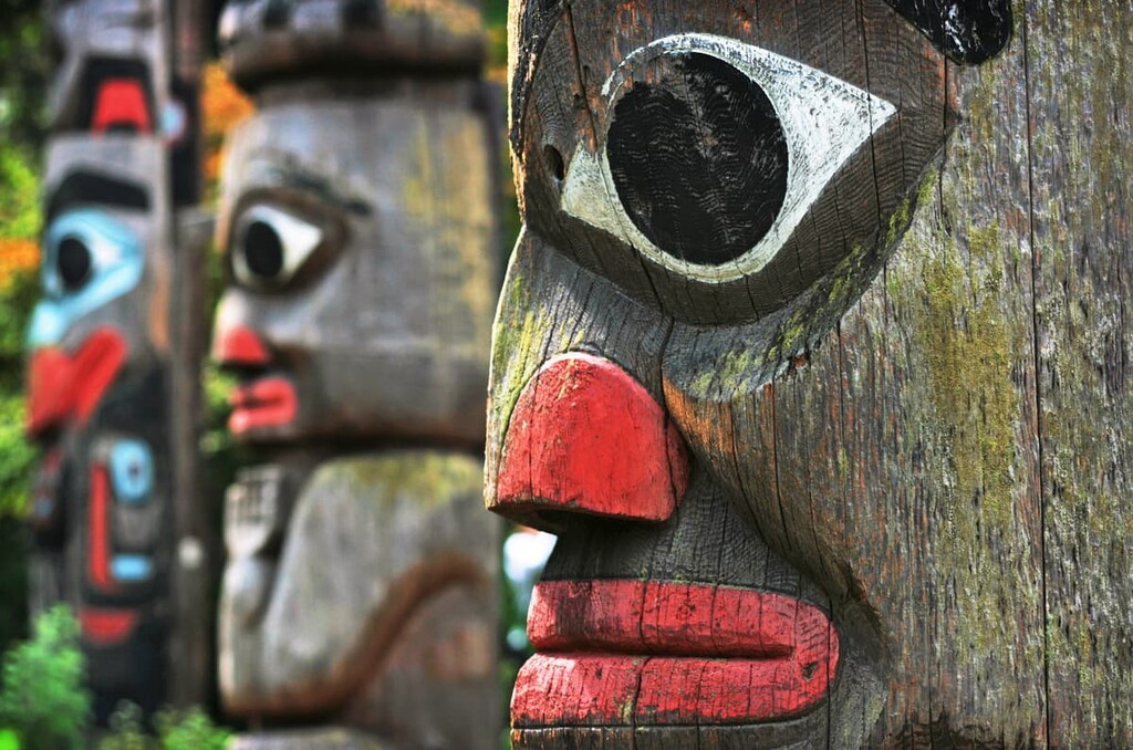
The locals of Kitselas Canyon are proud of their history and culture and want to share it with visitors. There are traditional long houses to view in the canyon as well as the Clan Totem Pole Garden.
Additionally, the canyon is home to trails that you can wander to experience the historic context of the community first hand. These trails also give you insight into the natural beauty of the Skeena River and the canyon, which is filled with beautiful moss-covered forests.
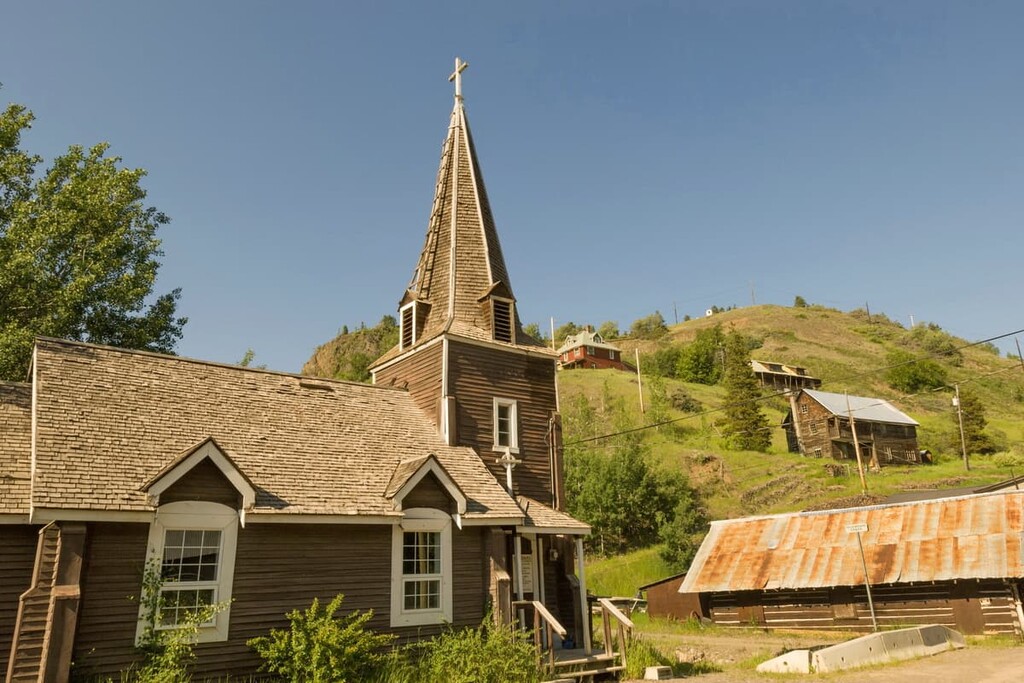
At the north end of the Regional District of Kitimat-Stikine is the Telegraph Creek Townsite. There are several reasons that it is worthwhile to make the trek to this location.
First, the Tahltan First Nation has used this region and town for generations as their winter settlement away from their remote summer camps. Many residents continue to practice their traditional way of life, passing their knowledge and skills down through the generations.
Second, the discovery of gold in the Stikine River in the 1860s brought a new industry to the region. At the turn of the twentieth century, the town was the trailhead for the Stikine and Teslin trails to the Klondike gold rush.
Third, Telegraph Creek was a major point on the telegraph line that connected Yukon to southern Canada. It was also a proposed site for the Collins Overland Telegraph Line which was proposed to connect North America to Europe through Siberia in Russia; however, this line was never built.
While the town currently has many modern homes and buildings, there are a lot of structures with more character. There are many historic buildings that are in various states of disrepair that let you look back over 150 years into the history of the region.
There are lots of trails right outside the town of Terrace, all of which have their own secrets to discover. The Terrace Mountain and Flathead Loop is a 5 km (3 mi) loop with only 267 m (876 ft) of elevation gain. This makes it a great trail to get you out and moving if you’re visiting the town of Terrace.
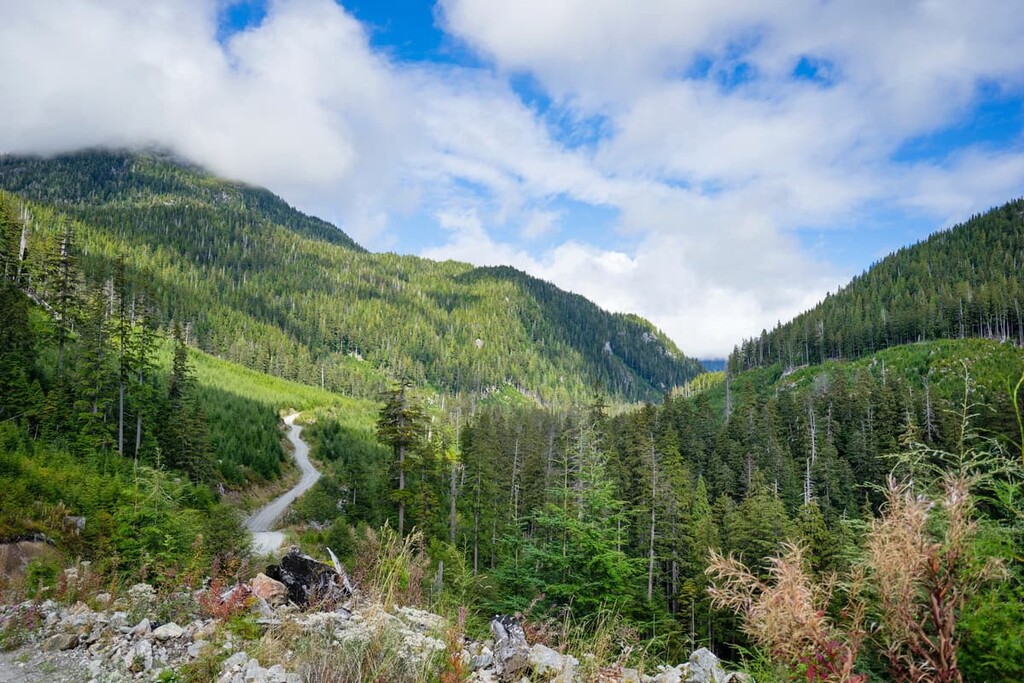
This hike will lead you through the beautiful forests of British Columbia, allowing for possible bird and mammal sightings. In addition to the beautiful and lush forest that you’ll trek through on this hike, there is also a spot at the top of the trail where you can get a great view of the region.
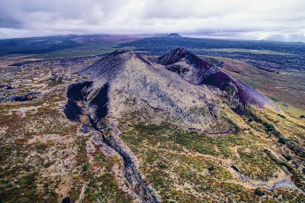
At some point between 1675 and 1778, the Tseax Cone volcano erupted. This makes it the last volcanic eruption in Canada. The event was devastating to the local community as three villages were destroyed and 2,000 people died during the eruption, possibly from noxious gases.
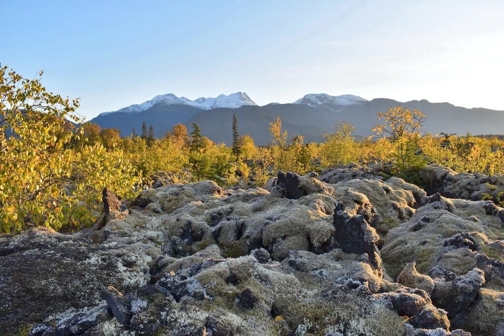
As a result of this eruption, vast lava beds dominate the landscape. If you’d like to see these lava beds, there are a number of hiking tours offered in the area. The tours introduce the culture and history of the area along the way to a viewpoint that overlooks the crater.
There are many towns throughout the Regional District of Kitimat-Stikine. Many of the towns maintain strong historical and cultural connections to the First Nations that have inhabited the region for thousands of years. The following are a few places where you can fly into or stay at while exploring the region.
Terrace is the primary community within the Regional District of Kitimat-Stikine. As such, it has become the main retail and service hub for the region. Terrace is at the junction of Highway 16 and Highway 37 and it is home to the Northwest Regional Airport as well as a railway station serviced by Via Rail’s passenger trains.
There are countless areas to explore near Terrace and many activities, such as fishing, hiking, mountain biking, climbing, and hunting, to enjoy. In fact, locals often spend the autumn searching for wild mushrooms and picking berries throughout the summer.
While the current town of Kitimat was constructed in the 1950s, First Nations that had lived in the area for generations in small fishing villages. The town is generally considered to have been founded in 1951 by Alcan, an aluminum producer that was invited to work on a hydroelectric project in the region to supply power to their aluminum smelting operations.
Kitimat is located alongside tidal waters at the head of the Kitimat Arm of the Douglas Channel. The town has over 8,000 residents who benefit from the thoughtful city planning of Clarence Stein who created a beautiful and functional town for the residents who initially, were mostly employed by Alcan.
Located along tidal waters and amongst lush forest and tall peaks, Kitimat has many hidden gems to discover. With trails that lead up mountains, along creeks, along rivers, through valleys, or along the ocean shore, there is sure to be something for everybody to enjoy in Kitimat.


Yes. Regional District of Kitimat-Stikine has 598 named mountains. The highest is Mount Ratz at 3,090 m.
The highest mountain in Regional District of Kitimat-Stikine is Mount Ratz, at 3,090 m.
Regional District of Kitimat-Stikine has 598 named mountains.


