Scan the QR code and open PeakVisor on your phone
The Todagin Wildlife Management Area is a parcel of public land located in the Regional District of Kitimat-Stikine in northern British Columbia, Canada. Encompassing over 1,200 square kilometers (470 square miles) of the Todagin Plateau and Tsatia Mountains, the area features diverse wildlife, boreal forests, and fascinating geological features. There are 3 named peaks within the wildlife management area, the highest and most prominent of which is Tsatia Mountain (2,345 m/7,694 ft).
The remote northern mountains of western British Columbia, Canada are home to a number of significant parks and conservation areas. The Todagin Wildlife Management Area is one of the many conservation areas in the region. Other parks and conservation areas that are located nearby include:
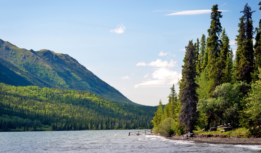
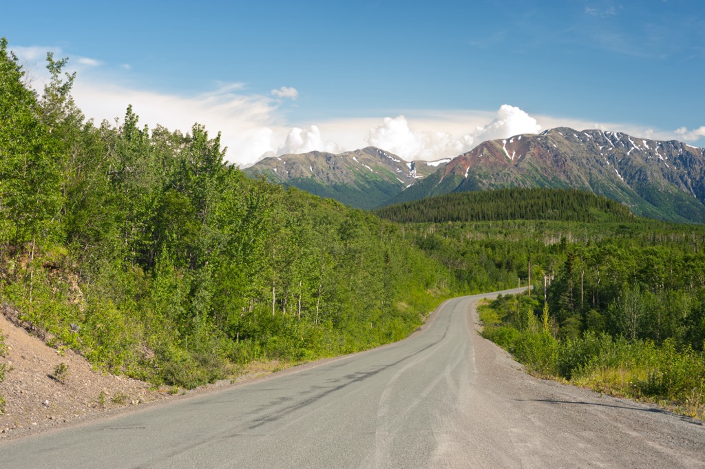
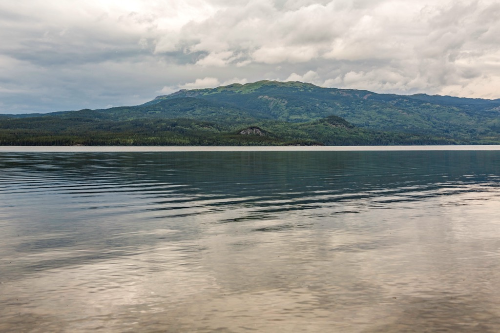
The Todagin Wildlife Management Area (WMA) is accessible via Highway 37, and it is situated on the east side of Kinaskan Lake and the Iskut River. Tsatia Mountain (2,345 m/ 7,694 ft) is the tallest and most prominent of the WMA’s three peaks, and alongside Todagin and Round Mountain, it serves as a critical winter range and a lambing area for Stone sheep.
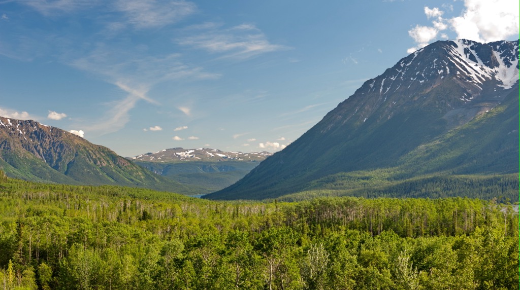
The Todagin WMA lies on the western edge of the Stikine Ranges, which are the northernmost subdivision of the Cassiar Mountains. The wildlife area encompasses parts of the Todagin Plateau and the Tsatia Mountains. The Klastine Plateau is located to the north of the WMA while the Eaglenest Range is situated to the east and the Skeena Mountains are nestled to the south.
The mountains of the Todagin WMA are composed of black fine-grained argillite and shale as well as dark greywacke. Layers of folded sedimentary rocks are visible throughout the area, too.
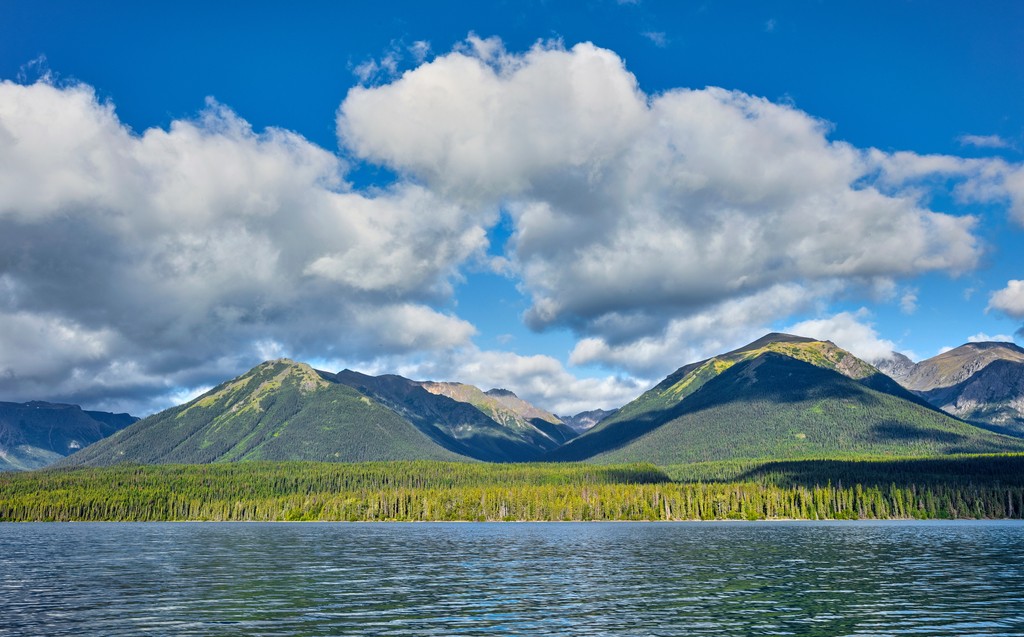
During the glacial events of the Pleistocene, the region was covered by thousands of meters of ice. There were also smaller localized glaciers that formed among the mountain peaks of the region. Alpine glaciers carved out the region’s sedimentary rocks into the serrated and jagged peaks that we see to this day.
The summers of northern British Columbia are typically short and cool while the winters are long and cold. However, Todagin WMA lies in a rain shadow of the Coast Mountains, which means the area receives less precipitation than you might otherwise expect for the region.
This rain shadow is created when most of the moisture carried by prevailing winds is released over the Coast Mountains before it reaches the Cassiar Mountains and other Interior Mountains of British Columbia.
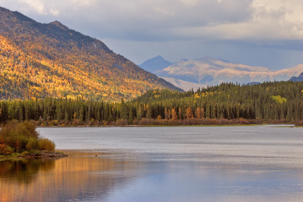
The alpine region of the park is relatively dry and rocky. Meanwhile, the park’s subalpine is filled with scrublands of willow and dwarf birch, though there are also subalpine forests of white spruce and fir.
At the valley bottoms, the park’s landscape is dominated by spruce and pine boreal forests. There are also open highlands and rolling plateaus that are filled with lichen grasslands, deciduous scrub, and heath vegetation.
The WMA contains 12 plants that are considered rare in the province, including whorled lousewort and Mount Sheldon buttercup. Additionally, two rare lichen species are known to grow in the park.
Stone sheep winter on the south slopes of Todagin Mountain and there is an important lambing area for the sheep on the mountain, too. Within the park’s mountains, we can also see an example of an important flora–fauna interaction.
In particular, the park has a unique phenomenon where a rare plant community of glaucous bluegrass and violet wheat grass only grows in places where Stone sheep and mountain goats graze. Researchers believe that the sheep and goats fertilize these areas with their manure, which is why these rare plant communities are able to survive.
Other animals that inhabit the WMA are mountain goats, grizzly bears, wolves, woodland caribou, moose, and hoary marmots. Furthermore, the area is used by over 120 bird species, including the endangered Hudsonian godwit, the rare short-eared owl, as well as northern goshawk, great horned owls, yellow-bellied sapsuckers, and green-winged teals.
The traditional territory of the Tahltan First Nation encompasses Todagin WMA and the surrounding area. The Todagin Plateau and Tsatia Mountains have been used by First Nations for generations for the gathering of resources and other cultural practices.
In particular, the Tahltan used the area for hunting, fishing, and the gathering other resources for food, medicine, tools, and whatever else they needed to live. The area is home to many culturally important sites for the Tahltan First Nation as well as historic trails that traverse the region’s mountains and valleys.
Additionally, Mount Edziza Provincial Park is located to the west of Todagin WMA, and it was a historically important area for gathering obsidian. Obsidian was valued for generations as it could be used for tools and crafting.
The Tahltan traditionally traded their obsidian to other First Nations. In fact, obsidian from Mount Edziza has been located in First Nations communities and in cultural sites across British Columbia, and along the Alberta and Yukon borders.
The WMA was created in 2001 to protect critical Stone sheep habitat and habitat for other wildlife. The area has certain restrictions that limit what can be hunted, how wildlife can be hunted, and what access is allowed within the area.
Todagin South Slope Provincial Park is located within the Todagin WMA, too. The park further restricts hunting and accessibility to preserve the health of the local mountain goat and sheep populations. Nowadays, visitors come to view wildlife from the highway or for backcountry recreation.
The major attraction of Todagin WMA is likely the ample wildlife that is relatively easy to find and view within the region. However, there are also other opportunities for wilderness recreation in the park. The following are some of the major activities and attractions in the Todagin WMA:
Remember that the hiking paths in the Todagin WMA are unofficial and unmaintained, so they are only recommended for very experienced hikers who are comfortable with route finding and backcountry travel.
As it is located adjacent to Highway 37 in northern British Columbia, the Todagin WMA is situated near a number of smaller towns and communities. Here’s a look at some of the main communities in the area around the Todagin WMA.
Tatogga Lake is located to the northwest of Todagin WMA along Highway 37. There is a restaurant and fuel station at the resort for those that are passing through the region. Additionally, the resort offers wilderness adventure experiences for those that are wanting to stay for a bit. At the resort, you can find hotel accommodations as well as an RV park.
Thanks to its location on the shores of Tatogga Lake, the resort has canoe rentals and access to trails for hiking and cycling. There are places for fishing as well as opportunities for hunters.
Floatplanes are often based out of the resort, too, and they typically fly guests on tours of the incredible mountain ranges. Many of these float planes also shuttle guests to remote hiking, fishing, hunting, and paddling areas in and around the nearby Mount Edziza Provincial Park, such as Low Ball, Mowdade, and Buckley lakes.
Iskut is a small community located along Highway 37 in northern British Columbia. It is the closest community to the Todagin WMA, and it is home to the Iskut First Nations. There is fuel and some shopping available in the community, too.
The opening of Highway 37 has increased access to the region’s recreational opportunities. Guided hunting and fishing trips are now popular activities in the area. Fishing in the Iskut Chain Lakes and hunting in the nearby wilderness areas are particularly popular activities among visitors to Iskut. Snowmobile and OHV use are also common pastimes for many Iskut residents.
In addition to its proximity to Todagin WMA, Iskut is located near the trailhead for the overland routes into Gladys Lake Ecological Reserve and Spatsizi Plateau Wilderness Provincial Park. The community is surrounded by stunning wilderness and beautiful lakes, all of which are full of recreational opportunities.
The town of Dease Lake is situated about 100 km (60 mi) to the north of Todagin WMA. The town has a service station, fuel, a hotel, and a store. Many visitors pass through the town on their way to the Alaska Highway and other tourist destinations in the north. The road junction for the route to Telegraph Creek and the overland hiking route to Mount Edziza both start at Dease Lake, too.

In 1837, the Hudson’s Bay Company built a trading post on the shores of Dease Lake, which was known as Lake House. The post eventually became a major rest area for miners traveling to the gold rush in the Cassiar Mountains. The town still benefits from local gold, copper, and jade mining. It is also a destination for hunting and other wilderness activities.