Scan the QR code and open PeakVisor on your phone
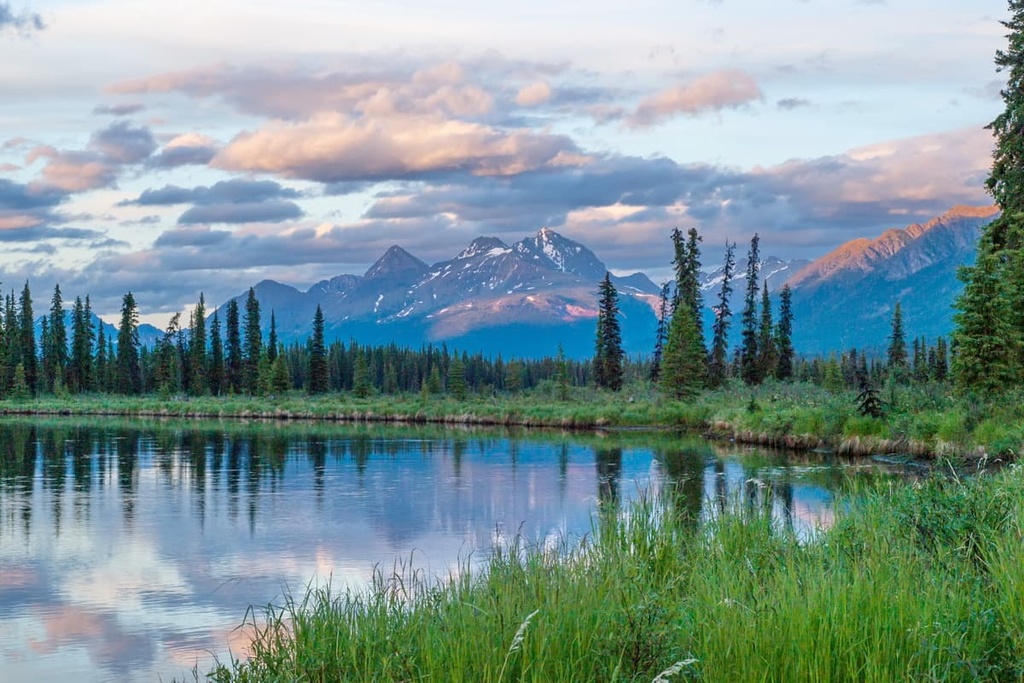
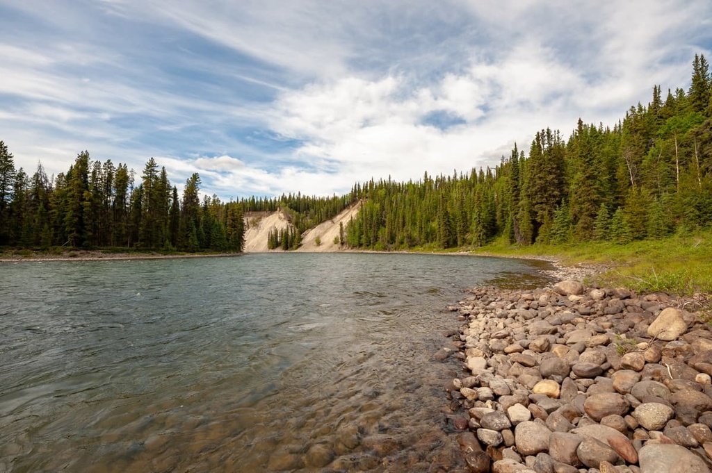
Gladys Lake Ecological Reserve is a protected area that covers 440 square kilometers (170 square miles) of land in the middle of Spatsizi Plateau Wilderness Provincial Park of northern British Columbia, Canada. The reserve is centered around Gladys Lake, which is surrounded by nine peaks, the tallest and most prominent of which is Mount Will (2,520 m/8,268 ft).
Located in northern British Columbia, Canada, Gladys Lake Ecological Reserve is a protected area located in the Skeena Mountains. It is completely surrounded by Spatsizi Plateau Wilderness Provincial Park. The reserve protects 440 square kilometers (170 square miles) of pristine wilderness and important wildlife habitat around Gladys Lake.
Gladys Lake Ecological Reserve was established 1975, independent of Spatsizi Plateau Wilderness Provincial Park. It was created to preserve the ecosystems and wildlife of the area, particularly the populations of Stone’s sheep and mountain goats that roam through the region’s peaks.
The reserve encompasses nine peaks of the Eaglenest Range of the Skeena Mountains, which is a division of the Interior Mountains of British Columbia. Of the peaks in the reserve, Mount Will is the tallest and most prominent with 2,520 m (8,268 ft) of elevation and 1,269 m (4,163 ft) of prominence.
Gladys Lake Ecological Reserve is part of a broad group of parks and protected areas in an area referred to as Stikine Country. Stikine Country includes parts of the Stikine Region and the Regional District of Kitimat-Stikine in northwest British Columbia.
Some of the other parks that are part of the Stikine Country Protected Areas include:
The Gladys Lake Ecological Reserve is situated within the Eaglenest Range of the Skeena Mountains, which are part of the Interior Mountains of British Columbia.
The Skeena Mountains are bounded by the Tahltan Highland and Boundary Ranges on the west and the Omineca Mountains on the east. Additionally, the Stikine Plateau is located to the north and the Nechako Plateau is to the south of the Skeena Mountains.
The Eaglenest Range is located at the northwest corner of the Skeena Mountains. It is adjacent to several plateaus and other subranges of the Skeena Mountains. Furthermore, located adjacent to the Eaglenest Range are the Klastline and Skeena Plateaus along the north and west, which are part of the Stikine Plateau. Meanwhile, the Klappan Range is located to the southwest.
Most of the mountains in Gladys Lake Provincial Park are made of argillite, greywacke, conglomerate, shale, and coal that formed about 130 million years ago.
However, the northeastern side of the reserve consists of sedimentary rocks that are about 180 million years old. Ammonite fossils have been found throughout the Eaglenest Range, which have aided the understanding of the geology of the area.
The rock structures of the Skeena Mountains are very complex. The region averages more than two major folds per kilometer.
The valleys and saddles in the region typically consist of easily eroded argillite. Meanwhile, the peaks and massifs are made of the erosion-resistant greywacke. Gladys Lake Ecological Reserve has some of the best examples of exposed folds in British Columbia outside of the Rocky Mountains.
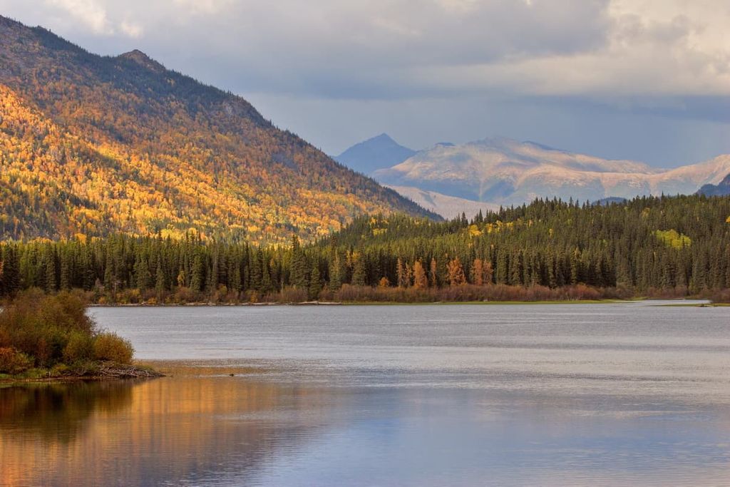
During the Pleistocene, the ice sheets in the region reached elevations of about 2,100 m (6,900) ft, scouring the mountains, and depositing a layer of sediments across the region. The characteristic U-shaped valleys in the area were formed as the glaciers receded, shaping the region’s jagged mountain peaks and ridges in the process.
Gladys Lake Ecological Reserve contains an alpine region that is part of the Boreal Altai Fescue Alpine zone. It also contains a section of subalpine that is part of the boreal Spruce-Willow Birch zone.
Elevation determines the presence of each ecological zone in the reserve; however, there is a transitional area between the two ecologies that features a parkland-like ecosystem.
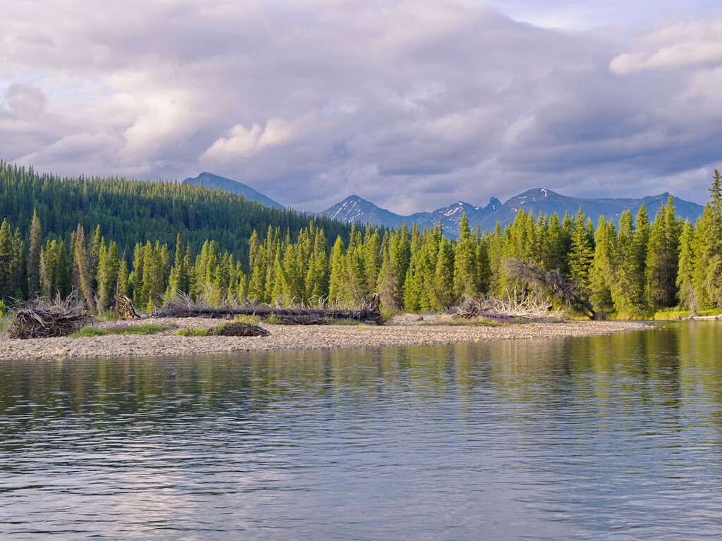
Boreal forest dominates the subalpine valleys and slopes of the nine mountains across Gladys Lakes Ecological Reserve. The main trees in the reserve are white spruce, alpine fir, and lodgepole pine. Aspen and cottonwood also make an appearance in the park.
White spruce dominates the valley bottoms and only small groups of alpine fir are found within the spruce forests; however, alpine fir dominates the upper elevations of the region. Lodgepole pine is most prevalent along the well-drained morainal ridges in the park while aspen occurs in stands in the parkland-like area above the spruce forests.
During the summer, caribou, Stone's sheep, mountain goats, snowshoe hares, and ground squirrels inhabit and pass through the alpine zone. During the winter, the snowpack is deep and vegetation is scarce, so much so that most animals take shelter in the forests at lower elevations during the colder months of the year.
The boreal forest that dominates the lower elevations transitions to the Boreal Altai Fescue Alpine, which is dominated by various grasses.
However, there are many other plant species present amongst the alpine grasses, such as dwarf willows, small awned sedge, boreal mugwort, moss campion, Arctic blue grass, white mountain-avens, showy Jacob’s ladder, mountains monkshood, and various lichens.
Above the alpine meadows, lichens cover over 30 percent of the exposed, high, windswept ridges. The highest elevations of the mountains in the ecological reserve tend to be too hostile for any vegetation; however, some mosses, sedges, and dwarf willows grow in protected areas, especially along seepage slopes, depressions, and drainageways.
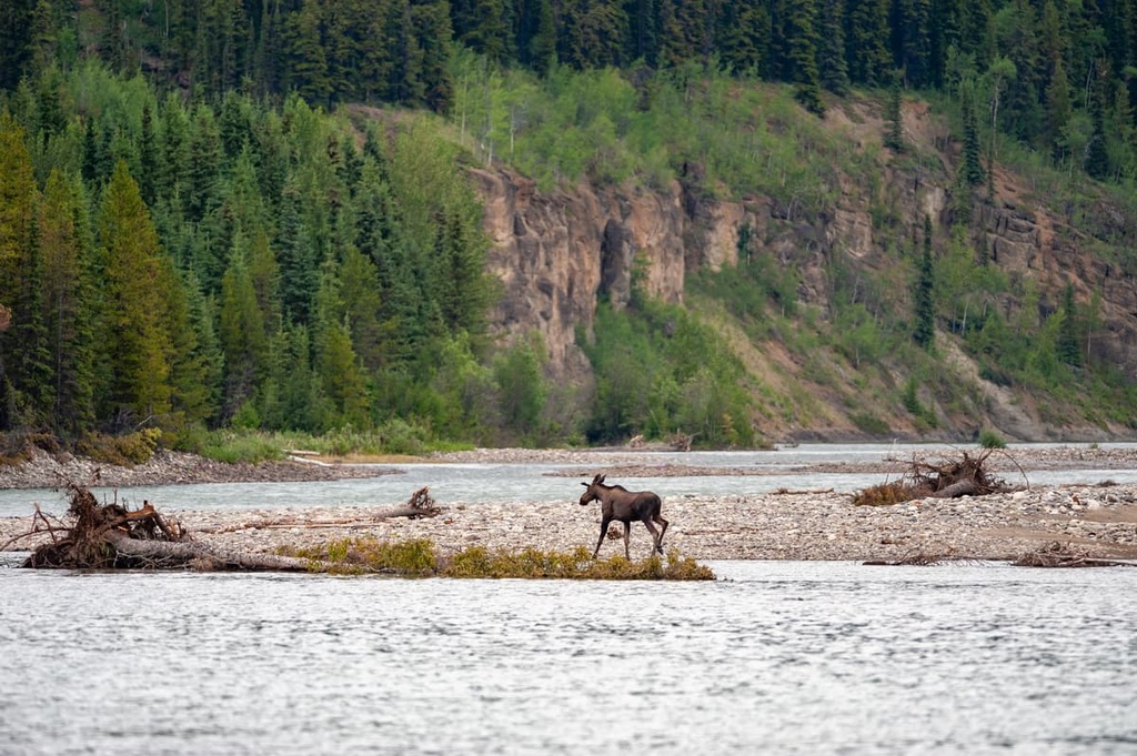
One of the reasons that Gladys Lake Ecological Reserve was initially designated was to protect the region's populations of Stone’s sheep and mountain goats. Other large mammals that are present in the reserve include moose, woodland caribou, mule deer, wolves, grizzly bears, and black bears.
Major fur-bearing animals such as marten, fisher, mink, weasel, wolverine, otter, lynx, and beaver are also present in the park. Additionally, there are over 140 recorded species of birds found in the reserve that are representative of coastal, continental, alpine, wetland, and grassland ecosystems.
Since the retreat of the ice sheet about 10,000 years ago from the British Columbia Interior Mountains, the upper Stikine and Spatsizi area have been home to the Denendeh First Nations, including the Tahltan, Sikani, and the Tsetsaut. The Tahltlans have been the primary First Nations group living upon the Spatsizi Plateau, while the Sikani and Tsetsaut traditionally lived to the east and south.
The Tahltan First Nation is now headquartered around Telegraph Creek; however, their traditional territory includes the Spatsizi Plateau, which is now the site of Gladys Lake Ecological Reserve.
Within Spatsizi Plateau Wilderness Provincial Park, there are over a dozen archaeological sites. These are primarily located along the rivers and along the Hyland Post Trail, which is an established First Nations trading route.
Traditionally, the First Nations of the plateau spent summers fishing along the Stikine River and winters hunting among the uplands. The First Nations traditionally lived in temporary camps that they transported with them along their seasonal rounds. They would net trout and whitefish from lakes and rivers and would primarily use snares to capture caribou, sheep, goats, marmots, ground squirrels, and ptarmigans.
Travel and trading would routinely occur between Telegraph Creek and Fort Ware, within the Rocky Mountain Trench. Additionally, the Tahltan First Nations would trade with the Tlingit, who traditionally live throughout the region that is now the Alaskan panhandle.
During the late 1700s and early 1800s, when the Russians monopolized the north coast fur trade, the Tlingit traders often worked as middlemen for between the Russians and the Tahtlans, which represented their first indirect contact with Europeans.
However, the arrival of Europeans also signaled the arrival of many infectious diseases that First Nations had no natural immunity to. These infectious diseases, such as smallpox and measles killed an estimated 90% of First Nations citizens in the region.
During the early twentieth century the Spatsizi Plateau became a destination for guided hunting trips. In 1948, Tommy Walker established his now well-known guiding service upon the plateau.
He built cabins and structures at Cold Fish Lake and took over Hyland Post. Tommy Walker was instrumental in the establishment of Spatsizi Plateau Wilderness and Tweedsmuir Provincial Park.
Gladys Lake Ecological Reserve is a protected enclave within Spatsizi Plateau Wilderness Provincial Park. As a reserve, the area has very few established trails.
However, there are many trails that navigate the border of the reserve, and the Hyland Post Trail passes through areas that used to be part of the reserve. That said, most of these trails are now part of the Spatsizi Plateau Wilderness Provincial Park.
The following are trails that pass through and around Gladys Lake Ecological Reserve:
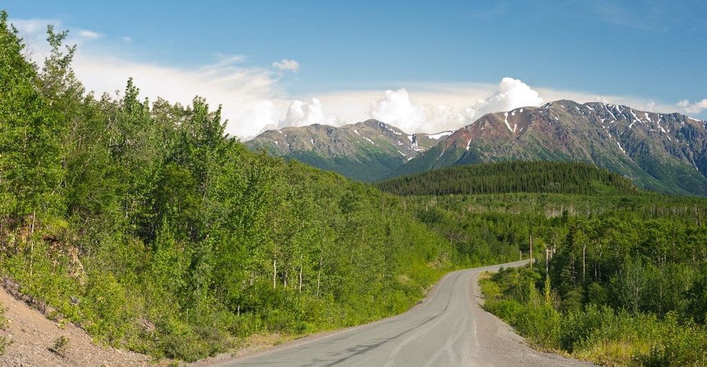
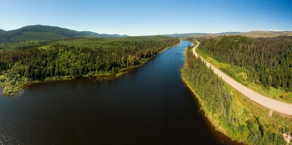
Gladys Lake Ecological Reserve is located upon the remote Spatsizi Plateau in northern British Columbia. The following are some of the major cities and communities near the reserve that offer access to the remote areas of northern British Columbia:
The town of Dease Lake is situated about 120 km (72 mi) northwest of Gladys Lake Ecological Reserve. The town receives many visitors as they drive along the Stewart-Cassiar Highway toward other destinations. The community has a service station, fuel, a hotel, and a store. It is located at the junction to Telegraph Creek and its overland hiking route to Mount Edziza.
Hudson’s Bay Company built a trading post on the shores of Dease Lake, then known as Lake House, in 1837. The trading post became a major stop for prospectors travelling to the gold rush in the Cassiar Mountains during the nineteenth century. While the town still benefits from local gold, copper, and jade mining, it is also a destination for hunting and other wilderness activities.
Dease Lake is located along the ancient Hyland Post Trail, and it is situated near many of northern British Columbia’s most spectacular wilderness areas.
Mount Edziza Provincial Park is located to the southwest of the community, while Stikine River Provincial Park, Gladys Lake Ecological Reserve, and Spatsizi Plateau Wilderness Provincial Park are situated to the southeast.
Prince George is located at the junction of Highways 16 and 97. It is the major service and transportation center for the north of British Columbia. Whether flying or hiking into Gladys Lake Ecological Reserve, you’ll likely pass through Prince George.
If you have some time to spend around the city, you can check out its fine dining, movie theaters, and other entertainment options. There are also some great hikes around town. Some of the most popular hikes are the Cottonwoods Island Loop, the Greenway Trail to Shane Lake Loop, McMillan Creek Loop, Troll Lake, Kakwa Lake Trail, and Forests for the World Lookout.
Additionally, off-roading is a popular pastime of locals in the region and there are well-established clubs and areas to practice motocross and drive OHVs near the city. Fishing, canoeing, hunting, and winter activities such as snowmobiling, snowshoeing, and backcountry skiing, are also popular regional activities.
Located along Highway 37 in northern British Columbia, Iskut is a small community that is home to the Iskut First Nations. There is shopping and fuel available in the community. The town is located near the trailhead for the overland routes into Gladys Lake Ecological Reserve and Spatsizi Plateau Wilderness Provincial Park.
The common overland routes onto the Spatsizi Plateau are the McEwan Trail and the Eaglenest Trail. Both trails originate at the BC Railgrade that intersects with the Ealue Lake Forest Service Road near Iskut. The McEwan Trail leads off the railgrade at the 28 km marker while the Eaglenest Trail leaves the railgrade at the 50 km marker.
The opening of Highway 37 has increased access to the region’s recreational opportunities. Guided hunting and fishing trips are popular activities in the area. Fishing in the Iskut Chain Lakes and hunting in the nearby wilderness areas are particularly popular. Snowmobile and OHV use are also pastimes for the locals of the community.