Scan the QR code and open PeakVisor on your phone
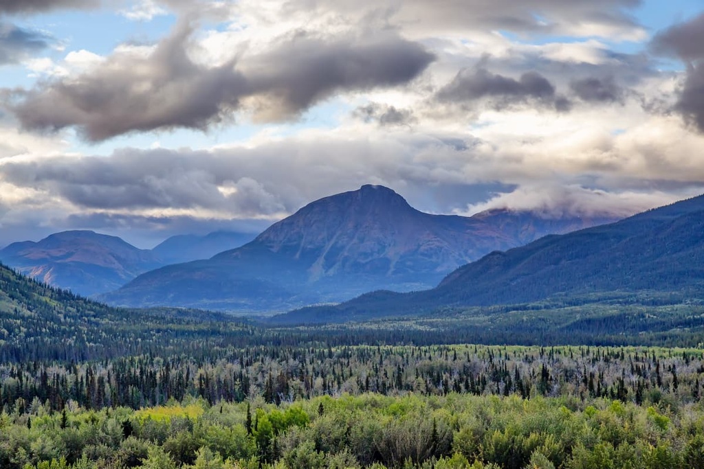
Tatlatui Provincial Park is a protected area and outdoor recreation destination that’s located on the western edge of the Peace River Regional District in north-central British Columbia, Canada. This remote wilderness park contains 10 named peaks, though the 2,372 m (7,782 ft) tall Melanistic Peak rises above the rest.

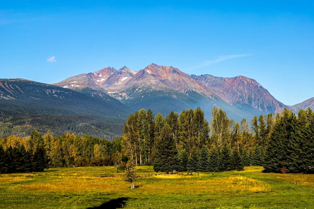
Covering part of the eastern fringe of the Skeena Mountains of northern British Columbia, Canada, Tatlatui Provincial Park encompasses over 1,059 square kilometers (408 square miles) of wilderness terrain. The park envelopes beautiful rivers, creeks, lakes, glacier carved valleys, and 10 named peaks.
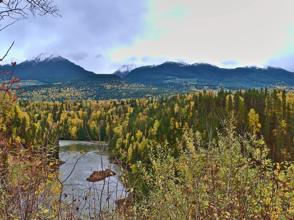
The tallest and most prominent peak in the park is Melanistic Peak, which stands 2,372 m (7,782 ft) in elevation and has 838 m (2,749 ft) of prominence. In addition to the peaks, the park features Thutade Lake, Tatlatui Lake, Kitchener Lake, and Trygve Lake, which are all long lakes that reside in the bottom of the region’s glacier carved valleys.
Tatlatui Provincial Park is part of the Stikine Country Protected Area, which also includes the following nearby parks:
Tatlatui Provincial Park is situated on the eastern limits of the Skeena Mountains, and it also covers part of the Spatsizi Plateau, which is a division of the Stikine Plateau. The mountains of the Tatlatui Range are formed from layers of Jurassic and Cretaceous aged sedimentary rocks that have been broken and folded over time.
The Skeena Mountains formed after the Sevier orogeny and before the Laramide orogeny. The Sevier orogeny started about 180 million years ago was the mountain building event that was mostly responsible for the creation of the Columbia Mountains, which were the first mountains of the Western Cordillera to form.
The Western Cordillera includes the mountain ranges that cover the western coast of Canada, including the Columbia, Coast, Interior, Insular, and Rocky Mountains. The Laramide orogeny occurred between 75 and 45 million years ago, and it created the Rocky Mountains that are now the eastern limit of the Western Cordillera.
The initial uplift and formation of the Tatlatui Range were influenced by the Laramide orogeny while the final topography was influenced by Cenozoic erosion and Pleistocene glaciers. The Tatlatui Range is mainly composed of fine-grained, dark, and easily eroded argillite and shale, though it also contains areas of the more erosion-resistant, peak-forming greywacke.
The argillite of the Tatlatui Range was heavily eroded during the Laramide orogeny as water drained from the continent due to the creation of the new Continental Divide. Additionally, rain and meltwater created major drainage channels across what is now the province of British Columbia. The final event that affected the topography of the park were the Pleistocene glaciers.
During the Pleistocene, the Cordilleran ice sheet was several kilometers thick in places, and it covered the area of Tatlatui Provincial Park. While the ice sheet removed and eroded massive amounts of the soft argillite and shale from the region, the smaller alpine glaciers were responsible for carving out the region's valleys and peaks.
During the Pleistocene, the persistent snowfall and cold weather among the peaks of the Tatatui Range created a permanent snowpack. The continued accumulation of snow compressed the snowpack and, over many years, this created glacier ice. Eventually, the weight of this ice caused it to flow downhill from the peaks.
As the ice flowed from the mountain peaks, it carved away the softer argillite and shale, leaving behind durable greywacke peaks. These glaciers flowed toward lower elevations and carved out the long valleys that later filled with bodies of water like Thutade Lake, Tatlatui Lake, Kitchener Lake, and Trygve Lake.
The glaciers in the region left behind deposits of eroded rock in some areas as a thin layer, and, in other areas, they left behind large piles of glacial debris called moraines. Moraines are piles of glacial debris that are created as a glacier retreats. Other formations found in the region include, kames which are deposits left by melting glaciers, and eskers, which are sinuous deposits created by subglacial rivers.
Tatlatui Provincial Park encompasses parts of the alpine and subalpine zones of the eastern edge of the Skeena Mountains.
The alpine in the park is considered to be part of the Boreal Altai Fescue Alpine Tundra, which receives significant precipitation and has a very short growing season.
These alpine slopes are covered with large patches of red and white moss heather and shrubby cinquefoil forms a border around most of the lakes. Dwarf birch, alpine willow, and Sitka mountain ash are abundant across the alpine, and there are patches of juniper and Saskatoon berry, too.
There is also an abundance of flowering plants that can be found across the park that add to the region’s overall beauty. Various lupines grow in the region alongside mountain forget-me-nots, monkshood, blue Jacob’s ladder, larkspur, white dryas, blue columbine, white and yellow paintbrush, and mountain dandelion.
The subalpine forests of Tatlatui are filled with white and black spruce, while lodgepole pine is the typical pioneer species found in the region after a wildfire. Alpine fir typically covers the ridges and fills the treeline of the park though there are also patches of aspen and birch at lower, south facing sites.
Mountain goats, marmots, ground squirrels, and stone sheep are some of the many inhabitants of the alpine zone. Moose, caribou, black bear, beaver, wolf, and grizzly bear have part of their range in the park as well. The rivers and lakes are filled with rainbow trout, and there are many birds to be seen in the region.
In fact, the park contains nesting habitats for goldeneye and Canadian geese on Kitchener Lake. The yellow warbler, blackpoll warbler, northern waterthrush, Bonaparte gulls, Bohemian waxwing, and rock ptarmigan can be found in the park as well.
The first non-Indigenous people to visit the area of Tatlatui Provincial Park may have come to the area as early as 1797, when John Finlay made a voyage west of the Rockies for the North West Company. His travels took him up the northern branch of the Peace River toward and possibly into the area now protected as Tatlatui Provincial Park.
The northern branch of the Peace River that Finlay traveled through at the end of the eighteenth century was given its English language name after him and is known as the Finlay River. It wasn’t until 1824, when Samuel Black and his team worked their way up the Finlay River to Thutade Lake that we have the first recorded non-Indigenous visit to the area. The team traveled by foot around the northwestern region of the lake, which is now part of the park.
However, long before Finlay and Black ever arrived in the area, the region had been and continues to be part of the traditional territory and ancestral homelands of many First Nations of Athapaskan descent. Some of the First Nations that have lived here for countless generations include the Kaska Dena, Tahtlan, and Takla.
The park itself was established in 1973. Like other provincial parks in the province, it is managed by BC Parks.
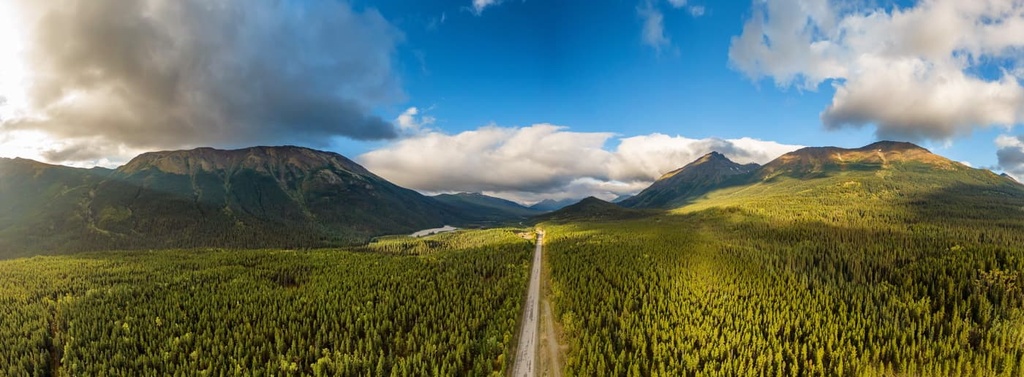
Tatlatui Provincial Park is a remote wilderness park in north-central British Columbia. There is no road access into the park; however, all the major lakes are accessible by floatplane. While there are no official trails, there are unmaintained paths that lead through the park to all the region’s major destinations.
Most visitors come to the park to hike, fish, canoe, hunt, or ride horses. Other activities include photographing the stunning scenery and taking note of the various wildflowers or bird species viewed. Extended backpacking expeditions are the typical way that visitors travel in the park, as a letter of permission is required to bring horses into the protected area.
Tatlatui Provincial Park is located in the remote northern wilderness of the Skeena Mountains in British Columbia. The following are some of the largest communities located near your park that can serve as a great basecamp for your travel.s
Located on the east side of the Hazleton Mountains along Highway 16, the community of Smithers has a population of over 5,000 people and is the major service hub for the Bulkley Valley. Downtown Smithers is constructed in a charming Alpine style that beautifully reflects the stunning wilderness around the town.
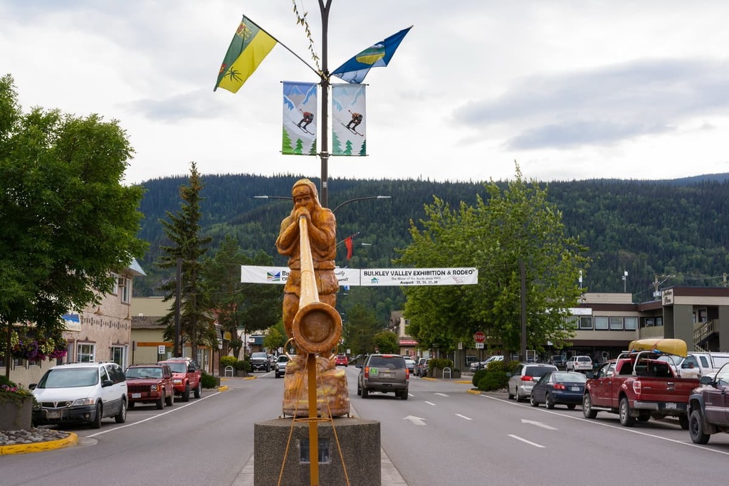
Smithers is one of the larger communities that is located near some of the remote wilderness parks in northern British Columbia, such as Tatlatui Provincial Park, Spatsizi Plateau Wilderness Provincial Park, Swan Lake/ Kispiox River Provincial Park, and Babine River Corridor Provincial Park.
Some of the top local hikes around Smithers include the Crater Lake Trail, Malkow Lookout, Silvern Lake Trail, and Call Lake Trail. Several of the more rugged mountain trails found near the town include the Harvey Mountain Trail and the trail to Hudson Mountain.
Prince George is located at the junction of Highways 16 and 97. It is the major service and transportation center for the north of British Columbia and is home to the major airport that services passengers on their way to the remote wilderness parks like Tatlatui.
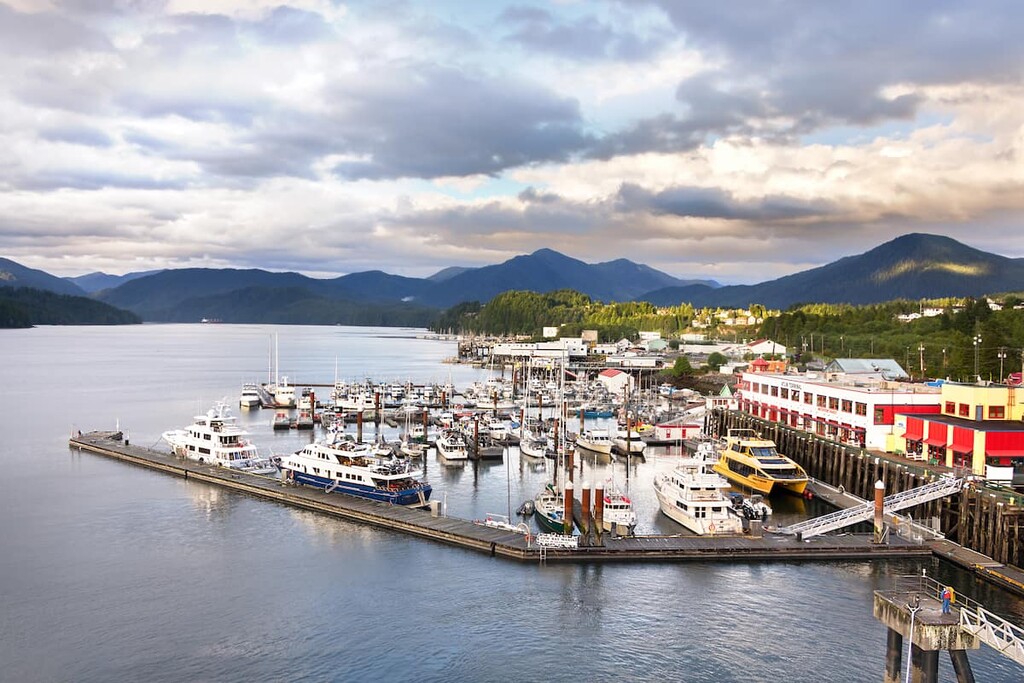
The city has fine dining, movie theaters, and other entertainment options for visitors to enjoy in addition to some great hikes around town. Some of the most popular hikes in the region include the Cottonwoods Island Loop, the Greenway Trail to Shane Lake Loop, McMillan Creek Loop, Troll Lake, Kakwa Lake Trail, and Forests for the World Lookout.
Additionally, off-roading is a popular pastime of locals in the region and there are well-established clubs and areas to practice motocross and drive OHVs near the city. Fishing, canoeing, hunting, and winter activities such as snowmobiling, snowshoeing, and backcountry skiing, are also popular regional activities.