Scan the QR code and open PeakVisor on your phone
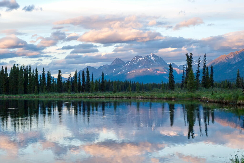
The Stikine Plateau is a vast plateau that covers much of the northwest corner of British Columbia. Though the tallest summit within the plateau itself, Glacial Mountain, reaches just over 7,500 feet in elevation, the plateau is bounded by some of the most awe-inspiring summits in British Columbia and Alaska, including the Boundary Ranges of the Coast Mountains, the Cassiar Mountains, and the Skeena Mountains.
The Stikine Plateau houses impressive peaks like Ash Mountain, the highest summit in the Tuya Range of the Stikine Ranges, Gabrielse Cone, a remarkably clear postglacial monogenetic cinder cone tucked within the Tuya Volcanic Field, and Simpson Peak, the northernmost named summit in the Stikine Range.
The Stikine Plateau is generally characterized by flat and gently sloping upland surfaces. However, it also contains areas modified by extensive Pleistocene volcanic activity and glaciation. The plateau is dissected by several major river valleys and is subdivided into several sub-plateaus, including the Nahlin, Kawdy, Tanzilla, Spatsizi, and Klastine Plateaus.
The Nahlin Plateau lies between the Sheslay, Tuya, Nahlin, and Stikine Rivers. It contains two prominent volcanic mountain ranges: The Level Mountain Range and Heart Peaks. The Level Mountain Range occupies the broad summit of Level Mountain, the most voluminous and persistent eruptive center of the Stikine volcanic belt. West of Level Mountain, Heart Peaks consists of a large, 21-mile-long shield volcano that formed over the last 23 million years.
The Kawdy Plateau lies between the Nahlin and Tuya Rivers. It contains the granitic Atsutla Range and Nazcha Hills, as well as Kawdy Mountain, a subglacial volcanic feature of the Stikine Volcanic Belt.
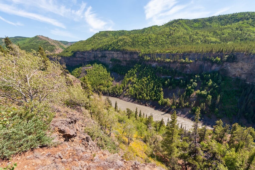
The Tanzilla Plateau lies between the Stikine and Tuya Rivers. The upper portion of the Grand Canyon of the Stikine, an imposing, lava-walled gorge, begins along the southern edge of this plateau.
The Spatsizi Plateau occupies an area between the Skeena Mountains and encompasses the headwaters of the Stikine River, as well as the basin of the Spatsizi River. Most of the Spatsizi Plateau is protected by the Spatsizi Plateau Wilderness Provincial Park and Spatsizi Headwaters Provincial Park.
The Klastine Plateau is situated north of the Klappan Range and contains the headwaters of the Iskut River. The plateau contains Eddontenajon and Iskut, two small, unincorporated communities located along the Stewart-Cassiar Highway.
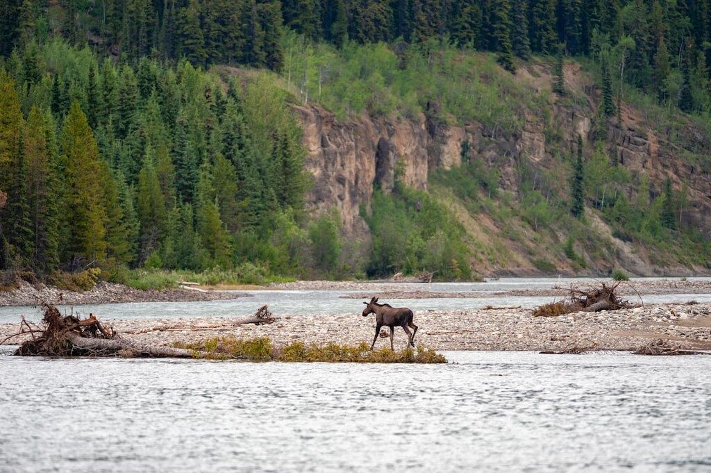
The Stikine Plateau serves as an important habitat for populations of caribou, moose, sheep, and goats. A wide range of subalpine and alpine vegetation, including low lying shrubs, mosses, and lichens, can be found throughout the region.
Established in 2001, Tuya Mountains Provincial Park is a spectacular park that protects internationally significant and rare volcanic subglacial landforms, or tuyas. Tuyas resemble flat-topped cinder cones and are created through volcanic eruptions underneath a glacier.
Tuya Butte, located in the Tuya Range within the park, is widely regarded as one of the best examples of these unique volcanic landforms outside of Iceland and Antarctica.
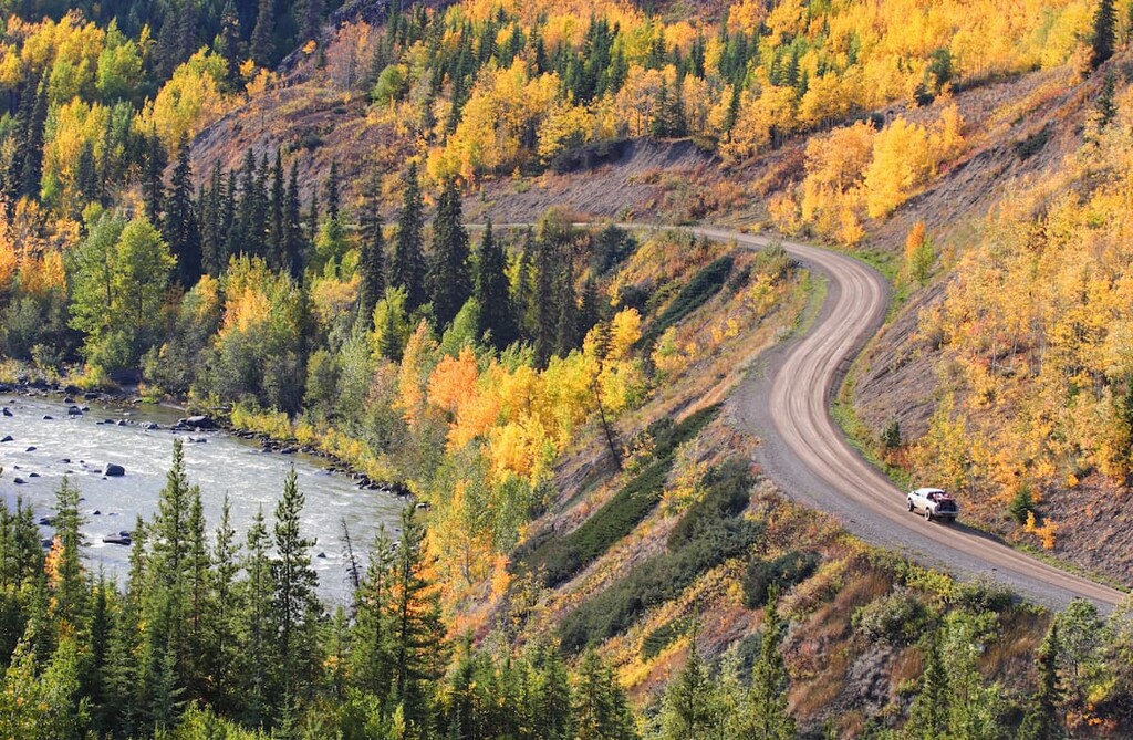
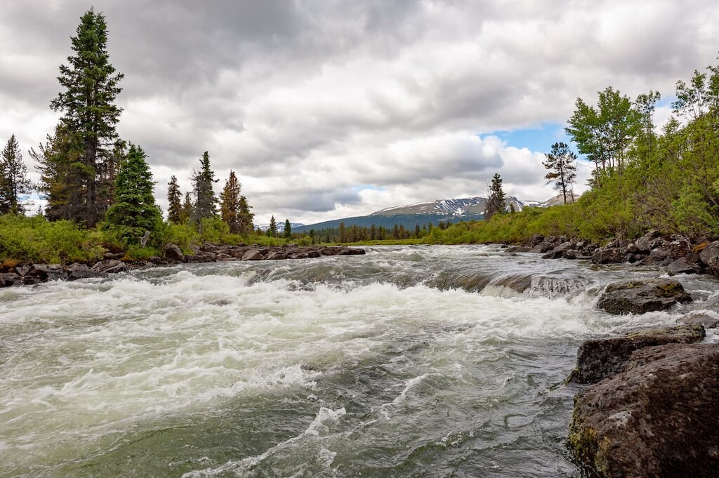
Established to protect the wild and dramatic Stikine River, the Stikine River Provincial Park protects roughly 536,000 acres of wilderness, including the 50-mile-long ‘Grand Canyon’ of Stikine. The Grand Canyon of Stikine is an incredible and unique geological feature. The canyon walls reach as high as 984 feet in places, and depths range anywhere from 656 feet wide to just 6.5 feet wide.
The upper Stikine River is a popular destination for experienced kayakers. Just keep in mind that the lower portion of the river, which passes through the Grand Canyon, is unnavigable and should not be attempted.
Hiking opportunities are limited, due to the park’s rugged topography and remote location. However, visitors traveling from Dease Lake can stop at a short trail that leads to a viewpoint overlooking the Tuya River Valley. A primitive boat launch is also available on the west side of Highway 37.
The Spatsizi Plateau Wilderness Park is one of Canada’s largest parks and, like other parks in the region, offers visitors a true wilderness experience. Protecting over 1.7 million acres, Spatsizi Plateau covers two physiographic regions: The Spatsizi Plateau and the Skeena Mountains.
Several overland routes can be used to access the park. The most common access points are found at the BC Railgrade that intersects with the Ealue Lake Forest Service Road, near Iskut. In order to explore the park’s backcountry areas, hikers must be well-equipped, experience in backcountry travel, and be in good physical condition.
There are six, first-come-first-serve cabins located at the Cold Fish Lake Camp. Several trails, including the Gladys Lake, Black Fox Creek, Danihue Pass, and Spatsizi Plateau trails commence at Cold Fish Lake.
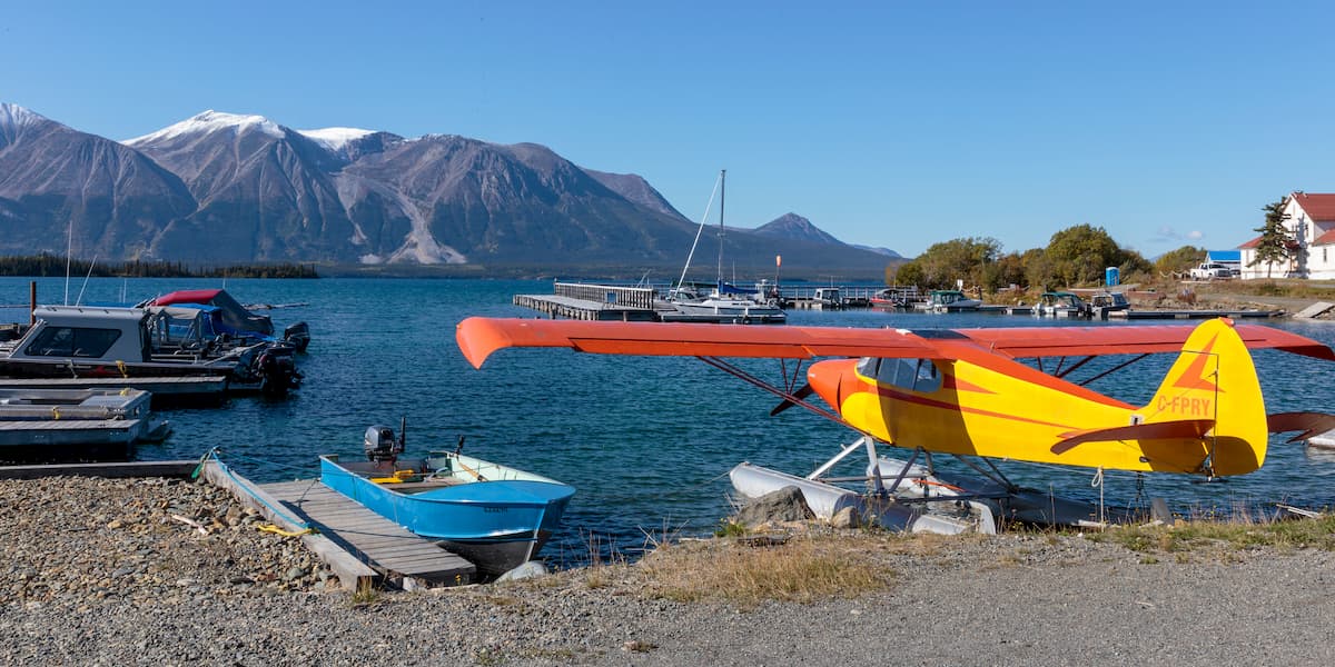
Atlin is a small, isolated community tucked in the northwest corner of British Columbia. The community is located on the traditional lands of the Taku River Tlingits and is home to just 300 to 500 permanent residents. Atlin was once an important gold mining center and remnants of the gold-mining era can still be found scattered throughout the community. Surrounded by incredible, pristine wilderness, and impressive snow-capped summits, Atlin offers plenty of epic outdoor recreation options.
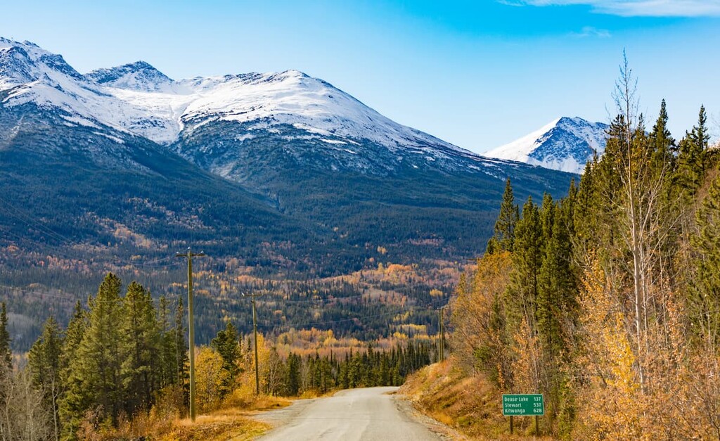
Once a major transportation route in the north for traders and trappers, Dease Lake was established as a Hudson Bay trading post in 1838. The town, which is located along Highway 37 at the junction to Telegraph Creek, was once a center of the gold rush on Dease and Thibert Creeks. Today, the tiny town hosts a population of just 475, and serves as a government service and supply center for the northwest region. Dease Lake is also a popular departure point for adventures into British Columbia’s most remote and rugged wilderness.
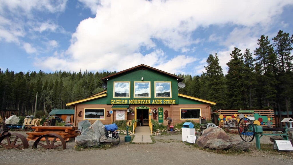
Located along Highway 37, west of Good Hope Lake, Jade City is a small town named for its jade deposits found to the east of the community. The tiny town hosts a Jade Store, post office, a 40-site RV campground, and a highway maintenance camp. Though amenities are scarce in this region, Jade City lies directly within a huge expanse of unspoiled wilderness. Explorers looking to spend time off the grid will appreciate the town’s isolation, as well as the complimentary coffee and wifi.