Scan the QR code and open PeakVisor on your phone
Established in 1975, Spatsizi Plateau Wilderness Provincial Park protects most of the Spatsizi Plateau, the southeastern most sub plateau of the Stikine Plateau, and the upper reaches of the basin of the Stikine River. The park encompasses roughly 1.7 million acres and is considered one of Canada’s largest and most impressive wilderness areas.
Spatsizi Plateau Wilderness Park borders Stikine River Provincial Park, a 635,498-acre area that forms a corridor on both sides of the Stikine River, and Tatlatui Provincial Park, a region that protects the headwaters of the Firesteel River and portions of the Finlay-Peace River basin. It also surrounds the Gladys Lake Ecological Reserve, a protected area that was established to study stone sheep and mountain goats.
Historically, Spatsizi was the hunting ground of the Tahltan First Nation. The park’s name, Spatsizi, translates to “red goat,” a Tahitan word used to describe the mountain goats in the area that had a habit of rolling around in iron oxide-colored dust, changing their white coats red.
In 1926, the Hyland brothers established a post on the Spatsizi River to trade with native fur trappers. The post was abandoned just a few years later. By the late 1940s, permanent hunting and fishing camps were established at Hyland Post and Cold Fish Lake by Tommy Walker. Walker operated a guide/outfitting operation that would entice avid sportsmen to the region. Walker also played an important role in the establishment of the park.
Today, the Spatsizi region is beloved for its true wilderness atmosphere and spectacular scenery. The park was established specifically to conserve the region’s unique and impressive natural features. As a result, recreational use is limited to activities that will not detract from or disturb the wilderness experience.
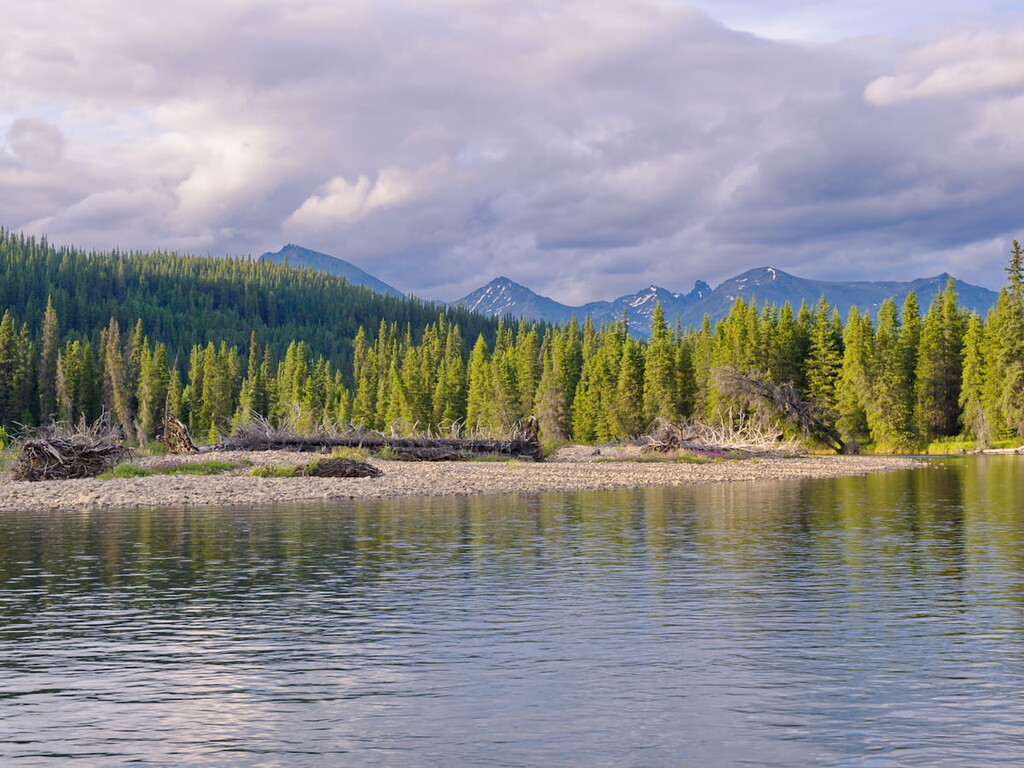
Extended backcountry hiking, wildlife viewing, fishing and wilderness canoeing are all available in the area. However, accessing this incredible landscape isn’t easy, so the park receives far less visitors than other, more accessible Canadian Provincial Parks.
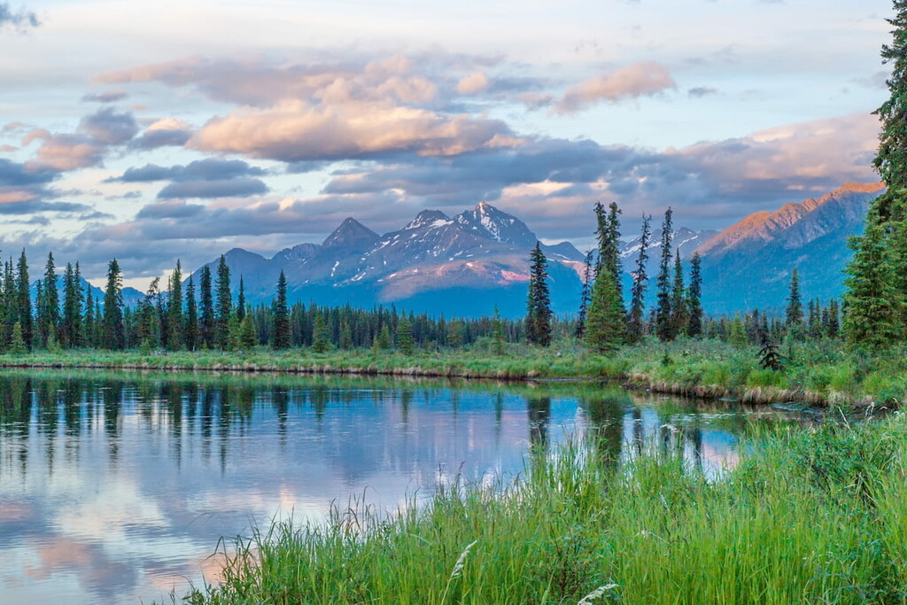
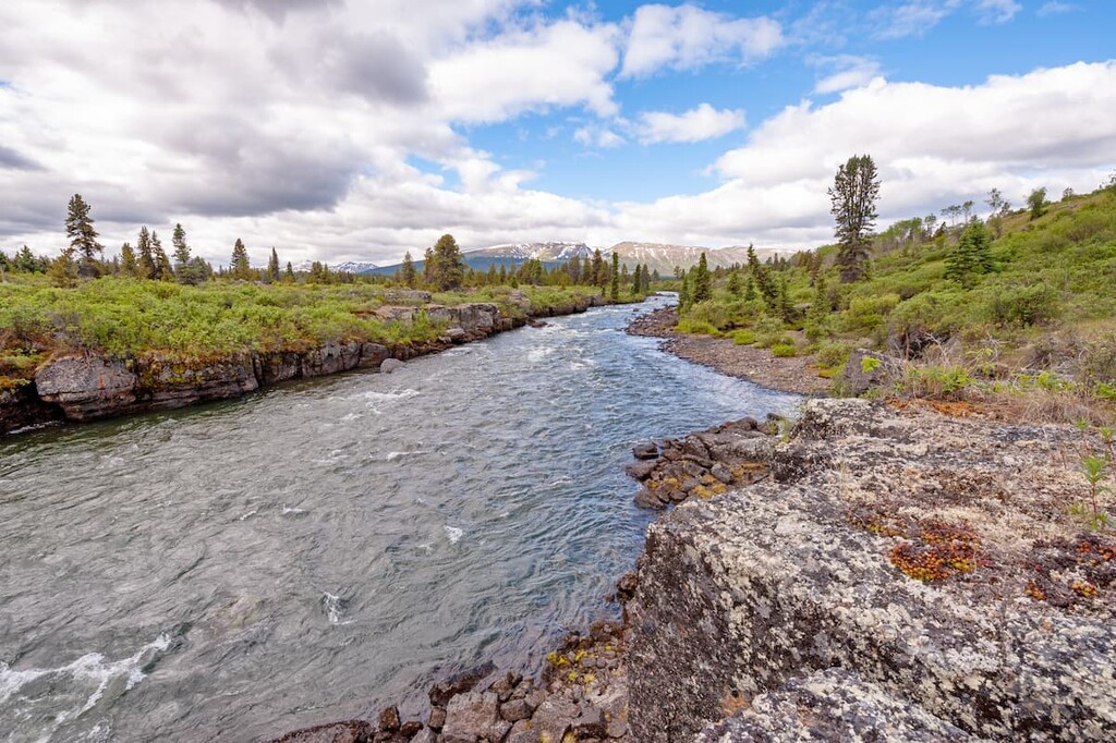
Spatsizi Plateau Wilderness Provincial Park represents two vital physiographic regions: the Spatsizi Plateau and the Skeena Mountains. Characterized by high alpine plateaus, rugged mountains, and sub-alpine forests, this vast and remote wilderness is home to incredible diversity and natural beauty. The plateau region, a rolling upland, boasts flaring valleys, rolling table uplands, and vast expanses of alpine vegetation, while the mountain region is home to weathered summits, like Mount Will and Nation Peak, as well as amphitheater-shaped cirque basins.
Elevations in the Spatsizi range from roughly 3,100 feet to over 8,000 feet. Several summits in the park reach over 7,000 feet in elevation, including Taylor Peak, Mount Skady, Abethledua Mountain, and Mount Umbach.
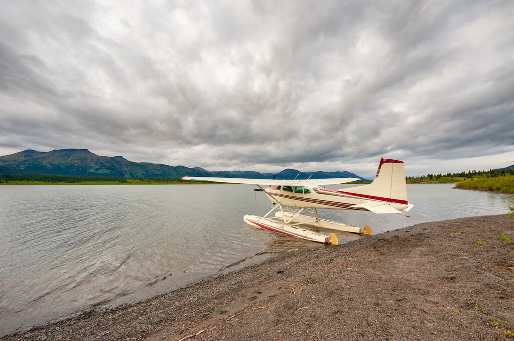
Visitors to the Spatsizi Plateau Wilderness Park are expected to be self-sufficient. There are no supplies of any kind in the park, with the exception of Cold Fish Lake Camp and a few private guide outfitter camps.
The park maintains trails at Eaglenest Creek, McEwan Creek, Black Fox Creek, Cold Fish Lake, Danihue Pass and Spatsizi Plateau; and portage trails at Didene Creek, Fountain Rapids, Chapea Rapids, and Beggerlay Rapids.
Established routes and trails include: Airplane Valley, Cartmel Lake, Gladys Lake, Hyland Post, Icebox Canyon, Mink Creek and Ram Creek trails; and Hotlesklwa Lake, Ross River, Tahltan, Tuaton Lake and Upper Stikine historical routes.
There are six cabins and a public cookhouse located at Cold Fish Lake camp within Spatsizi Plateau Wilderness Provincial Park. All cabins are on a first-come, first-served basis. The cookhouse has running water, a propane stove, and rodent-proof storage boxes available for public use. Users are responsible to clean the cookhouse after they use it. Visitors must pack out what they pack in.