
Scan the QR code and open PeakVisor on your phone
Stikine Region is home to 459 named mountains, including 1 fourteener. The highest is Mount Fairweather at 4,671 m.
Not to be confused with the Stikine Territory, Stikine District, or Stikine Country, the Stikine Region is an unincorporated area of northwestern British Columbia that covers roughly 45,816 square miles. When the regional district system was established in the 1960s, the Stikine Region was the only area that was left unincorporated due to its insufficient population or property assessment value.
The Stikine Region lies in the far northwest corner of British Columbia, bordering the Yukon Territory and Alaska. The region’s remaining borders are shared with the Northern Rockies Regional Municipality, and the Kitimat-Stikine, Peace River, and Bulkley-Nechako regional districts.
Less than 750 people live in the Stikine Region and most residents are centered in the Atlin community, which contains two Taku River Tlingit reserves. Remaining Stikine residents are scattered between Lower Post, Good Hope Lake, Jade City, and Laird River.
The Stikine Region is the traditional territory of several First Nations, including Taku River Tlingit, Kaska Dene, Tahltan, Gitxsan and Takla Lake.
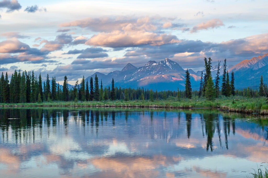
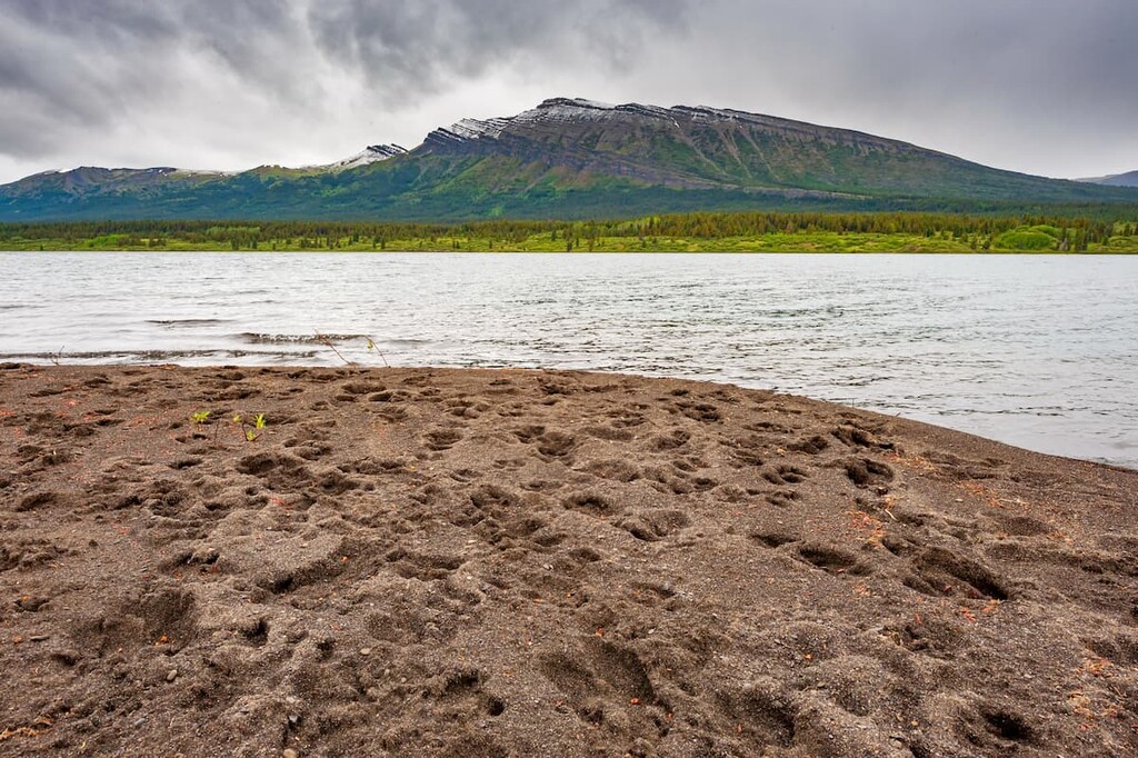
Several remote wilderness areas and Provincial Parks lie within the Stikine Region, including Tatshenshini-Alsek Provincial Park, Spatsizi Plateau Wilderness Provincial Park, Stikine River Provincial Park, and parts of Glacier Bay National Park.
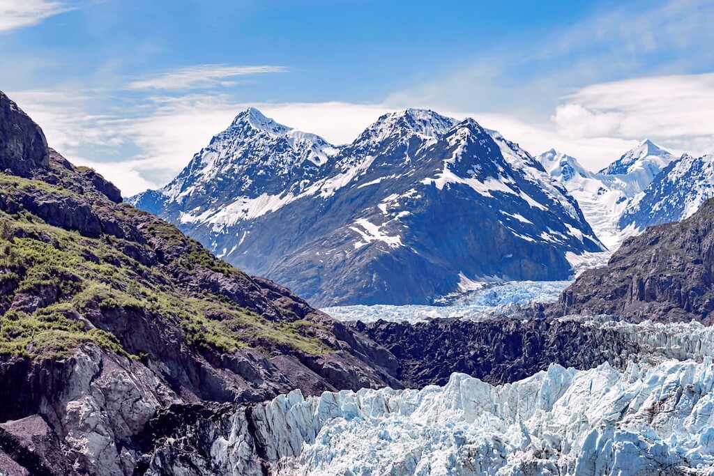
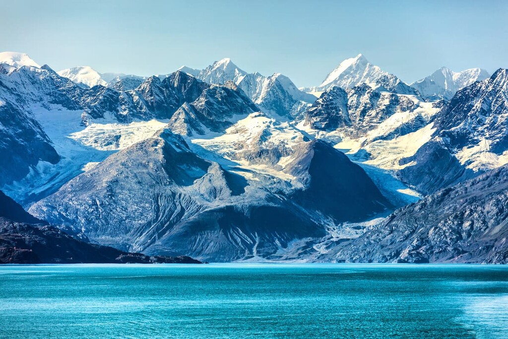
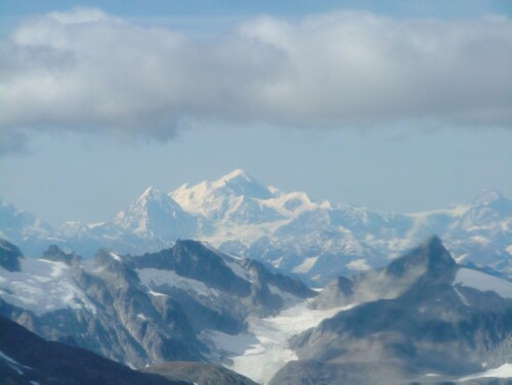
The Saint Elias Mountains dominate the landscape in the Stikine Region. The tallest peak in the region, Mount Fairweather, reaches an impressive 15,325 feet in elevation. Nestled in Glacier Bay National Park, Mount Fairweather is the highest mountain in British Columbia and marks the northwest extremity of the Alaska Panhandle.
Nearby, the second and third tallest peaks in the Stikine Region, Mount Root and Mount Lodge, lie along the Canada/United States border and reach an imposing 12,720 feet and 10,371 feet, respectively.
Established in 1993, Tatshenshini-Alsek contains nearly 3,700 square miles of glacier-covered peaks, wild rivers, and unusual plant communities. The park is located in the northwest corner of British Columbia, between Kluane National Park in the Yukon and Glacier Bay and Wrangell-St. Elias National Parks in Alaska. Combined, these incredible landscapes comprise the largest protected area in the world.
Despite its relative remoteness, kayakers and rafters are drawn to the Tatshenshini-Alsek for incredible river systems, hikers and mountaineers take advantage of infinite opportunities to explore pristine alpine meadows and craggy, snow-capped summits, and mountain bikers often venture to the park to tackle its challenging terrain.
The only designated and maintained trail in the park is the Chuck Creek Trail, a moderately difficult 5.6-mile trek that features impressive views of Samuel Glacier. All other routes in the park follow old mining roads and require extensive backcountry route-finding and survival experience.
Established to protect the wild and dramatic Stikine River, the Stikine River Provincial Park protects roughly 536,000 acres of wilderness, including the 50-mile-long ‘Grand Canyon’ of Stikine. The Grand Canyon of Stikine is an incredible and unique geological feature. The canyon walls reach as high as 984 feet in places, and depths range anywhere from 656 feet wide to just 6.5 feet wide.
The upper Stikine River is a popular destination for experienced kayakers. Just keep in mind that the lower portion of the river, which passes through the Grand Canyon, is unnavigable and should not be attempted.
Hiking opportunities are limited, due to the park’s rugged topography and remote location. However, visitors traveling from Dease Lake can stop at a short trail that leads to a viewpoint overlooking the Tuya River Valley. A primitive boat launch is also available on the west side of Highway 37.
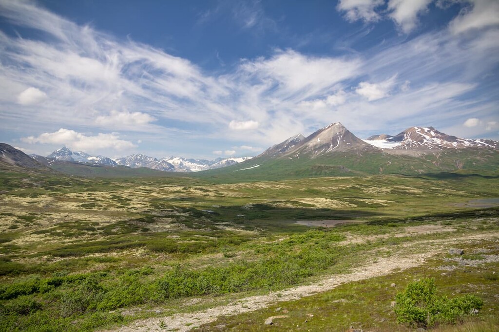
The Spatsizi Plateau Wilderness Park is one of Canada’s largest parks and, like other parks in the region, offers visitors a true wilderness experience. Protecting over 1.7 million acres, Spatsizi Plateau covers two physiographic regions: The Spatsizi Plateau and the Skeena Mountains.
Several overland routes can be used to access the park. The most common access points are found at the BC Railgrade that intersects with the Ealue Lake Forest Service Road, near Iskut. In order to explore the park’s backcountry areas, hikers must be well-equipped, experience in backcountry travel, and be in good physical condition.
There are six, first-come-first-serve cabins located at the Cold Fish Lake Camp. Several trails, including the Gladys Lake, Black Fox Creek, Danihue Pass, and Spatsizi Plateau trails commence at Cold Fish Lake.
Located on the coast of the southeast Alaska panhandle, Glacier Bay is an enormous swath of public land that was established to preserve some of the world’s most impressive tidewater glaciers. The park currently encompasses roughly 3.2 million acres of land, 2.7 million of which is designated wilderness.
Glacier Bay is generally accessed by boat, with a number of tour companies offering cruises through the inside passage. Kayak rentals and guided hikes are also available.
Visitors that only have a few hours in the park can stop by the Visitor Center, walk the Forest Trail, or visit the Whale Exhibit to see one of the largest humpback whale skeletons in the world. With more time, visitors to the park can opt to explore the Bartlett River, hike to Bartlett Lake, or view the Healing Pole and traditional Tlingit canoe.
Located on the Cassiar Highway, south of Iskut, the Red Goat Lodge is a quaint resort nestled alongside Eddontenajon Lake in a valley of mountains. The Red Goat Lodge offers cabins and rooms nestled in the woods, a lakeside campground and RV park, and dining room services for large groups. Basic services (i.e. a small grocery store and gas station) are available nearby in Iskut and Dease Lake.
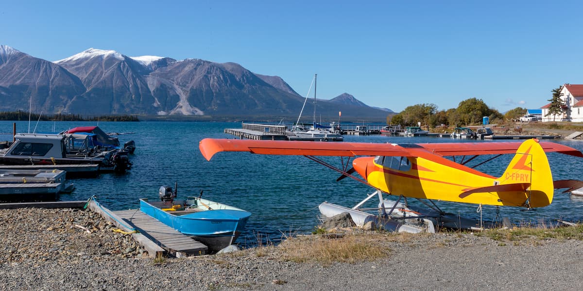
Atlin is a small, isolated community tucked in the northwest corner of British Columbia. The community is located on the traditional lands of the Taku River Tlingits and is home to just 300 to 500 permanent residents. Atlin was once an important gold mining center and remnants of the gold-mining era can still be found scattered throughout the community. Surrounded by incredible, pristine wilderness, and impressive snow-capped summits, Atlin offers plenty of epic outdoor recreation options.
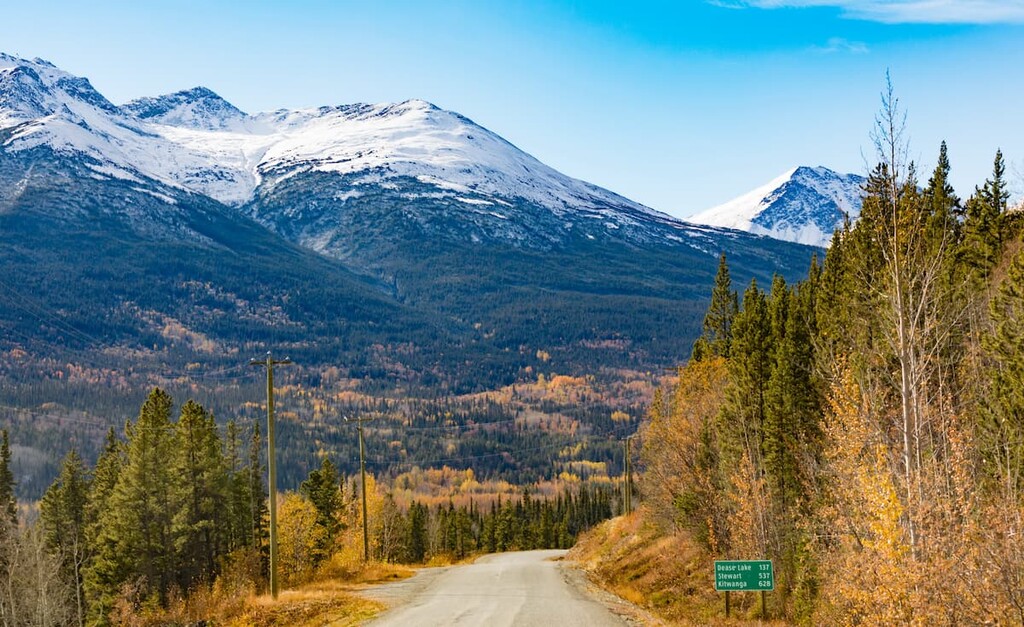
Once a major transportation route in the north for traders and trappers, Dease Lake was established as a Hudson Bay trading post in 1838. The town, which is located along Highway 37 at the junction to Telegraph Creek, was once a center of the gold rush on Dease and Thibert Creeks. Today, the tiny town hosts a population of just 475, and serves as a government service and supply center for the northwest region. Dease Lake is also a popular departure point for adventures into British Columbia’s most remote and rugged wilderness.


14er
ultra
4000ers-canada
11ers-bc
alaska-13ers
canada-sampler
british-columbia-ultras
alaska-ultras
14er
ultra
4000ers-canada
11ers-bc
alaska-13ers
canada-sampler
british-columbia-ultras
alaska-ultras
Yes. Stikine Region has 459 named mountains. The highest is Mount Fairweather at 4,671 m.
The highest mountain in Stikine Region is Mount Fairweather, at 4,671 m.
Stikine Region has 459 named mountains.
Stikine Region has 1 fourteener — peaks above 14,000 ft (4,267 m).


