
Scan the QR code and open PeakVisor on your phone
The Omineca Mountains include 143 named peaks. The highest is Sustut Peak at 2,475 m. Other notable peaks include Fleet Peak, Horn Peak and Mount Irish.
The Omineca Mountains are a collection of peaks located to the west of the Rocky Mountain Trench in the northeastern part of the province of British Columbia in Canada. The Ominecas are the southernmost extension of the Cassiar Mountains of the Interior Ranges of British Columbia. Sustut Peak is the tallest mountain in the Omineca Mountains with an elevation of 2,475 m (8,120 ft).
Located to the west of the Rocky Mountain Trench in the northeastern part of British Columbia, Canada, the Omineca Mountains are one of the many mountain ranges in the province.
The Ominecas are the southernmost extension of the Cassiar Mountains and they are located to the east of the Rocky Mountains. The Muskwa Ranges of the Rockies are located to the northeast of the Ominecas, while the Hart Ranges are situated to the southeast.
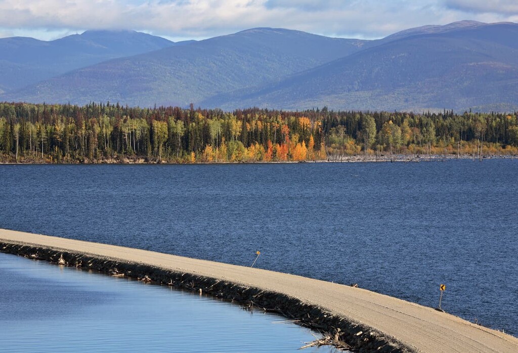
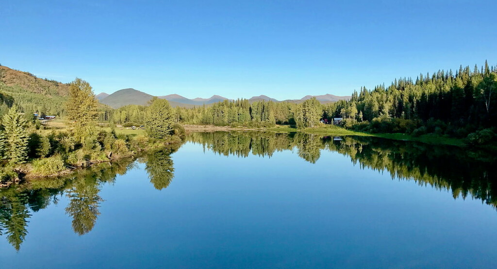
The Omineca River flows through the Omineca Mountains. The Ominecas are bounded by the Spatsizi Plateau and the Skeena Mountains on the west and by the Rocky Mountain Trench on the west. The Nechako Plateau is found to the south of the Ominecas, while Cassiar Mountains are located to the north.
The Omineca Mountains are separated from the Cassiar Mountains by the valleys of Chukach’da River, Cushing Creek, Thudaka Creek, and Finlay River. The Cassiar and Omineca Mountains have complete topographic and geologic continuity and have only an arbitrary naming distinction between the two ranges.
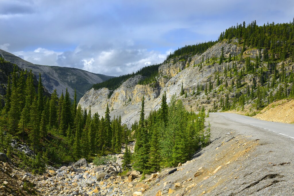
There are highways leading into the Omineca Mountains, though and the mountains themselves are very remote. There are some gravel roads that lead to small settlements, and to hunting and fishing camps. The municipalities of Mackenzie and Fort St. James are the largest towns with services that are close to the Ominecas.
There are many protected areas in the Omineca Mountains; however, most of the provincial parks are remote and there is limited or no road access to the area. The following are the protected areas in the Omineca Mountains:
The Omineca Mountains are a topographic and geological extension of the Cassiar Mountains, which extend northwest of the range. The Ominecas have three main subunits: the Swannell Ranges, Finlay Ranges, and the Hogem Ranges. There are an additional 26 mountain groups that divide the three primary sub-ranges of the Omineca Mountains.
The Omineca Mountains have a core of granite rock that is known as the Omineca Intrusions. The intrusions created batholiths during the Jurassic and Cretaceous periods when magma flowed up from the Earth’s mantle along fault lines and through the layers of rock and then slowly cooled in pockets among the sedimentary rocks.
The magma intruded sedimentary, volcanic, and metamorphic rocks that were created between the Proterozoic and Jurassic. The volcanic activity in the region was the result of the collision and subsequent subduction of the tectonic plates under the Pacific and the western edge of North America. This subduction started around 180 million years ago.
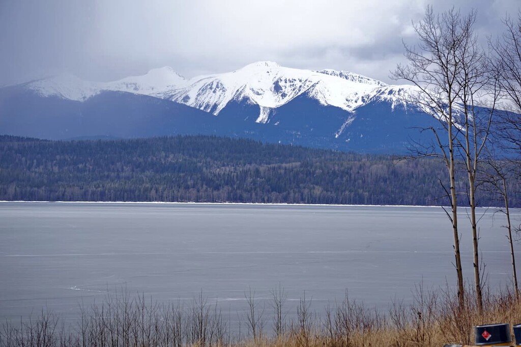
During the Pleistocene, the Cordilleran ice sheet and glaciers covered most of western Canada and significantly impacted the topography of the mountain ranges. The three main ranges of the Omineca Mountains were affected differently during the glaciation due to their slight geological differences.
The Swannell Ranges were glaciated during the Pleistocene; however, glaciation varied according to location and elevation. Peaks and ridges below 1,830 m (6,000 ft) are generally rounded over in this area as they were covered by ice, while the peaks are more rugged at progressively higher elevations where glaciers weren’t present. The glaciers created significant U-shaped and hanging valleys throughout the ranges and the tallest peaks show the effects of cirque glaciation.
The Finlay Ranges were also glaciated; however, no ice remains in the ranges today. The peaks over 1,830 m (6,000 ft) in the range were carved out from eroded limestones, quartzites, and metamorphosed schists. The peaks and ridges of the Finlay Ranges were generally rounded when the Cordilleran ice sheet receded. The current topography was influenced by later cirque and valley glaciers.
The peaks of the Hogem Ranges formed from the erosion of Paleozoic and Mesozoic volcanic and sedimentary rocks in the north and Cretaceous and Paleocene rocks in the south. The erosion of the rock beds of the Hogem Ranges creates gently sloping ridges and abrupt cliffs. While the peaks avoided the grinding of the Cordilleran ice sheet, the ice sheet created flaring valleys. Later cirque glaciers affected the northern slopes of all the mountains in the Hogem Ranges.
The ecology of the Omineca Mountains can be divided into two major divisions, the boreal ecology in the north of the ranges and the sub-boreal ecology in the southern half of the ranges. The ecological division is created from the latitude of the mountains as well as the elevation.
The northern half of the range is dominated by the boreal ecology. While the peaks of the whole range are considered part of the barren Alpine Tundra Ecology, the differences are found below the tree line. Forests of spruce, willow and birch are the common trees on the slopes of the mountains while white and black spruce forests dominate the valleys.
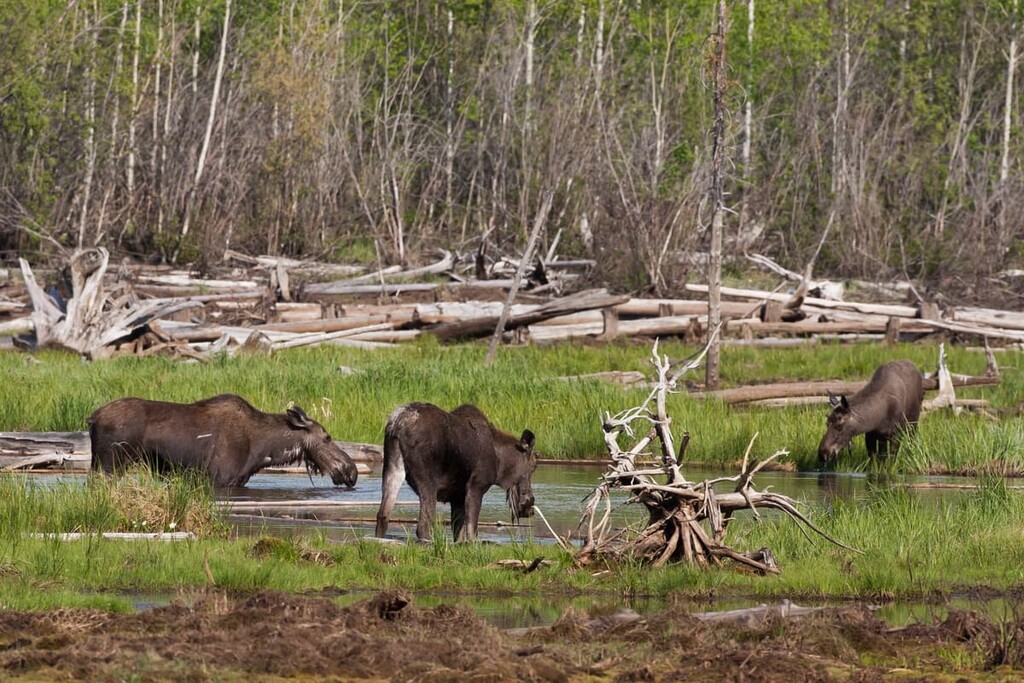
The boreal forests are especially popular with moose, caribou, and mule deer. Rocky Mountain elk, Stone sheep, and mountain goats also inhabit the boreal forests and peaks of the Omineca Mountains. Other large mammals include grizzly and black bears, and grey wolves. There are many species of birds and small mammals that especially prefer the deciduous forests.
The southern half of the range has the sub-boreal ecologies of the Engelmann Spruce – Subalpine Fir ecosystems on the mountain slopes and the Sub-Boreal Spruce ecosystems in the valleys. Spruce and fir dominate the forests and there is a continuum from the mosaic of meadow and small stands of trees near the alpine to dense forests in the valley bottoms.
Spruce typically dominates the forest canopy; however, fir is more tolerant to the cold at higher elevations and it often dominates the tree line. Whitebark pine, limber pine, and larch are also common trees in the sub-boreal forests; however, aside from the larch there are no other deciduous trees commonly found in this region.
The animals that inhabit the boreal forests of the Omineca Mountains also inhabit the sub-boreal areas. Indeed, many of the animals in this region migrate south and to lower elevations where it may be warmer in the winter. The exception to winter migration is that some birds and small animals prefer to stay in the deciduous forests that grow in the boreal region of the mountain range, due to their great variety of food sources and habitats.
The Omineca Mountains are the traditional territory of the Dakelh (Carrier) and Tse’kene (Sekani) First Nations. They have lived in the region for countless generations with the Dakelh traditionally living along the waterways and fishing for sustenance while the Tse’kene lived among the mountains hunting and foraging for their sustenance.
European fur traders first came to the region in the 1800s. The traders would, on occasion, employ and trade with the region’s First Nations. In 1861, gold was discovered in the Omineca Mountains; however, the gold rush didn’t start until 1869 and it lasted about five years.
By 1890, most of the individual miners and small operations had moved on from the area, making space for larger companies to mine the region. The large companies used hydraulic mining systems and were active well into the twentieth century. Mining is still practiced in the Omineca Mountains, although Manson Creek is the only gold rush town remaining. Mining flumes are still visible along the banks of the rivers.
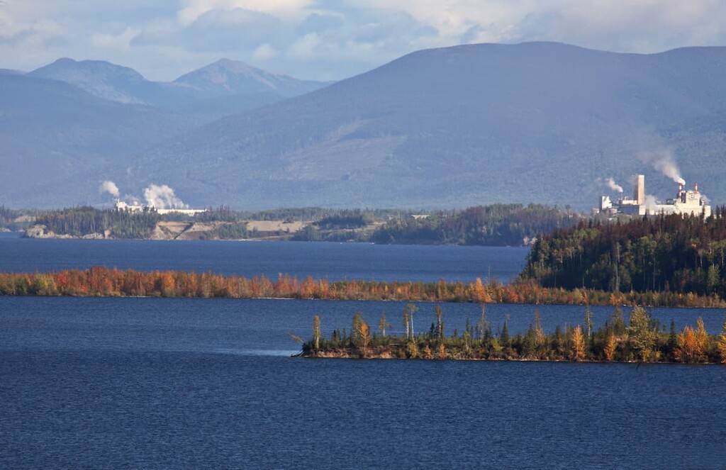
In addition to mining, forestry recently became a large part of the economy in the region. Roads that were built to reach the mines and forestry roads are essentially the only infrastructure in the mountains. The Ominecas are mostly uninhabited with the exception of a few settlements such as Manson Creek, Germansen Landing, and Takla Landing.
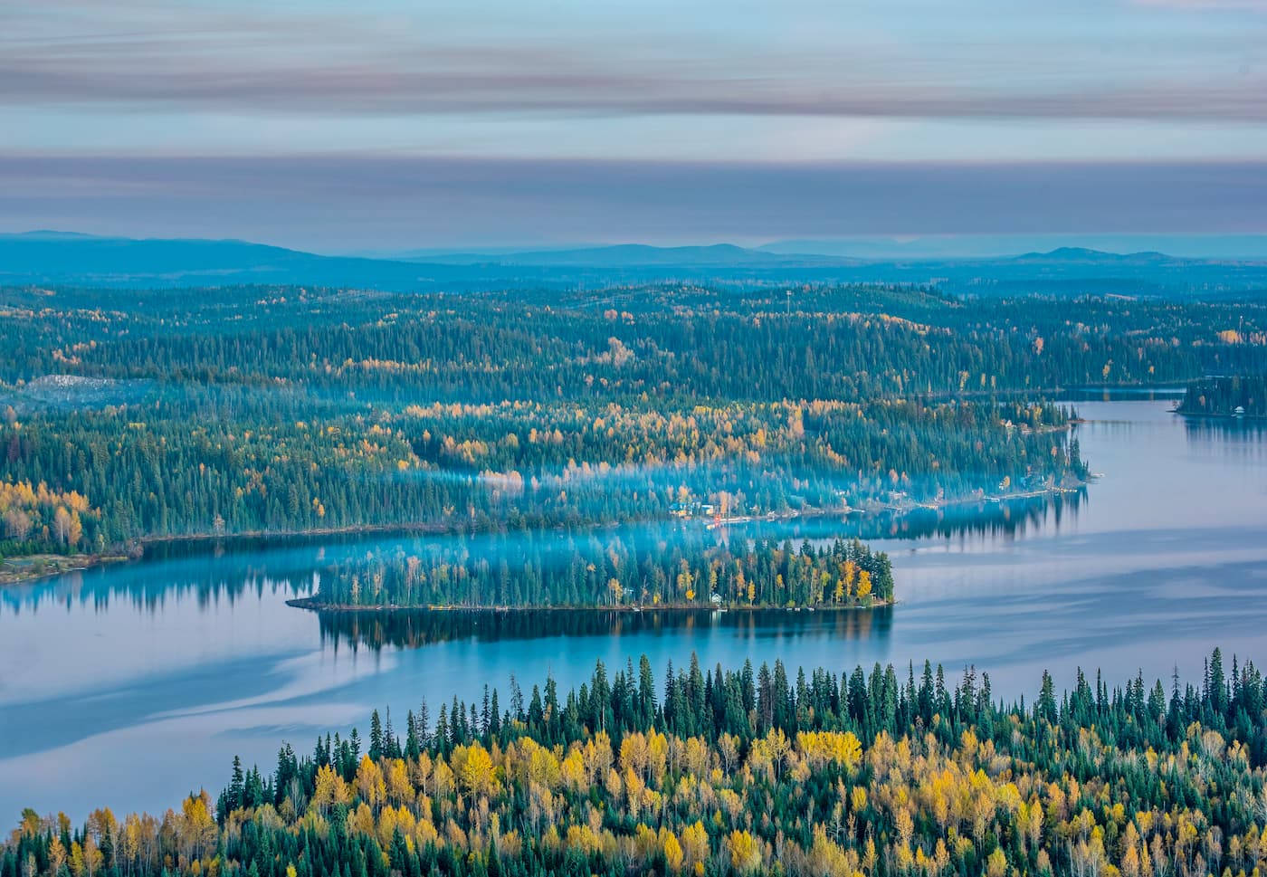
The Omineca Mountains are a remote range where visitors usually come to explore, fish, and hunt in the wilderness. The following are some of the popular areas to visit in the range.
Established in 2001, Omineca Provincial Park encompasses 1,323 square kilometers (513 square miles) of rugged mountains and rivers with the Omineca River running centrally through the park. The settlements at Germansen Landing and Manson Creek are located near the provincial park.
The park has opportunities for boating, fishing, sightseeing, and hiking. There are trails in the park; however, there are no official trails and none of the trails are mapped. The park does offer exceptional wilderness for snowshoeing and ski touring during the winter months.
Mount Blanchet Provincial Park is on the western edge of the Omineca Mountains along the shores of Takla Lake, south of Takla Landing. There are three prominent peaks in the park, which are Base Peak, Spike Peak, and Mount Blanchet.
The park offers many wilderness activities such as fishing, boating, and hiking. While there are no official trails in the park, there is a route from the shore that leads to Mount Blanchet. The remote wilderness can be explored by adventurous backpackers and mountaineers.
The Omineca Mountains are remote and most of the settlements in the mountains are very small and isolated; however, there are several larger municipalities that border the ranges. The following are several places to find accommodation while adventuring in the Omineca Mountains.
Prince George is the largest municipality in northern British Columbia. It is located to the south of the Omineca Mountains. It is the commercial, service, and transportation hub for the north and it has all the amenities of a modern city; however, it is nestled among amazing wilderness.
There are many activities to enjoy while in Prince George, from fishing, hiking, to cycling, and boating. The Pidherny Trails are a series of well imagined and maintained cross country and downhill bike trails which are near the city. Some other places to explore are the Prince George Cutbanks, Forests of the World municipal park, and Moore’s Meadow Nature Park.
There are several wilderness camps and lodges in the Omineca Mountains. The camps are often used by miners, prospectors, surveyors, as well as forestry employees; however, they are available for hikers, hunters, and anglers, too.
Although there are dozens to choose from, a few of the camps include Oslinka Camp, Omenica Camp, Camp Munro, and Kwadacha Eight Mile Camp. Some of the camps have outfitters’ tents for accommodations while others have trailers. The camps are a good place to establish a base camp while exploring the Omineca Mountains.
Mackenzie is located to the southeast of the Omineca Range along Highway 39. Coinciding with the construction of a pulp mill and two sawmills, Mackenzie was built and settled in 1965. However, the area has a rich history dating back thousands of years to the arrival of the initial First Nations of the region.
The area around Mackenzie has many recreation areas with scenic hikes. Some of the areas are Bijoux Falls Provincial Park, Tudyah Lake Provincial Park, Gataiga Lake Recreation Site, and the Mackenzie Recreational Trails.


The highest peak in the Omineca Mountains is Sustut Peak, at 2,475 m.
The Omineca Mountains have 143 named peaks.


