
Scan the QR code and open PeakVisor on your phone
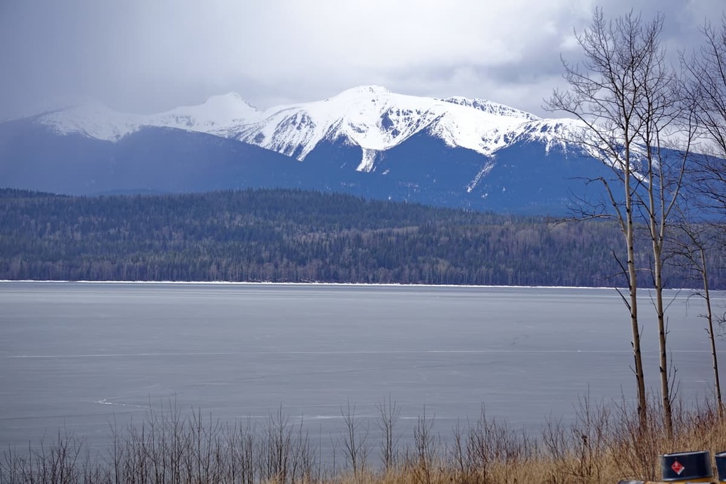
Mount Blanchet Provincial Park is located along the shores of Takla Lake in a remote area of central British Columbia, Canada. The park covers the mountainous area between the main and northwest arms of Takla Lake and has 6 mountains, the highest and most prominent of which is Spike Peak (2,015 m/6,611 ft); however, Mount Blanchet (2,000 m/6,562 ft) is the most popular mountain for summit attempts.
Mount Blanchet Provincial Park encompasses the mountains and wilderness between the main and northwest arm of Takla Lake in the Regional District of Bulkley-Nechako, British Columbia, Canada. The area is remote and sparsely populated. Most visitors to the park arrive by boat in the summer and snowmobiles in the winter.
There are six peaks within the park, the highest and most prominent of which is Spike Peak. Spike Peak is 2,015 m (6,611 ft) tall and has 1,213 m (3,980 ft) of prominence. The most popular peak to hike in the park is Mount Blanchet, which has a trail from the shore leading to its summit.
The park surrounds Takla Lake Ecological Reserve, which is located on the west shore of Takla Lake. Takla Lake Ecological Reserve protects the most northerly known stand of Douglas fir trees in the province. Other significant parks that are situated near Mount Blanchet Provincial Park include:
The Canadian Cordillera includes all of the mountain ranges that cover western Canada. The three major physiographic divisions of the cordillera are the Western, Interior, and Eastern Systems of mountains.
The Western System includes the Coast and Insular Mountains while the Eastern System includes the Mackenzie and Rocky Mountains. The Interior System is much more complex than the others and contains many more subdivisions.
The Interior System includes the Yukon Plateau and the Liard Plain in the north while the southern system includes the Columbia Mountains and the Interior Plateaus. The plateaus and mountain ranges found here include the Stikine Plateau and the Skeena, Hazelton, Cassiar, and Omineca Mountains.
Mount Blanchet Provincial Park is located on the eastern edge of the Skeena Mountains. Here, Takla Lake forms the border between the Skeena and the Omineca Mountains. The Skeena Mountains are a unique range that mainly formed from folded sedimentary rocks from the Cretaceous and Jurassic.
The primary rocks found in the Skeena Mountains, which includes the mountains of Mount Blanchet Provincial Park, are dark greywacke, a black fine-grained argillite, and shale.
Limestone and rocks of volcanic origin are absent in the range and there are only a few igneous intrusions, which are primarily located in the Babine Range. Mount Blanchet Provincial Park is located to the south of the Bait Range and to the east of the Babine Range.
Mount Blanchet Provincial Park plays an important role in the conservation of several species of trees and animals in the region. The park preserves significant northern caribou wintering and calving grounds, as well as important habitat for mountain goats and grizzly bears.
Furthermore, the park has an excellent representation of alpine flora. The stands of Douglas fir and whitebark pine in the park are notable because they are located at the northern limit of their species’ typical ranges.
The typical sub-alpine forests of the park are filled with Engelmann spruce and subalpine fir in addition to the Douglas fir and whitebark pine.
Whitebark pines have an interesting codependency with the Clark’s nutcrackers that feed on the pine seeds and create seed caches for their winter food sources. The seed caches left by the Clark’s nutcracker are also an important food source for grizzly bears and they help to disperse whitebark pines throughout a forest.
The early human inhabitants of the region tended to primarily live along the banks of the area’s major rivers and the shores of its lakes. Some of the many cultural and historical sites that have been uncovered in the region include earthworks, human remains, pictographs, petroforms, cultural materials, and habitation sites.
The territory around Takla Lake is traditionally part of the homelands of the Dakelh (Carrier) First Nations (ᑕᗸᒡ), including the Takla Lake First Nation. The First Nations that have lived in this region since time immemorial traditionally followed a seasonal round between important hunting and harvesting sites.
Summer was the time for gathering berries and for both harvesting and preserving fish. The hunting and trapping of moose, caribou, elk, deer, black bear, beaver, and rabbit also provided First Nations in the region with both food and raw materials for clothing and tools.
Hunting and trapping of smaller fur-bearing animals occurred in the region long before First Nations made contact with European trappers and traders; however, the fur trade quickly became the primary economic activity in the area from the end of the eighteenth century onward.
The park and communities in the area have remained relatively isolated until the mid-twentieth century when forestry roads pushed their way to the community of Takla Landing. Before the creation of the forestry road, the only way to access the community was by plane, snowmobile, or boat. In fact, these remain the only ways to access Mount Blanchet Provincial Park to this day.
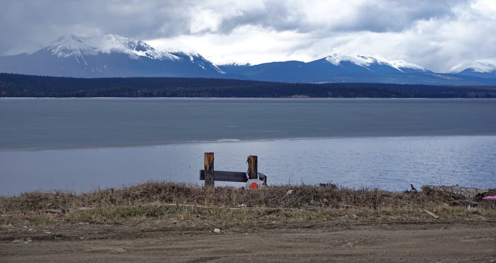
The only way to access the remote wilderness of Mount Blanchet Provincial Park is by boat in the summer or snowmobile in the winter. There are several areas along the shore of Takla Lake, near Takla Narrows, where rustic campsites have been created by visitors.
The park offers boat-accessed lakeside and backcountry recreational opportunities. Visitors to the park can enjoy wildlife viewing, hunting, fishing, camping, and some hiking. The 10 km (6 mi) rustic trail from Takla Narrows to the summit of Mount Blanchet is the only developed trail in the park.
Mount Blanchet Provincial Park is located along the isolated shores of Takla Lake in central British Columbia. The closest community to the park is Takla Landing, which is also situated on the shores of Takla Lake. The closest city to the park is Fort St. John. Here’s what you need to know before your next trip to the area.
Mount Blanchet Provincial Park is situated about 120 km (72 mi) to the west of Fort St. John. Fort St. John is the largest city in the Peace River Regional District, and it is located at Mile 47 of the Alaska Highway.
Due to the abundant local wildlife, the community was originally established as a trading post for the fur trade in 1794, a year after Alexander Mackenzie traveled to the region. The wilderness and mountains that surround Fort St. John continue to be home to an abundance of wildlife, scenic landscapes, wild rivers and creeks, trails to follow, and wilderness to explore.
Some of the best places to check out around the city include the Charlie Lake Caves (which have evidence of human inhabitation from 10,500 years ago), Willow Loop Trail, Cactus Trails, and the Cecil Lake Highway Trail Loop.
Takla Landing is a small community located on the eastern side of Takla Lake. It is also home to the main community and headquarters of the Takla Lake First Nation.
The community of Takla Landing is home to approximately 250 residents, most of whom are citizens of the First Nation. During the Omineca Gold Rush in the late 1860s, the community was used as a popular steamboat landing site for prospectors who hoped to make it to the gold strikes along the Omineca River.
For many decades, the community of Takla Landing was fairly isolated from the rest of British Columbia due to the ruggedness of the surrounding terrain. However, the forestry industry pushed its way into the area in the 1950s and built a number of unpaved roads that now connect the community to Fort St. James and Germansen Landing.


