
Scan the QR code and open PeakVisor on your phone
Regional District of Bulkley-Nechako is home to 306 named mountains. The highest is Tsaydaychuz Peak at 2,759 m.
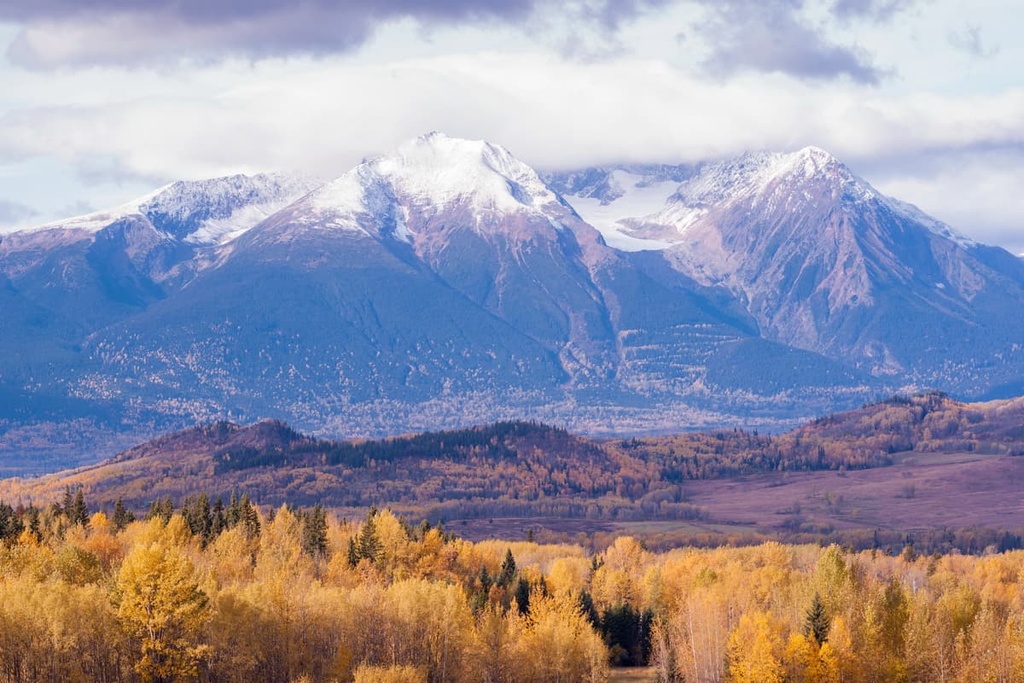
The Regional District of Bulkley-Nechako is located in the central part of the province of British Columbia in Canada. The region contains parts of the Nechako Plateau, as well as the Hazelton, Omineca, Skeena, and the Coast Mountains. There are 331 named peaks in the region, the tallest and most prominent of which is Tsaydaychuz Peak (2,759 m/9,052 ft).
The Regional District of Bulkley-Nechako is an administrative region located in the central part of the province of British Columbia in Canada. Highway 16 (the Yellowhead Highway) is the main transportation corridor through the region.
It is bordered by the Regional District of Kitimat-Stikine and the Central Coast Regional District to the west and by the Regional District of Fraser-Fort George to the east. Additionally, the Cariboo Regional District is located to the south and the Peace River Regional District and the Stikine District are both located to the north.
The Regional District of Bulkley-Nechako nearly perfectly coincides with the traditional territory of the Dakelh, or Carrier First Nations.
The district is also roughly identical to the old New Caledonia fur district, which existed at the height of the fur trading industry in the region, particularly with respect to the activities of the North West Company. The region is often still referred to as New Caledonia.
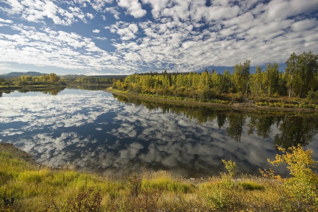
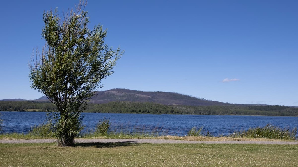
The regional district includes approximately 73,400 square kilometers (28,450 square miles) of land. The region’s primary geographical feature is the Nechako Plateau; however, there are also parts of the Hazelton, Omineca, Skeena, and the Coast Mountains within its borders.
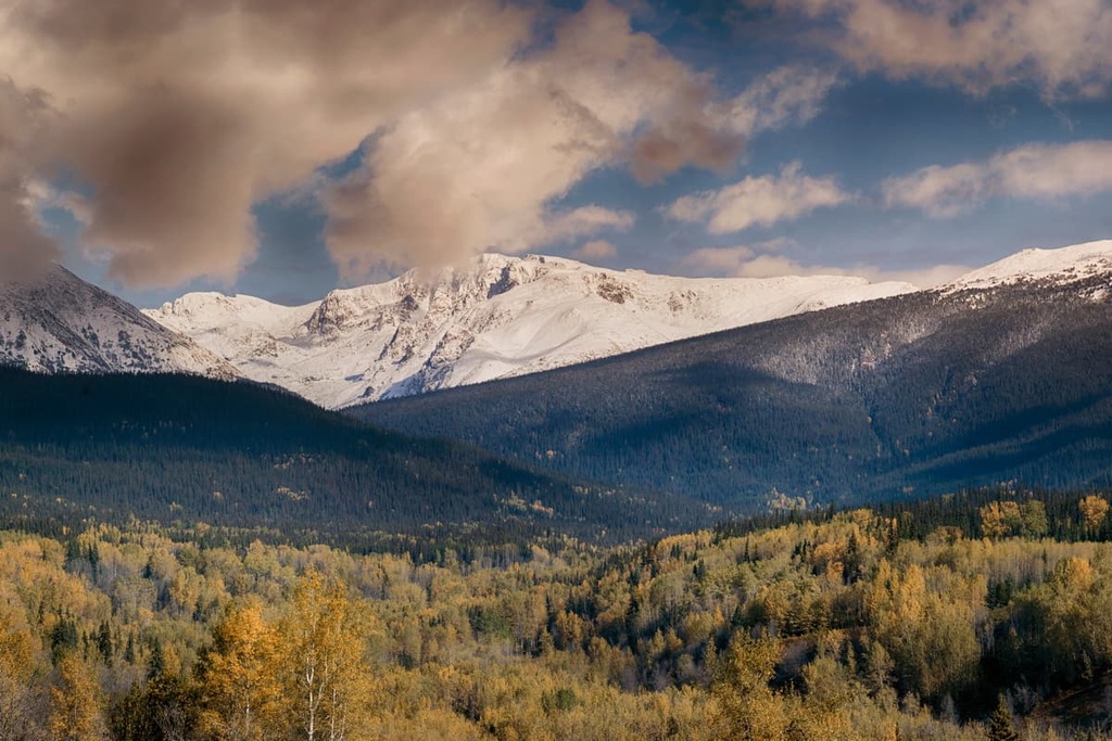
The tallest and most prominent peak in the Regional District of Bulkley-Nechako is Tsaydaychuz Peak, with 2,759 m (9,052 ft) of elevation and 1,830 m (6,004 ft) of prominence. The region is home to an additional five ultra-prominent peaks: Shedin Peak, Atna Peak, The Galleon, Hudson Bay Mountain, and Netalzul Mountain.
The Regional District of Bulkley-Nechako is also home to many provincial parks preserving the spectacular scenery, and recreational opportunities of central British Columbia. The following are some of the parks in the region:
The e Nechako Plateau is the central feature of the Regional District of Bulkley-Nechako; however, there are also parts of the Hazelton, Omineca, Skeena, and Coast Mountains in the region.
The common geological element among the mountain ranges in the district is that they consist of exotic terranes that were accreted to the west coast of British Columbia over the past 160 million years.
The Hazelton Mountains, Omineca Mountains, and the Kitimat Ranges of the Coast Mountains share the geological trait of containing volcanic rocks. Indeed, many mountains in these ranges have a granite or batholithic core. Meanwhile, the Skeena Mountains contain no significant amount of volcanic rock and very few granitic intrusions.
The granite cored mountains of the Hazleton and Omineca Mountains, and the Kitimat Ranges tend to have domed tops that were subjected to significant cirque glaciation during the Pleistocene.
These cirque glaciers carved Matterhorn-like peaks on many of the taller mountains in these ranges. At the same time, the lower elevation peaks are typically serrated, or they were completely rounded by the ice sheet.
The Skeena Mountains have a unique geology in the Western Cordillera. The principal rocks are and black fine-grained argillite and shale, and dark greywacke. Limestone, which has significant presence in the Rocky Mountains and the rest of the cordillera, and volcanic rocks which are abundant in the interior and Coast Mountains, are absent in the Skeena Mountains.
The Pleistocene brought significant glaciation to the Skeena Mountains, creating a jagged ridgeline as cirque glaciers formed on the north and east slopes of the range. Glaciers are still present in the Skeena Mountains and the valleys have been heavily influenced by glaciers, with tarns, hanging valleys, and significant glacial drift covering the valleys.
The Nechako Plateau is situated at the northern end of an ancient interior depression between the Columbia and the Coast Mountains.
About 50 million years ago, the immense forces that were pushing and bending the west coast into mountains created weak and thin spots in the Earth’s crust within the interior plateau. In these areas, tremendous amounts of lava poured over the landscape over millions of years.
These tertiary lava flows covered over the older volcanic and sedimentary rock, creating a relatively level plateau. Much of the Nechako Plateau is almost completely undissected by rivers. Meanwhile, the Fraser River and its tributaries have eroded deep incisions into the plateau.
The Pleistocene glaciers and ice sheets scoured the plateau, further levelling the terrain while depositing a near universal layer of till across the region. Most of the plateau is defined as being below 5,000 ft (1,525 m); however, there are some exceptions, particularly in areas where monadnocks were left behind.
Monadnocks are mountains or hills in an otherwise flat landscape, such as the Quanchus and Fawnie Range on the Nechako Plateau. These ranges are made from granite and their aureoles of hornfelsed rocks which resisted the glacial erosion of the Pleistocene.
Except for the monadnocks, the plateau area of the Regional District of Bulkley-Nechako has only minimal topographical relief. Most of the relief is from the glacial drumlins, eskers, glacial grooves, and meltwater channels.
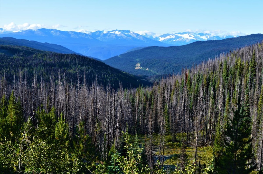
The Regional District of Bulkley-Nechako is representative of the Sub-Boreal Spruce ecology in the flatlands and both the Engelmann Spruce-Subalpine Fir and the Boreal Altai Fescue Alpine ecology in the mountains.
Warm summers, cold winters, deep snow cover, dense forests, varied wildlife, and clear rivers and lakes characterize the Sub-Boreal Spruce ecology. The Regional District of Bulkley-Nechako is densely forested with hybrid white spruce, subalpine fir, and black spruce. Douglas fir grows in the drier areas of the plateau.
The sub-boreal forests transition from the white and black spruce to forests of Engelmann spruce with an understory of subalpine fir with the increasing elevation. Subalpine fir is more cold-tolerant than spruce and tends to dominate the alpine tree line.
At the highest elevations of the region, winds and winter storms stunt tree growth, such that the trees grow in gnarled masses called krummholz. Here, the forests dwindle to scattered stands of stunted trees and large areas of heath. The heath typically has fescue grasses and sedge, where there is enough soil and moisture to grow among the rocky outcrops.
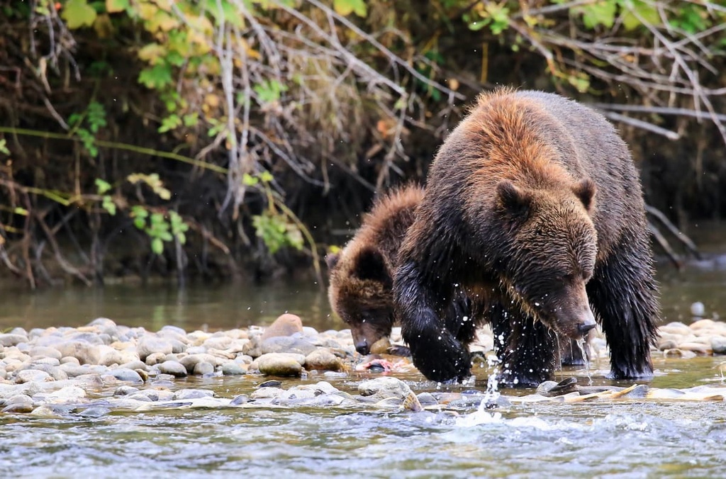
Moose, which are well adapted to the deep snows that accumulate in the winter, are common in the region, as are many of the smaller, fur-bearing mammals that made the region popular during the fur trade. Mountain goats, grizzly bears, wolves, fisher, ermine, marten, and snowshoe hare are all common in the region.
Some birds, such as the pine grosbeak, red crossbill, great gray owl, and great horned owl remain on the plateau all winter; however, many birds, such as pine siskin, golden crowned kinglet, magnolia warbler, and yellow-rumped warbler nest on the plateau and migrate during the winter.
The boundaries of the Regional District of Bulkley-Nechako coincide with much of the traditional territory of the Dakelh (Carrier First Nations). Additionally, some of the land in the region is part of the traditional territory of the Beaver First Nation.
The early inhabitants of the region tended to primarily live along the banks of the area’s major rivers and the shores of its lakes. Some of the many cultural and historical sites that have been uncovered in the region are earthworks, human remains, pictographs, petroforms, cultural material, and habitation sites.
The First Nations that have lived in this region since time immemorial traditionally followed a seasonal round, with the greatest activity occurring during the warmer summer months.
Summer was the time for gathering berries, and harvesting and preserving fish. The hunting and trapping of moose, caribou, elk, deer, black bear, beaver, and rabbit also provided food and raw materials for clothing and tools.
Hunting and trapping of smaller fur-bearing animals did occur before contact with European trappers and traders; however, the fur trade quickly became the primary activity from the end of the eighteenth century.
In 1793, Alexander Mackenzie made contact with the First Nations of what is now the Regional District of Bulkley-Nechako. Afterward, many First Nations entered the trapping and hunting trades.
Several kilometers away from what is now the community of Vanderhoof, the Dakelh village of Chinlac stood for many generations at the confluence of the Stuart and Nechako Rivers. The village was a major population center for the region, and it has become one of the richest archaeological sites in British Columbia.
According to oral history, in around 1745, members of the Tsilhqotʼin (Chilcotin First Nations) massacred the Dakelh women and children who lived in the village while most of the men were away hunting, destroying the village in the process.
In the 1950s, archaeologist Carl Borden led an excavation of the Chinlac village. Interestingly, Borden found a coin from the Song Dynasty in China during his excavation of the village. These sorts of coins aren’t necessarily reliable chronological evidence, but it suggests that the First Nations in what is now British Columbia took part in a trans-Pacific trade network.
The Regional District of Bulkley-Nechako has many wild and remote wilderness areas. Much of the region’s wilderness is only accessible by boat or aircraft; however, in addition to some of the provincial parks, there are many established hiking areas along Highway 20.
The following are some of the popular hiking areas in the district.
Tweedsmuir Provincial Park was established in 1938 after the Governor General of Canada, John Buchanan, Baron Tweedsmuir of Elsfield traveled the wilderness area by floatplane and horseback in 1937 and was impressed by its magnificence.
In addition to the region’s pristine wilderness rivers and lakes, the park is home to some great hiking opportunities. The following are some of the trails in the north end of the park:
The locals of the village Burns Lake have spent decades exploring the wilderness around their homes. Here are some of the trails around their village:
Some of the other popular trails near Burns Lake are the Star Lake Trail, Kager Lake Trail, Rod Reid Nature Trail, and the Evenshen Nature Trail.
Located on the north side of Highway 16, Fraser Lake is home to many trails that take you into the region’s stunning wilderness. The following are some of the popular hikes of the area:
Some other trails around Fraser Lake are the Black Point Trail, Cabin Creek Falls, Cheslatta Falls Trail, and Greer Creek Falls. Additional trails to explore include the White Swan Park Trail, Ormond Creek Canyon Side Trail, and the Kenny Dam.
The Regional District of Bulkley-Nechako is one of the most remote regional districts of British Columbia. Most of the populated areas are along Highway 16, which is the only major highway through the region.
The following are some of the larger communities in the region where you can find services and accomodations for your northern wilderness adventures.
Vanderhoof is a community located on the eastern side of the Regional District of Bulkley-Nechako. It is surrounded by seemingly endless miles of wilderness. The small town is rich with ancient history as it was an important location among the European settlers of what is now British Columbia.
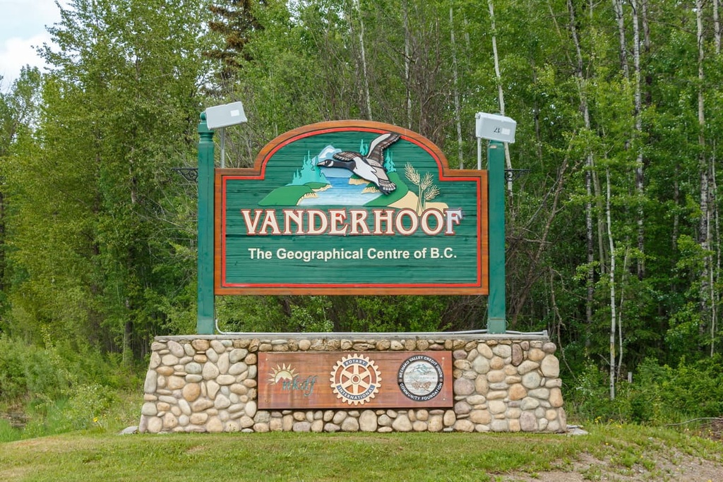
Located several miles west of Vanderhoof is the remains of a First Nations village called Chinlac. Simon Fraser made note of the village in his diary that, in 1806, he was likely the first European to trade with the people of the village.
While the area is rich in history and culture, there are also incredible wilderness areas and trails that are worth hiking. Some of the main attractions are a walking tour of Vanderhoof, the Chinlac Village Site, the Vanderhoof Bird Sanctuary, Telegraph Trail, Home Lake Trail, Johnson Lake Trail, and Gluten Lake.
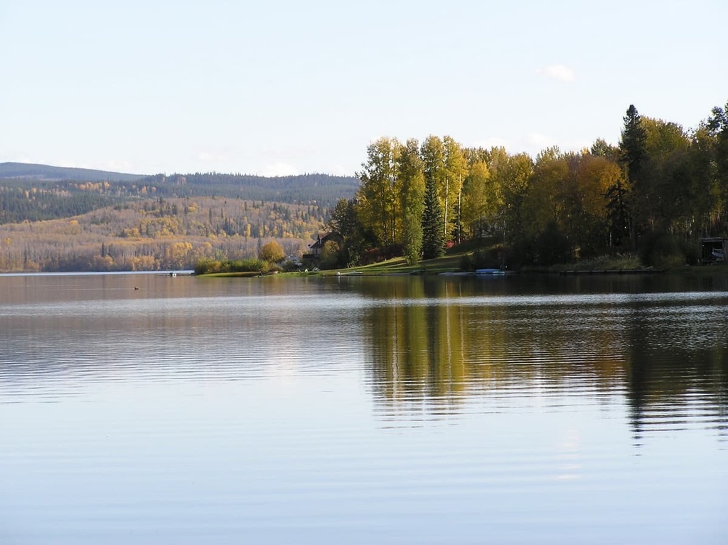
Smithers is a town located on the west side of the Regional District of Bulkley-Nechako. It is located on the Nechako Plateau to the east of the Hazleton Mountains.
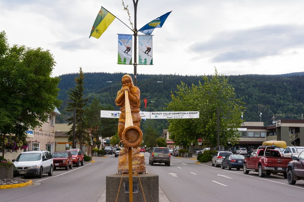
Situated along Highway 16, Smithers has a population of over 5,000 people. It is also the major service hub for the Bulkley Valley. The downtown area is built in a beautiful alpine style and the locals are enthusiastic about protecting their beautiful wilderness areas.
Some of the top local hikes around Smithers are the Crater Lake Trail, Malkow Lookout, the Silvern Lake Trail, and the Call Lake Trail. Good mountain trails to check out around the town include the Harvey Mountain Trail and the trail to Hudson Bay Mountain.


Yes. Regional District of Bulkley-Nechako has 306 named mountains. The highest is Tsaydaychuz Peak at 2,759 m.
The highest mountain in Regional District of Bulkley-Nechako is Tsaydaychuz Peak, at 2,759 m.
Regional District of Bulkley-Nechako has 306 named mountains.


