
Scan the QR code and open PeakVisor on your phone
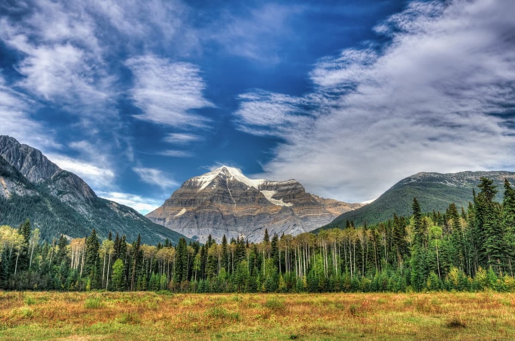
The Regional District of Fraser-Fort George is an administrative region located in central British Columbia, Canada, along the province’s border with Alberta. The district has nearly 363 named peaks, including Mount Robson, which is the highest point in the Canadian Rockies with 3,954 m (12,972 ft) of elevation. Mount Robson is also the most prominent mountain in the Rocky Mountains with 2,762 m (9,062 ft) of prominence.
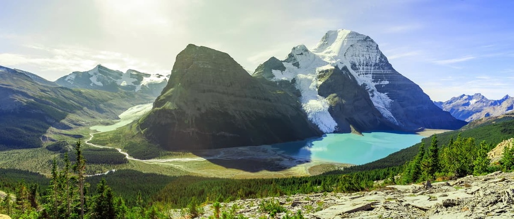
The Regional District of Fraser-Fort George is home to nearly 400 named peaks, including Mount Robson (Yuh-hai-has-kun)—the tallest and most prominent mountain in the Canadian Rockies. The district is located along the west side of the Continental Divide in British Columbia, Canada.
The province of Alberta is situated to the east of the Regional District of Fraser-Fort George while the Peace River Regional District is located to the north and Cariboo Regional District is located to the west. The Thompson-Nicola and Columbia-Shuswap Regional Districts are both located to the south of the Fraser-Fort George Regional District.
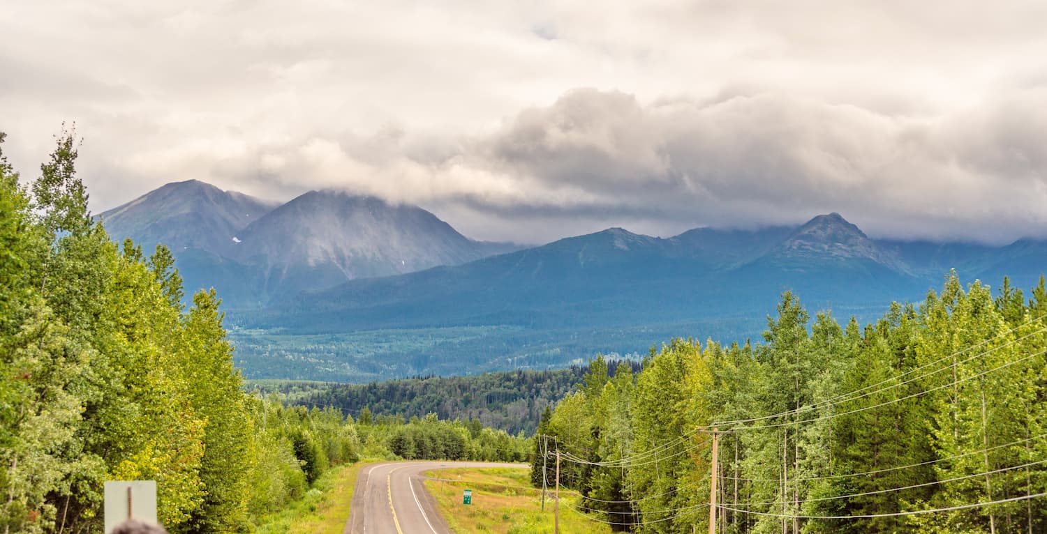
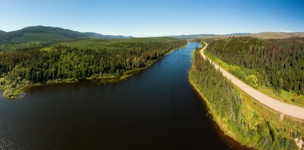
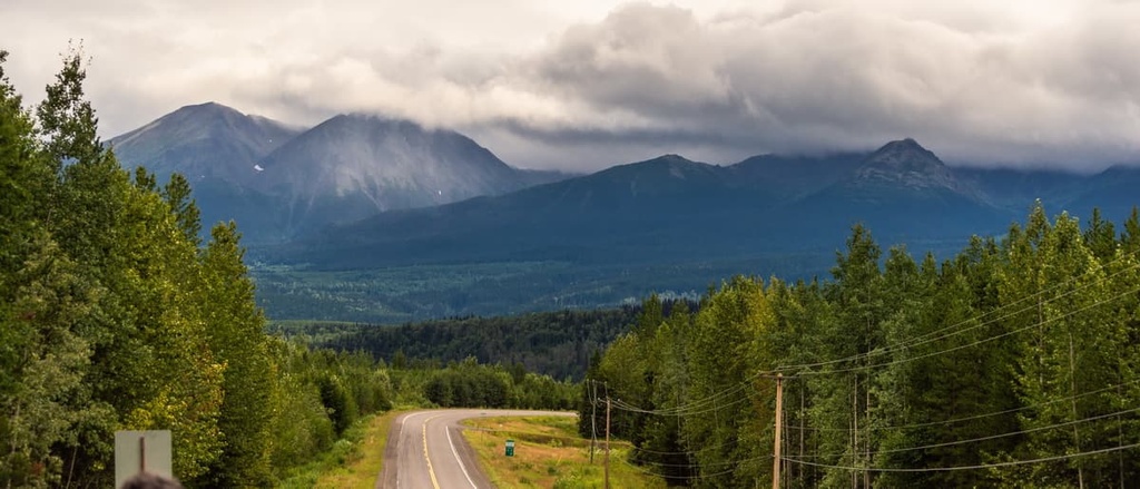
Highway 16 is the major road through the district. It is part of the Trans-Canada Highway. The largest city in the district is Prince George, which is a major transportation hub and service center for northern British Columbia. As such, Prince George is considered the unofficial capital of the northern part of the province.
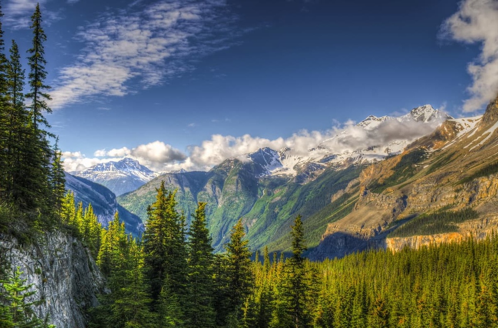
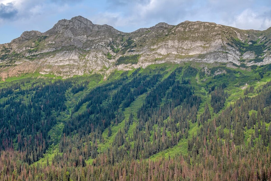
The district encompasses several different mountain ranges and other major geological features. The Misinchinka Ranges of the Far Northern Rockies, as well as the northern end of the Park Ranges of the Rocky Mountains, are included in the Regional District of Fraser-Fort George.
Additionally, the district also contains parts of the Cariboo Mountains, which are a subrange of the Columbia Mountains. It is also home to parts of the Fraser and Nechako Plateaus.
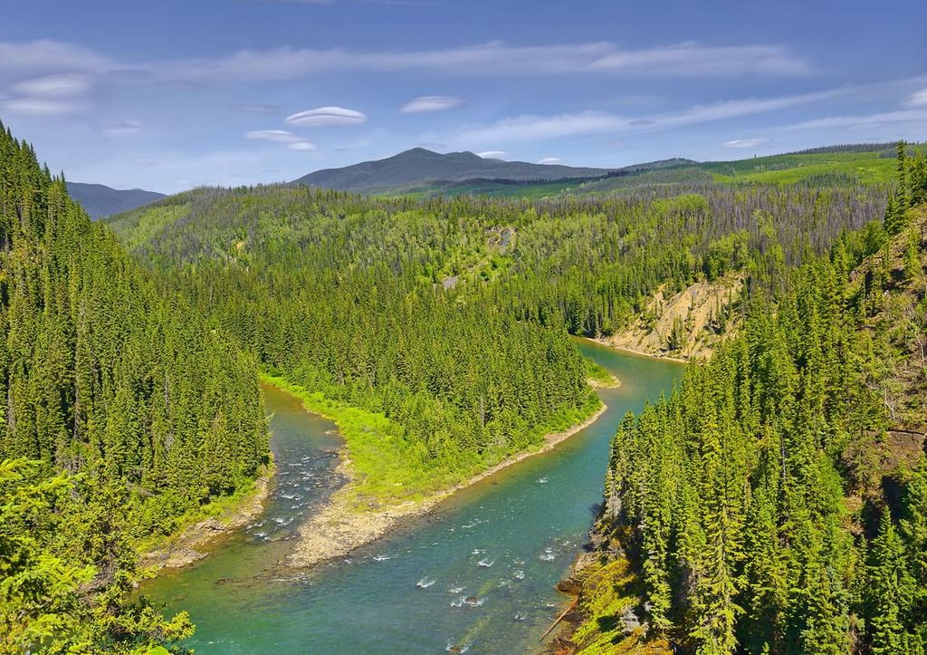
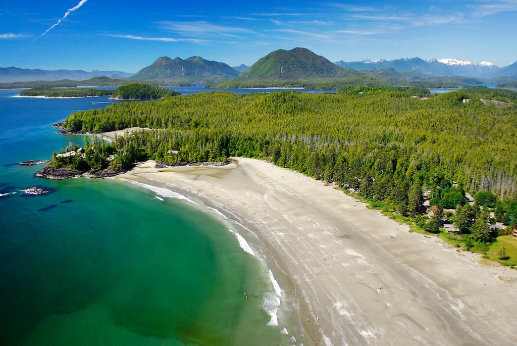
The wilderness of the Regional District of Fraser-Fort George is incredibly beautiful. It contains many stunning natural landscapes and features. The following are some of the provincial parks and protected areas in the district:
The geology of the Regional District of Fraser-Fort George is fairly complex as it spans several major geological features of British Columbia. The major geological features of the district include parts of the Rocky Mountains, the Columbia Mountains, and the Fraser and Nechako Plateaus.
The oldest geological feature in the district is the Columbia Mountains, which were the first mountains formed along the west coast of Canada. The Sevier orogeny, which is the formation event for the Columbia Mountains, started about 160 million years ago and continued for about 110 million years.
During the Sevier orogeny, the oceanic Farallon Plate subducted beneath the North American Plate, causing heating and compression of the Earth’s crust. The compression created heat that allowed for significant deformation of the Paleozoic and Mesozoic layers of rock along the continental margin, leading to the eventual uplift of the Columbia Mountains.
As the Farallon Plate subducted beneath the continent, chains of volcanic island and micro-continents that were floated on the oceanic plate were accreted to the west coast of the continent. The island arcs and micro-continents are exotic terranes which account for most of the land area of British Columbia.
With the accretion of the exotic terranes, the land of the Interior Plateau was added to the west coast of British Columbia. This was followed by the addition of more land to the west coast and the uplifting of the Canadian Coast Mountains and the Insular Mountains.
Toward the end of the Sevier orogeny, the Laramide orogeny began. The Laramide orogeny was responsible for the formation of the Rocky Mountains, which are on the east side of the Regional District of Fraser-Fort George. In this part of the range, the Rocky Mountains mainly consist of limestone and dolomite.
However, the Misinchinka Ranges of the Far Northern Rockies are composed of Misinchinka schist, which is much softer than limestone. The soft schist was more susceptible to erosion, and as such, the peaks of the Misinchinka Ranges are typically lower and more rounded and subdued than the adjacent limestone peaks.
Following the formation of the Rocky Mountains, significant volcanic activity occurred in the interior of British Columbia. The Nechako Plateau was created from massive Tertiary lava flows that started around 60 million years ago.
The lava that covered the Fraser Plateau erupted as recently as five million years ago. The lava flowed over the ancient sedimentary and volcanic terranes to form the relatively level plateaus that we see today.
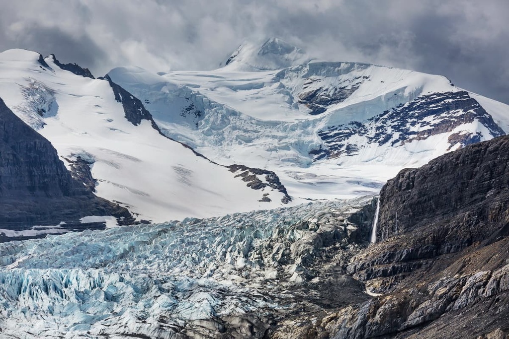
Most of the topographical relief on the plateaus was caused by the glaciers and ice sheets of the Pleistocene. The ice sheet created drumlin-like formations, eskers, and grooves across the plateaus.
In the mountain ranges, the ice sheet covered the mountains with the exception of the tallest peaks, which stood above the ice sheet as nunataks. However, even though many peaks stood above the cordilleran ice sheet, cirque glaciation carved the peaks to how we see them today.
The three main ecological zones of the Regional District of Fraser-Fort George are the rocky alpine, the subalpine forest of Engelmann spruce and subalpine fir, and the low-lying sub-boreal forests.
The alpine is typically barren and rocky among the peaks with communities of heather, sedge, and other hardy plants growing in protected areas. The cold winters and short growing season make it difficult for any woody plants to grow, except in dwarf form.
The rocky peaks eventually transition into alpine meadows and then become a parkland-like ecology toward the tree line. The alpine transitions into the subalpine at the elevations where the growing season is long enough to support the growth of woody plants.
Mountain goats and mountain sheep commonly inhabit the alpine of the region, as do several bird species that nest among the rocks, such as the white-tailed ptarmigan and the American pipit. Hoary marmots and Columbian ground squirrels are among the few mammals that regularly inhabit the alpine area, as they typically build their nests under the alpine rocks.
The subalpine tree line is dominated by subalpine fir, while the longer-living Engelmann spruce tends to dominate the canopy at lower elevations. Lodgepole pine is also common in the subalpine areas, especially in areas recently affected by forest fires.
The sub-boreal carpet the plateaus and mountain valleys of the Regional District of Fraser-Fort George. With a longer growing season, the sub-boreal forests have hybrid Engelmann-white spruce in addition to the lodgepole pine, subalpine fir, and Engelmann spruce.
Elk and deer forage in the alpine meadows during the summer while bighorn sheep remain in the alpine during the winter, moving to steep slopes that resist the accumulation of snow. Most mammals who don’t hibernate migrate to the valleys and plateaus during the winter to escape the deep snow that accumulates in the mountains.
Golden eagles can be seen soaring over the mountains in the regional district, while gray jays, ravens, and other robust birds are found throughout the region. Caribou, moose, grizzly bears, wolves, cougars, black bears, and other small mammals round out the common inhabitants of the region.
The seeds of the mature coniferous forests provide food for pine siskins, pine grosbeaks, and golden-crowned kinglets. There are many migratory birds that come to the range during their season, while only a few, such as the pine grosbeak, red crossbill, great gray owl, and great horned owl remain all year.
The Regional District of Fraser-Fort George is in the traditional territory of the Métis Nation of British Columbia as well as the Dene, Secwépemc, and Cree First Nations. The Secwepemc are the first known people to have inhabited the region and they lived a nomadic lifestyle according to seasonal rounds of hunting and gathering.
The Secwépemc built lodges and fish drying racks along the Fraser River and near Mount Robson. The Shuswap language (Secwepemctsín) name for Mount Robson is Yuh-hai-has-kun. This means ‘The Mountain of the Spiralling Road,’ a reference to the sloping layers on the mountain.
By the nineteenth century, European fur traders were regularly trapping and trading in what is now the Regional District of Fraser-Fort George. Yellowhead Pass became a common route through the Rocky Mountains. During this time, the famed “Overlanders,” who made their way from Toronto, passed through the Yellowhead Pass near Mount Robson.
The early twentieth century saw an increase in mountaineering and tourism in the region. In 1906, A.O. Wheeler and Elizabeth Parker founded the Alpine Club of Canada, and within a year, they were sending expeditions to Mount Robson to survey the area.
As the tallest mountain in the Rockies, Mount Robson received the majority of mountaineers’ attention during the early years of mountaineering in the area. Despite this, most of the major peaks in the region received their first recorded ascents throughout the early twentieth century.
During the early twentieth century, when mountaineers were vying to be the first to ascend the tall peaks and the railways were building their lines through the Yellowhead Pass, the fur trade and logging continued throughout the Regional District of Fraser-Fort George. Slowly, the small trading post of Fort George grew into the transportation and service hub of northern British Columbia.
There are many natural wonders among the wilderness parks of the Regional District of Fraser-Fort George. The following are some of the major hiking areas and wilderness parks of the district:
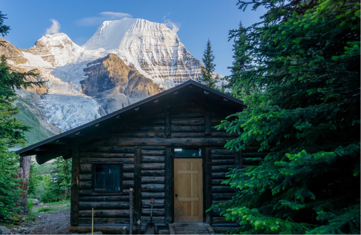
Established in 1913, Mount Robson Provincial Park is the second oldest park in British Columbia. The park’s namesake, Mount Robson is the tallest peak in the Canadian Rockies and the most prominent peak in the entire Rocky Mountain system of North America.
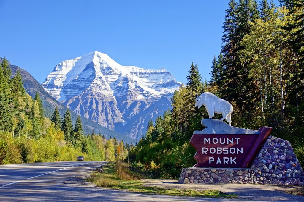
The park offers a full range of facilities and activities, from developed vehicle-accessible campgrounds to serene valleys that rarely have human visitors. The park protects the headwaters of the Fraser River and is part of the UNESCO designated Rocky Mountain World Heritage site. The following are some of the popular excursions in the park:
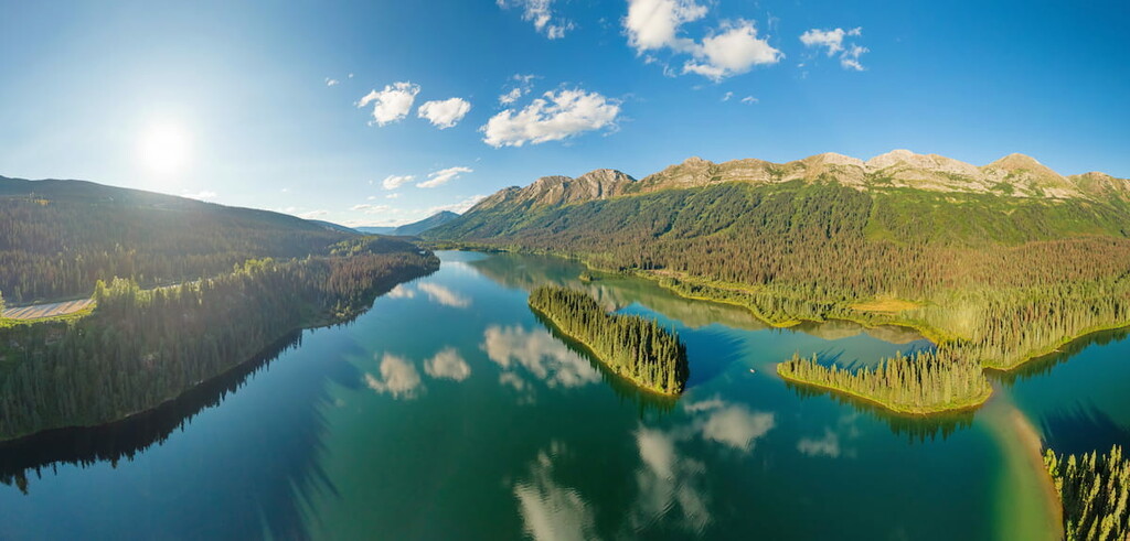
Beautiful turquoise lakes surrounded by steep cliffs, set against a backdrop of alpine peaks and ridges are what you’ll find at Arctic Pacific Lakes Provincial Park. The park is home to a chain of lakes that’s located along the Continental Divide where water from the lakes flows west to the Pacific or north to the Arctic Ocean.
Paddling the lakes is the most popular way to explore the park and take in its stunning scenery. Additionally, for the anglers, the lakes have a variety of fish species including lake trout, bull trout, rainbow trout, kokanee, dolly varden, mountain whitefish, redside shiner, lake char, and chinook salmon, as well as arctic grayling in Arctic Lake.
The easiest way to access the park is by canoeing from Arctic Lake through to Portage and finally Pacific Lake. The only trail in the park is the portage trail between Arctic and Pacific Lakes. The other secluded areas of the park are best accessed from the water.
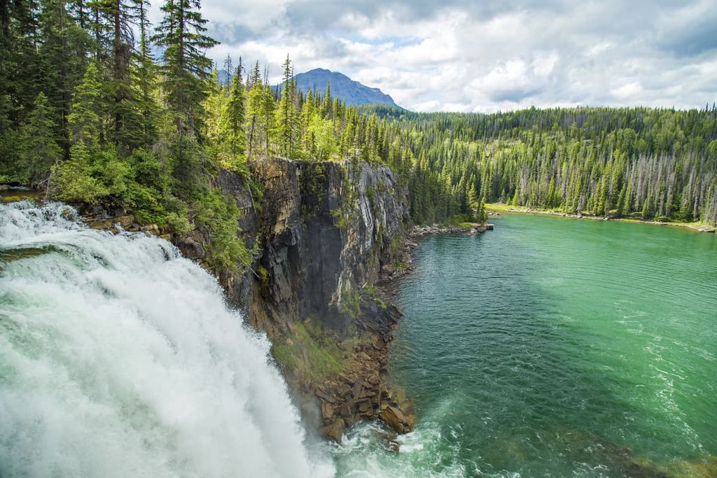
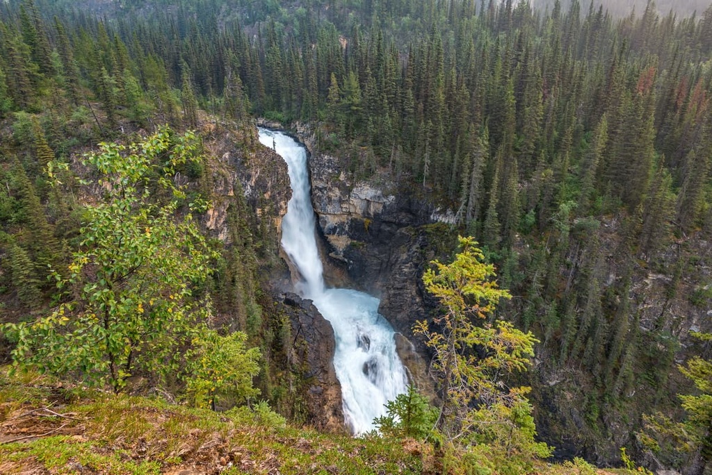
Straddling the distinct Minischinka Ranges and Hart Ranges of the Far Northern Rockies, Monkman Provincial Park has several unique and beautiful features that make the park a worthwhile backcountry destination. Some of the incredible features found in the park include Kinuseo Falls, the Monkman Cascades, and the Stone Corral.
Pine Le Moray Provincial Park is located on the east side of the Regional District of Fraser-Fort George in the Hart Ranges. While there are no official hiking trails in the park, there is a vehicle-access campground and two unofficial peak trails.
With regards to trails that start from Highway 97 on the west side of the park, one option is an 8.4 km (5 mi) out and back to the top of Mount Murray via Pine Pass.
The other popular hike is to the ridge of the Murray Range. While it is not even 2.5 km (1.5) mi long to the summit, this is a grueling and steep hike; however, the views of the Murray Range and the surrounding Hart Ranges, make it worthwhile.
Kakwa Provincial Park is located along the Continental Divide. It features glaciated mountain peaks, extensive alpine meadows, and numerous rivers and lakes.The park is part an interprovincial park with Alberta. It’s combined with Kakwa Wildland Provincial Park and the Willmore Wilderness Park in Alberta to form the Kakwa-Willmore Interprovincial Park.
The only official trail leads into Kakwa Provincial Park and ends at a public cabin on the shores of Kakwa Lake. There are dozens of named peaks in the park, such as the massive Mount Sir Alexander and Mount Ida.
There are many unofficial and unmaintained trails through that park that lead through the beautiful wilderness. Additionally, there are many opportunities for climbing and mountaineering in the park; however, there are no officially marked routes.
Set among the stunning wilderness of the Nechako and Fraser Plateaus, the Columbia Mountains, and the tallest peaks of the Rocky Mountains, the Regional District of Fraser-Fort George is the service and transportation hub for northern British Columbia.
The following are some of the major cities in and around the district where you can start or finish your northern wilderness adventures:
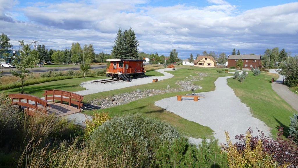
Prince George is considered the capital of northern British Columbia. It is located on the western side of the Regional District of Fraser-Fort George, at the junction of Highways 16 and 97. The city was originally founded as Fort George, a North West Company trading post established by Simon Fraser in 1807.
Situated at the confluence of the Fraser and Stuart Rivers, Prince George has grown into an important transportation and service hub for the north of British Columbia with all the amenities of a modern city. It features fine dining restaurants, cinemas, museums, a range of accommodations and an international airport.
Some of the most popular hikes around the city are the Cottonwoods Island Loop, the Greenway Trail to Shane Lake Loop, McMillan Creek Loop, Troll Lake, Kakwa Lake Trail, and Forests for the World Lookout. Additionally, the city is located near several beautiful wilderness areas such as the Sugarbowl-Grizzly Den and Stuart River Provincial Parks.
Off-roading is a popular pastime of locals in the region and there are well established clubs and areas to practice motocross and drive OHVs. The area also has vast wilderness areas that local hiking groups flock to as well as opportunities for fishing and other outdoor recreation activities.
Located at the north end of the Regional District of Fraser-Fort George, Mackenzie is situated along the eastern shores of Williston Lake. The municipality of Mackenzie is a great place for winter-loving outdoor enthusiasts, as the community hosts dog sledding, cross country skiing, and snowmobiling competitions each year.
The community maintains 32 km (19 mi) of groomed cross country ski trail throughout the winter. Additionally, there are many trails nearby that are worth hiking if you’re in the area. Some of the recommended trails are the Morfee Lake Trails, Cut Thumb Falls, and the Kimta Creek Trail.
Mackenzie is also the largest community near many of the northern provincial parks. This includes Pine Le Moray, Carp Lake, and Heather-Dina Lakes provincial parks.
Vanderhoof is a community located on the eastern side of the Regional District of Bulkley-Nechako. It is surrounded by seemingly endless miles of wilderness. The small town is rich with ancient history as it was an important location among the European settlers of what is now British Columbia.
Located several miles west of Vanderhoof is the remains of a First Nations village called Chinlac. Simon Fraser made note of the village in his diary that, in 1806, he was likely the first European to trade with the people of the village.
While the area is rich in history and culture, there are also incredible wilderness areas and trails that are worth hiking. Some of the main attractions are a walking tour of Vanderhoof, the Chinlac Village Site, the Vanderhoof Bird Sanctuary, Telegraph Trail, Home Lake Trail, Johnson Lake Trail, and Gluten Lake.
Fort St. John is the largest city in the Peace River Regional District, and it is located at Mile 47 of the Alaska Highway. The community was originally established as a trading post for the fur trade in 1794, a year after Alexander Mackenzie traveled to the region.
The wilderness areas and mountains that surround Fort St. John are home to abundant wildlife, scenic landscapes, wild rivers and creeks, trails to follow, and wilderness to explore. Some of the main attractions and trails around the city include the Charlie Lake Caves, Willow Loop, Cactus Trails, and the Cecil Lake Highway Trail Loop.


ultra
11ers-bc
11ers-ca-rockies
fred-beckey-great-peaks
canada-sampler
british-columbia-ultras
ultra
11ers-bc
canada-sampler
british-columbia-ultras
ultra
11ers-bc
11ers-ca-rockies
british-columbia-ultras
ultra
11ers-bc
11ers-ca-rockies
fred-beckey-great-peaks
canada-sampler
british-columbia-ultras
ultra
11ers-bc
canada-sampler
british-columbia-ultras
ultra
11ers-bc
11ers-ca-rockies
british-columbia-ultras


